A cosy night in the outhouse listening to more howling wind outside was followed by a morning climbing. First on tarred road then dirt track followed by sandy trails and earthern paths and wooden steps to reach a road at over 1000mt.

The town had an imposing lump of rock hanging over it and fantastic flowers clung to the walls above the road into the mountains.


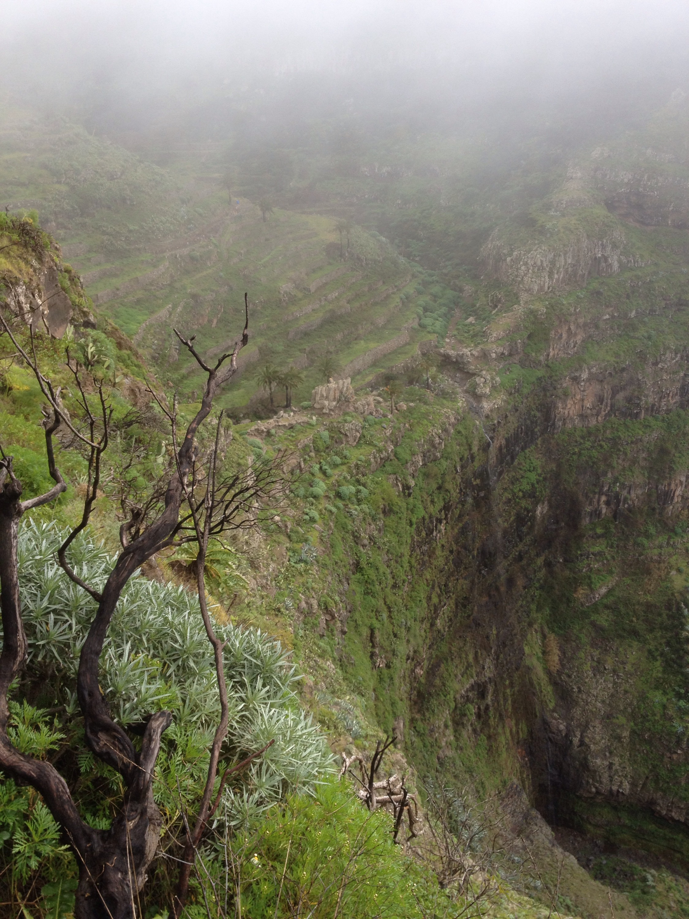
When the tar ran out the tracks weaved their way steeply back and forth past more and more isolated terraces and fincas. Eventually the farms ran out too and the narrow path plunged into dense vegetation to emerge every so often to ever higher viewpoints.


The cloud was on the mountain tops but they were still a fair bit higher and I was grateful for the shade they provided as I walked the varied ways.


I entered the Parque Nacional de Garajonay, the protected area taking up most of the highlands and containing the largest juniper forest in the Canaries.
But I was in the giant laurisilver cloud forest where the common mists dressed the trees in garlands of dripping lichen.


Once I had reached the high road I had to share the nice gently flat trails with many other hikers, and there were many other trails signed to left and right.


As on El Hierro I had entered the cloud around 1000mt and it was wet and cold enough for waterproofs and gloves. The sun was tantalisingly shining brightly behind the thin veil of misty drizzle which would wear out every so often to let the light shine through.
At Las Hayas it was bright and warm momentarily

And then as the scenery became increasingly dramatic it became increasingly hidden.

A narrow stone paved path led down a cliff edge and across a pretty stream bed through terraces overlooking the gorge of Valle Gran Rey.


With the rain and mist still swirling around and after another 1500 mt climb it was with relief that I walked into Chipude, past the communal washing area.

I was glad, with the cloudy and damp conditions to have a bed awaiting me in the hikers favorite Hotel Sonia but the cod and wet couldn’t take away the beauty of this isand and in the sun I imagine it could look like Shangri La.

Hey Stevie been avidly following your ramblings through the changing landscapes of las canarias and enjoying them immensely – la gomera is stunning isn’t it – your pics are reminding me of when I walked with a donkey, a dog and friend from Los acevinos to San Sebastián – we were returning the donkey that we had borrowed to help build a house in the rain forest. Beautiful place enjoying the memories! Look forward to seeing you in Spain – keep rambling! Xxx
LikeLike
Ta Debs, good to know i’m not talking to myself. Yea it is stunning here. Can see why the hippies came.
Congrats on the graduation. Go girl!
LikeLike
Hi Steve, I wrote a couple of times but they didnt show until I joined wordpress just now.. Enjoying your ramblings, especially as its freezing here! Had to stop Ben posting negative comments after he saw the swimming pool!
LikeLike
Thanks Babs. Stay cosy. A lot of snow in spain too. Im sure i’ll be lovely there in a month. You should join us.
LikeLike
Give ’em all my regards at the hotel.
LikeLike
I tried Paddy but either my spanish
LikeLike
I tried Paddy but either my spanish is completely unintelligable or it’s been too long!
LikeLike
Hey Stevie B. Great to see you’re doing so well on your adventure. La Gomera looks so beautiful. I must put it on my list. Looking forward to seeing you next month and hearing all about it. You’re fantastic……keep on rambling!! Sam n Emma xx
LikeLike
The list keeps getting longer Sam! Looking forward to seeing you too
LikeLike
Hi Steve!
Fascinating read! La Gomera looks beautiful but quite challenging. It seems a far cry from relatively flat Fuerteventura.
Best wishes for the rest of your walk/climb!
LikeLike
Thanks Eamann, its mostly downhill today and im steeling myself for the serious stuff on la palma where the accents are 2500mt. Not sure if my treking so far has trained me up or knackered me out!
LikeLike
You need good weather on your side for that big climb on La Palma. If it’s going to be cold and wet, then there’s nowhere to hide. You could always reverse the route, and spend two or three days climbing, then have one long, steep, but relatively easy descent.
LikeLike
Thanks Paddy thats what im going to do. Im thinking of just doing from faro to town to start with then up to refugio next day. Then try and get passed the rocques for somewhere to camp. Or do you think i should stop at the other refugio?
LikeLike
The only place you’ll be able to buy food is Fuencaliente… so make sure you have enough. You can get water at Refugio del Pilar, but you’re supposed to get a permit in advance to camp. My guess is… turn up late and they probably won’t turf you out! There might be water at the basic Refugio Punta de los Roques, but you can’t rely on it. (Probably best to leave Refugio del Pilar with as much water as you can carry.) The same goes for a tank of water on top of Roque de los Muchachos. However, there will be someone, somewhere up there, and if necessary you can beg for water. There’s a road to the top, and a car park, but that will be completely off-limits to motorists once it gets dark, to prevent light pollution near the observatories. For discreet camping, you’ll pass an occasional stone-built windbreak, where you might be able to pitch a tent with some discomfort… and that’s your lot! Of course, once you pass the summit, it’s downhill all the way, and there’s a roadside bar restaurant before the last steep descent to the sea.
LikeLike