Last weekend we headed off in the camper to tackle a hike that i’ve been trying to get to for a while. Listed in the “1001 Walks you must experience before you die” book, and also perhaps more surprisingly, ” The 50 Greatest Walks in the World”, the Keenagh Loop does a 12km circuit into the vast and empty blanket bog of Mayo.

We’d parked up for the night at Windy Gap, atop a pass on the hills to the southeast, and indeed it was. The misty, murky morning cloud slowly rose to reveal the hills we were heading towards.


By the time we got going it was, at Met Eireann had promised, turning into a fine day.
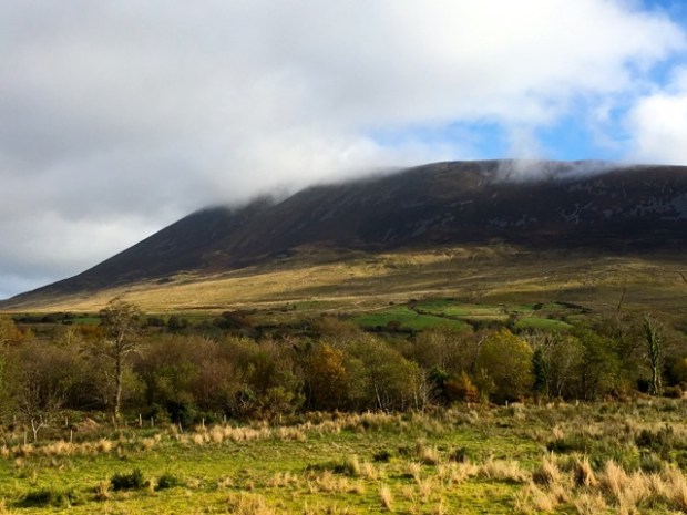
Nephin emerges from the cloud
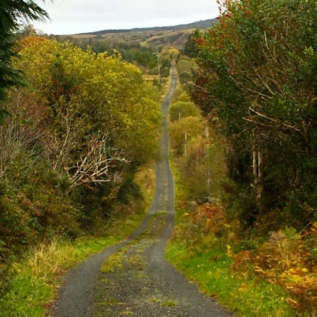
The road from Castlebar to Bangor passes along the shore of Beltra Lough and alongside the beautifully wooded Boghadoon river before passing between the solitary bulk of Nephin mountain and the peaks of the southern end of the extensive Nephin Beg range. The trail starts where Bellanaderg Bridge spans the river and heads south down a tarmac boreen for a couple of km through the townland of Dereen.
We had started out with the dogs as the notice at the trailhead had only asked for dogs to be on leads but annoyingly after awhile we came to the all too common NO DOGS sign so had to retrace our steps to leave them in the van before carrying on again, complaining to each other about the severe lack of dog walking opportunities in Ireland and the general lack of access for people too. Having just returned from the 650km Gran Senda de Malaga in Andalusia which, typically, crosses all kinds of farmed land with open access and no dog restrictions it was frustrating to be confronted with this attitude of landowners again. But it seems we must be grateful for any ability to stray off public roads or forest tracks.
Many Mayo landowners may have a much bigger problem than walkers and their dogs. The threat of foreigners. Invaders. Of the flora variety.

We had passed dozens of these signs and their associated clumps of noxious weeds as we drove alone the highways and byeways of Mayo and this one was deep into the hinterland, past the only farmhouse on the boreen, just as the tarmac ran out. And Knotweed was not the only rampant plant taking over the land. Rhododendron ponticum is marching across the bogland of the Wild Nephin Wilderness Area, a huge tract of land where a “hands off” land management approach to “rewilding” the landscape could see it buried under the smothering blanket of the evergreen leaves of a bullyboy shrub that takes out any competition with toxic chemicals. Giant rhubarb, gunnera tinctoria, has also taken over large areas of once productive arable land with well over 1000 sites recorded on Achill alone. The speed with which it can take over is understandable when you know that one plant can produce 750,000 seeds and a square metre of ground can have 30,000 seedlings crowding out any other species.
We were accompanied for a while by a farm dog that was seemingly surplus to the requirements of the farmer and top dog herding some sheep around a derelict cottage.

The black road became a green road, the old route to Newport, and we passed more forlorn and abandoned homesteads, still containing remnants of their previous occupation including an old bed heaped with sheep wool.


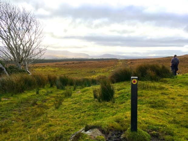
As we climbed to a rise on the shoulder of Letterkeeghaun an amazing view lay before us southwards down the wide valley of Glen Hest, beside Beltra Lough, all the way to Croagh Patrick whose pyramidical summit was still hidden by clouds on the far side of Clew Bay.
The old road was slowly disappearing under a layer of grass and moss, the mountains reclaiming the hard won mark of mans toil through the ages. In places it was now wet enough ground to warrant the placing of wooden bridges and boardwalks, although they didn’t stop me getting a wet foot at the bottom of an unnoticed bog hole.


We followed the ghost of the old way for about 3km under a big open sky until we reached the somewhat surreal edifice of a concrete waterworks where we stopped for a time to soak up the peace and have a sandwich, the only sound that of an unseen waterfall.

We left the track here, as we approached a large block of forestry, and followed a line of fencing towards the sounds of running water. The erosion of delicate vegetation by overgrazing had caused big areas of waterlogged turf to be exposed, that plentiful rain and the padding of hooves were, bit by bit, sending sliding into the river and off into the lower lakes and sea. Since the end to headage payments, which saw the marginal hillsides covered by overstocked flocks of sheep, the numbers of animals has certainly reduced, but once uncovered the turf takes an age to repair itself and the presence of even a few trampling hooves can slow or stop the regeneration of a covering blanket of grasses.


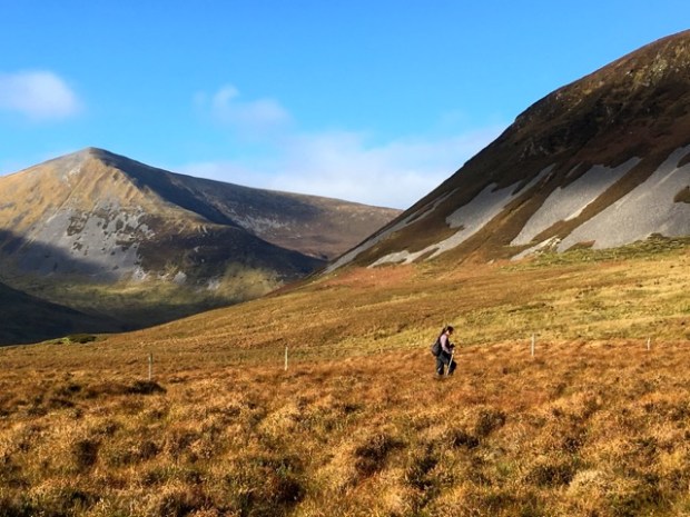
It was still glorious out there, despite the signs of environmental degredation, and it got better as we reached the river and followed it upstream into the remote Glendorragha valley with the summit of Birreencorragh as a magnificent backdrop.


Ahead of us a lone tree stood out, a surviver in its youth of the grazing sheep that have kept any of it’s prodigy from surviving. It’s not the climate, or even the waterlogged conditions that stop the expanses of western Ireland returning to forest, it’s the nibbling teeth of a livestock that makes little economic sense. Maybe we should pay the landowners more to grow hardwoods rather than undervalued wool and meat.

Under the deep blue sky the mountains looked inviting and the thought crossed my mind that from here you could wander for days towards the west and north without seeing a soul. You could head out across the entire Nephin Beg range and work your way along the old Bangor trail or across the bogs of Ballycroy National Park to the sea. Tempting enough under these conditions but I knew what it could be like in the wild west and thought better of it. (See other posts on the Bangor Trail)
Instead we turned away from the river to follow the line of a disused fence passed the patches of scree on the flanks of Knockaffertagh towards a pass on it’s shoulder at about 250m.

It was a fairly long but gradual climb across the tussocky grass and heather and a pleasure in the sunshine, to be savoured with repeated stopping to turn and admire the landscape we were leaving which seemed to glint in the crystallised light. Food for the soul. Another stop for edible nourishment at the pass and a different view to the north, of Nephin and passed our starting point towards the forests of Tristia and the sea at Killala bay.


It seemed like we were rejoining the civilised and tamed world as we climbed down on the sheep paths to join a farm track and eventually a tarmaced boreen. A couple of red jacketed hikers passed us on their way into the wild and we hoped they had time to finish before the light went. The days were getting shorter and the clocks went back in a few hours time. Summertime was over for the year and with it the likelihood of any long hikes into the hills. The Letterkeen Loop was a nice one to finish with and the autumnal colours in the trees along the boreen made the new season welcome.

As summer ends in the northern hemisphere however, it starts in the southern, so my next posts- while visiting family in Australia- will continue in the sun.
