The 5km restraining order finally lifted, allowing us to travel anywhere within our county so we headed back up to Connemara in the camper- this time to the far northeast. 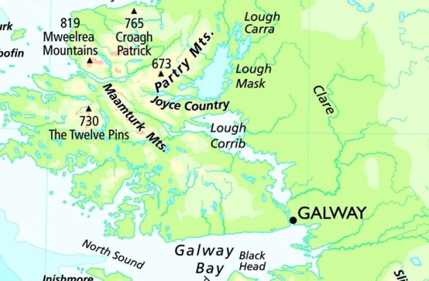
Joyce Country is a wild, beautiful and often overlooked area of north Galway and south Mayo between loughs Mask and Corrib from Maam to Clonbur, from the mighty Maamturks mountains to the tranquil wooded shores of the lowland lakes.
Named after the Joyce family who arrived from Wales in the 13th c in the wake of the Norman invaders it kept its name and identity due to its remote inaccessibility. The family married into the O’Flahertys and other clans and ended up controlling a vast area of the Barony of Ross.

We parked up on the pier at Cornamona, last visited when our boat had broken down out in the lake and the rescue services had towed us to shore here ( a story told in my Lough Corrib: Walking on Water blog post)
On arrival I noticed a couple struggling with bailing buckets and ropes tied to a listing vessel and went to help. Incredibly, when I told the fella about the circumstances of my previous rescue there he said “That was me”!
He had been the duty commander of the volunteer team that fateful day- and now, coincidentally I was attempting to help with his leaking boat.

Unfortunately it proved impossible to get the holed aft back to shore and the boat was left on blocks for the night.
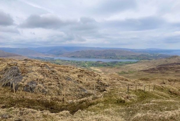
Our first hike in the morning was up Benlevy or Mt Gable, a 416m mass that dominates the isthmus between Mask and Corrib, guarding one of the major routes into Connemara from the east. It also has what is reckoned to be one of the most beautiful and scenic mountain walks in Ireland and supposedly gives a lot in return for not too much effort, with one of the reviews on the Mountainviews website reporting on a family birthday hike claiming ” an easy walk for first timers- our 9,6 and 3 yr old did it”! It wasn’t that easy!

Years ago we had walked the Seanbhothar route between Clonbur ( An Fhairche) and Corr na Móna, a 10km hike along the old road along the shoulder of Benlevy ( Binn Shleibhe) and had been enchanted by the views of the island dotted lake. The proper Irish names would often be used as most of this area is within an Irish speaking Gaeltacht, the largest in the country.
Pulling up in a small car park at the base of the mountain at Ballard we were happy and grateful to see we were welcome as hillwalkers and a stile and signage had been provided. The route was unmistakeable though as we followed the old turf cutters track steeply up the side of the hill passed some contented sheep.


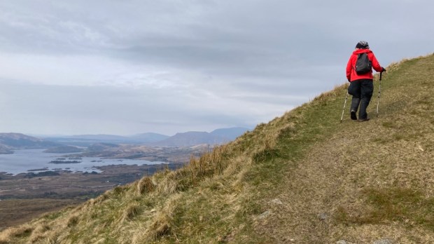
The views down over the islands got better and better and in the distance to the west the high ranges glowed in the morning sun. The track went all the way to the broad and open summit plateau where we continued west for another km or so to reach the concrete trig point.


Crossing the summit passed the peat hags we gained views northwest over Lough Nafooey and Finny and further on northwest over Mask and Coolin Lough and the woodlands we were off to explore next.
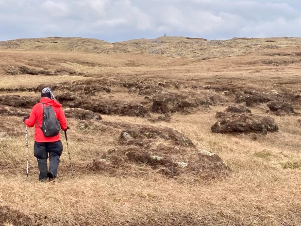

Sally couldn’t resist collecting some bones that belonged to an unfortunate sheep that had died and was being subsumed into the bog.


The area we were exploring was all part of the 1500 sq km proposed Joyce Country and Western Lakes Geopark , a €1.2 million project running in 2020 and 21 to prepare a submission to UNESCO and hopefully be granted Geopark status in 2023 and join the Copper Coast (Wexford), Burren and Cliffs of Moher (Clare) and Marble Arch Caves (Fermanagh and Cavan). Unfortunately started during the Covid pandemic the plan was to run a series of events and activities and an educational programme for all levels.
Having explored all three of the other Geoparks I’d definitely say the area is worthy, with the contrasting upland and lowland landscapes and big range of rock types and habitats so good luck to them.
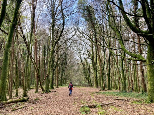
On to Clonbur to the glorious woodlands on the shores of Lough Mask. Part of the Ashford estate owned by the Guinness family ( along with another 20,000 acres of County Galway) until sold to the state in 1939, Coillte have restored/created 300 hectares of diverse native woodland here under the EU’s LIFE Nature programme.

We parked up next to the early Christian settlement and abbey of Teampall Brendain at Rosshill cemetery and headed off around White Island and then the 7km Ballykine loop.


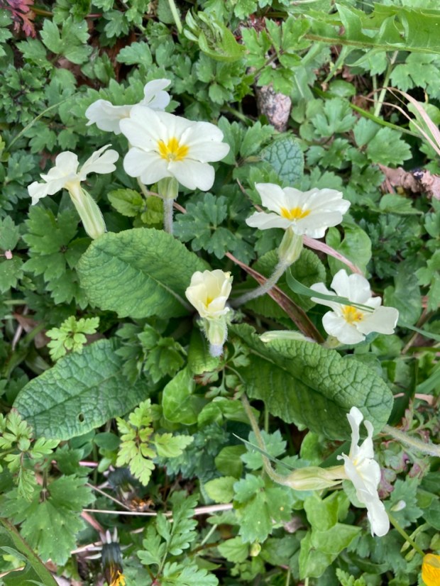
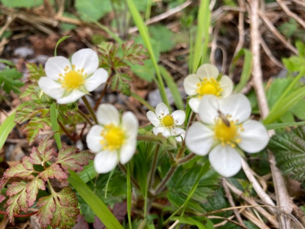
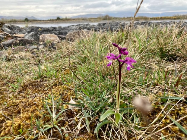
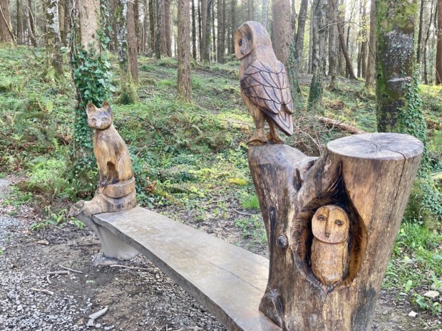
The spring flowers were a glory as we followed the path over a man made causeway and around the island, stopping for a rest at one of the scenic benches.


Although there were some mature conifers and exotic non natives the restoration carried out had involved the removal of many to encourage natural regeneration of native species and the planting of many more. The yew wood had been extended by the planting of cuttings taken locally.
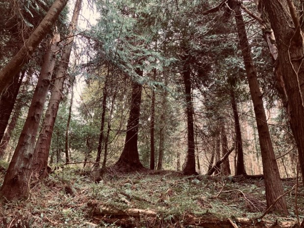

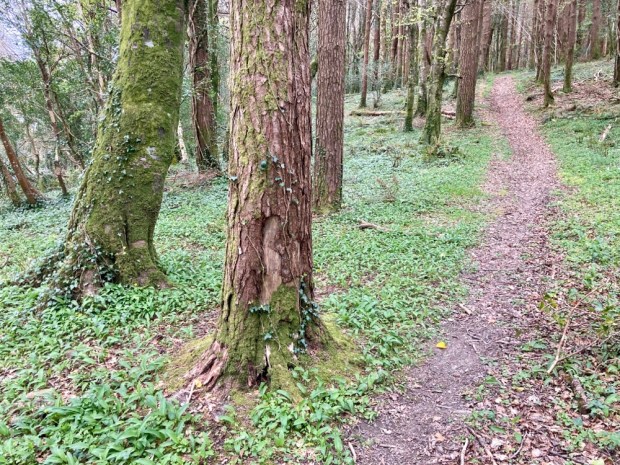
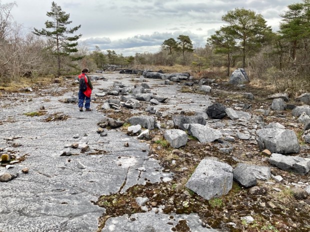
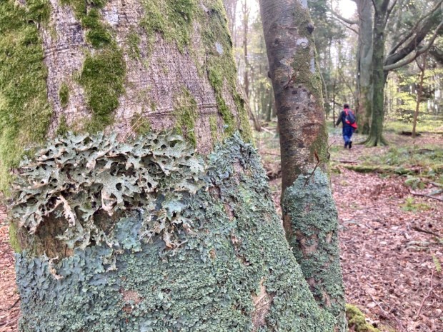
After our circumnavigation of the lake island we continued eastwards and out onto the limestone pavement that make this mixed woodland so special. Part of the much larger Lough Carra Mask SAC this is the largest area of limestone pavement outside of the Burren and is home to all the same species of tree , hazel, ash, white beam, buckthorn, black and hawthorn, spindle and yew.


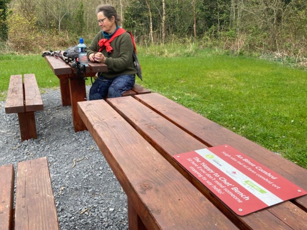
Across a wooden bridge over the Clonbur river we passed small lakes to a track junction at the site of an old sawmill. There we had our antisocial lunch on the ” not happy to chat” bench, although I would have quickly moved if anyone had happened along.


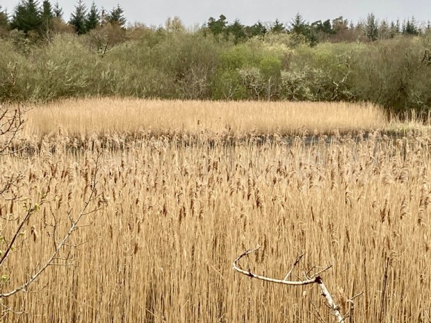
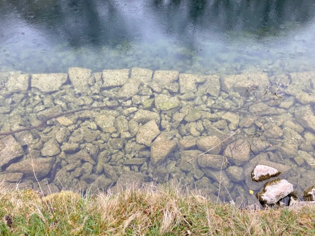
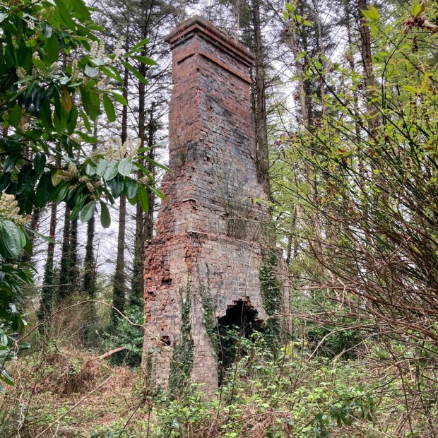
Next up a strange collection of moss covered limestone boulders that was referred to as the Guinness luncheon house ruin, a reed bed haven for bird life, a stone built submerged jetty and the chimney remnant of a shooting lodge.

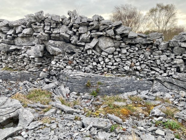
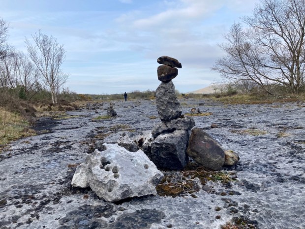
Not wanting to disturb the dead, (or be disturbed by them!), we moved for the night to a park up on the Lough Mask limestone plateau.


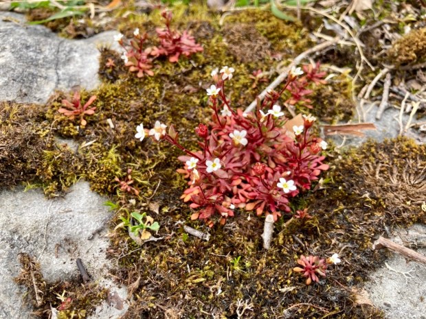
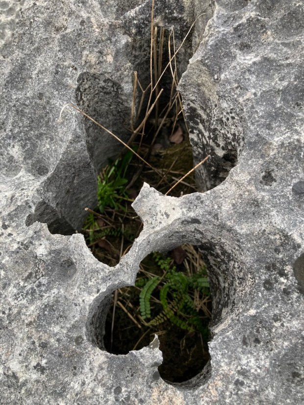
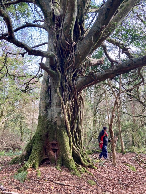
A remarkable spot. In the morning we ventured out onto the slab and marvelled at the walls, the grikes and clints, the egg box and boulder in socket formations ( unique globally to the Lough Mask region) , the bonsai tree microcosm and the tenacious orchids.


Our last walk was another circumnavigation, this time the 3.5 km loop of Big Island again joined to the mainland by another Victorian causeway. We were greeted by chainsaw carvings in the children’s nature corner and fine mature tree specimens.
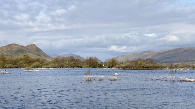


With the sun shining we took advantage of another scenic bench to sit in the sun and admire the views of the Partry mountains before climbing up to the top of the island’s inner mound for more meetings with remarkable trees.


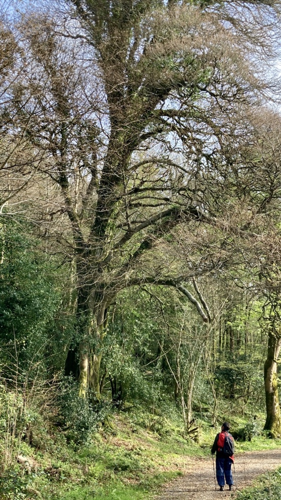
Venerable old trees, giving life even in death, we returned homewards along a fine wide woodland ride, planning our own journey into native woodland management.