3 months since a Ramblingman posting i thought i would report on a couple of recent excursions or micro adventures as i believe they are called in the on-trend world.

The first was a trip we’d been meaning to take for a long time. To take the ferry from Cleggan on the northwestern tip of Co Galway the 7 miles out to Inishbofin or to give it’s proper name, Inis Bo Finne, the Island of the White Cow. The inspiration to finally get it together was supplied by the presence of our WWOOFer (Willing Worker On Organic Farms, or nowadays for some reason changed to WorldWide Opportunities on Organic Farms). We wanted to show off Connemara to Hanna on her first trip to Ireland from Germany.
It was a fairly gloomy day driving through the bogs and mountains and the clouds hung low over the sea as we boarded the boat along with a surprisingly large amount of other folk and the two dogs.
We had been having beautiful spring weather recently so it was a bit disappointing to gaze out towards the grey 6 by 4 km smudge on the horizon and back towards the twelve Bens and the Maumturk peaks lost in cloud.

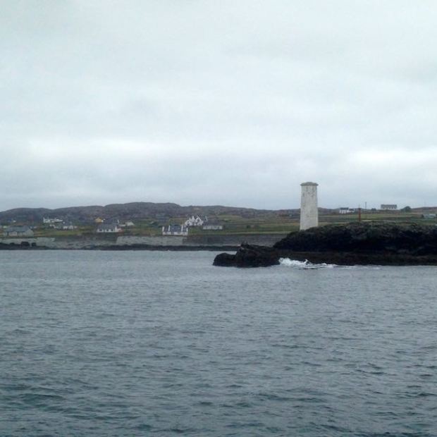
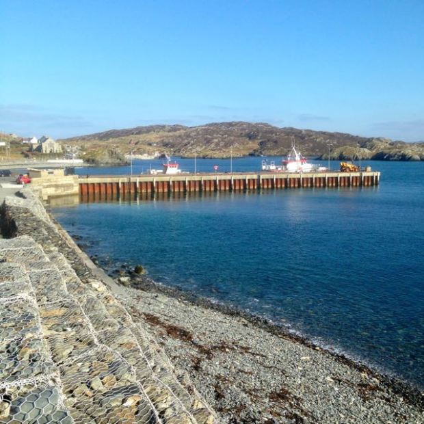
It took about half an hour to cross to the island and pass the beacons that led ships into the fine sheltered harbour below the smattering of buildings that comprised the main settlement.
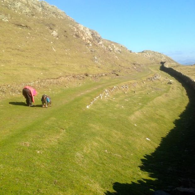
The island has three looped walks and with 4 hours available to us we had combined two of them, the Middle and Western Quarters. Climbing up from the harbour along the network of boreens we started out on the Middle Quarter loop first, albeit in the opposite direction to the way marks, which possibly explains how we got lost fairly soon after passing the cottages,new and old, and heading out north towards the islands high ground.
Passing an airstrip carved into the rocky and boggy ground we took the wrong turn but only had to climb to the highest point to get back on track and admire the views east towards the mainland and south across the ocean.

Rejoining the way marked route we descended from the 90 mt highpoint towards the bog track leading to Loch Bofin and the pebble embankment separating it from the Atlantic at North beach.


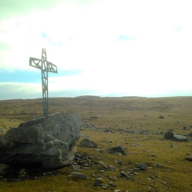
Following a flock of sheep being herded along a boreen we moved on to the open expanse of the Westquarter and now in bright sunshine passed by the sad monument to the memory of some American students that had drowned off the coast here in the 7o’s. 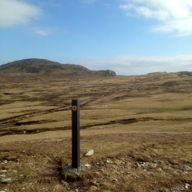
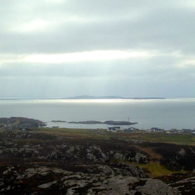
Somewhere around here there had been a quarry of valuable soapstone which, along with the abundance of fish, fresh water, fertile ground and a sheltered harbour had made Inish Bofin an attractive place to live for the 6-8000 yrs of human settlement. Strangely there are none of the megalithic remains of standing stones, circles or burial tombs that feature on the mainland from that period, leading some people to surmise that a different people with a different culture may have inhabited these islands. There is a promontory fort, Dun Mor, that we under below once we reached the old green road that travels along the southern shore with a warren of rabbit holes peppering the slope below it.

There is a fine view from this section of the walk over towards Inishark and the now roofless houses finally abandoned in October 1960.We couldn’t resist clambering down to the beautiful pristine beach hemmed in by headlands on either side and after fruitless beach combing to the eastern end, availed of the handy rope to climb back up to the green road.


The sparkling sea and sunshine and soft, sheep cropped grass persuaded us that this was a good picnic spot before we rejoined the tarmac road that serves the simple homesteads and its remnants of rusting transport.


It’s a shame that Inishark could not sustain itself long enough to enjoy the better economic conditions that Inis Bofin seems to enjoy, with new sea defences, a fine and active community centre and a hotel popular with stag and hen nights by all accounts , but it’s lonely and empty stillness could be a draw of itself and can be enjoyed during the Inis Bofin Walking Festival in a couple of weeks (22nd to 24th April) when a guided hike over the island will take place, weather permitting.
Our ferry awaited and soon we were cruising out past Port Island separated by a narrow gulley and once the castle site of Don Bosco, not the puppet once popular on Irish TV, but a famed and feared Spanish pirate who, along with his mate Granuaile, the pirate Queen, in another castle opposite, controlled these waters and plundered any foolish enough to venture in. Since the 16th century another warlord, Cromwell, has had a presence here in the star shaped shape of the barracks used as a prison for catholic priests from all over the country declared guilty of high treason for being– catholic priests.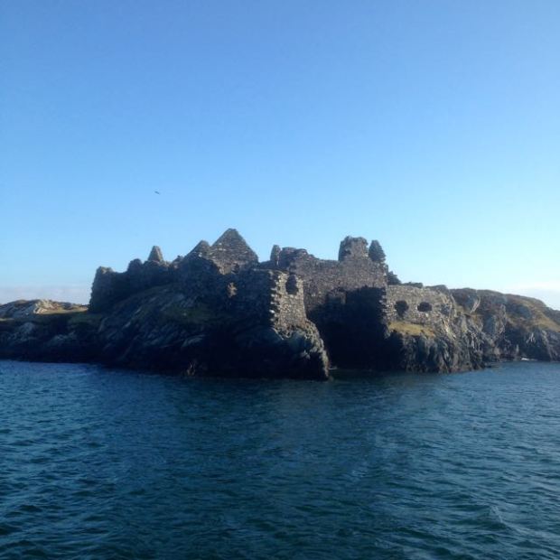
It would have been their last view of their homeland as they eventually got shipped out to the West Indies and an unknown fate. We, on the other hand, had the pleasure of anticipating a fair weather drive back through the mountains of Connemara now revealed in all their glory for the benefit of our German visitor.


She turned out fair in the end – some of the picture quality doesn’t look as good as your previous trips though or has shadowing on the left – are you uploading differently or is this part of the continuing phone troubles? M
LikeLike
Both Milo, pictures taken on my little camera which involves different unload system from computer. Hoping for new phone next week.
LikeLike
Best of luck with it. I suppose you’ll be back down to finish off the Bibbulman once the camera is sorted. Have you spotted the young lad walking the coasts of the UK and Ireland to raise money for coastguard? 4000 miles in of ~10000. He’s heading out west of Galway now.
https://www.facebook.com/alexellisroswell
LikeLike
Good to see you putting fingers to keyboard again Steve. I always enjoy your posts x
LikeLike
Cheers Di, Hoping to do more treks in the coming months..if i can get away from the weeding etc etc etc
LikeLiked by 1 person