After a few days on the Loophead Peninsula, voted the best place to holiday in Ireland , our next trip was up to County Mayo, to an area deemed “the best place to go wild”. We were going to explore the Erris or Belmullet Peninsula, a little dog leg of land sticking out in the Atlantic off the North West coast of Ireland.
On route we had hoped to climb Croagh Patrick again but the ground zero cloud base meant there was no chance of a view of the islands of Clew Bay from the summit, so we headed north around the bay and past Lough Furnace and Feeagh for another skirmish in the Nephin Begs, at the start of the Bangor trail, which i’ve written about elsewhere on this blog.
The old drovers track, dating from the 16th century, that crosses the vast empty bogland of Ballycroy for 30km and takes you as far as you can get from “civilisation”in Ireland, has been recently named by The Telegraph as one of Europes top walking routes but that accolade is unlikely to draw the crowds to this remote and lonely line through the landscape. A big chunk of it has been designated a Wilderness Area and the 50 year plan is to leave it entirely to nature, without any management intervention. Lets hope the encroaching rhododendron doesn’t take over.
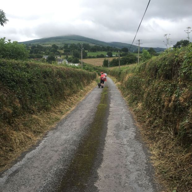
We had a wet 3 hour slosh from the Brogan Carroll bothy up the Letterkeen Loop, circling back on the lower and shorter option as the surroundings were shrouded in mist and drizzle. We saw that the roof of the little hikers shelter near Lough Archer had been blown off …so campers beware.
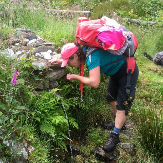
On the way up to Belmullet we stopped at the Ballycroy National Park Visitor Centre, a modernist slab set into the hillside with permanent and temporary exhibitions, a cafe, picnic area, boardwalk out over the fragile bog and a flag waving Gael on the front desk who we had an argument with about the “right to roam”or how to improve access over private land. His argument seemed to be that once Eire’s green fields had been wrested from the oppressive colonialist landlords and distributed amongst the downtrodden peasantry they had every right, even an obligation, to keep everyone else off them for ever. Not an attitude that continental walkers are used to, or appreciate.
The Erris peninsular is attached to the mainland with a thin strand of an isthmus at Belmullet. From a few kms north at Erris Head it projects south over 30km with the Atlantic on one side and the sheltered waters of a succession of bays on the East. Both sides are threaded with pearls of white sand beaches, at one point a mere 50m apart, one wild and one placid.
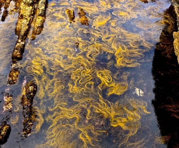
We spent a night parked up on the shore of Cross Lough, a storm beach away from the waves whose energy is being tapped by a range of several device types on one of the worlds best stretches of coastline for this renewable resource. I did the looped walk that took me along the beach with a huge bank of beautiful smoothed pebbles piled up by the waves protecting the dunes from inundation and back around the lake where kite surfers took advantage of the strong on shore winds.

Opposite me a couple of kms across the sea was Inishglora island with the remains of an early Christian monastery, one of many ancient religious sites in this far flung edge of Europe. Looking south i could see the next days destination, the Inishkea Islands, (Geese Islands) ,also dotted with churches, cross slabs and other antiquities.
The following morning we drove down to the bottom of the narrow peninsular to Blacksod harbour from where a charter boat was going to take us the 45 minute trip out to the south island. From the same harbour in 1883 and 1884 an assisted emigration scheme, funded by the Quaker philanthropist James Hack Tuke, saw 3,35o people from the area leave on 15 steamships for Boston and Quebec. In an effort to alleviate to hardships of the “last Irish Famine” of 1879/80 Tuke was concerned with the comfort and welfare of those travelling and provided new clothes and “landing money” on arrival in the New World. We strolled through the memorial garden while waiting for our voyage back into the old world.


Plaques representing each ship had been erected bearing the names of every passenger.It is estimated that there are 2 million descendants of the emigrants and the project behind the gardens hopes to strengthen the bond between these descendants and the home place of their ancestors whose last view of the familiar would have been Blacksod lighthouse,( whose unfavourable and unexpected weather report led to the delay of D Day), and the mountains of Achill.

Ironically the Islanders themselves seemed to have had an easier time of it during the famine years as the dreaded potato blight, carried on the westerly winds, didn’t appear until the mainland.
6kms out,the Inishkea’s, North and South, cover a couple of sq kms each and are separated by a very narrow channel with strong currents. The northern, rounded, island is lower and flatter while a hill 72m high in the middle of the southern island gives protection to the village and harbour on its eastern shore.First colonised in the neolithic period, they were christian outposts from the 6th to 10th centuries and abandoned in the Middle Ages before being reinhabited with the spread and growth of the mainland population in the 17th century. About 55 families lived there by 1850 and the disaster of the drownings in 1927, when 10 men lost their lives fishing from their currachs in a terrible storm that swept down the west coast,was the prime reason for the eventual evacuation in the early 1930’s.
The fine white sand, rich with mica, that now fills the abandoned houses, supports a well drained machair grassland that brings up to 300 barnacle geese from Greenland overwinter and the fish rich waters of the islands feed 1/3 of the nations grey seal population with 150 pups born each year.

These favourable conditions also meant that the islanders were relatively well off compared to much of western Ireland.Each island had a “king” who cast lots every 3 years for the allotment of the tillage land farmed on the Rundale system. The potato ridges are still visible across the islands and oats and barley were also grown in large amounts as well as good grazing grass for cattle, sheep and donkeys.
They lived mainly by the rich fishing and sale of kelp. Lobster fishing was also extremely profitable and plentiful and their catch would be sent by train to Dublin and then ship to England. A visitor to the islands in the 1830’s described the cod, hake and ling as being inexhaustible and all shellfish were bountiful.


The Islanders were a bit of a breed apart, perhaps literally. They were reported as having different characteristics to people on the mainland- fairer hair and complexion, although a number had dark Mediterranean type of colouring.It was also said that they had very acute sight and hearing and could see small objects floating in the sea that others would find impossible.

They were tough folk and although they had a landlord they refused to pay rent or rates and woe betide any collector who could persuade a mainland boatman to risk his craft by taking them out where they would be greeted by a hail of rocks and pebbles.One gunboat sent as an escort was smashed by the islanders. So many failed efforts eventually resulted in giving up and the landlord John Walshe was probably only too happy to sell the islands to the Congested Districts Board in 1906.
There were also renown for piracy and would frequently hold up cargo vessels with a volley of stones and make off with their currachs full of flour and meal or whatever was going.
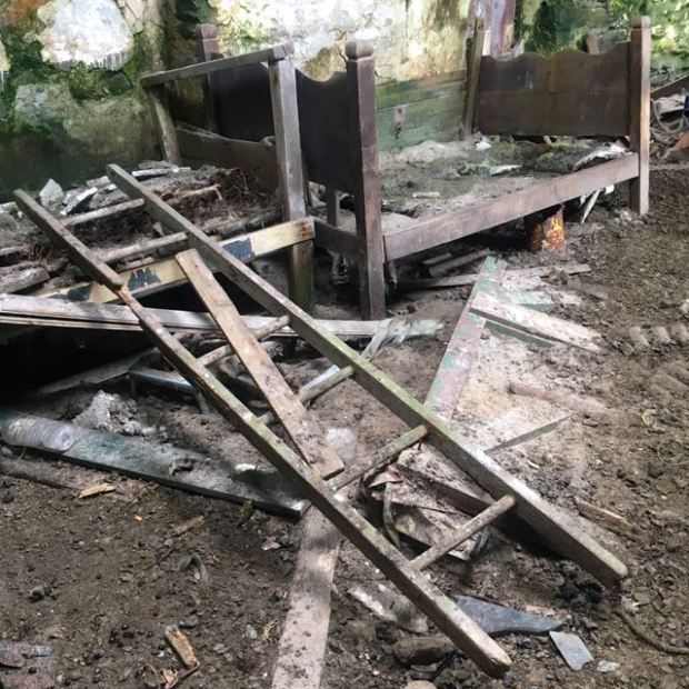
The many wrecks around the coast also supplied all sorts of domestic items most mainlanders had to do without and their homes sometimes contained surprisingly fine furnishings, hard to imagine now.

One of their luxuries were feather mattresses or ticks, while most at the time were straw or rush.
 Every year the men would collect vast quantities of feathers by going out to Black Rock where the birds were so tame they could be knocked by sticks from the rocky ledges.

They also had fine wool from the sheep raised on the machair which supplied insulation and the material for their distinctive navy blue homespun clothes.

They had a thriving export market in quality poitin with one contemporary visitor remarking,” if such be the customary produce of their stills, those islanders are worthy of being canonised”. It must have helped them cope with the harsh winter weather.

The illicit liquor, brewed without much fear of discovery, was reckoned to be so good because of the island grown barley and the copper stills when most on the mainland were tin. These stills were prized family heirlooms, handed down father to son, and lowered by rope into sea caves when not in use.
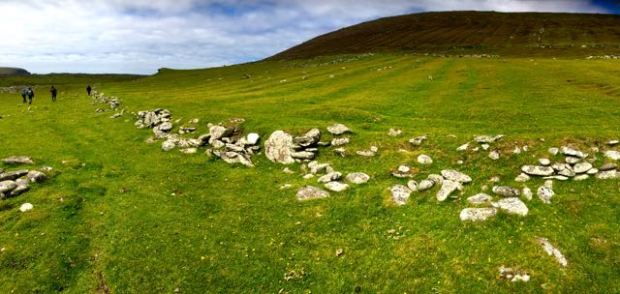
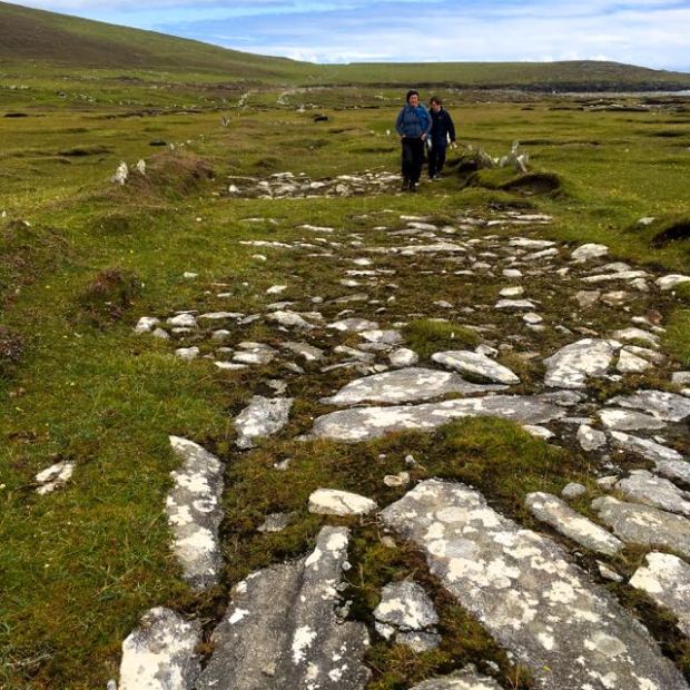
After exploring the forlorn remains of the village we headed off on the green road which heads south across the close cropped grass.

Passing the remains of an ancient church and a holy well surrounded by large stones of quartz it was interesting to think of the religious life of the islanders.
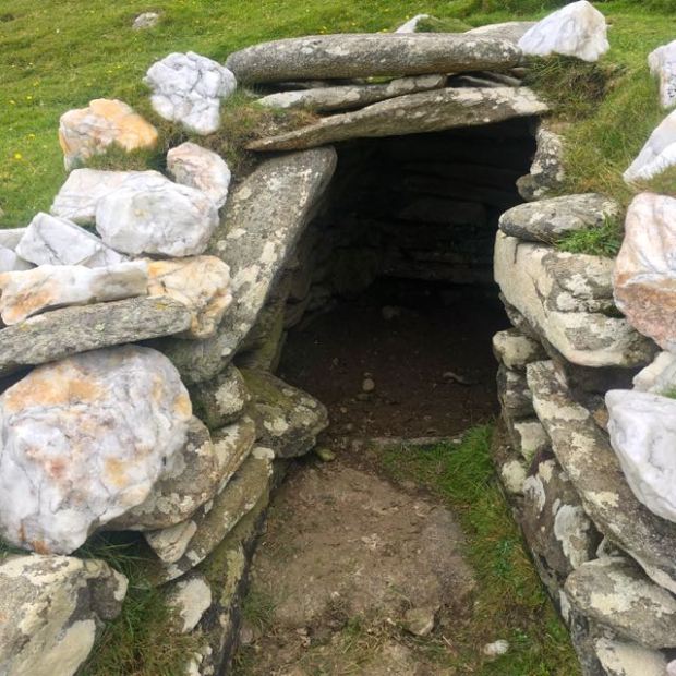 Although there had been a busy monastic style community here more than 1000 years ago the more recent inhabitants were happy to weave a layer of paganism over any christianity and practice a form of stone worship that could have its origins in the neolithic past. Ancient graves have been excavated on the north island with the bodies clutching quartz stones to their chests, some of the christian cross-slabs are thought to have been carved onto existing pillar or standing stones and when the storm winds blew up the raging sea or the potato crop didn’t flourish it was a 2ft high totem known as the Namhog stone that was idolised and asked for help. Dressed in a new homespun red flannel every year and kept in a niche in one of the houses it’s supernatural powers were not appreciated by the late 19th century curate Fr O’Reilly who threw it into the sea….and died shortly after.
We followed the old track passed a couple of seal filled bays opposite each other and separated by a huge storm beach whose mass of rocks and pebbles are still breached by waves in rough weather and will one day join up to form another island.
From here we turned back to scale Knocknaskea the central hill which opened up an amazing vista south to the cliffs of Achill.

At the top the white beacon towered over the land and seascape as a sentry point for the village and guide for those plying the surrounding ocean.

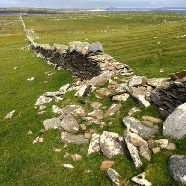
From here we followed the long high stone wall running towards the north island which gave some protection to the strip fields which ran down from it to the houses on the eastern shore.
From the island’s tip we looked across at its neighbour, from whom it is thought it stole the Namhog stone. It’s said there wasn’t much love between them, especially when, due to the influence of teachers during the civil war, the North Island was pro treaty while the South was anti, and they lined up on either shore to hurl rocks at each other. A fine example of the futility of war.

Another reason for the prosperity of the south island and the bad relations with its neighbour involves the whaling station set up in 1908 on Rusheen Island just next to the harbour and village. This Norwegian enterprise was forced to only employ men from the south island although the smell and pollution had to be endured by both.Paul Henry, the celebrated artist, reported that “this was so appalling and so bad was it that it was a couple of months before i got it out of my clothes.” He also spoke of the loads of whale offal being thrown to the great numbers of the most enormous pigs he ever saw.
Up to 40 men were employed there at generous wages for the time although the company found them “indolent and unreliable”, perhaps understandably as they were unused to conditions of employment and would be absent for days at wakes and during the lobster season when two men in a curragh could earn £20 a week opposed to the £1 they were getting from the whaling station. (And that was after striking for more than the original 15 shillings).
But to put that into context those wages meant they were doing well enough to employ men from the mainland to dig their spuds for 1 shilling a day. They were even paid when sick and got overtime wages. You can understand the company’s displeasure when, with a load of whales to process before they went off, they offered overtime and men on full pay sick leave left their beds to avail of it!
The self reliant attitude of the islanders encouraged them to make hay while the sun shone and harvest whatever money they could. The families who had been living on Rusheen before were claiming rent from the company even though they had never paid any themselves.But all good things come to an end, and bad management, tricky access and employee problems meant that even in 1909 when 102 whales were caught, a loss of over £2000 was recorded and so the whole thing folded after 5 years . The men helped themselves to materials and equipment before it could be removed for sale and returned to their traditional way of life for another 15 years before hardship and tragedy drove them ashore to 5 acre plots allotted to the families on the mainland overlooking their island home.

………………………………………
From the bottom of the peninsular to the top and the next day we did a looped walk around Erris Head where the land rises north of Belmullet across miles of blanket bogland to end at the dramatic cliffs overlooking the Atlantic.

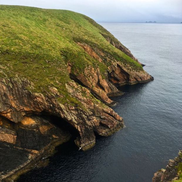
A well known and recognised landmark featuring in weather reports, it is a Special Area of Conservation and the protection extends out to sea aways to include nesting seabirds. From the steep slipway and steps at the oddly named Danish Cellar cove where an adventure sports operation had set up we crossed a stile onto the open land.
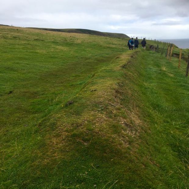
We followed an earthen bank that could have been defensive, a parish or field boundary or maybe just to prevent sheep from tumbling over the cliff.
This led us around the headland with more and more of the even more dramatic cliffs of Benwee Head coming into view towards the east. They rise to 250 m and drop vertically to the sea below but were too far away for my cameraphone to capture.Somewhere between us under the water was the gas pipeline leading towards Rossport and whole heap of trouble and strife (or possibly clean energy and local employment).

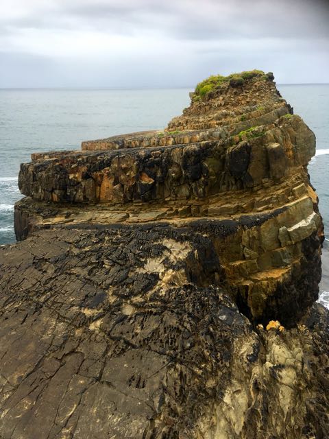
Beneath our feet the turfy grass and heather was eaten to the bones of the quartzite and gneiss below, the oldest rocks in Ireland and originating from what are now Greenland and Canada.


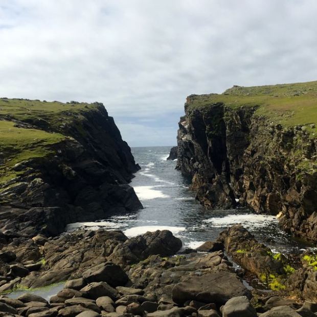
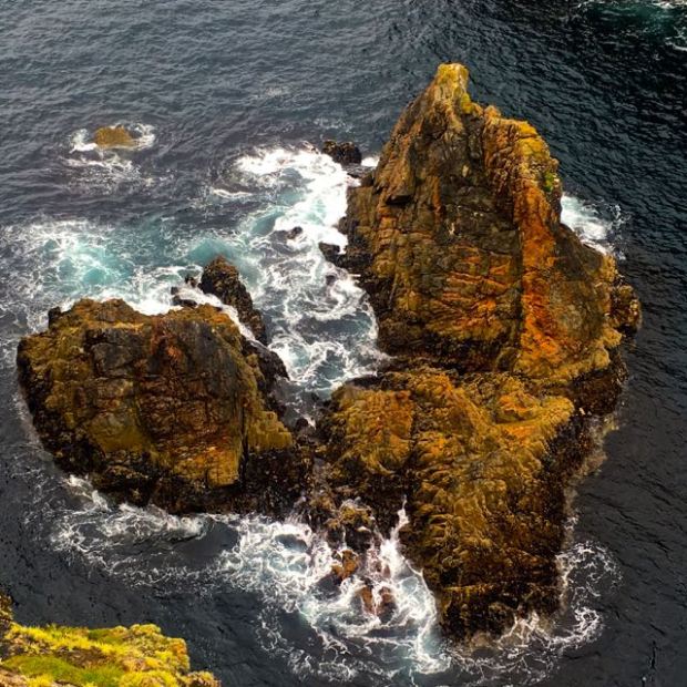
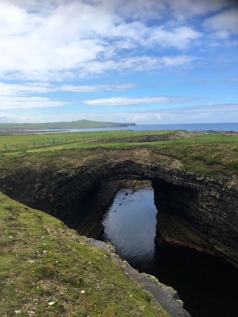
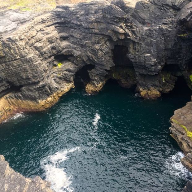
The seas here are often visited by pods of dolphin, porpoise and whale while the skies above are the arena for aerobatic displays by fulmars and ring to the cries of the chough. There are a number of mini islands and at the heads extremity a couple of acres of rock has broken away over millennia to form a narrow channel of booming waves and sea arches.
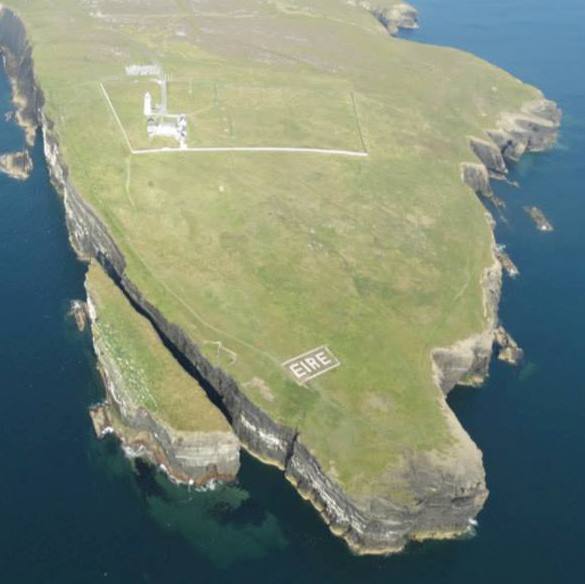
10km away across Broad Haven bay you can just make out the jagged peaks of The Stags at the bottom of the Benwee cliffs. `From the promontory the route led up to one of the WW2 coastal lookout posts, like the one we had seen on Loop Head the week before, again complete with a giant “Eire” laid out in stone for any lost pilots.
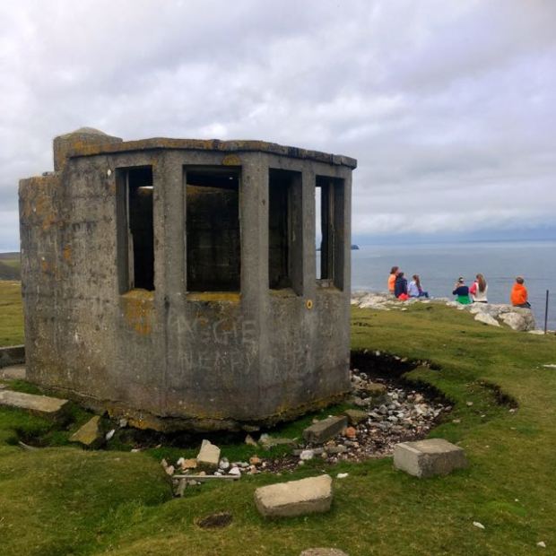
Manned by locals 24hrs a day the 82 of these stations dotted around the coast reported any noteworthy events to HQ by radio.

We followed the climbing ground passed the vertically sided inlet of Ooghwee to the trig point at 82m that had once held meteorological equipment and from there white stones set in the turf back southwards to the starting point.


Our time for “going wild” was over and it was time to return to the sedate surroundings of South Galway.


 There’s not many dog friendly Ways in Ireland as i have complained before, and the South Leinster Way was the last on my list, having previously walked the Grand and Royal Canals, the Ballyhoura,the Slieve Felim, the North Kerry and the Offaly Ways and not wanting to do the only other, the Dublin Mountains Way.
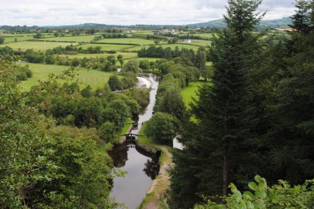
 And so it was, we spent a peaceful evening on the waterside wondering if we could remember it from our boating trip the length of the river 4 years previously. A jogger and a couple of strollers were all that passed us by and the frequent splashes awoke the optimistic hunter in me and i wished i’d brought a rod to catch the obviously massive fish that filled the unseen depths.The lack of one saved me from the mundane reality of waiting hours to,perhaps, eventually land a miniscule and inedible roach.
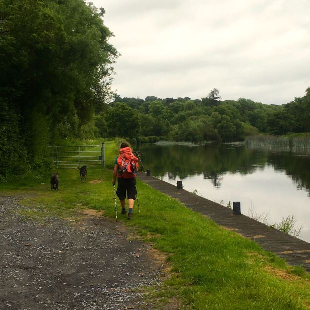 As with the canals, the Barrow is certainly an under-utilised resource and it must be hard for Waterways Ireland to justify the expense of keeping the channels clear of weed and silt and the paths mowed. There certainly seemed to have been a build up of vegetation since we motored through on the Jack Daniells.