
Many moons,or decades, ago, we made our first trip out to the foot of County Clare, into what seemed then a little known or visited corner of Ireland. With the coming of the Wild Atlantic Way and all it’s signage and viewpoints and after being voted the best place to holiday, things have changed. Some good, some bad.
To be fair to the folk promoting its beauty and benefits they have tried hard to keep tourist developments sustainable and to keep the financial rewards amongst the local community but it has, inevitably, lost some of its quiet mystery. Luckily, and consciously, the narrow lanes of the peninsular are not conducive to mass coach traffic so it will not become a Ring of Kerry although the wild and dramatic seascapes deserve the increase in people enjoying them.
With a gathering happening in Kilkee to watch and cheer on an extended family member rowing for Ireland in the Olympics (not our genes) we took the opportunity to head down across the treeless landscape of flat rushy pasture slowly rising up to Loop Head where we could park up by the lighthouse.

Originally ,350 years ago,a single story cottage with a signal fire on top it was built in its current form in 1854 and its blinking beam of light projects across the waves for 23 miles to warn seafarers of the 200ft cliffs it sits on.
These days you can rent the cottages and there are guided tours for a fiver but its still a wild spot with the salt laden westerly winds ensuring that coastal plants can survive far from the sea.
We went walking down to the lower edges of the cliff tops and around the headland and were watched carefully by a seal and ignored by a pod of dolphins as we bounced across the springy matts of sea pinks that made a thick carpet over the shattered rock. It must be a beautiful sight when they are all in bloom.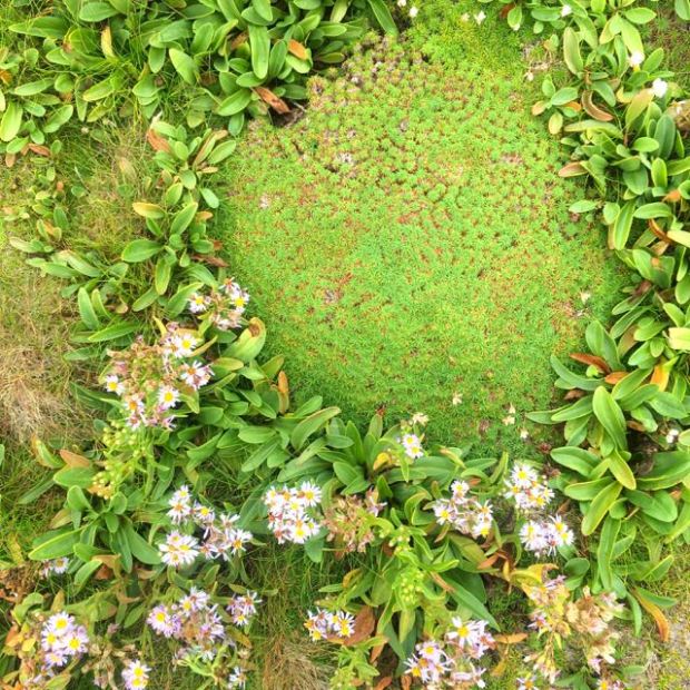
(Not sure what the Aster type flowers are)
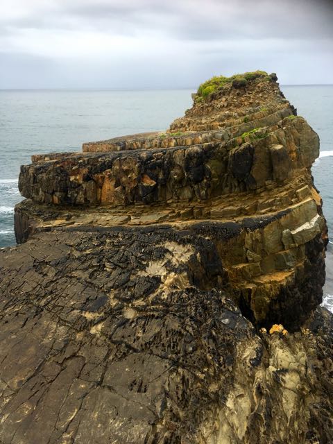
The cliffs were black and sheer even though there were a lot of strata and twisting and turning of rock made up of layers of solidified sand and mud carried down a vast river system some 300 million years ago when it was all underwater. At that time the area would have looked like the Mississippi delta does today and the cliffs bear the marks. In places you can see fossilised ripples created on the seabed by wave action then buried by a subsequent layer of mud and sand.
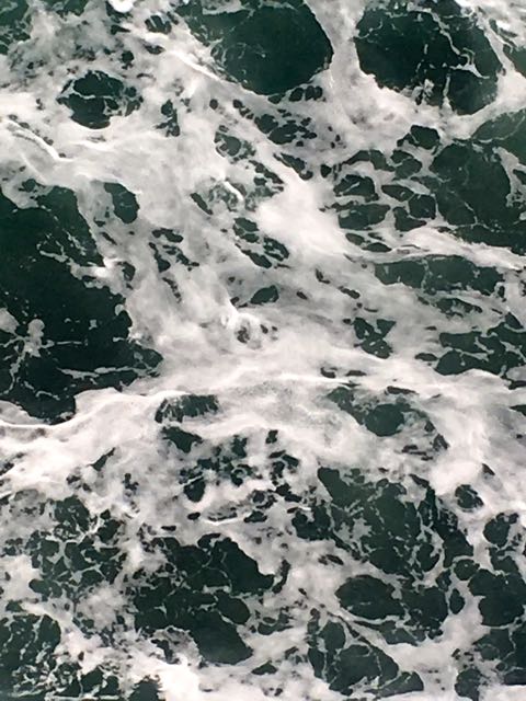
I’d read some reports by sea kayakers who had had trouble rounding the Head and remembered an aborted fishing trip when the captain had turned us back to Kilbaha as the vomit to fish ratio climbed as steeply as the boat climbed the waves. This is not a coast for paddling.
It is a coast though of epic sea warfare from the Armada to the Battle of the Atlantic in the second World War and on our way back around the Head and up towards the lighthouse we came upon puzzling white stones laid out on the ground in a pattern we couldn’t recognise. I later discovered there had been a WW2 lookout here built by local soldiers of the Coast Watching Service and were an early warning system against invasion.There were 83 of them built around the coast and coincidently we came across another one a few days later on Erris Head in Mayo. They had also laid out the stones to alert pilots that they were now flying over neutral Eire.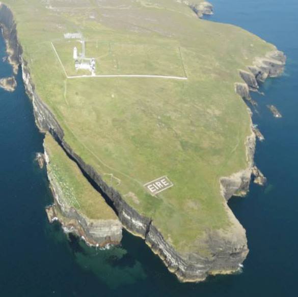
The lookouts witnessed much of the Battle of the Atlantic from their eyrie with the cliff top views taking in most of the west coast from the Twelve Bens of Connemara, the Aran Islands, Cliffs of Moher and to the south the mountains of the Dingle Peninsular and even the distant dots of the Blasket Islands.
We carried on to another geological wonderland a few miles east at the Bridges of Ross. Once again we were greeting by the WAW signage including the bizarre empty rusted metal map? boards and new car park. From there a path led us the few hundred yards along the coast to the one remaining sea arch. Originally 3, there now remains only one but the waves are working on creating more even as they try to destroy whats left. Life is change especially in geological time frames.
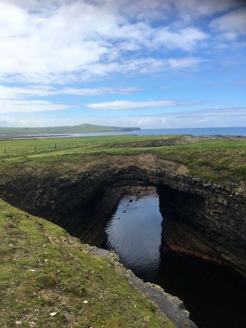
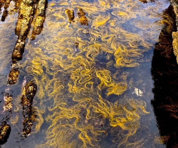
The little cove formed at the back of the arch was an artwork of swaying seaweed.
After exploring the amazing natural architecture created by the movements of the earths plates folding and tilting the sedimentary rock beds we were keen to find one of the sand volcanos we had heard about. With advice coming over the internet from our geologist son in Australia as to their whereabouts we headed northeast along the chaotic shoreline but weren’t convinced the lumpy heaps of gravel were what we were looking for.Resting up overlooking a dramatic cove 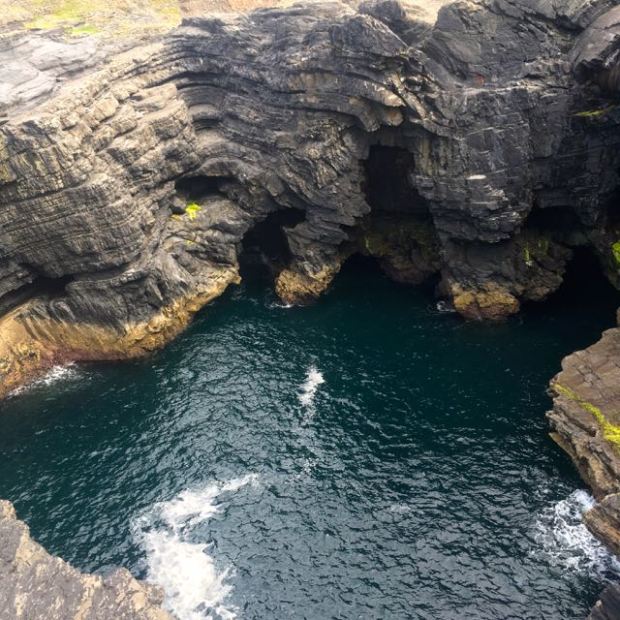
i spotted a team of international “rock stars”on a study trip on the cliff opposite. I headed over, interrupted their learned discussion, and asked for directions. Only too happy to spread the good word one of them told me how to find the nearest, and best example. Showing me pictures on his mobile phone and explaining the secrets to their formation in a dumbed down kind of way he informed me that back in the day when all around us had been a sandy sea bed, there had been a massive landslide of the coastal cliffs covering the sea bed with debris. This had trapped air which the huge pressure had caused to erupt up through the layers of mud and sand to create the “sand volcanos”. Or something like that.

Mission accomplished.


Turning into a geoblogger
LikeLike
Blimey Milo, about time you caught up. Long time since we were after directions to the sand volcanos.
LikeLike