Month: August 2020

Dingle Ramblings

We had thought we might head down to the southwest and do the Sheeps Head, or Dingle Way long distance trails but having just survived Storm Ellen and with Storm Frances on the way thought it wiser to do day hikes from the camper as the weather permitted. And so it was that we arrived at Brandon Head under Ireland’s highest mountain outside of the MacGillycuddy Reeks with a plan.

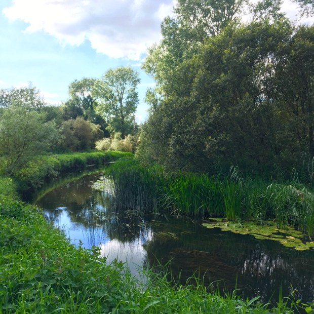
This was staycation summer on the Dingle peninsular and we were concerned it could be crowded. But no, once you venture into the hills there is always wide open spaces for all. Even on the Wild Atlantic Way.

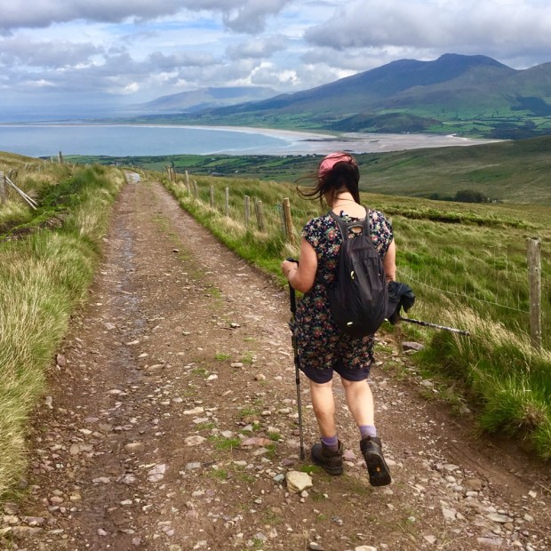
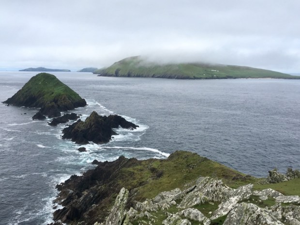
Our planned route of an out and back to the pass between Masatiopan and Piaras Mor north of Brandon Mountain changed when we saw the signs for a loop to Sauce Creek.

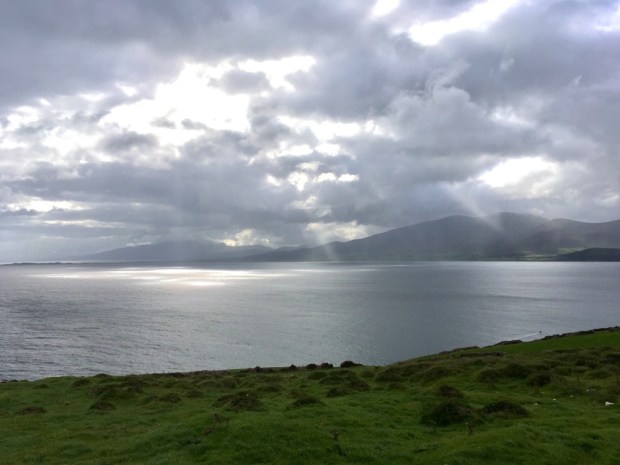
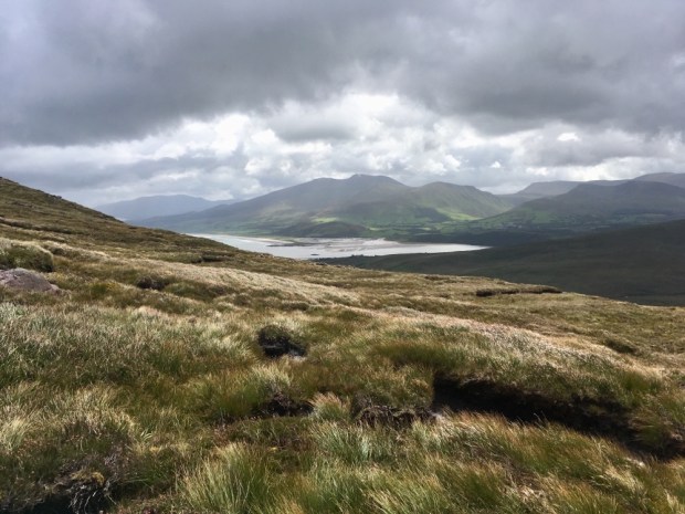
The Loop was 12km I think and we would add another 10 km by continuing west over the pass on the Dingle Way. It was a dramatic place to park up for the night with waves crashing onto the cliffs below us and views out over Tralee Bay to Kerry Head and the Slieve Mish Mountains.

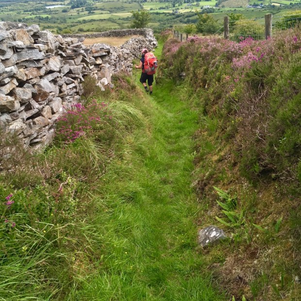
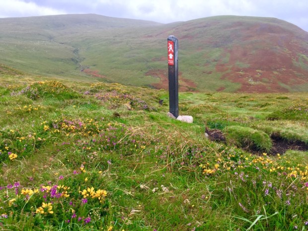
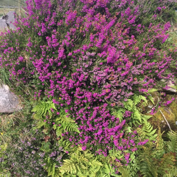
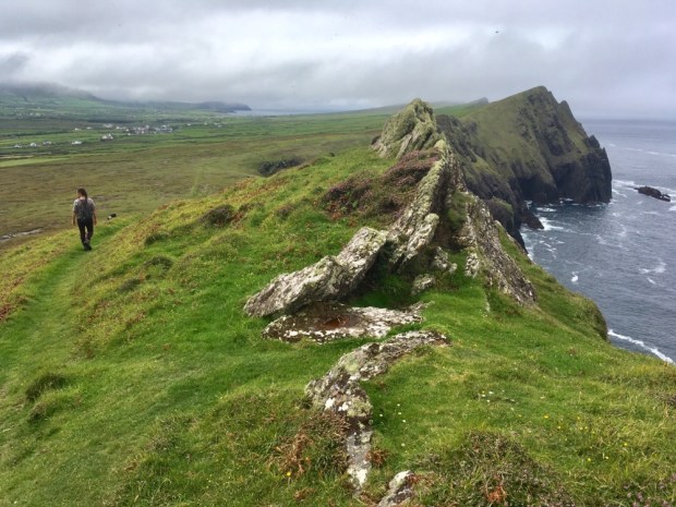
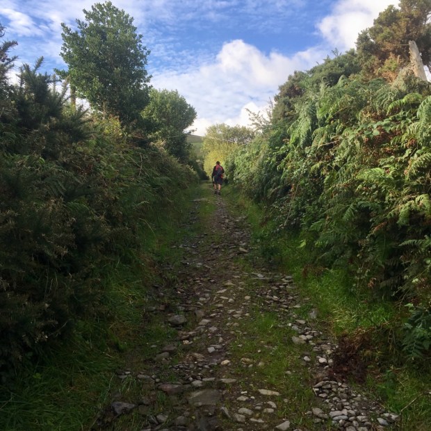
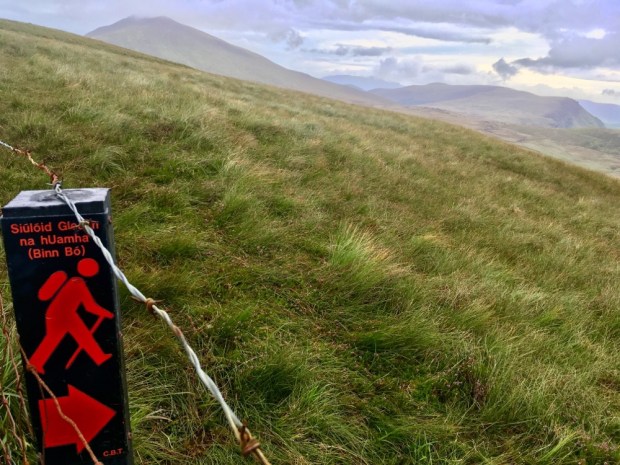
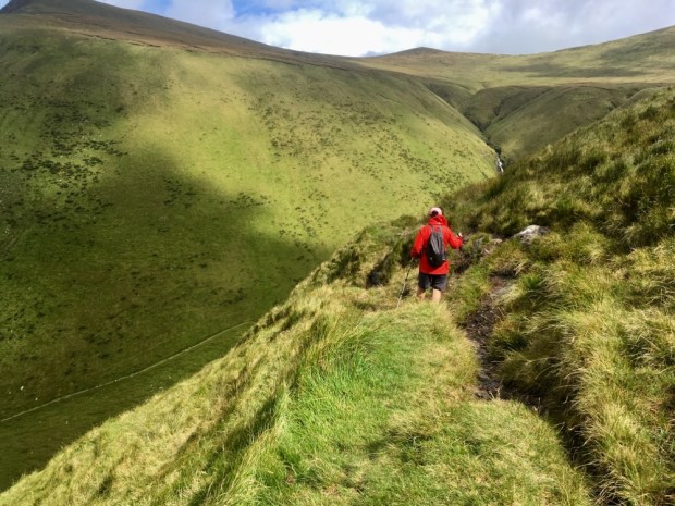
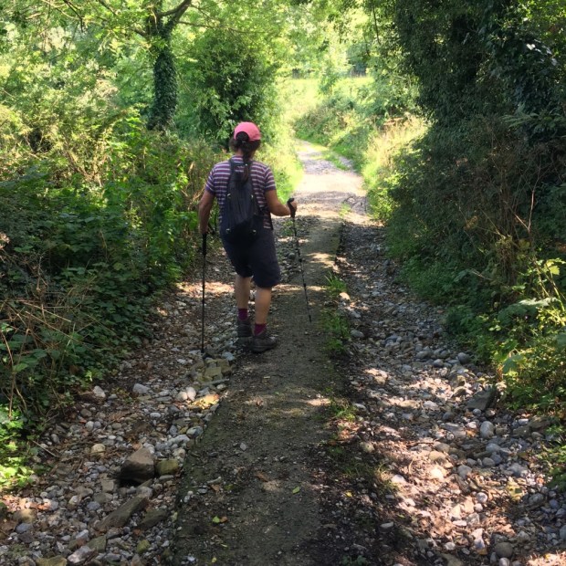
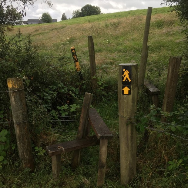
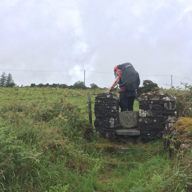
Climbing the stile with the red walking man signs in the morning we climbed higher up the headland and away from the cliffs through a wild and open landscape of russet brown grasses and bracken and the purple and yellow splashes of sheep trimmed heather and gorse.

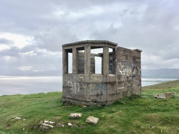
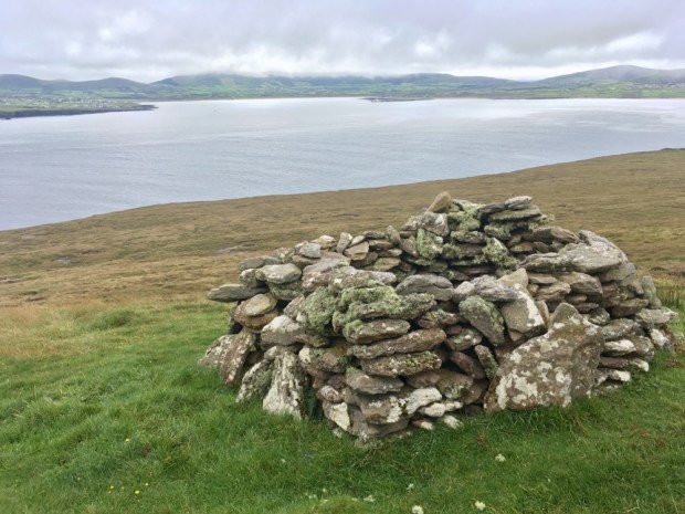
We passed one of the Second World War lookout posts that we’ve come across on numerous headlands around the coast of Ireland. Manned 24/7 by 2 men who watched for and logged and reported any military activity, the LOP’s were often accompanied with a giant EIRE laid out in white painted rocks on prominent sites to alert pilots they were over the coast of neutral Ireland. Historical remnants that often puzzle the coastal visitor there are still around 50 of the original 83 standing sentinel awaiting some other purpose.

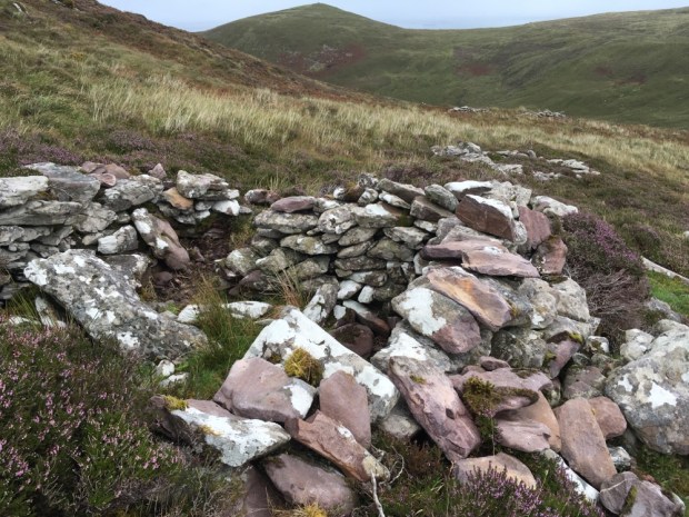
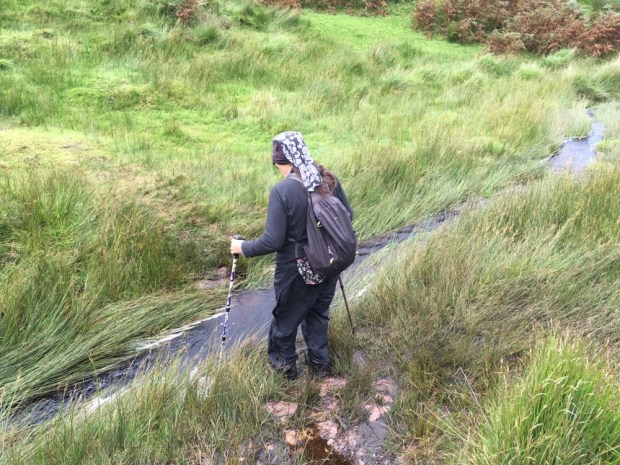
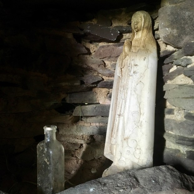
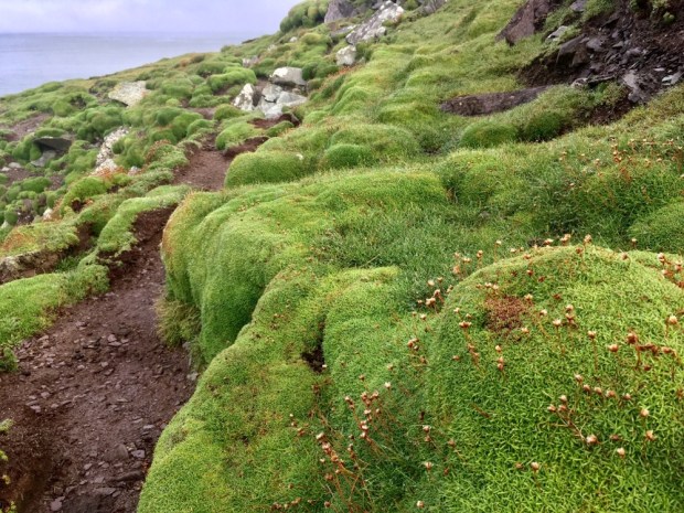
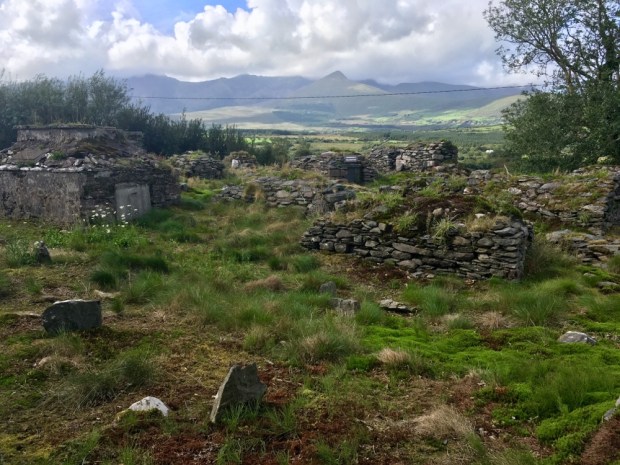
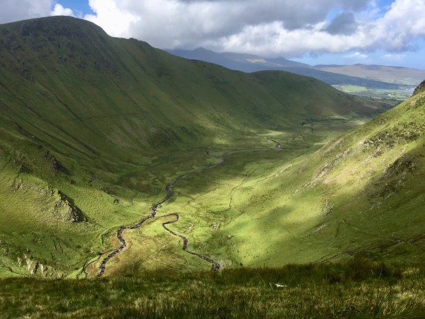
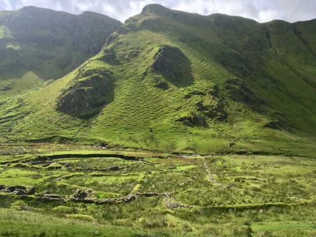
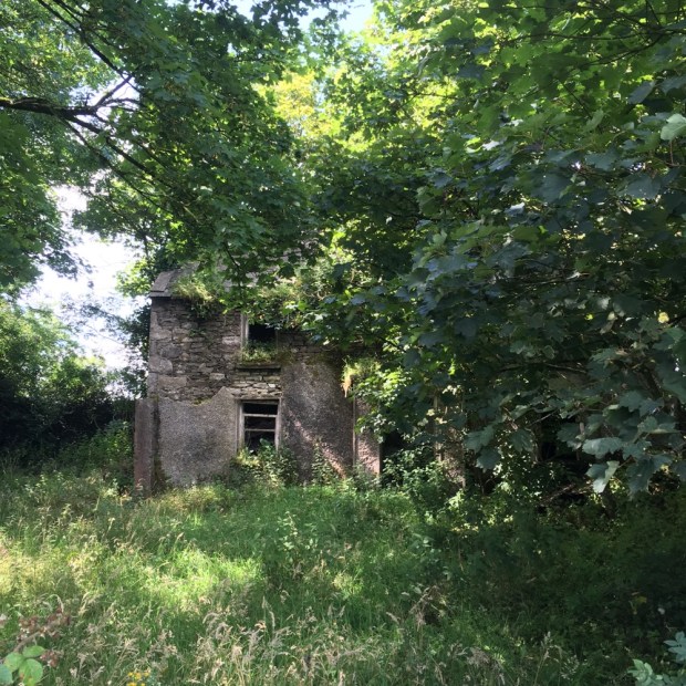
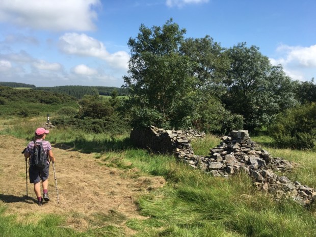
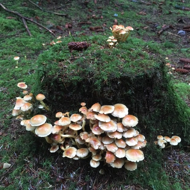
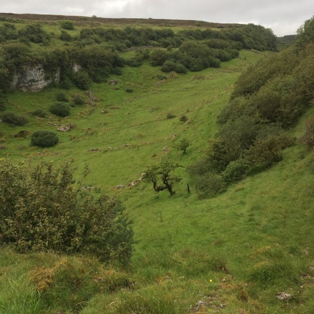
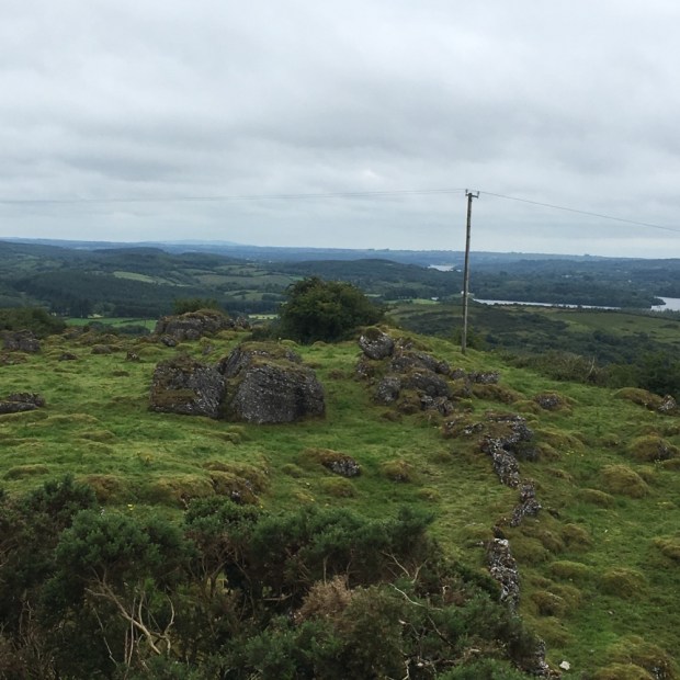
Almost lost in the soft boggy ground and hidden in the long rushy grasses were the stone walls of animal shelters or human habitations from a time of hard and isolated living. We descended into a deep valley to ford a steam and then climb up and over the rounded summit of Cnoc Duileibhe (311m).

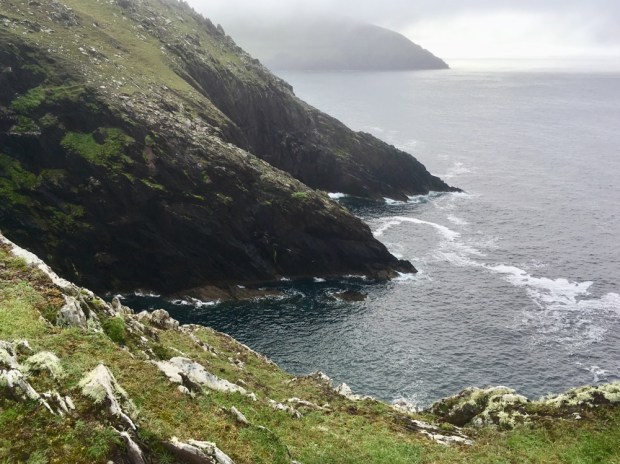
Heading due west towards the sounds of the sea we reached the flatish heathery area of Sliabh Glas and a view down into the jaws of An Sas. Translated as “trap with a noose” the horseshoe shaped Bay was reputed to hold fast any boat that ventured, or was swept, in. There used to be 3 families living at the bottom of the 750m long curve of cliff, scrapping a living from a few acres of land and the vastness of the sea, the last to leave in 1910 after a local midwife lost her life falling from the heights on her way down to deliver a baby.

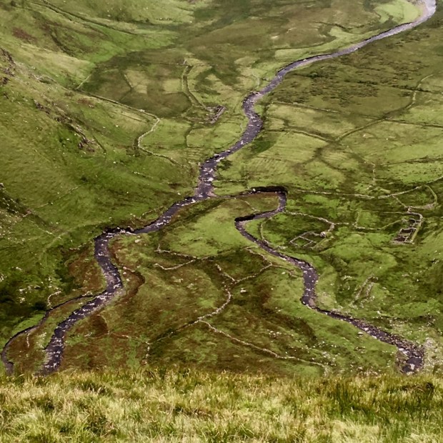
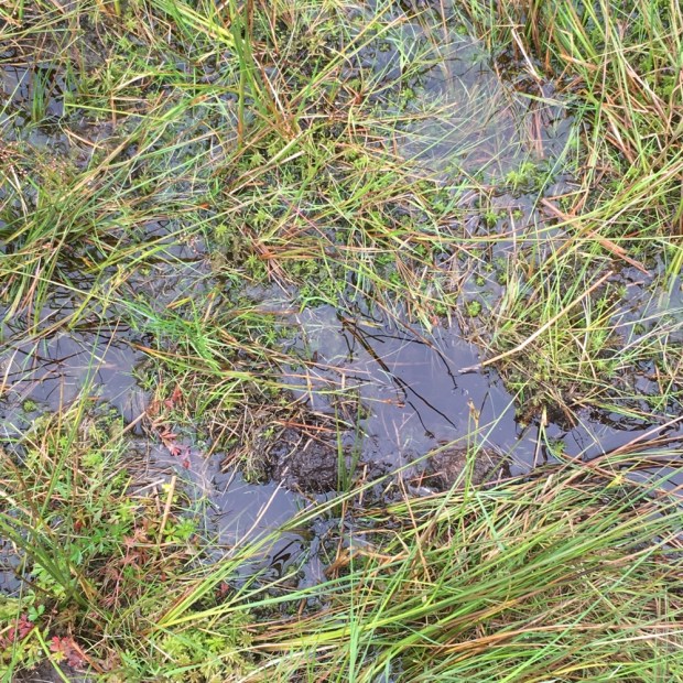
Half of the Kerry coastline is defined as “soft” and liable to erosion and about 10 acres of these cliffs fell into the sea in 2014 so much of the remains of the early settlements are slowly being lost to the sea. As we turned our backs to the ocean and continued south the ground was riddled with deep bog holes and fenced off ravines and care was needed to avoid a twisted ankle or worse.

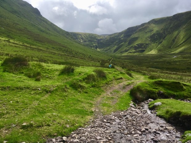
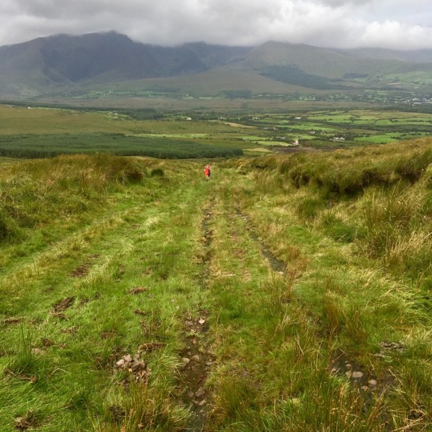
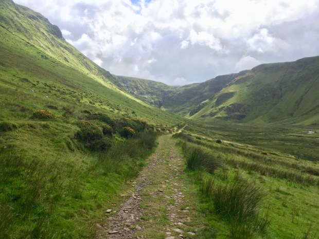
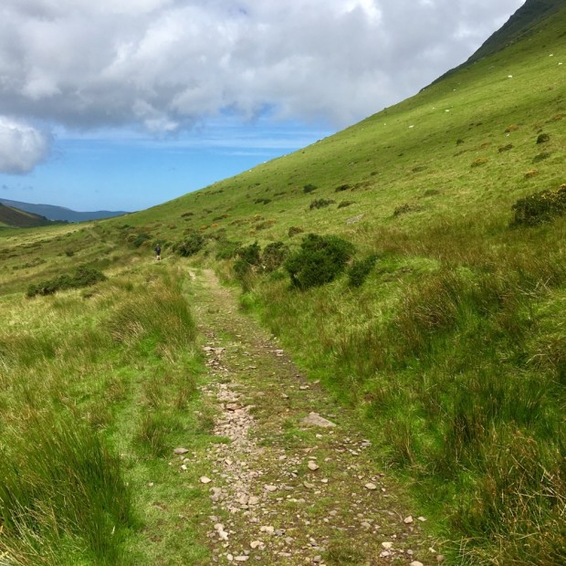
Rising over a knoll following the marker posts we had a vista of uninterrupted bogland and the silver glinting of Brandon Bay beyond. Reaching an ancient trackway we turned west again. We were now following the Dingle Way on its route over the shoulder of Mt Brandon and down towards Feohanagh and Smerwick Harbour.

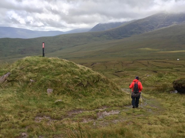
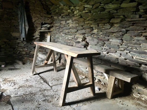
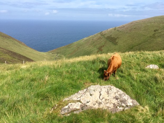
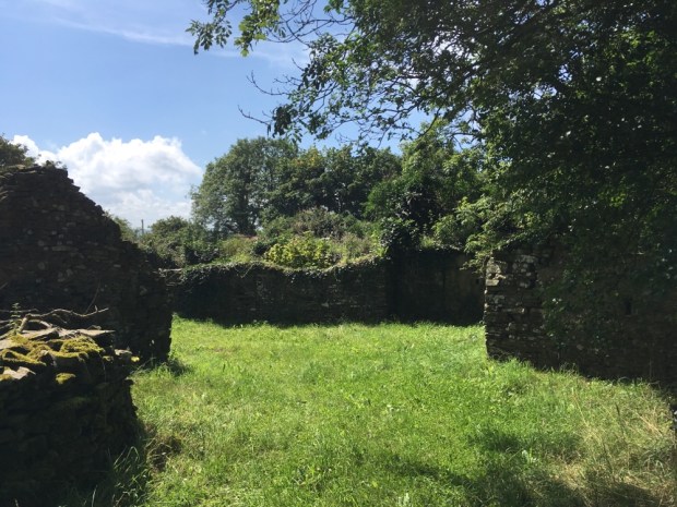
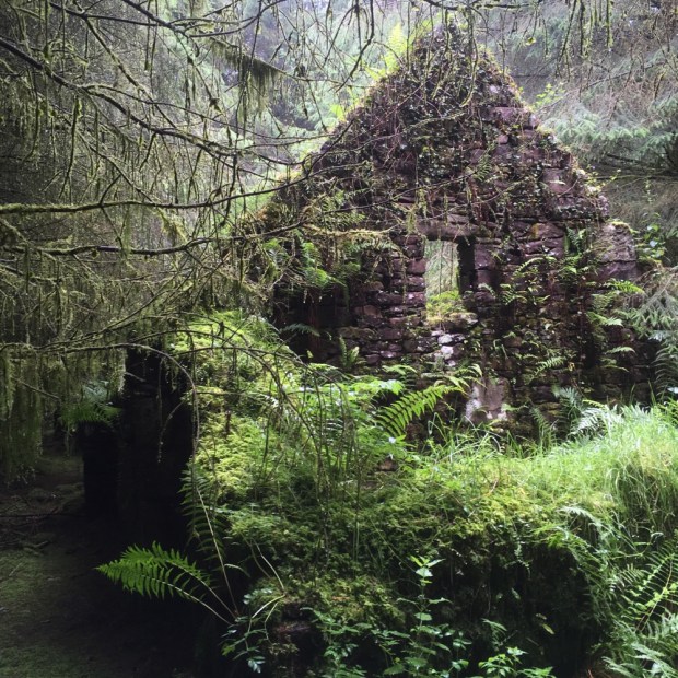
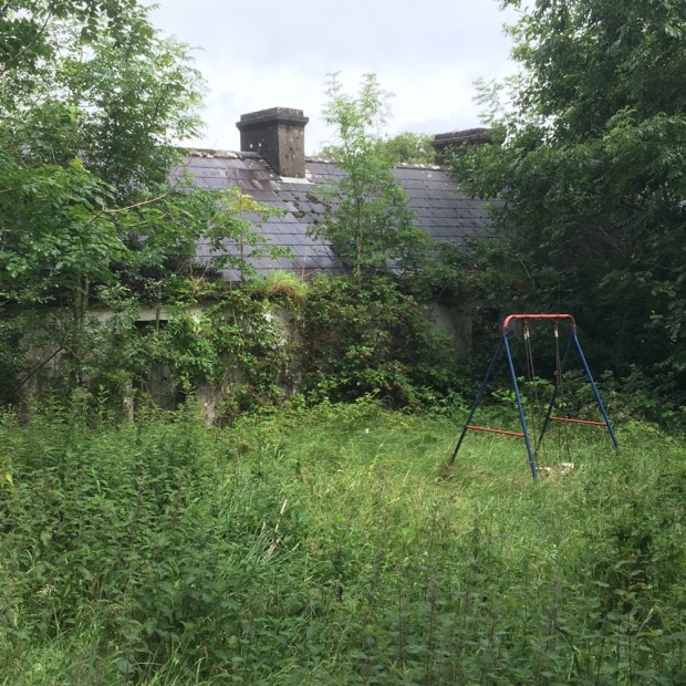
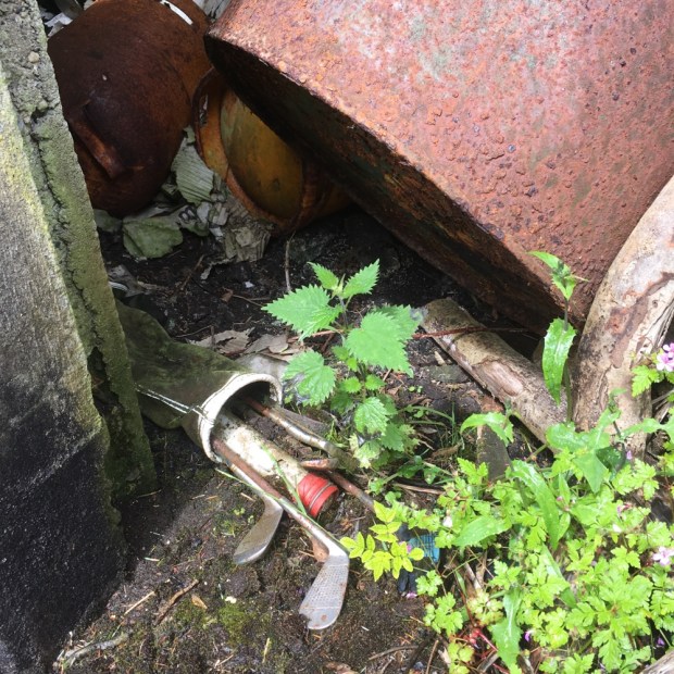
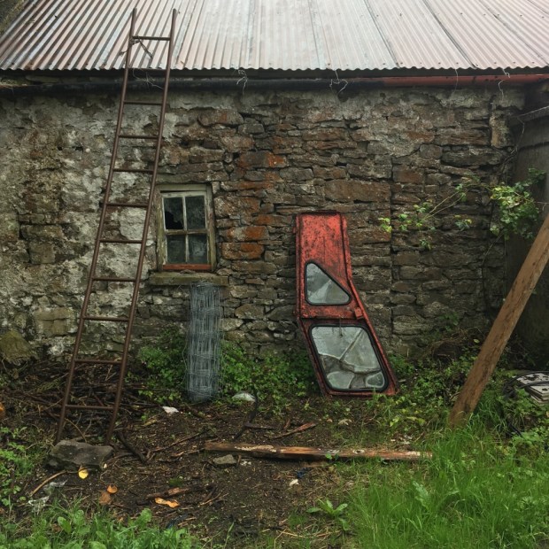
At the far end of the track we stopped for lunch at a roofed building amongst what had been an extensive settlement. It had possibly once been a home and still had traces and relics of its past life but now looked like it was a shelter for people working on the track or tending the cattle that were now the only inhabitants of this lonely spot.

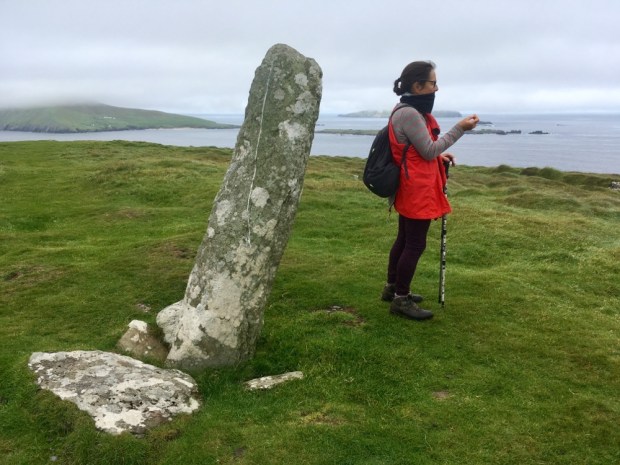
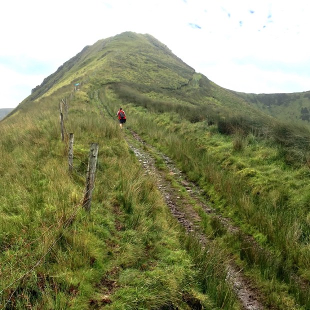
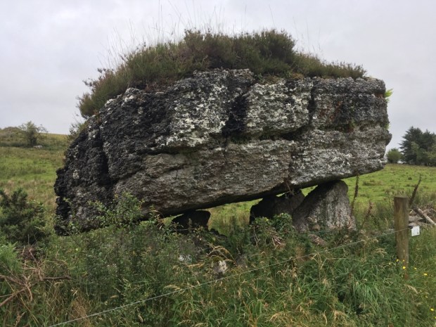
This was the hamlet of Arraglen and was once home to 13 families. A lot of effort was being put into creating a solid path from here up towards the coll high above with a mini digger creating ditches and drains. At its end we continued to clamber over the steep slope to the pass at 610m where somehow we missed the 1500 year old Ogham stone but reveled in the views down to the west.

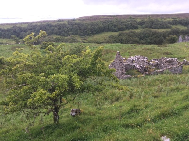
Below us were the walls of Fothar na Manach, the Fields of the Monks, where a community of monks lived and farmed what must be one of the wildest and most inaccessible sites in Ireland next to Skellig Michael which would have been visible in clearer weather. We could see Brandon Creek, from where St Brendan and the lads headed off to America in the curragh, the sloping pointed peaks of the Three Sisters, and, fading into the murk of sea and sky, Slea Head and the Blaskets islands.

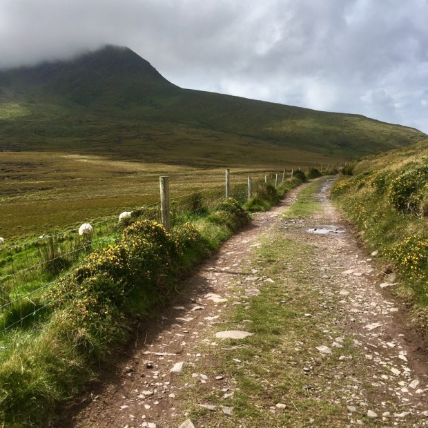
Returning to the camper via the Dingle Way along the old bog track we were rewarded with equally stunning views to the East which at times included Carrauntoohil, Ireland’s highest. But Mt Brandon continued to wear its hat of cloud. In the sheltered walls of the boreens in the valley below the colors of the fushia, montbretia and heather were a shock after the bare mountain above.

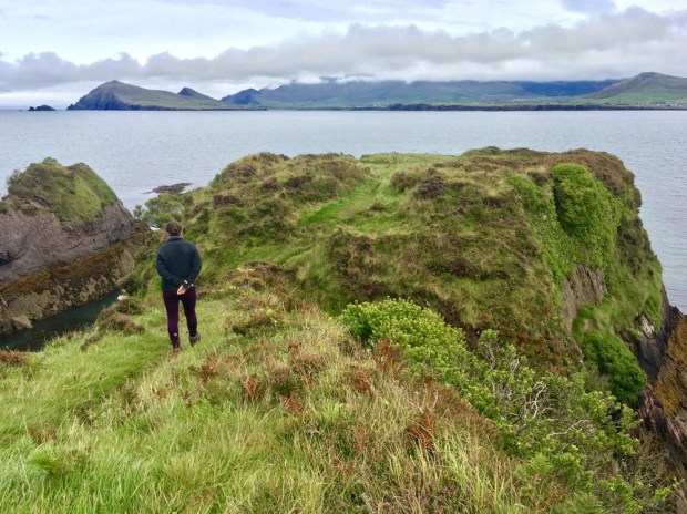
Moving on to the most westerly point in Ireland , on Dunmore Head , for the night, we were again grateful for an empty and dramatic seaside parkup without any ” no overnight parking/ camping ” signs.

We had planned to tackle Mount Eagle in the morning but the cloud was too low so we explored the short but sweet local loop around the head, where some of the last Star Wars movie was shot. We could imagine the location finder was well pleased with themselves on discovering the stunning otherworldly scenery of this western outpost with only the hauntingly atmospheric Blaskets Islands any more “Far Out”.

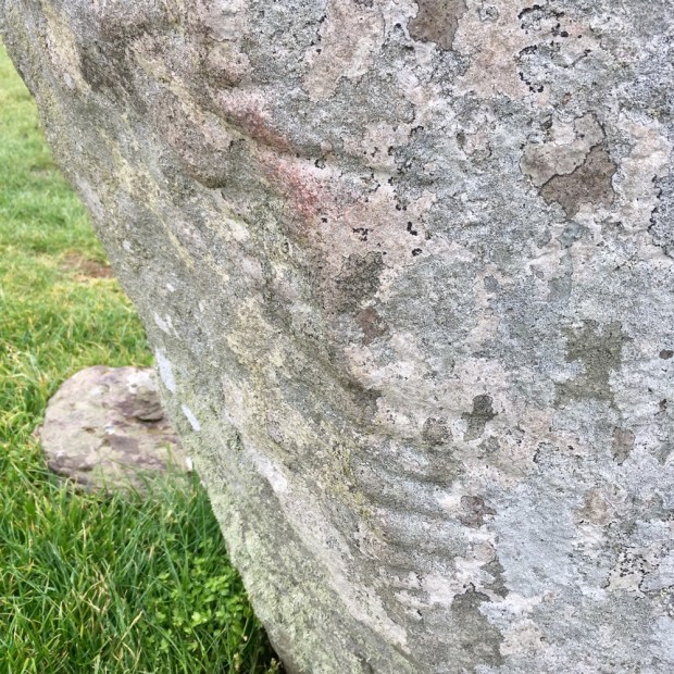
Atop the headland was another LOP, that’s Loop Out Point to those who haven’t been paying attention, this one with an Ogham stone for company, it’s 1500 year old script still plainly visible.

The sky was clearer to the north so we headed round the indented coastline on the Slea Head Drive wondering if pre-covid we would have encountered coach tours on the narrow winding road. Parked up overlooking the embracing shelter of Smerwick Harbour we walked a muddy farm track to gain access to the commonage around the Three Sisters.

An untamed and rugged landscape that had witnessed the savagery of man at Dun an Oir, the promontory fort we explored below the Sisters. It was here in the defensive Iron Age site that one of the bloodiest events in Irish history took place in 1580.

A force of 600 Spanish, Italian and Irish, sent by Pope Gregory in support of the Desmond Rebellion were forced to defend themselves there when their ships had been blockaded within the bay. The English forces, 4000 strong, massacred them all after they had surrendered following a 3 day siege. All but the commanders were beheaded and the bodies thrown into the sea, the heads lined up in an adjoining field, since called Gort na gCeann ( Field of the Heads).

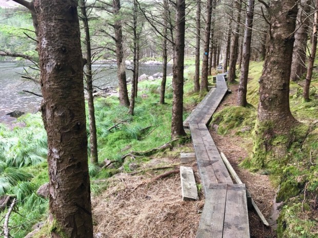
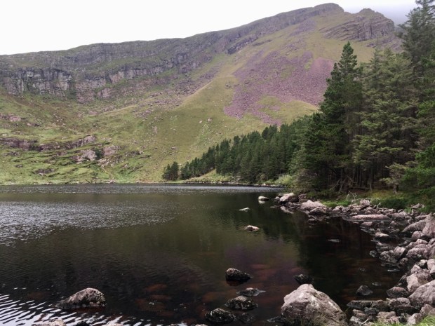
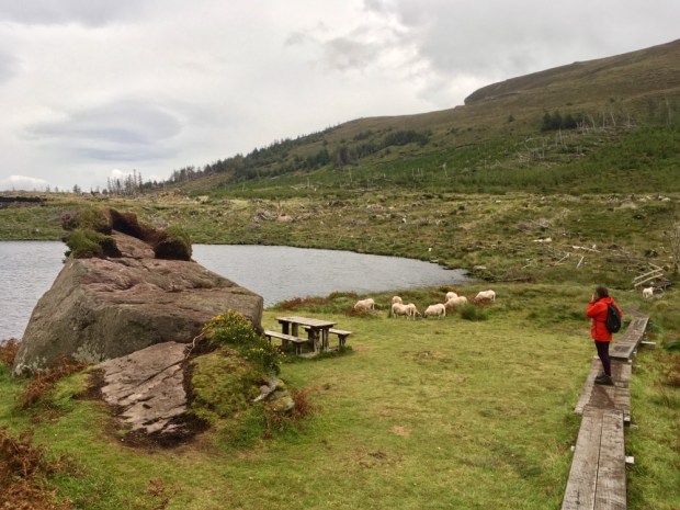
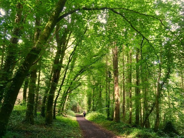
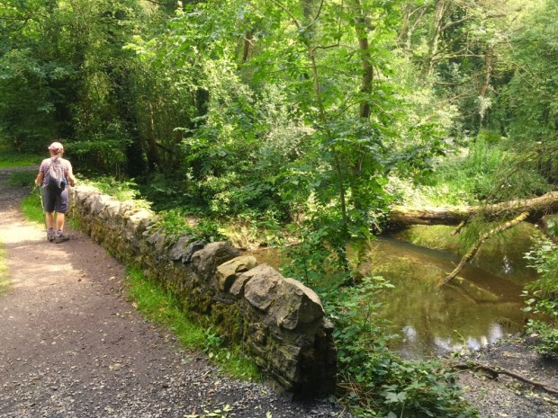
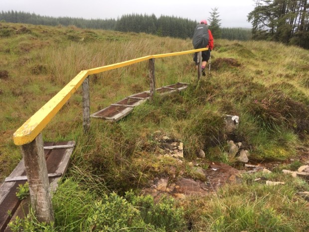
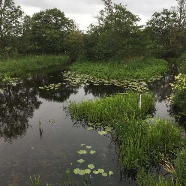
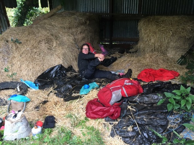
With a wild, wet and windy night forecast as Storm Francis swept in we thought we’d better retreat inland to safety. Glanteenassig Forest Park in a sheltered valley nestled among the peaks of the Slieve Mish mountains sounded good. The 450 hectares of forest, mountain and peatland were billed by Coillte as ” an outdoor enthusiasts dreamland”. Seemed to fit the bill. Up a long single track lane towards the only farm at the valley end we turned in over the Drishoge river and drive on up the forestry track to the upper lake, Caum.

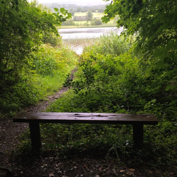
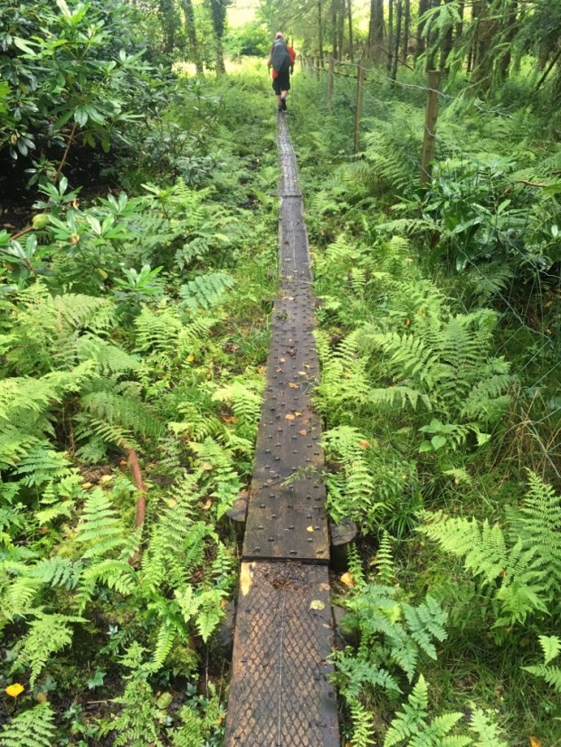
Amazingly the 2 km circular walk around the lake was all boardwalk. Some serious amount of effort and cash had been put into placing the 1000 or so slabs of 9×2. Wether this was to protect us from the environment or the environment from us I couldn’t be sure but certainly made for a dry footed walk over some seriously wet ground.

The deep lake, gauged out by a retreating glacier, was silent and tranquil as we awaited the wind and rain in a carefully selected parkup.

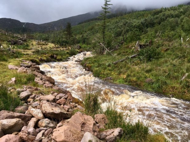
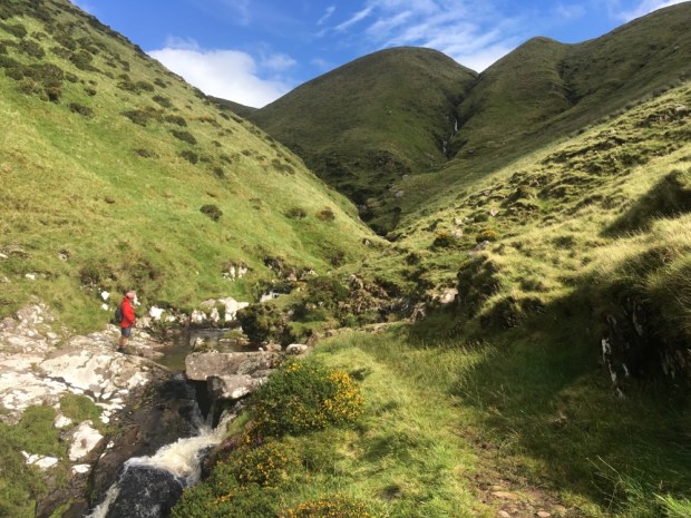
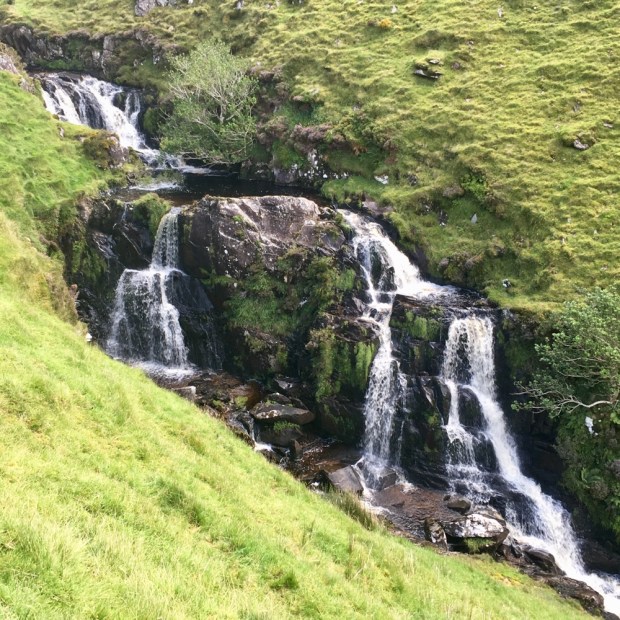
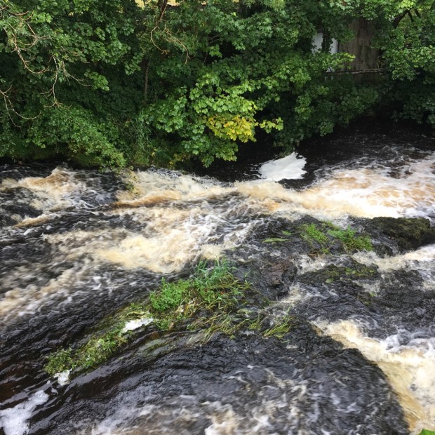
Our sheltered position protected us from much of the storm and it was only when I ventured away from the van in the morning that the amount of rain became evident. It was easy to understand the origin of the name Glanteenassig or Gleann Ti an Easaigh which translates as Valley of the Waterfalls. They were streaming down the mountainsides in silver ribbons and when we walked to Lough Slat the words of the Irish poet J J Callinan couldn’t have been truer,” a thousand wild fountains rush down to that lake from their home in the mountains”.

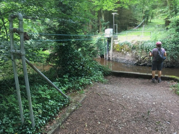
A roaring, foaming, rushing mass of white water raced down beside us as we ventured up the River Walk alongside the Owencashla and the views from the picnic spot high up on a glacial moraine were elemental.

With the storm abated we headed out to another fine seafront parkup for the night with miles of empty beach backed by a vast expanse of salt marsh. So much nicer than the nearby campsite/ trailer park we abandoned after having our showers and charging Sally’s computer.

Our final hike was around the Glennahoo valley, a truly beautiful u shaped glacial valley carved out of the mountains by unfathomable forces. We started at the old graveyard at Ballyduff or An Baile Dubh, associated with the Celtic deity Crom Dubh, a god of fertility and harvest.

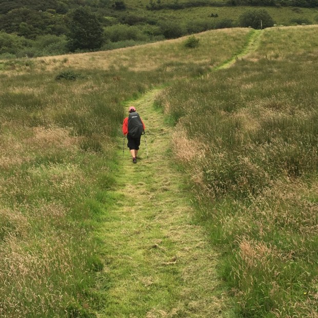
An old narrow boreen led us past empty dwellings and up onto a treeless expanse of rough grass and turf banks, the track once tarmac way beyond ” civilization”.

The extraordinary track continued up the narrow ridge of Beenbo to 475m where we had a fine view back down the romantic Glen of Macha na Bo ( Plain of the Cow) and south across a featureless expanse of bog towards Anascaul, the final destination of the ancient trackway.

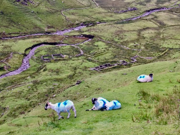
A bit of a soggy trudge to an unnamed hillock below us followed by an even soggier trudge back around towards the cliffs at the head of the Glennahoo river valley rewarded us with the panorama of the trip. We stopped for a sandwich and soaked it up. Nearly 300m below us lay the fields and homesteads of people who lived in the isolated splendour of a terrible beauty.

Setting off again we met a sheep farmer and dog out looking for his flock. He told us that the houses had been lived in until the fifties by the Dineens and the O’Donnells. From there another old trackway leading over the mountains from the valley took us down to Wolf’s Step, where the last wolf in Ireland was allegedly killed in 1710.

We crossed over the river here and continued down the steep track with a series of waterfalls beside us until finally reaching the valley floor and stopping again to contemplate the life of Mary ‘Macha na Bo’ the last inhabitant of this lonely spot, supposedly an old lady with long flowing white hair who would emerge to hurl abuse at hikers but also on occasion have them in for tea.

The long straight track out of the valley was about 4 km long but seemed to bring us forward decades or centuries in time. Looking back towards the mountains and turning out towards the sea the path felt in a time and space somehow separate from the 21st century tourism hotspot of Dingle and the busy city of Tralee visible in the distance.

Walking the long track had reminded me of the long long line leading back to the early inhabitants here, so palpable through the wealth of remnants left scattered across the landscape. A special place out on the western fringes of what is now known as Europe that has drawn people to it for Millenia. Long may it last.

Co Laois – The Leafy Loop in Lockdown

Looking for a long circular hike we discovered the Leafy Loop in Durrow, Co Laois. It sounded lovely. 23 km of waymarked trail through plantations of beech, ancient native mixed woodlands, conifer forest, hazel coppice, riparian spinneys alongside steams, over lush fields and along wsterside paths by the Nore, Erkina and Gully rivers.

One of the longest looped walks in the country and in a part of Ireland we hadn’t visited since calling into the Durrow scarecrow festival a couple of years ago. We loaded the camper and printed off the maps and then…

Counties Laois, Offaly and Kildare re-entered a 2week lockdown that night because of rising Covid numbers. Our planned walks were on either side of the Laois and Kilkenny border and we had a decision to make. We could do our Kilkenny Walks no bother. But the Loop went into Laois.

Right or wrong we decided, on balance, that if we stayed outside on the trails, kept well away from anybody else and didn’t stop anywhere else in the county we would be doing no harm but still felt slightly uneasy and guilty for going.

Once out in the woods and up on the hills however, taking a step from an open county to one in lockdown , the arbitrary nature of the winding border made a mockery of the imposed restrictions. We understand the need to restrict people’s contact with the virus and we behaved safely but illicitly.

The walk was normally described as starting in Durrow village but in an effort at social responsibility we avoided the possibility of human contact and started in the Coillte operated Dunmore Demesne woods on the outskirts of town.

The trail immediately lived up to its “Leafy Loop” moniker and continued to do so. Durrow means ” Plain of the Oak” and this area was reputed to have woods so dense in the 18th century that the outlaw Jeremiah Grant and his gang of ne’er do wells were able to hide out with ease. It wasn’t until the early post independence days that mass felling took place making the current tree cover a precious thing.

Following the River Gully for awhile we crossed over a stone bridge past the remains of the outbuildings to the old Dunmore House- rendered roofless in the early 20th century to avoid paying rates and soon becoming a ruin that was knocked leaving only the basement and some steps down to the river Nore.

We encountered a pulley system across the river serving some unknown purpose and later a metal bridge brought us downstream to a stone bridge carrying the main road over the river.

A very pleasant stretch beside the river bought us to another footbridge, this time across the Erkina and out onto open fields where the path followed the meanders of the Nore past the impressive bulk of another grand mansion- Knockatrina House mid way through extensive ( and expensive) reconstruction.

A beautifully bucolic landscape in the ” fat of the land”, so different from the rushy impoverished country where the multitudes wrestled a living around our way in the West. Emerging from the fields and reentering woods we crossed the main road again at the site of the Durrow brickworks, an enterprise that produced fine red bricks from shale dug from the hill we climbed from 1890 to 1922.

The steep climb took us to The Ballagh, our high point at about 250 m from where we got occasional views through the trees over the lush farmland of Laois.

The fields were big, the sheds were big and the dairy herds were big. Down through a hazel coppice , across another road and past the lodge into Bishops Wood where the man of the cloth was executed in penal times beside a tree still growing here.

Bishop’s Wood is one of about a dozen “Life Sites” around Ireland where care is being taken to restore native woodland by removal of invasive species and reintroduction of a variety of original plant life. But strangely this was where we got very confused and thought we were lost as what was marked on our maps and google earth as forest had become mono grassland.

The sizeable chunk of field in the photo had , until recently, been forest. We watched a long long line of cows progressing across the prairie from the milking sheds in the distance before turning back into the woods and the charm of the lush path beside the Erkina.

Liable to annual flooding this is part of the largest alluvial woodland in the country and is remnant of a huge wetland known as the Laois Curragh. It was bursting with green growth of meadowsweet, flag iris, Angelica, bugle, sedges rush and water mint and buzzing with insect life. From here you could continue riverside to Durrow but we took the footbridge over to our last stretch of Bishop’s Wood, freshly strimmed.

A couple of km of road saw us back in Dunmore Wood to complete the Leafy Loop, a delight in the summer and, I imagine, even better in the spring when a carpet of bluebells and wild garlic adorn the forest floor. A few minutes drive later we were in Co Kilkenny, no longer illicit, on our way to Jenkinstown Woods for the night, parked up in the walled garden below the threshing mill. Mission accomplished.

Next day we tackled the Gathabawn Loop, a 12 km hike up and around Cullahill Mountain, small enough at 250 m but towering above the surrounding plains and providing far reaching views over 360 degrees. This walk would have us back and forth across the county borders in an uncontrollable way.

We checked out the terrain from a viewpoint carpark overlooking the mountain and waited for the cloud to lift before driving down to Gathabawn village to start the walk opposite Mackeys bar.

Passing by the pleasant Millenium Garden we climbed beyond the old Coolcashin graveyard and the invisible remains of a Norman settlement to reach the charming in name and nature, Ballygooney Lane, which took us up towards the windmills and forestry of Binnianea.

Emerging from the trees we crossed open farmland to reach the equally charming Shirley’s Lane. Was the abandoned farmhouse Shirley’s old home?

Now out of the mono species grassland and on to the wilder pastures we could see why it had been given special area of conservation status. Plant rich limestone country with many different grasses and herbs and protected because of the population of Green-winged,Frog, Bee, Early purple and Twayblade orchids. We sat atop a rath for lunch and admired the views.

Weaving our way through a short section of new plantation we walked along the back of Cullahill Mountain to discover a well placed bench where we rested again to soak up the vista to the north ( Slieve Blooms), West ( Silvermines), east ( Blackstairs, Mt Leinster, Devils Bit) to add to the southerly views earlier ( Comeraghs, Galtees).

Down below us sat the remains of Cullahill Castle the seat of the MacGiollaPadraig or Fitzpatrick clan long rulers of the area until the castle was sacked by Cromwellian forces. It is apparently adorned by a Sheila- na -gig high on a surviving wall. A 17km linear walk, the MacGiollaPadraig Way, has been created from Durrow to Gathabawn and we had shared much of its route.

Crossing the fields deep in drying hay we passed the sad remains of a famine village reminding us that the rich and prosperous landscape laid out before us had not always been so bountiful for the people. Passing by the rath or fairy fort again we made our way along the Gooseneck road to rejoin Ballygooney Lane and back to the Millenium Park and a more recent Fairy world.

Miners Way and Historical Trail: A Loop Around Roscommon, Sligo and Leitrim

Seems like a long time since we were walking the Camino Mozarabe under a blue Spanish sky. Longtime lockdown under the Covid curfew. We left Spain just as the shutters came down and were blessed with acres of homestead gardens to work and rest in under a blue Irish sky for weeks as a hush fell over the world. As a cautious emerging of people began to take place so the clouds also started to gather and by the time we were able to leave the county the summer had settled into the rainy season.

But a change of surroundings was needed along with a kickstart to a much needed fitness programme and trial of our new homemade lightweight 2 person tent. And so it was that we arrived on the shores of Lough Meelagh on the outskirts of Keadew, Co Roscommon to embark on a trail I had long had on my “to do ” list. The Miners Way and Historical Trail is a complex shaped figure of eight with “wings” to surrounding towns and the Leitrim Way and the Beara Brefne Way. It’s “officially” 118km but many hikers would reckon it’s much more. Our circular route without wings or connections came in at 110 km over 5 days.

Our first day was from Keadew to Lough Key forest park. 28 km

It was a ” fine soft day” as we entered Knockranny Woods, sharing our route with a nature trail to the Neolithic court tomb. We were immediately impressed with the amount of staple studded boardwalks erected to keep us out of the slop.

The whole trail was to impress us with its signage, stiles of many styles, wooden and metal bridges, strimmed and mown grass, general waymarking and above all- access over farmland and open mountain. A lot of people have been caring for it and thanks for that.

The woods were fully formed with many mature specimens. It seemed that the historical estates in the area had bequeathed a wealth of woodland.

The first half of our trip, the first two and a half days, would be spent on the Historical Trail with another couple of days continuing on the Miners Way, bringing us back to Keadew via the iron and coal mining areas around Arigna. The closure of the mines in 1990 had led to the development of the trail in an attempt to encourage tourism to the area. And we felt it was a beautiful but neglected landscape deserving of more visitors, with a wealth of rivers and lakes and varied upland and mountainous terrain.

After walking the southern shoreline of Lough Meelagh we reentered a mossy and mushroom rich woodland for awhile before a quick change succession of quiet backroad and rushy field sections led us down to Knockvicar where we had lunch beside the River Boyle which takes leisure boats from Carrick on Shannon to Lough Key.

We had a look around the Knockvicar Organic Garden with its welcoming orchard and displays of fruit and veg and flowers. It shows what can be done with 10 polytunnels on a very small space. They also run training courses and offer a gardening service.

There was a “Trail Closed Today” sign ( which has been there for at least 3 years!) owing to some ongoing land dispute and we were sent on a detour on a bogside track and through thick scrub woodland before emerging onto the lanes leading into the forest park over the “fairy bridge”.

We were weary by the time we reached the epicenter of the park with many staycationers strolling, cycling, picnicking and boating. There was a camping and caravan park but only catering for those self sufficient in bathrooms, toilets and kitchens so we moved on looking for a wild camping site affording some shelter from the rain.

Sally fancied setting up next to the mysterious mother and child statue but the ground was too peg resistant. I couldn’t find out anything about the sculpture other than it was by Jaqueline Duigan of whom the National Visual Arts Libary says ” virtually no information is available on this artist”.

We ended up a little further down the trail, behind the Nash designed gate house to the Rockingham Lough Key estate. A wet and windy night was promised and we were well sheltered by trees and Nash’s wall.

Quickly into Boyle in the morning under a leaden sky that released its watery payload sporadically as we bought supplies and miraculously found a seamstress to mend my packs shoulder strap for under a fiver. Then a long climb up into the Curlew Mountains. After about 3 km of road we headed cross country on the ancient Red Earls road past the site of his 1599 ” Battle of the Curlews”. It was soggy going across the boggy moorland and into a block of forestry where we stumbled upon a 2 story stonebuilt farmhouse subsumed by the trees.

There was a lot of mushrooms and bilberries available but we filled up on bread and cheese as the midges filled up on our blood and the drizzle cane and went. We stopped again after a few km of empty lane when a heavy shower had us sheltering in the shed of an abandoned farm cottage. With a swing in the garden and a cot in the cow shed it had a forlorn feeling of broken dreams.

But ” things can only get better” and as the weather improved so did the surroundings as we came down out of the saturated Curlew and up into the dramatic karst landscape of the limestone Bricklieve mountains. A tarmac and gravel track turned into a grassy boreen and finally a narrow wall lined path, past beautifully located abandoned farms and cottages with mighty views down to Lough Arrow and Lough Key with the Plains of Boyle beyond. We climbed alongside and then crossed a narrow u shaped valley, the Devils Bite, before joining a disused bog track heading northwest towards the Carrowkeel passage tombs.

We had crossed into Sligo and Carrowkeel Neolithic cemetery with 14 five thousand year old passage tombs was just one of the very many impressive archeological/sacred sites in the area. Our friend was meeting us at the bottom of the access track so we didn’t have time to explore but the Bricklieves had instilled a desire to return for further ramblings.

22km done we were very happy to be transported to our friends house for a night of good food, drink, company, warmth and sleep and a lift back to the trail at Castlebaldwin in the morning for the next 22km leg.

We kept a close eye on the clouds as they rose and fell over Carrowkeel making our way on a mix of road and field around the top of Lough Arrow, over the river leaving it to the north and up past the abandoned Cromlech Lodge hotel, once prosperous enough to warrant a helicopter pad, to the Labby Stone- Ireland’s second largest portal tomb.

Another change in the landscape and we hiked mown paths across fields and up onto the Plain of the Pillars a reference to the 14 megalithic monuments in the area. It’s a place of glacial drumlins formed in groups known as “swarms” for some reason. We had lunch at a trig point at 226m overlooking Lough Arrow and a land inhabited for thousands of years, and left with a mass of reminders of their passing including a rich concentration of ancient saunas or sweat houses.

In recent years many inhabitants have deserted the land hereabouts and we past many homesteads slowly returning to the earth. Another downpour was avoided by resting up in a hay barn where we took the tea in comfort.

Settling off again under heavy dark skies over the rushing river Feorish we were on the look out for a camping spot. Nothing suitable found we asked a farmer if we could erect our tent in his hay shed. He said he had a better,less exposed option for us- the old home place cottage- and directed us toward it. It proved to be completely buried under vegetation outside and junk and rubbish inside, so bad that the damp and dark cowshed next door was preferable.

We did a fine job of fixing it up a treat and settled in for the night. Not everyone’s idea of glamping but we have modest needs!

Still misty and moisty next morning as we started another 22km leg by following an old miners track up towards the wind farm atop Carrane Hill. We had switched on to the Miners Way and the hills here were littered with old coal mines.

Down into The Glen, a narrow valley between Carrane and Corry and Lynchs mountain where many miners had lived and whose children must have attended the school we passed on the way to the Arigna river.

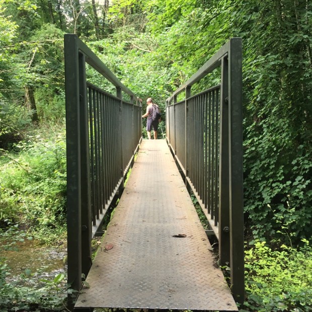
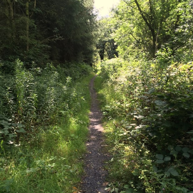
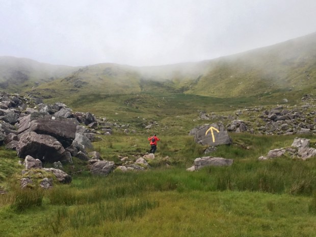
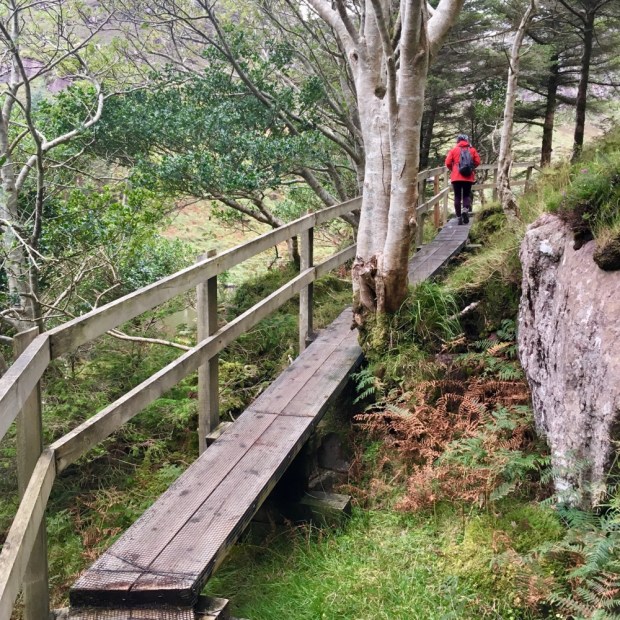
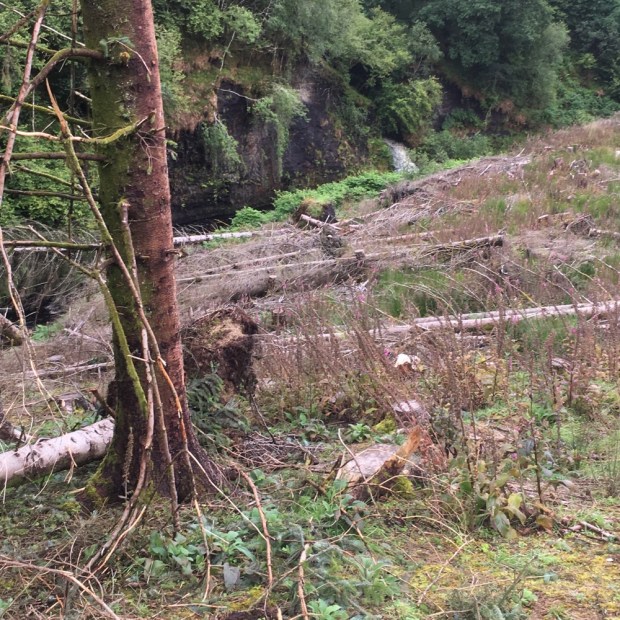
When we entered the forest things got tricky. Recent felling had left the track a quagmire of deep mud and muck. The waymarks disappeared and we were left floundering about through a section of clearfell attempting to find the bridge across the river. Not easy.

When we eventually managed to get to the road beyond the forest there was a “Trail closed today” sign! Looking online later I saw a notification on the closure due to felling dated 2018.

Onwards and upwards to the highest point of the whole trail at over 400m. By the time we reached the top ridge the rain was relentless and we were enveloped in cloud with no view to reward our efforts. Too wet to use the phones camera anyway we squelched on down below the cloud towards Lough Allen in Leitrim and the sanctuary of more friends and a place to dry out, warm up, and eat drink and be merry.

Our 5th and last day on the trail was a relief. Blue skies, sunshine and only 16 km over interesting and beautiful countryside to return us to our car.

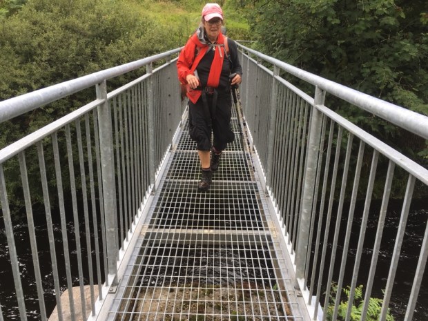
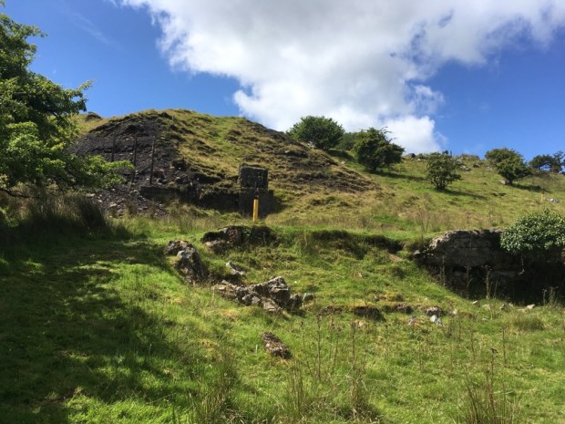
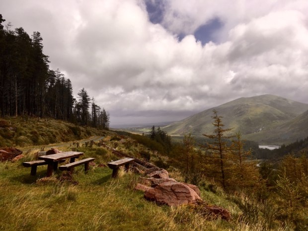
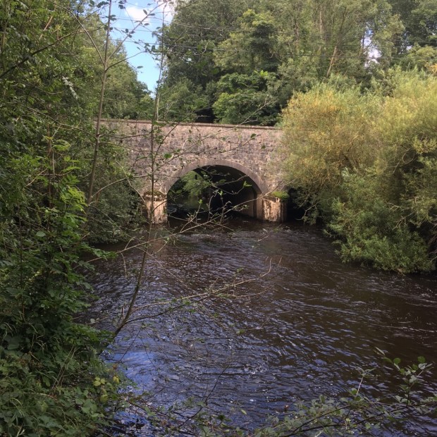
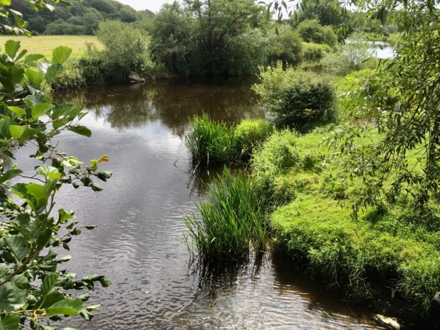
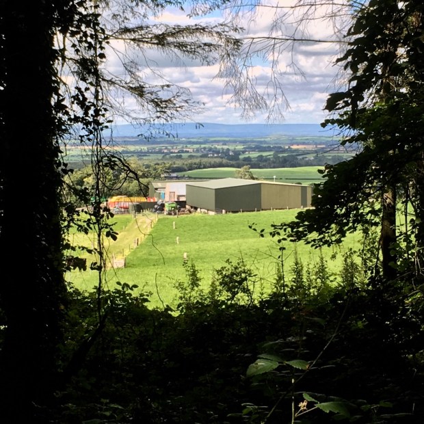
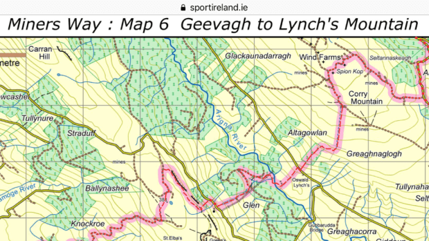
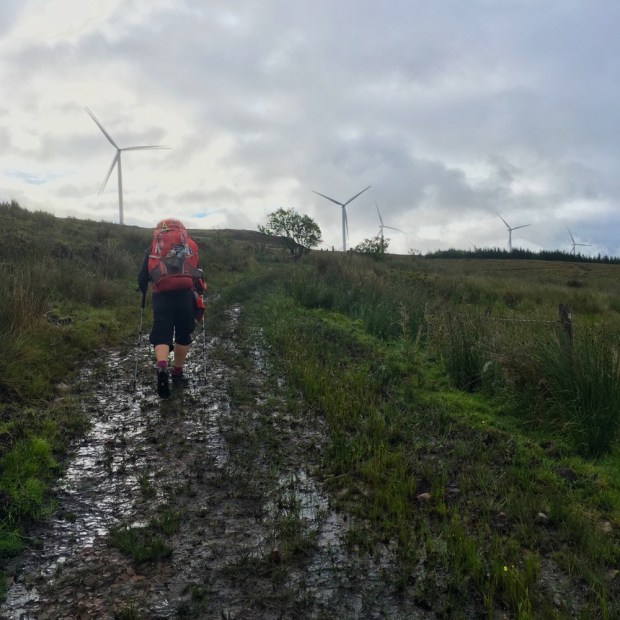
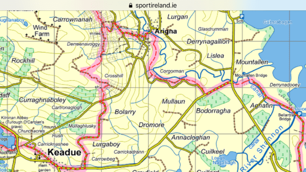
A leisurely start after a lift to the trail and off over the stiles again and along the thoughtfully laid gravel paths across fields towards Arigna. The sunlit landscape made us appreciate the terrain we’d been through even more as we recrossed the Arigna river and returned to mine country stopping for lunch at the Mining Experience Centre’s restaurant.

The final leg took us up over the flank of Kilronan mountain on ancient old miners tracks. They’ve been hacking away at the rock for over 400 years up there and it felt like we were following in the weary footsteps of generations.

A sunny final days hike was a lovely way to finish a much anticipated but sadly pretty washed out walk. We arrived back at our car by Lough Meelagh well satisfied and tempted to advise the strollers around Knockranny Woods to carry on ( and on and on and……….)