Sustained sunshine and a dry Indian summer provided too good an opportunity to miss. After a few ” mild” walks I hankered after some “wild”. And so thoughts turned to Nephin and what is usually uncomfortably wet and soggy terrain. I’d twice crossed the boggy wastelands of Ballycroy and the Bangor Trail and relished the empty openness of that Big Country. I had also been inspired by Sean Lysaght’s book on Wild Nephin and had pored over the excellent 1:25,000 scale map of the area put together by Barry Dalby of EastWest Mapping.
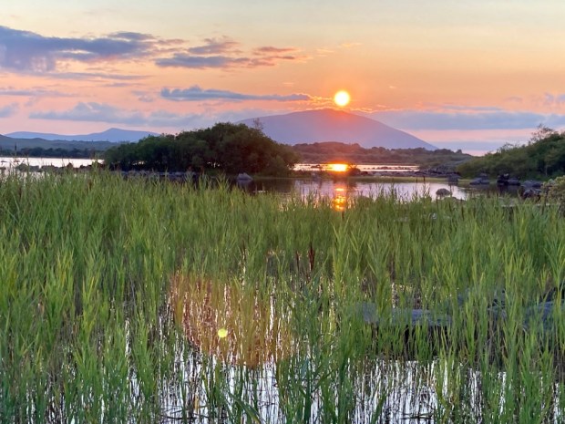
So a maiden voyage in the repaired and whine and grind free campervan got me to a lovely parkup on the shores of Lough Cullin with the setting sun rolling down the shoulder of my goal for the morning.

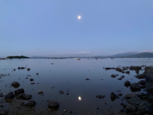
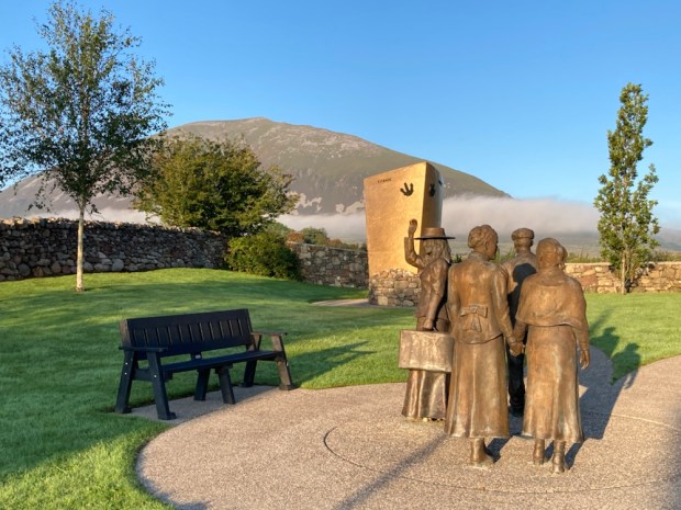
A big full moon hanging over the lake when I awoke added to the call of the wild as I drove off, stopping on route at the poignant Titanic memorial in the village of Lahardaun. 14 souls from the area lost their lives in the disaster and others miraculously survived. Anne McGowan, a local, survived and lived on to reach 95 years finally dying in 1990. Every year here at 2.20 on April 15 th the church bell tolls and a ceremony is held in their memory.
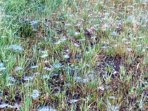
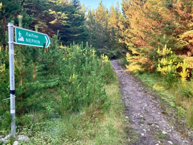
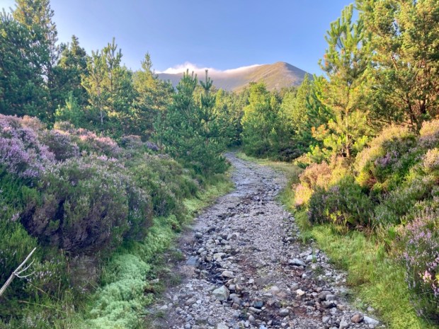
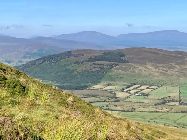
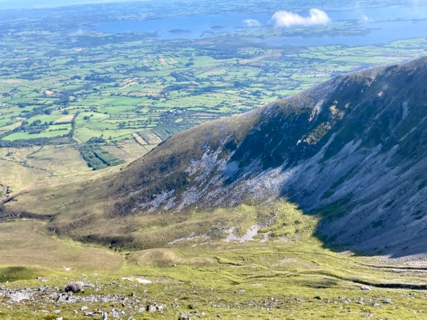
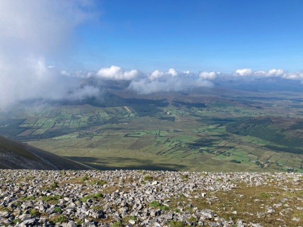
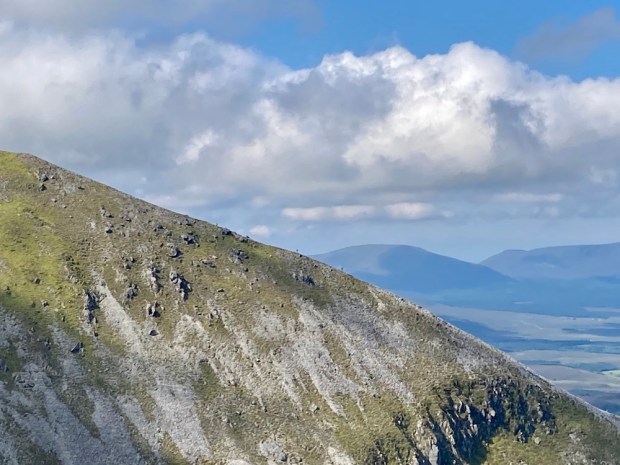
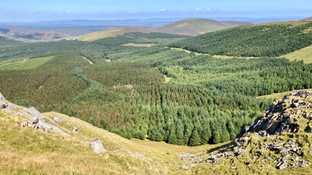
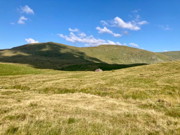
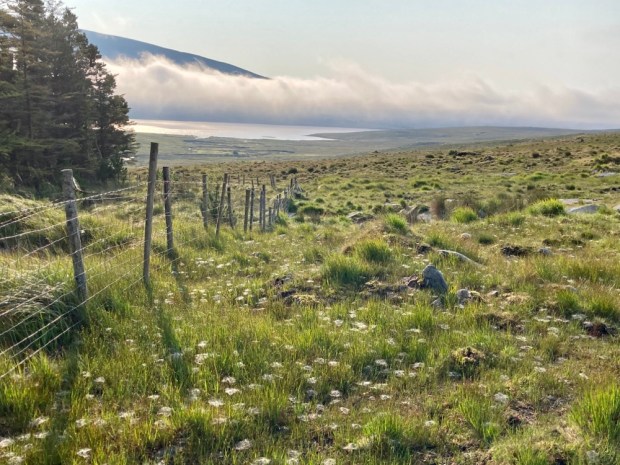
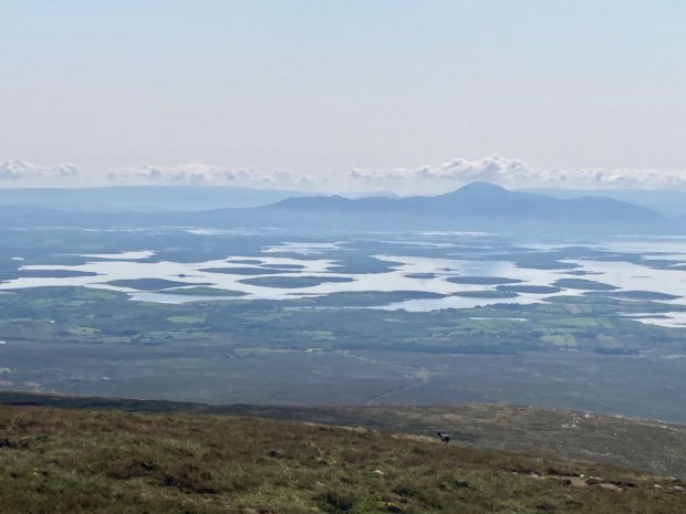
Nephin is the highest standalone mountain in Ireland and second highest point in Connacht, second only to Mweelrea. From its summit at 806 m there are outstanding views over the vast tracts of moorland, forest, blanket bog, farmland and the mountains of Donegal, Sligo, Galway, even Clare on a clear day. And of course Croagh Patrick and the Nephin Beg range. It’s a mountain I’d been attracted to for decades with its enticing and mystical pyramidical formation, but been unsure the best way to tackle it. Problem solved by local community groups with help from Coillte and the Co Council who created a marked trail on the north face with its fantastic Corrie. Known as “Finn Mc Cool’s Armchair” the Corrie does not contain a lake but is certainly dramatic. Leaving the camper in a recently created trail head car park I started off up a forest track with the early morning dew still glowing on the spider’s webs and a small blanket of cloud still draped over the summit.

An old Mass Path lead me on to the edge of the forest and out on the heather clad open mountain. The path got muddy and eroded in places, the downside of creating a route and car park and increasing the amount of footfall. Moving on up and starting to slow as the incline increased I was bemused to be overtaken by a young one running up the, to me , daunting climb stretching ahead. He turned out to be an Italian, and bizarrely a mad Mayo football fan, over for the final, as I discovered when he passed me again on his way down.

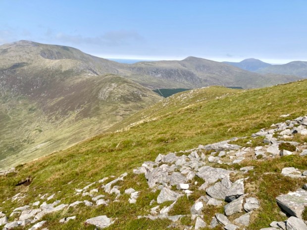
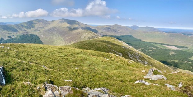
The views opened up as I rose up through the heather and scrambled on the loose rocks. I looked over to the west at the lower rounded hill of Tristia, where I planned to visit a holy well.
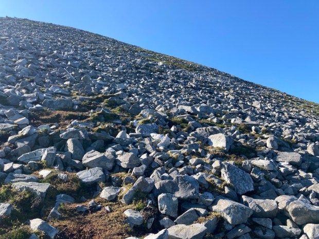
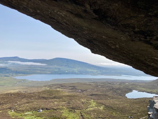
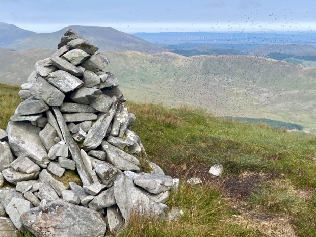
I moved over towards the edge of the steep drop into the corrie, thrilled by the views, and clambered on up towards the now visible trig point.


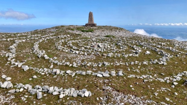
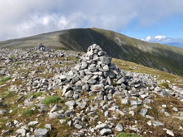
At the summit I found a spiral art work had been created below the trig point and a wasp nest was resident in it. I discovered this while resting against it congratulating myself on a successful ascent, just before receiving a couple of stings. A mysterious figure emerged from the cloud to the west.

Eamon was on a mission from Scotland to climb all the Irish peaks over 600m, known as the Vandeleur-Lynams, of which there are 273. He was doing this without transport, hitching to the trailheads. He was also doing it without paying for accommodation instead hoping to meet friendly folk to put him up or camping out. But just to ensure that his life did not become too easy and diminish the challenge he was doing it without a tent, just sleeping bag and mat!
And he was about my age. Not one for the Saga coach tour then- and way beyond the definition of Active Retirement.
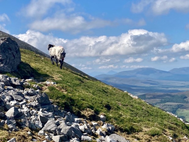
With so many peaks to bag he couldn’t stay too long and disappeared back into the cloud leaving me to carry on around the rim of the corrie and start back down on the opposite slope to complete a horseshoe climb. I could make out tiny figures scaling the shoulder across the gulf of Finn’s armchair and I disturbed a resting sheep who hobbled off with a broken leg. How long to survive?
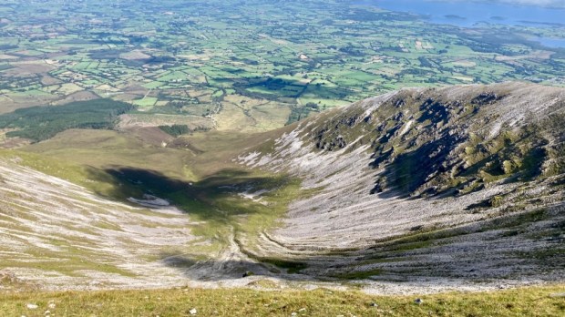
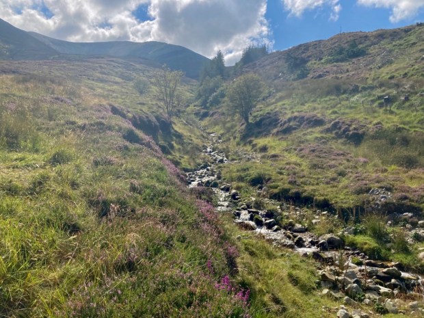
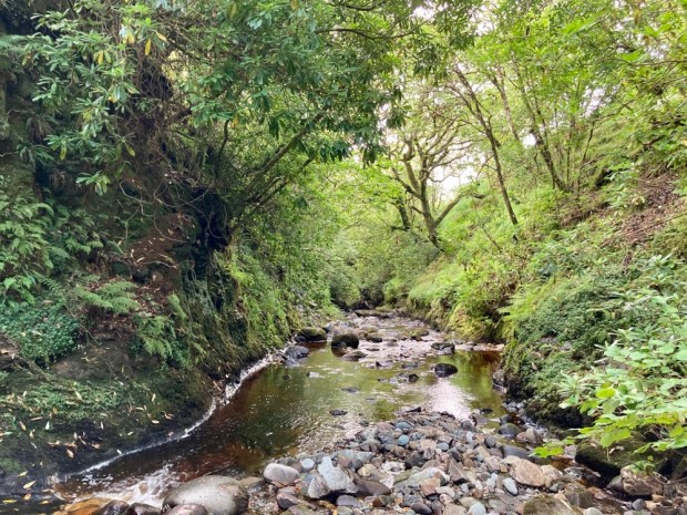
Jumbled rocks gave way to rough grass and heather on the steep slope down towards the ravine caused by the scouring waters of the stream that becomes Castlehill river.

After the exertion of the climb I took the restorative waters at the holy well on the slope of Tristia, a few km away. Originally a site of pre Christian celebration at Lughnasa it was later dedicated to St Patrick after he was said to have called here himself for a drink. In fact there are two wells, one for Patrick and the other, in a gesture of sexual equality, Bridget. The waters are reputed to cure lost eyesight and to bring about reconciliation to troubled families.
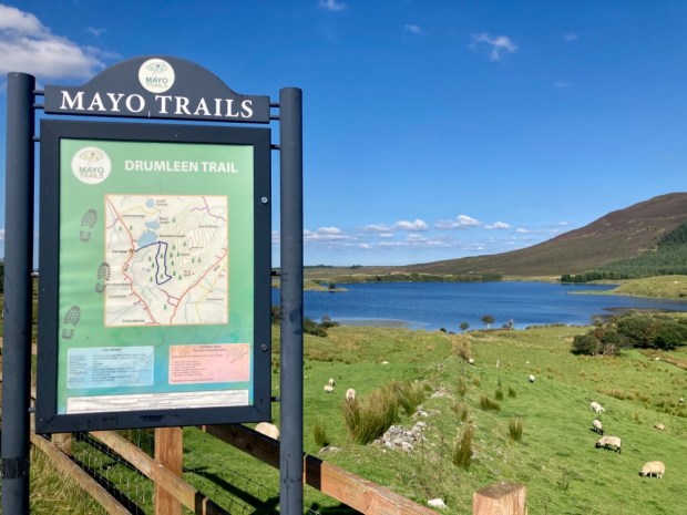
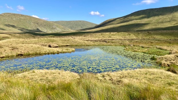
With a fair bit of fine day left I moved around to the opposite side of the hill to Drumleen Lough for a refreshing swim. An easy 3km loop walk encircles the lake thanks to the efforts of local community and willingness of landowners. A laid gravel track and boardwalks take one past an old homestead and around the lake held between the glacial drumlins with a thoughtfully placed picnic table and benches where I stripped off and cooled myself in the placid waters.

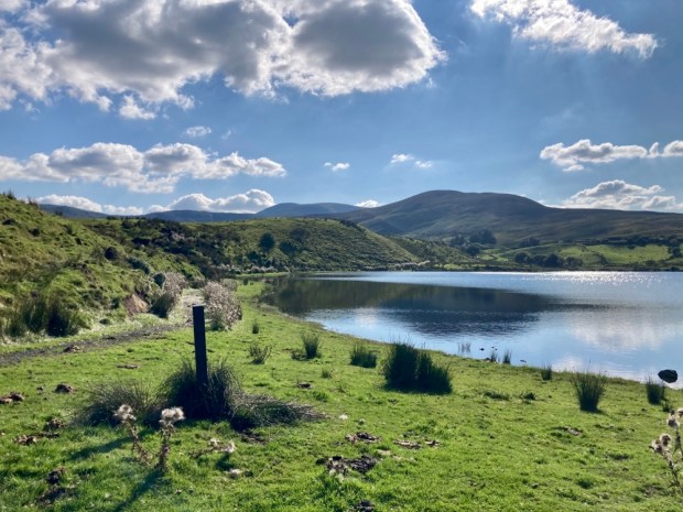

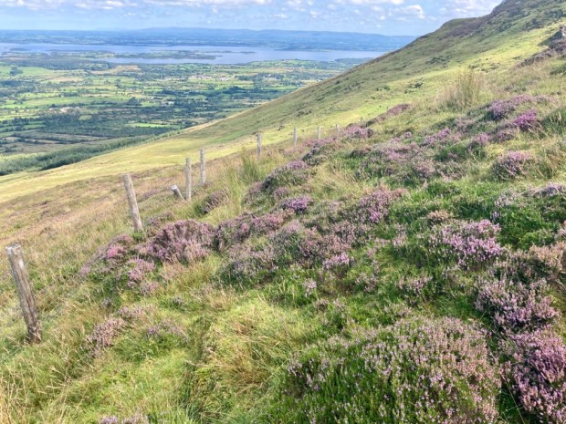
With the evening drawing in it was time to head deeper into the Nephin Wilderness and find a parkup. Turning off the Bangor road toward Keenagh with the vast expanse of the bog stretching away to the north I visited Bunaveela Lough before finding a beautiful spot in a little lay-by overlooking the forest and folded landscape above the Goulaun river.


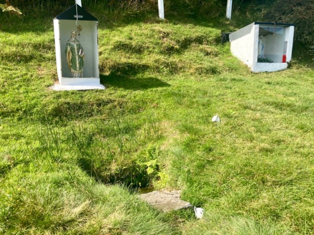
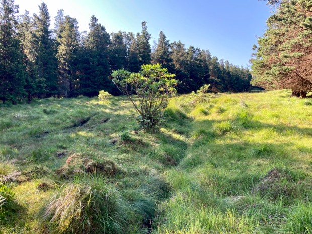
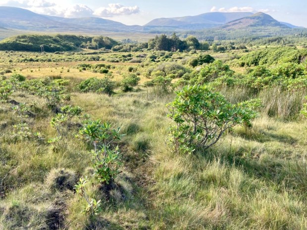
Another place of curative waters was my first destination in the morning – deep into the bowels of Glen Augh under the watchful eye of Mount Eagle. Driving up a forestry track as far as possible, I followed on foot the post markers leading along boggy firebreaks to Jamesie’s Well. The old lodge pole pines were festooned with lichen- a testament to the pure air. Unfortunately the rhododendron that plagues so much of the area, and could cause problems for the hands off rewilding plans for the park, had managed to get a purchase even here.

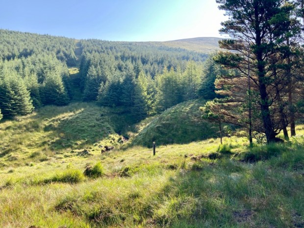
There were actually 3 spring wells spurting the purist of waters from under the trees. Said to be effective in the treatment of kidney stones, when Jamesie McIntyre passed a stone after drinking the waters, they will not work for those attempting to sell the aqua viva.


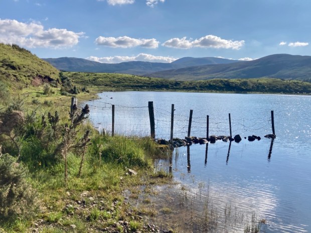
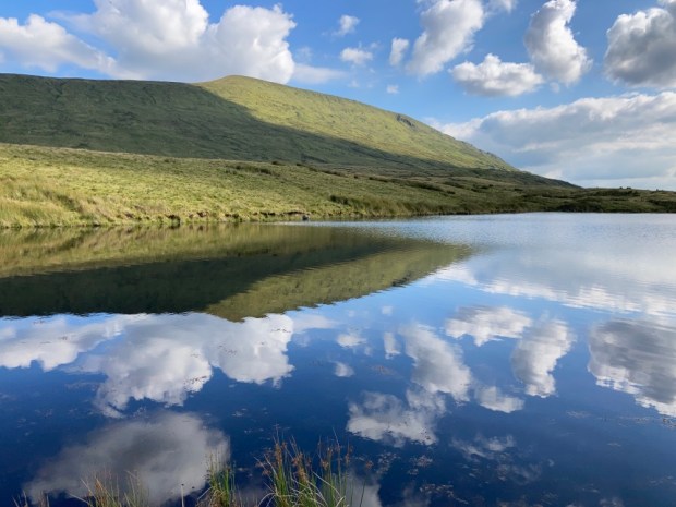
I supped deep from each in turn before following the gurgling sounds of the infant Srahrevagh River up to Lough Doo in the saddle between Mt Eagle and Top of Lena peaks. Blazing sun, cooling waters, empty, isolated and open to enormous vistas – perfect for a bit of “wild swimming”.
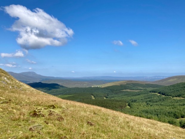

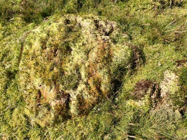
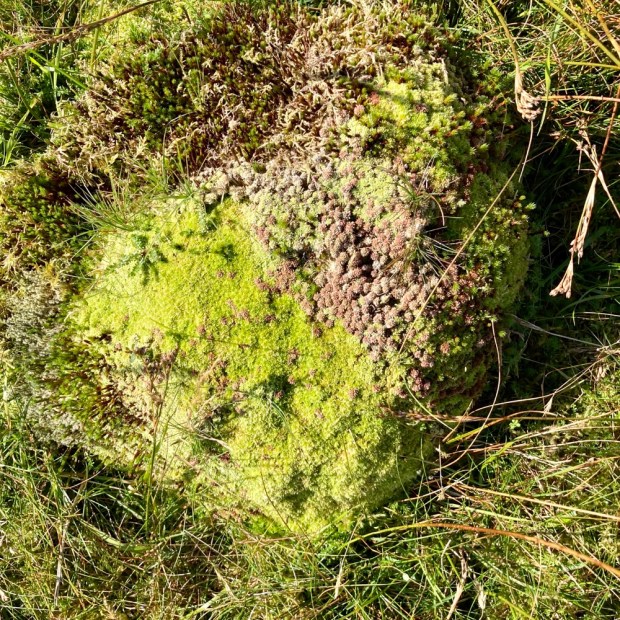
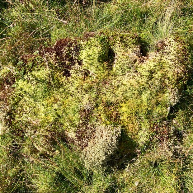
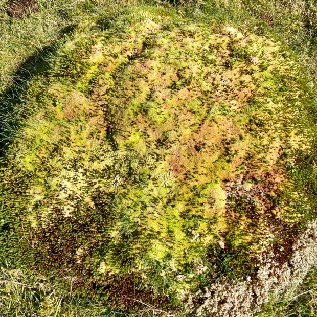
The views only improved as I climbed on up to the summit, admiring the micro worlds held within the clumps of mosses and the macro world of the vastness of earth under the heavens.
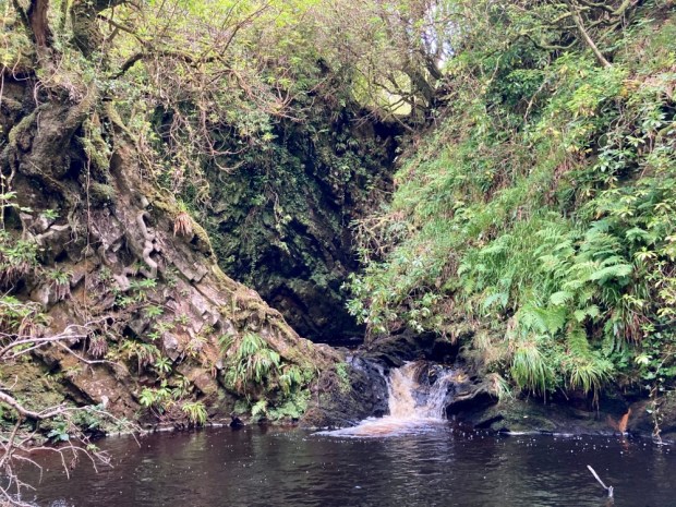
Back down in the river valley I went in search of some waterfalls known as The Lep or leap. Hidden in a deep and steep ravine, sheltered by ancient gnarled oaks whose precarious positions have protected them from browsing sheep and men with saws, the falls are heard way before they are found. Even now, after weeks of dry weather, the cascades were impressive. To be here in a winters flood would be awesome.
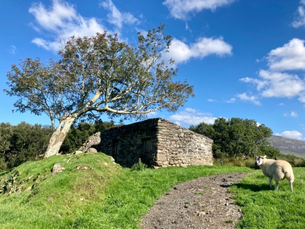
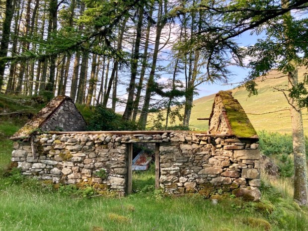
Inspired by my view east from Mt Eagle of ancient trackways and settlements at the far end of Glen Lara and the booleys of The Pullidge I set out from Shrahmore Lodge towards the mighty Burren Corrough. This land, once so full of hard lives, was now deserted but still harboured remnants. Potato ridges, ditches and banks, the deep impressions of discarded turf banks, stone walls of cottage and booley huts.

There was a melancholy to the place and I had planned another wild swim in Derrybrock Lough but on reaching it somehow my desire for immersion faltered. Perhaps something to do with the fairies the area is associated with , a place children were warned to avoid. The lakes Irish name , Doire Bhroc ( Badger Wood), is another cause for sadness- the despoliation of the landscape has seen both badger and wood eradicated. In the end though the blue sky and shining sun banished the banshees and the swim was a blessing.

Invigorated by the swim I carried on over the tussocks of rush and grasses into a vision of the American Badlands or the Mongolian steppes. The vastness was a little daunting, or maybe it was the fairies, and I decided I’d better retreat before the light did. From the furthest flung roofed building, adrift in the featureless void, I struggled to follow the ghost of a cart track back to the van. In another few decades this could all be a rhododendron forest, so many of them were progressing across the land, triffid like.
I drove south then west to cross the Black River and around the top of Lough Freeagh to continue down a forestry track into Glennamong. Parking up next to the bridge I was visited by a logging lorry just before dark and another late at night and again in the misty (and midgy) morning. Their timber cargo was going to Enniskillen in the north which seemed absurdly far away but the driver told me they go all over the country.


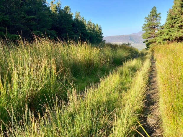
A still and humid morning had the midges out in swarms so as soon as the mist had risen enough for me to see my route up towards Ben Gorm I was off, first through a clearing in the plantation, then up over the sheep wrecked mountainside of sparse vegetation, hags of turf and swampy hollows. The erosion had revealed a lot of prehistoric tree stumps, relics of another age and another climate. And there were sundews.


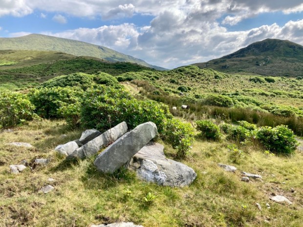
I’d read about a discovery I was hopeful to find high up in the moraine of jumbled boulders and rocks that have detached themselves from the side of Ben Gorm and lie strewn around dangerously awaiting careless ankles. A local man had followed a fox into a narrow fissure in the rocks and found a 20 m corridor and later chambers containing human bones. Subsequent examination determined that the chambers had been used for ritual burial for several centuries from over 5000 years ago. My first effort was woefully inadequate as far as Neolithic burial chambers go but I spied what must be it, a huge slab, high up the cliff, guarding a wide opening.
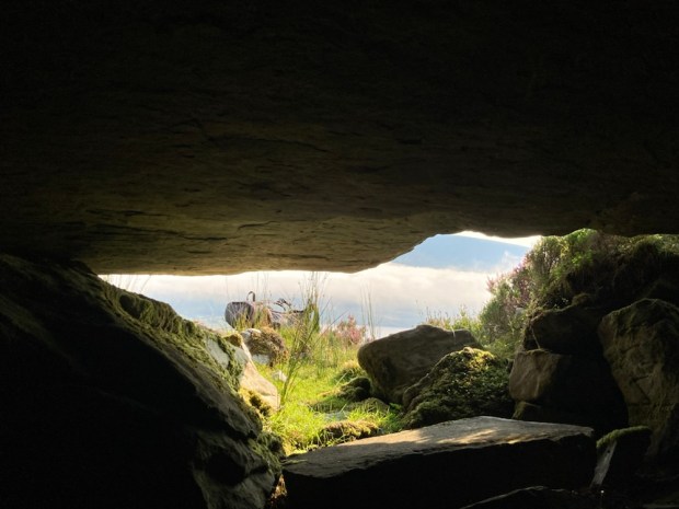
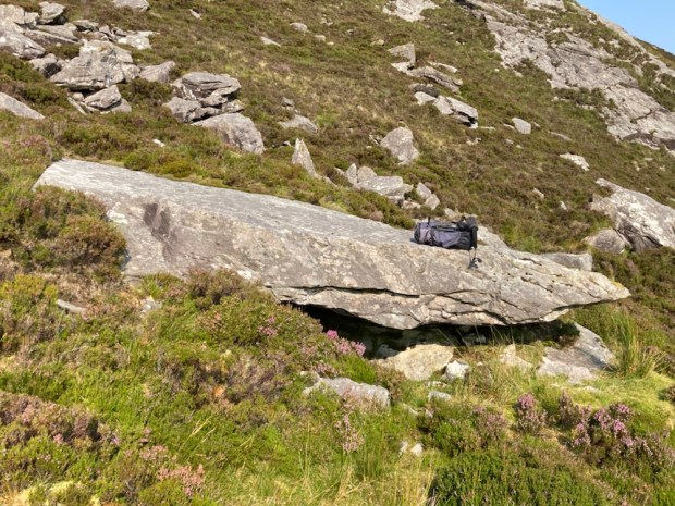

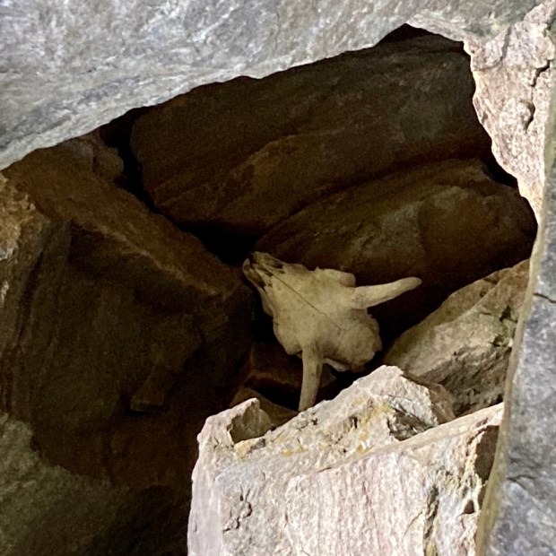
Unfortunately a difficult clamber up there revealed only the skull of a sheep, but the view was good.

I had got myself into a position where the only way was up, and it was a sweaty scramble clinging to rocks and heather before I finally breached the ridge and hauled myself to the reward.
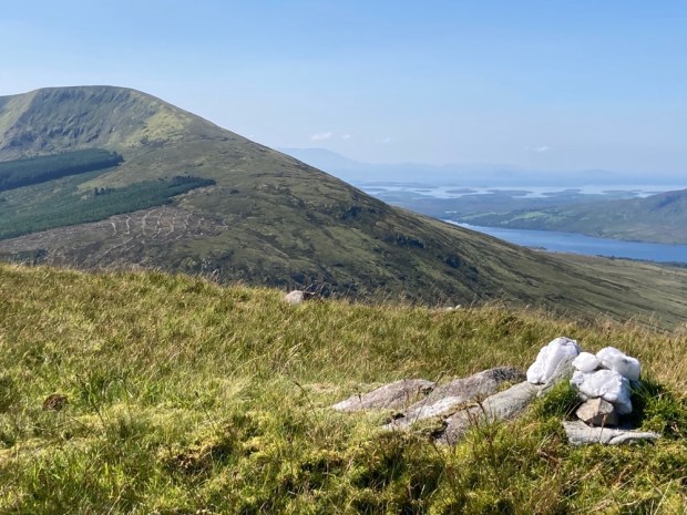
Beautiful weather beautiful views. The pinnacle of Croagh Patrick rose above a sea of islands in Clew Bay to the south and the wilderness of the Nephin range faded into the east. To the west were the mountains and cliffs of Achill while down to the east the camper, and a long journey home awaited.
My thirst for the wild had been sated but my attachment to this landscape had only grown. Laid out in such a grand scale it displays its history in geological and human scale openly and I can only wonder what comes next.

stunning snaps, beautiful description, the ultimate in exploration from the mysterious god of adventure, you are my hero brother stevy B ,
LikeLike
Nice of you to say so
LikeLike
Great photos as always, sending lots of love to Sally and you. Sharon xxx
LikeLike
Thanks Sharon and love right back to you and yours x
LikeLike
What a wonderful blog thanks Steve -well done indeed. lots of love Andrew
Sent from my iPhone
>
LikeLike
Cheers A.
LikeLike
An outstanding post. What a lovely country Ireland is.
LikeLike
Mayo is certainly beautiful (when the sun is shining) but could do with less midges! What do they eat until a hiker comes along?
Hope the heel heals
LikeLike
Thanks.
I stopped going to Scotland in the summer months because of those wee beasties, didn’t realise you had the same problem over there.
LikeLike