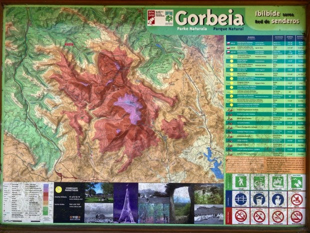
Our last exploration in Spain before braving the Bay of Biscay homeward bound for Ireland was this 200km2 park, the largest in the Euskadi region of Basque Country. Established in 1994 it forms a bridge between the Pyrénées and the mountains of Cantabria in a series of dramatic limestone sierras.
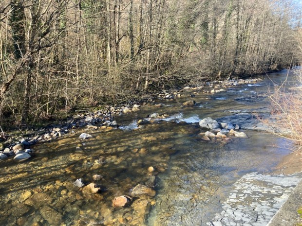
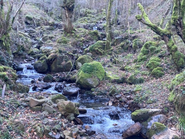
In a stunning contrast to the parched dry south we started by walking in lush green fields and forests beside rushing streams and gushing waterfalls.
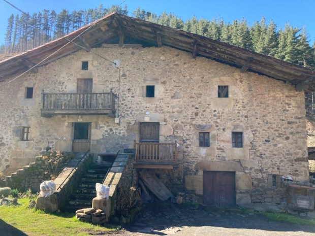
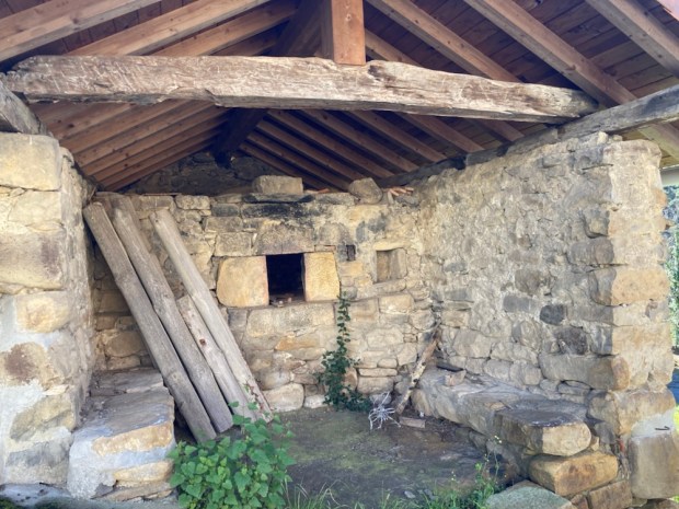
In the little traditional hamlet of Usabel we followed the road past the mill pond of a former forge and , later, hydroelectric turbine and the adjoining 16th c farmhouse. The traditional 3 storey farmhouses of this area were built to house livestock and workshops on the ground floor, hay and corn on the top and domestic living was sandwiched, insulated, between the two. 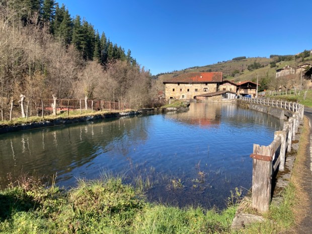

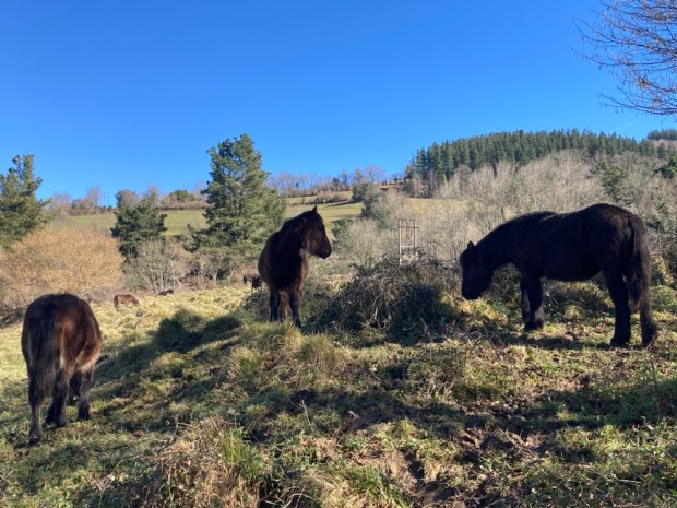
Climbing up a narrow lane way and along a field side path we entered some coppice woodland and herds of stocky horses similar to a breed we’d seen raised for meat. 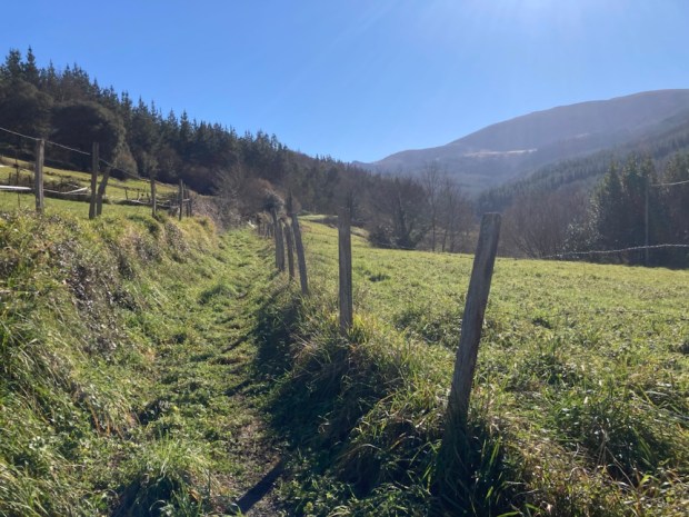
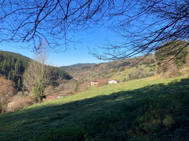
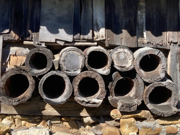
We shortly passed through Urigoiti, another hamlet of ancient vernacular buildings, one with an inbuilt bread oven and another with tree trunk beehives adorning its wooden siding.


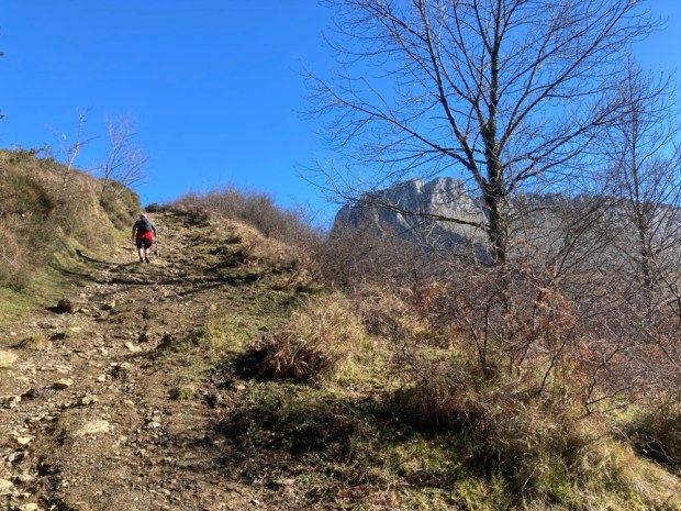
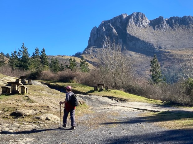
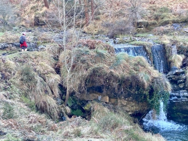
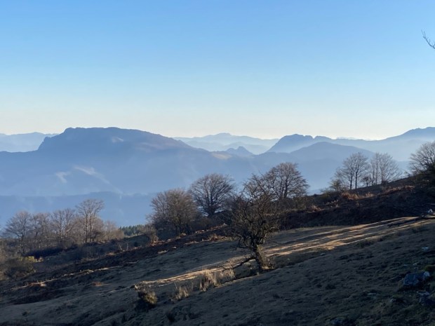
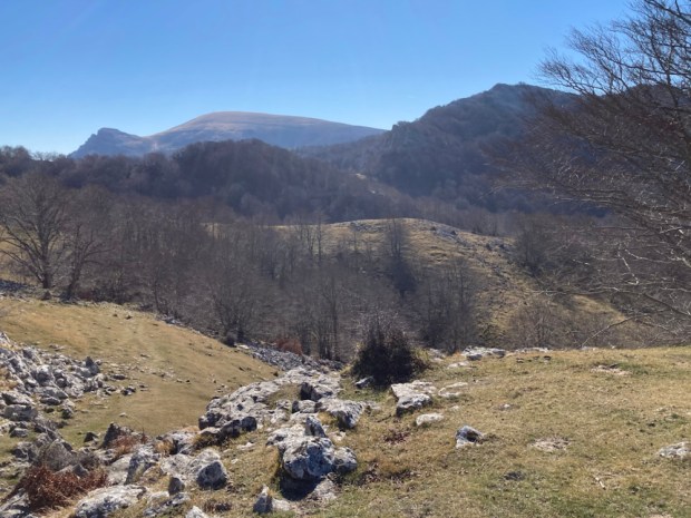
Climbing out of the village slowly the conifer forest gave way to more open mountain side affording wide views back towards the coast with the imposing hulk of the Itxina massif rearing up above us as we ascended through beech woods and rough tracks to the Aldabide waterfall.
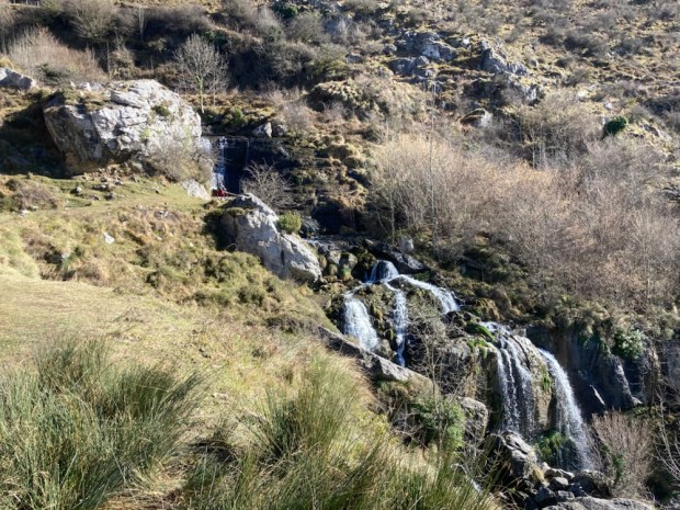
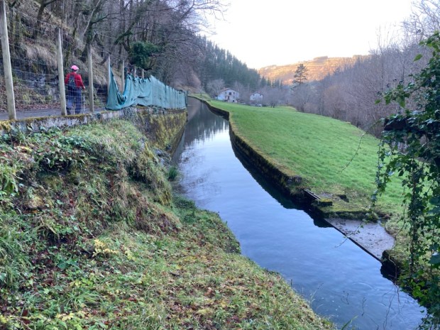
The water came from 2 springs that emerged from fissures in the limestone and had been planned to travel 9km across the mountainside in the concrete canal (we walked alongside) and join another stream and power a hydroelectic plant. Unfortunately the structure which took 12 years to complete (1945-1957) never worked and a landslide finished it off.
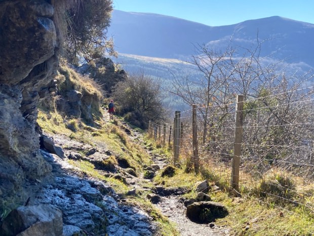

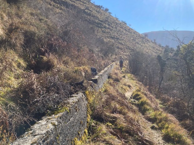
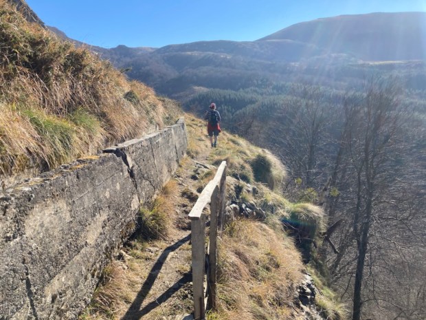


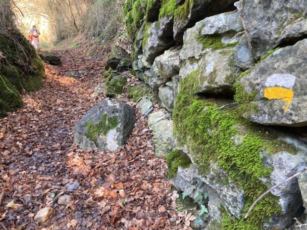
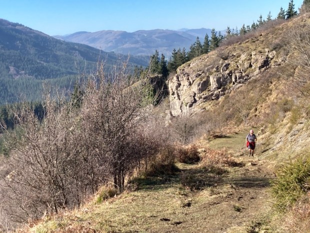
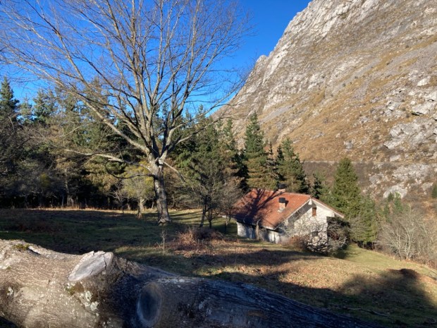
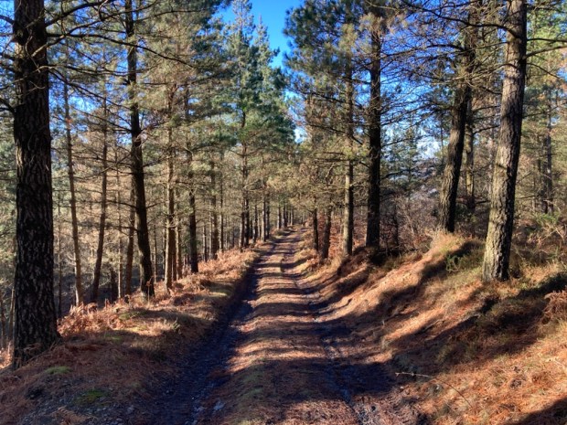
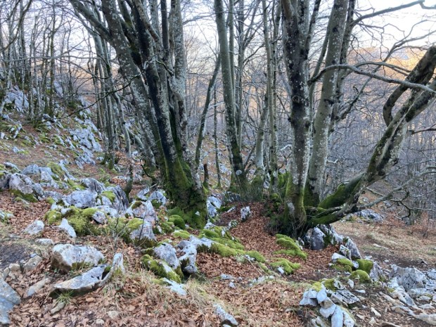
After traversing the flank of Itxina alongside the failed canal we began our return down through the pine and beech forests of the Sintxieta river valley past a remote hunting lodge at the end of a long and rutted track.
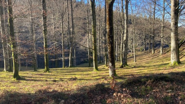
Some of the beech were ancient pollards cut by generations of charcoal makers and woodsman, the track through them worn down into a holloway deep in rustling leaves.


The steep valley sides flattened onto a narrow floor where a mill race canal was diverted from the river to feed another old hydro scheme. Soon back at the camper after our 12km/ 4hr ramble we drove around to the Pagomakurre picnic area on the eastern side of the Itxina massif ready to go deep into it in the morning.

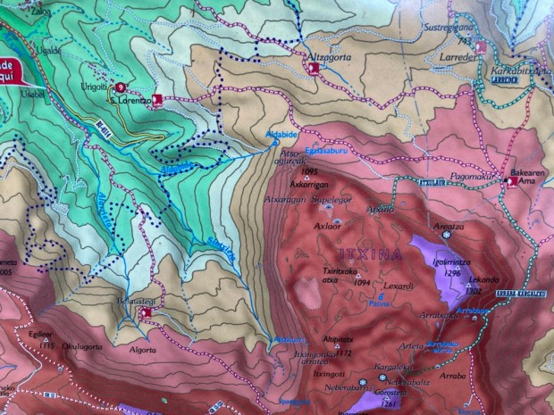
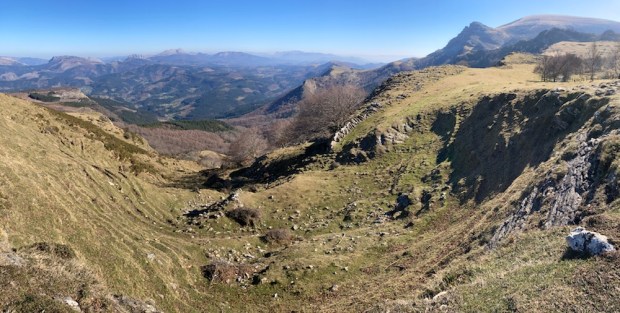
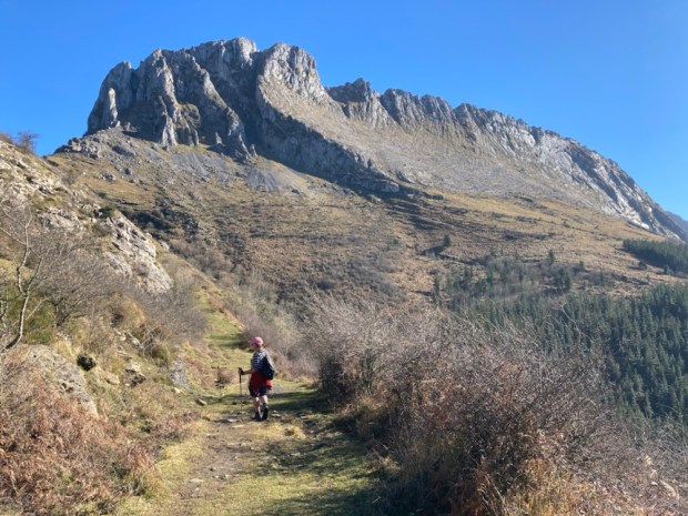
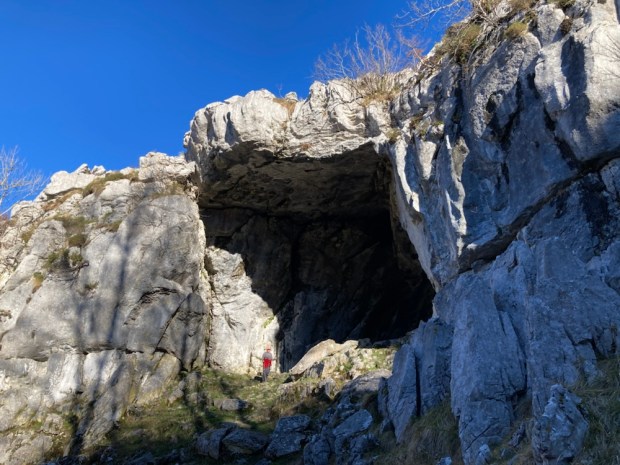
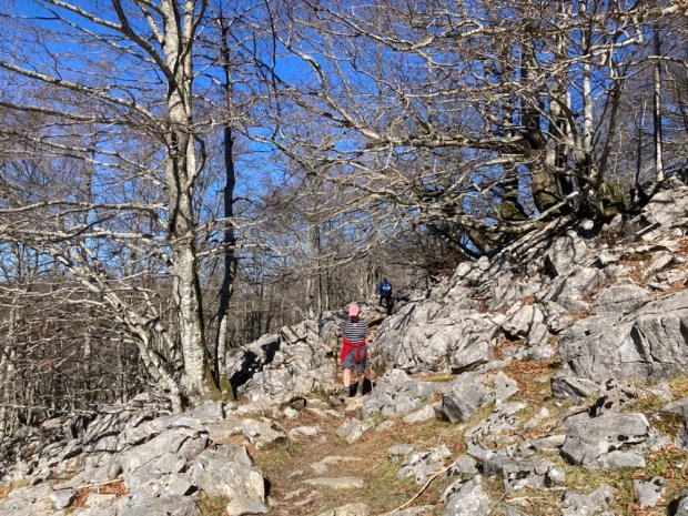
This popular iconic route would take us up through a spectacular natural stone arch at about 1000m and into the bizarre karst formations, 500 sinkholes , mysterious caves, hidden upland meadows and sacred beech groves of the magical world of the Itxina protected biotope.
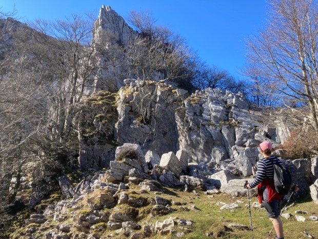
Leaving the area recreativa in the early morning sun we started to climb a well worn path up through the forest and out onto more open pasture where, as wide ranging views opened towards the Pyrenees, the Ojo de Atxular ( Eye of Atxular) peered down at us from the rocky crest.


Used since time immemorial by shepherds and woodcutters to gain entry into the rocky plateau , encircled by a crescent shaped ridge of protective limestone, we clambered up and through it- and the wind immediately quieted and we were becalmed.


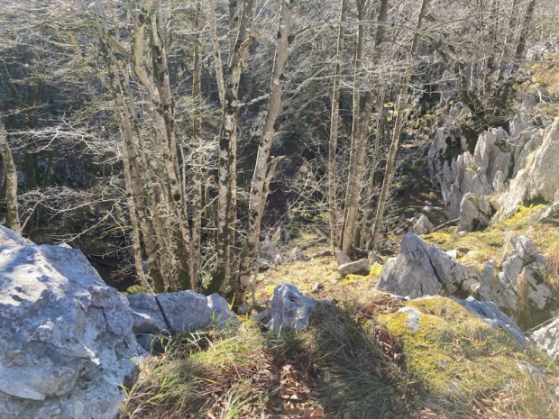
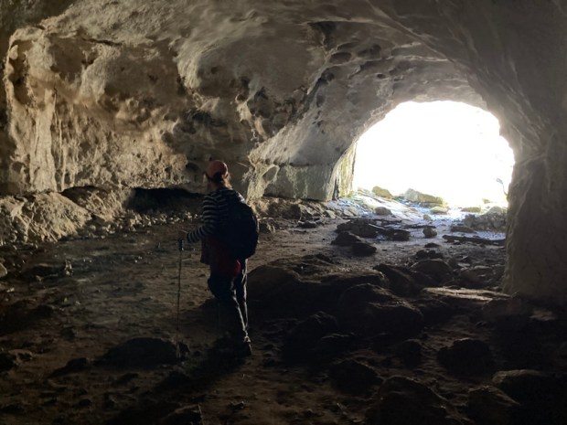
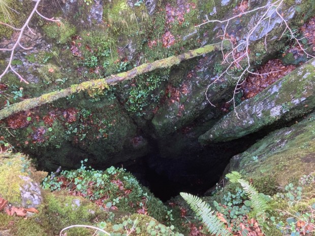
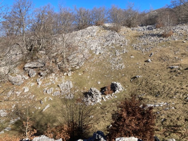
We followed a spur trail through the labyrinth of sinkholes surrounded by cracked and fissured limestone like the scattered artworks of a prodigious sculptor. A faint path, sporadic splashes of paint and numerous cairns of stacked stones led us up and down through the mossy maze to the gaping mouth of Supelegor Cave.
Many miles of passageways and caverns connect these caves and sinkholes, home to some of the characters of Basque mythology. Supelegor is particularly associated with the Goddess Mari, a beautiful feminine personification of the Earth. She lives deep within the world, connecting to our realm via mountaintop caves, and adopting diverse forms such as a TreeWoman. Shepherds would leave offerings for her here.


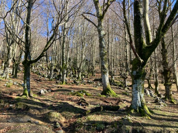
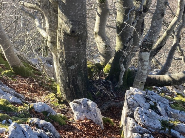
There was a mysterious and timeless aura to the place. The bones of Neanderthals have been found in the caves and the area is rich in dolmens and menhirs. The ancient beech trees looked as though they had been coppiced for millennia for the ironworks and lime kilns and were coated with a variety of rare mosses that would excite any bryologist, as were the rocks and sinkholes. We passed one yawning hole reputed to be 100m deep.
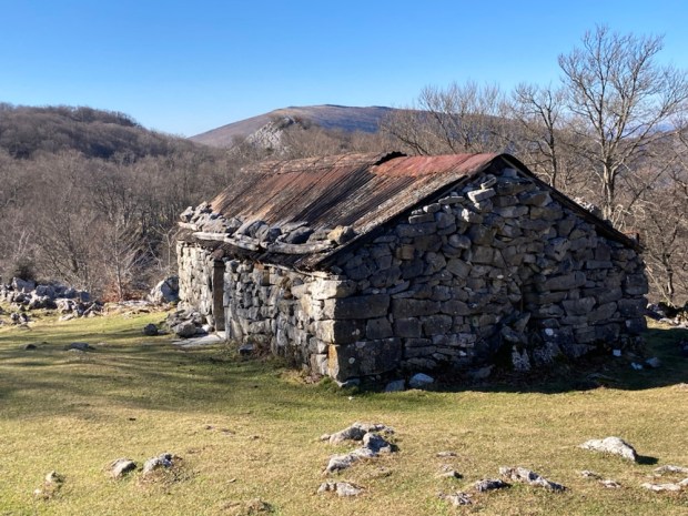
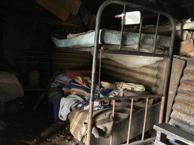
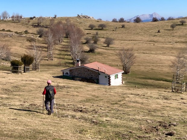
After clambering back towards the Eye of Atxular we headed onwards eventually reaching more open ground with views of the plateau and then beautiful Alpine like meadows with the crumbling remains of one shepherds hut and the more welcoming refuge of another. The weather can quickly get bad here and I can imagine this shelter amidst the labyrinth has saved lives in the snow.
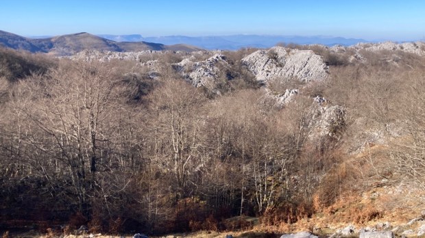
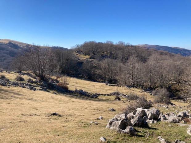
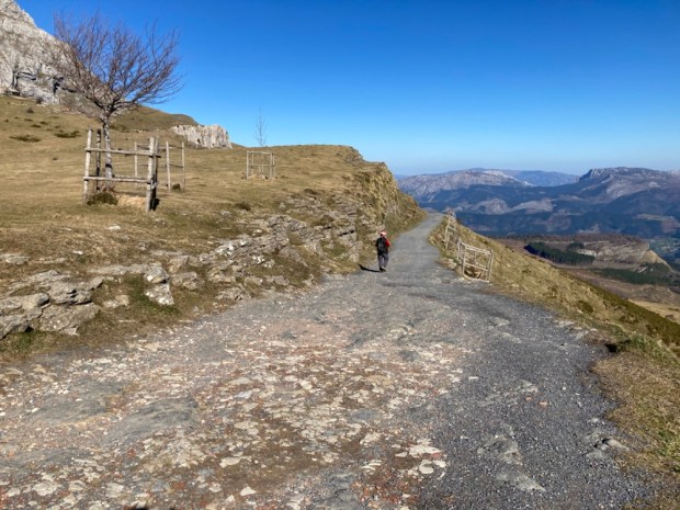
Continuing to the southern end of the massif we got views of the swollen dome of Gorbeia itself, the highest in the region at 1480m, before dropping down through the pass at the sheer cliffs of Arrabako Ate and out onto the vast grassy plateau of Arraba.

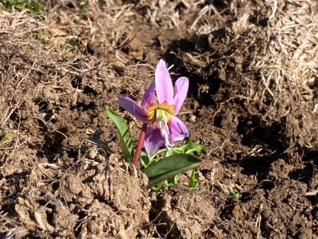
From here the going was easy, across the empty grazing pasture dotted with early flowers, past a building used by those scaling Gorbeia and other peaks and down past some impressive sinkholes to a drivable track with a glorious vista across the Basque mountains to the east. From there we had a long downward stroll to complete the 10km/ 5hr loop and return to the camper.

A good hike to finish a great trip on a country wide loop from Bilbao. Homeward bound.


Wonderful wild country. Safe journey home.
LikeLike
Thanks BC. Already back luckily. I wouldn’t fancy the Bay of Biscay in these storms!
LikeLiked by 1 person
yet again a superb instalment detailing the wonderful adventures under foot and its amazing to read the unfolding dramas and hidden history that you both so diligently seek out for us thank you and look forward to your next exciting adventure
LikeLike