Walking in Tipperary

A Trip to Tipperary

Time to report on a modest Irish ramble after recent foreign escapades.

I’d been reading for a couple of years about a small village in deepest Tipp that has gone to great efforts to sell itself as a walking destination, setting up 3 Failte Ireland looped walks, guided walks and an annual walking festival. So when looking for a bank holiday hike location on line and seeing on the Irishtrails website that one of the loops was dog friendly ( a hard to find rarity) we loaded the camper and headed southeast… to Upperchurch.

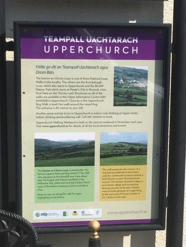
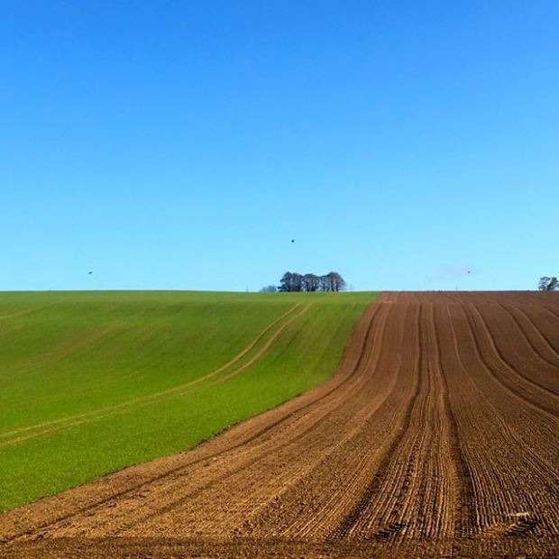
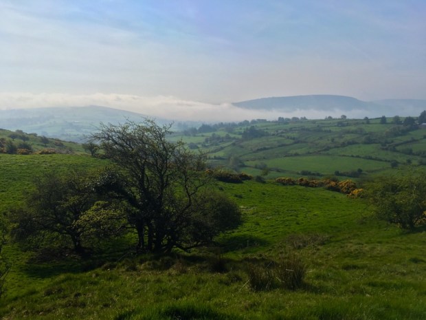
West of the Nenagh to Thurles road the village is at the eastern end of the Slieve Felim mountain range and set amidst a beguiling landscape of rounded rolling hills of fine green grassland and forest in the full forty shades with a fair smattering of golden gorse.

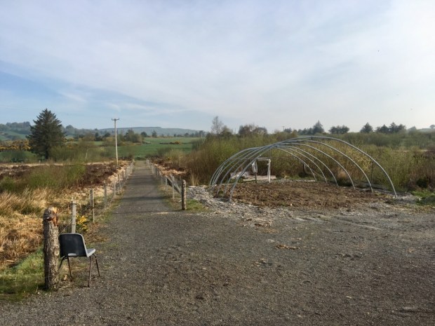
Unusually for rural Ireland these days the village still has 3 functioning pubs, a shop, community Centre complete with crèche and climbing wall and an information center. We stopped there to try and get maps of the walks and discovering it to be shut tried one of the bars. The welcoming owner spent some time rummaging around but couldn’t find what we wanted so kindly got his coworker to open the info centre and furnish us with leaflets and maps.

We discovered that the Beara- Breifne Way, a (very) long distance hiking trail that commemorates the 14 day/ 250 mile forced march of Donal Cam O’Sullivan Beare from West Cork to Leitrim, passes through here. Too late in the day to explore we headed up to the Ballyboy lookout to park up for the night.

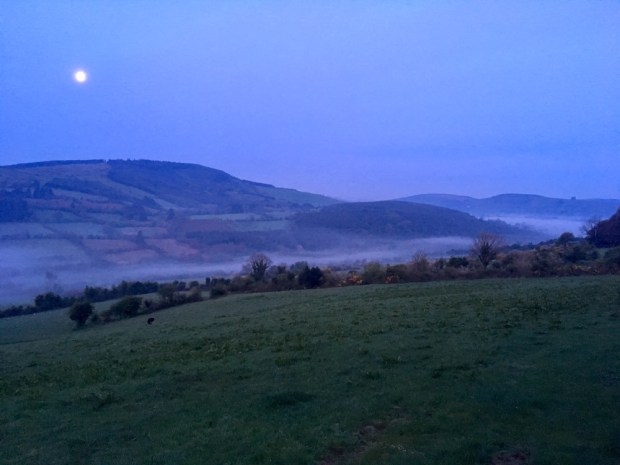
In the very early morning we were surprised to be woken by increasing car activity outside. Still dark we couldn’t see what was occurring. We thought perhaps late night revelers or predawn hunters. But then I remembered some briefly scanned mention of an Easter Sunday Sunrise Mass happening somewhere in the area. I quickly got some clothes on and emerged from the van like a risen prophet to discover rows of seats had been placed in front of the camper and many folk in high viz looking expectantly towards me. Whoops- we’d parked in the alter-place. After a bit of banter I explained we were going to Upperchurch for a walk but as there were by then about 100 walkers heading up the road towards us was advised to go the opposite way, passing many more folk on their way to celebrate the resurrection of Jesus.

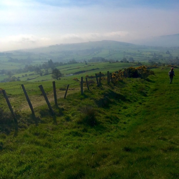
With the full moon still hanging above the misty valley in the dawn light we headed off into the mountains named in Irish after an ancient goddess, Sliabh Eibhlinne- the mountains of Ebliu.

After stopping for breakfast and waiting for the sun to burn off the mist we started off from the village on the Eamonn an Chnoic loop. Eamonn, or Ned of the Hill, was one of the 17th century Robin Hood type outlaws championing the cause of the dispossessed natives and harassing the English planters. Born locally he roamed these hills after shooting a tax collector dead for confiscating a poor women’s cow before coming to a sticky end , murdered for blood money, and his exploits inspired a famous ballad.

Passing another local walk initiative , a bog walk and garden, we continued up the quiet country road accompanied by our first cuckoo song of the year.

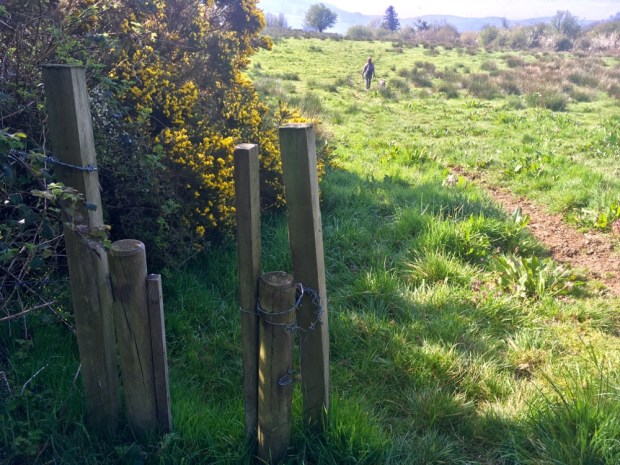
At our first stile we were disappointed to see a no dogs sign. We’d chosen this walk because it was listed as dogs permitted so with our mutts on leads and best behavior we carried on across a series of fields and stiles slowly climbing through Glenbeg.

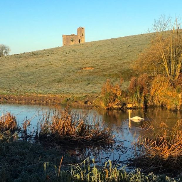
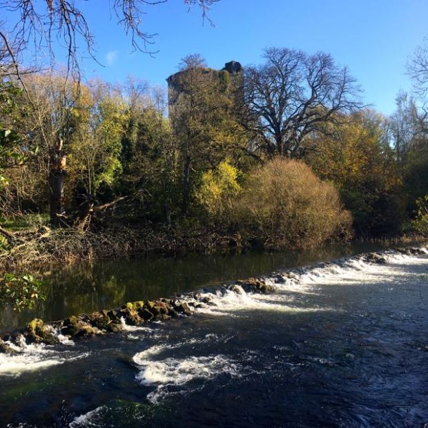
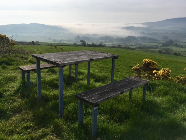
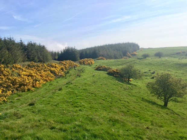
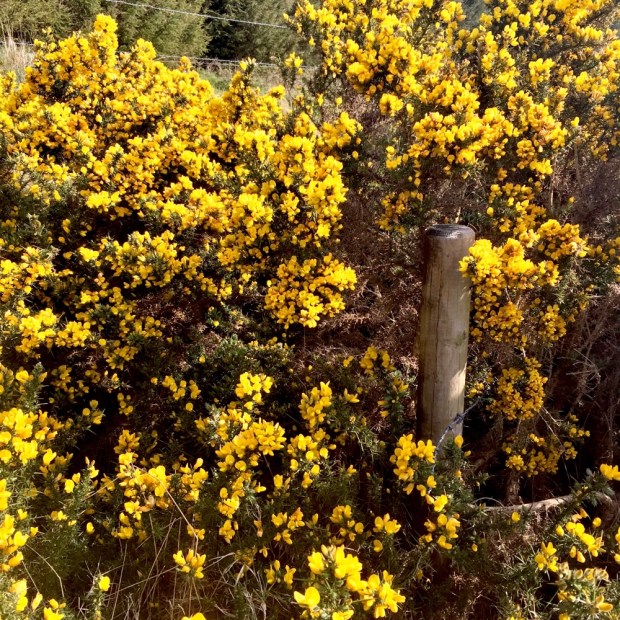
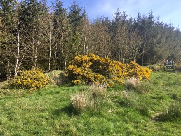
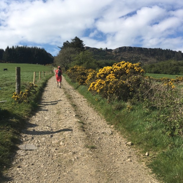
Passing a picnic spot overlooking the still misty river valley to the south we continued up on farm tracks beside a mass of sweet smelling gorse towards a band of forestry.

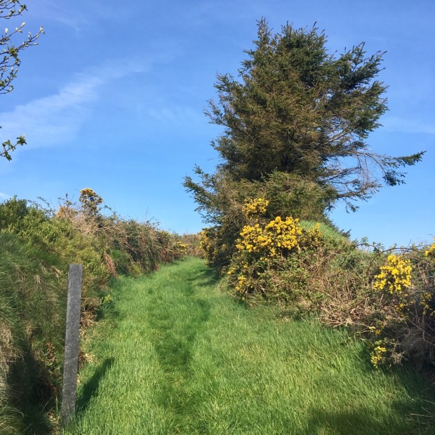
Turning east at the forest we followed an ancient sunken greenway through the gorse and bilberries and down towards a cottage near a ring fort.

We passed the site of a pre-famine hedge school where a schoolmaster named Burke held the only available classes of that period. Hard as those times were, the wildflowers in the “classroom” might have made things more pleasant than in the Industrial schools some of the children have have ended up in.

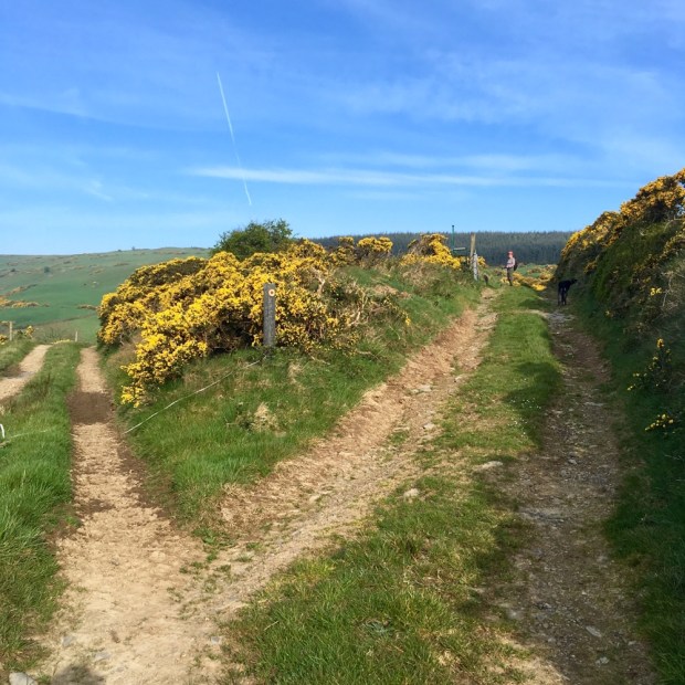
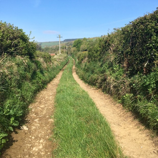
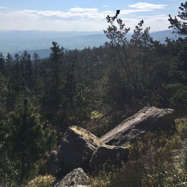
After only 500m of tarred road we were off cross country again for the rest of the walk. Climbing again to another block of forestry on the high ground we walked the fields beside what had been the official trail, now swallowed by gorse.

The forces of nature had overwhelmed other remnants from the past too. We failed to see the old potato ridges and foundations of a famine village supposed to be visible. 29 families from here emigrated to Monroe county in Iowa on one day in 1879. But we did see what’s left of a Bronze Age ring barrow and a little further along a rare bowl barrow.

Downhill all the way back to the village we had one slight route finding problem where signage was missing and fencing down but it was all very pleasant in the spring sunshine.

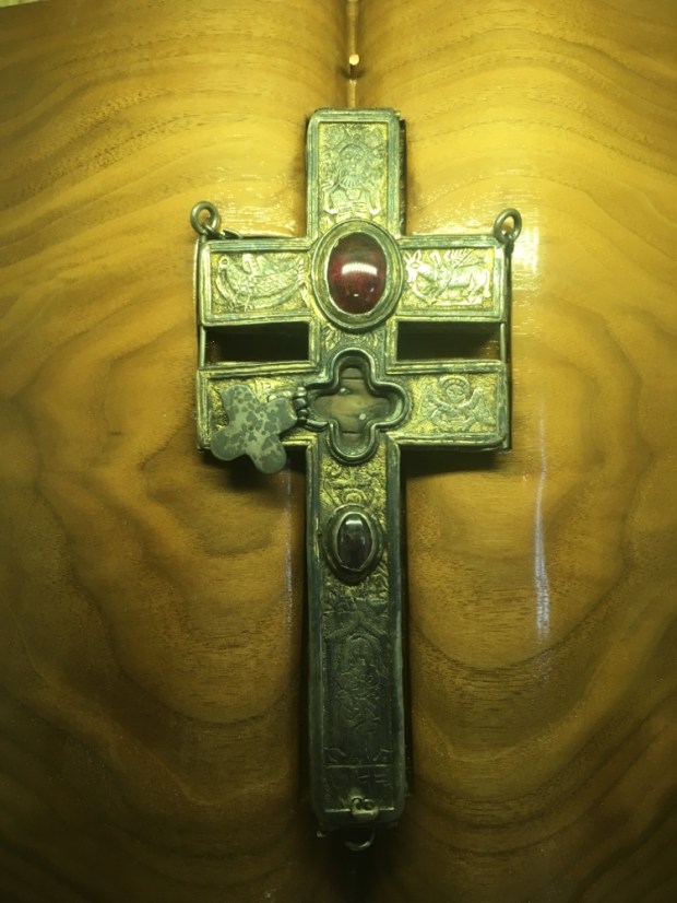
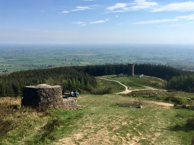
We took a quick detour to Holy Cross Abbey on our way to another looped hike at the Devils Bit. The restored Cistercian monastery has impressive stonework and a marvelous sloping floor beneath the pegged oak roof timbers.

But the real draw for pilgrims over the last 800 years is a silver crucifix containing a relic of the true cross on which Jesus is said to have died. This, along with another artifact were stolen in October 2011 and recovered by the Garda 3 months later in what the parish priest Fr Tom Breen said ” once again demonstrates the power of praying”.

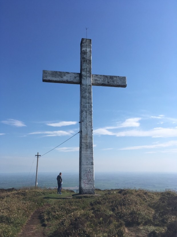
Another cross was our next destination but at ,45 ft high and a span of 25ft , was somewhat bigger.

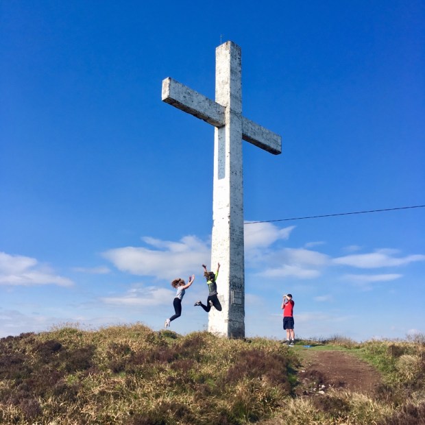
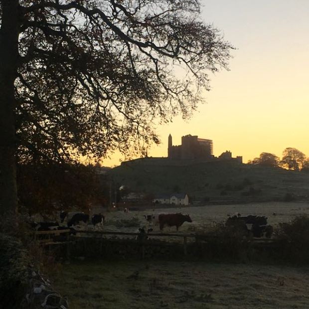
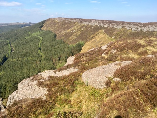
Standing at 480m on an outcrop ( known as the Rock) it boasts a view of 8 counties. I always thought that the devil had spat ” the gap” that he bit out of the mountain to form the Rock of Cashel but then I read that the Rock of Cashel is actually (!) the tooth he spat out after breaking it biting the mountain.

Easter Sunday and the car park was jammers with families setting off up the steep track towards the Rock.

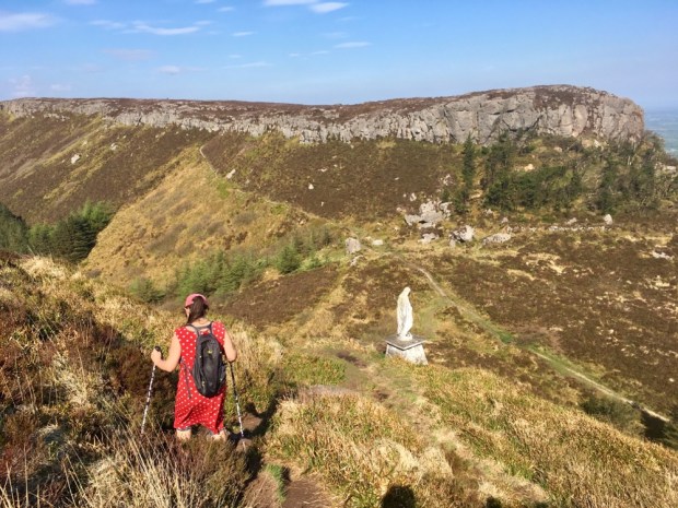
Passing Carden’s Folly where Daniel O’Connell is supposed to have addressed a monster meeting of 50,000 tithe payment resisters and a mock ” burial” of the tithes took place, we reached a stone alter and Marion shrine- the scene of another open air mass and pilgrimage in July.

A steep stony scramble had us up to the looming cross and we rewarded ourselves by soaking up the 360 degrees views of the fertile plains and half a dozen mountain ranges faint in the hazy light.

We descended by climbing down a cliff face on the eastern side, down past another Marion shrine and into the gap that broke the devils teeth.

Nice to explore another unknown patch of Ireland and reaffirm that it’s still a varied and beautiful place to ramble around.

A TRIP TO TIPP: St Declans and the Tipperary Heritage Ways

img_1782

For awhile i’ve been hankering after another Irish pilgrimage route and this one in particular.

St Declans Way runs for 96km between Cashel in county Tipperary and Ardmore on the Waterford coast. It had been resurrected a good few years ago in the nineties, but had started to fade back into the landscape again until recently, when the current resurgence in interest in Caminos took hold. There’s now an Irish Pilgrim Passport that you can get stamped along various routes that qualifies you for an Irish compostella or certificate but having already done most of the Ways i won’t be applying for one.

Made up by stringing a collection of ancient highways together on the route supposedly taken by St Declan, who was preaching Christianity to the heathens of Ireland before St Patrick’s arrival, from his 5th century monastery in Ardmore to the seat of the Kings of Munster at Cashel.

img_1773

I didn’t have the 5 days needed complete the entire walk so devised a circular hike starting in Cahir and going north up St Declans Way to Cashel. After a night there i would circle back down on the Tipperary Heritage Way along the Suir river and skirting over the end of the Galty mountain range to Cahir a trip of approximately 60km.

img_1775

The river was with me from the start when i set off under a clear blue November sky through the market town, passed the churchyard sensory garden

img_1779

on the route of the Rian Bo Padraig, the Track of St Patricks Cow. Folklaw has it that the path, still visible in sections as a depression in the turf flanked by grassy banks, was created by St Patricks Cow pursuing the cattle thief who stole her calf. As she thundered furiously through the landscape her horns raked the lines of the trail into the earth.

Unfortunately the poetic license of the origin myth is not matched by the prosaic modern reality and i saw no sign of the age old track as i made my way along 25km of unrelenting tarmac. However, once i’d got over the motorway that had signalled its presence with a long aural introduction of hums and roars

img_1783

i was off down very quiet back roads through the rich farmland of South Tipperary .The fields were big and open and the farmers seemed to be growing grain rather than the rushes we’re used to around us.

img_1786

On it’s way to Ardmore the Way climbs over the Knockmealdown mountains through Bottleneck pass at 540m, but i had my back to that range as i headed north, with the Comeragh mountains to my right and the Galtees to the east on my left.

img_1789

The names of the townlands i was passing through were a mixture of the Anglicised, like Mortlestown, Chamberlainstown,Farbankindry and the Irish, like Carrigeen, Carron, Knocksantlour. As i neared Cashel later there was a sequence of places called Lot’s, which seemed to be named after the owners the land had been sold or given to. From south to north i traversed Lalor’s Lot, Bigg’s Lot, Owen’s Lot, Waller’s Lot and Ashwell’s Lot. The houses were mostly pretty grand with big gates and sweeping drives with none of the clusters of close quarter cottages seen in the west.

img_1784

Most of the houses had security gates firmly closed to the outside world but perhaps the most down market property on the route had the road going straight through their yard.

img_1790

One feature of the landscape stood out for me and that was the size and health of the trees that grew in the deep rich soil.

img_1788

The area must have a good reputation amongst arboriculturists as this was where the Annaveigh wholesale tree nursery set up in 2004 and now exports to Holland and Germany which is pretty impressive as was the 70 acres of well pruned and tended trees i walked past on my way toward Cashel.

img_1795

My journey up the Rian Bo Padraig had not been rich in sacred sites or monuments of the past but near the end i passed, in quick succession, memorials ancient and modern.

img_1792

img_1791

I was grateful to arrive at Cashel after what had been an early start after a very late night and a long day on a hard road surface. I was too late to visit the castle atop the Rock that the devil had spat at St Patrick so retired to my hostel for a rest by the fire in the lounge.

img_1870

Heading out into the sunrise the following morning the sky was bright, the air was crystal clear and a sharp frost sparkled on the grass. It’s coming to that time of year again as autumn turns to winter. It’s been a beautiful season here in Ireland with lots of dry weather and a fine display of red, gold and orange on the trees. The unusually dry weather was enabling me to return to Caher on the Tipperary Heritage way which followed the banks of the river Suir for the first 10- 12km and was officially closed to walkers along the stretch to Golden from October to March due to the common winter floods. I knew from the water levels in the turloughs and rivers around us that there was no risk from that at the moment so set off confidently westwards down the 4km of road to the river.tipp-heritage1

On the outskirts of the town, adrift in a field of cattle, was Hore Abbey, founded in 1266 by the Benedictine order but expelled by the Archbishop of Cashel 6 years later after dreaming that the monks were about to kill him. He didn’t make himself popular with the folk of Cashel as he gave over land and property belonging to the town, and the Abbey, to the Cistercians of Mellifont. Even more grevious was to tax the 38 local brewers 2 flagons out of every batch of ale.

img_1801

Looking back from the Abbey the bulk of the castle stood out against the lightening sky.

img_1804

Going against the flow of cars ferrying workers and school kids into another day in the hurly-burly of modern life, i felt very privileged to be heading towards a dead end in the road and a peaceful riverside path devoid of the activities of humankind. An illusion of course, as all around me had been created and managed by man. And well managed. I was admiring of the efforts of the landowners along the trail to facilitate the walkers.

The rising sun had still not generated enough heat to thaw the frost that made art of the vegetation and held the moisture off my boots as i laid a new trail through the whiteness.

img_1809

I could see why the path was often impassable in winter when a footbridge over a stream revealed the height level of seasonal flood waters.

img_1813

There was, as the name of the Way implied, a lot of heritage alongside the river presumably as it was a means of transport in the days before the road network was established. On the opposite bank lay the ruins of Ballynahinch Castle patrolled by a lone swan.

img_1812

The gently flowing and winding river is one of the Three Sisters along with the Barrow and Nore, all of which come together to leave the country at Waterford. Rising from the slopes of Devil’s Bit Mountain it takes 185km to reach the sea making it Ireland’s third longest river. There was little evidence of it’s might on this tranquil stretch.

img_1825

On my print out maps from the Irishtrails website the Way leaves the riverside on a couple of sections but whatever difficulties there were with landowners has been resolved and now you can stay beside the Suir all the way to the road bridge at Suirville, about 6km south of Golden. At times the path is on the riverbank fenced off from the adjoining farmland and at others you are in fields with cattle that could be muddy in wetter weather.

The day warmed up as i followed the meandering flow, the stillness only broken by startled birdlife splashing a retreat and the gurgling rush of water over weirs.

I’m not sure if the weirs were constructed to slow the flow and alleviate flooding or what but anglers appreciate fishing for Brown Trout and Salmon in these waters and there are plans to attract more people on leisurely pursuits with the creation of a cycle and walking Greenway from Carrick on Suir to Clonmel and a canoeing Blueway from Carrick to Cahir.

Before long i was in Golden, with its 15th century castle sitting on a mid stream island.

img_1839

During the 1641 rebellion the castle gave shelter to 120 men , women and children and 10 years later was taken by Cromwell himself. A more impressive structure lay another few km further down stream where what was once the largest abbey in Ireland stands in ruins.

img_1845img_1843

Athassel Abbey. Dating from 1200 this majestic pile, of which only a fraction appears in the photo, used to have a sizeable settlement around it of which nothing now remains.

A little further on another medieval towerhouse ,Suir Castle, appeared above the trees.

img_1848

And then a well kept track had been cut through a copse on a section that had previously been out of bounds and a riverside water meadow with grazing horses sporting hair accessories before i sadly came to the bridge that led me away from the Suir.

tipp-heritage-2

As can be seen from the map above there was a long stretch of road ahead and after less than a km i’d decided to escape what i could of it. The 25km of tarmac the day before had left it’s mark on my feet and with a fair climb to do over the last 8km or so up through Ballydrohid Wood i thought i’d chance my arm- or my hitching thumb.

I must have made the right decision as fate was with me and a car appeared and stopped.    A charming and chatty lady swept me down the road saving me over an hour of wear and tear in minutes, letting me out to cross the main N24 and head for the hills.

tipp-heritage-3

I had my first ascent of the walk as i rose up through beech woods and conifer plantation onto the easternmost shoulder of the Galty mountains. I’d spent a couple of days eyeing up this range when i hiked the Ballyhoura Way and there is something about Galtymore, the highest peak and one of Irelands few that reaches over 1000m, that attracts me. I did climb it decades ago when i tackled all of the county’s “Munroe’s”,but it calls again.

img_1853

The views from the edge of the forest unveiled the rich patchwork of fields of the Golden Vale, the heartland of Ireland’s productive agriculture industry.

img_1854

A network of forest tracks switchbacked up the folds in the hills leading me deeper into wilder country with patches of bare rock and scrubland, a welcome contrast to the manicured and managed farmland i’d been travelling through over the last couple of days.

But this was Ireland where an area of bogland and conifer forest in Mayo is declared a “Wilderness” so my impression of walking in the wild is relative to the general lack of anything approaching it. The levelled gravel track led me through the serried ranks of the conifer crop and then, thankfully and unusually, a more attractive stand of Scots Pine.

img_1857

img_1867

Cahir appeared in flashes between the trees, nestled down below me at the base of the hill. As the forest track morphed into a farm track and then a road overlooking ,(and overhearing), the busy M8 i noticed the sky, clear and blue all day, turning a little dark. So i was grateful that after going over the motorway and under the N24 i had only a km of suburban street to go to reach my car and complete my Tour de Tipperary.

img_1869