Rota Vicentina

THE FISHERMANS TRAIL2: Barranco da Fonte to Aljezur 2 days

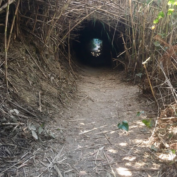
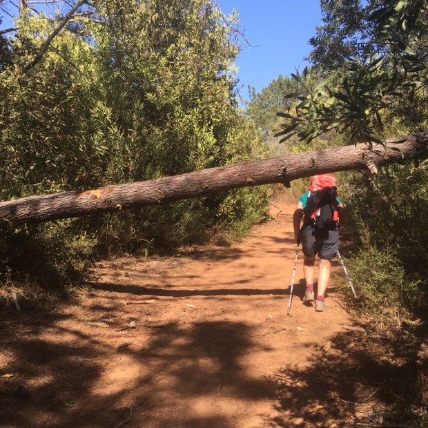
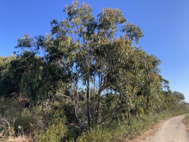
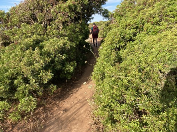
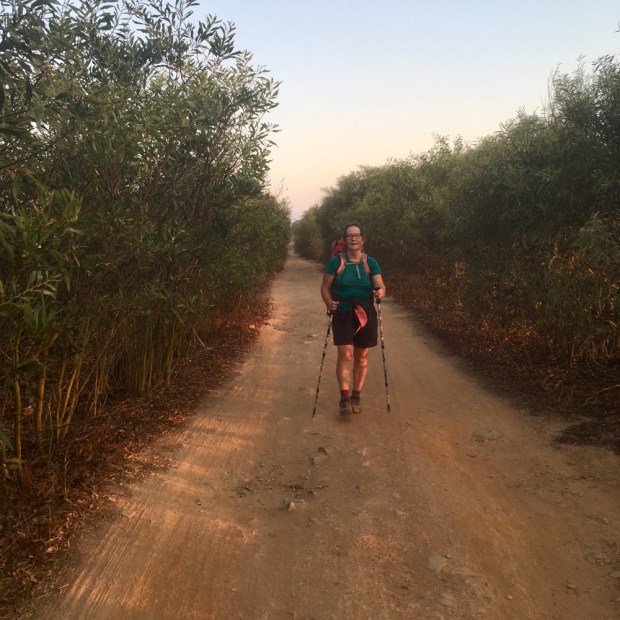
Leaving the luxury of our stay in the middle of the long 22 km stage between Carrapateira and Arrifana we only had about 10 km to go with one serious up and down. It was our last day with our friends and the penultimate one of the trip for us. We took off down the wide solid track which soon led us into eucalyptus plantations which afforded us welcome shade. The weather had been perfect the whole trip, with our rain jackets remaining at the bottom of our packs.

The trail was soon quite busy with hikers coming the other way, from Arrifana, so it could only be a few hours away. Some people I spoke to said there were no soft sand sections to come and I warned them of the slog they had coming. They needed an early start and plenty of energy to complete the whole section in one.

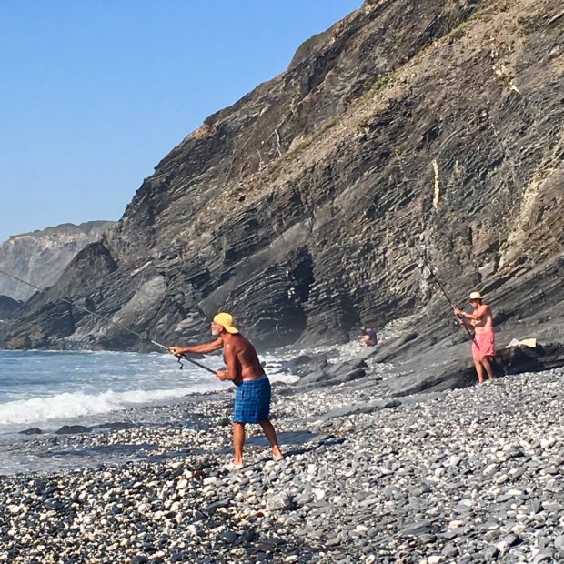
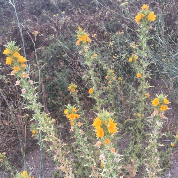
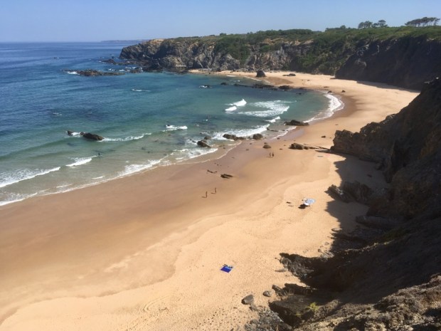
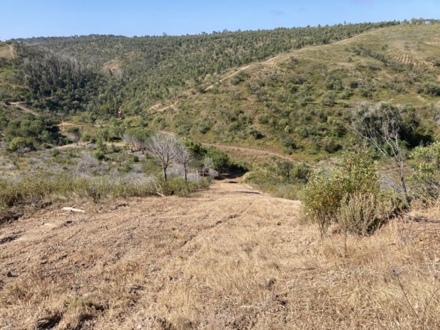
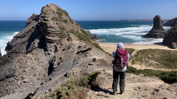
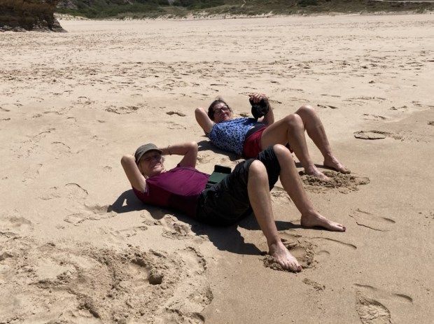
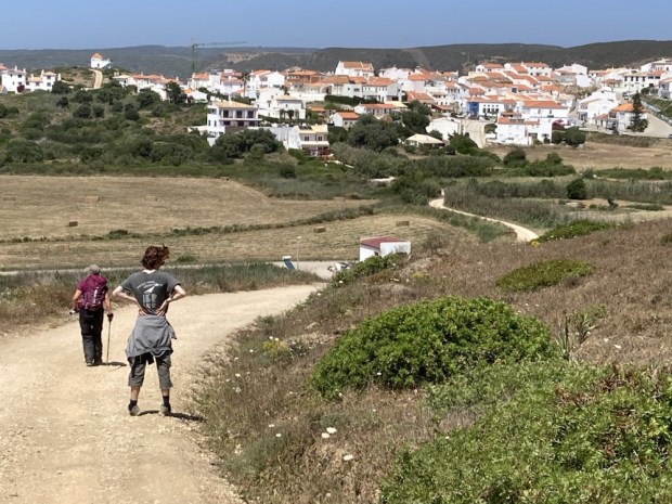
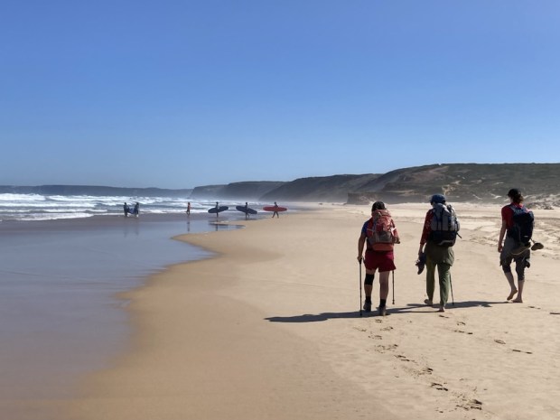
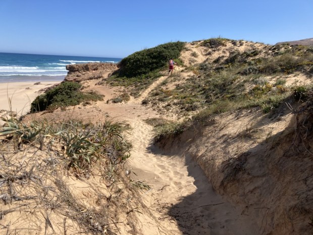
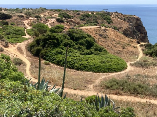
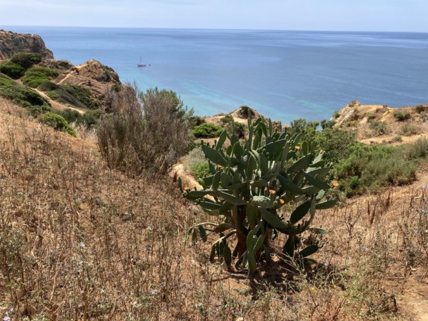
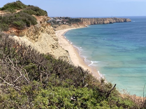
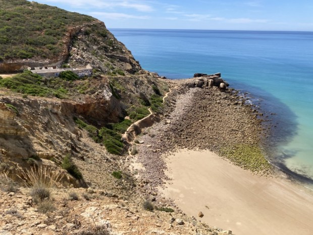
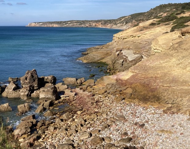
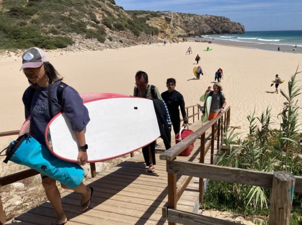
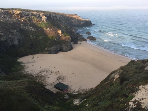
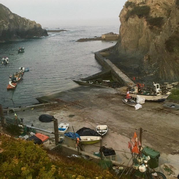
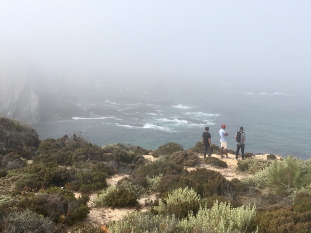
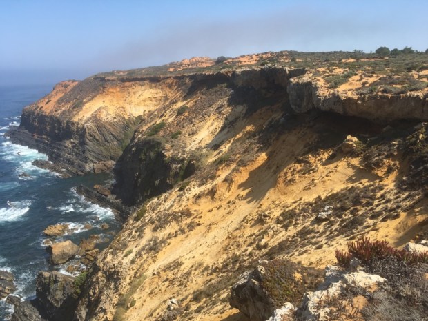
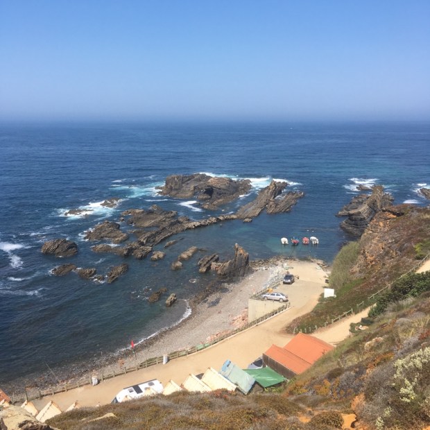
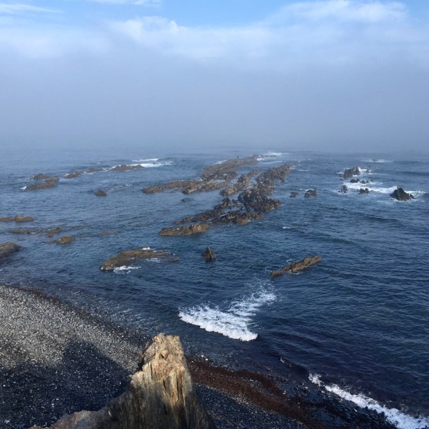
Emerging from the plantation we crossed a long high shoulder of rocky ground covered with low lying cistus and lentiscus with lusher valleys below. We shared the track with determined surfers in 4×4’s who risked the steep rutted track down to the boulder beach of Praia do Canal where we stopped for snacks and a breather before tackling the equally steep and rutted track up and out of the beach. The long climb was rewarded, as usual, with fantastic views back along the coast.

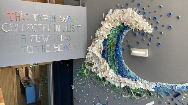
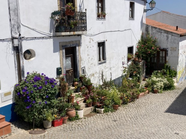
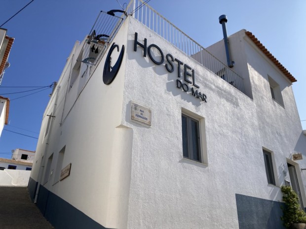
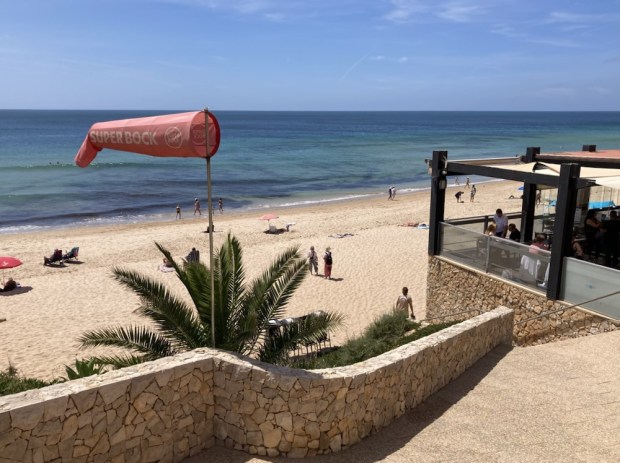
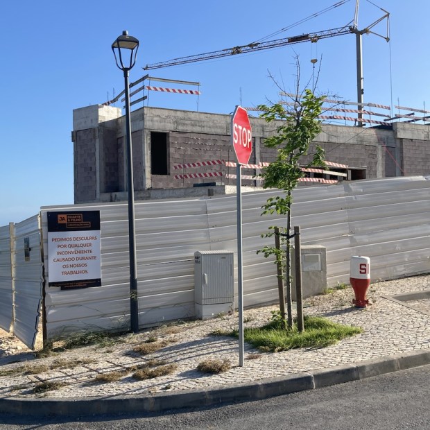
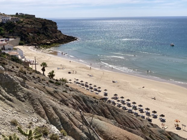
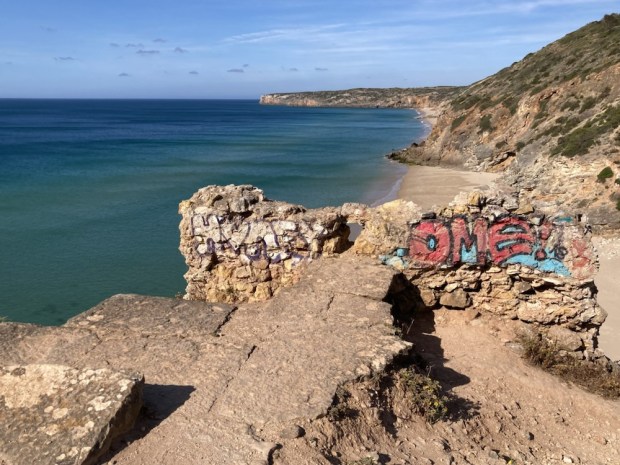
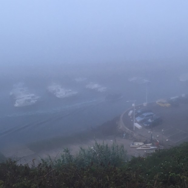
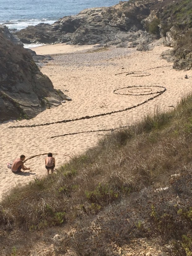
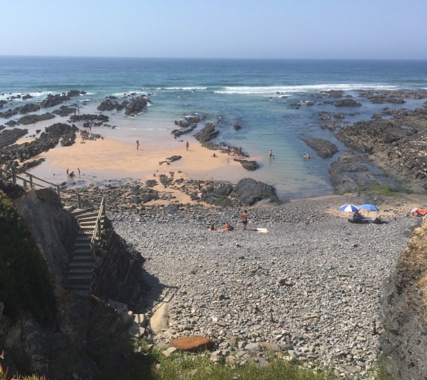
The rising ground eventually levelled off in more eucalyptus forest where we rested again and watched easier methods of transport go by. But we didn’t have far to go, the last few kms had Arrifana in view and before too long the final sting in the tail of a steep roadside climb into town was done and we were drinking refreshments poolside at our hostel high above the surfers beach from which plastic trash had been collected and made into art.

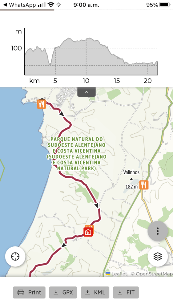
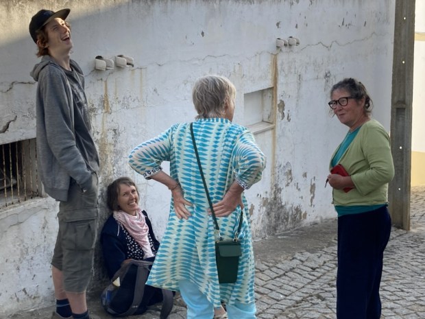
I don’t know if was the sun or one of my ailments but that night I retired early with a fever and high temperature which had gone down by the morning but still leaving me feeling weak. So after much soul searching we decided to be prudent and rather than tackling the 17.5km coastal route we would take the Historical Trail to Aljezur. And as our departing friends were driving off that way we’d take a lift a few kms too leaving us only 6km, which I figured I could crawl in the time available if need be.

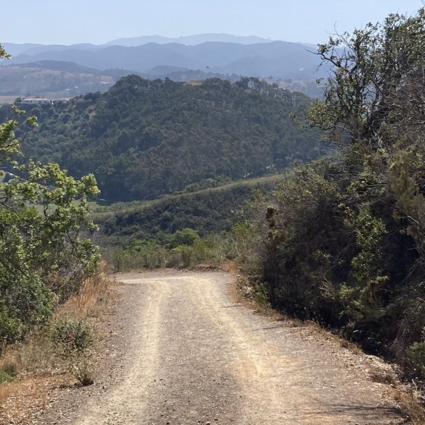
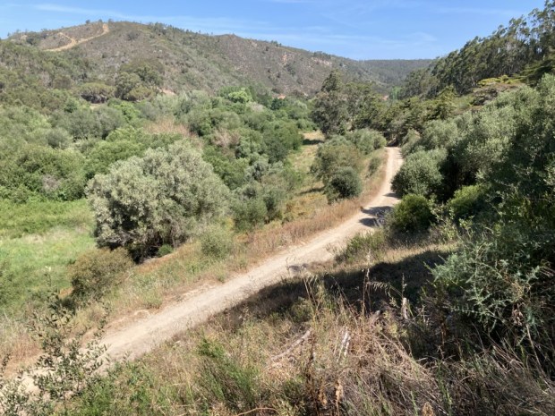
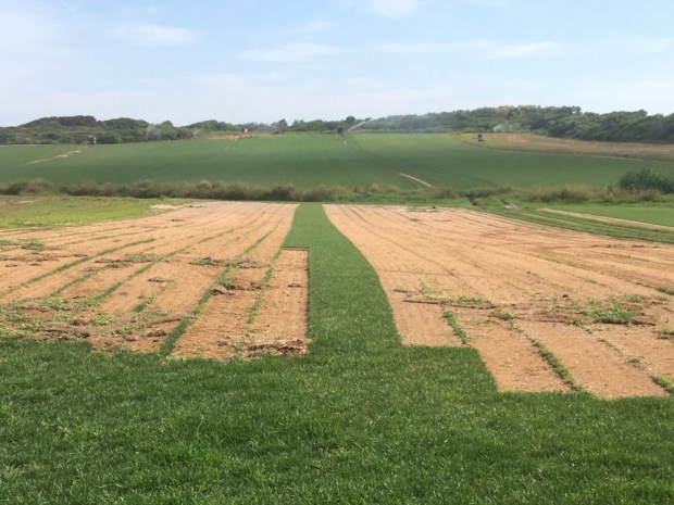
It was luckily a gentle route, with only one real descent/ ascent, on solid tracks through woods and farmland.

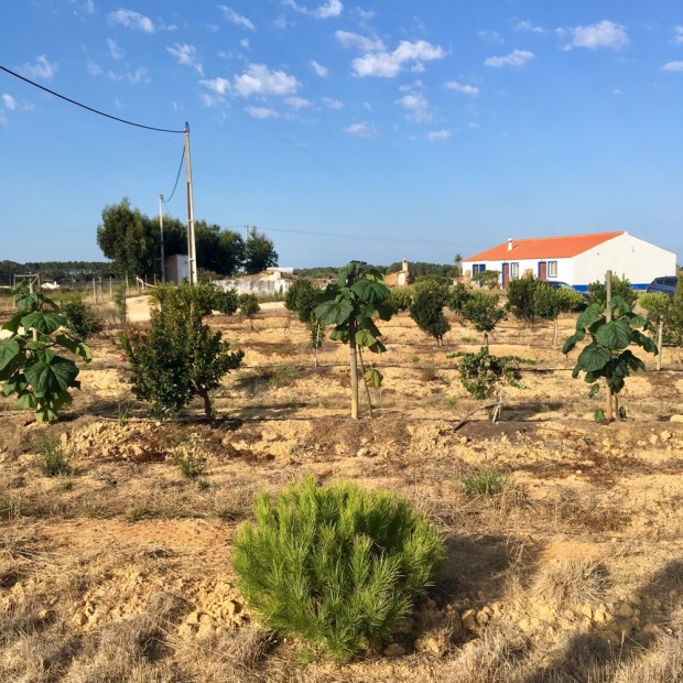
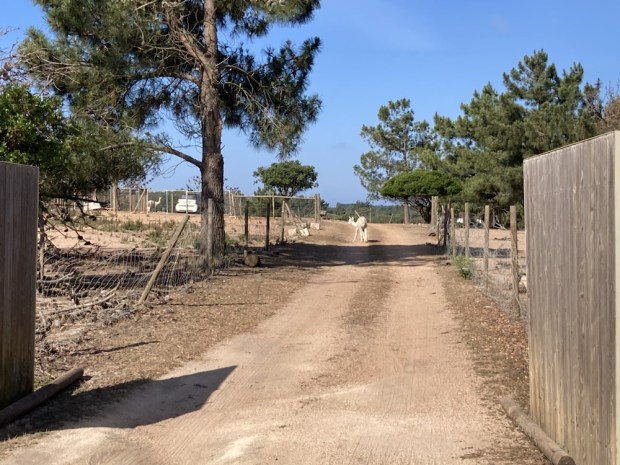
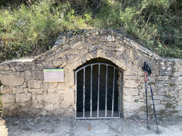
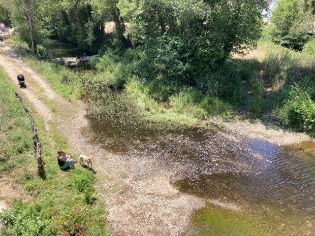
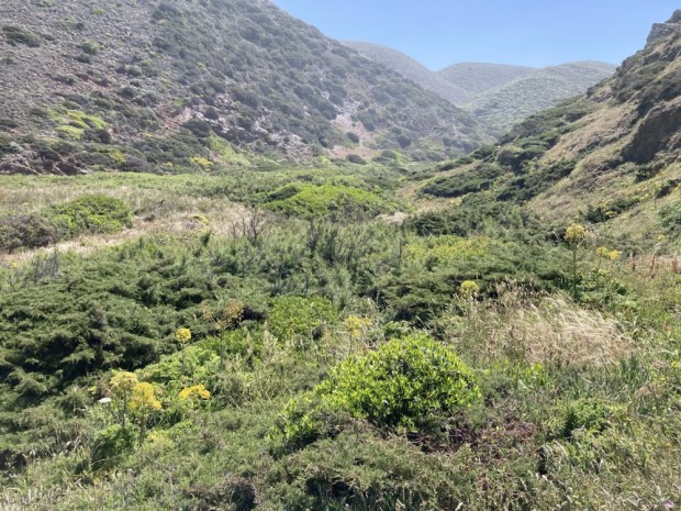
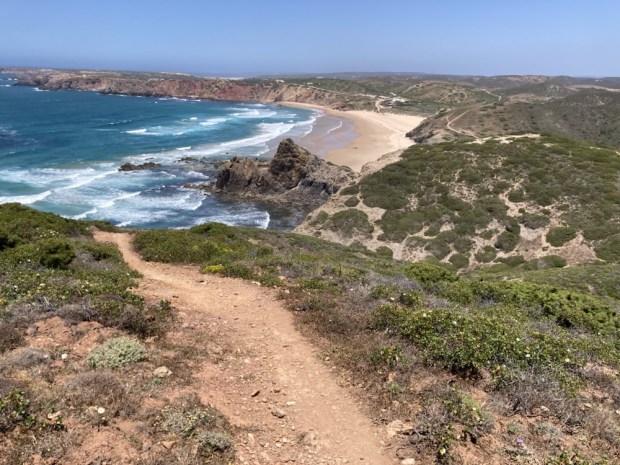
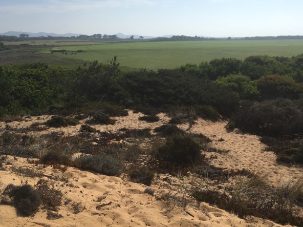
We passed some pretty sickly looking cork oaks and an alpaca farm where one of the beasts seemed to have escaped the fencing. The way crossed and followed a road a little way before again turning off on a dirt track that afforded fine views of the river valley from the coast towards Aljezur.

The final downhill inflicted on Sally’s knees took us past a strange hamlet of restored or built holiday houses which although fairly new looking were worse for west and unused. The path took us through the complex along a little lush valley complete with ancient moorish well and up the final uphill to be inflicted on my lungs. And then we were there, at the church, with not enough puff or desire to climb the extra distance to the hilltop castle.

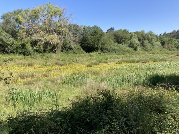
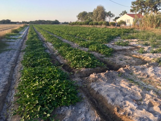
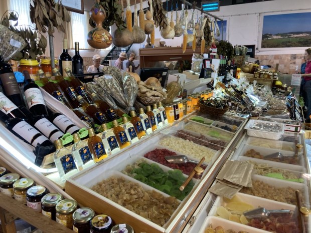
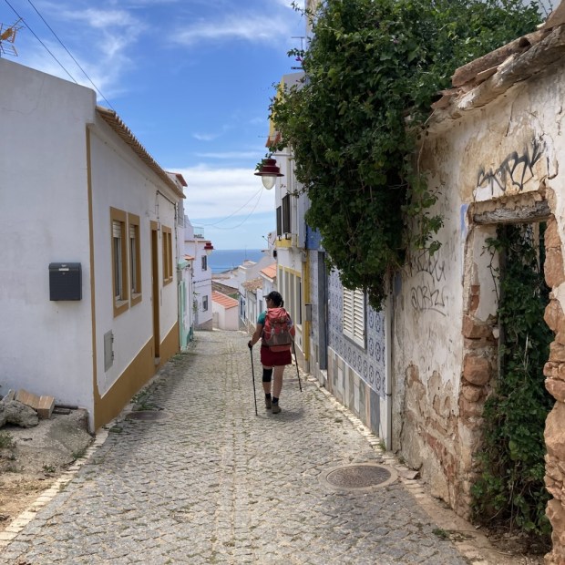
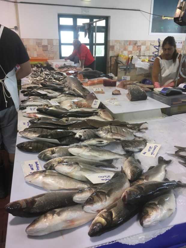
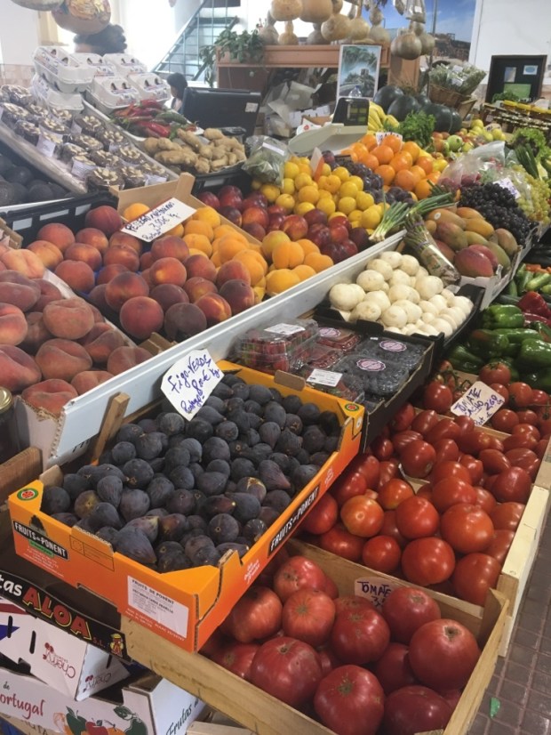
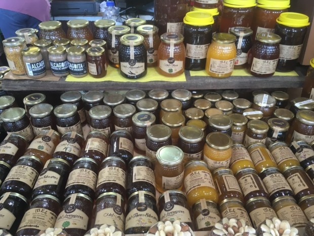
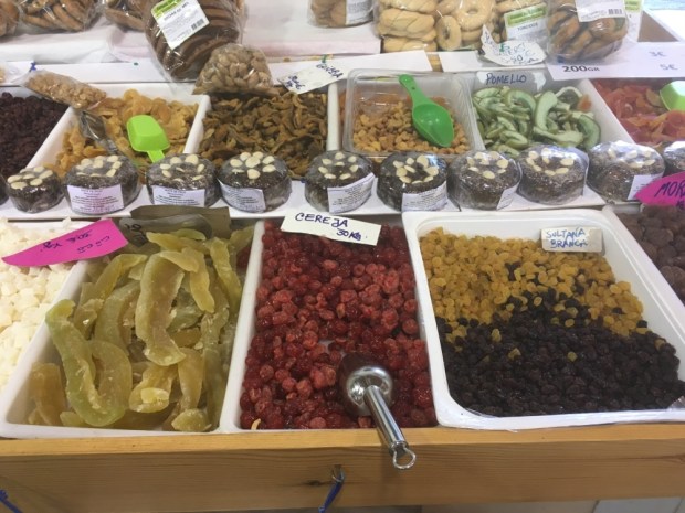
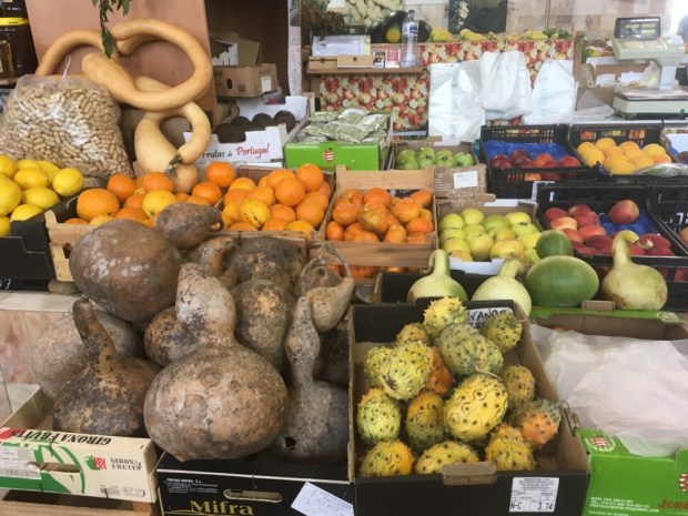
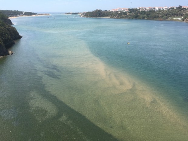
The river had, in the 15 th century been navigable all the way from the sea to Aljezur, giving the only spacious safe harbourage for miles of west coast. The town lies on the fertile plain and is famous for its sweet potatoes. With a couple of hours before we could check in the our hostel we visited the market where our first adventure on the Fisherman’s Trail started 4 years ago and then strolled to the riverside to relax and watch the crayfish.

We’d made it to the finish. Another beautiful route completed. The trail network has obviously been a huge success judging by the number of hikers we’ve seen and goes to show what can be achieved when tourist bodies, marketers, commercial interests and the public work together to create a heathly and sustainable hiking and holiday option.

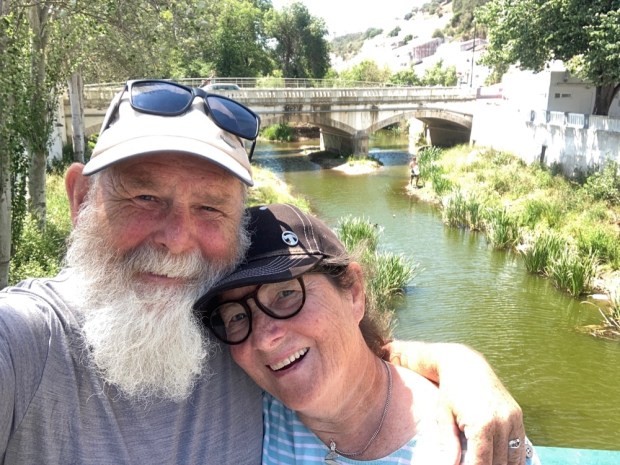
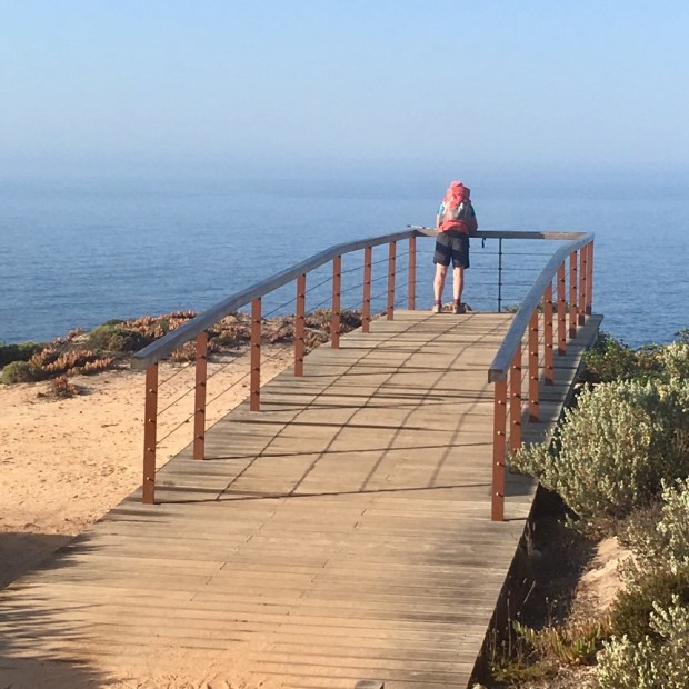
One final selfie, one final Portuguese sunrise and the journey home begins. Bom dia.

THE FISHERMANS TRAIL 2: Vila do Bispo to Barranco da Fonte 2 days.

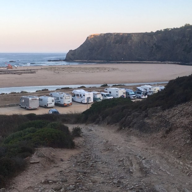
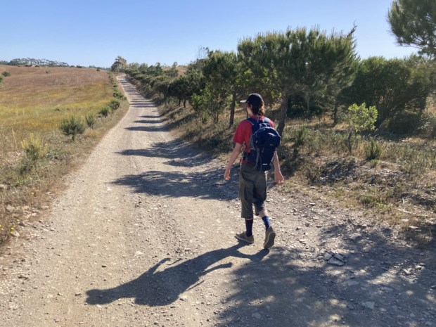
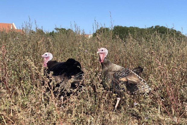
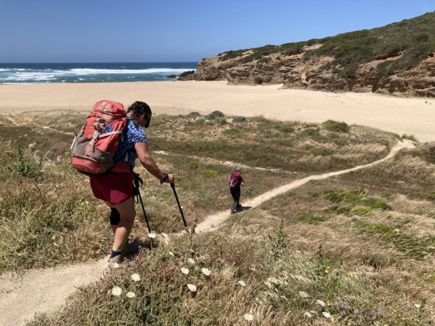
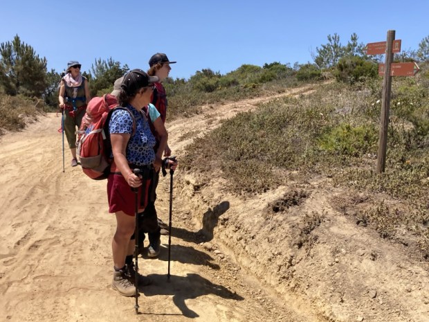
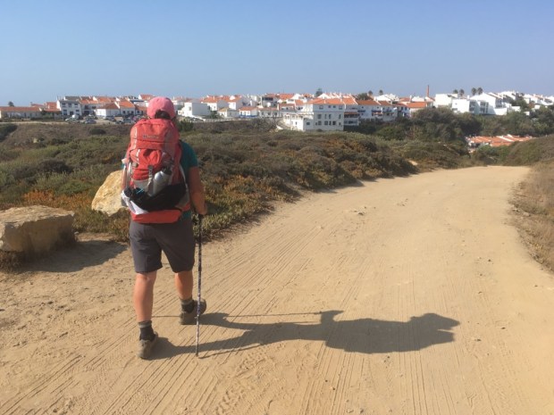
Three of us headed off from Vila do Bispo, a climbed out of the town and then a stretch alongside the road, accompanied by some turkeys and windswept trees, before turning off on sandy tracks towards the coast.

Patches of eucalyptus sheltered us from the strong wind now and again as we crossed wild and high shrubland on wide gravel tracks with the sea on one side and thickly vegetated hills and valleys on the other.

The plant life was again varied and beautiful, sometimes growing in a pure gravel bed.

We reached the sea cliffs and climbed down into a glorious remote valley with a spectacular beach. Steeply down and steeply up again. Hard going but awe inspiring scenery all around.

Then after a stretch along the cliff top it was another climb down to sea level to Praia da Murracao where we had a rest and admired the rock formations and I had a cooling dip in a pool sheltered by rocks from the crashing waves.

What goes down must go up again so another brutal climb up away from the beach was followed too soon with another descent to yet another huge expanse of sand, Praia do Amado, where we met our other two friends and we all carried on to the stages end at Carrapateira and our hostel, glad to arrive after 15.5km.

A great spot, a well designed modern hostel and a friendly and delicious restaurant next door made for a good night before we headed of again at the leisurely hour of 9.30 with only about 10 km to do that day. An easy day we thought, having broken the 20 km stage to Arrifana in half. It was uphill all the way mind you but 150 m over that distance should be easy peasy. But very soon after starting we were slogging along tracks of deep soft sand, always a energy sapping surface.

Across the Sahara like dunes to the hard wet sand of the beach at Praia da Bordeira where a class of surf schoolers were trying their luck in the mushy waves.

At the end of the beach the climbing began, first up to the cliff top and then turning away from the sea on a succession of soft soft sandy tracks up and up to a trig point at 158 m. The treasure trove of plant life in my eyes , the heady scent in my nose and Eddie Kendricks ” Keep on Trucking” in my ears kept me going along with my desire to get the top.

The narrow soft track became a wide hard one and with the climbing done and some resting in the shade of eucalyptus coppice before too long we were walking through fields of grain and enjoying our just rewards in more lovely designer accommodation at Barranco da Fonte.

Another fine day on the Fisherman’s over.

THE FISHERMANS TRAIL 2: Lagos to Zavial 3 days

Back in Portugal after last years Camino and back on the Fisherman’s Trail after 4 years. Since then the trail has been extended along the south coast to Lagos so this time we’re starting there and going around the Cape of Sao Vicente and north up the west coast to Aljezur where we started last time. This trip is only about 120 km over 9 days but with the condition our bodies are in and the rugged up and downs of the trail it’ll be enough of a challenge.

And back to the Portuguese cobbles. By plane to Faro, train to Lagos, and cab out of town to the trail at Praia de Dona Ana where after the starting line selfie we clambered onto the boardwalk steps to begin a long stretch of timbered trail past a dazzling selection of rocky coves lapped by crystal clear emerald waters.

The geology was impressive sandstone , limestone, and otherstone in layers and whorles, caves and arches in a colour palette of earthy hues as we crossed the headland to the old lighthouse at Ponta de Piedale ( Point of Mercy) admiring the flowers huddled dry and hot in the forceful winds.

Passing through an enclave of posh villas we came down to a busy Sunday lunch time at Praia de Porto de Mos where we joined the diners at Antonio’s before scaling the path to the cliff top and continuing high above the beautiful beaches to the dramatic black and white monument above the beach of Luz.

A long clamber down into the popular town with its beach and cafe restaurants both of which we enjoyed at leisure before continuing up the cliff top path at the western end of town, passing ever more grand building dreams to our more modest space for the night, although we did have the cool pool I needed.

Next morning we retraced our steps to the cliff top path to carry on west, warned by a local ,(German), to keep away from the crumbling cliff top as every year some folk are lost, in fact just 2 weeks ago- and still no body found. The sky was blue and clear again and we were glad to have made an early start as the temperature rose. A lovely path past many old lime kilns and across high ground full of flowers before a descent to Burgau where we stopped for breakfast at a very good bakery, cafe and supermarket. A popular place we were surrounded by ex pats of many varieties.

Exiting the town through a rather surreal mix of controlled and wild landscape of multicoloured rock, we again climbed up to the high cliff top plateau and continued past what I guessed to be some old mine workings before dropping to another pristine beach where I could no longer resist the cooling ( seriously cooling!) waters.

Another steep climb up away from the beach and along to the 17c fort built by Luis de Sousa in an attempt to protect the coast from pirates and privateers before we again dropped down on a steep and slippy path to Boca do Rio where a snake slithered back to the river as we passed. Once more we ascended on weary legs with panting breath to gain the heights for the final time that day, grateful for the level cliff top but wary of the inevitable descent. Happy when Salema came into view, happier still to discover a fine old “era” or threshing circle nearly lost to the plants.

Before long we were down among its charming streets and making ourselves at home on our top floor balcony (second from left!) before an invigorating dip in the still flat calm sea.

Our third day on the trail was the toughest so far even though we only managed about 9 km. We had split the 20km stage from Salema to Sagres into two, booking a room at the Hostel on the Hill, a couple of km in land from Zavial beach. An easy day we thought. An easy trail altogether we thought. We had studied the altitude profiles of all the days from the comfort of our sitting room and it had all looked benign. Looks can be deceiving.

We were warned by a lady at breakfast in the hotel “It’s horrible”.

“So steep and slippy”

“It’s dangerous, be very careful”

Mind you perhaps we didn’t make it as easy as we could for ourselves by following some shortcut Wikiloc trails and not the official Fishermans but after climbing out of town in the road we veered off on a narrow cliffside rather than cliff top path. It had some challenging sections we’ll say.

There were a few stretches that reminded me of the clambering on the rocky Lycian Way trail but after we rejoined the “official Fisherman’s” things calmed down and we romped along for awhile till we had to tackle another near vertical ascent on rock and tree roots. But the views of the untouched looking beaches and the wild flowers were enough to keep us going.

Another descent another ascent and another unofficial shortcut, that luckily ended well, and we were on the final leg, on a lovely high rocky plateau full of flowers. This led to the Ponta de Torre where suddenly we heard the sound of crashing waves and the wind, as we gained the high point, was a different beast. Things had changed. The calm had gone. The surfers were out.

A much needed drink and food at the beachside restaurant and we started up the hill towards the Hostel on the Hill. Sticking our thumbs out was rewarded by a smart white Range Rover picking us up.

So now we are done for the day. 6 more days to go. It’s going to get easier.

THE FISHERMANS TRAIL: Vila Nova de Milfontes to Porto Covo (20km)

Our last day on the trail was the toughest with long stretches of deep soft sand traversing the most extensive consolidated sand dunes in the whole of Portugal. It was another reason we had started in the south with a short and easy acclimatization to track life.

Our day had started early to claim as much cool as we could. With all the advice against hiking here in August we had been careful, and lucky, with unseasonable temperatures in the high 20’s rather than 30’s.

Passing through the unfinished developments at the edge of town, strange plants emerged from the gloom.

The overnight sea mist had left its deposit of moisture and the snails were out in force, covering the bushes and making abstract art of their trails in the sand.

After a couple of km we heard boat engines and watched a fishing boat make its way out of the harbor at Porto das Barca’s through the mist.

As the sun started to rise the warming temperature burned off the mist and the coastline appeared again.

After the last few days of luxuriating in the macrocosm of the wide open spaces and dramatic headlands of this beautiful and undeveloped Alentejo Coast I started to appreciate the microcosm of the plant and rock formations.

I think I’d would be fabulous to be here in April or May when there is a carpet of flowers although with so many evergreen species there is always color when a lot of Southern Europe is a uniform burnt brown.

The scent of the various herbs has also been a delight as well as the familiar heady aroma of hot pine needles and the invigorating briny sea smell carried of the spray.

Our aural senses had been satisfied with the constant rhythmic thud and crash of the breakers, the calls of the seabirds and the only vehicle noise was the low hum of boat engines carrying far across the waves.

The rocks told tales of rising and lowering seas and coastline with massive contortions of strata witness to upheavals over millions of years. At times the beaches were 60 miles out into the current waters and yet sometimes we were walking on a bed of coral and shells on the cliff tops high above the sea.

Everywhere were little paths threading down to the fishing rocks on impossibly steep routes. We saw ladders and ropes to aid the fishermans descent and large encampments on very remote beaches. How they got all their kit down and back up was beyond us.

There is a guy fishing from the very end of that far spit of needle like rock in the last photo.

The white stocks also had precarious perches although with very good defenses building their stick nests atop towering sea stacks.

At Angra da Barrela the birds and fishermen came together on a rocky limestone headland lined with men and rods in a landscape very similar to Blackhead, at home in the Burren, another- different – fishing spot.

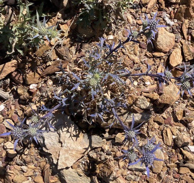
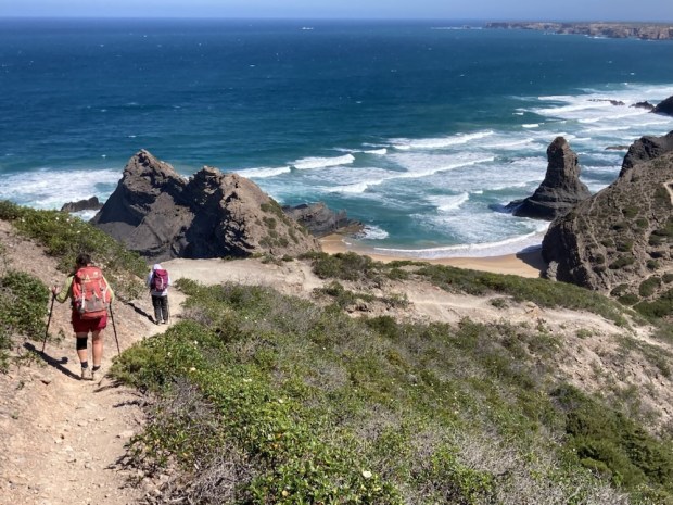
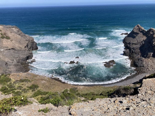
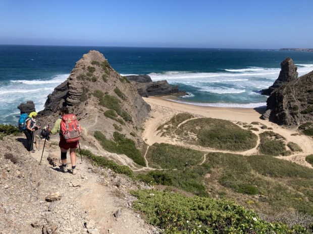
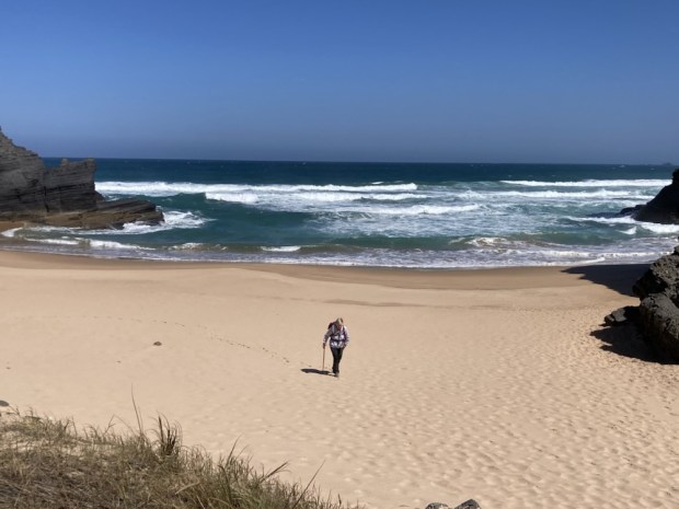
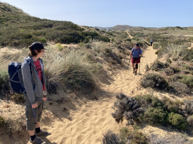
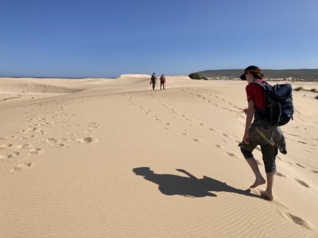
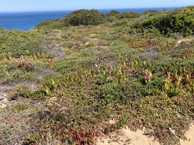
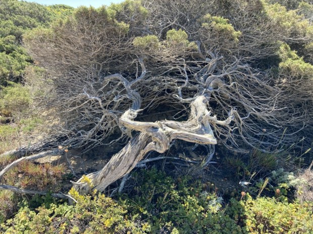
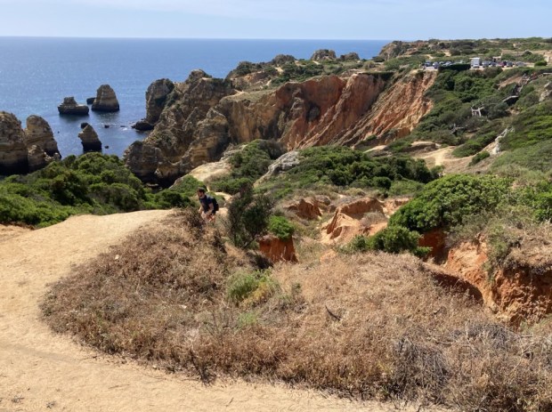
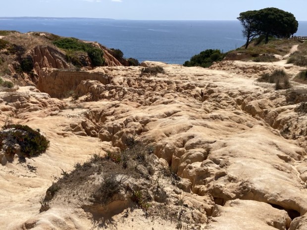
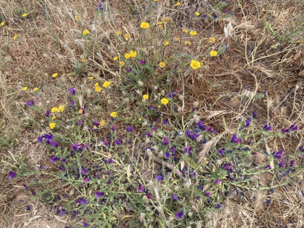
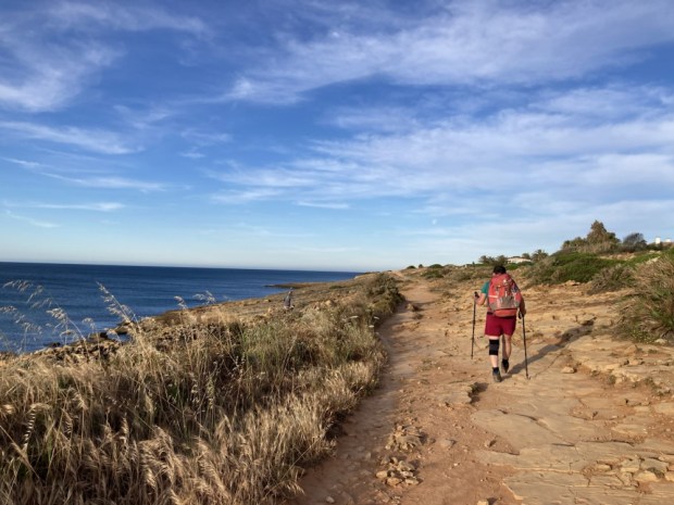
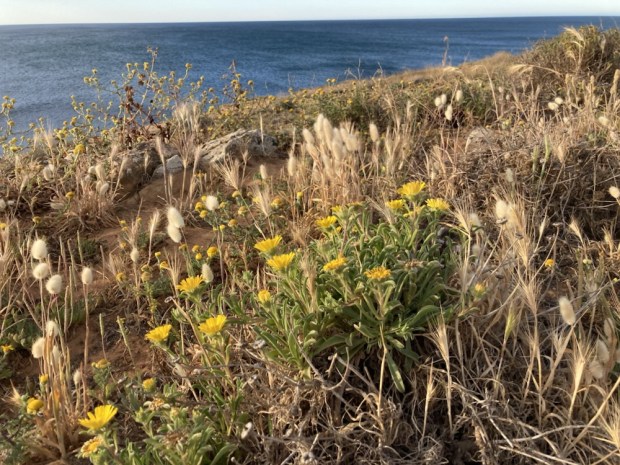
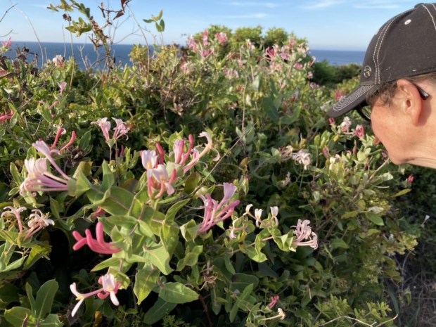
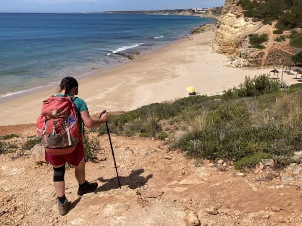
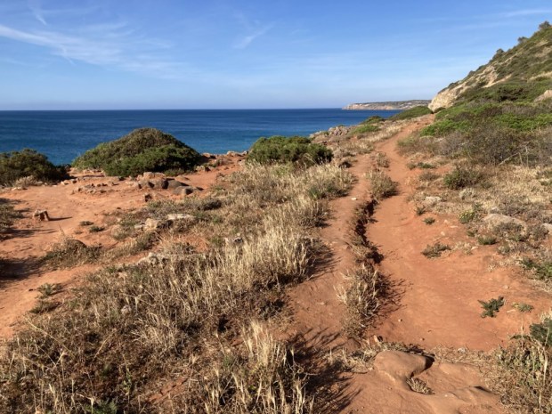
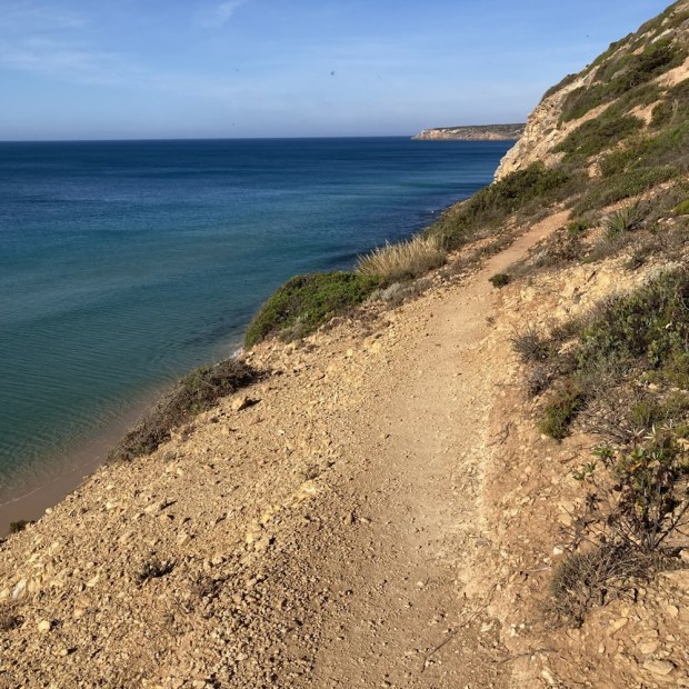
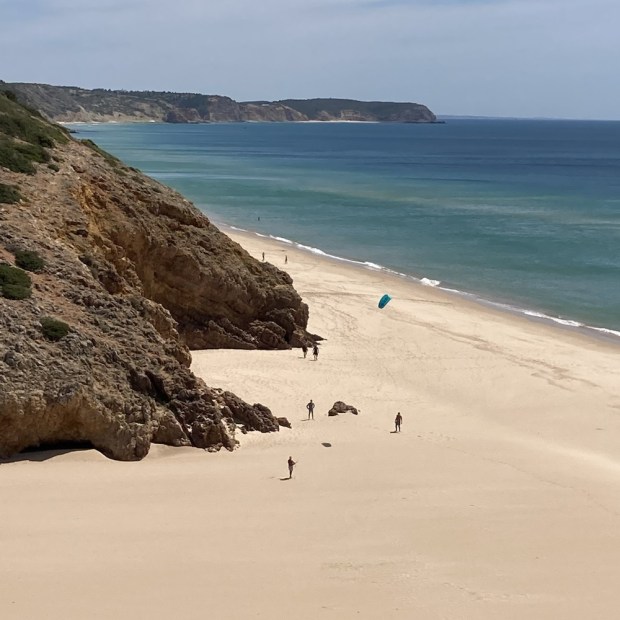
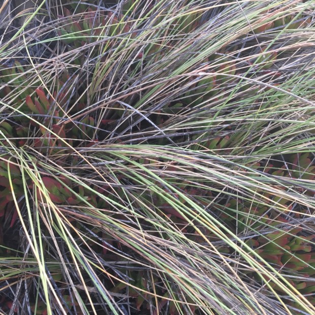
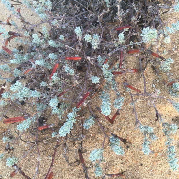
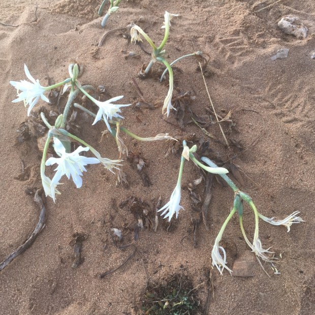
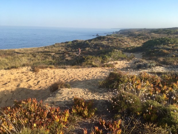
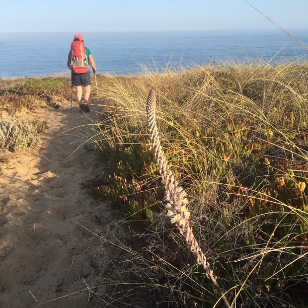
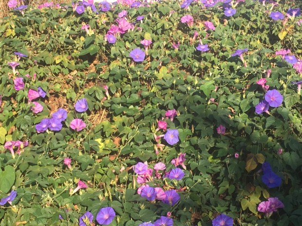
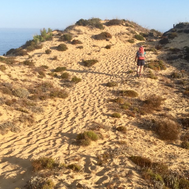
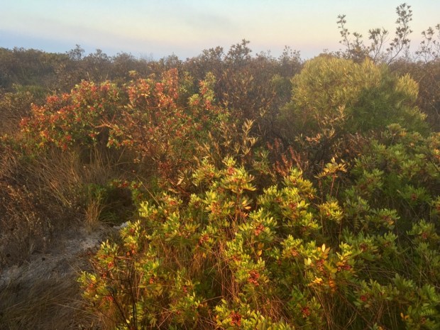
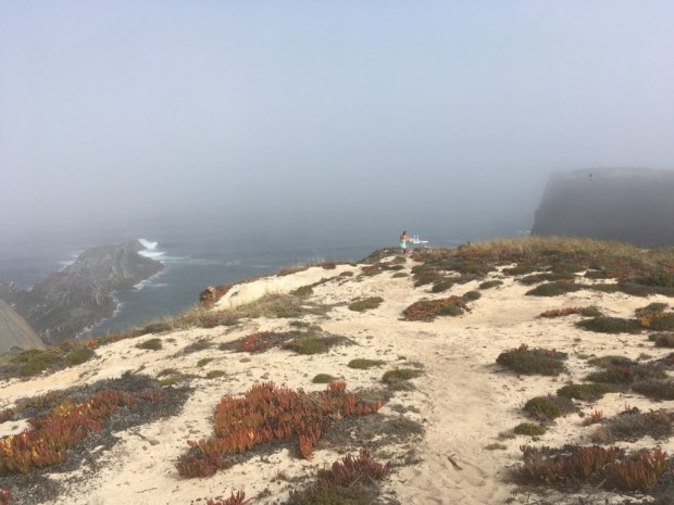
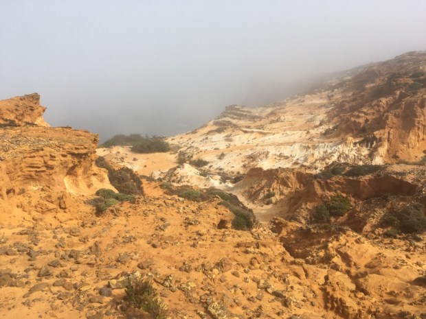
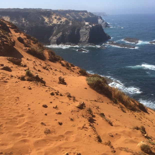
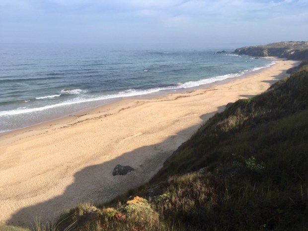
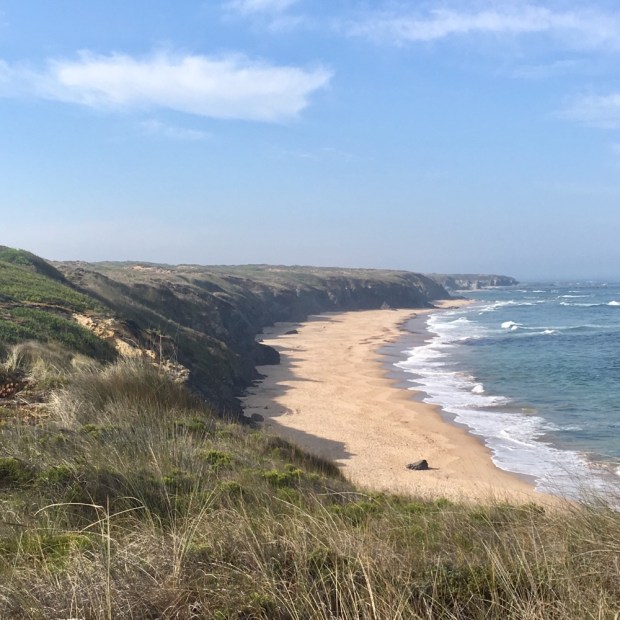
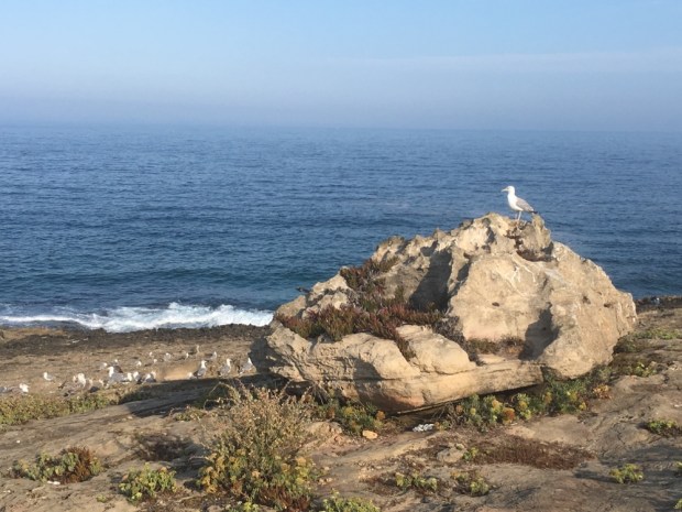
But it was the cliff top paths across the rugged headlands though the endemic plant life sculpted by the sun, salt and wind that was truly a joy, although the sections of deep sinking sand were slow and hard.

And of course the fabulous beaches with the promise of cold water immersion in the heat of the afternoon were a treat keenly anticipated as the sweat dripped.

We stopped for lunch in the bar restaurant next to the fort above the island protected beach of Ilha do Pessegueiro- hanging on to our last couple of hours on the trail.

The fresh fish available on this route is another plus. In fact the eating alone could justify a visit to the area. There appeared to be a culture that recognized the value of good, fresh, local healthy food- and the wine was also very quaffable! The variety of cheap fruit, veg, fish and shellfish in the markets of small towns and villages was remarkable.

A last swim and we continued the final couple of km to Porto Covo passed a tiny beach where a couple of lads were working on a piece of land art. Probably the creators of the pebble spiral maze from the day before.

And so for us the Rota Vicentina , ” The last coastal wilderness of Southern Europe”, was a great discovery, and after buying the official map of all its varied routes, one I’m sure we will be returning to.

Our host that night said the hostel had one rule.

Leave your stress at the door.

We had left ours a long way back down The Fishermans Trail.

THE FISHERMANS TRAIL : Zambujeira do Mar to Almograve (23km) to Vila Nova de Milfontes (18km)

As this blog site can testify I’ve hiked a good few trails in the last few years, but I’ve gotta say this one is special.

If you like wild coastal scenery, walking through a gently undulating landscape of exotic flora and geology under blue skies and glorious sunshine before splashing in the crashing breakers of the Atlantic to cool off on secluded sandy beaches- then like me you’d love this Fisherman’s Trail.

Normally walked from north to south, and the route descriptions are all orientated that way, we were going the other way. Partly because of the transport links and logistics but also we thought it a good idea to have the sun behind us as much as possible.

So even though it’s not recommended to be out here on the trail in the heat of August there has been a good few folk coming against us these last couple of days. Well maybe 10 or 20 people, so probably not much relative to many popular routes !

We set off pre dawn from Zambujeira following a long straight road past a huge area of tunnels and greenhouses. Even through the sandy ground would seem infertile they seem to coax a lot of crops out of it. Water and chemicals I guess.

Hoping to see some the many nocturnal carnivores of the area, mongoose,weasel,marten,badger,genet,otter- we only came across a couple of dogs. We had seen a group of wild boar the morning before and a few rabbits, which were supposed to be the ” original stock of all rabbits worldwide.

We reached the little fishing settlement of Entrada da Barca with its charming little houses and huts.

Down to the harbor where the boats were winched up the steep slip and up a zig zag of wooden steps to the cliff top paths above.

The first half of the walk to the little village of Cavaleiro was on a maze of vehicle tracks that ran along the cliff tops above rocky coves, many with precipitous paths or lines of rope to allow access for the hardy fisherfolk. The tracks also allowed access to many and varied campervans.

The dune vegetation got spectacular around the lighthouse of Cape Sardao where we learnt that many species only existed here. Famed for its bird life and unique stork nests the area also claimed to be the home of Rock Doves that are ” the original species from which all the feral pigeons in the world descend”!

There were a number of viewing platforms built here and there presumably to help wheelchair access but seemed a bit of a eurofund folly.

Diverted inland to Cavaleiro to avoid a specially sensitive area we had coffee and chocolate, admired the farm buildings on the outskirts and then continued on a fantastic route of rock and dunes and forest of pine and acacia ( which we had learnt was very invasive and is spreading wildly)

A sea mist had come in lending the scenery a mysterious aura.

The craggy rocks and red sandstone cliffs were laid down over twisted and convoluted layers of an older base making a truly dramatic shoreline.

We’d had a fair bit of soft sand walking by the time we got to the small natural harbor of Lapa das Pombas

and were glad to reach the beaches of Almograve where we took a couple of hours out to enjoy the breakers before heading on again past the final coves of the day to our room in the youth hostel.

In the village there was an exhibition of photos and graphics of a huge oil spill that took place in 1989 and turned the entire coastline we have been walking into a black environmental nightmare. The massive clean up operation seemed successful though as we had been remarking how pristine it appeared to be.

A leisurely start this morning as we expected to be able to avail of a ferry service across the river Mira at the end of the hike, thereby shaving off 4km of mostly road walking. So with what we thought to be an easy 14km ahead of us we laid abed till 7! looking at the misty world beyond our balcony.

A slap up breakfast fueled a brisk walk out out town, past the grotto, fountain and wash area, onto a sandy path beside farmland and off to more coves passing fishermen returning from their spots.

Later we were amazed to see a fisherman casting from a rocky reef way out in the sea. Not sure if you can see him.

There was a lot of soft sand dunes to navigate past another set of beautiful coves for a few km before suddenly emerging next to irrigated glassland for grazing cows and cropped turves.

There was a series of wooden bridges over streams and tunnels through rampant vegetation of canna and acacia, and a lot more sand.

And then we were at the beach bar at Furnas looking for the ferry.

Alas it was not running. Don’t know why. Plenty of signs for it. It meant hiking down river to the bridge and a lot of fast moving cars as we trod the tarmac.

It wasn’t all bad though. The route went passed an interesting landscape of farmland and cork oak and river views before landing us in the maelstrom of a holiday Sunday resort town in full flood.

And a couple of goats on a table.

THE FISHERMANS TRAIL: Rogil to Odeceixe (15km) to Zambujeira do Mar ( 20km)

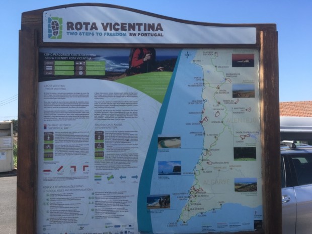
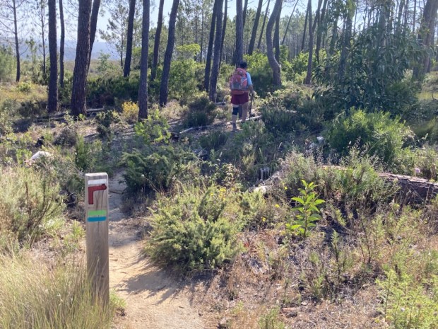
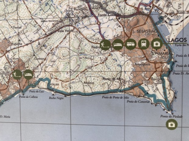
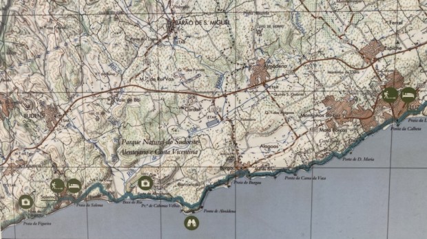
Somehow or other the Rota Vicentina, a collection of hiking routes through the SW Alentejo and Vicentina Coast Natural Park of Portugal entired our consciousness.

The more we read about it the more we knew we had to go.

Running down the Atlantic coast of southern Portugal the trail consisted of the Historical Way, a 230 km mostly inland path, and the Fisherman’s Trail, a coastal trek of about 125km divided into 5 sections of 18 to 22 km between towns or villages to sleep and eat in. Perfect if you don’t want to carry all that camping and cooking gear, which we didn’t given that it was going to be hot and we would be struggling through a fair bit of loose, energy sapping sand.

There’s a very good website for anyone contemplating the Rota Vicentina with a wealth of info and aids and they warned that July and August were too hot to enjoy the route. Well a “summer” at home in western Ireland made us yearn for blue skies and sun so against the advise we headed south.

A flight, Shannon to Faro, train to Lagos and bus to Rogil all went like clockwork although we couldn’t see anything out of our train window.

We had an Airbnb at a young organic smallholding and the kindly host lent us bikes to cycle the few km past the sandy veg plots to a wild beach where we saw the first fisherman whose trails to the best spots our journey was named after.

To avoid the heat we started at 7 the next morning after checking out the livestock and garden and walked out of the village past the canal which supplied a lot of the water to make horticulture viable in this dry and sandy region.

To start we were on paths at the edge of the cultivated area, through woods and rural paths and then emerging out onto the top of the cliffs and continuing across a delightful landscape of herbs, scrubs and flowers, many unknown to us.

The pine trees had been cut/ tapped for something. Turpentine ?

With the heat building to a level where the cold Atlantic waters seem to be irresistible it was with relief that we arrived at the broad sweep of sandy beach before Odeceixe where we found a steep path down to the relatively quiet southern end and quickly cooled off in the breakers among the surfers and holiday makers.

This was prime time for Portuguese beach holiday as the website had warned us but the beautiful beaches were big enough to accommodate all and the busier areas were a work of art from the cliff tops with the colorful dots of sun shades and decorative bodies placed just so.

After a couple of hours R&R we continued to the town walking alongside the sweeping river wishing for a rod to try our luck on the masses of jumping fish. On the other side of the river was a motley collection of campervans that enjoyed one of the free park ups we had seen all along this coastline.

On arriving in Odeceixe we discovered it was fiesta time and the place was decorated accordingly. We didn’t stay up to see the magician or puppet show but retired to bed early enough after a meal in a hippyish veggie cafe. What with the surf scene, the laidback sunny vibe and the legality of all drugs it’s not surprising that we’d noticed a lot of ” types” about and a new age culture thriving.

More signs of which we passed in the morning as we hiked down the north side of the river back to the sea.

Climbing up to the cliff top we were off on another beautiful trek in the rising sun along a sandy trail through a garden like world of plant life.

The trail went up and down, but not too much, and was sometimes hard underfoot and sometimes deep and soft sand. At times we traversed patches of giant rushes and bamboo like cania where springs leaked water through the undergrowth.

And then there were the beaches. Amalia, Machados, Carvalhal, Alteirinhos and finally Zambujeira. Beautiful golden sand and invigoratingly cold and refreshing water. The ones away from road access involved a long walk in and were pretty empty and these were the ones we dropped down to on the ” fisherman’s trails” to chill out on in the heat of midday.

One had a rushing river tumbling over the cliff in a torrential beachside shower. Perfect for washing off the sand and salt!

On our last leg towards Zambujeira do Mar we past a strange place with a massive bull bison, llama and ostrich and later, after enjoying the cool shade of a long acacia tunnel, some fossilized sand tubes and other interesting geological formations.

One more stop at a funky beach bar I could have been happy in for hours and off again for another shady pine and acacia forest and another cliff top walk through sandy trails above busy beaches.

Up the wooden steps and into a busy resort town bustling with bars and restaurants. I’ll be glad to be on the empty cliff tops again come 6.30 in the morning.