hiking canaries

TENERIFE 29th JAN

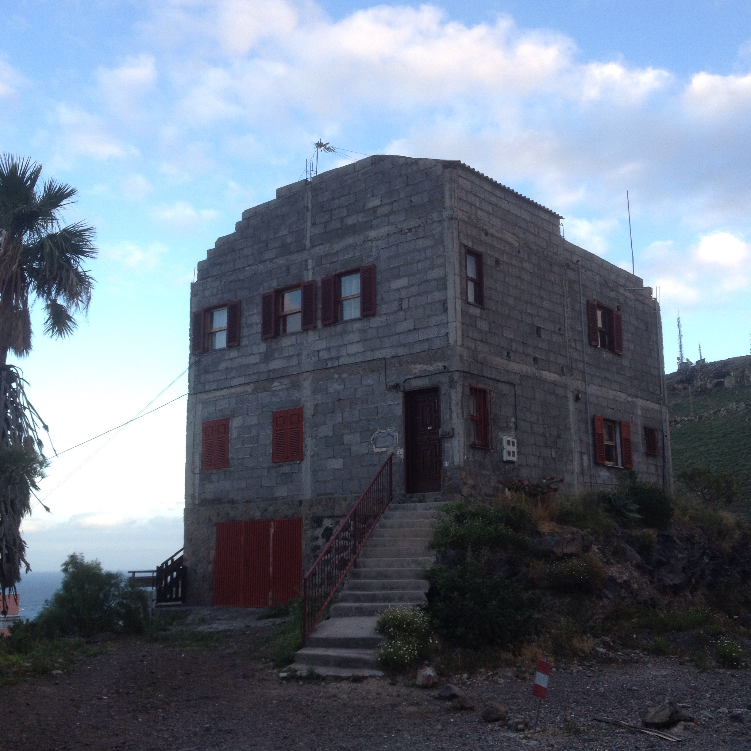
I think I’m getting my mojo back. After a relatively easy couple of days and good sleeps In Soft beds and square meals containing fresh veg I think my energy is coming back. It hasn’t really been tested because I’ve been pack free but I was actually running down the trail at times today and generally had a spring in my step again.
And I’m looking forward to getting going in a straight line again so to speak without the stopping and starting. I find it’s too disjointed and doesn’t have the sense of progress and journeying that starting at the beginning and keeping on till the end does. But it was very nice to loose the monkey off my back for a couple of days. I keep thinking that maybe I should ditch the tent but you can be sure the day I do I’ll rain and I’ll be in the middle of nowhere.
So I got the bus up to the Parador in the Parque National Del Teide this morning where there was a cafe, tourist info, hotel ,restaurant, coach and car parks not far from more car and coach parks for the cable car to take you to the top of mt Teide, or nearly.
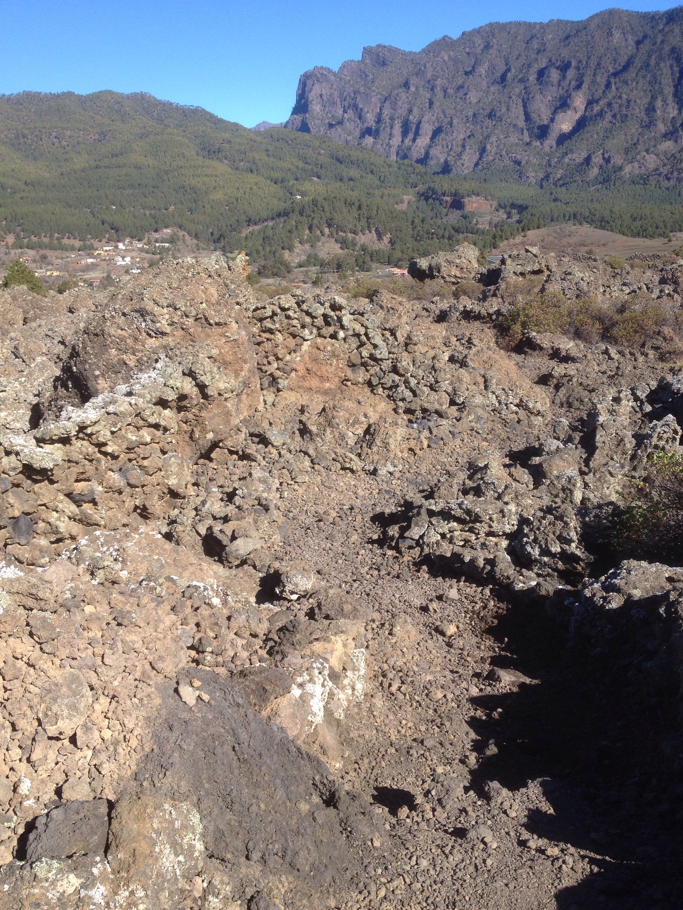
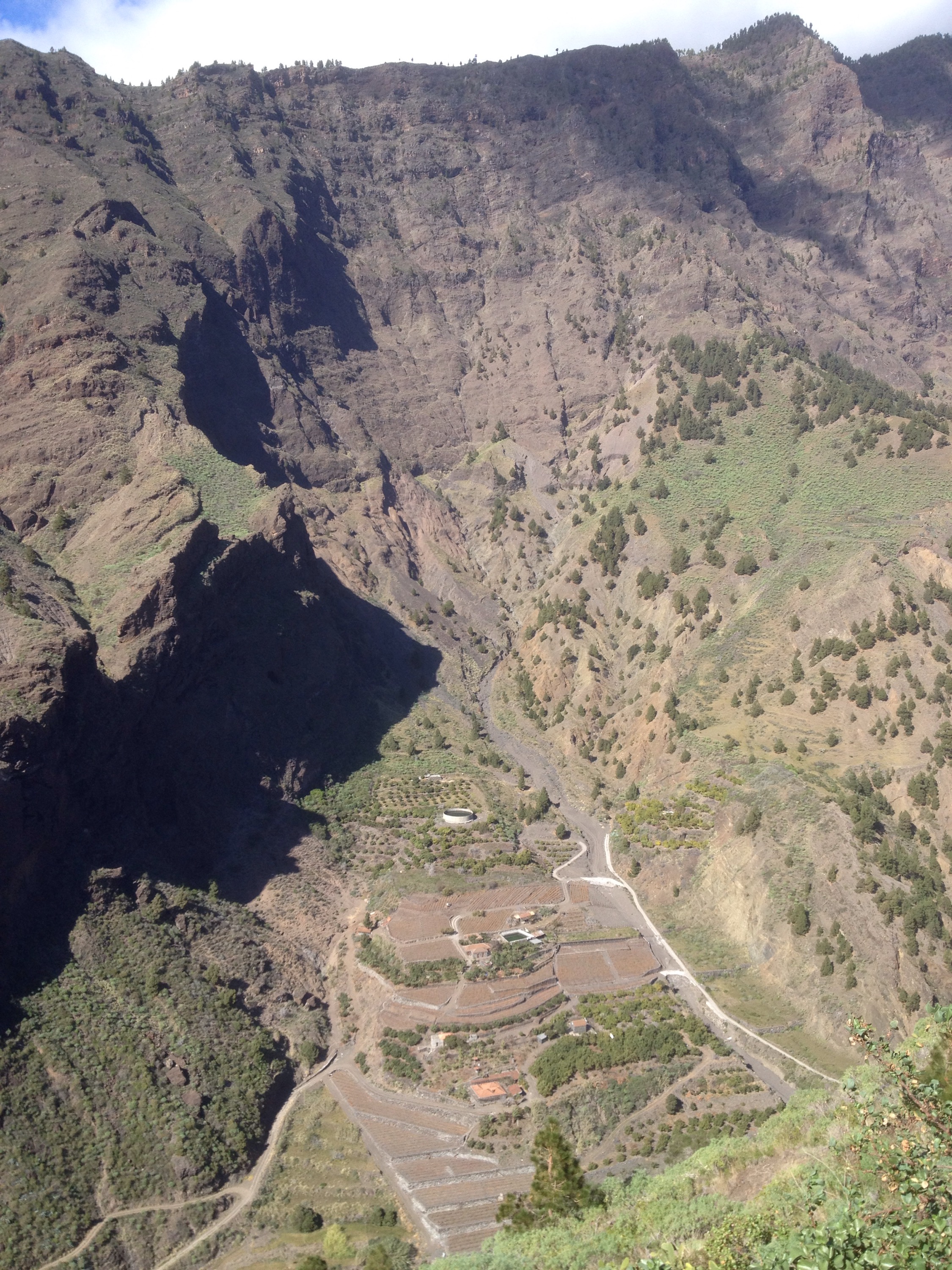
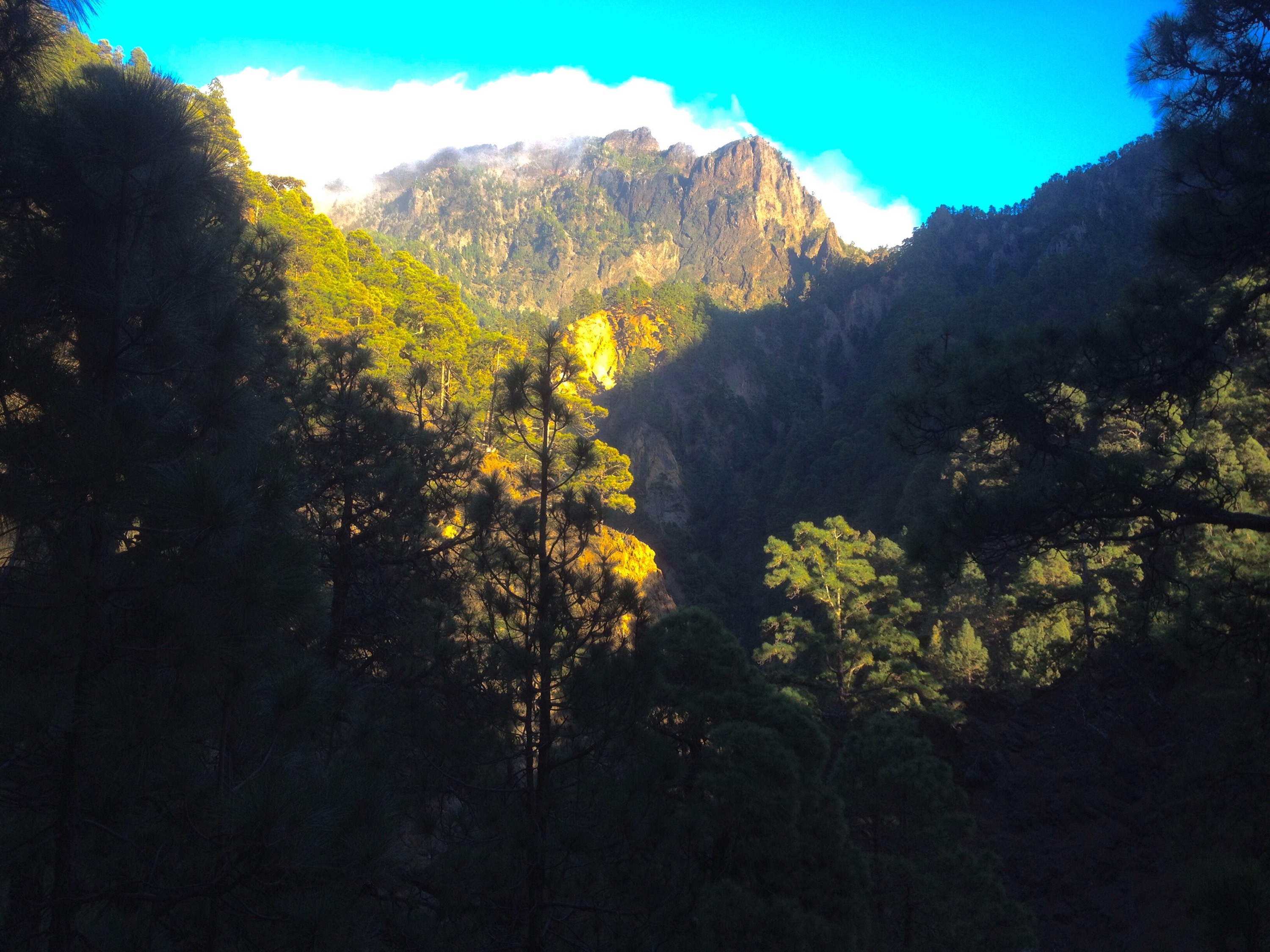
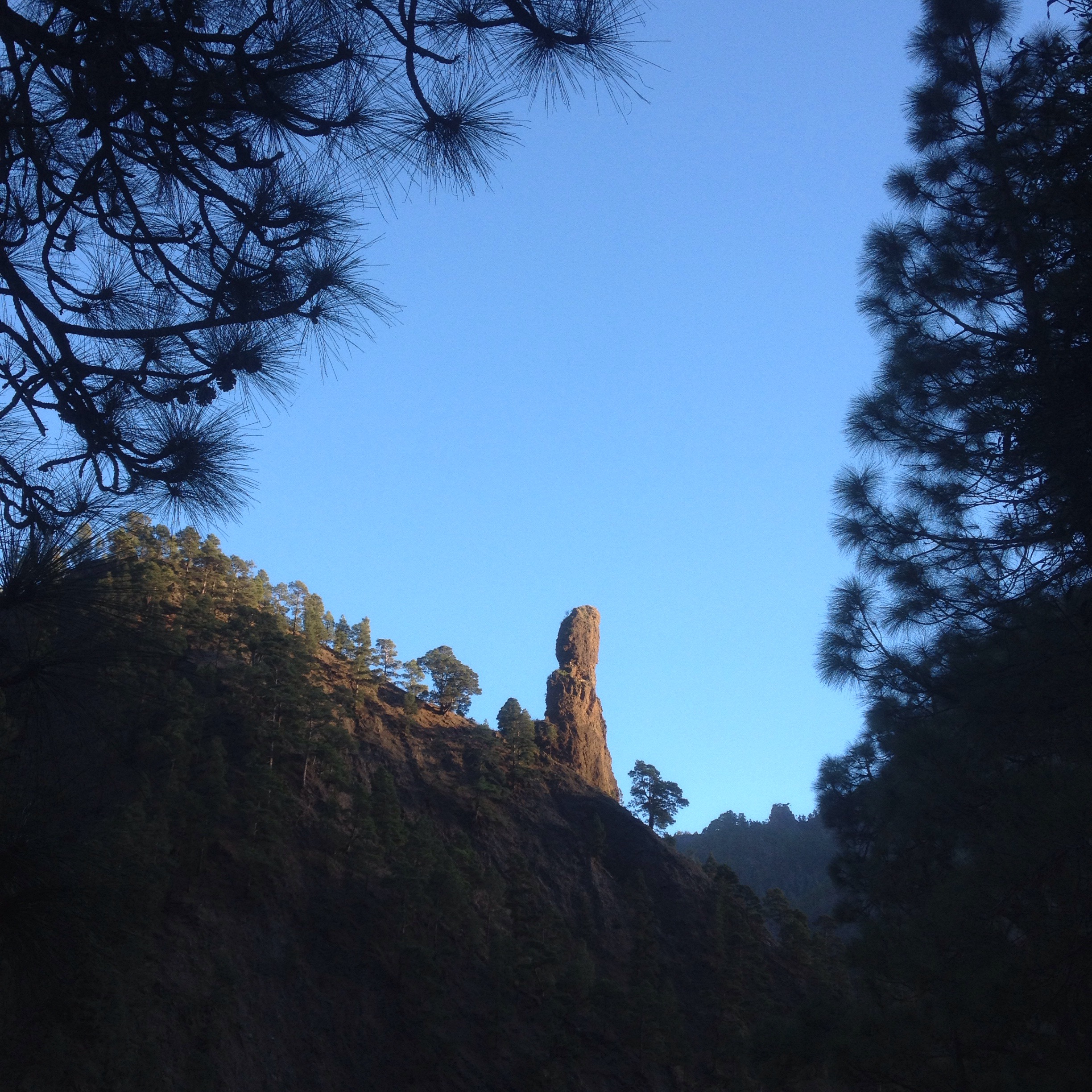
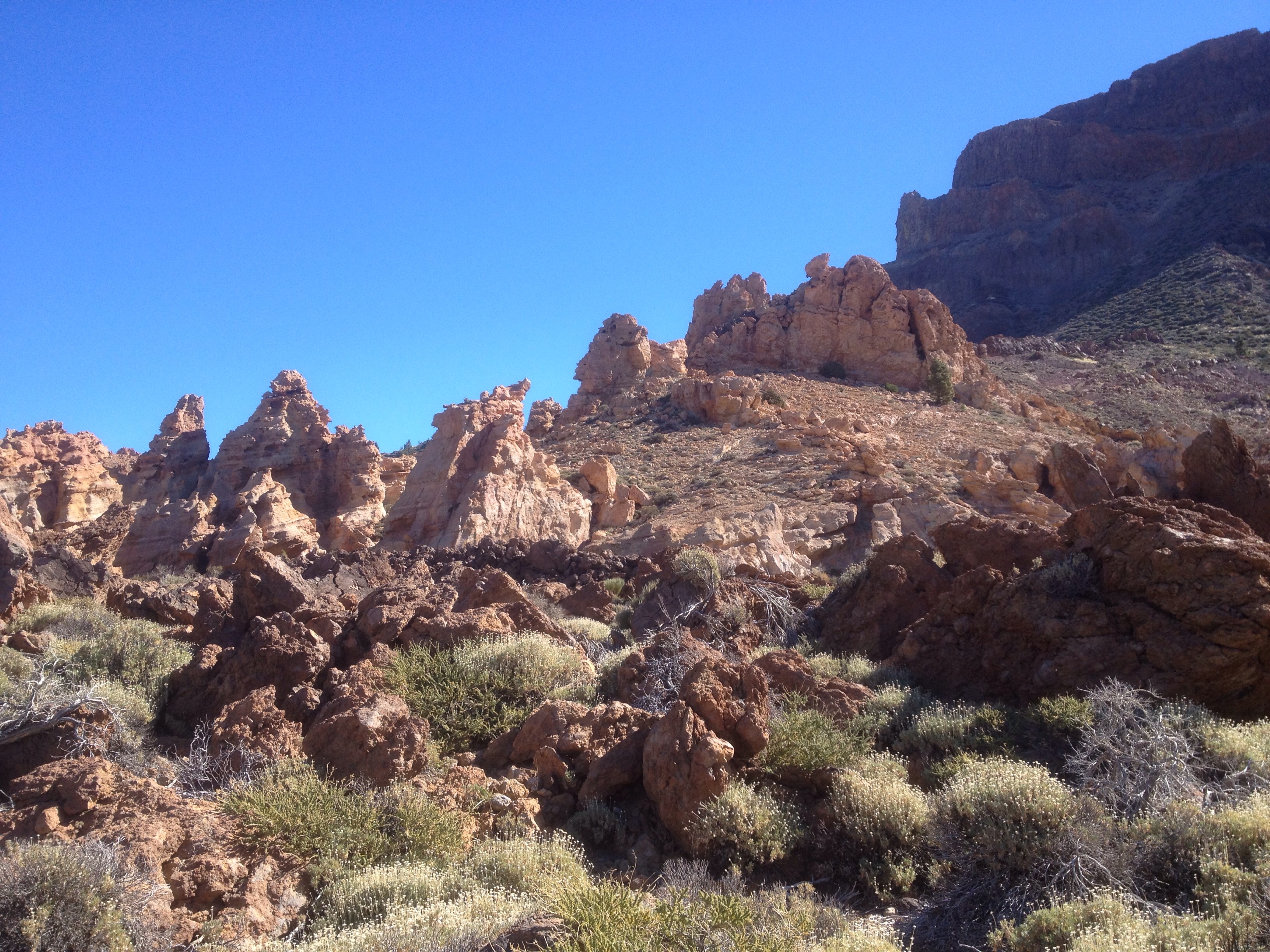
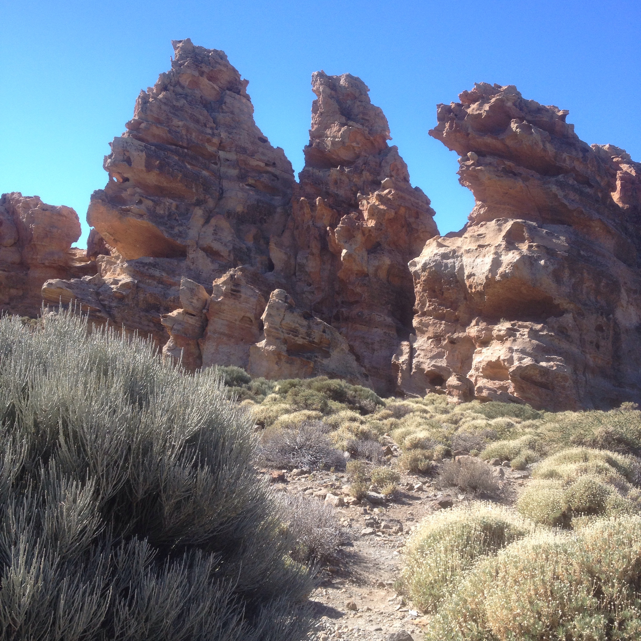
I tried to explore the Roques de Garcia, plugs of sand coloured rocks standing sentinel at the base of Teide but the crowds were too great and I retreated back into the interior, out of reach of motorised transport.

2015/01/img_0967.jpg
First a few hundred mt climb up and around the back of Montana Guajara, the birth place of high mountain observatories after Piazzi Smyth, Royal Astronomer of Scotland, mounted an expedition to set up his 1.88m telescope on the summit to prove the advantages of altitude and clean atmosphere for astronomy. After his trip he named some lunar mountains he discovered ” El Teide ” and ” Tenerife ”
His expedition and following ones used the path I’m following ” Camino de Chasna” which I discovered had been used since before the arrival of the Europeans to link the North and South of the island. The Guanches used it to reach their communal pastures in Las Canadas and for centuries,before roads , it was the lifeline for the movement of people,livestock and goods of all kinds.
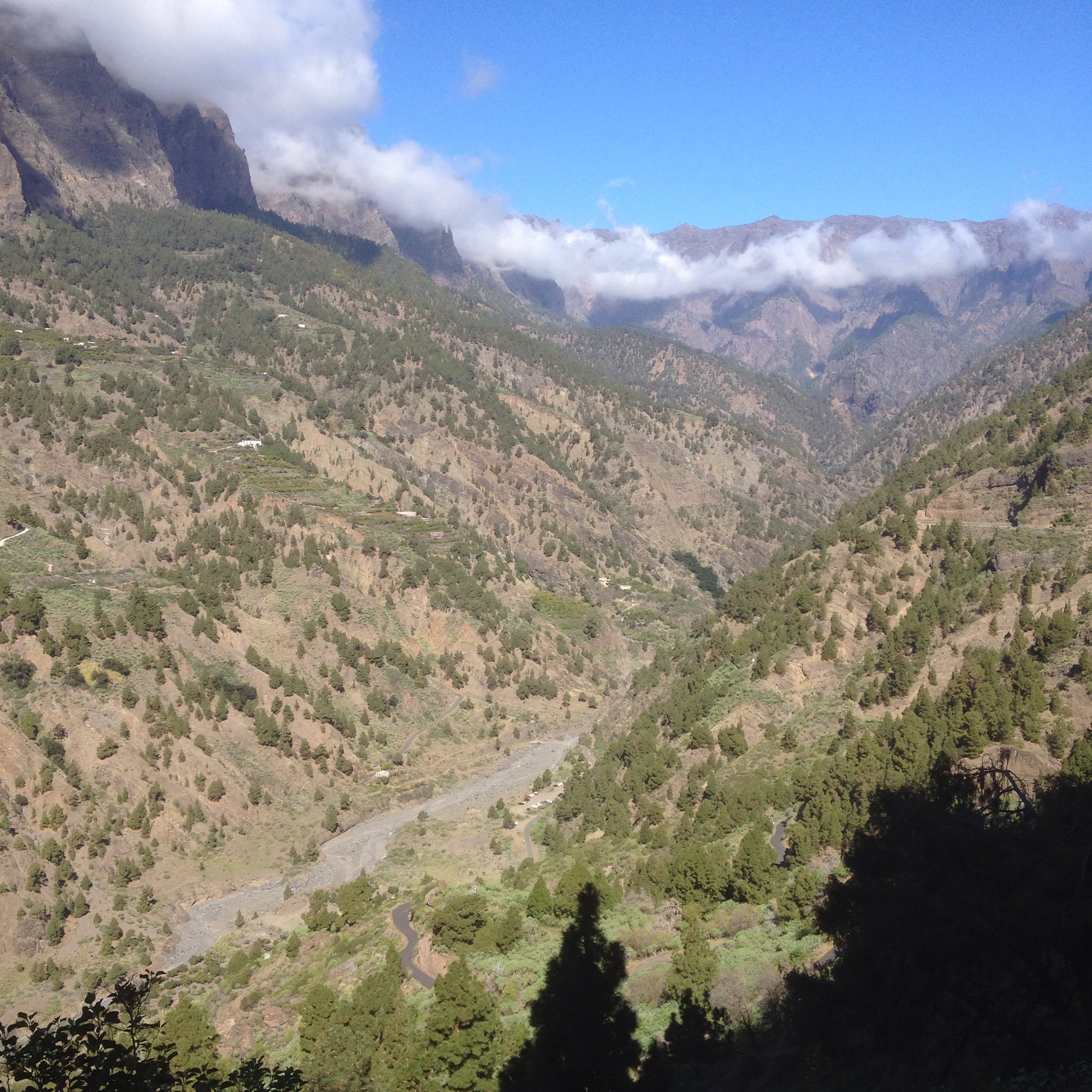
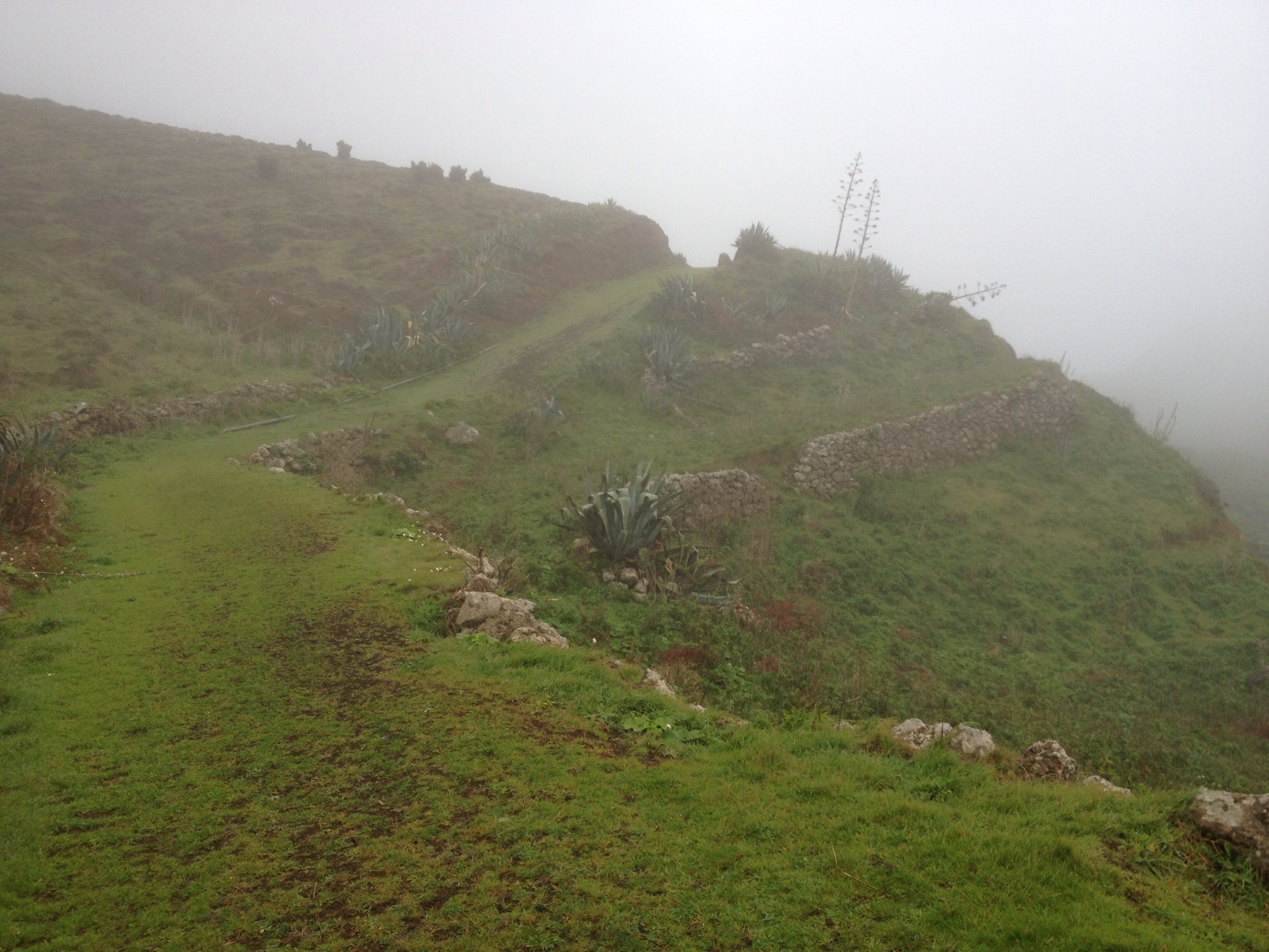
When I had climbed my way to the pass overlooking the south side of the island I was presented with a fluffy white thick blanket of cloud from left to right and to the horizon a long long way below me.
Before long I had reached the high point of my travels on Tenerife at the Degollada de Guajara at 2373mt and the luxury of downhill trekking began.
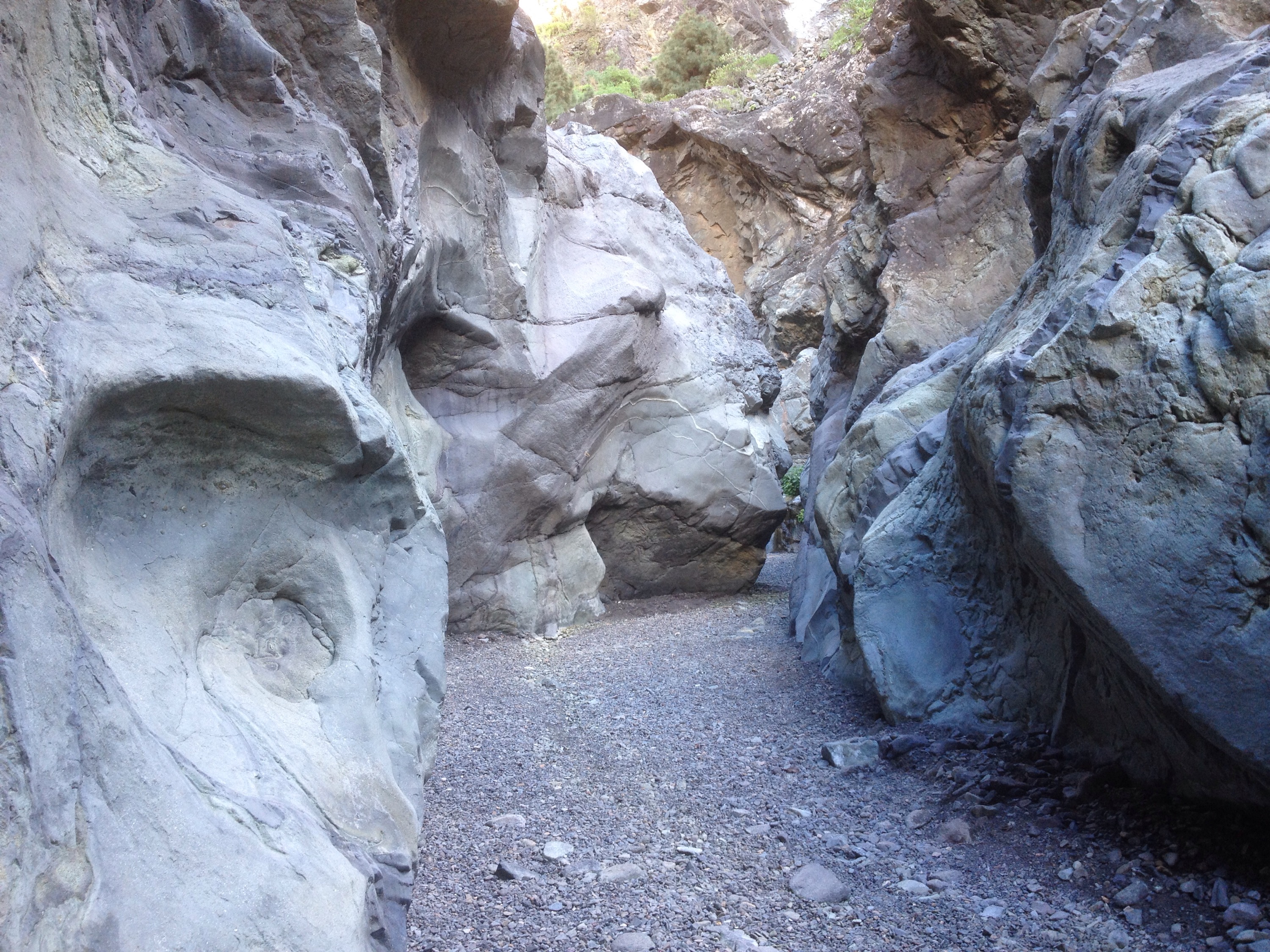
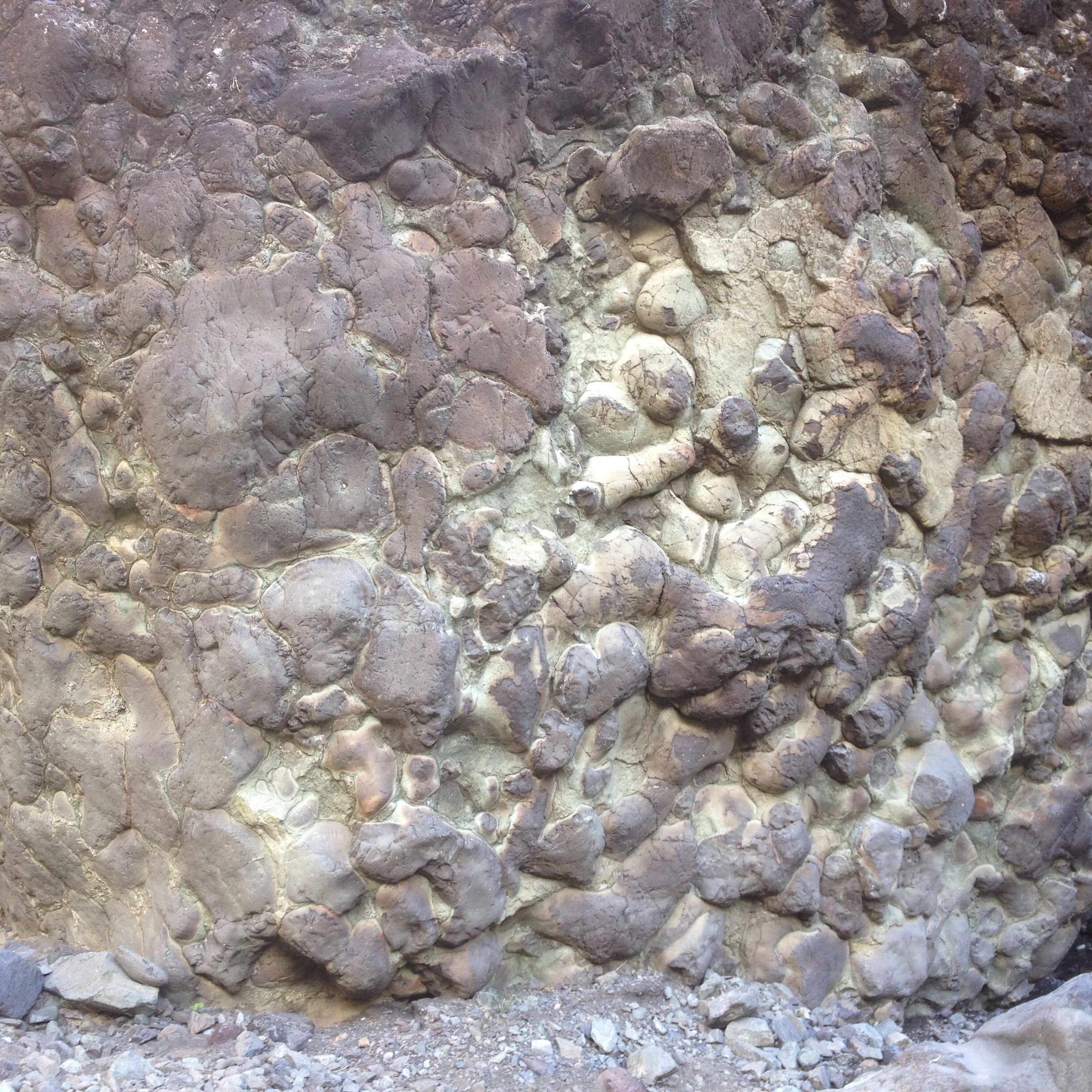
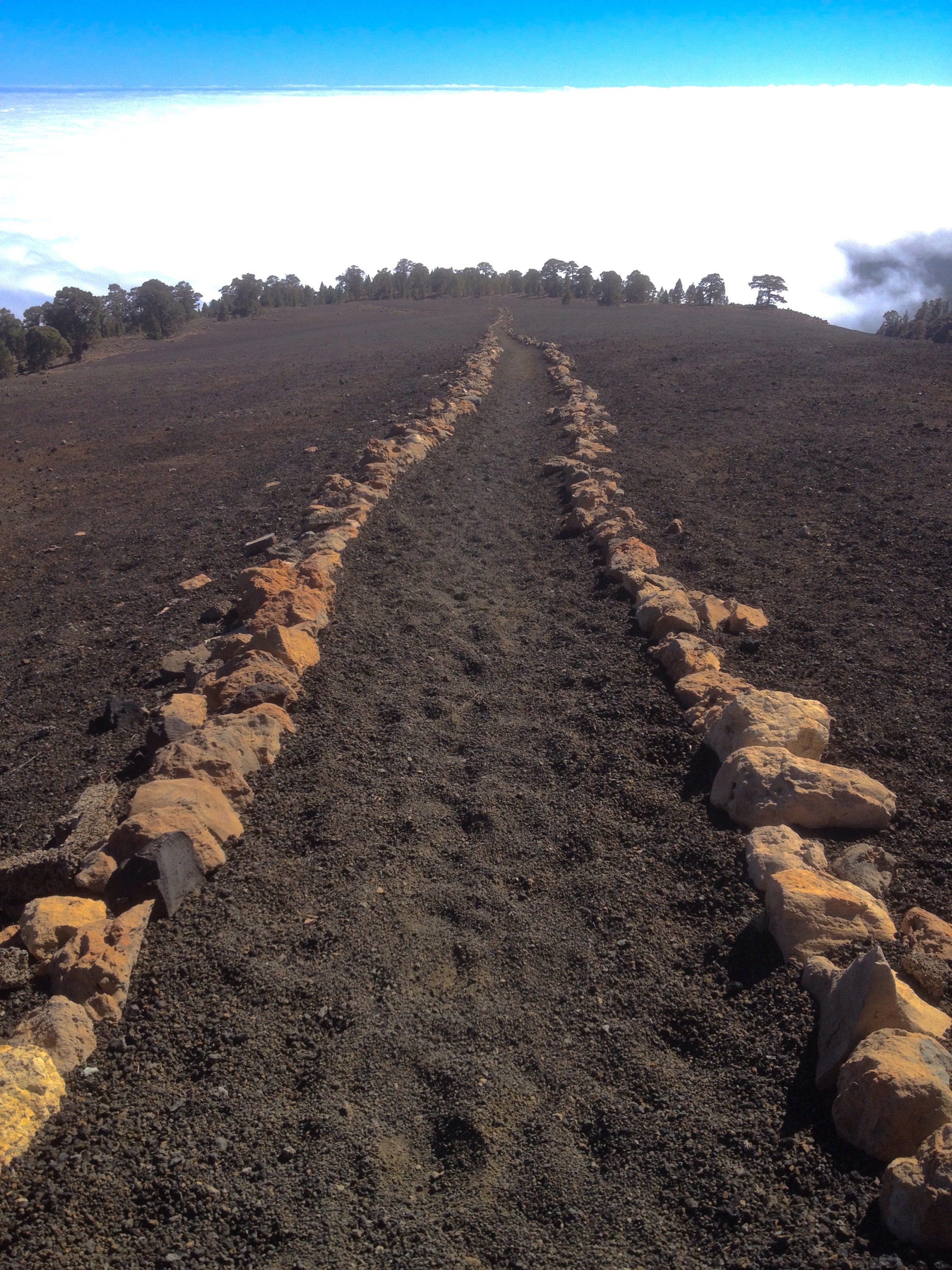
A rough and rocky path led me down to a vast area of black volcanic ash with my Camino marked out in stones.
Half way across the ash I met a young French man who asked me the way to “the summit”.
He was planning to spend the night star gazing so I told him of the astronomical history of Guajara and wished him well.
Not too long after, as I began to leave the ash and enter pine forest I stopped to watch a man staggering up a steep pathless slope from the trees towards me. An older Italian man he also wanted to now where he was and where was the Pueblo. I had to tell him there wasn’t one but sweetened the bad news by telling him the glorious history of astronomical research carried out on the mountain above by one of his countrymen. As we had no language in common it was understandable he was more impressed when I gave him my water as he had very little.
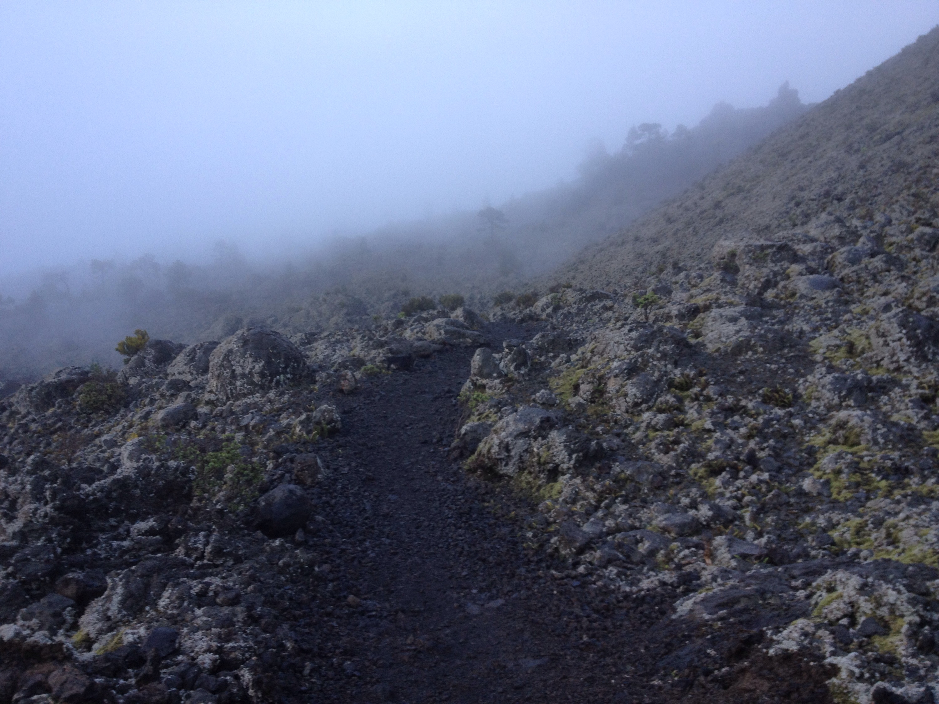
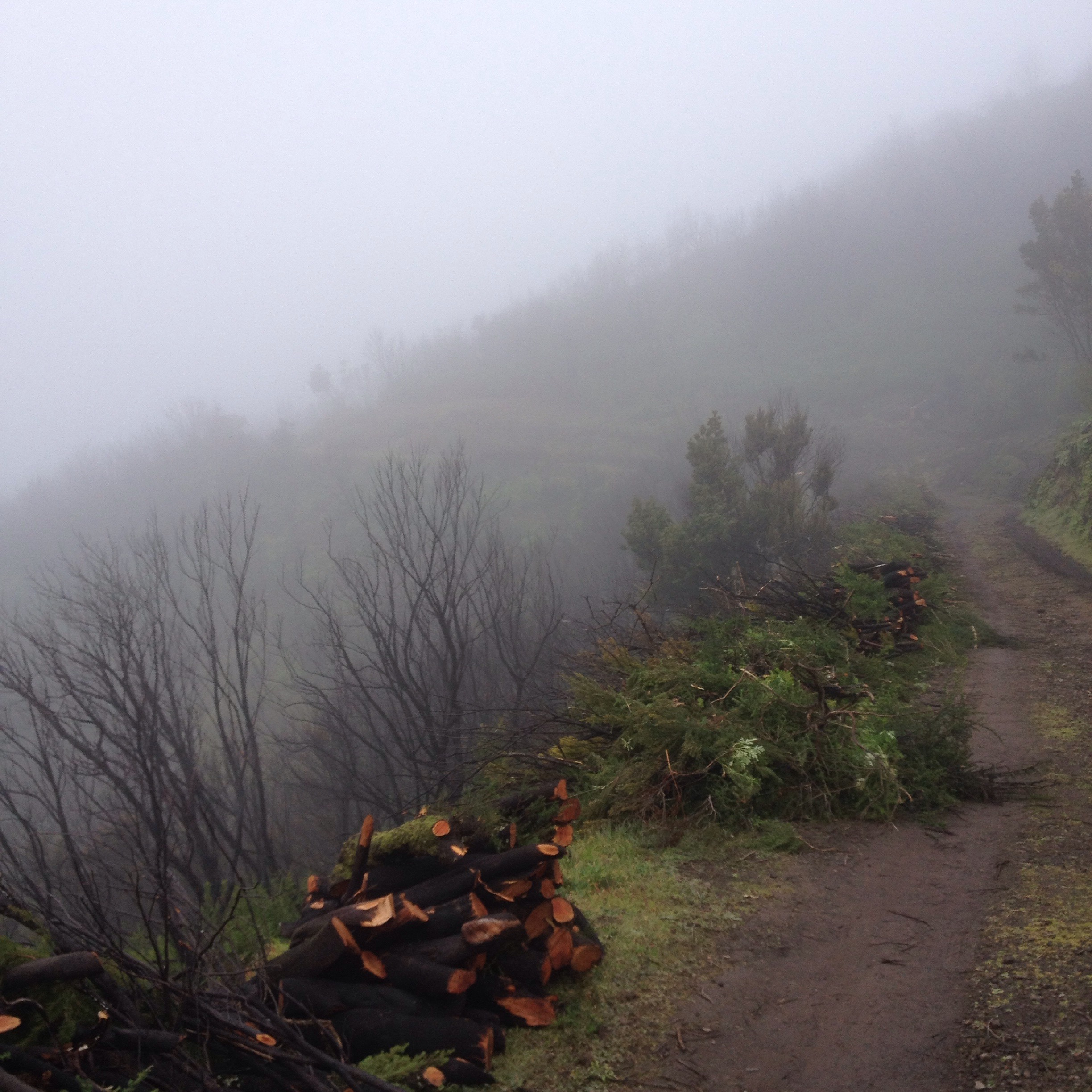
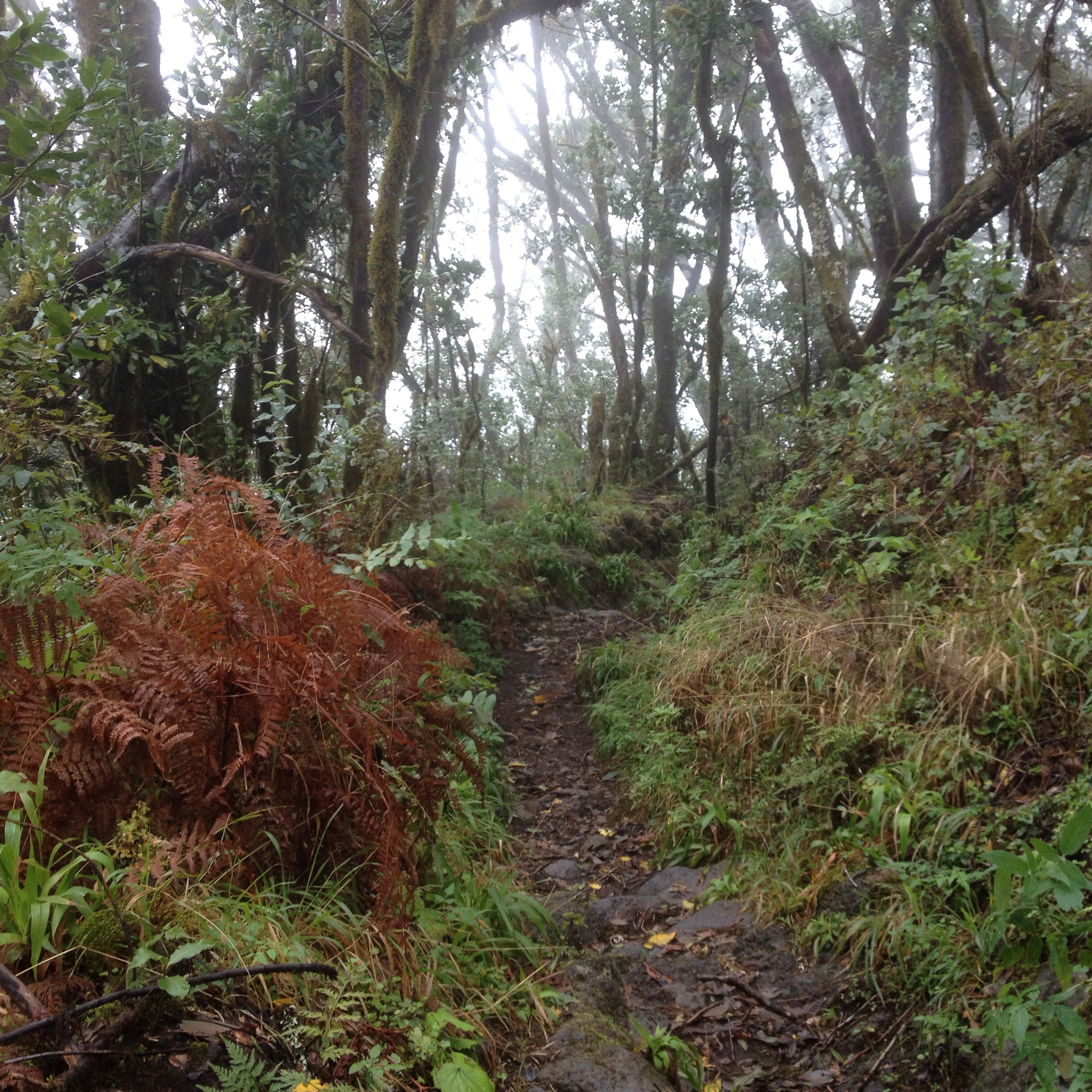
The track started to level and I couldn’t resist picking up speed until I was running down through the soft ash towards the all enveloping cloud ahead.
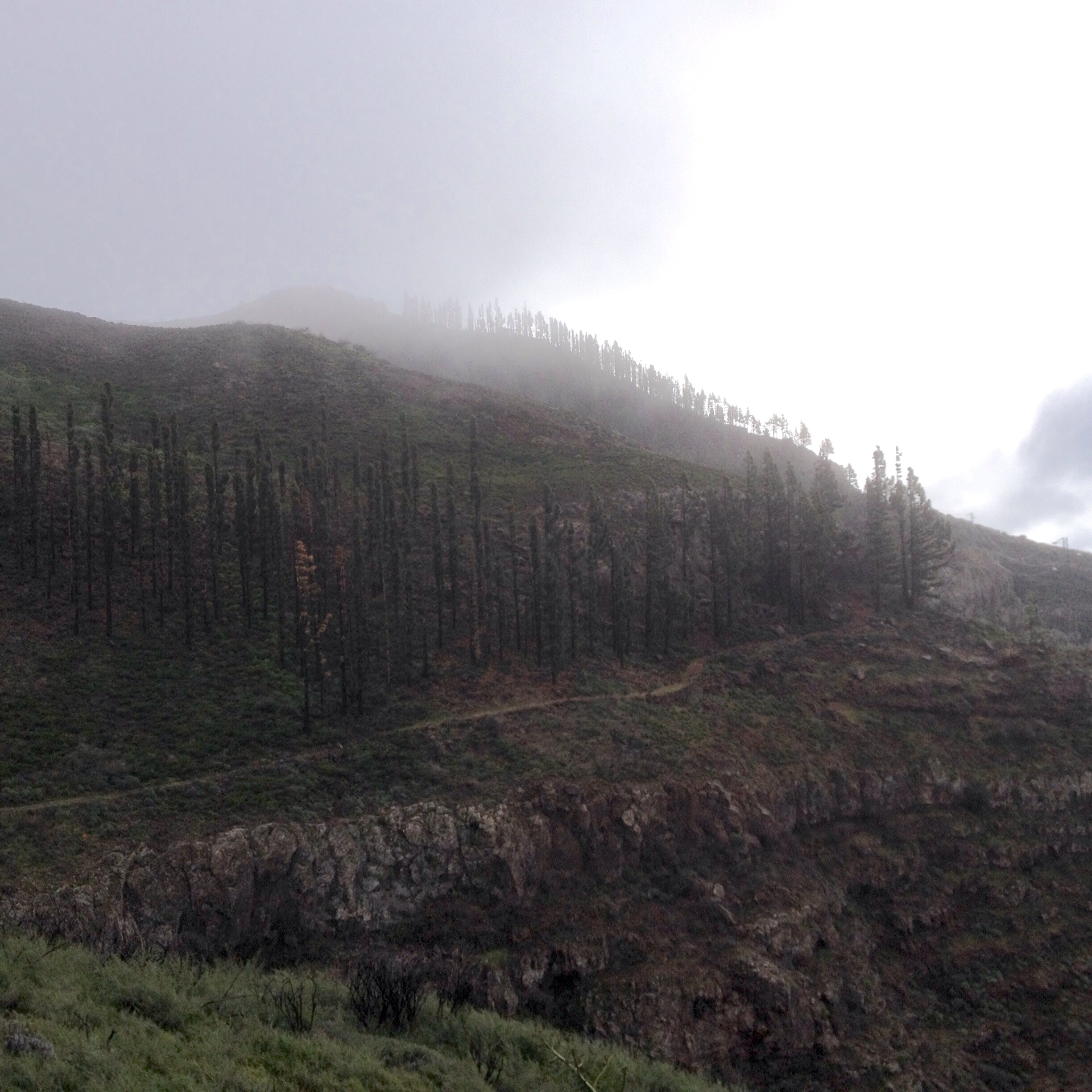
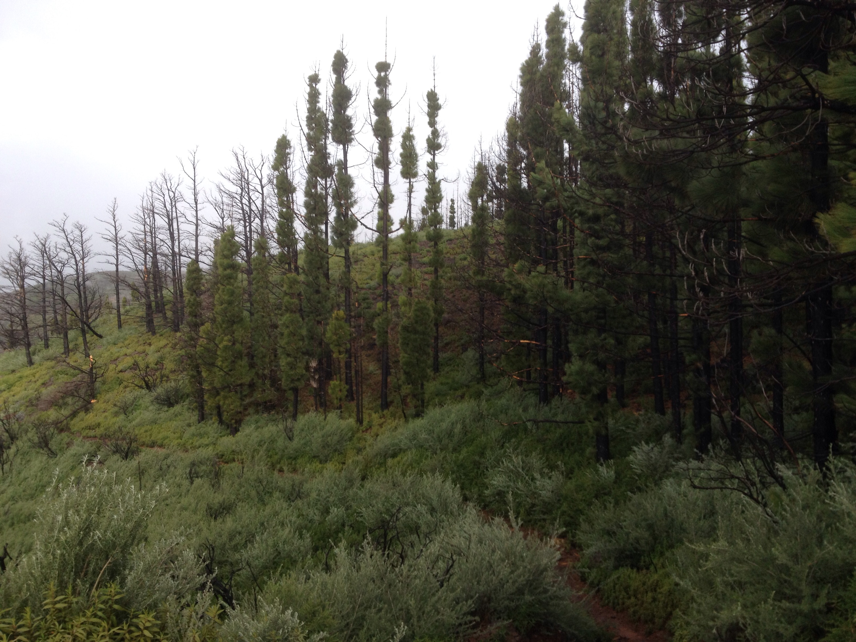
However this wasn’t the cold wet windy cloud of LA PALMA but cool and soft mist which was actually a bit of a relief after the intense glare of the high altitude sun.
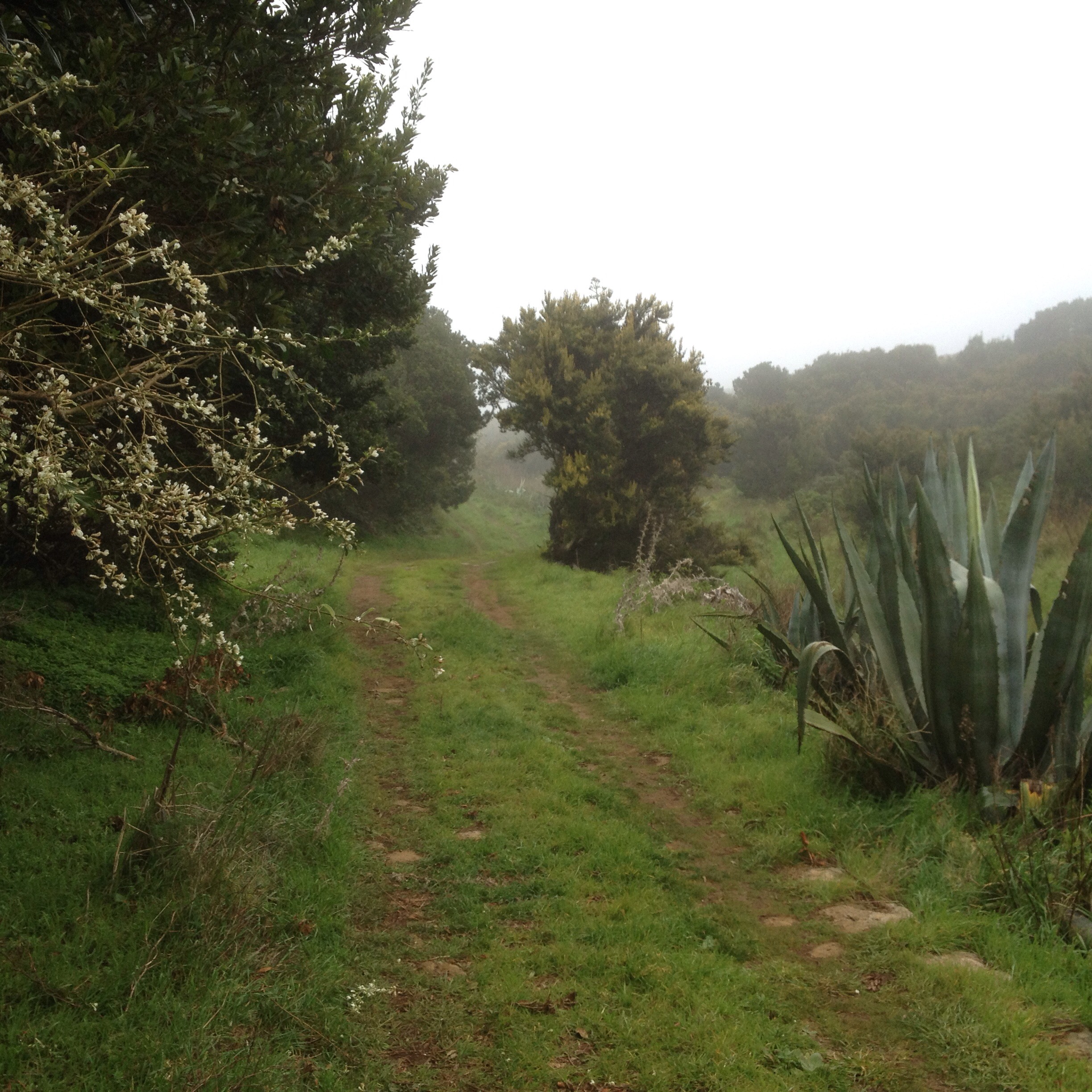
And so down and down through the pines until I , suddenly, was back in Vilaflor.
Tomorrow it’s back to the pack.

2015/01/img_0969.jpg

2015/01/img_0972.jpg

2015/01/img_0978.jpg

2015/01/img_0975.jpg

2015/01/img_0987.jpg

2015/01/img_0988.jpg

2015/01/img_0990.jpg
I’m sorry all the pictures are at the end. I had hoped I could write the blog with bad coverage and then insert photos in text when I move to the cold outside for good coverage. But no. And just to prove its cold here too here’s some snow.

2015/01/img_0974.jpg

LA PALMA 24th JAN

So after about 25km, about 1200 mt descent and 800mt ascent I didn’t end up where expected.
When I got up it was still windy wet and cold.

2015/01/img_0808.jpg
I knew I had to get out off the cloud but didn’t know wether to go up or down. Down would mean abandoning mission.Up would mean hopefully above the cloud but into wind. And then the thought of the cold last night at 1450mt and thinking about the freezing cold at 2400mt and with the words of P. Dillon going through my thoughts” there’s nowhere to hide up there in bad weather”, I reluctantly turned my back on the GR 131 and embraced the PR LP14. It was a wet embrace but it was leading me down to where I knew the sun shone.
We went through dripping forest

2015/01/img_0809.jpg
and trees hung with yards of lichen?

2015/01/img_0811.jpg
We descended through a different kind of lava field to the others I’d seen. These were obviously in the ” wet zone” as they too were sprouting green primitive life.

2015/01/img_0816.jpg

2015/01/img_0814.jpg
But after an hour or so the cloud went up as I went down and I felt heat upon my skin again. Hallelujah
Looking back from the valley towards the ridge of the Cumbre Nueve that I should have been on I saw the thick cloud still swooping and swirling in what looked a malevolent fashion. Glad I’m not up there I thought.
I decided that as I wasn’t going to walk around the rim of the Taburiente crater as planned I would walk instead into the very heart of it and camp the night at a site deep and high surrounded by the peaks.
So I first visited the Centro de Visitantes of the National Park which involved following a trail across lumpy rugged lava.

2015/01/img_0824.jpg
When I got there it wasn’t, as the trail had made me wonder, sculpted out of a lava tube or in some knarley cave but a big modern concrete building on a main road. Inside were impressive displays and info panels and helpful staff handing out details of the park and hiking routes.
They also had weather charts…( wind moderate!! Not where I’ve come from mate!) and a model. This is the bit i climbed.

2015/01/img_0825.jpg
I had to get a bus from the centre to Los Llanos and start to walk into the caldera from there on the PR LP13, one of La Palmas “top walks”. It didn’t take long to see why after I’d left the town and its suburbs behind.
After a long climb (another) a bend in the road revealed the deep valley reaching in towards the high rim of mountains now in glorious sunshine. Wish I was up there I thought.
On the other side of the valley were fincas with land climbing up from the riverbed.

2015/01/img_0829.jpg

2015/01/img_0828.jpg

2015/01/img_0826.jpg
The trail to the camp ground led up the riverbed with many sections clambering over stretches of mountainside. There were notices warning that with rain the track becomes dangerous and impassible and you could see why.

2015/01/img_0833.jpg
A fine example of pillow lava I’m sure you’ll agree.

2015/01/img_0832.jpg
It was beautiful but longer than I thought 13km was supposed to be and steeper than a 600mt climb ought to be. We past miles of painstakingly made acequias or water channels cut through the mountain and carried high over the riverbed on concrete viaducts.

2015/01/img_0837.jpg
And a long way in was this what I imagine was an old hydro plant complex.

2015/01/img_0837-0.jpg
The climb went on higher and higher as the sun sank lower and lower till only the peaks were illuminated.

2015/01/img_0841.jpg

2015/01/img_0845.jpg

2015/01/img_0842.jpg
At last, with not a lot left in me, I passed through this prickly pear to the camp site that had miraculously solar lit service block and soft pine needle pitches.

2015/01/img_0846.jpg

LA GOMERA 21st JAN

Now that was a day’s walk. 25 km of rough tough mountain hiking with 800 mt of ascent and nearly 2000mt of descent. I thought that the last third of the route, the downhill stretch would be quick but the paths were what Paddy Dillon described as very rugged so you can be sure they were.
Knee jarring, ankle twisting, shin spraining bolder paved paths. I prefer it when I get to a section that Paddy describes as gentle walking.
Still, the gods were kind to me today with cloud lifting for most of the morning and late afternoon with just a shortish stretch of the highest ground blanketed in the mist. The wind also got too strong at one dodgy route forcing me to take the road for awhile to save myself from being blown off the mountain.
I started out from Chipude under the dramatic bulk of La Fortaleza a sacred mountain to the natives of Gomera who practised divination and sacrifice up there.

2015/01/img_0675.jpg

2015/01/img_0677.jpg
I had set off in my waterproofs as it was raining to start with but I must have made the right sacrifice because the sun came out and the glories were revealed at every turn.
The day’s section took me an hour or so longer than it should because I stopped so often to take pictures.

2015/01/img_0685.jpg

2015/01/img_0679.jpg
This part of Gomera and the national park had been badly damaged by fire a few years ago but it is recovering very well and even some of the pines seem to be sprouting new growth.

2015/01/img_0691.jpg

2015/01/img_0688.jpg
There were impressive views down the ravines and canyons.

2015/01/img_0690.jpg
Then I turned and climbed to higher ground and entered the cloud again.

2015/01/img_0694.jpg
They were clearing some of the dead wood and replanting. The tracks became closed in with vegetation as I returned to the laurel forests that depend on lots of “horizontal rain”

2015/01/img_0695.jpg

2015/01/img_0703.jpg
Unfortunately the cloud hid the huge Roque de Agando from me but after that I descended into more sunlit vistas.

2015/01/img_0706.jpg

2015/01/img_0716.jpg

2015/01/img_0717.jpg
I was signed down a steep and rocky path for quite a way before being signed back up again behind massive cliffs. A long drop and climb but very little distance covered. They seem to be keen to keep you off the roads. Then began the rugged downhill terrain. The rough rock and Boulder paving meant you had to watch your step and not the scenery but there were more easy going stretches to soak up the surroundings on.

2015/01/img_0721.jpg

2015/01/img_0728.jpg

2015/01/img_0726.jpg
I came to a lovely flatish piece of land with glorious views that had white painted rocks around it, the sign that it is for sale. That got the imagination going. It even had a donkey.

2015/01/img_0731.jpg

2015/01/img_0730.jpg
Some simple houses were grouped together in the shelter of a rock face overlooking the sea.

2015/01/img_0732.jpg
The final leg down to San Sebastián was the real ankle hazard and it would have been too easy, in a hurry to finish for the day, to put paid to any more exploring of the Canaries GR 131.
But I made it down intact and after admiring this house

2015/01/img_0735.jpg
I found a bar for a pint and tapas and made my way to the ferry port for the boat to La Palma.
I’m going to give myself tomorrow to sort some things out ( my packs shoulder strap has come away and needs sewing) and make my way down to Fuencaliente where the serious stuff will begin.

LA GOMERA 19th JAN

Last night the resort of Los Christianos on Tenerife was a throbbing mass of humanity on holiday, mostly elderly, out to have a good time. The streets were busy with mobility scooters and lined with outlets for intoxicants.
Sucked into the vortex of the unholy alliance between cheap drink and holiday Bon homme I hung out for awhile in a dispiriting English karaoke bar where a slick suited and haired master of ceremonies tried to whip up some enthusiasm. I liked the sign announcing that due to local “noise pollution” laws, the doors would have to shut at 12!
I retired upstairs to the Irish bar where the fun was warm and open and I enjoyed a Jameson’s and a Guinness.

2015/01/img_0609.jpg

2015/01/img_0611.jpg
After all the excitement I had a good nights sleep in a dorm with six others at a sea front dive centre, and after a few errands in the morning ( I found a great replacement for my lost long sleeve top in a charity shop) I was back on a ferry.

2015/01/img_0612.jpg
Just over an hour later we dock at San Sebastián on Gomera with just enough time to get the bus to Vallehermoso where the route starts at the beach.

2015/01/img_0614.jpg
The bus journey took me through a big chunk of the island and my first impressions were of wild green lushness. High topped with deep canyons and jagged peaks. Palms and cactus and cloud over red tiled roofs.

2015/01/img_0616.jpg
Signs for hiking routes that snaked away through the mountains, orange trees gone feral and vertigo inducing switchback roads.
Steps of neat and fertile, stone walled terraces stacked one above the other in the water fed ravines and across the mountain slopes.

2015/01/img_0617.jpg
The seafront was windy with crashing waves, certainly no call for the thatched sunshades or loungers.
The cliff bottom road to the strange Castillo del Mar had been completely destroyed by both the sea and the crumbling cliff. Originally built to process, store and load bananas onto boats it had become a private property and is now a cut off folly.

2015/01/img_0621.jpg
Certainly no sheltered spots down on the coast so I started to walk up the valley and found myself a little abandoned finca to call home for the night.

2015/01/img_0624.jpg
It’s another 1500mt climb tomorrow so I shall let the croaking of the frogs in the barranco serenade me to sleep.

EL HIERRO 18th JAN

A mercifully short days hike today after what I consider to be the Herculean efforts of yesterday. In fact I could have had a couple of extra hours in bed I overestimated the time needed so much.
Still when I got out to where I had finished last night I was glad I hadn’t camped. It was still in the cloud and cold and wet.
I started off through a kind of forest park and then continued slowly downhill on old cobbled and sandy tracks.

2015/01/img_0583.jpg

2015/01/img_0585.jpg
It really was as if I was on a Sunday walk at home with muddy boreens and Friesian cows.

2015/01/img_0587.jpg
The stone walls were coated in signs of clinging damp.

2015/01/img_0533.jpg

2015/01/img_0584.jpg
The way was lined with plants both familiar from home like brambles, bracken willow and lush clover and also more exotic species that differentiated it from Ireland.

2015/01/img_0588.jpg

2015/01/img_0591.jpg
There was agave, giant cistus(?),heather trees, avocado, eucalyptus and geranium hedges. A host of other plants I don’t know the name of but am sure I’ve seen them in pots in garden centres with expensive labels attached.
I stayed up In the mist until back down in Valverde.

2015/01/img_0592.jpg

2015/01/img_0590.jpg
The path down to the ferry port was the old road where all goods arriving or leaving the island would have been taken by mule.

2015/01/img_0596.jpg
The end in sight it started to get sunny and by the time I arrived the island looked different.

2015/01/img_0597.jpg

2015/01/img_0602.jpg
I spotted a plaque commemorating 400 years of the pilgrimage down the road I had just travelled over the spine of El Hierro.

2015/01/img_0593.jpg
So now a ferry to Tenerife in order to catch a ferry to Gomera. And just to let you know I have now taken over half a million steps. 500819

LANZAROTE 13 th Jan

My tent is up for the first time this trip. So far I’ve just been in the bivvy bag but it could be windy or drizzly tonight so thought I’d risk it ( it’s technically illegal )

2015/01/img_0452.jpg
I’m up here with the parascenders and the hangliders on the slopes of Montana Tinasoria about 10km past the end of the 1st stage in Yaiza.
I was glad to get out of Playa Blanca although if I’d made it to the kariokie it seems I would never had wanted to.

2015/01/img_0403-1.jpg
A bit of a haul through the outskirts of the resort and a dirt track had me hiking past more of the empty developments

2015/01/img_0408.jpg
but soon enough I was on the trail proper through the recently marked and signed lava fields. The day was dull and cloudy and the black ash fields did little to brighten it.

2015/01/img_0409.jpg
I could see over to the west coast as I picked my way carefully over the rocks. With my hiking poles probing and searching for solid ground and balance I felt like some kind of insect with twitching feelers.
Up past a goat farm into Brena which had the best cactus gardens I’ve seen and the first of the grape pits I was to see thousands of later.

2015/01/img_0413.jpg
On again on some ancient old laid stone track for awhile as I struggled into the accursed headwind yet again.
I stopped for awhile in the Aloe Vera museum in Yaiza to get out of it and discovered thatChristopher Columbus said it was one of the four indispensable veg for wellbeing along with the grape the olive and wheat. It was also what sustained Gandhi during his long fasts.
I also found out that the lichen I’d been seeing aplenty was orchilla and had been a major earner as a source of a purple or violet dye, the colour of kings and bishops. And the cochineal beatle that supplied the valuable red dye breeds and lives on the prickly pear cactus and was introduced after the conquistadores saw it in Mexico.
The best quality in the world is still produced by hand here in a couple of villages.
Between Yaiza and Uga is a narrow path through the lava field that the camels who work in the natural park use.

2015/01/img_0414.jpg
It was from here that the parish priest of Yaiza watched and wrote about the huge eruption of Timanfaya in 1730 that spread all this lava about.
In Uga the information signs ran out temporarily

2015/01/img_0419-1.jpg
Before coming back in droves

2015/01/img_0420.jpg
Then we were really up into the ashfields and grape pits

2015/01/img_0424.jpg
After seeing no one hiking the route on Fuerteventura this afternoon I passed 3 couples coming the other way. On and on up and up to the pass where I saw the gliders and chutes and it was nice to watch them.

2015/01/img_0442.jpg
But now I’ve been standing In a cold wind for too long to get a signal and I’m glad I have the tent to get warm in.