walking in Connemara

CONNEMARA WEST: Walking into Paradise

For Sam

A few days commitment free and an invitation from old friends to visit them on Omey Island was all the encouragement we needed to load up the camper and head into the west. The Wild West weather wise. Our friends place on the far western edge of an island off the far western edge of Ireland was no place for camping the day we set off so we decided to seek shelter and explore the Aughrus peninsular to the north till the weather improved.

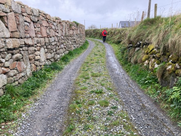
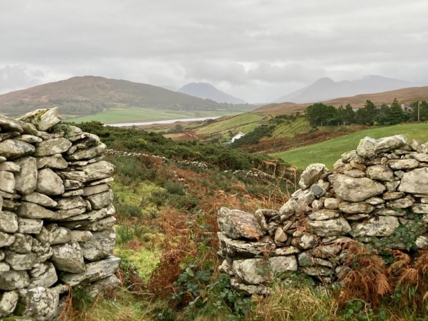
Parking up at the harbour in Cleggan we took the little boreen up past the pink granite house that the poet Richard Murphy built himself from the stone of abandoned cottages. The lane led us up one of the many drumlins in the area, little hills of boulder clay and glacial till. The good drainage afforded made for more fertile grazing land and the appearance of the stone studded soil, viewed from the sea that has cut a cross section through it, explains its name- Cnoc Breac / Speckled Hill.

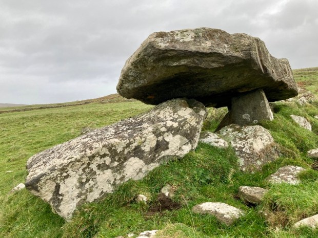
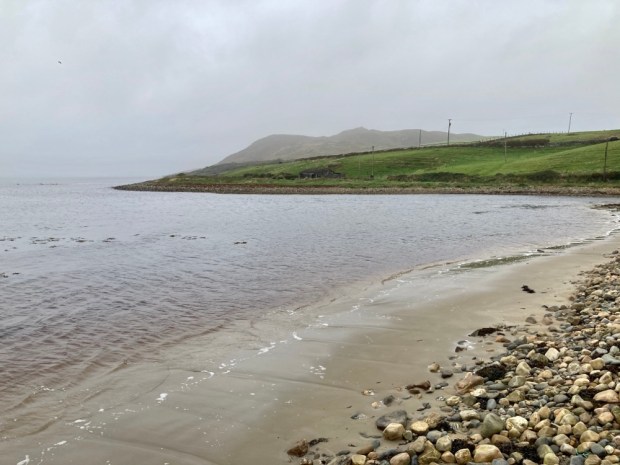
Cresting the rise we continued down a long neglected little boreen through fields of cattle with faint views of the islands of Inisbofin and Inishshark across the misted sea. A fine Neolithic tomb, erected perhaps 6000 years ago sits near the sands of Sellerna Bay ( Sailearnach- sally or willow garden) where willow for lobster pots and baskets would have been grown.

Above the other, western, end of the crescent beach lies another, sadder, memorial to death. A scattering of small stones amongst the grassy tussocks are the only markers to the lives of the unbaptised children in this Cillin.

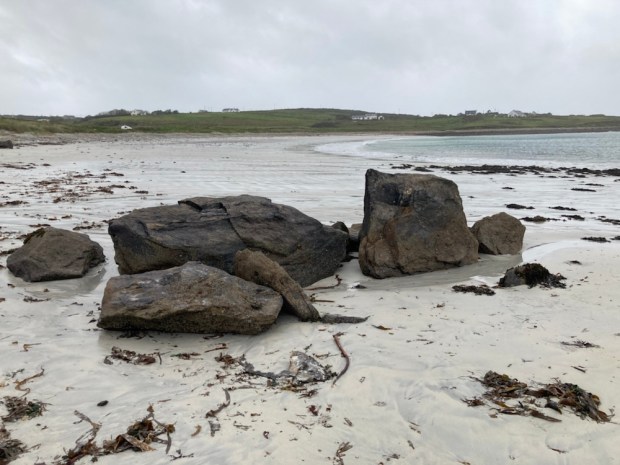
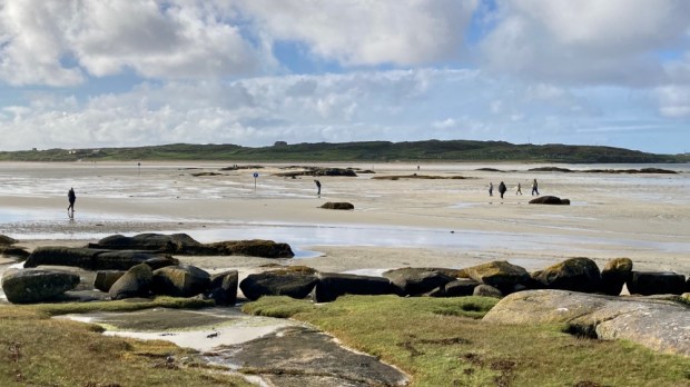
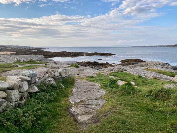
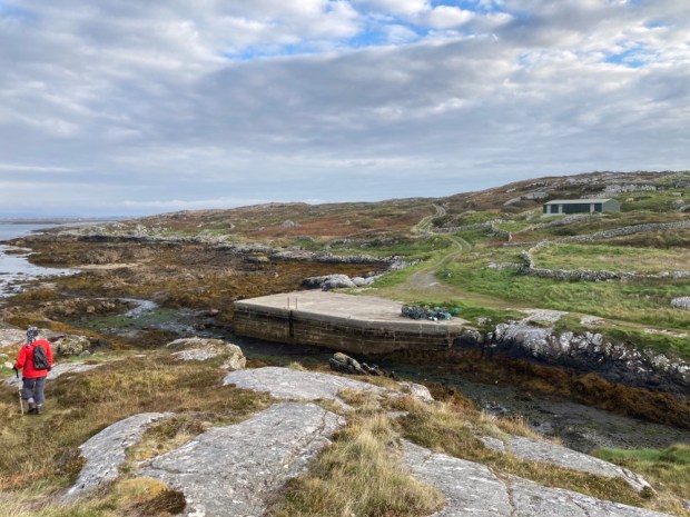
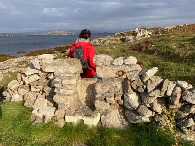
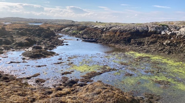
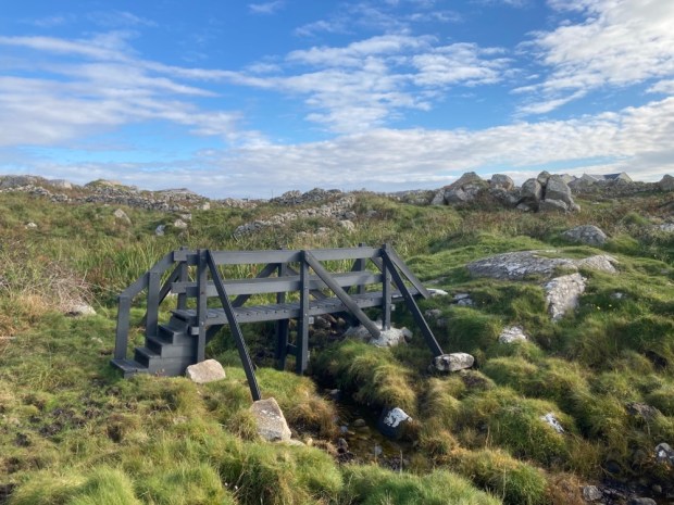
Crossing a little stream into the town land of Rossadillisk- named after the edible seaweed dillisk or dulse that grows on the shoreline-we clambered over the rocks before discovering an easier cliff top path that led us to the next beach, Tra Bhride ( Bridgets Strand) where some enigmatic structures look out onto the scene of a great tragedy.

The Cleggan Disaster of October 1927 devastated the area when a violent storm swept down the coast taking the lives of 45 fishermen, 16 of them from this small town land – dependant on fishing. Prior to the storm there were 36 households here- within 10 years it had reduced to 6, ruined by the event which also took 10 lives from Inishboffin and 19 from Lacken Bay and Iniskea island further north in Mayo, where the tragedy led to the total abandonment of the island I visited and wrote about in my The Back of Beyond: The Barony of Erris blog post. A heart and community breaking event which saw a calm and pleasant evening turn without warning into hellish maelstrom that smashed the fragile canvas currachs onto the rocks within sight of their families who wailed from the shore.

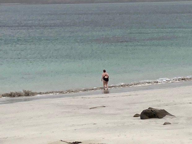
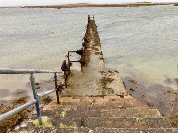
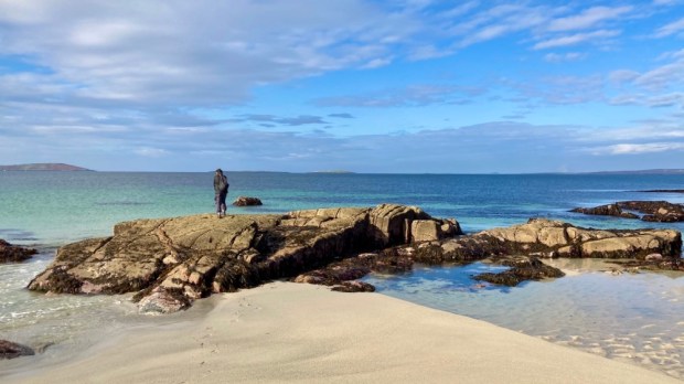
We left a lone brave swimmer and carried on around Rossadillisk Point to the little harbour pier and jetty jutting out towards the off shore reef.

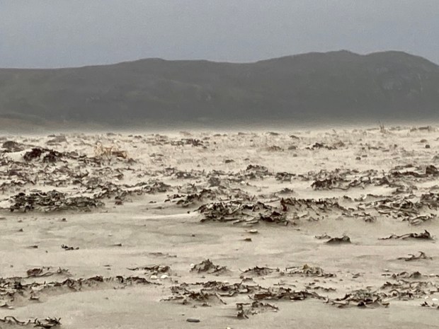
Paradise in fine weather maybe but the winds on this western fringe can raise a sand storm, tear flags apart and, as it did in October 1927, rip the roofs from houses. Luckily we only suffered some squally showers on our return to Cleggan.

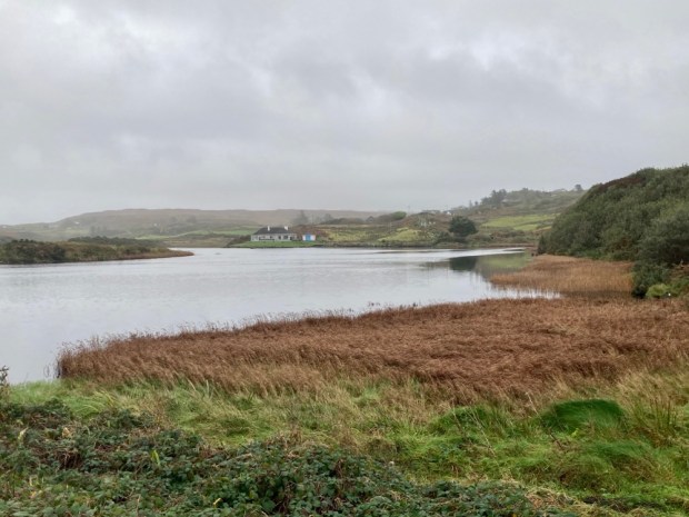
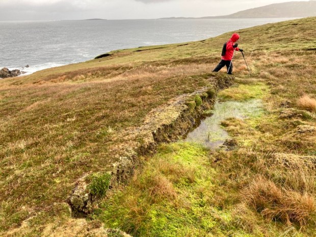
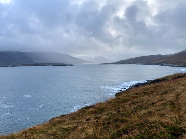
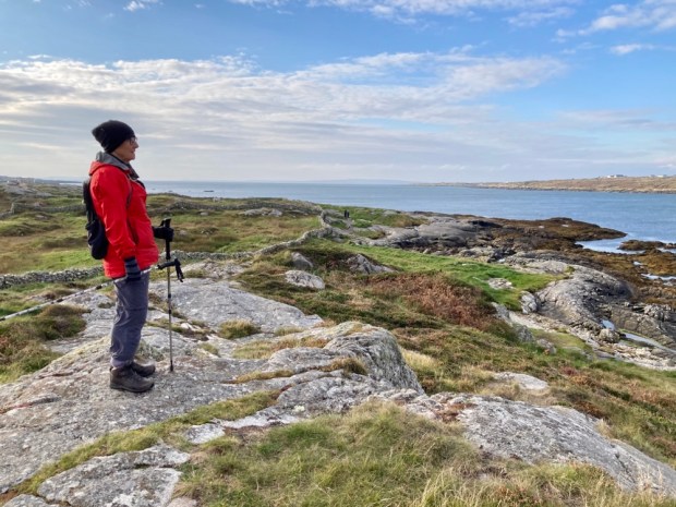
The bald dome of Cleggan Head rises 500ft above the ocean on the north side of the bay and in the morning we walked across the causeway between beach and lake towards it. Not to scale it’s bracken and heather clothed slopes to the ruined Napoleonic signal tower in search of the resident Peregrine falcons but to follow the farm track, past the fine Victorian complex of houses and converted outbuildings of the Musgraves estate and down to the little cove of Port on the headlands northern shore.

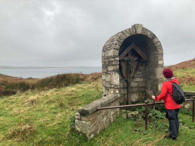
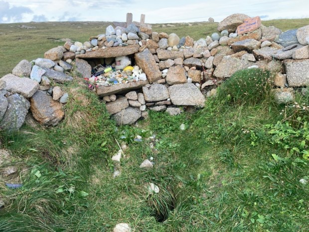
The farms 500 acres of rough grazing on the head along with another 500 of commonage to the east are part of a Europe wide study of extensive grazing and the ecology and biodiversity and farm incomes that can go with such a sustainable system. People have certainly been farming here since the very first clearance of the trees over 5000 years ago, a monument of those original settlers lies next to the sea below the track – a humped backed wedgetomb. Passing another monument, to a family member who died in a riding accident, we carried on through a series of cleverly hung self closing gates to the little secluded cove and its ancient holy well.

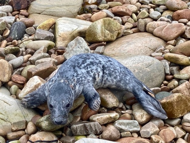
We came upon an injured young seal on the grassland above the beach and spent a good while in worried telephone consultation with Jo from the farm and Seal rescue down in Wexford who were sending out a local volunteer before we managed to encourage it back into the water to hopefully find mum.

After watching the seal disappear into the water we explored the dramatic and indented rocky cliffs of schist before retreating from another wind driven shower.

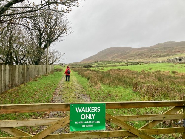
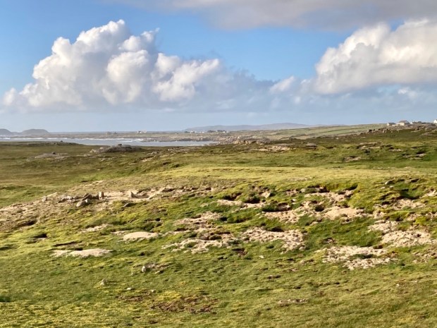
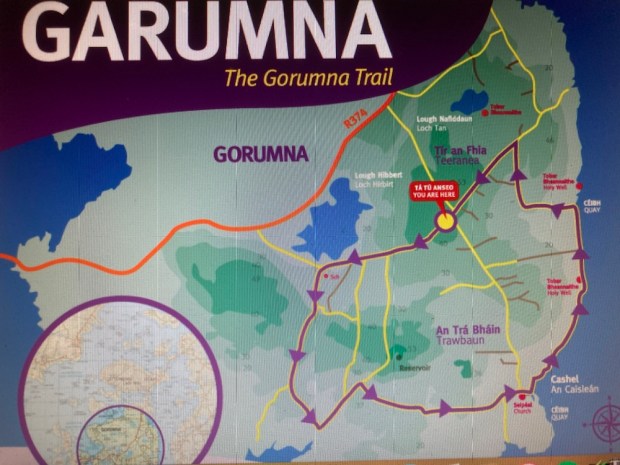
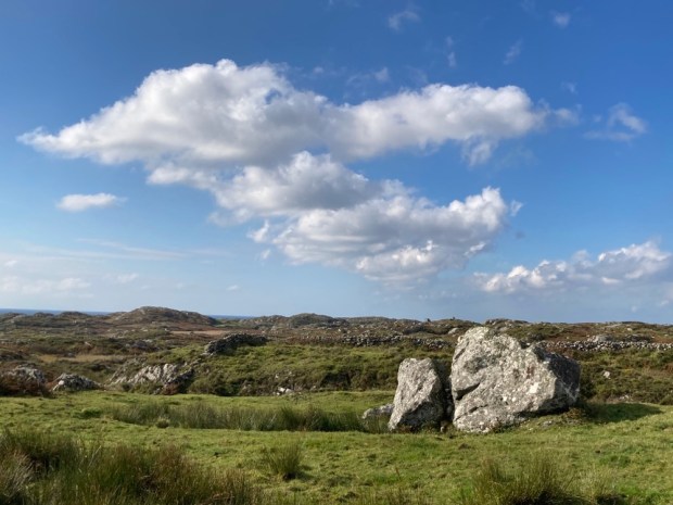
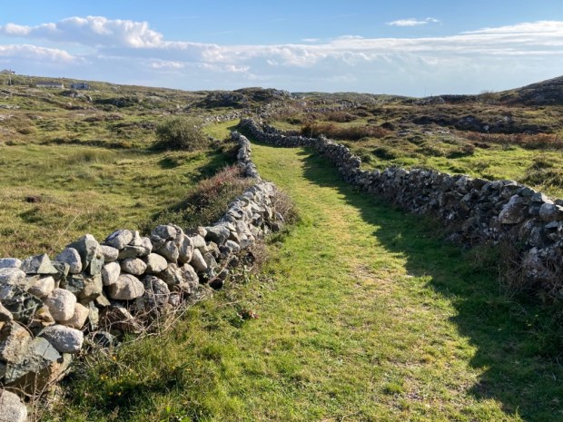
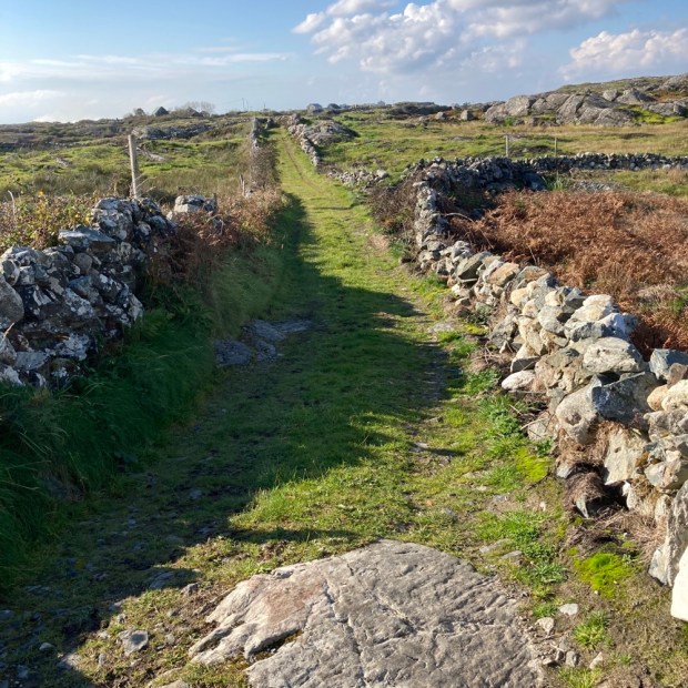
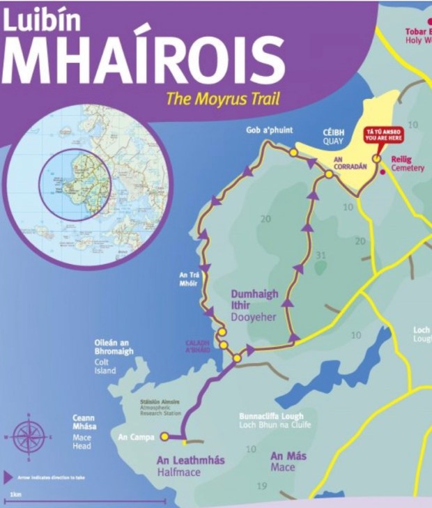
After lunch in the camper on the causeway we embarked upon walk number 2 on the above map of the area, to explore the town land of Sheeauns, or Na Siain, the fairy mounds, an area of low rounded hillocks of glacial moraine or drumlins that accommodates a wealth of Bronze Age monuments. Stone alignments, rows and sacred standing stones litter the landscape hereabouts along with the 1000 year older tombs of Neolithic times. Portal tombs, wedge tombs, court tomb and passage tombs – different designs laid bare after millennia of wind and rain have washed away their covering of soil- 32 of which have been found in this corner of Connemara , the richest concentration in Ireland- testify to a rich and unknowable past life around these quiet fairy mounds that now harbour more recent relics of people gone before.

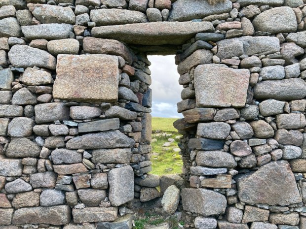
But in climbing up to inspect the ring fort atop a prominent fairy hill I incurred the wrath, not of the fairies, but of the farmer who owned the land and the cattle or sheep pen that had been refashioned from the Iron Age structure. Banished from the ancient homestead I retreated to the camper and onward to Sellerna beach for the night.

With an improvement in weather forecast we were ready for Omey but had to wait for slack tide in order to cross from the mainland. That gave us time next morning for one more exploration of Cleggan head and its beaches and cliffs.

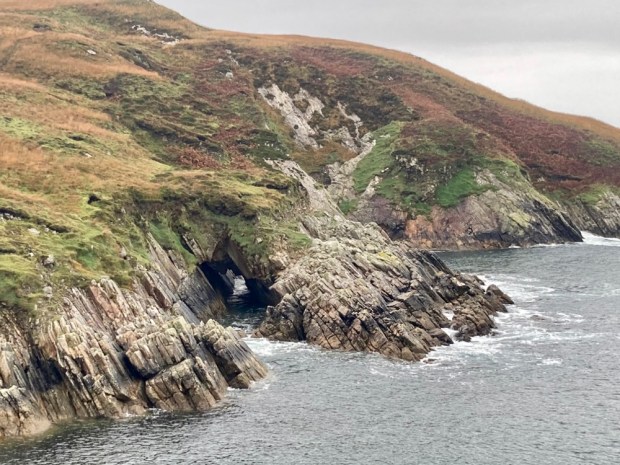
A couple of km east of Port the OS map showed a track from the town land of Bundouglas crossing northwest across the headland towards high cliffs on the indented coastline. From there we hiked back around to the stony beach below Shanboolard Hall which we also planned to visit.

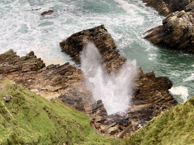
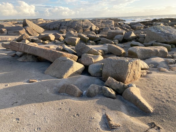
The track, presumably made for getting to the shallow turf banks scattered across a wide area, ended abruptly at the high cliff edge. The savage seas here have torn into the sandstone and glacial till leaving the harder quartzite jutting out or standing tall in defiance. Kayak tours are popular below the cliffs, exploring the caves, coves, arches, stacks and stumps.

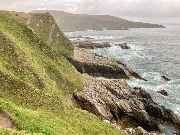
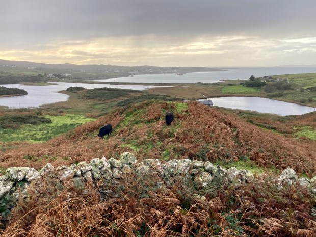
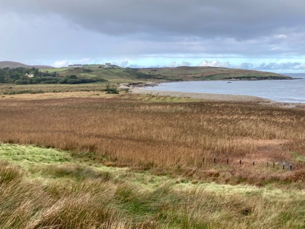
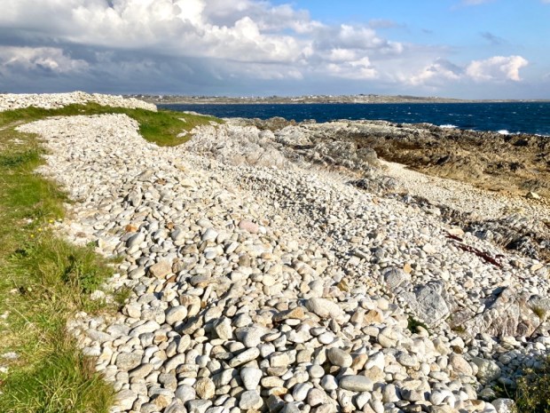
Making our way eastwards along the high ground buffeted by squally showers we passed a series of small bays, deep clefts scoured out by the waves, with exotic names- Ooeyuna, Ooeywalter, Ooeywaria, Ooeyandinnawarriv, Ooeylaunnlauraush and Ooeyansconsa. Views opened up down Ballynakill Harbour towards the 12 Bens and eventually we made it down onto the crescent wall of storm tossed pebbles and crossed to climb the grassy track leading up to Shanboolard Hall, another fine Anglo Irish estate house now an organic farm with walked gardens and a mighty wind turbine.

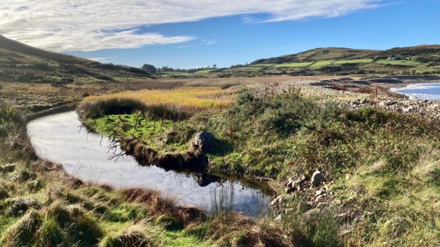
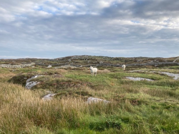
Related by marriage to the Musgraves of Cleggan House ,just over the headland, the former owner here relished in the name Captain Graham de Montmorency Armstrong- Lushington Tulloch. Now producing a wealth of organic fruit and veg they also have free range pigs and chickens, Connemara ponies and horses and a few Guinea fowl and bee hives. And a 3 bed holiday cottage to let. We had a chat with a couple working away in the garden and returned to the storm beach, crossing the stream emerging from the reed covered wetland.

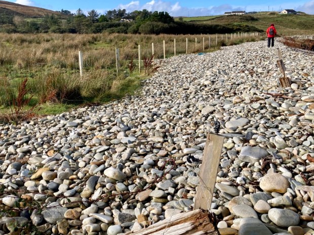
The constant movement of the beachpebble mound was illustrated by the buried line of redundant fencing that led us to the boot marking the way back to the camper.

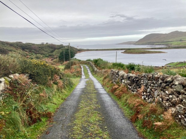
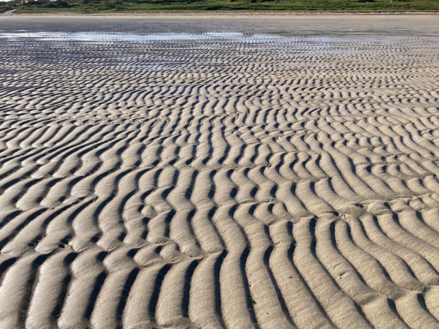
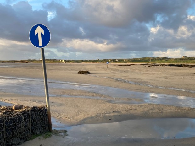
The sky was blue, rain and wind gone, the tide was retreating so off to cross the strand to Omey. Home to nearly 400 people before the famine and half that shortly after, it has only one permanent household now, our friends on the far western tip. The way across the wave rippled sands, open a few hours either side of low tide, is marked although locals seem to use other routes.

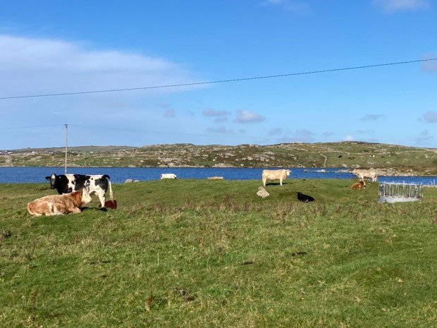
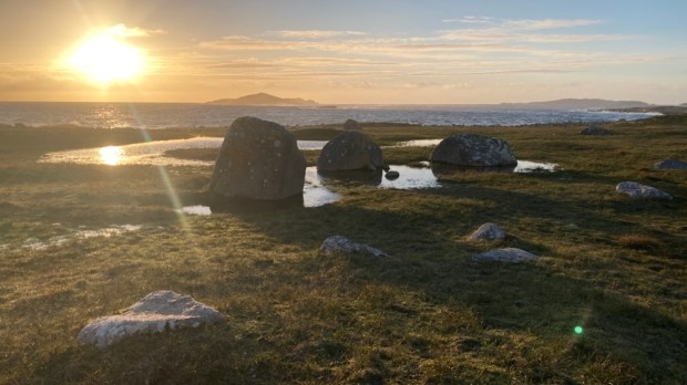
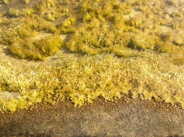
Once across the one narrow track leads up a rocky shore and passed small fields of grazing cattle on the eastern side. There are no sheep on the island, leaving it to the multitude of rabbits, whose burrows litter the sandy banks, to nibble the machair vegetation down to the nub. A large circular lake, Fahy Lough, takes up much of the centre of the island while the west is open and wild, with outcrops of granite looking like the works of Hepworth or Moore.

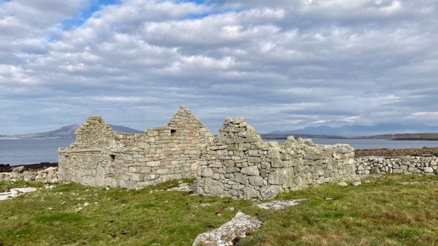
We took a leisurely stroll in the afternoon sun across the beach of Tra Rabhach to visit the holy well of St Feichin who came in the 6th century to found a monastic settlement and encountered fierce opposition from the locals, reputedly the very last pagans in Ireland. We carried on over the hillock high point of 26m adding our offering to the cairn and went on to gaze down at the excavated ruins of the medieval church, buried for centuries beneath the sands until dug out by the parish priest and locals in 1981. 100 years earlier, in 1881, a touring Daily Mail writer noted ” against the inhabited part of the island is what is now a mere sandbank. It is covered with sand, and not a soul dwells thereon. But there were people there once who clung in their stone cabins till the sand finally covered them; so that they might fairly be described as dwellers or burrowers therein”

The island struggled to feed its 400 inhabitants in the thin sandy soil although potatoes could do well as the same writer noted,” There us too much fresh air; for it blows so hard that people are afraid to disturb the thin covering of herbage……” if ye break the shkin of ‘um, your honour, the wind blows the sand away and leaves the pitaties bare. And, begorra, there are nights when the pitaties themselves ‘ud be blown away”.”

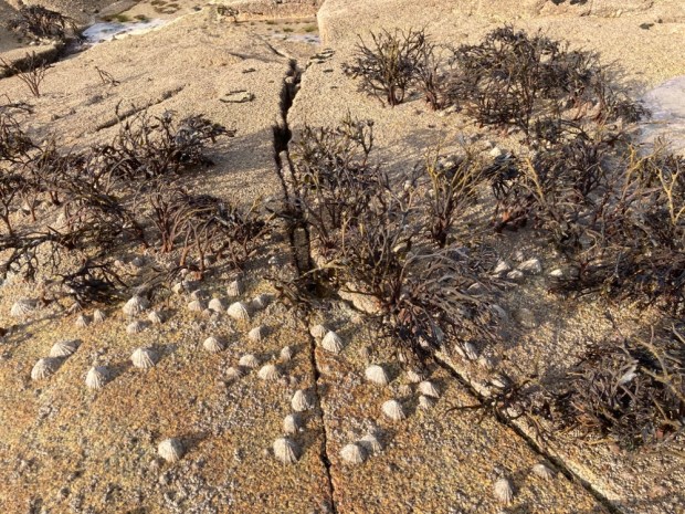
But we were blessed with being on Omey during a possibly very narrow window of time when the living is easy. There have been many changes to the island since the 1000 yr old shell middens were created here from the wastes of the society. And the changes wrought by the wastes of the present global society are likely to really stir up the sands of Omey. May St Feichin and his pagan god predecessors protect us.
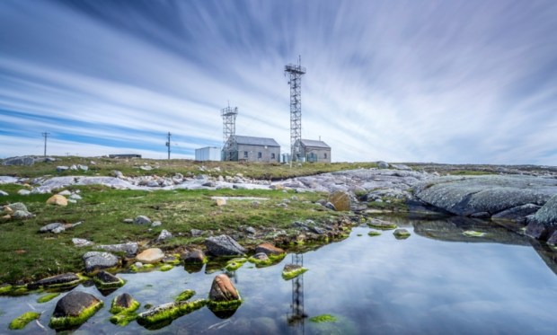
Connemara: The Southside

December 2020: Emerging from another Covid lockdown I finally get around to a post on a short exploration we enjoyed just prior to shutting ourselves away again within our 5km cocoon.

Heading west into Connemara we usually favour the mountainous areas to the north, the mighty lumps of quartzite and marble that make up the Twelves Bens and the Maumturk ranges. From the peaks of some we have gazed south, across the low lying bogland scattered with shining pearls of light reflected from a myriad of lakes and pools, to the sea beyond. The coastline there is so wildly indented, so convoluted, with peninsulas bulging out in all directions, surrounded by a flotilla of islands and islets, that it takes effort and time to explore some of the further flung pieces of this mesmerising landscape.

So although we have, over the years, been many times to the (relatively) more accessible beauty spots, we wanted to delve deeper and started with a walk on An Cheathru Rua, anglicised as Carraroe, a low lying peninsular of about 4×1 miles jutting south from Casla.

Home to nearly 2500 people, over 80% of whom are native Irish speakers, this is the heartland of the Connemara gaeltacht and the Irish language media ,being the base of the Foinse newspaper, with RTE Raidio National Gaeltachta and TG4 television station both nearby.

We started our walk on the beach that featured in the first Irish language film “Poitin” directed by Bob Quinn whose home and production company are/ were based in Carraroe.

Tra an Doilin, Strand of the Creek, is nowadays better known as Coral Strand and is made up of a rare biogenic gravel, a coralline algae known as Maerl. An Cheathru Rua translates as the Red or Ruddy Quarter in reference to the poor land of rock, heath, grass and rush possibly through the browning or bronzing of dead vegetation. In the past the Maerl would have been used as a soil conditioner to sweeten the acidic soil.

Heading north along the coastline past grazing horses in rocky fields we soon reached Doilin Quay.

There are very many piers, quays and landing/ mooring places all over the South Connemara area, a reflection of the vital importance the sea had for the generations of people gaining sustenance from these waters for over 4000 years. Roads have only come relatively recently and the sea was the main route from place to place until modern times. Another name for this place is Ceibh na Mine, Meal Quay, because cornmeal used to be landed here.

From here we left the “official” loop and continued on a narrow path along the coast, climbing over and through a wonderful variety of stiles fashioned from the granite to hand.

Soon enough we reached ‘Tadhg’s landing place’, Caladh Thaidhg a once busy port built in 1840 by Tadhg O’Cathain, a prominent local busnessman running a fleet of boats from here to the Aran islands and Galway city.

The hookers and other boats of old were busy transporting primarily turf to the Aran islands, a trade that continued into the 60’s when “cosey gas” as Kosangas was known had started to arrive on the islands. Connemara turf is still important fuel in these parts though and we passed many neatly piled stacks on our ramblings. None of these sods originated in the local area though as the profitable turf trade to Galway city and the Aran islands had ensured that the granite hereabouts had been stripped bare to earn money, at one time leaving only the unsellable top layer of heather roots or “scraw” to be burnt at home.

From the pier we turned up the road toward Loch na Tamhnai Moire , lake of the big field, anglicised as Natawnymore and turned off into a charming little grass covered boreen that led us up, down, around and back to the road from the village to Coral Strand, from where we looked across Greatman’s Bay, Cuan an Fhir Mhoir , to our next walk on Garumna island.

Although only a km away by water we had to drive about 20 km by tarmac ,up to Casla and then on a lovely road that spanned 3 bridges between the islands of Eanach Mheain , Leitrim Moir and Garmna. A beautiful landscape but as in WB Yeats’s words, ” a terrible beauty”, as this area suffered terribly in the famine and post famine years.

Carraroe in particular became famous for the evictions of the cottagers and especially for a rebellious battle against them. In 1880 the western half of the peninsular was owned by the Kirwan estate whose men with 60 police were serving eviction notices and closing houses when a melee broke out that warranted an extra 200 police to be sent down to Galway and on to Carraroe where they charged and bayoneted a group of women defending the homes, wounding several severely and one mortally.

The New York Herald reported that when attempts were made to serve eviction notice at another home the women ripped it to shreds and a did of blazing turf was snatched up from the fire and smashed into the inspectors neck. With 2000 or more protesters now gathered to defend the cottages the situation was deemed too dangerous and the notice server, a Mr Fenton, refused to carry on and all the police were withdrawn.

However evictions did eventually continue over the coming years and the Land Leaguers Davitt and Parnell visited and used its example in America to raise funds for famine relief and political change.

Hardships unimaginable to us as we embarked upon the 8km loop in the sunshine with full belly’s and a cosy camper van to return to.

Garumna is the largest of dozens of islands in the archipelago of Ceantar na hOilean, the mosaic of water, rock, bog and land that are the heart of the south Connemara Gaeltacht. Small lumpy fields of dips and hollows bordered by a writhing mass of stone walls are made up of a variety of habitats and flora. Pools and marsh, granite slab and boulder, rush and grasses, bracken, gorse and heather. The low lying acidic land rises bare metres above the Atlantic whose westerly winds beat down any trees attempting a life here.

As we set off westwards towards loch Hoirbeaird we had to disagree with the anthropologist Dr Charles Browne who came here in 1898 to study ” probably the poorest and most primitive population in Ireland” when he said of the area that ” a more utterly barren, dreary looking region could hardly be imagined”, although I had to admit that some of the holiday accommodation had seen better days.

We turned off down a small winding backroad that became a track which took us , after losing our way, down to a tiny quay lost among the seaweed covered rocks.

Gathering seaweed has a long history in the area as a food source and fertiliser and the days of burning kelp for soapmaking, dyeing, paper and glassmaking and producing iodine were succeeded by collecting vast amounts of ascophyllum nodosum or egg wrack for the extraction of alginic acid, used in so many foods, cosmetics, biotechnology as well as animal food and fertiliser. Some 20,000 t are now harvested annually by hand in the region and transported by road to factories across the water in Cill Chiarain where the Canadian owned company Arramara Teo are about to upgrade their factories to food grade and take in bladderwrack seaweed as well, a move which they say will have ” far reaching economic benefits within the local community and west coast of Ireland”

We had our lunch gazing at all the riches clinging to the rocks and reminiscing about the times, 40 years ago, when we earned our living gathering seaweed in West Cork.

Turning back up the track aways we found our turnoff, a grassy track leading us deeply into the island towards a line of smoke in the sky. Someone was clearing heather or gorse in the hope of fresh grass but we passed some areas where this method of burning had resulted in mosses alone.

We reached the coast again at the medieval church and graveyard at An Tra Bhain, the white beach, from where pilgrims would gather for the journey out to the monasteries of the Aran islands.

An enchanting path now led us northwards along the shoreline of Greatman’s Bay, looking back over towards the Coral beach, and on reaching yet another little jetty we turned west again to return to the camper along a quiet backroad.

Looking for a quiet park up for the night we drove back over the causeways to Leitir Moir and Eanach Mheain and followed our noses to a graveyard on the north coast overlooking the Bens and Maumturks way in the distance.

The very tranquil spot was shared by the buried with golfers who got to play in what surely must be the most dramatic setting on the Wild Atlantic Way, although a risky spot for amateurs, being surrounded by water.

The following day we headed further into the depths of the Connemara Gaeltacht by driving around the large peninsular of Iorras Aithneach to Mhairois where another loop awaited.

Another beautiful 5km walk on beach and boreen started at the ancient seaside church ruins and headed southwest along the immense strand where the ghost of a friars massive hound was said to be seen running races from end to end.

At the far end at a headland we turned south along a rock shoreline of wonderfully hued slabs and boulders of granite and tropical looking crystal clear waters, as calm and flat as a mill pond.

The views across Cuan na Beirtri Bui, Bertraghboy Bay were stunning, a palette of blues and greens and pale turquoise from which swellings of land emerged, rocks, islets, islands and mountains. The microcosm was as appealing as the wider picture with miniature seas held in rock pools and the abstract artworks of gigantic stone sculpture under our feet.

There was the work of man here too. Ruins of stone cottages that must have caught the spray of storms sat squatly atop the rock, a testament to the resilience of man and his work. Calm and tranquil in the weather we were enjoying, the usual conditions must have made for a harsh life on the Atlantic’s edge.

I fruitlessly searched around for a Holywell marked on the map below the high tide line, the third of these seashore relics we’d passed on our rambles unspotted. Further along, on the grassland above the beach of An Tra Mhoir, we discovered another of the Eire navigation and neutrality markers from the days of “the emergency”we had spotted in many places around the coast. This was number 52 of 83 and had been recently restored by locals.

Next up was an inlet that was fed by a stream we crossed on a new looking recycled plastic bridge. A good use for the silage wrap that so often gets left to decorate the hedgerows, block drainage and ends up in the bellys or around the necks of wildlife.

On reaching the road we took the detour to the right to check out the Atmospheric Research Station in Mace Head. It is uniquely situated, far from shipping lanes, cities and other pollutant sources to look for aerosol and trace gas elements within the clean air mass coming from the North Atlantic. Part of a large number of international research networks into global warming it also produces data for the weather forecast. In 1994 it was recognised by the World Meteorological Organisation as one of the most important stations in the northern hemisphere.

*Not my photo

Then up to the top of the broad summit of An Mas , translation buttock, where the Coastal Watch Look-Out Post number 82 still kept a watch out for friendly and foreign goings on.

Having our sarnies we had a magnificent view northward to the mountains and southwards over the rough and rocky fields littered with long abandoned cottages and beyond to the sea and islands, the nearest being St Macdara’s, home to an early Christian monastery.

Then back down the winding boreen, passed signs of the low intensity of the agricultural practises in the area. A couple spending a long long time driving some cattle into a ruined cottage and a tractor in retirement.

Finally we did get drawn towards the distant peaks , to the ancient woodland of the Nature Reserve on the shores of Derryclare lake in the Inagh valley north of Recess. This 19 hectare old oak woodland is a remnant of what used to be and an indication of what could be again if the ravages of a “sheep wrecked” environment could be resisted.

Access is down a forestry track off the R344. Parking the camper we crossed the river between locks Inagh and Derryclare above a salmon hatchery, and followed the track around the end of the lake and on until we eventually found an unmarked and slight trail that seemed to be going in the right direction and were soon enveloped in a mysterious green stillness of another world.

The aboriginal oaks, hangovers whose ancestors arrived here after the last ice age, are smothered with thick coats of mosses and host colonies of polypody ferns. Although in theory protected, the sheep continue to find their way in and these elderly trees do not have a lot of youngsters to take their place having been nibbled at birth. The National Parks and Wildlife service have been ringing the non native conifers and have translocated 19 red squirrels from Portumna Forest Park to Derryclare. They have been doing well according to study’s and hair tubes and traps and wildlife cameras keep a close eye on their movements.

The edges of the Oakwood are home to a range of other species, alder and willow on the marshy boggy bits and birch and ash on the dryer sedge covered ground.

Here and there are yew, chestnut and sycamore but the species that the visiting botanist really get excited about are the lichens. The clean air and humid climate have allowed over 100 species to flourish here, some unknown elsewhere in Europe or the northern hemisphere. or extremely rare.

The macrocosm of the mountain ranges, the lakes, the bogs and the vast fractal coastline complimented again here by the microcosm of forests of mosses and lichens and fungi. A beautiful interconnected web reaching out from within the earth up to the highest peaks and passing through the hearts of some who journey here.