Walking Hiking Rambling

SUCK VALLEY WAY: 30/31st March 2016

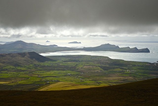
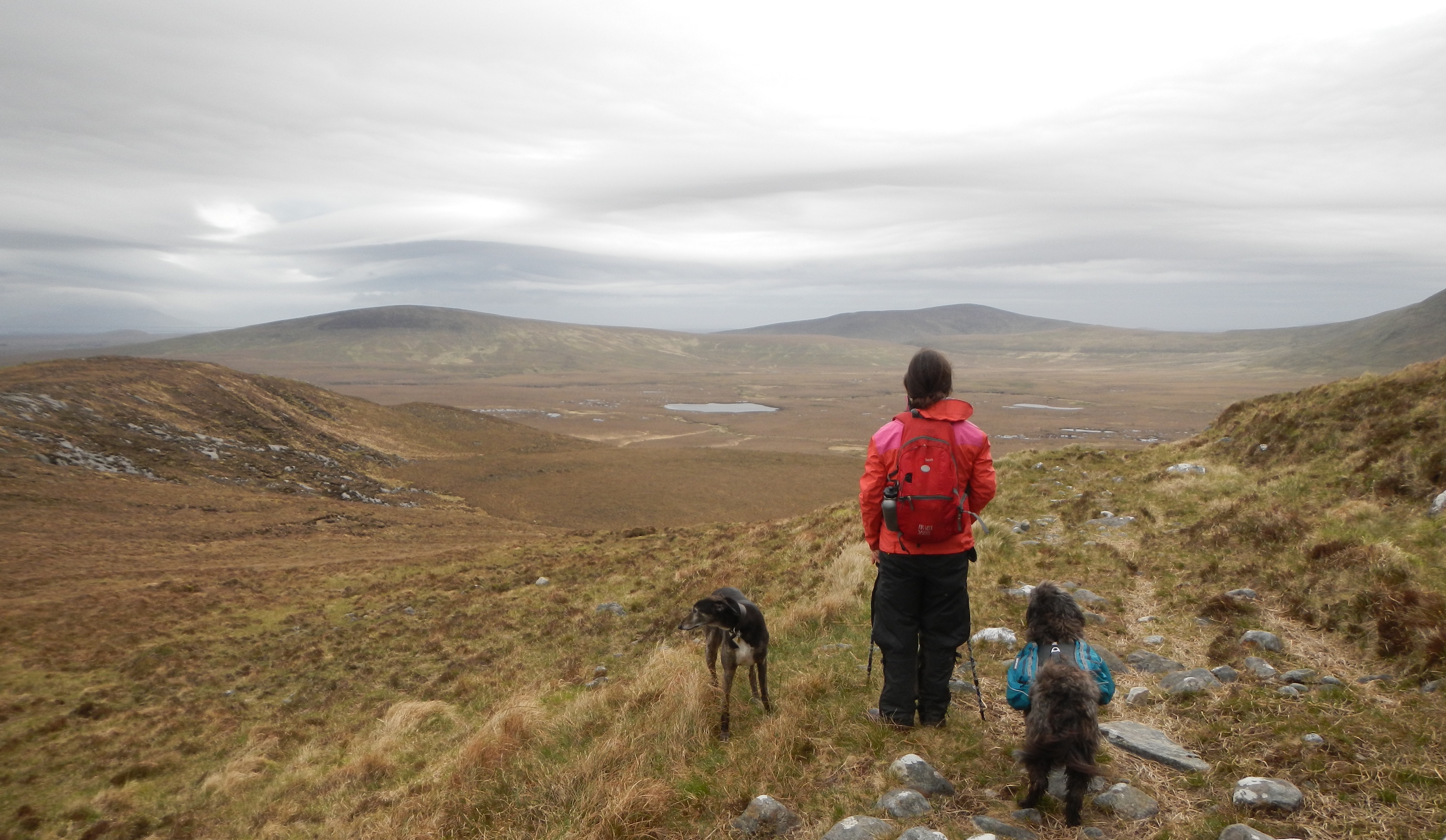
Our last outing, to Inishbofin, was prompted by the presence of a WWOOFer and my next was made possible by the absence of another. She had to cancel her visit at the last minute which meant i had a couple of, thankfully, fine days to explore the little visited hinterlands of northeast Galway and west Roscommon on the Suck Valley Way, a 105 km clockwise loop from Ballygar to Castlerea on the western side of the river and back down on the eastern.

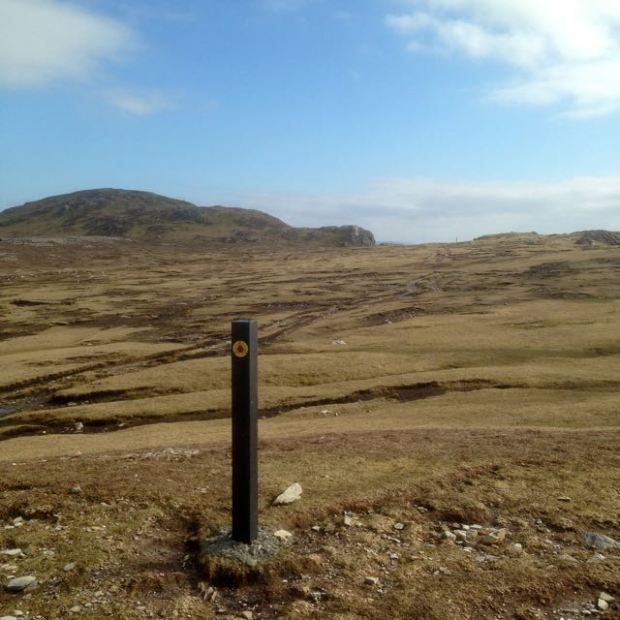
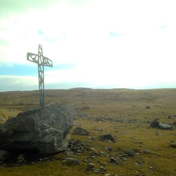
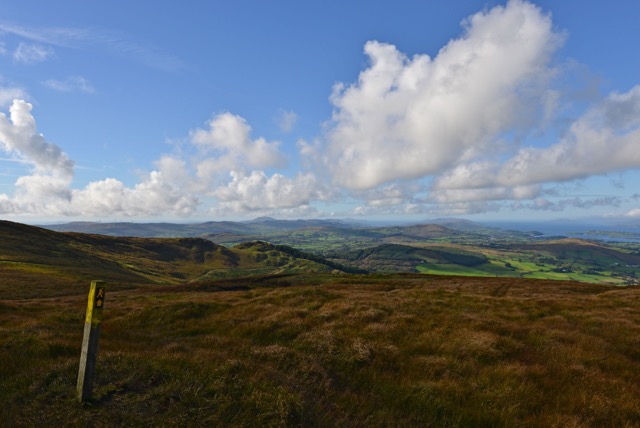
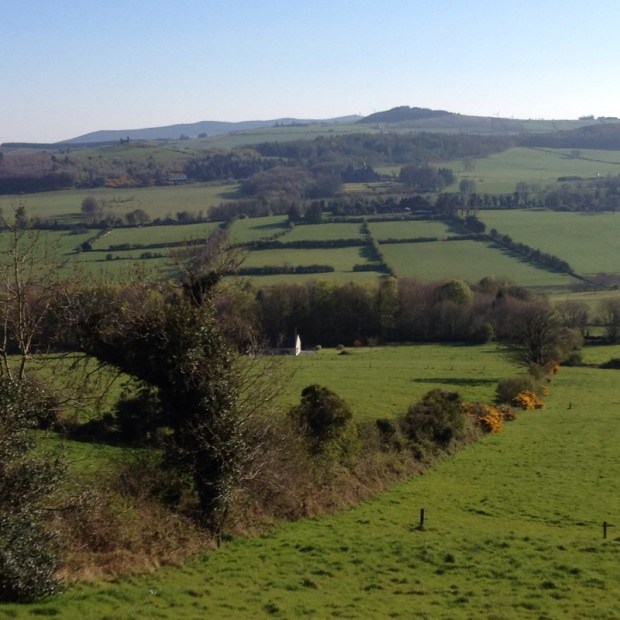
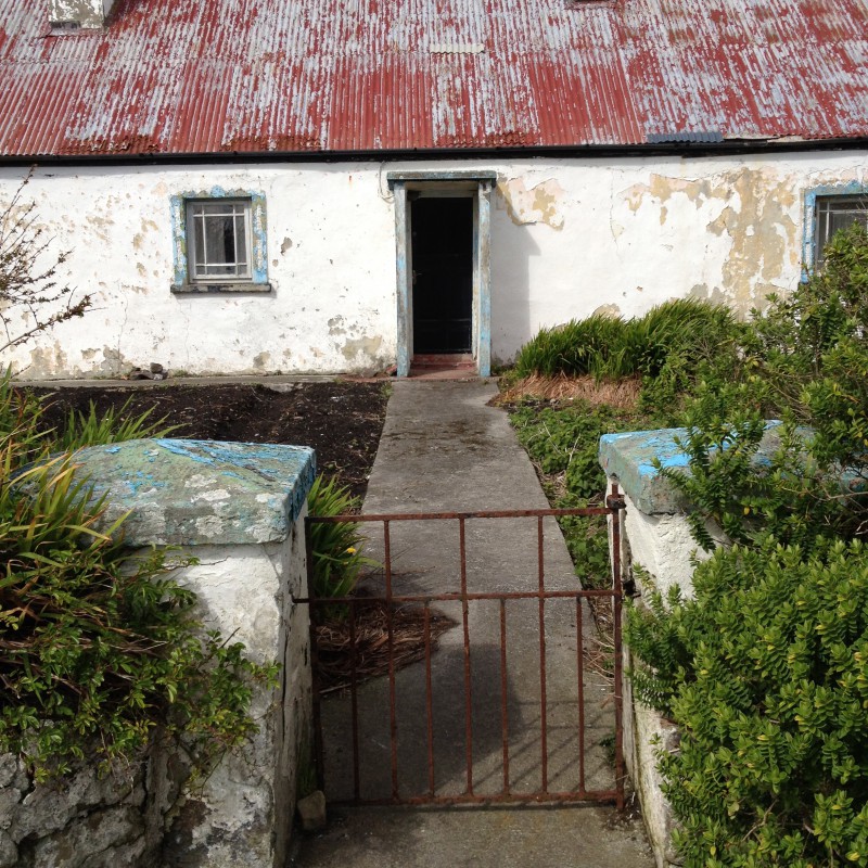
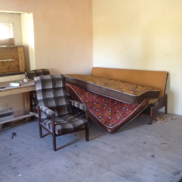
A relatively unsung Way, this modest low level route passes through the heart of rural Ireland on minor backroads and boreens, across turf bogs, through wooded areas and pine plantations, riverside paths and a surprising amount of crossing of rich grazing farmland.The journey through the quiet countryside reminded me of other neglected Ways i had hiked in the midlands a couple of years ago in Offaly and the Slieve Blooms and there is something about these overlooked areas with their abundance of abandoned houses that i find really attractive in a slightly melancholic way. Perhaps they are far more “Real Ireland” than the lavishly marketed and hyped routes along the Wild Atlantic Way, and although they lack the rugged splendour of the Western, Kerry, Dingle and Beara Ways the big open skies of the flat boglands and the wildflower lined boreens past once loved homesteads exude their own hypnotic charm.

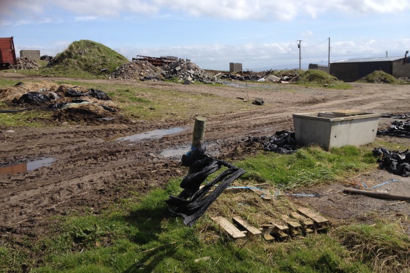
They also go through more villages, unfortunately these days not as lively as they once were, but still a source of interest and hopefully sustenance, requiring less need to carry supplies. The bulk of the country is made up of hundreds of these minor settlements and to visit them is to see where a lot of Greater Dublin, with nearly half the countrys population, has emigrated from. The emptying villages the Way passes through, Ballygar, Creggs, Glinsk, Ballymore, Ballintubber, Donamon, Castlecoote, Athleague, Mount Talbot have also lost countless to America, Australian and the UK and with little tourism only agriculture remains. But less is more, and small is beautiful, and the quiet,empty, green and unspoilt (mostly-rubbish dumpers are everywhere) nature of the midlands could be it’s greatest asset.

Bord Failte have been pushing the Wild West and the Ancient East, let’s hear it for the Forgotten Midlands.DSCN2988

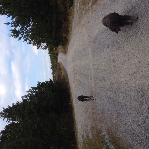
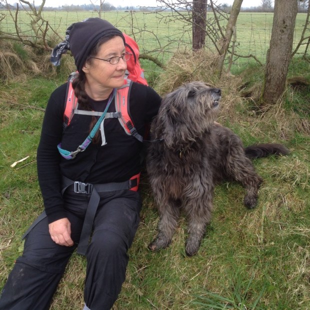
Sally and i had done a 40km loop from Ballygar a couple of years ago, crossing over the river at Dunamon to circle back to Ballygar, so that left me with a 65km stretch to finish over 2 days. Starting at the graveyard in the downland of Kilbegnet, i planned to get to a B and B in Castlerea for the night and carry on down the east side of the valley to Dunamon where i could cross back over. With a weather forecast of minus 2 overnight i didn’t fancy camping which meant i had a light pack, although it did contain a load of waterproofs that luckily i didn’t need.

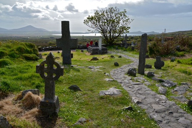
The graveyard apparently contained many victims of the famine which seemed ironic as i gazed over the rich productive farmland that had been settled for thousands of years and was the site of a church dating back to St Patrick’s days.DSCN2956

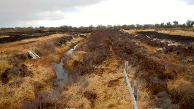
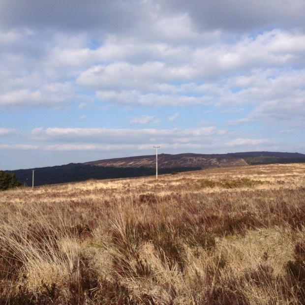
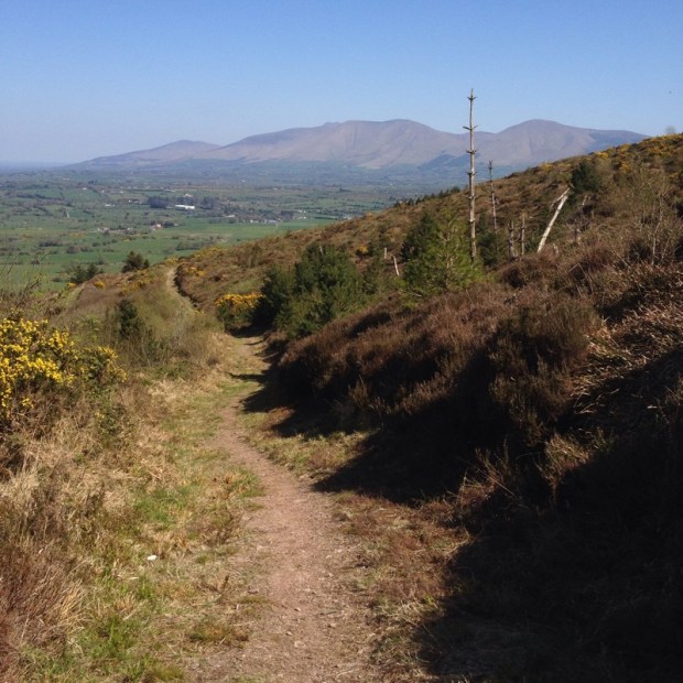
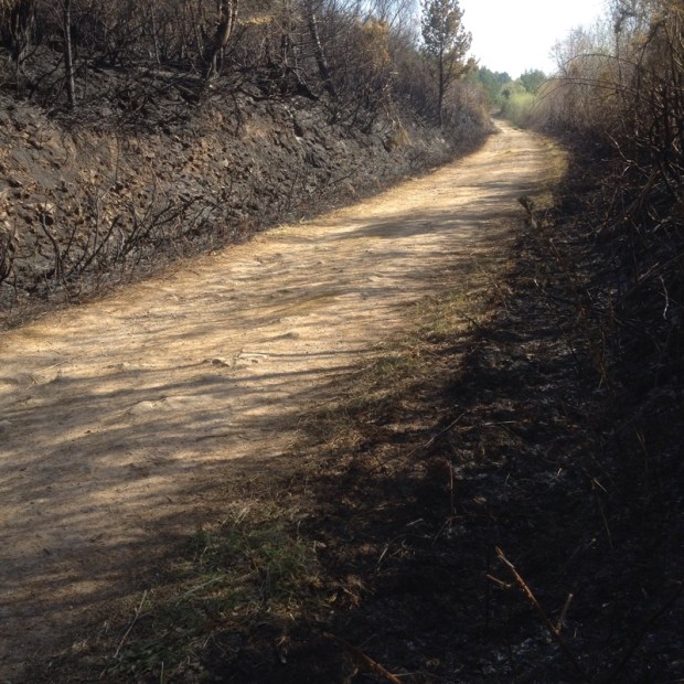
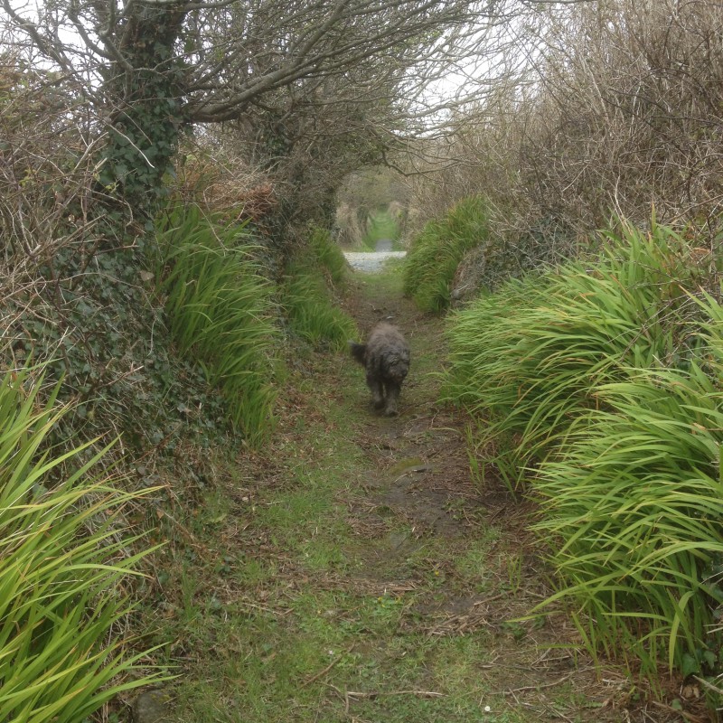
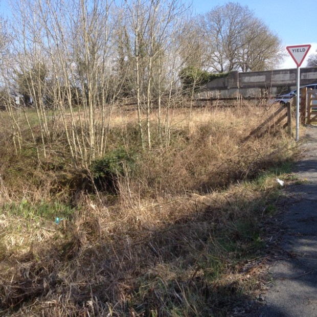
The Way took me down a minor road towards more marginal land on the edge of Rosmoylan bog and past a collection of covered turf piles and a wall mounted dustbin that seemed like installations in the landscape.

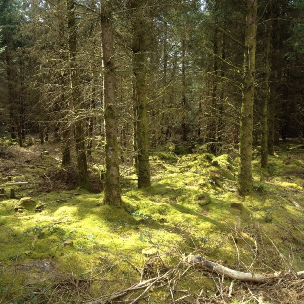
Leaving the last of the housing behind i headed out on a track across the bog, still supplying a lot of fuel despite the recent legislation that forbade a lot of the turf cutting. There was a patch of ancient oak, hazel and holly woodland , a lough that had been home to a hermit named Peter of the Pikes and more modern archaeological remains.

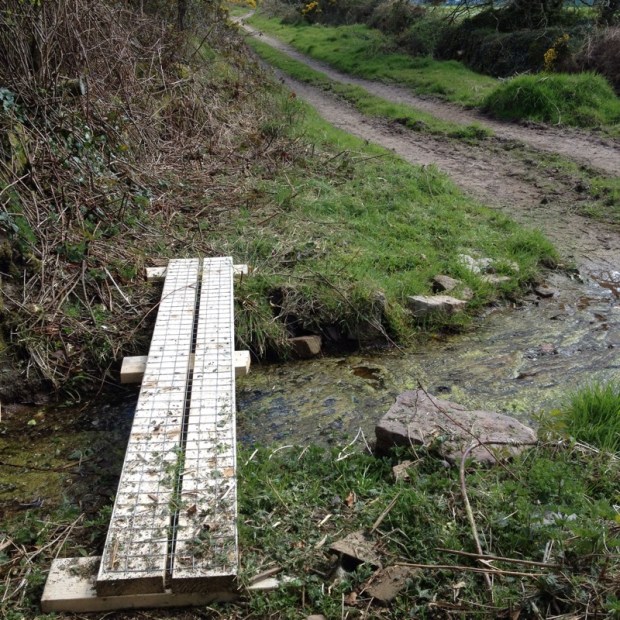
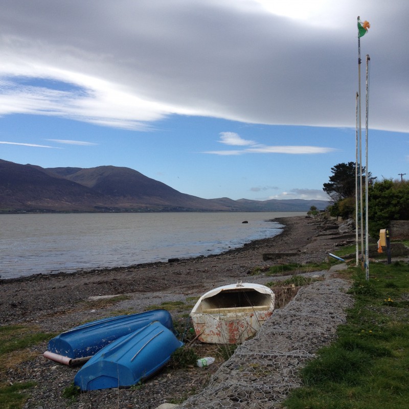
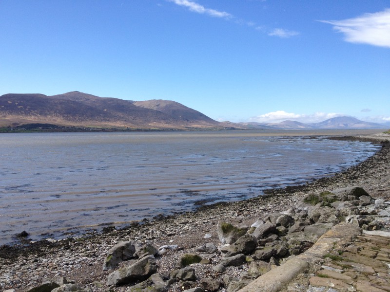
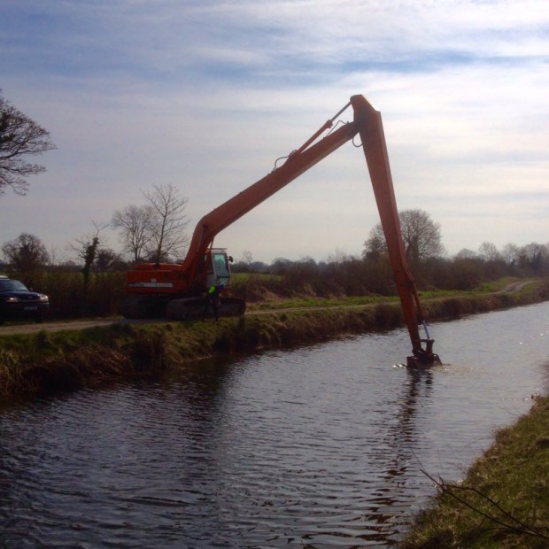
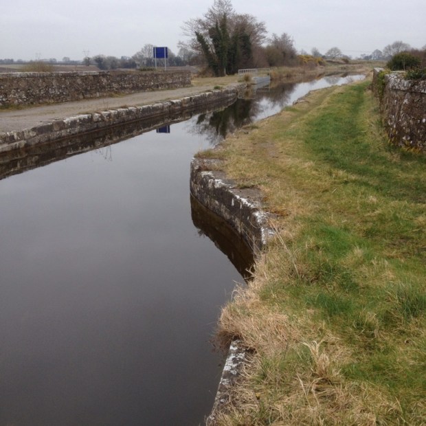
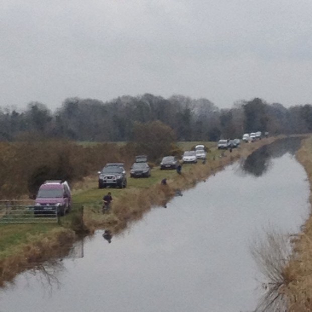
Emerging back onto tarmac briefly i came to a sign warning of possible flooding on the main overland (or water) route and advising of a longer, dryer roadway alternative.With 30km to do that day i didn’t want to lengthen it any, so i continued and before long came to a high footbridge over a stream or drain feeding Lough Loung. The massive rainfall over the winter had caused widespread and long-lasting flooding on the Shannon and the Suck and it still hadn’t gone down enough for me to avoid taking off my boots and socks at this point to paddle up to higher ground. Still, the reedy debris on the bridge told me i would have been up to my neck in water not long ago.

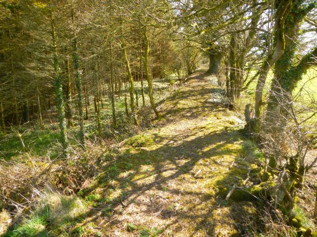
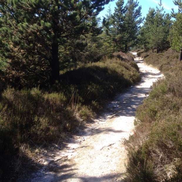
Then it was a short hike across more scrubby bog to the shores of the Lough where access by a boreen has made it a charming and peaceful park up for the camper van. More lush farmland led to a passage through a forestry plantation and a pleasant stretch of woodland on the outskirts of Glinsk.

Another section of farmland drain by a multitude of ditches brought me onto a track leading across heathy bogland that was being well and truly infested with the rhododendron scourge.

DSCN2987

Into Ballymoe and, strangely, the empty shops at the southern end of the village seemed to have been taken over by a radical pro beard movement.

At the other end of the street, behind the old abandoned Church of Ireland , was a neglected tomb for the Bagot clan who where the landowners of the area and have a Dublin street to their name.

DSCN2997

A bizarre and somewhat sinister story concerning the church tells of how Mary Burke,the niece of a Catholic bishop had wanted to convert after attending lectures there by the Reverent Welden only to be locked in a lightless room for a month by Fr O’Connor and some of her relatives and then starved for days in an attempt to force her to attend mass. Mary managed to flee to Castlerea where she was put under the protection of the Royal Irish Constabulary.

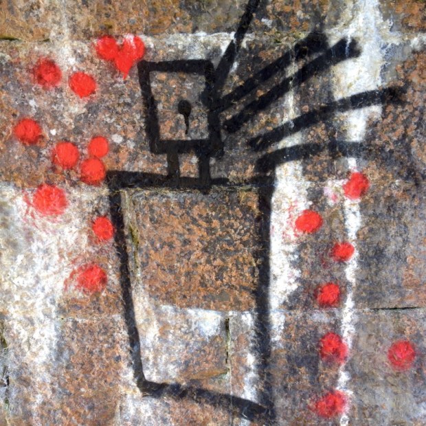
Leaving the village on a bridge over the river it was back to the bog at Corliskea and more thoughtful artistic pieces dealing with the meltdown of consumer society and it’s hostile reaction to pervasive technology. Or not.DSCN2999

DSCN3006

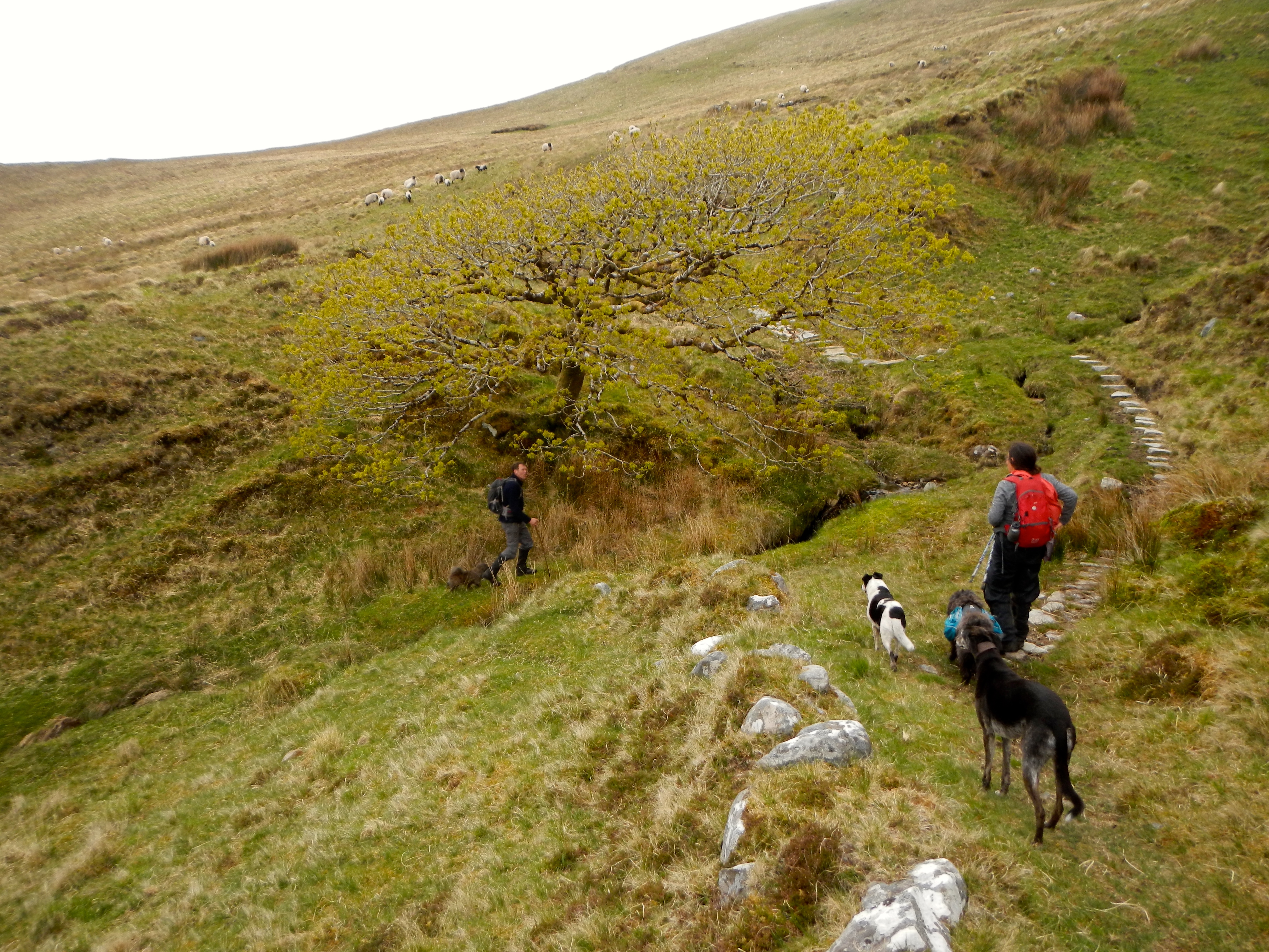
After that is was nice to enjoy the bright spring sunshine among the happy sheep families in the pastoral splendours of the riverside pastures. Even though it was pretty wet going at times my HiTec boots performed very well and i arrived at my B and B on the outskirts of Castlerea weary but dry.

Revived by cups of tea and a hot shower i went for a fish and chips dinner in Castlerea , neither of which i found very inspiring and was disappointed that the possible excitement of “The only pub in the world with a train in the bar” was closed.

A bright morning with a sparkling frost that made me grateful for the nights warm bed saw me retrace my steps to Cloondacarra bridge and a drainside section of track alongside the prison, that had been badly poached by horses.DSCN3020

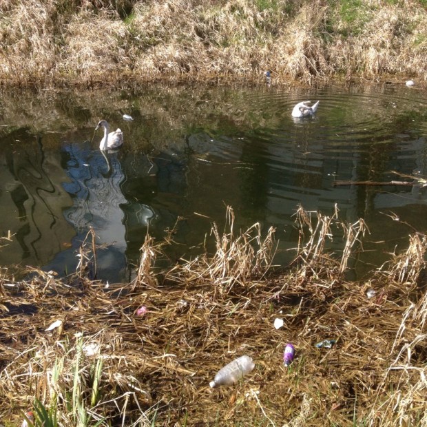
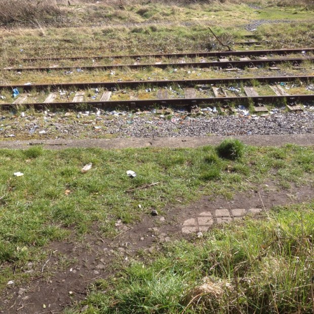
Crossing the main road by the traveller site the lane that led to the Dublin-Westport railway line had been visited by a heath conscious litterer.

DSCN3028

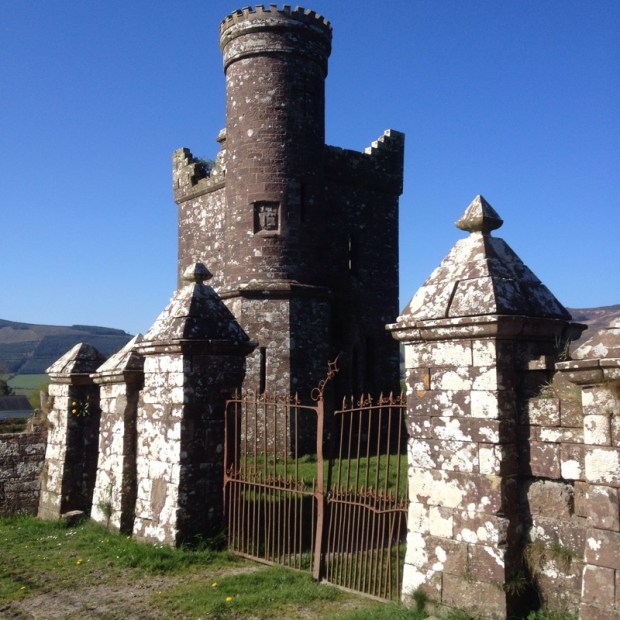
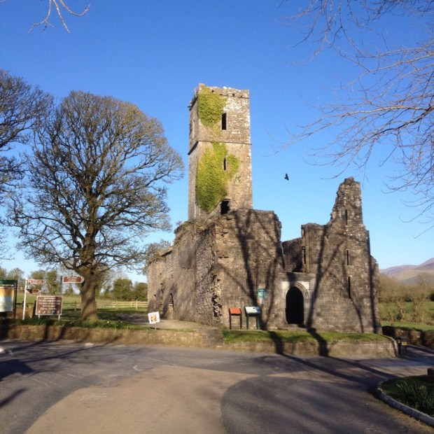
Over the train track and along some tranquil lanes past remnants of a 5th century monastery founded by St Pat’s nephew Brochard and more real estate of potential i had to negotiate fields of lively cows before coming down into Ballintober and the ivy clad castle ruins.

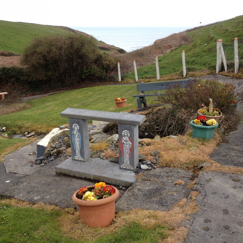
The 13th century castle has been the scene of many battles and sieges but now all is quiet in this well kept tidy town winner with its Bridgits Well and Memorial and Biodiversity Gardens. There is a grocery store from a byegone era with its window display of essential items of the past and elsewhere an intriguing building of unknown use.DSCN3044DSCN3043 After lunch at a picnic table i had a long section over farmland criss-crossed with drainage channels and badly poached by cattle. One herd of cows had a frisky collie harassing them, nipping in to snap their snouts when they lowered their heads to graze.

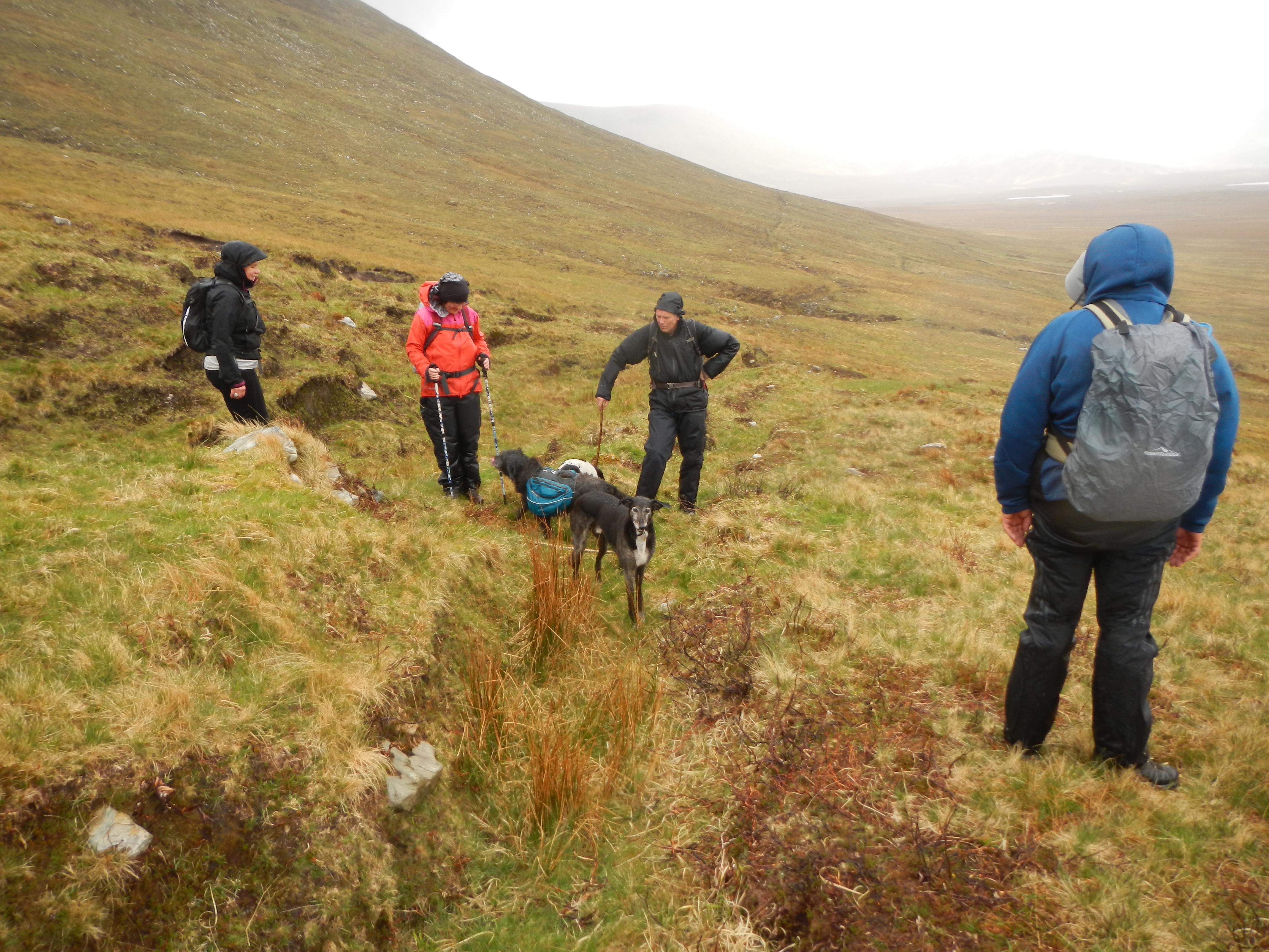
Some of the landowning farmers (or maybe volunteers)along the way took great care over their segments, fencing off the livestock, clearing the brambles, putting down stepping stones and even providing picnic tables. Others didn’t bother, making the walker negotiate strings of temporary electric fencing and slop through a sea of mud. In one field someone had set a couple of wire snares across an animal run which could have upset an unwary hiker.DSCN3050

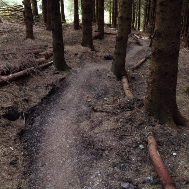
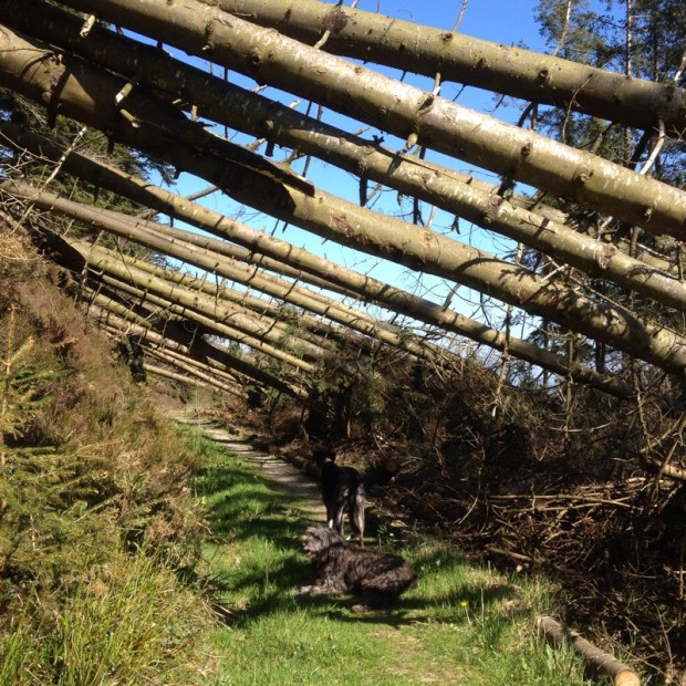
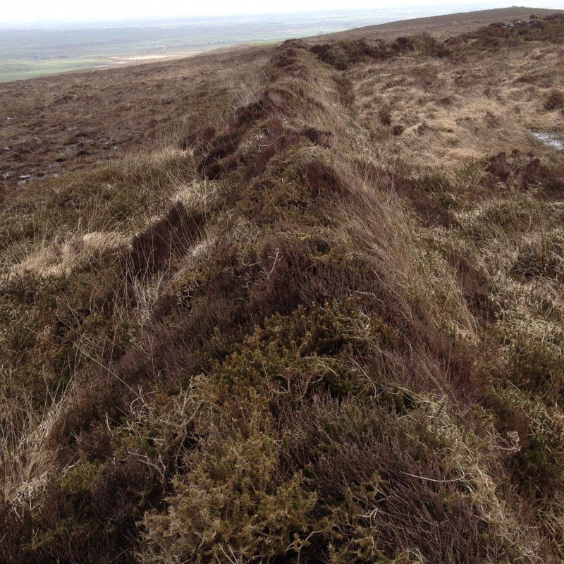
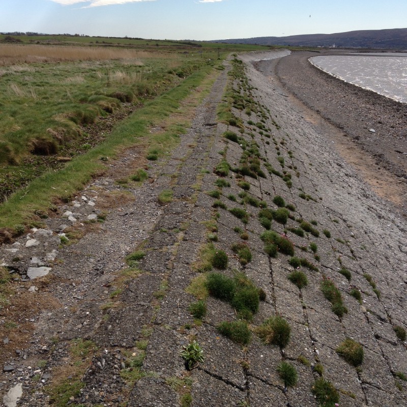
A firm raised path through a wood got me out of the preceding slop and up to some higher ground.After the vehicleless farmland it was a bit unpleasant to have to approach and cross the noisy N60 but i was soon away from it and enjoying a hike on bogland next to the much less used railway again. The turf here was very deep and impressive ditches had been dug to drain off the banks.

DSCN3048DSCN3051

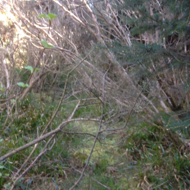
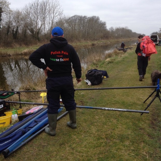
Corbally Bog was succeeded by a bit of field path, a lovely dead end boreen and a track leading past an abandoned farm with huge mature beech trees to a sylvan riverside setting. Briefly turning away from the waters i came to another flood warning sign and longer alternative route. With the end in sight (figuratively) i was not for turning and carried on down a bog track to the river again. Waving to a solitary fisherman i followed the way marks into a birch wood which turned into a rhododendron forest before emerging ,once again, Suckside.

DSCN3054

So that was it more or less. A few pleasant kms alongside the water  brought me into Dunamon, with a castle that had originally been the stronghold of the O’Finahty clan, then the Norman English Burkes, then Cromwellian then an estate belonging to the Caulfields and finally in the 30’s became home to the Divine Word Missionaries and a care home for disabled.

DSCN3055

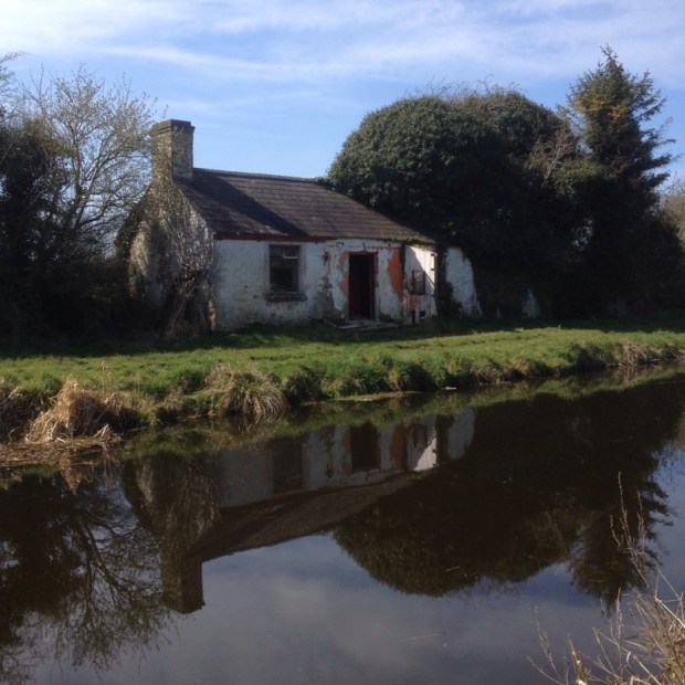
It was a fine building, but as i made my way slowly and wearily back to the van i reflected that it seemed a little out of character with the small and humble dwellings that had typified this enjoyable ramble.

DSCN2968

INISHBOFIN:19th March 2016

3 months since a Ramblingman posting i thought i would report on a couple of recent excursions or micro adventures as i believe they are called in the on-trend world.

IMG_4971

The first was a trip we’d been meaning to take for a long time. To take the ferry from Cleggan on the northwestern tip of Co Galway the 7 miles out to Inishbofin or to give it’s proper name, Inis Bo Finne, the Island of the White Cow. The inspiration to finally get it together was supplied by the presence of our WWOOFer (Willing Worker On Organic Farms, or nowadays for some reason changed to WorldWide Opportunities on Organic Farms). We wanted to show off Connemara to Hanna on her first trip to Ireland from Germany.

It was a fairly gloomy day driving through the bogs and mountains and the clouds hung low over the sea as we boarded the boat along with a surprisingly large amount of other folk and the two dogs.IMG_4956

We had been having beautiful spring weather recently so it was a bit disappointing to gaze out towards the grey 6 by 4 km smudge on the horizon and back towards the twelve Bens and the Maumturk peaks lost in cloud.

IMG_4959

It took about half an hour to cross to the island and pass the beacons that led ships into the fine sheltered harbour below the smattering of buildings that comprised the main settlement.

IMG_4960

The island has three looped walks and with 4 hours available to us we had combined two of them, the Middle and Western Quarters. Climbing up from the harbour along the network of boreens we started out on the Middle Quarter loop first, albeit in the opposite direction to the way marks, which possibly explains how we got lost fairly soon after passing the cottages,new and old, and heading out north towards the islands high ground.IMG_4966

Passing an airstrip carved into the rocky and boggy ground we took the wrong turn but only had to climb to the highest point to get back on track and admire the views east towards the mainland and south across the ocean.

IMG_4973

IMG_4972

Rejoining the way marked route we descended from the 90 mt highpoint towards the bog track leading to Loch Bofin and the pebble embankment separating it from the Atlantic at North beach.

IMG_4976            IMG_4977

Following a flock of sheep being herded along a boreen we moved on to the open expanse of the Westquarter and now in bright sunshine passed by the sad monument to the memory of some American students that had drowned off the coast here in the 7o’s. IMG_4982

IMG_4979

Somewhere around here there had been a quarry of valuable soapstone which, along with the abundance of fish, fresh water, fertile ground and a sheltered harbour had made Inish Bofin an attractive place to live for the 6-8000 yrs of human settlement. Strangely there are none of the megalithic remains of standing stones, circles or burial tombs that feature on the mainland from that period, leading some people to surmise that a different people with a different culture may have inhabited these islands. There is a promontory fort, Dun Mor, that we under below once we reached the old green road that travels along the southern shore with a warren of rabbit holes peppering the slope below it.

IMG_4986

There is a fine view from this section of the walk over towards Inishark and the now roofless houses finally abandoned in October 1960.We couldn’t resist clambering down to the beautiful pristine beach hemmed in by headlands on either side and after fruitless beach combing to the eastern end, availed of the handy rope to climb back up to the green road.

IMG_4997

IMG_5001

IMG_5002

The sparkling sea and sunshine and soft, sheep cropped grass persuaded us that this was a good picnic spot before we rejoined the tarmac road that serves the simple homesteads and its remnants of rusting transport.

It’s a shame that Inishark could not sustain itself long enough to enjoy the better economic conditions that Inis Bofin seems to enjoy, with new sea defences, a fine and active community centre and a hotel popular with stag and hen nights by all accounts , but it’s lonely and empty stillness could be a draw of itself and can be enjoyed during the Inis Bofin Walking Festival in a couple of weeks (22nd to 24th April) when a guided hike over the island will take place, weather permitting.

IMG_5007

Our ferry awaited and soon we were cruising out past Port Island separated by a narrow gulley and once the castle site of Don Bosco, not the puppet once popular on Irish TV, but a famed and feared Spanish pirate who, along with his mate Granuaile, the pirate Queen, in another castle opposite, controlled these waters and plundered any foolish enough to venture in. Since the 16th century another warlord, Cromwell, has had a presence here in the star shaped shape of the barracks used as a prison for catholic priests from all over the country declared guilty of high treason for being– catholic priests.IMG_5009

It would have been their last view of their homeland as they eventually got shipped out to the West Indies and an unknown fate. We, on the other hand, had the pleasure of anticipating a fair weather drive back through the mountains of Connemara now revealed in all their glory for the benefit of our German visitor.

IMG_5016


ON THE PILGRIM PATHS IN THE LAND OF SAINTS AND SCHOLARS

At a time when 200,000 weary pilgrims a year queue up for their certificate in Santiago de Compostela in Northwest Spain, walkers in Ireland are re-discovering their own, much less visited Caminos.

Way before a religious hermit stumbled upon the bones of St. James in 814AD and kick started what has become the most popular long distance hike in the world, Pagans and then Christians were following ancient paths to sacred sites throughout Ireland.

Barefoot pilgrim on summit of Croagh Patrick

The pilgrimage to the hallowed peak of Croagh Patrick overlooking the 365 islands of Clew Bay in Mayo existed 3,000 BC and was popularized by the Patron Saint of Ireland 500 years before St. James’ way got going. It still draws 30,000 people to the summit on the last Sunday in July, or Reek Sunday.

Croagh Patrick's well worn scree slope

Patrick is also associated with an Island in Lough Derg, Co Donegal, attracting pilgrims from all over Europe since medieval times – a site so important that it was the only Irish place named on a world map of 1492.

There are other, more unfamiliar paths now being promoted as walking trails with a difference and together they make up about a dozen routes over 250 kms of tranquil country lanes, stone paved tracks, paths through meadows and forests, across heather moor and bog lands and over rocky mountain summits, passing through some of the most beautiful scenery in Europe.

In County Mayo the 30km Tóchar Phadraig (St Patrick’s Causeway) was in use in Pagan times as the Royal Road to Cruachan Aille, the original name for Croagh Patrick and during its clearance by a local initiative ancient stone flagstones came to light indicating its archeological pedigree.

The route leaves from Ballintubber Abbey and meanders over low lying fields and through a serene and timeless landscape dotted with a round tower, holy wells, druidic sites, famine graves,
medieval churches, mass rocks and sacred stones, including the miraculous rock of Boheh. This cup and circle marked stone from around 3,000BC was the focal point of Sun worshippers and used to divide the year into 3 in prehistoric times when standing at this spot at sunset on April 18th and August 24th the Sun lands on the very peak of Croagh Patrick and then proceeds to roll or slide down the Northern slope, the angle of setting Sun and mountain side matching exactly – a truly jaw dropping sight. Even without witnessing this phenomena the view of the iconic quartzite cone of ‘the Reek”, visable for most of the way, is what draws you irrepressibly onward.

Slieve League donegal, a pilgrim destination for over 1000 years

Other ways in the West include the spectacular Slieve League Pilgrim path with its 400m sea cliffs in Co Donegal and , in Connemara in Co Galway, the mountain pass of Maumeen – another Druidic sacred site that became overlaid with Christianity.

The gateway to St Patricks oratory at Maumeen

Statue of St Patrick at Maumeen co. galway

Two of the most striking and atmospheric of these age old paths are in the scenic Southwest and can both be enjoyed in a long weekend.
………………….
Cosán No Naomh (The Saint’s Road) Dingle, Kerry. 24 km

The enchanting Dingle peninsula is the northern most of the five fingers of land jutting out into the Atlantic from Ireland’s southwestern coastline and near its western tip is glorious golden Ventry beach

Ventry Beach - the start of Cosan na Naomh (The Saints Road)

– the trail head for a centuries old path traditionally culminating 952 m higher, atop Mount Brandon, the highest peak in the country outside of the MacGillycuddy’s Reeks.

Approaching the 952m summit of Mt Brandon

The summit of Brandon was, like Croagh Patrick, the scene of pre Christian revelry celebrating the festival of Lughnasa in honour of Lug ,the God of the Pagan Celts ,at the end of July. Come Christianity and the mountain was appropriated by St Brendan who supposedly spent time on the summit praying for a safe return from his sea voyage to America in a leather skinned currach nearly 1,000 years before Columbus.

From the beach it’s a relatively flat 18 km walk along tranquil ,fuschia lined backroads and fields to the grotto at the base of Mount Brandon from where a more arduous 6 km return hike to the Summit will reward you with breath taking views of the dramatic coastal and mountain scenery (if not shrouded in fairly common mist and cloud!)

The graveyard of the 12th century Kilmalkedar church on the Cosan na Naomh

The route will certainly envelop you in the mists of time and takes in many ancient sites of interest including bee hive huts, holy wells, Churches, Ogham stones and the iconic Gallans Oratory whose dry stone sloping roof and walls have been keeping out the driving rain for 1,000 years.

The view west to the Blasket Islands from Mt Brandon

The route is well marked with posts sporting a yellow pilgrim symbol and directional arrows which will lead you across this beautiful Irish speaking area.

…………………
Saint Finbarr’s Pilgrim Way – West Cork . 36 km
Drimoleague to Kealkill 22km / Kealkill to Gougane Barra 14 km

Starting at the Top of the Rock, Drimoleague, this two day walk follow’s in the footsteps of Cork’s Patron Saint Finbarr who visited in the 6th Century before setting off to Gougane Barra to set up his monastery in what became Ireland’s first National Park.

Kealkill megalithic stone circle and standing stones

There is a fine Walking Centre at Top of the Rock which as well as dispensing information on the many walks in the area offers transport, luggage transfers and accommodation for campers or in a range of wooden glamping “pods” and makes for a good base whilst undertaking this trail (topoftherock.ie).

Reckoned by John G. O’Dwyer, author of Pilgrim Paths in Ireland, to be the finest of them all this route reveals some of the best scenery in West Cork as it traverses three mountain systems and four river valleys.

The old mass path, St FinbarrsWay on the Ilen River

Serene and gentle at times alongside rushing streams and through lush green meadows the way becomes more demanding when it rises on old bog roads and forest tracks to cross the higher uplands and open mountainside, before reaching the cliffs overlooking the tranquil lake of Gougane Barra.

The bog road at Glanaclohy on St Finbarr's Way passes massive glacial erratics

It is this variety in the trail and the far reaching views of Bantry Bay and the mountains surrounding it that make this such a special walk that well rewards the effort put in on and rocky and boggy stretches.

The peninsulars below St Finbarrs Way reaching out into the Atlantic

Although mostly in the wild western counties there are pilgrim paths in other areas including, in the south, the 96km St Declan’s Way from Ardmore in Waterford to the Rock of Cashel in Co Tipperary which crosses the Knockmealdown Mountains, and Saint Brigid’s Way in the east, rediscovered or created in 2013 along a 112km route linking the Saint’s Shrine and Holy Well in Faughart, Co. Louth to her Monastic City in Kildare, passing a variety of Sacred Sites along the Way.

Also in the East is Saint Kevin’s Way in Co Wicklow, starting either in Valleymount or Hollywood where the Saint slept in a cave and ending at Glendalough. Both routes are less than 30km and take about six hours.
Although this way includes a fair bit of road walking the second half from Ballinagee Bridge up over the Wicklow gap, down along the Gendasan river and into the hauntingly beautiful lakeside valley make it worthwhile.
St Kevin came here to retreat from the world and spent his life in quiet contemplation and after his death in AD 618 his followers developed it into a thriving monastic centre of learning that has now become a tourist hot spot.

In the centre of Ireland is Clonmacnoise, another medieval seat of Knowledge and artistic culture and the destination of countless thousands of seekers over the centuries.

Looking down the Medieval highway of the Esker Riada towards the once great monastic city of Clonmacnoise on the banks of the river Shannon
Now know as the Pilgrim Path the way follows the ridge of the Esker Riada, a glacial gravel deposit that afforded the traveller a dry route raised above the wetlands of the Shannon Callows. Starting in Ballycomber the flat route takes 25km to reach the monastic site of Clonmacnoise on the mighty river’s bank to which it owes its original popularity being on a transportation hub of water and roadways. Now developed as a cycleway rather than a walking route it nevertheless is a worthwhile trip into the tranquil heartland of Ireland.

Details of these and other routes and the annual pilgrimages along them can be found at pilgrimpaths.ie.

BANGOR TRAIL 2 and the FAMINE WALK : 15/16th MAY

28/ 18km

We were off to the wilds of Mayo last week for a trek across the Nephin Beg wilderness area through the Ballycroy National Park and the most “out there” spaces in Ireland.

The trail, an old drovers road used for bringing cattle from the Erris peninsular and area to Newport market crosses 30km of bog and many many streams as it makes it’s lonely way along a route as far from any house or road as you can get.

I’ve already posted a blog on this route from when i tackled it solo last September, camping out and making it a circular hike by returning on the Western Way but this time i was accompanied by trail buddies Mor and Beg Dawson, Ivor Bundle and The Missus as well as four dogs in a range from lap to hound.

We started with a bit of a road trip in order to leave a vehicle at the finish in Bangor, driving up a beautiful road heading northwest from Castlebar past the 800m Nephin mountain before returning to the start of the hike at the little bothy at Letterkeen above Lough Feeagh.DSCN2621

Heading out about 7 in the following morning we were hopeful the dry weather would continue although the skies were fairly leaden and the forecast was not great.

DSCN2626

The area around the bothy has been spruced up with new tarmac and a wheelchair friendly path and decking over the bridge spanning the Attamoney river with picnic tables affording views of the surrounding Nephin Beg range of mountains.The invading rhododendron i had noted last time was just beginning to come into flower and another week would see the landscape turn purple.

The beginning stages of the walk, as we headed north into the hills, were dry underfoot as the valley is covered by glacial gravel, apparently to a height 100m.

DSCN2629

As we rose higher the blanket bog and forestry around us would give us no idea that in prehistoric times” the area was a Shangri-La with an oasis of well drained fertile soil, sheltered by a ring of high ground”

In fact excavations on a rath here have revealed two periods of habitation and agriculture. Bronze age people were here perhaps 3000 years ago before abandoning the site to shrub and later the arrival of Early Christian farmers saw grain being grown in what is now a vast inhospitable bog.

DSCN2634

The strangely fluid venticular clouds added to the otherworldly atmosphere as we trekked over the shoulder of Nephin Beg and up past the only tree on the trail, an heroic oak with little chance of procreation.

DSCN2632

The trail was still furnished with stepping stones across the wettest sections here but soon these luxuries were gone, leaving us to squelch through the mire as the rain started to make it as wet above us as below.

DSCN2636 DSCN2637

After passing the forlorn ruins of an ancient habitation we climbed another rise before coming down into the valley bottom to follow a stream where we found a relatively sheltered spot for lunch. By now the wet had penetrated pretty deep and feeling chilly we didn’t hang about too long stopping only to empty boots of water.

DSCN2640 and to collect  a momento.DSCN2643

The next challenge was to cross the Tarsaghaunmore river where the footbridge was down which involved a balancing act on the remaining girder for some and a wet footed wade for others.

From there the remaining 8 or so km were a bit of a slog through deep sponge occasionally relieved by wooden boardwalks and with the view reduced to a swirl of grey mist.

DSCN2647

It was a relief to make it to the van at the finish DSCN2650  and return to the bothy where we celebrated the heroic efforts of men, women and dogs.

DSCN2654

The next day Mor, Beg and The Missus headed home whilst Ivor and I drove down past Clew Bay and west along the coast under Croagh Patrick to Louisburgh to take part in the Afri Famine Walk.

Afri are a 40 year old aid organisation concerned with global justice, peace, human rights and sustainability and ending poverty and hunger. Every May for the last 27 years they have hosted a Famine Walk between Louisburgh and Delphi Lodge to commemorate and re-enact a tragedy that took place in the freezing winter of 1849 when dozens of starving died by the roadside on their way back to Louisburg after being turned away from Delphi Lodge where they had been told to walk to in order to receive food aid.

Afri always invites walk leaders from a range of campaigns around the world to attend and this year a couple of hundred people gathered in the town hall to hear brief talks from family of Chelsea ( Ex Bradley) Manning the US whistleblower serving 35 years and Maitet Ledesma, a Philippino who works with an NGO that supports social movements all over the world.

DSCN2660

We were then bundled into buses and driven the 18km to Delphi where there was a tree planting ceremony before we headed off from the grounds of the imposing “big house” behind the leaders flags.

DSCN2670

It was good to be walking in a large group for once, especially one with a political or humanitarian aim. Hiking with a conscious purpose to protest or bare witness has an honourable history and a great power to it.

DSCN2674

However we were on a tight schedule and the pace was too slow for us so we pulled on ahead and set off down the side of Doo Lough where it was fitting to experience a couple of freezing showers of rain and hail.

DSCN2677

The countryside was dramatic and as we climbed to the top of the rise and the Famine memorial i looked back to the straggle of walkers and tried to imagine the horrors of the journey in 1849, but it was too lovely in the sunshine.

DSCN2682

Once away from the lake we headed north across the bogland with fantastic views of Croagh Patrick but unlike the day before we were walking on a hard surface, in fact by the time we had made it back to Louisburgh my knees were complaining slightly. My suffering was put into perspective by a reminder of the history of our walk.

BALLYHOURA WAY: 20/21/22nd April

18/32/20kms

Glorious sunny weather and beautiful  lush spring countryside this week on the Ballyhoura Way, another dog friendly trail me and the hounds undertook over 3 days. 

It’s a 90 km walk, starting east of Liscarroll in Co Cork and finishing at Limerick Junction near Tipperary town. 

There are spectacular views for much of the route over the Golden Vale, the Glen of Aherlow and the Galtee Mountains as the way involves 4 upland sections over the Ballyhoura Mountains, Slievereagh and Benyvoughella Hills and along the ridge of Slievenamuck before coming down into Tipp. 

The way makes up a segment of the Beara-Breifne Way which follows the route of the 14 day March of Donal O’Sullivan Beare and 1000 of his supporters in January 1603 from West Cork to Leitrim where only 35 people remained. It’s an epic tale and wonderfully told in a one man show by Aidan Dooley if you get a chance to see it. 

Coincidentally the International Ballyhoura Walking Festival is happening next weekend over the May bank holiday and sections of the route had been freshly strimmed and a couple of new bridges installed. It’s the oldest walking festival in Ireland ,celebrating its 21st birthday and is expecting over 1000 walkers. The whole area is really well marketed as Ballyhoura Country with a wealth of outdoor activities intergrated with accommodation etc and made me wonder if the Slieve Aughties could do likewise. 

The first 20 km of the way is on tarmac roads which I didn’t fancy with the dogs so I left the van at the 2nd trailhead just south of Ballyhea where the trail heads off road and heads into the hills. 


A nice stretch of primrose dotted boreen with plank bridges over ditches led us up to a rutted farm track with views back over the Golden Vale. 


Before long we entered forestry where it was a bit off putting to come across this sign

but heartening to find a weath of mountain biking trails looping and crisscrossing the walking routes. 
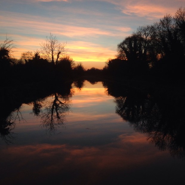


I usually find forestry boring to walk through but here it seemed more open with cleared views and plantings of beach. 


I don’t know wether it was bad signage or loss of concentration but somehow I missed the turn to take us up over the top of Carron mountain and had to use the maps I had downloaded from the irishtrails website to follow forest tracks around to get back on track. In doing so I came upon the site of a party held many years ago where a troop of scouts had hiked through the marquee erected over the trail during my early morning ambient set. A surreal memory. 


As is the sideways image of the site that I cannot make go the right way up. 

We reached open moorland 

and climbed to the Ways highest point at Castle Phillip (477mt) and down a little to camp witha view North. 


A fine sunset

and a fine sunrise


We carried on down through the forest with more bike trails

and the Ballyhoura Trim Trail, a looped circuit of exercise stations for sit ups,  parallel bars, hurdles, ladder walk etc


There were info boards on different species of fauna and flora and a bridge led us through a lovely beech wood. 


Out to open country again overlooking the vast 6500 acres estate of Castle Oliver where the tree planting in the 18th century was based on the battle positions at the battle of Waterloo and was thought to be the birthplace of Marie Gilbert better known as Lola Montez, actress and dancer and mistress of King Ludwig of Bavaria. 


One of the gate lodges of the now broken up estate. 

A riverside strip of ash woods led to a collection of holiday lodges both grand and basic


though none as basic as the little off grid Eco cabin we came to a little later

A lot of wind blown trees on Ballyroe Hill made for an interesting archway  n the way to Kilfinane the main town of  the Ballyhoura Country area where the lady in the impressive info centre ran around sourcing maps and guides for me and water for the dogs. On the outskirts of town the site of the old corn mill set up by Richard Oliver which brought prosperity to the town was being invaded by Knot Weed. 

The sun shone brightly lighting up the gorse flower on the trail with the Galtees now in sight. 


Some unusual fencing made the section of road walking to Galbally more interesting. 


After over 30km it was good to get to Moor Abbey our campsite for the night on the banks of the river Aherlow. The abbey had a troubled history, taking 300 years to complete and being burnt 4 times. Legend has it that 3 Friars beheaded by Cromwells men shed no blood. 


The next morning started with a 2km walk along the riverside and another km up hill across open grassland and fields to the track that traverses Slievenamuck with views across to the 3000ft peaks of the Galtees. 


There had been a fire in the forest the previous weekend that came perilously close to the houses there. 


Not long after I got lost trying to take a “short cut” to avoid a  bit of road walking. Not having my GPS on me I couldn’t work out where I was and ended up on a looped trail to the top of the ridge. 


Seeing Tipperary laid out below me I made the brave but foolish decision to head straight down to a road leading there which involved a lot a clambering through nearly impenetreble  thickets and forest. 


We made it , just, and a 4km road walk took us into Tipp where we took a taxi in half an hour the 3 day route back. 

NORTH KERRY WAY: Kerry Head to Tralee 13/14th April

20/24km

The North Kerry Way starts in Tralee and goes north up the coast to Ballyheigue before doing a loop around Kerry Head. I left my van in Ballyheigue ,did the loop on the first day, slept in the van,continued to Tralee the next day and then got a cab with the dogs back.

IMG_2086

An old narrow boreen lead us out of BallyheigueIMG_2087

climbing up to higher ground passing the ancient earthwork of An Clai Rua [track of the red ditch] a 6 foot wide bank that runs intermittently from  Kerry Head all the way to Co. Limerick.

IMG_2106  A much quieter way than it’s neighbour the Dingle Way through a landscape dotted with many signs of abandonment both ancient and modern.IMG_2088 IMG_2089

I took a detour of a couple of kms down towards the sea to visit the well of St DahalinIMG_2092

known as Tobar na Sul [The spring of the eyes] which is reputed to heal blindness and still visited by people who come to bath their eyes in the holy waters. We picked up a huge greyhound there who was determined to follow us IMG_2099

and it took an hour to find the owner and move on up the gorse lined bog road to Maulin mountain.IMG_2101

Good boots were needed on a long wet stretch of sunken path that must be a river in the rain.           IMG_2102

Towards the top the track became wide and open again and the views opened out to take in the mouth of the Shannon all the way down to Limerick and across to the south Clare coast and Loop Head lighthouse.

IMG_2105 IMG_2104

A tiny path lined with newly and optimistically planted trees IMG_2107 took us over Triskmore Mountain and down to a track leading west, passed more hounds IMG_2109 and dumped rubbish IMG_2110 to the end of Kerry Head where the farm would not win any prizes for eco awareness. IMG_2113

Turning south the expanse of Tralee Bay lay before us from the Slieve Mish range all the way west to Mount Brandon at the end of the Dingle Peninsular.The fine grassy fields were in south facing strips down to the sea from the road we followed past more old cottages back to Ballyheigue Bay.IMG_2114

IMG_2115  IMG_2116 IMG_2118 IMG_2120

Next morning we headed off down about 8km of wide empty beach going inland briefly on a sluice bridge over the Tyse river IMG_2127

and across the flat heath Cul Tra “the back strand”, the dogs excited by the rabbits and skylarks.

IMG_2129                            IMG_2130

Back to the beach above Banna where the view was distracting enough for me to miss my path

IMG_2132                           IMG_2138

off the beach which meant i had to cross the luckily low tide sands of Carrahane Strand to get back to the road.

IMG_2142                          IMG_2144

The road was fairly narrow and fairly busy with no verges or easy escape from the traffic with the dogs so i was glad when we crossed the old Tralee to Fenit railway line and came down to Spa harbour.IMG_2151   IMG_2152

In the 18th century this was a popular and fashionable location when many of the large local English population came to take the mineral waters there. I don’t know if the sea wall i now followed was part of the relief scheme work carried out during the famine but half way along is a small bridge called Meal Bridge and was where the workers collected their Indian Meal payment.

IMG_2155     IMG_2153    IMG_2156

A deep narrow channel through the shallow water of the bay leads to “The Point” where the Tralee shipping canal brought freighters safely up the 2 1/2 kms to the city for 100 years.

IMG_2158     IMG_2159    IMG_2161

It passes the windmill that was restored by local people and continues to grind grain and now also holds a museum of famine emigration in ships like the Jennie Johnston whose replica was built here recently.

IMG_2165      IMG_2164

IMG_2167

The Ireland of today is in a very different place toothed and all the talk of austerity and the hardships of water charges are bought into perspective when you walk, blissfully, on “amenity areas” overlaid onto the spine of a desperate past. The landscape is/was beautiful, I only hope it gave some succour to the sufferers of the past.

ROYAL CANAL: Ballymahon to Longford 8th April

22kms

Clear skies again with the promise of another hot day once the most had been burned off.  


Our last day on the walk and we had decided we would walk up the canal branch to Longford and try to get us and the dogs on the train back to the car at Maynooth. 

At the next lock the keeper told us that there were lots of leaks and it was a bit of a struggle keeping water in some sections. Sure enough later on we noticed that the level was down at least a foot between a couple of locks. 

There is currently a lot of work being done on the towpaths creating the walk/ cycle way and dredging and clearing the canal itself. We came upon one of the diggers with a massive arms for scrapping the opposite bank. 


After a longer than planned breakfast stop at Foigha bridge waiting for the shop to open it was out onto the Corlea bog where the visitor centre that displays the Neolithic timber trackway has been making a path out to the canal. 


It was a lovely peaceful stetch of wildness through the land that time forgot. We passed another little canal house slowly disappearing into the bog. 

It was sad to think of all the work and effort that had gone be into the 30 years of building the canal only really funcioning for another 30 before the railways signalled the end to the endeavour apart from a few years over WW2 when fuel shortages encouraged horsedrawn barge transport. 

The massive clearance task taken on by the voluntary Ammenity groups over decades was really brought home to us when we got to the Longford branch and saw it was blocked off and unrestored. 

Time for a rest with just 8kms to go. 


On the outskirts of Longford a roadbridge over the top of the canal shows what little regard the planners of the seventies and eighties had for the amazing structure we had followed across the country for 125kms. 


All of Ireland’s inland waterways are a beatiful way to explore what is still”real Ireland”. I hope that the creation of the new walk/cycle tracks and greenways encourage more people out there to enjoy the sadly under-utilised resource. 


Mission accomplished. 

ROYAL CANAL: Coolnahay to Ballymahon 7th April

28kms

Another cold clear night under a micron of nylon and a frosty start to the day. There was a skin of ice over everything and no camp fire to dry/warm things over so we put the tents away wet hoping to dry it all out at camp that night. 


After reclaiming my battery pack that had been charging in the tea room all night and a chat with the friendly lock keeper, who we have awarded best of 2015, we headed off down past his canal side gardens and tree planting on a newly laid walking / cycling track. There was a rash of bridges and locks over the next few kms some sporting interesting graffiti and some with neatly kept flowerbeds. 


Then quite a long straight section across empty flat land on the approach to Ballynacarrigy. 


The lock keeper of the year had given us fresh scones for breakfast but we needed more so we stopped at the impressive harbour there for coffee and chocolate and marvelled at the unknown or celebrated attractive villages we were discovering on the canal. 150 years ago this backwater was a important trading centre and had in the early seventies formed the first Royal Canal Ammenity Group which kick started the whole restoration process. By 1990 the canal had been, bit by bit, cleared and rewatered from Dublin to Mullingar but it took another 20 years to complete all the way to the upper Shannon at Tarmonbarry. 


We carried on towards the bog at Ballymaglavy passing an abandoned canal house that would have made a fine home for the night. 


We went over the beginnings of the river Blackwater 

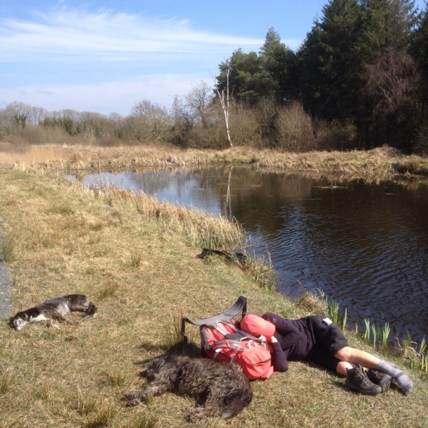
and across a  vast expanse of bog where the turf was being harvested in a way we hadn’t seen before. 


There was yet another of the meloncoly bridges to nowhere

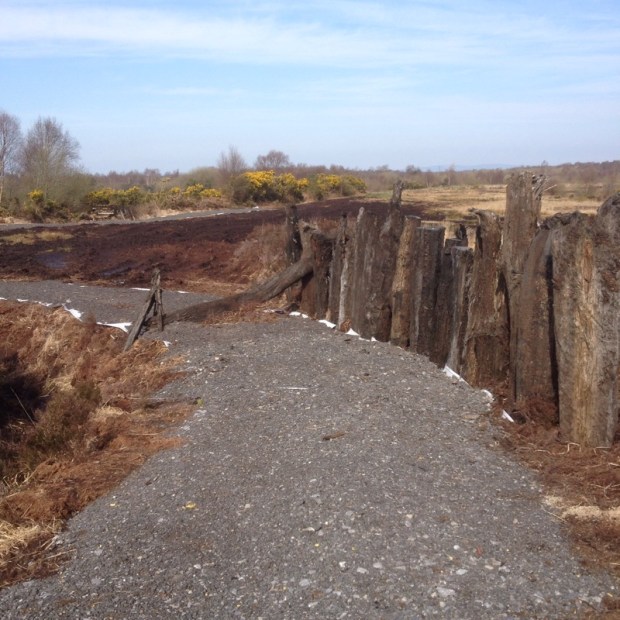
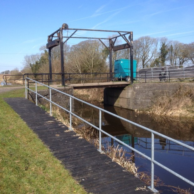
and a derelict lock house with an interior that needed a severe makeover. 


We crossed over the river Inny and past an airfield on the outskirts of Abbeyshrule where we had soup and sandwich to get us through the heat of the afternoon for another 12kms. This section of the canal is very twisty turns with a series of curves and bends following the river valley and is also the most level with 11kms between locks. 

By the time we got to Ballybrannigan harbour I was ready to join the swimmers

but we needed to go on a bit further to get supplies and camp. Sally headed into Ballymahon, celebrating its massive investment by Centre Parcs, to get dinner while I took all the kit on to Archie’s bridge and set up camp. 

A nice sheltered spot by old derelict canal warehouses kept us warmer than previous nights but it had been a long hot day and my track buddies feet were suffering. 


ROYAL CANAL: Killucan to Coolnahay 6th April

26km

A quick posting so as not to get too far behind real life events but with dwindling battery and meagre coverage and dogs and track buddy keen to get going. 

A lovely misty start after a cold clear night. There was a hard frost and our bags had done well to keep us cosy. The problem with the cheap one skin tents is the condensation on nights like that so we spent a while drying gear before heading off. 

There had been a run of 6 locks in quick succession and we headed past the charming 7th to bring us up to the summit level which was to then run flat for 24kms. 


Before long we had got to the (closed) pub at the road bridge replacing the old Neads bridge which had very nearly been built too low to allow any canal traffic before it had been restored. 


We’ve been past a few of these “accommodation ” bridges built to facilitate farmers and raised by hand. 


For a long stretch towards Mullingar the engineers had chosen a route which involved a lot of deep cutting though rock which pretty much bankrupted the company again. 


The outskirts of Mullingar were pretty grim with terraces of boarded up housing and swans swimming amongst filth. 


The railway line to Athlone was abandoned and one particular spot was bush drinking central station. 


There had been a lot of restored and gravelled or tarmaced tow path in Westmeath for walkers and cyclists and a lot of it was part of the Dublin to Galway greenway being got together. It looked like they were getting this deserted line done as part of it. 

After Mullingar the way was really lovely and the swans had a nicer time of it. Nice harbour at Ballinea with picnic tables and grassy bits etc but we decided to carry on to Coolnahay, recommended by the lads on the barge. 


We were glad we did. It was a beatiful walk in the sun to get there and we had tea and scones in the little old lock keepers cottage and camped on the grass surrounded by flower beds and benches. There was a water tap and toilet but we were a bit dissapointed to discover no pub. 


ROYAL CANAL: Enfield to Killucan 5th April

24kms 

A disappointingly cloudy start to a disappointingly cloudy day and by the time we had faffed around packing up etc it was 10,30 before we got going. 


There were more people out and about running and walking down the tow path. Easter Sunday strolling. 

Before long we got to the Meath/Kildare county boundary and the river Blackwater aqueduct. 

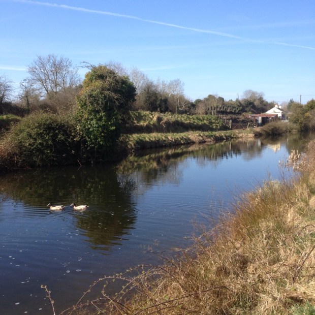
The aqueducts are very hard to photograph Lord knows how hard to construct. My admiration for the engineers and labourers of the time grows with every passing km. 

After Kilmore bridge

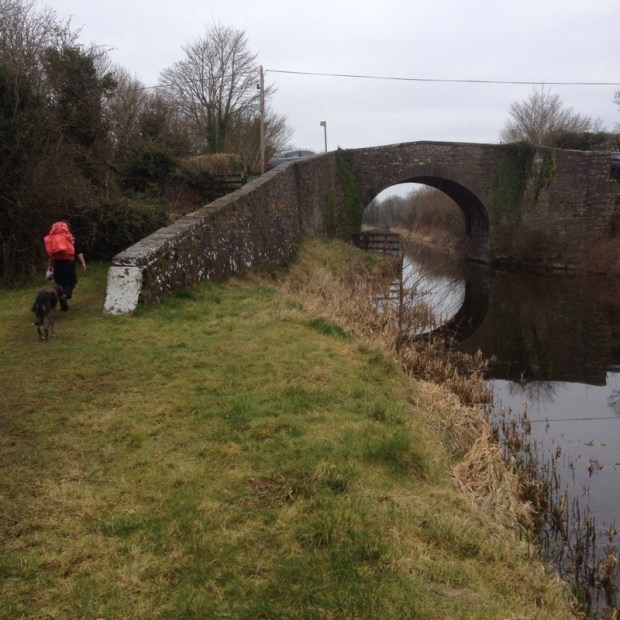
the canal went through a lovely wooded stretch awns the towpath became narrow and lined with primroses. 


The next bridge Moyvalley, had a nicelooking canal side pub/restaurant but unfortunately we were too early, or maybe it was just as well. There was a big fishing competition going on with a long line of guys and a mass of gear strung out down the towpath. 


The line ended at the Ribbontail lifting bridge, built to facilitate people going to the nearby church but ironically a favorite hang out of the Ribbon Men, naughty men who back in the day would make holes in the canal bank to cause big breaches which would create loads of work to repair. 


Good rich land surrounded us. Big fields. Big trees. Soon we crossed high above the river Boyne on another aqueduct.  


A very cheery lady called Sadie passed us going the other way and a few kms later caught up with us from behind. I fell into step with her for a chat for awhile but her 76 year old pace was a bit too much for my track buddy who has been suffering badly from cold/flu and it was as a relief to e able to slow down again when she peeled off. 


An inspiration. That gives us another 15 years anyway. 

A nice length of wilder path got us to the pub at the Hill of Down where we had been hoping for lunch. 

No luck beyond Guiness ,lager and crisps which kept us going another 8 kms to the great pub restaurant Nanny Quinns at Thomastown harbour where we had a slap up. 

Near here were moored up the last two working barges on the canal but it must have been awhile ago. 


We camped up on a lovely spot not long after and a new barge came through the lock. 

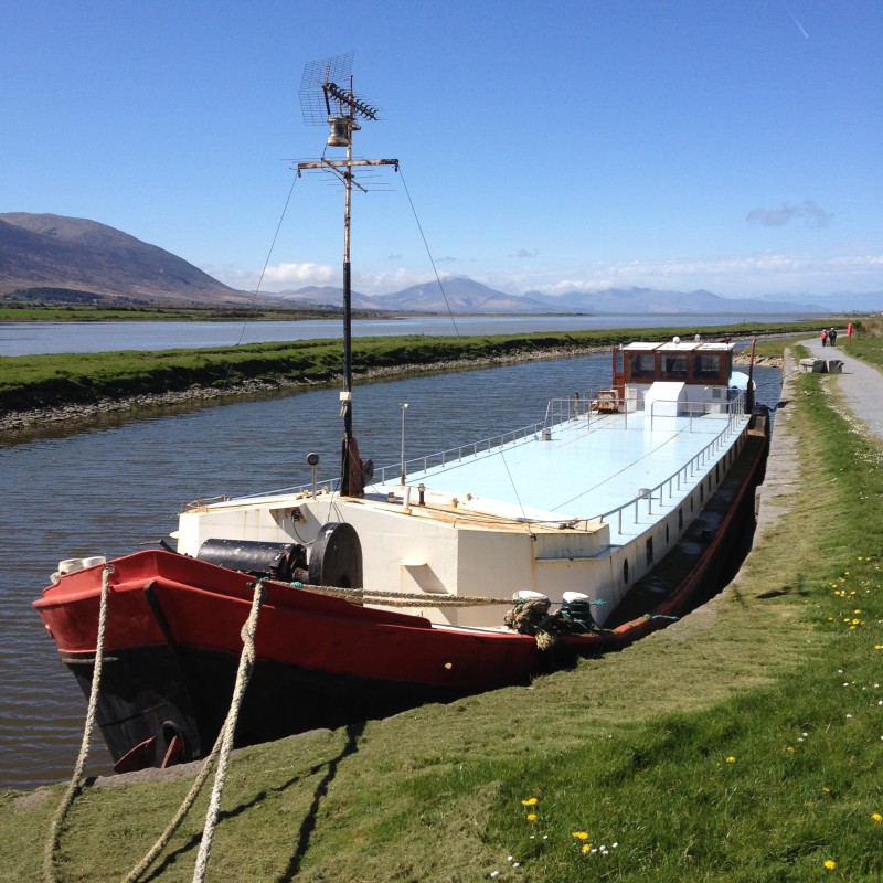
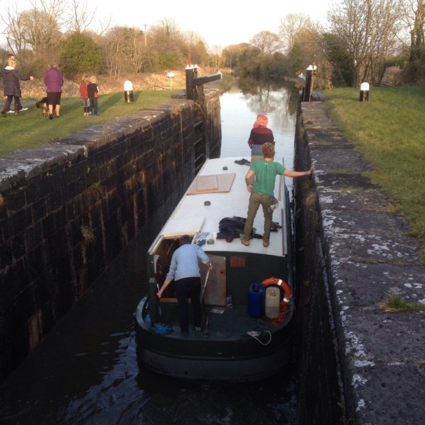
A nice lad had just got himself a 20 grand bargain. New Diesel engine,7 year old steel hull. Him and some mates were taking it down to Dublin to live on. Their first boat trip. It had already involved a trip to hospital for a load of stitches after the lock key had  spun on the rachet and cracked yer mans head open. Good luck to them. 


So time for gathering firewood and settling in to admire a nice sunset as the clouds had finally gone.