GR7: Rio Gordo to Ventas de Zafarraya

IMG_0083

On a (too) short break in  Spain last week we tackled the local section of the GR7 route that works it’s way 1900km from Tarifa on the southwestern tip of the country, through the regions of Andalucia, Murcia, Valencia and Catalunya.

And the Spanish trail is only a small part of the International E4 route, starting in Portugal and traversing Spain, Andorra, France, Switzerland, Austria, Hungary, Romania, Bulgaria, Greece and finally Cyprus making up an epic 10,500 km. Thats some hike.

Unfortunately we didn’t have time to do the whole thing and so made do with a 500th of it.

IMG_0048

Starting out in the early morning light we climbed a long way up out of Rio Gordo north, over the main road towards Malaga, past a lot of the prickly pears that been struck down with the white fly infestation of the cochineal beetle that is a relative of the one that produces the vivid red dye and ironically the original reason for the introduction of the prickly pear, its home and food source. But for some reason the population of this species is out of hand and has wiped out the iconic pear across a large and growing area of Spain.IMG_0053.jpg

It took us about an hour to climb the couple of hundred mts up into the sun, levelling off at  about 650m with fantastic views back down the sierra and on towards the imposing bulk of Dona Ana.IMG_0064.jpg

The wild flowers were a glory, mid April, and although a good few had obviously gone over there were plenty to admire, and smell, and gather seeds from.

IMG_0063

Even though there had been very little rain all winter the fields of grain and broad beans were green and the hedgerows lush. The colours of the flowers were very vibrant in the sun and the buzz of insects became loader as the heat started to rise.
IMG_0068

The broad open flatish land up on the high ground below the limestone peaks was obviously richer and easier to cultivate than the steep and stony olive groves of the lower levels and it was up here that the oldest and biggest fincas or cortijo seemed to be.We approached the crumbling ruins of one that was supposedly the birthplace of Andalusia’s famous Robin Hood figure Omar Ibn Hafsun whose rebel army controlled a vast territory in the 9th century, but had since been used to house a load of sheep in sheds above some ancient caves in the cliff.IMG_0069

From here a narrow and sticky farm track that gathered on our boots as we went led us between the fields yellow with some weed or old crop (rape? mustard?) , across a little arroyo running with the previous mornings rain, and slowly down again to reach a road.

We hit tarmac for awhile at the Puerto del Sabar at 600m but the wide views and wealth of roadside flowers made it an enjoyable stretch until we crossed a river  and turned up a narrow track and gained height again to reach a little hamlet with a bar and an interesting looking Casa Rural.

Climbing up and away from the houses on a track that heads southeast around the hillside we had our first view down the valleys towards the reservoir at Vinuela and beyond it in the distance the twinking Mediterranean .IMG_0111

Before too long we were approaching another fine old Cortijo, this one boasting a cobbled track and era (grain threshing platform. Not far beyond Sally got a bootfull in a puddle and we stopped for lunch by a fountain on the way into the elevated village of Guaro.

We needed the sustenance to fortify ourselves for a pretty big climb up out of the prosperous looking village and up to the crest of the hill at about 900m where we turned left to join an old railway bed that was built to accommodate mine workings in the mountains and led us eventually all the way to Ventas de Zafarraya.

We had more great views across the sierra and down to the lake and at one point there was strange bridge across the track whose purpose we could not determine.

We crossed into Granada province as we approached the end of our 8 hour 30km journey.The highest mountain in the area , Maroma, at over 2000m, came into view and soon after we passed through a short section of tunnel and through the gap in the ridge thats allows the road up from the coast and into the high plain beyond that is a very productive vegetable growing area. Many of the (presumably low paid) workers on the land here seemed to be immigrants from North Africa and we shared the plaza and bus stop with some of them.

We passed a sign on our way into town that showed we were right on time.

8h. Eight very enjoyable hours on the GR7  E4. Only another 500 days to go.

IMG_0158


SUCK VALLEY WAY: 30/31st March 2016

Our last outing, to Inishbofin, was prompted by the presence of a WWOOFer and my next was made possible by the absence of another. She had to cancel her visit at the last minute which meant i had a couple of, thankfully, fine days to explore the little visited hinterlands of northeast Galway and west Roscommon on the Suck Valley Way, a 105 km clockwise loop from Ballygar to Castlerea on the western side of the river and back down on the eastern.

A relatively unsung Way, this modest low level route passes through the heart of rural Ireland on minor backroads and boreens, across turf bogs, through wooded areas and pine plantations, riverside paths and a surprising amount of crossing of rich grazing farmland.The journey through the quiet countryside reminded me of other neglected Ways i had hiked in the midlands a couple of years ago in Offaly and the Slieve Blooms and there is something about these overlooked areas with their abundance of abandoned houses that i find really attractive in a slightly melancholic way. Perhaps they are far more “Real Ireland” than the lavishly marketed and hyped routes along the Wild Atlantic Way, and although they lack the rugged splendour of the Western, Kerry, Dingle and Beara Ways the big open skies of the flat boglands and the wildflower lined boreens past once loved homesteads exude their own hypnotic charm.

They also go through more villages, unfortunately these days not as lively as they once were, but still a source of interest and hopefully sustenance, requiring less need to carry supplies. The bulk of the country is made up of hundreds of these minor settlements and to visit them is to see where a lot of Greater Dublin, with nearly half the countrys population, has emigrated from. The emptying villages the Way passes through, Ballygar, Creggs, Glinsk, Ballymore, Ballintubber, Donamon, Castlecoote, Athleague, Mount Talbot have also lost countless to America, Australian and the UK and with little tourism only agriculture remains. But less is more, and small is beautiful, and the quiet,empty, green and unspoilt (mostly-rubbish dumpers are everywhere) nature of the midlands could be it’s greatest asset.

Bord Failte have been pushing the Wild West and the Ancient East, let’s hear it for the Forgotten Midlands.DSCN2988

Sally and i had done a 40km loop from Ballygar a couple of years ago, crossing over the river at Dunamon to circle back to Ballygar, so that left me with a 65km stretch to finish over 2 days. Starting at the graveyard in the downland of Kilbegnet, i planned to get to a B and B in Castlerea for the night and carry on down the east side of the valley to Dunamon where i could cross back over. With a weather forecast of minus 2 overnight i didn’t fancy camping which meant i had a light pack, although it did contain a load of waterproofs that luckily i didn’t need.

The graveyard apparently contained many victims of the famine which seemed ironic as i gazed over the rich productive farmland that had been settled for thousands of years and was the site of a church dating back to St Patrick’s days.DSCN2956

The Way took me down a minor road towards more marginal land on the edge of Rosmoylan bog and past a collection of covered turf piles and a wall mounted dustbin that seemed like installations in the landscape.

Leaving the last of the housing behind i headed out on a track across the bog, still supplying a lot of fuel despite the recent legislation that forbade a lot of the turf cutting. There was a patch of ancient oak, hazel and holly woodland , a lough that had been home to a hermit named Peter of the Pikes and more modern archaeological remains.

Emerging back onto tarmac briefly i came to a sign warning of possible flooding on the main overland (or water) route and advising of a longer, dryer roadway alternative.With 30km to do that day i didn’t want to lengthen it any, so i continued and before long came to a high footbridge over a stream or drain feeding Lough Loung. The massive rainfall over the winter had caused widespread and long-lasting flooding on the Shannon and the Suck and it still hadn’t gone down enough for me to avoid taking off my boots and socks at this point to paddle up to higher ground. Still, the reedy debris on the bridge told me i would have been up to my neck in water not long ago.

Then it was a short hike across more scrubby bog to the shores of the Lough where access by a boreen has made it a charming and peaceful park up for the camper van. More lush farmland led to a passage through a forestry plantation and a pleasant stretch of woodland on the outskirts of Glinsk.

Another section of farmland drain by a multitude of ditches brought me onto a track leading across heathy bogland that was being well and truly infested with the rhododendron scourge.

DSCN2987

Into Ballymoe and, strangely, the empty shops at the southern end of the village seemed to have been taken over by a radical pro beard movement.

At the other end of the street, behind the old abandoned Church of Ireland , was a neglected tomb for the Bagot clan who where the landowners of the area and have a Dublin street to their name.

DSCN2997

A bizarre and somewhat sinister story concerning the church tells of how Mary Burke,the niece of a Catholic bishop had wanted to convert after attending lectures there by the Reverent Welden only to be locked in a lightless room for a month by Fr O’Connor and some of her relatives and then starved for days in an attempt to force her to attend mass. Mary managed to flee to Castlerea where she was put under the protection of the Royal Irish Constabulary.

Leaving the village on a bridge over the river it was back to the bog at Corliskea and more thoughtful artistic pieces dealing with the meltdown of consumer society and it’s hostile reaction to pervasive technology. Or not.DSCN2999

DSCN3006

After that is was nice to enjoy the bright spring sunshine among the happy sheep families in the pastoral splendours of the riverside pastures. Even though it was pretty wet going at times my HiTec boots performed very well and i arrived at my B and B on the outskirts of Castlerea weary but dry.

Revived by cups of tea and a hot shower i went for a fish and chips dinner in Castlerea , neither of which i found very inspiring and was disappointed that the possible excitement of “The only pub in the world with a train in the bar” was closed.

A bright morning with a sparkling frost that made me grateful for the nights warm bed saw me retrace my steps to Cloondacarra bridge and a drainside section of track alongside the prison, that had been badly poached by horses.DSCN3020

Crossing the main road by the traveller site the lane that led to the Dublin-Westport railway line had been visited by a heath conscious litterer.

DSCN3028

Over the train track and along some tranquil lanes past remnants of a 5th century monastery founded by St Pat’s nephew Brochard and more real estate of potential i had to negotiate fields of lively cows before coming down into Ballintober and the ivy clad castle ruins.

The 13th century castle has been the scene of many battles and sieges but now all is quiet in this well kept tidy town winner with its Bridgits Well and Memorial and Biodiversity Gardens. There is a grocery store from a byegone era with its window display of essential items of the past and elsewhere an intriguing building of unknown use.DSCN3044DSCN3043 After lunch at a picnic table i had a long section over farmland criss-crossed with drainage channels and badly poached by cattle. One herd of cows had a frisky collie harassing them, nipping in to snap their snouts when they lowered their heads to graze.

Some of the landowning farmers (or maybe volunteers)along the way took great care over their segments, fencing off the livestock, clearing the brambles, putting down stepping stones and even providing picnic tables. Others didn’t bother, making the walker negotiate strings of temporary electric fencing and slop through a sea of mud. In one field someone had set a couple of wire snares across an animal run which could have upset an unwary hiker.DSCN3050

A firm raised path through a wood got me out of the preceding slop and up to some higher ground.After the vehicleless farmland it was a bit unpleasant to have to approach and cross the noisy N60 but i was soon away from it and enjoying a hike on bogland next to the much less used railway again. The turf here was very deep and impressive ditches had been dug to drain off the banks.

DSCN3048DSCN3051

Corbally Bog was succeeded by a bit of field path, a lovely dead end boreen and a track leading past an abandoned farm with huge mature beech trees to a sylvan riverside setting. Briefly turning away from the waters i came to another flood warning sign and longer alternative route. With the end in sight (figuratively) i was not for turning and carried on down a bog track to the river again. Waving to a solitary fisherman i followed the way marks into a birch wood which turned into a rhododendron forest before emerging ,once again, Suckside.

DSCN3054

So that was it more or less. A few pleasant kms alongside the water  brought me into Dunamon, with a castle that had originally been the stronghold of the O’Finahty clan, then the Norman English Burkes, then Cromwellian then an estate belonging to the Caulfields and finally in the 30’s became home to the Divine Word Missionaries and a care home for disabled.

DSCN3055

It was a fine building, but as i made my way slowly and wearily back to the van i reflected that it seemed a little out of character with the small and humble dwellings that had typified this enjoyable ramble.

DSCN2968

INISHBOFIN:19th March 2016

3 months since a Ramblingman posting i thought i would report on a couple of recent excursions or micro adventures as i believe they are called in the on-trend world.

IMG_4971

The first was a trip we’d been meaning to take for a long time. To take the ferry from Cleggan on the northwestern tip of Co Galway the 7 miles out to Inishbofin or to give it’s proper name, Inis Bo Finne, the Island of the White Cow. The inspiration to finally get it together was supplied by the presence of our WWOOFer (Willing Worker On Organic Farms, or nowadays for some reason changed to WorldWide Opportunities on Organic Farms). We wanted to show off Connemara to Hanna on her first trip to Ireland from Germany.

It was a fairly gloomy day driving through the bogs and mountains and the clouds hung low over the sea as we boarded the boat along with a surprisingly large amount of other folk and the two dogs.IMG_4956

We had been having beautiful spring weather recently so it was a bit disappointing to gaze out towards the grey 6 by 4 km smudge on the horizon and back towards the twelve Bens and the Maumturk peaks lost in cloud.

IMG_4959

It took about half an hour to cross to the island and pass the beacons that led ships into the fine sheltered harbour below the smattering of buildings that comprised the main settlement.

IMG_4960

The island has three looped walks and with 4 hours available to us we had combined two of them, the Middle and Western Quarters. Climbing up from the harbour along the network of boreens we started out on the Middle Quarter loop first, albeit in the opposite direction to the way marks, which possibly explains how we got lost fairly soon after passing the cottages,new and old, and heading out north towards the islands high ground.IMG_4966

Passing an airstrip carved into the rocky and boggy ground we took the wrong turn but only had to climb to the highest point to get back on track and admire the views east towards the mainland and south across the ocean.

IMG_4973

IMG_4972

Rejoining the way marked route we descended from the 90 mt highpoint towards the bog track leading to Loch Bofin and the pebble embankment separating it from the Atlantic at North beach.

IMG_4976            IMG_4977

Following a flock of sheep being herded along a boreen we moved on to the open expanse of the Westquarter and now in bright sunshine passed by the sad monument to the memory of some American students that had drowned off the coast here in the 7o’s. IMG_4982

IMG_4979

Somewhere around here there had been a quarry of valuable soapstone which, along with the abundance of fish, fresh water, fertile ground and a sheltered harbour had made Inish Bofin an attractive place to live for the 6-8000 yrs of human settlement. Strangely there are none of the megalithic remains of standing stones, circles or burial tombs that feature on the mainland from that period, leading some people to surmise that a different people with a different culture may have inhabited these islands. There is a promontory fort, Dun Mor, that we under below once we reached the old green road that travels along the southern shore with a warren of rabbit holes peppering the slope below it.

IMG_4986

There is a fine view from this section of the walk over towards Inishark and the now roofless houses finally abandoned in October 1960.We couldn’t resist clambering down to the beautiful pristine beach hemmed in by headlands on either side and after fruitless beach combing to the eastern end, availed of the handy rope to climb back up to the green road.

IMG_4997

IMG_5001

IMG_5002

The sparkling sea and sunshine and soft, sheep cropped grass persuaded us that this was a good picnic spot before we rejoined the tarmac road that serves the simple homesteads and its remnants of rusting transport.

It’s a shame that Inishark could not sustain itself long enough to enjoy the better economic conditions that Inis Bofin seems to enjoy, with new sea defences, a fine and active community centre and a hotel popular with stag and hen nights by all accounts , but it’s lonely and empty stillness could be a draw of itself and can be enjoyed during the Inis Bofin Walking Festival in a couple of weeks (22nd to 24th April) when a guided hike over the island will take place, weather permitting.

IMG_5007

Our ferry awaited and soon we were cruising out past Port Island separated by a narrow gulley and once the castle site of Don Bosco, not the puppet once popular on Irish TV, but a famed and feared Spanish pirate who, along with his mate Granuaile, the pirate Queen, in another castle opposite, controlled these waters and plundered any foolish enough to venture in. Since the 16th century another warlord, Cromwell, has had a presence here in the star shaped shape of the barracks used as a prison for catholic priests from all over the country declared guilty of high treason for being– catholic priests.IMG_5009

It would have been their last view of their homeland as they eventually got shipped out to the West Indies and an unknown fate. We, on the other hand, had the pleasure of anticipating a fair weather drive back through the mountains of Connemara now revealed in all their glory for the benefit of our German visitor.

IMG_5016


MIKUMI NATIONAL PARK, MAFIA ISLAND AND SELOUS GAME RESERVE 17th/31st DECEMBER

  The main highway from the Tanzanian coast at Dar es Salaam cross country to Zambia passes through the 3230sq km of the Mikumi National Park  

 and speed limits and bumps and expensive fines for road kill try to limit wildlife casualties among the many animal jaywalkers.  

We had ticked off a good few sightings before we had even got to the entrance gates 15km from our lodgings in the nearest village.  But once inside and cruising the “drives” with our guide Samuel we were amazed at the richness and quantity of life in the wilds. My phone camera with no real zoom was not the best for intimate animal portraits and we were often too enraptured to put anything between ourselves and the scenes before us but I offer a few pictures as a flavour of the experience.  

 The park is home to four of the “big five”, elephants,Buffaloes, lions and leopards, leaving only the endangered rhino. The phrase refers to the five most difficult animals to hunt on foot and after I had been reading lately of the devastation caused by poaching I was really heartened by the seemingly healthy populations.  


 We slowly moved around from one area to another following large herds and family groups. Giraffe, buffalo, Impala, and also zebra and elephant.  


 At one point we were passing some bushes and saw a young male lion resting in it’s shade. He didn’t bother moving when we parked alongside and we watched him gently slumbering for 15 mins before he rolled over and padded off into deeper shade.  


 An hour or so later I spotted a flock of vultures circling and we headed over to where we could see something on the ground. We discovered another lion, this time female, with a freshish wildebeest kill, which she left as we approached and sauntered nonchalantly passed our land rover within arms distance. Up close and personal.  


 Far less threatening and comically endearing were the warthogs. Normally Mum, Dad and a few kids they were quite wary and shot off if we got too near, tails held high and erect like antenna.  

 There were many beautiful old Baobabs offering shade from the baking sun, one of which we could clamber up into.  


After a day off nursing Tanzania Tummy we were back in the park for another drive before flying off to Mafia from the tiny Park airstrip. We continued to cross off the species, studying the antics of hippo, crocodile,baboon,bushbuck and dik dik. There were also all manner of exotic birds which aroused interest in our feathered friends for the first time.  

 After a long circuit through a much drier and emptier area in the north of the Park it was time to board our little prop plane with no time to visit the facilities offered in the “airstrip lounge” and soon we were enjoying a birds eye view of the park entrance and then the seemingly endless jungle to the east.  


 Our flight path took us over the Selous game reserve we would be visiting after Christmas and we followed the Rufiji river all the way down to the maze of serpentine branches opening to the Indian Ocean through the mangrove swamps of the delta.  

 Minutes later we reached the sandy shores of the undeveloped, coconut covered green wedge of land where more family awaited our arrival.  


 There was one tarmac road on the island and it took us from the only town,Kilindoni, on the west coast to the village of Utende, 15km away by the island dotted Chole bay on the east coast. 

Mafia remains well off the map and has suffered none of the mass tourism that has overwhelmed Zanzibar further north. The rich turquoise waters surrounding it have been known for a while to game fishermen and divers. There is a vast variety of underwater life and a Marine Park, covering most of the south and east coasts, has been established to protect it. Of Mafia ‘s 45000 population 15,000 live within the park boundaries and are reliant on its natural resources for their livelihoods so the park authorities, NGO’s and volunteers help the communities todevelop  sustainable practices. To help fund this and all the other work and research there is a $20 per day charge for everyone staying in the park which we payed before getting to our little bandas in the sand.  

 Didimiza bungalows was the only local owned and run simple resort on the island. There were other boho chic barefoot luxury lodges on better beaches but they cost a fortune and we like to support the little guy not some multinational brand. Besides we had 3 of the 4 bandas and we could use any beach we liked as no one could own them. An exploration the next morning revealed the rustic charms of our immediate surroundings.  


  And so began a week of family games, swimming with whale sharks, watching the fruit bats,snorkelling trips,walking the beaches, decorating for Christmas and feasting on the sand under the full moon with a meteor flashing through the heavens and fireflies flitting about. 


 It would have been easy to stay put and just chill on the beach but we explored the island (by jeep) and the ocean ( by boat). One day we were taken 2 hours out into the Indian Ocean to a tiny little sand spit where a shelter was erected and fresh fish was grilled over a coconut husk fire while we chased ghost crabs and snorkelled on the coral reef.  Very special. 


  It was a great place to escape the rampant consumerism of Christmas and reflect on the simplicity of life led by millions in the world.  

 The smiling friendly people around us were some of the poorest in Tanzania, one of the poorest counties in Africa, the poorest continent on the planet. We felt very privileged to have been amongst them and sad to wave goodbye.  


We had to wave goodbye to half the family as well while the rest of us travelled to our final destination, a tented camp on Lake Manze, way out in the wilds of the 48,000sq km Selous Game Reserve. That’s an area the size of Switzerland free of the detritus of mankind, where other species are free to roam unimpeeded.  

 Our tent was one of 12 set up on the shores of the lake with a big communal lodge to eat and drink and watch the passing elephants from a short distance away.   


 It was thrilling to be deeply immersed in the natural habitat of so many truly wild animals particularly in the company of our 10 yr old grandson who was rapidly and excitedly ticking of the spotted species in his East Africa wildlife book. Thrilling but also potentialy deadly dangerous and we had to keep our eyes and ears open during the day when moving between tent and lodge and at night be accompanied by a Maasai , always cool and serene and able to deter savage beasts with tapping sticks apparently. Early on our first morning we went for a walking safari with our very knowledgeable guide, another Samuel, and again with the added security of an armed ranger who relied upon an AK47 rather than tapping sticks. We examined a wide selection of poo and from them built up an impressive understanding of the ecosystems at work around us. That set us up for a big breakfast before Samuel and champion driver Kamkumba took us off in the jeep to check off more enthralling creatures.  

 On the way in from the cleared patch that was the airstrip we had spotted 2 rarely seen animals, wild dogs and hyena , both resting up after a feed, and now we drove to the lakeside and watched young male elephants push each other around, testing their risking skills, and then a pride of lions. 


 Unlike Mikumi where we stuck to the sandy tracks, in the vastness of the Selous we seemed to be able to go anywhere to find the “game” and our man Kamkumba was certainly skilled at taking a Landrover to the limits of it’s capabilities whilst still providing a comfy ride. He couldn’t prevent a puncture though which gave us another chance to wander about under the Arcacia’s.  


 Later we headed out onto the lake on a boat safari. It was a brilliant way to get close to the shy and retiring hippos and crocodiles and there was a lot of startlingly coloured bird life including kingfishers and fish eagles and the weaver birds with their charmingly constructed nests overhanging the water.  


 It was a stunningly beautiful landscape with the hills in the distance and tall palms rising from the waters. Slowly cruising across the surface was very peaceful and calming in contrast to the life and death struggle that went on all around us., as crocodiles slid into the muddy depths and giant monitor lizards silently stole up on their prey.  

 At one point we approached a large male hippo as he clambered ashore which he was not happy about, spinning round roaring and crashing through the bushes towards us sending us cowering into the boat as we quickly reversed. 

The following day we had a long drive to the hills, known as the Beho Beho, and the hot springs there. As we were leaving some elephants came through the camp 

 and by the time we had got to Lake Tagalala some hours later we had seen all we could have hoped for including, briefly, a leopard. We passed the grave of the Great White(British) Hunter/ Explorer whom the reserve is named after, Frederick Courteney Selous. Killed here by a German sniper in WWI on a strange and mostly forgotten front line. It’s perhaps also strange to name a reserve after someone renown for shooting countless hundreds of animals although hunting is still allowed over the bulk of the reserve if you pay enough. 

We crossed a lot of rugged country and dry river beds, as the promised rains had yet to materialise,and picnicked on the shores of the lake where crocs had just vacated leaving only their footprints ( and a couple of teeth I now treasure).  


 It was madness to immerse ourselves in the roasting hot water of the lava surrounded springs in the heat of an African afternoon, but you don’t often get the opportunity so….. 

 We had our first hot shower in weeks under the sulfurous waterfall spilling into the ponds, raising our core temperature to heights that only a cold beer from the jeep could reduce. On the long drive back to camp we parked up in a shady dry stream bed next to a big pride of lions  

 and we’re lucky enough to come across a large family group of the rarely seen African wild dog and watch the hungry youngsters hassle the adults into attempting to catch a Impala for dinner. Luckily, (for the impala) some spooked warthogs alerted the herd to danger and they scattered out of reach. Live drama.  

 Plenty to talk about over our dinner under the stars that night after negotiating the hippos stomping through the camp. The day before we had to leave was spent on Lake Manze where between bird and beast spotting I caught a couple of the catfish that get big on the hippo poo.  

 We had them for lunch(delicious ), and retired to our tent for the afternoon for what Samuel described as a verandah safari, soaking up the sights and sounds around us and basking in the heat, conscious that it was all coming to an end very soon.   

 And so it did. The next morning Samuel and Kamkumba took us in the jeep for our last trip through the bush back to the little sandy airstrip and stood waving and jumping as we taxied past and slid into the sky above them and an hour later left the wilderness and flew into suburbia Dar es Salaam style.  


Many many hours and later we landed through the thick cloud into a damp and cold Dublin and drove west into a flooded Ireland. 

My year of wanderings , started on the 3rd of January in the Canaries and finishing in Tanzania on 31st December was over and adjustments had to be made. It had been a brilliant time, with many journeys of adventure, mostly on foot. 

I hadn’t managed to cure my wanderlust however so have luckily been able to arrange work commitments around weeks off frequently enough for the pedestrian explorations to continue. 

Watch this space.  


TANZANIAN TREKING: The Uluguru Mountains and Udzungwa National Park 10th/16th December

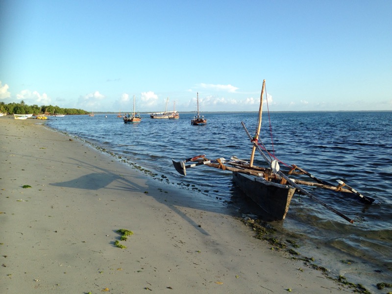
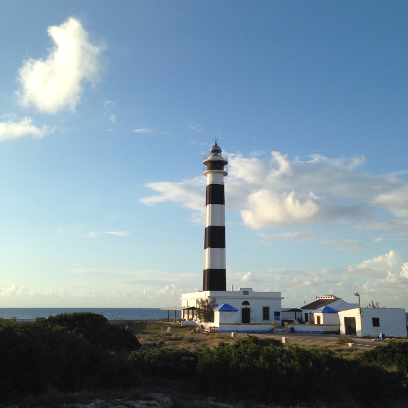
The last trip of my year’s sabbatical was the most distant and the most exotic. 

To celebrate Sally’s 60th we were returning to East Africa after 25 years, this time with grown children, their partners and 10 yr old grandson joining us at various stages. 

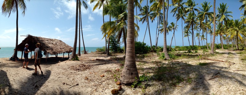
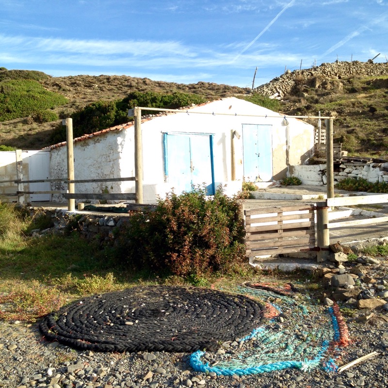
Although not strictly a rambling trip, we did start with a week or so exploring mountain ranges inland before retiring to Mafia island for Christmas so I have posted a blog as my finale of the years wanderings.  

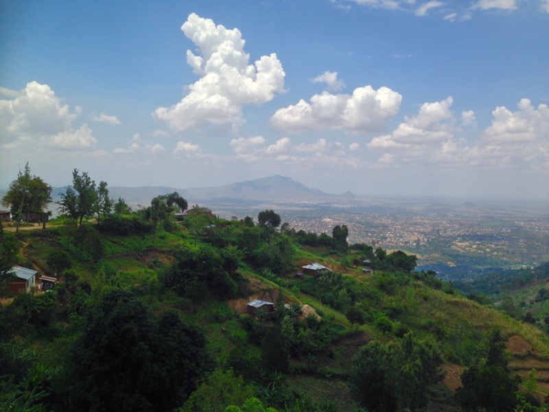
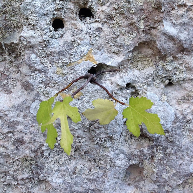
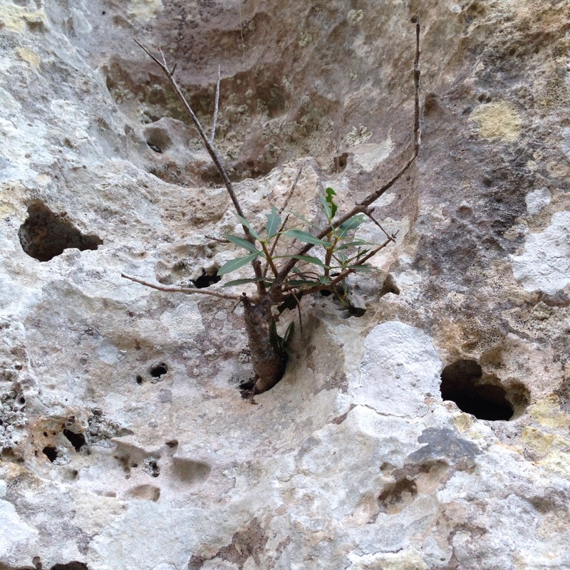
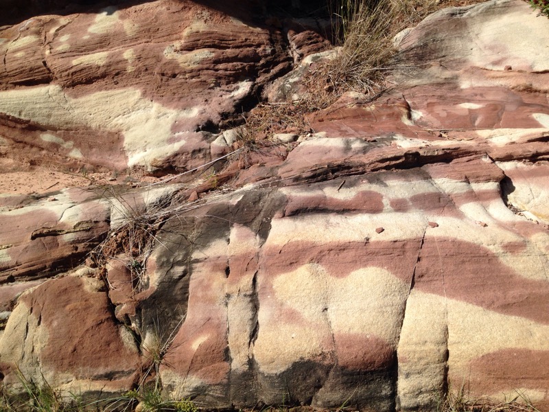
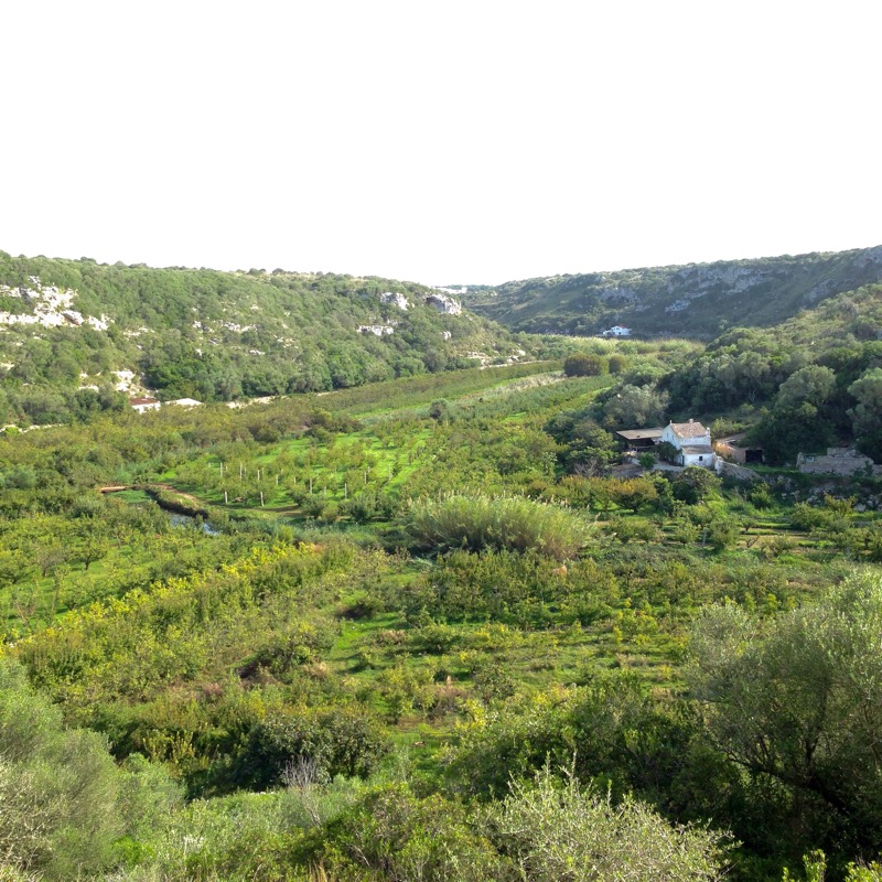
 Rising 2700m from the fertile plains south of Morogoro the lush slopes of the Uluguru mountains were our first destination in Tanzania. They are part of the Eastern Arc chain and contain some of the oldest original forest in Africa on their higher ground with a wealth of endemic species of birds plants and insects.  

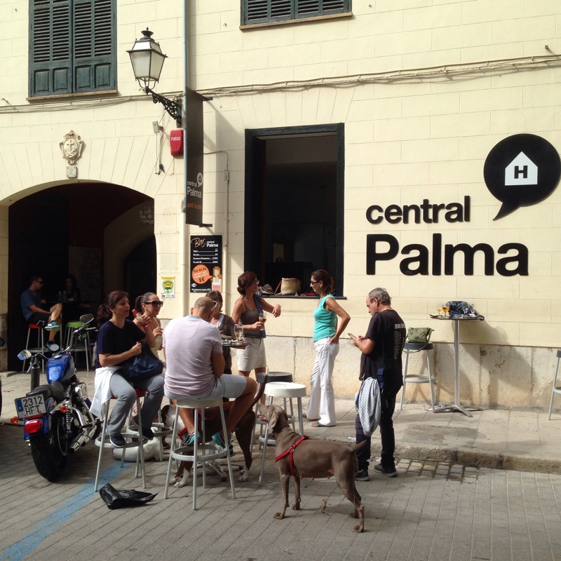
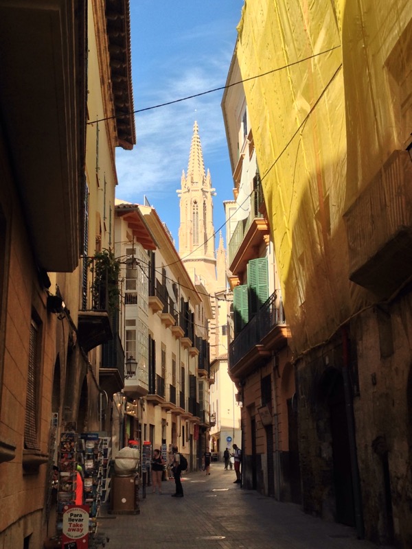
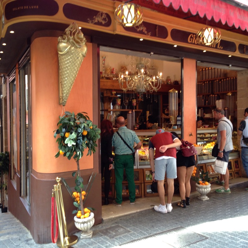
 After 4 hours on the hard seats of a bus from Dar de Salaam we were grateful to be picked up by our Maasai AirB+B host Ibram. After a stop at his nearby home shared with French wife Fanny and baby William we headed into Morogoro, a town of 250,000, to visit the Chilunga Culural Tourism office where we organised a guided hike up to an old German Mission station for the following day. 

Starting at 8am with our guide, Noel, and another trainee we headed up the wide  avenue shaded by “Christmas trees”, so called because of their fiery red flowers at this time of year.   


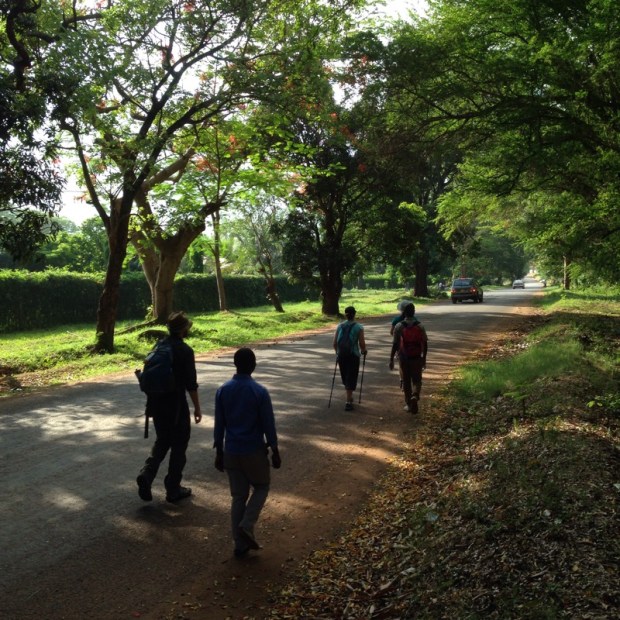
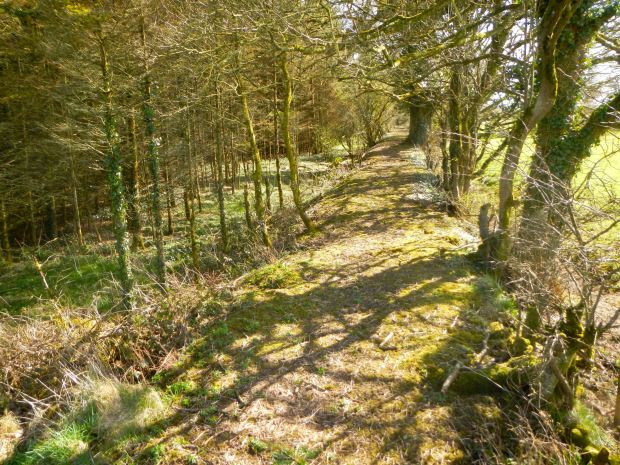
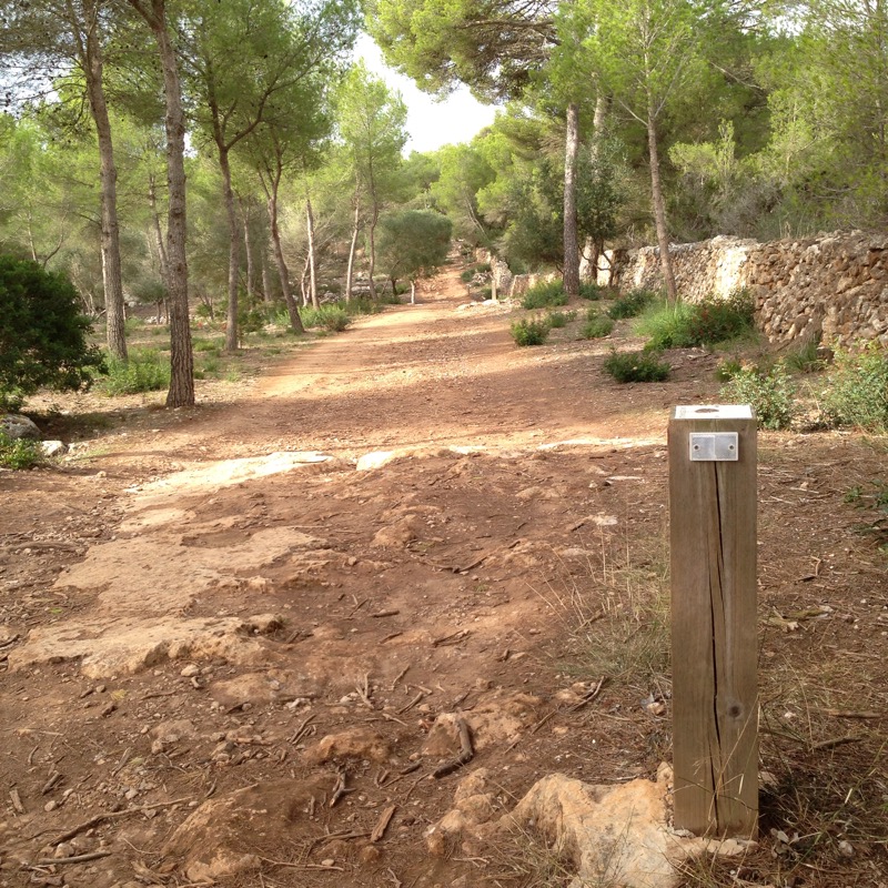
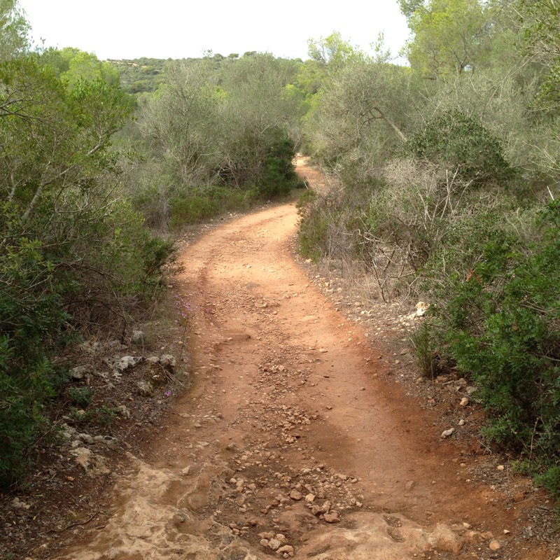
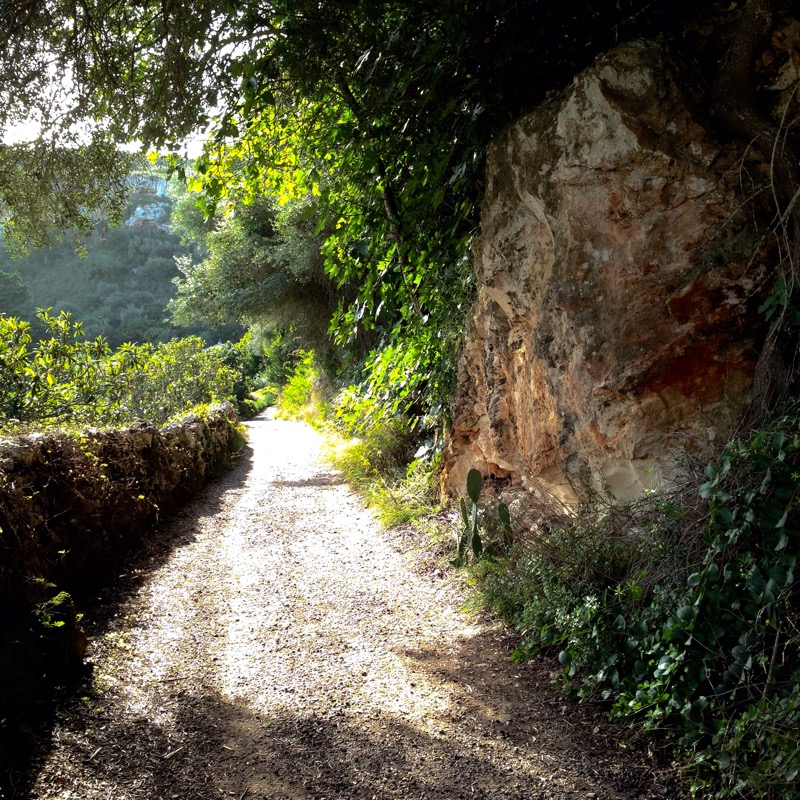
  We were truly grateful for all the shade we could get as the temperature quickly rose to the high thirtys and the humidity reached saturation point. It wasn’t long before we had run out of tarmac and were climbing up the red dirt tracks passed simple homesteads and into a conservation zone.  


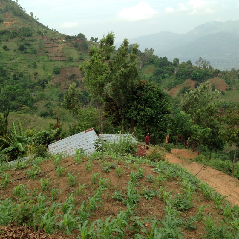
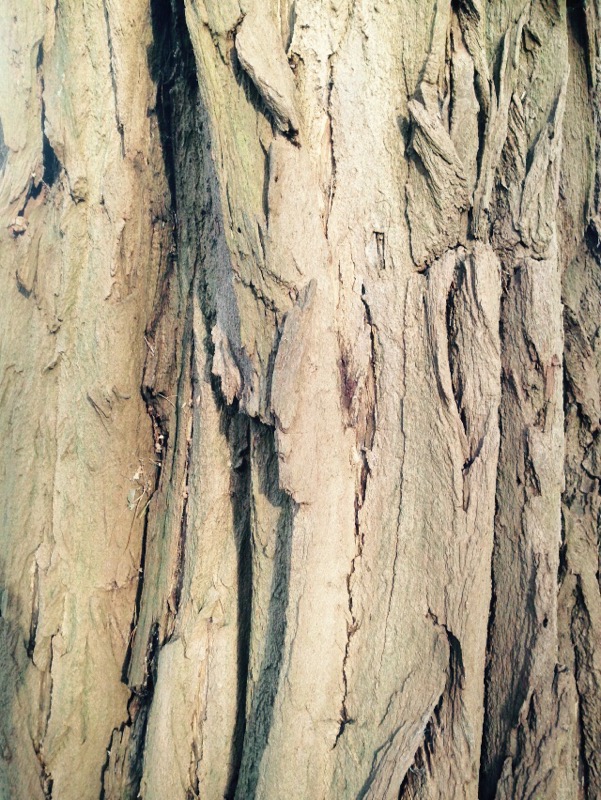
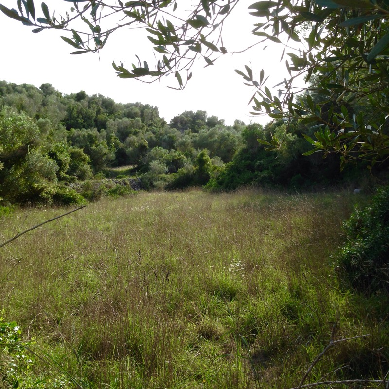
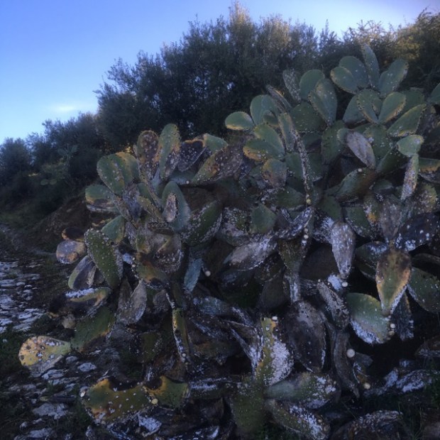
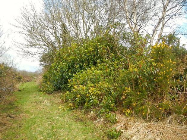
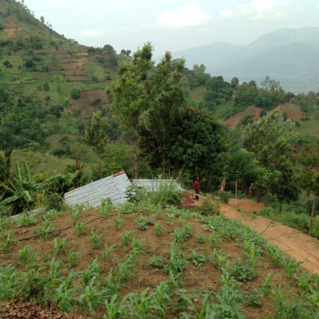
 There were terraces of onion, garlic,beans, corn and a whole load of other unidentifiable crops. The soil looked deep and fertile and there was an abundance of water running in ditches beside the track. Our guides pointed out various flora and told us their uses such as the kapok tree with its seed pods full of cotton like fluff.  


We passed through the tiny village of Ruvuma with its mud and corrugated huts and gangs of kids playing while the adults worked the steep terraced fields scratched into the surrounding hillsides.  


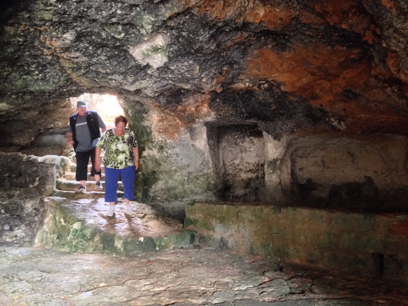
The track narrowed to a path and then became steeper and we stopped when crossing the streams to splash water on our faces and dowse our heads to cool off. The whitish buildings of Morningside became visible on the distant mountainside and half an hour later we were grateful to collapse in the shade after our 900m climb. 


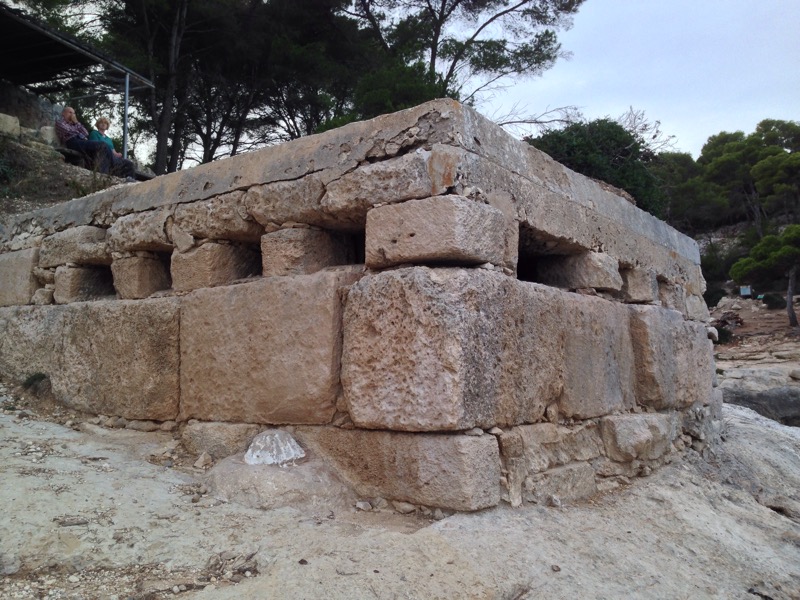
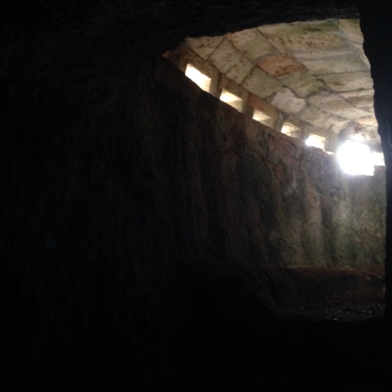
The history of the place was a little confusing but it seems to have been built around 1910 by German  missionaries using slave labour!

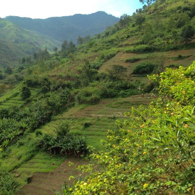
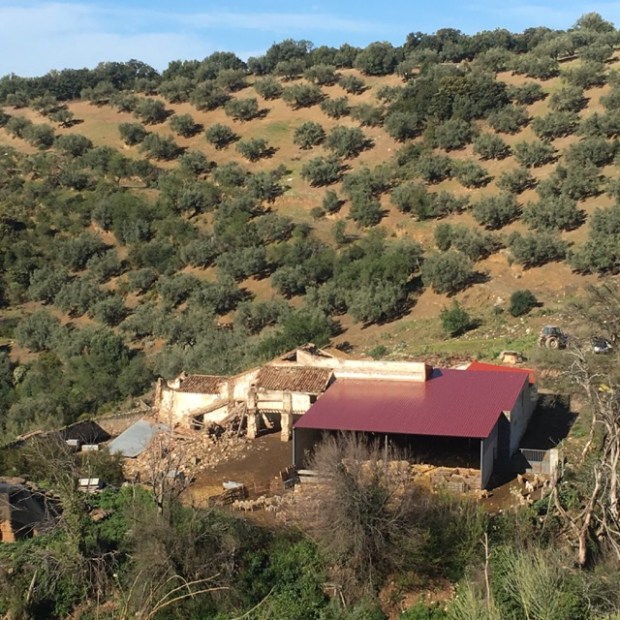
But it is also described as being a villa, a hotel and a mountain hut. Whatever it was its now pretty dilapidated but still being used as a home by some locals and I believe hikers can stay there for a euro or so. All around us were the productive self composting ladder terraces of the Luguru people of whom 100,000 live in these mountains growing a wide variety of grains, veg, fruits and coffee with the help of all the clean clear water. 

  The tribe are unusually and strongly matrilineal with the land being the property of women and passing from mother to daughter. This gives the women great independence and divorce is common, the man being sent away with nothing more than the clothes on his back. 

The feminine touch is also apparent in the traditional ugongo (joking) relationships between villages where conflict is avoided through a system of friendship, neighbourliness and good humour with an expectation of sharing food in hard times.  


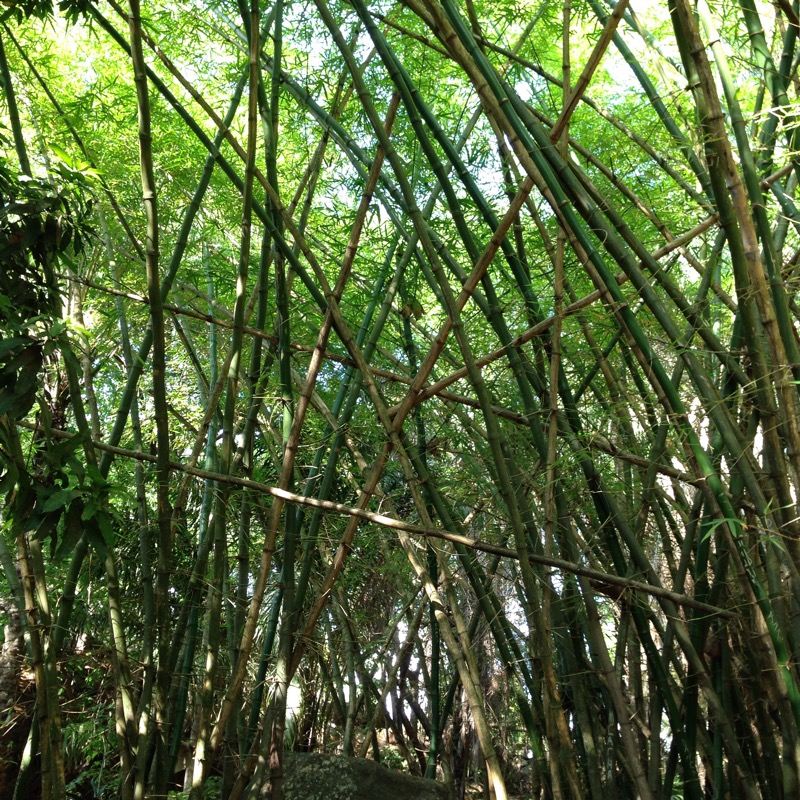
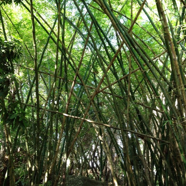
After a restful picnic lunch the hike back down was easy enough but we still felt the need to stop off at the bottom for a cold beer at the cool and shady “Rock Garden”, a natural and man made forest garden set among the river cascades.  

 Set up by benevolent Japanese some 40 years ago it’s a great spot to chill, eat, drink, swim, play and camp with giant bamboo and assorted exotica.  


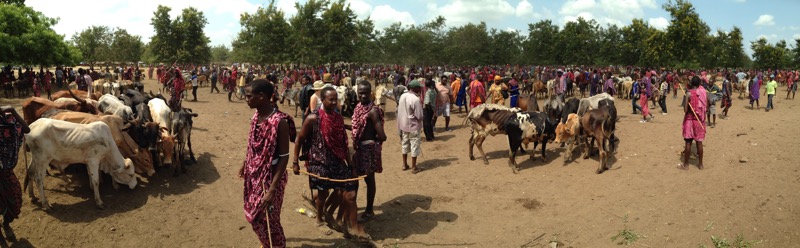
The next day we headed north on the Dodoma road for an hour or so with Ibra who wanted to take us to the Maasai market where his fellow tribesmen and women came to deal in cattle, goat and other necessities of village and nomadic life. We were very privileged to have a host that could open doors to us that outsiders wouldn’t normally have access to. 

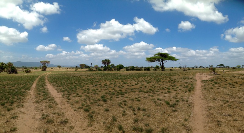
The sprawl of tin roofed suburban homes gradually gave way to a smattering of mud walled and palm frond thatched huts and then nothing but dry savannah for miles and miles. Eventually we lurched off road and into a scene that looked unchanged for centuries.  


The men can spend a week walking their cattle, which are a Maasai ‘s wealth, to the market and a fierce amount of trading takes place to ensure they don’t have to walk them home again.  

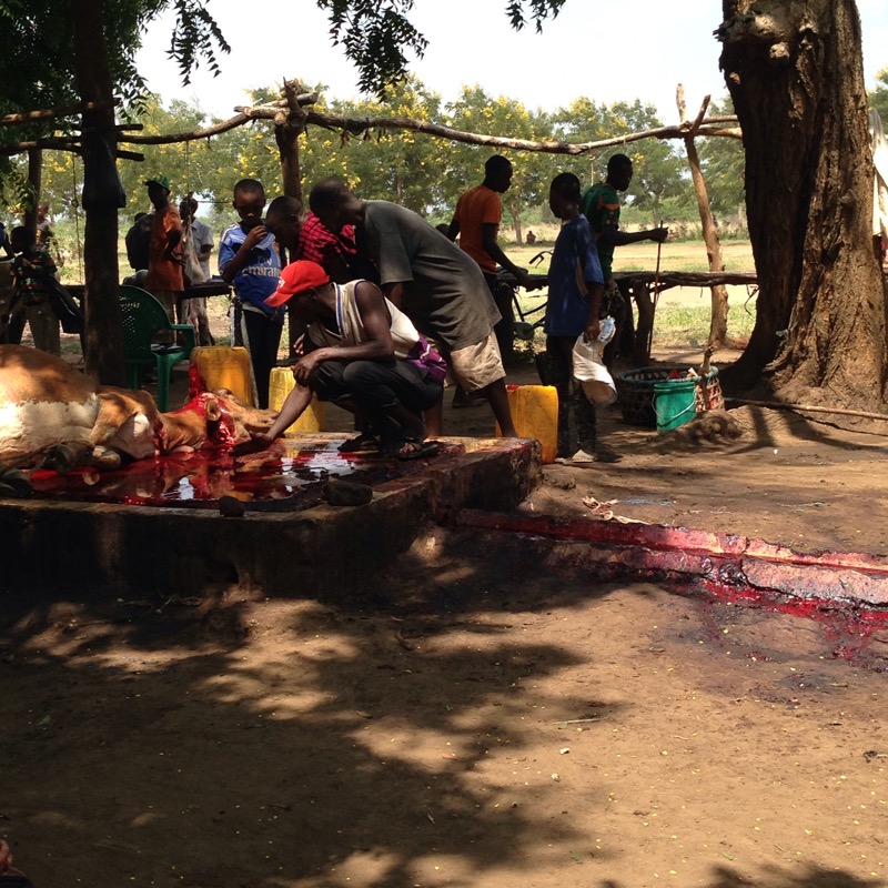
 A lot of the beasts don’t walk anywhere after the market as many are slaughtered, butchered and cooked (and eaten) on the spot in a very efficient, if not in our eyes particularly hygienic, fashion.  

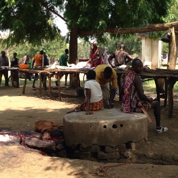
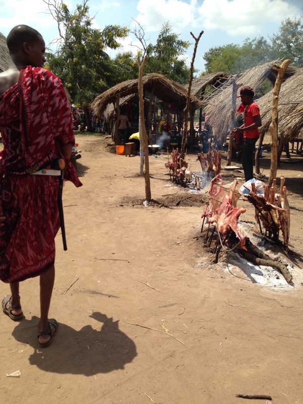
     The Maasai don’t do vegetarianism and can survive purely on their cattle meat, blood and milk for long periods. They have a very proud warrior status, a reputation that they are not to be messed with and always carry their knives ,sticks and clubs. 

Ibra, whose father had 5 wives, has 40 siblings and an interesting history and future having moved away from traditional life and married a French women. He has concerns about the sustainability of the tribal lifestyle with problems of overgrazing and the spread of aids and has put together a record and music video to promote his ideas among the Maasai. 

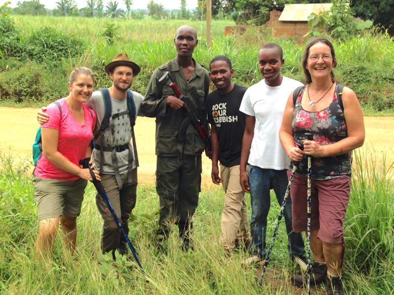
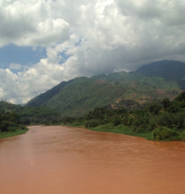
He used a trip to take us to our next destination as an opportunity to visit his village and the next day we piled into his jeep for the 4 1/2hr drive southwest to the Udzungwa mountains.  

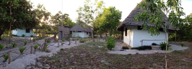
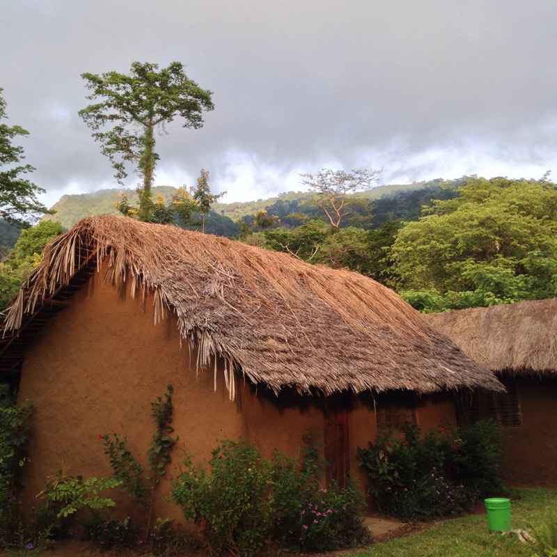
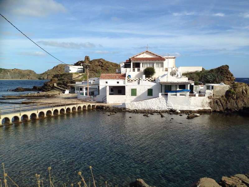
 The last couple of hours were on very rough and rutted sandy tracks and at one point we feared for the car as we were nearly swallowed by a massive mud pool and it was with relief that we turned into the entrance to our camp ,Hondo Hondo,and made ourselves at home in our mud and thatch ” banda’s”.  

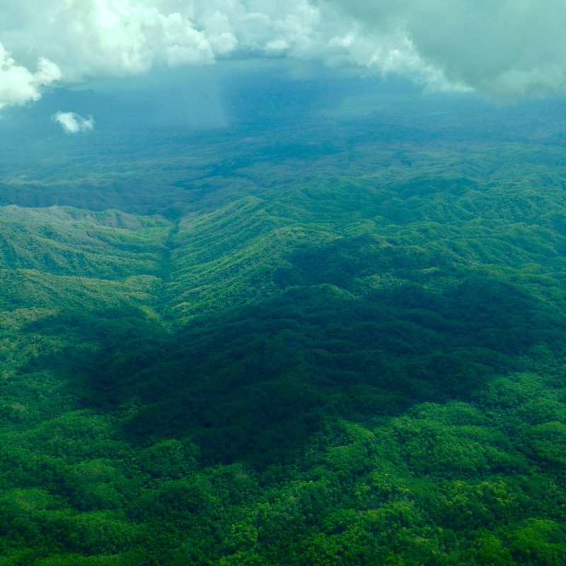
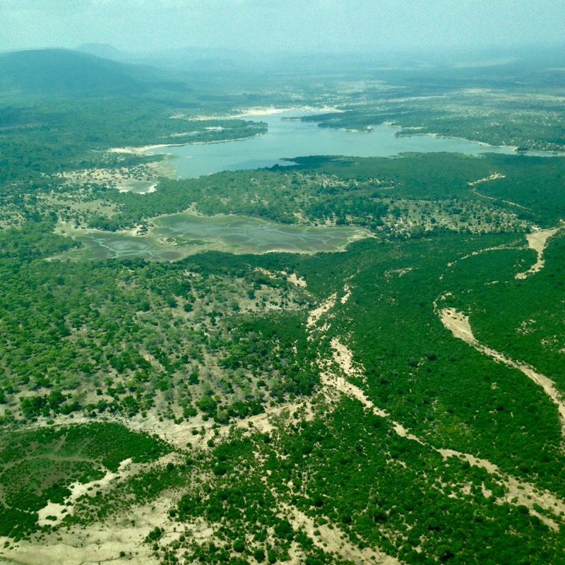
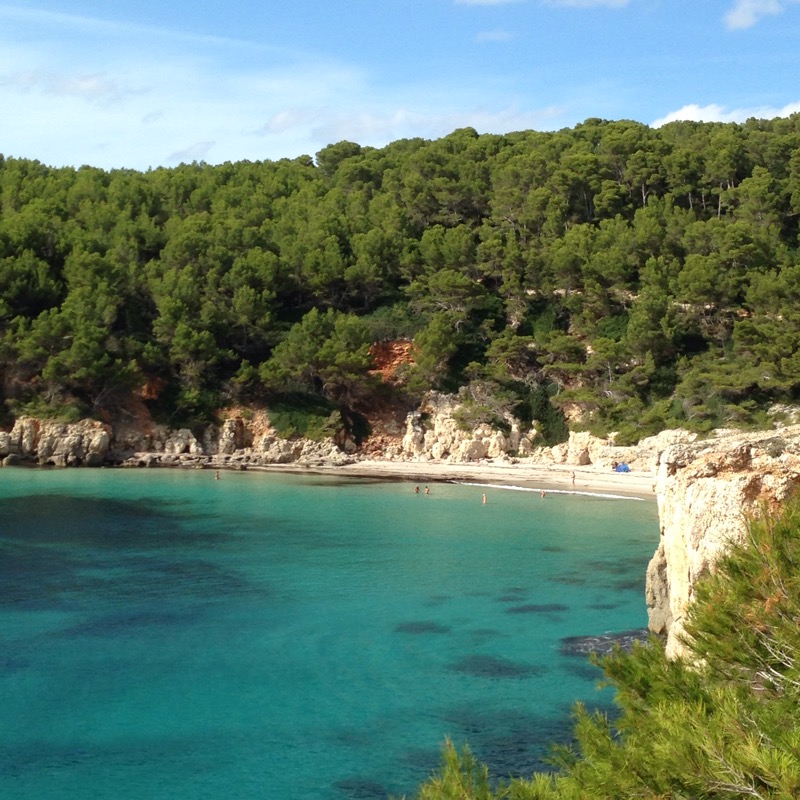
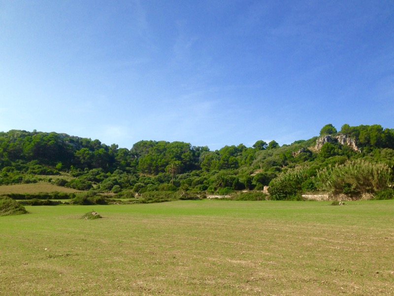
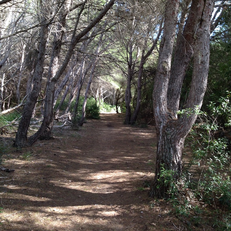
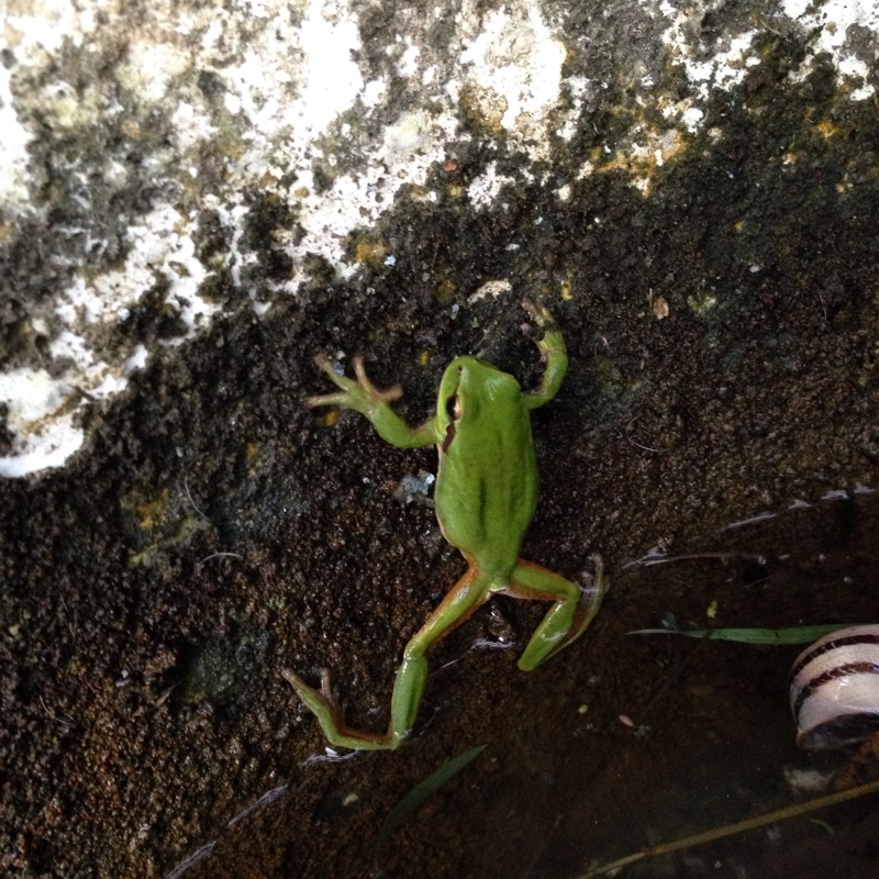
 It was a very beautiful and tranquil spot with the 1900sq km Udzungwa Mountains National Park starting a step behind us, and we had it to ourselves. The last peaks in the Eastern African Arc that start in Kenya ,their great age and isolation has enabled many endemic species to evolve and the forests have remained pristine thanks to the unusually steep terrain precluding cultivation. Taboos have also helped their conservation as the forest was left untouched as the abode of ancestor spirits, often the way in places with large primate populations. And there were plenty of primates about. Baboons ran all around us and more tree loving species called from the forest.  


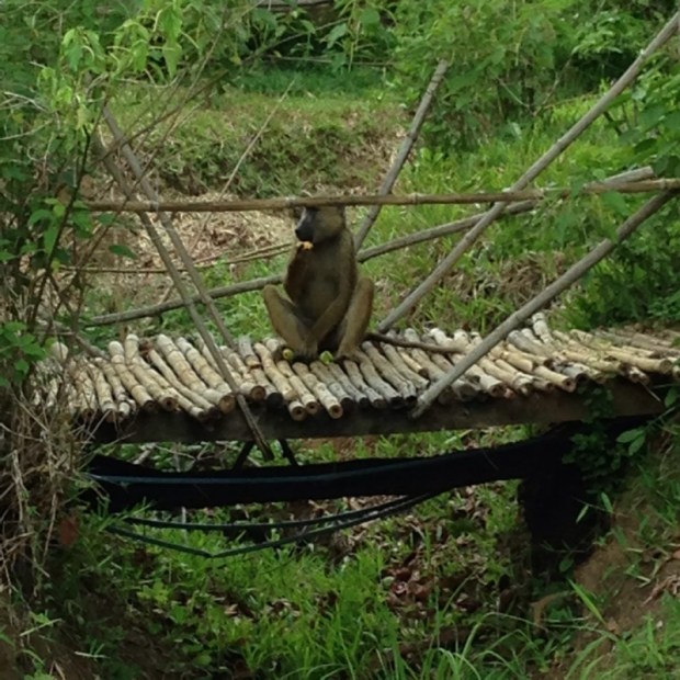
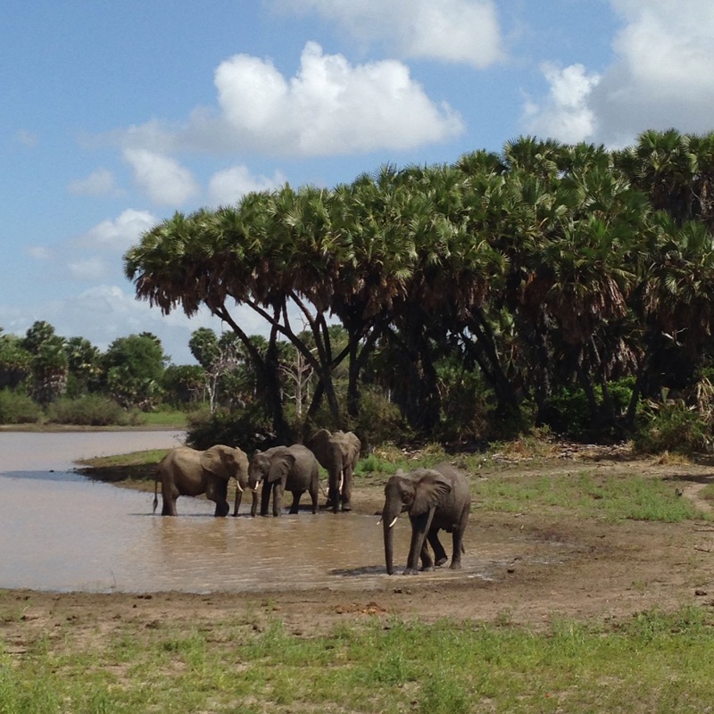
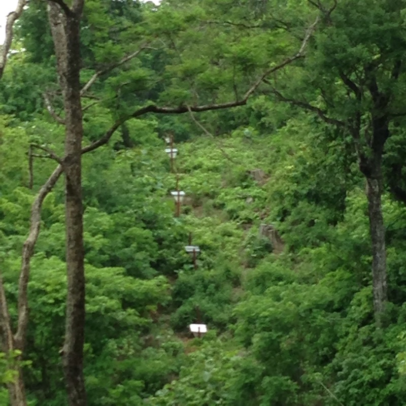
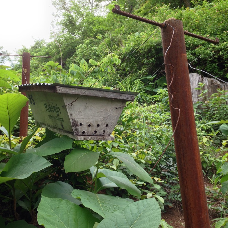
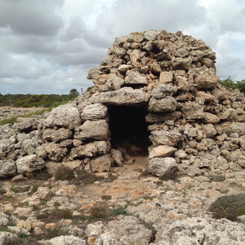
We went for an exploratory stroll into the forest and soon came upon a fence of sorts designed to keep elephants out. The huge beasts don’t like bees so hives are strung on fence wire and if shaken or knocked…….! 

   After the power cuts and mains water problems of Morogoro town it was nice to have solar powered lights and mountain stream fed showers and over a lovely dinner serenaded by birdsong and entertained by mongoose we organised the next two days hikes into the hills starting with a 5 hour trip to a series of waterfalls the following morning. 

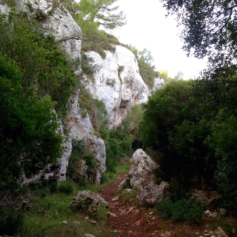
We had to start by getting a ride with Francis in a battered old Landcruiser to the Park HQ where we payed our $30 each conservation fee and had a talk from our obligatory guide, Gordy. He then joined us in the jeep for the ride back to the nearest village, sanje, and the start of the circular trail which led up and down on earthen paths hacked out of the jungle floor. There was a thick mass of vegetation and Gordy told us their names and uses including the “Psycho” plant whose smoked leaves will get the party going.  


We looked at Teak leaves which give off a deep red dye used for lipstick when squished  and I overdid it on the wild asparagus leaf good for high blood pressure. There were custard apple trees and cider trees that got the monkeys slaughtered and the elephants tipsy. We saw wild mangoes with lovely scented flowers, wild breadfruit,fig and a feast of others. There was a herbalists catalogue of cures in every direction and all this wealth of food and medicine was another reason why the forest is preserved by the local people.  

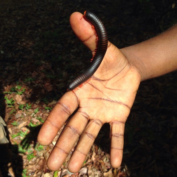
   The jungle/ forest rose above us in a series of layers from the pungent floor of leaf litter being digested by beatles and millipedes  

 to the top canopy where monkeys swung and eagles swooped.  

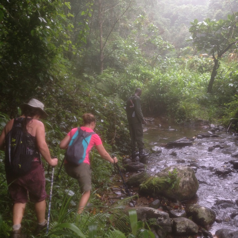
 We climbed in dappled shade up to and over the river which fed the falls.  

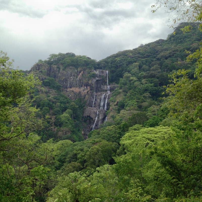
 Shortly arriving at the first, 30m cascade ,that we weren’t allowed to swim in , we carried on to the next 70m one that we could.  

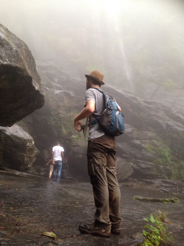
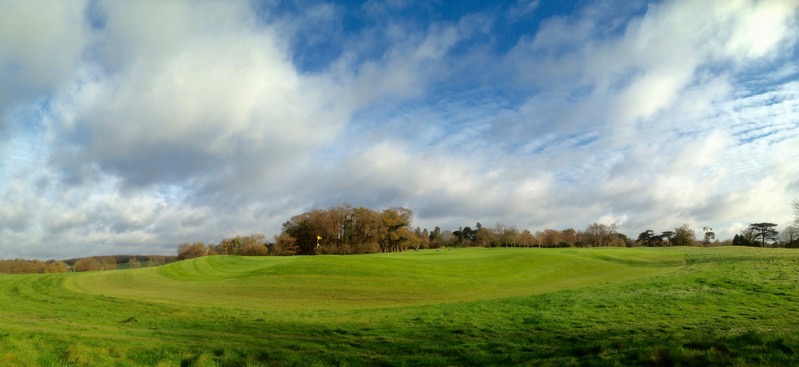
   After a very refreshing swim and “power shower” under the torrent we moved on to reach the top rocks of the 170m Sanje waterfall where we had our picnic lunch overlooking the sugarcane fields and rubber plantations stretching away to the east.  

 From up here we could hear the wild beats and banging bass of the post sugar cane harvest party happening in the village below. Fuelled by the cane rum and probably some “psycho” leaf, there was no let up day or night. 

We were nearly back down to the road before a gap in the greenery allowed for a view back to the falls and an appreciation of what had been below us as we dined al fresco.  

 There was a cacophony of bizarre bird calls, mostly from unseen sources deep in the greenery, including our camp’s namesake the Hondo Hondo bird, a kind of Hornbill,whose plaintive cry resembles a mournful baby. We saw some gymnastics performed by black and white Colobus monkeys and startled a shy red Duiker, looking something like a small deer ,but most of the wildlife remained elusive, including the 70 endemic species of spider luckily. 

Soon enough I was drinking cold beer in the deckchairs watching a large gang of mongoose getting seen off by a deadly Gaboon Adder.  


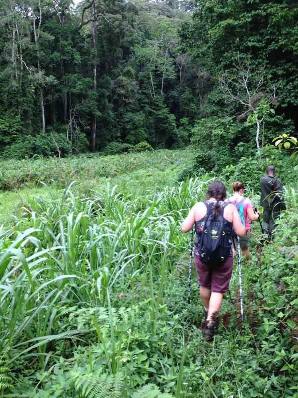
The next day was an early start to the Park HQ to pay our dues and pick up Gordy and an armed ranger to protect us from rampaging buffalo and elephants. We were tackling the 14km /8hr Hidden Valley Trail which promised to be steep and slippery.  

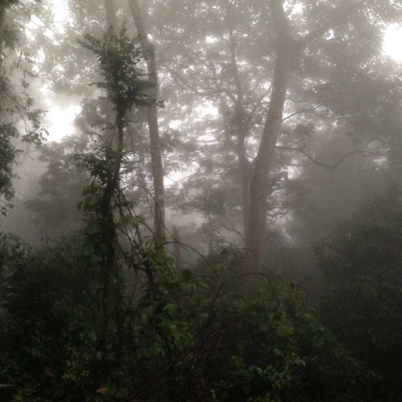
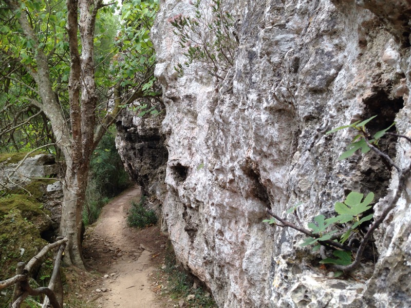
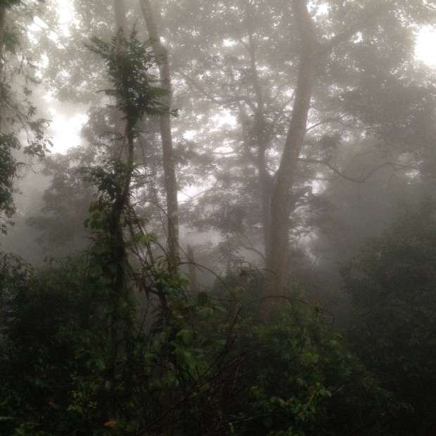
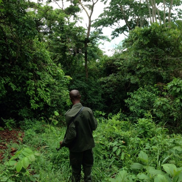
 The Kalashnikov toting ranger kept up a steady pace at the front and we didn’t have the frequent stops to describe and explain things but the going was slow enough on the steep uncleared paths, passed elephant Poo and into the cloud. The cloud was thick and deep so for awhile it was very dark and drippy- proper rainforest hiking through the sodden vegetation.  

  It was a strenuous climb and after 4km we did a short detour down to another waterfall and slabs of very slippery rocks where we filled our water bottles and had some food to give ourselves energy for the big push to the peak.  

 The humidity and the gentle rainfall ensured our clothes were soaked and with the tropical sun lost behind cloud it didn’t take long to start feeling cold when we reached the top after about 4 hours. With no view visible through the thick foliage we carried on crisscrossing the river and across the grassy, more open valley.


 No elephants but more poo and broken strings across the trail set up to establish their routes. We did come across a much smaller species, snails,  but these were the giant land snails. A couple of hermaphrodites were in a lovers embrace.  

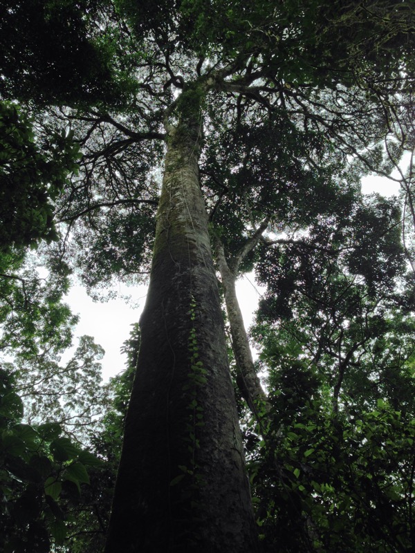
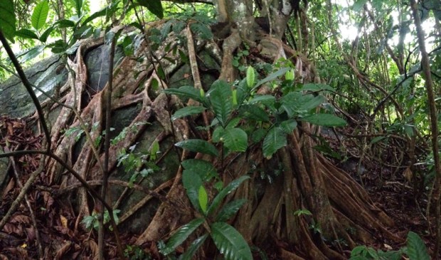
 As we descended from the valley the forest changed again with more widely spaced but huge trees with massive spans, giant bamboos and lianas, and some impressive roots and buttresses.  


 There were some spectacular acrobatic aerial displays from troops of red colobus, Sanje crested Mangabey, black and white colobus, blue monkeys and yellow baboons. Unfortunately we had also seen, and felt, Tetsie fly, a tough critter similar to our Horsefly but with a nastier bite. 

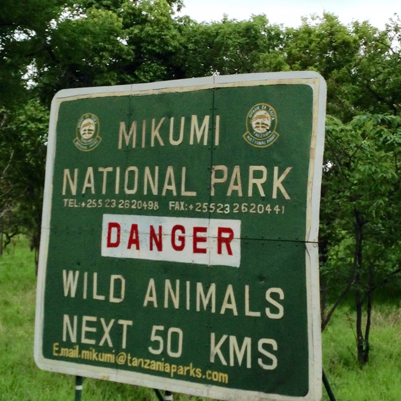
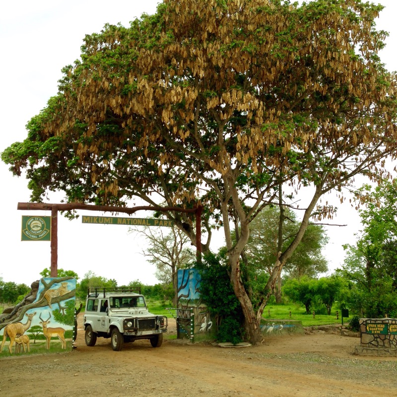
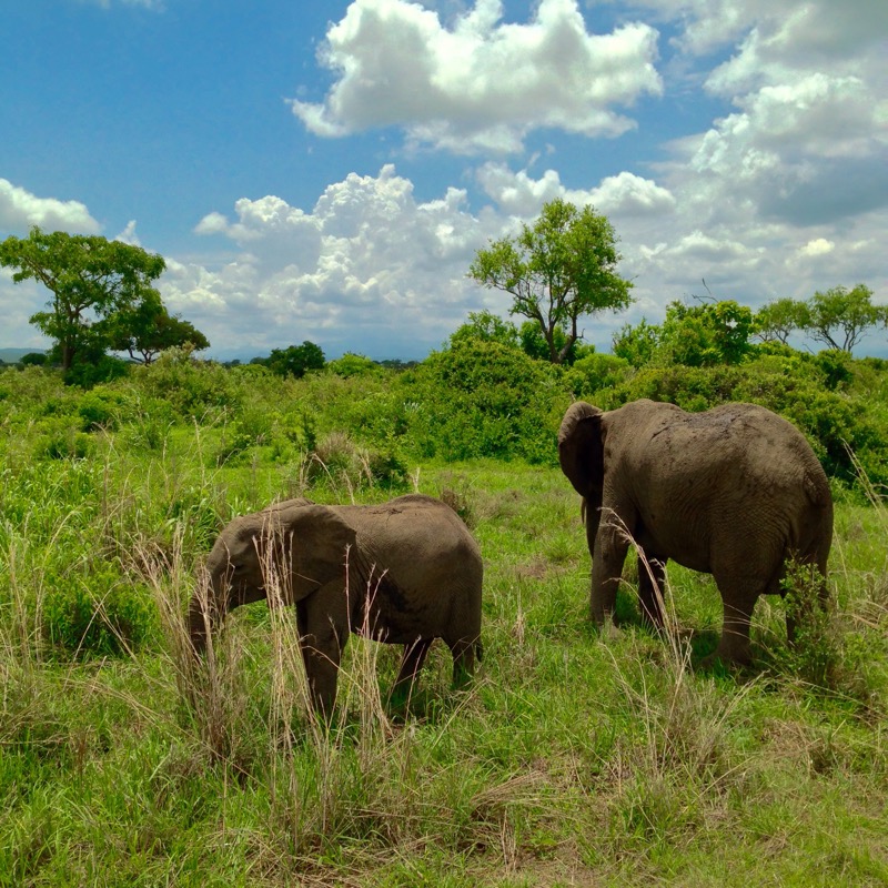
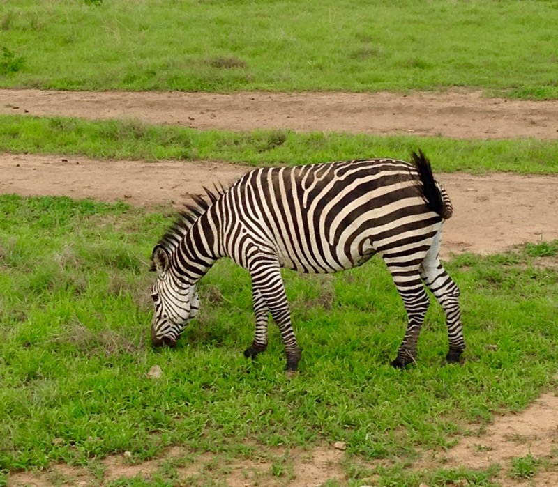
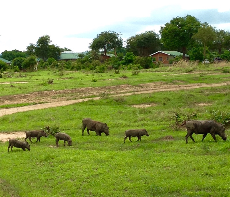
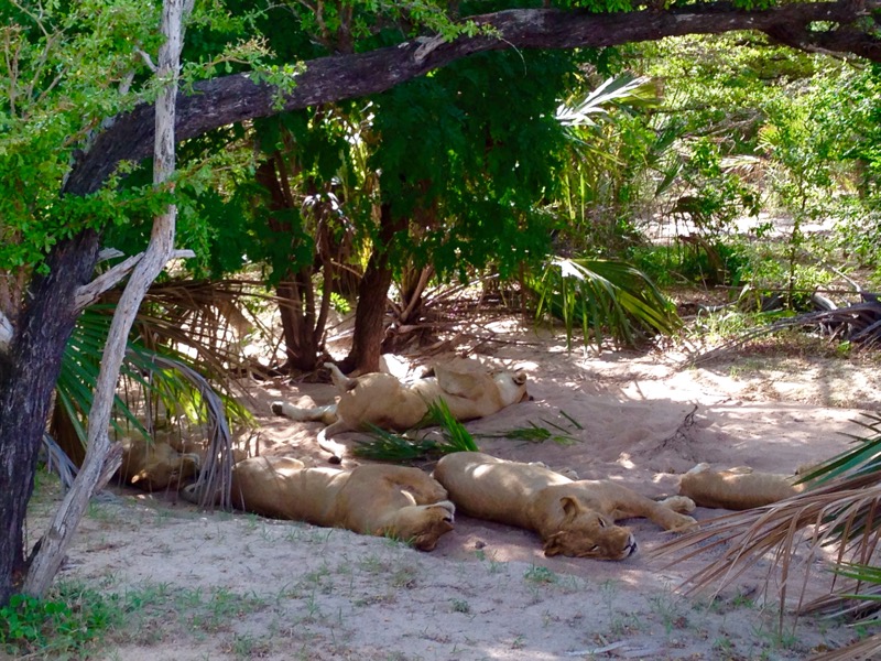
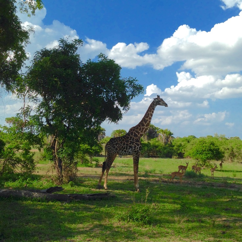
We had made good time on the route and it was congratulations all round when we got back down to the road but our time in the jungle was up, the next day we were heading for the Mikumi National Park.  
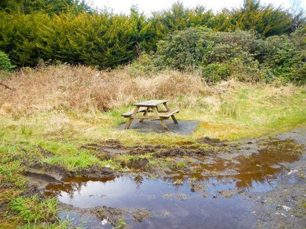
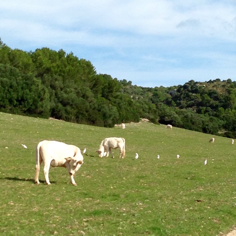
 

LEA VALLEY WAY: LUTON TO LONDON 26/27th NOV

A cold clear sky in Hertford as I crossed the frosty park towards the river, the lock, and the beginning of the Lea navigation and the tow paths that would lead me all the way to Hackney. The route would be lined with barges and houseboats of all types offering an alternative way of life to the liveaboards. 

 The Lee Valley Regional Park starts in Ware and goes to the Thames at East India Docks, 26 miles away. A 10,000acre linear strip of green its Londons lung and contains multiple facilities for outdoor activities. 

 Below the lock the waters crossed the huge expanse of the Kings Meads water meadows and passed the New River take off dug around 1610 to supply as it still does fresh spring drinking water to London.  

   Looming in the far distance was the vast GlaxoSmithKline factory and the wooden footbridge leading to it. A little beyond was a weir where I was sure I could detect a strong aroma of perfumed cleaning product and the water seemed suspiciously sudsy. Surely Glaxo couldn’t or wouldn’t.  

   The next town to appear was Ware, with its historical gazebos, originally known as Dutch summer houses after their inspiration. The inn keepers of the 18th century built them as a tranquil space away from the hussle and bustle of the streets.  

   An uninterrupted stretch of tranquil water followed dotted with barges and narrow boats leading towards Rye Meads Nature Reserve and the 17th century Rye House Inn whose landlord touted for tourist business by installing the famous 12 person Great Bed of Ware.  

       There was a board explaining the fate of the owner who plotted against King CharlesII  

 A lot of construction work was going on at the Rye power station , one of three originally coal powered stations whose spent ash filled the extracted gravel pits further downstream.  

   Another inn with colourful history lay a little further along. The Fish and Eels at  Dobb’s Weir was run for a few years by a workhouse  chaplain, encouraging temperance rather than abstinence. 

“I shall be the publican behind the bar, the sinners will be in front me, and Christ, I hope, will be in the midst of us” 

On passed Carthagena lock named for the Admiral Vernon returned from the siege of that Columbian city during the War of Jenkins’ Ear !

Passed Broxbourne and the third emergency lifeboat I’d seen and across Nazeing and Holyfield marshes with specially constructed orchid viewing boardwalks.  


 For miles down this marshy stretch there were traveller sites, big and small, rough and smart. It seemed that the unloved pockets of land that for the last couple of days had been given over to sewage works were now being used for caravan living. I couldn’t work out if the sites were privately owned, council or squatted. Maybe all three.  

 As I neared my destination I met a couple of magnet fishermen. Opposite an old brick bridge abutment they repeatedly threw in their magnets on lines and very occasionally pulled in some metal junk. They have, in the past, retrieved bags containing money and cocaine. Which, of course, they handed into the police.  

 The black timber lodges of the Lee Valley  Youth Hostel and the outdoor education center came into view and just past them was Cheshunt train station where Sally was arriving  to join me for the final days hike to London. 

 It is a good hostel with restaurant and bar and self catering  kitchens in the lodges where we had a double room with en suite for £30. Very different from the YHA experiences of our youth.

In the morning we had a look at a load of timber scultures before heading off down the towpath in a light drizzle. 

 The route became much more urban as we passed some 2nd WW anti aircraft gun platform and into the scuzzy Waltham Abbey area and under  the noisy M25. 

       We passed the old Royal Small Arms factory of Enfield Island with its Goverment Row workers cottages. 

   Enfield dry dock was a hive of industry with boaters doing up their craft of which their were an increasingly bizarre selection along the banks. 

       We passed a modern factory building sporting a row of birdboxes ,the four highrise blocks of Ponders End and the chimney of the London Eco waste recyling centre. 

        Nearby in scrubby woodland between the river and a reservoir we spotted a sad looking set up of tarps and tents  housing who knows who. 

 We stopped at the tiny Leaside Cafe on an industrial estate on the edge of Tottenham Marshes and as the sun started to emerge carried on towards Clendish Marsh and Walthamstow Wetlands, Europes largest urban wetland reserve. As we neared the heart of the city there were more and more people choosing to avoid the extreme property prices by living aboard, on some pretty small homemade jobs as well as luxurious floating studio apartments . 

                 There were cranes at Spring Hill where there had been a big timber yard and another boat yard and marina. The houseboat lined towpath was wide and grassy through  Walthamstow Marshes with it’s Galloway Belted cattle put there to encourage grass growth and retrict the spread of reed and weeds.

At this stage we had passed Tottenham Hale and were  into the new development around Middlesex Wharf. 

         Suddenly as we followed the towpath down the Hackney Cut past the Middlesex Fillter Beds our final destination  came into view, the ex council tower block of Landmark Heights, and before long we were looking back at the Lee from the flat’s balcony. 


A great way to arrive into central London after 80 km of near traffic free hiking.

LEA VALLEY WAY: LUTON TO LONDON 24th /25Nov

A very different hike than any other this year takes me 85 km from Luton to London along the  river and canal of the Lee or Lea.

After deciding to visit family in Hackney i discovered a walking trail  that went passed both Luton airport and the block  of flats that were my destination.  With my rambling year approaching the finale it was too  serendipitous to ignore.

It promised easy ,flat, traffic free walking all the way to the heart of the capital, mostly along smooth hard surfaced towpaths with a seldom seen perspective of Greater London.

Splitting the route into 4 sections over 3 1/2 days, i’m hoping will allow for a fairly leisurely hike through the short daylight hours.

Arriving late into Luton airport and thereby thankfully avoiding the triumphant blasting of Ryanair horns,i soon discovered that it wasnt a very walk friendly environment. 

 It took awhile to negotiate the under and overpasses and unmaned turnstiles of Luton Parkway station to get onto the trail which initially uses the old Dunstable to Welwyn railway line, abandoned in the 60’s.

Knowing the way was likely to be tarmaced i thought about employing a dumped trolley as a baggage carrier but decided that was embracing the urban aspect of the way a bit too far. 

 The hedge that had grown up through the adjoining fence had been cut to leave the forlorn stems and trunks dislocated under the control tower. 


With the airport and traintrack on one side and a road on the other i made my way passed old coppiced plains and maples, many with the red spots marking them out for the chop. 


My goal for the afternoon was to get the otherside of Harpenden, about 10 km away, and i passed a hilltop silouette of Eric Morecambe who lived there and was a faithful supporter of Luton football club. 


Not far beyond i passed by the work of another figure whose silouette had adorned the hilltop, the estate of Luton  Hoo, landscaped by Capability Brown.

I decended and crossed the young River Lee leaving the road behind and entering a more tranquil stretch through farmland. 

 Crossing the chiltern way I followed the path through the productive looking fields to the urban fringes of Harpenden. The former train track now took me between the postage stamp sized gardens before i left it to go through the Batford Springs Nature Reserve. The path created here in the early 70’s, running alongside the old willow and watercress beds  was the first step in the formation of the 85km Lee Valley Way. 


As darkness drew in i said goodnight to the ducks and called into the trackside Marquis of Granby to wallow in the British pub institution for the first time in ages. A pint of bitter, packet of nuts, a fire, and copies of the Mail and Telegraph to tut tut over restored my sense of everything gone to the dogs etc. 


Out into the dark along the unlit lane i had only to walk passed my second sewage works of the day, (there’s 65 million people to provide the raw material) and up the hill past an unseen golf course to arrive at my Airb+b for the night.

After a chat with my hostess Jane over breakfast  in the families kitchen i hit the trail under  gently weeping leaden skies. 

It wasnt long before the old railway track, busy with squirels, passed a golf course and then i had to deviate up over muddy horse paddock due to an incalcitrant(?) famer not joining in with the Lea Valley Walk planned route.     Across a field and into Wheathampstead with a little garden enclosed by willow fencing next to the 1310 church with it’s spire likened to an upside down ice cream cornet.    

 Past another veritable Tudor Inn, pouring pints since 1617, and shortly crossing the river again on a wooden footbridge passing yet another sewage works.    A long stretch over farmland followed with the shallow river visable alongside at times as it meandered through the  willow and reeds. A plethora(?) of footpaths came and went and i would have been lost without my guidebook.   Up through a big clump of trees of many species, including one whose bark was unknown to me, and onto another golf course, created on the parkland of Brocket Hall, home of Queen Victoria’s 1st Prime Minister, Lord Melbourne. His wife, Lady Caroline, had herself served up naked from a giant soup tureen at Melbournes birthday party and in later years was confined to the house by insanity.  

 After another crossing of fairways and farmland i joined the river to pass under the thundering A1 and emerged into the bird rich lakeland of the 126acre Stanborough Park, at the end of which another mainline transport route powered above my head, this time the Kings Cross rail line. 

     Rich farmland and an organic flour mill led me to a nasty stetch of busy dual carriageway with rubbish strewn edges. 

      The narrow wooded Gypsy Lane took me passed yet another sewage works and through yet another golf course. This one had signs warning of stray golf balls and sure enough there were 100’s scattered in the thickets. It’s  a sign of the affluence of the south east of England that no one bothers to collect them.

At the top of the lane i made my way through a few miles of 20th century brick housing in Welwyn Garden city  before heading off down another abandoned branch line lined with thick hedges of dogwood, teasel and sloes. 


 At the old Cole Green station were some old trunk carvings slowly returning to nature and shortly after the sunlit track led me passed more cosy horses to the back gardens of Hertfort with a selection of ruined and smart sheds. 

          Then it was just a short distance through the gardens of Hertford castle  and passed the brewery to my Airb+b  for the night, a cosy mews basement. 


 I can confirm that they produce a range of fine ales.

GR223 MENORCA: 10/11th OCTOBER

It was nearly dark as I followed the track between resorts across rock and scrub looking for someplace to pitch my tent. At the southwesern tip of the island with the lighthouse of Cap d’Artrutz flashing at me I made do with a flat patch of rock beside a civil war gun emplacement. I figured if the forecast rain happened and the 15€ Aldi tent didn’t stand up to it I could hunker down in the bunker.  

 In the morning I was still dry but clouds were brewing.  

   The last leg up the west coast was a cliff top hike across lumpy limestone, once I’d cleared the holiday hotels and lighthouse.  

   I passed the nodding seed heads that had greeted me on my first day on the trail and another ageless stone shelter with its gravity defying roof construction.  


Before I knew it I was in Ciutadella. At the ferry port there was a boat due to leave in 20 mins but I was too late to buy a ticket apparently so I had a day meandering the narrow city streets probably clocking up as many km as I would on the trail. It was photogenic though so forgive me any overexposure.  

                             I was puzzled by this completely walled in boat.  


The sun was shining again so before my ferry left I had a final swim with the fishes from the little city beach.  


Back in Port Alcudia the shining morning sun slowly drew out the beach goers.  

     Walking to the bus I reflected that you can look all day for a phone box and then along come 5 at a time.  

 Driving in an hour past the mountain range it had taken me 8 days to hike I got to Palma where my funky and busy hostel was smack in the middle of the old quarter.  

 I dumped my rucksack and floated off 12kg lighter to explore. Again the street scenes demanded recording so bare with me.  

               The cathedral by the way was 400years in the making, started after the re conquest from the Muslims on the site of the mosque. Gaudi did a load of stuff for a finish. The rose window is the largest in Europe I think but unfortunately being Sunday the cathedral was shut (?) so I didn’t get me admire the multitude of stained glass.  


It struck me again how wealthy and sophisticated this island is, particularly compared to its neighbour Menorca. Even the ice cream parlours are pure class.  

 And the lap dogs have carriages.  


I walked down to the marina to be a voyeur on an alien life form and lifestyle. Who are these people? 

   Raoul was “entertaining” in full view of us rubbernecking tourists but didn’t seem to be pulling to me.  

 Sated by the boat porn I returned to the normality of a 6 bed dorm in a back street hostel to prepare for re entry. 

For I decided to postpone the remaining 2 Spanish islands (actually I’m sure I can find more) for another time. I’ve been a deserter from the Homefront for long enough and I’ll be flying to Ireland in the morning. 

These two routes have been good. I missed out the highest and possibly the best of the Mallorcan route due to weather conditions and missed out the worst of the Menorcan route due to time constraints but both were special and recommended. But there’s no place like home.  


                      I’m outta here. 


Ps  Stay tuned for more adventures in December  and I’d love to know who is the avid reader in Italy  

GR223 MENORCA: 8/9th OCTOBER 

Two of the best days hiking so far have brought me along the south coast of this surprisingly unspoilt island. The south is easier going than the rugged north and thankfully flatter. 

After leaving the monumental stones of Torre d’en Galmes to their timeless slumber I retraced my steps to the Cami de Cavalls and wove my way through the wild olives ( of which there are thousands but no cultivated ones ?) pines and juniper.  The track was blocked in places by tree fall from last weeks storm. 

      There is a gin distillery on the island, a hangover (!) from the British colonial days but I read they import the juniper berries as there are none on the island. The way went passed white limestone cliffs sporting brave little trees starting out on a tough life, and down to a little cove at Caleta Llucalari.  


Then came the shock of civilisation.  

 Now that’s what I call sensitive development. To be fair it’s few and far between and after walking nearly all the way around the coast I’ve been pleasantly surprised how little of it has been touched at all. It could be down to the fact that MENORCA was the last province to hold out against Franco and so was left out of any tourism development money during the 60’s and after. 

Anyway the holiday villas have some lovely floral displays, sometimes getting out of hand.  

   Some buildings have features you couldn’t get away with in the rain sodden North.  

 Some developments never made it.  

 And some you might wish hadn’t. I wonder what the Irish Republican boys would think of their flag flying with this lot.  

 Still I was soon off down the trail with other oiled up sun seekers 

 into a pastoral countryside of white cows and white birds, black horses and white birds and reed rich wetlands.  

       The coast featured many islets and many walkers ambling between resorts.  

   And as this Camino was originally for horse riders unsurprising to find them also.  

 More development at Sant Tomas and then the wilds again.  

     At this point the Cami de Cavalls heads inland but an alternative route sticks to the coast and passed beaches I didn’t want to miss. A lovely cliff top path through pines and over jagged limestone.  

       There were steps and cave houses cut into the rock.  

     And interesting remains of former lives trapped in the stone.  

   The boating crowd found safe anchorage.  

 Then came adventure. I got to Cala Trebaluger where my guide mentioned a river crossing. It wasn’t as I imagined.  

 After watching a couple strip off and wade neck deep across the channel I was wary. My phone could get wet. Everything else, down bag, tent, clothes, food, clothes etc could also end up in the sea. It was a Bear Gyrils moment. Channeling my inner Ray Mears I stripped off stuffing everything in bags, in bags, in waterproof sacks. Hoisting my 12kilo rucksack on my head I gingerly followed the route across indicated by my fellow intrepid adventurers. It got tricky on the last leg across the deepest dip but luckily they were there on the rocks to release me of my load and I scrambled ignominious and naked up to join them. We can be heroes. 

No way horses could follow.  

 So off through the woods again to find a place to camp. I thought the next beach, Cala Mitjana, might be nice and so it was.  

 I found myself a sheltered hut set amongst civil war defences and an old limestone quarry overlooking the beach.  

       As I settled in about 15 kayaks paddled in and set up camp for the night. So much for the 4000€ fine for camping.  

 A nice night spent listening to the lapping and flapping of water on the rocks. 

More pine woods in the morning led to the resort of Santa Galdana a 5 hour walk from my destination for the day at Cala en Bosch on the southwestern tip of Menorca.  

   One feature of the domestic buildings on Menorca I hadn’t seen before are the zigzag tile downpipes.  

 I was tempted to swim here as there were beachside showers but it wasn’t hot enough so after a cafe con leche and wifi chat with home I headed off into more pine woods on a wide track and long and winding steps to a succession of beautiful access free beaches.  

         Some rocky stretches and interesting scat for the admitted minority interested in such things.  

   I came to what I knew was the last nice isolated beach on my trip so had to don the goggles one more time.  

   Refreshing. 

There were a lot of civil war emplacements in the following stretch that I explored as well as some much older structures.  


I met up with Birgit again on her journey in the opposite direction. It’s amazing how after meeting briefly once fellow travellers can seem like old friends. May the road rise to meet you Birgit. 

Speaking of fellow travellers, I came across the cave/ house mentioned by Olof back in Cala Morell but it was too early to consider staying there and also too busy with tourists.  

     A little later the sights and sounds of the resort of Son Xoriguer drew me to the bar where I write this. Tomorrow is an easy 4 or 5 hours back to Ciutadella where I started this odyssey. 

But now I have to find somewhere in resortville where a man and tent may go unnoticed.  


GR223 MENORCA: 6/7th OCTOBER

After breakfasting like a king at the buffet table in Arenal d’en Castell and a brief chat and info exchange with Birgit who I meet checking out and is going around the Cami de Cavell the other way, I cast a somewhat jealous eye over the holiday makers getting ready for another day poolside, and load up for the trail. 

Just out of town I bump into David, with his thumb out hitching. He said he needed to get down to Es Grau tonight for some reason I couldn’t quite follow. He’s been finding it tough and is carrying a lot of kit. I said I’d see him there if I made it that far. 

I soon entered the Parc Natural de S’ Albufera D’Es Grau with views across the waterways and old salt ponds.  

     The rules as to how to behave were very specific.  

 I think I got the constant pace right and my movements were not too erratic but I’m afraid I cut a swath through the wildlife with my red backpack.  

 The surrounding farmland looked rich with fresh grass or grain appearing after the rains and some strangely coloured rocks.  

       Then the way travelled over a high plain of stones fields and bushes before joining a road to the coast at Cap de Favaritz with its barbershop striped lighthouse.  

   That was a stage end but there were no facilities there or more importantly water. Paddy’s guide said strong walkers could carry on to Es Grau. Red rag to a bull. 

But first a swim to cool off at the lovely cove of Cala de Morella a couple of km further on.  

 Tearing myself away after an hour I had another couple of hours up and down the headlands between coves thankfully some shady paths through scrubs and woods and some open farmland.  

       A lot of the bay’s had thick piles of washed up sea grass and reed flower heads. I wondered if it could be composted or used on the land. By the time I crossed the last bay and Es Grau came into view I was ready for a cold beer and satisfied my need admiring some of the old school architecture.  

     I ran into David again, who was trying to do his video diary and film the sunset so I left him to it and headed for some woods near wetlands and a lake to camp. There were lots of big fish repeatedly jumping out of the water, probably after the mozzies of which there was an abundant supply.  

 After my swollen bites I’m a bit sensitive about mozzies so zipped myself in tight. Unfortunately I kept feeling things land on me and when I turned on the torch was disturbed to find a trillion (at least) ants marching everywhere.  

 The picture does nothing to reveal the true horror of the situation. I couldn’t go out or the mozzies would get me. When panic subsided I realised they weren’t biting so I drew deep on my zen attitude and acceptance and let them crawl over and in everywhere. 

More high acceptance levels were needed in the morning when I rolled my tent up good and tight squashing down hard with my knees….. with my glasses still inside. Well bent with one side open and screw less and a luckily intact lens popped out. 

More rugged coastline down the east coast in the morning sun led me up and down on sandy and rocky paths between little coves often with simple fishermans houses and boathouses.  

       The plant and animal life were colourful and hardy.  


 I came to the headland at Sa Mesquida  

There were some nice waterfront houses in the little village, there can’t be much of a tide here.  

     From here there was a 5km slog along hard Tarmac followed by a cross city hike. 

  I lost heart after awhile and stuck my thumb out at the only car I’d seen. Nice man from Mao drove me into city centre. 


I’d heard from a few people that the next stage, around the southeast corner below the capital was not very nice with one urbanization following another. So I’d decided to get a bus to the next section at Cala n Porter. This would free up enough time to get the boat back to Mallorca from Ciutadella on Saturday night rather than Sunday. After my previous experience with cancelled ferries and a flight first thing Monday morning it seemed prudent.  


The short (at bus speed) ride bought me to the resort where I stocked up on food and sat on the beach for a bit 

 before heading up a deep gorge filled with isolated fruit growing fincas.  

 The way lead through shady cliff paths up to higher level ground of small fields and past a water collection and storage structure.  


 There was a detour to a high point where the Talayotic settlement of Torre d’en Galmes seemed worth the extra effort. And so it was. Unique to MENORCA these enigmatic sites from between 850 and 200 bc are scattered around the island but this one was the nearest to the Cami de Cavalls. The scale was impressive as was the size of the construction stones.  

           I was very taken by the atmosphere of the place and decided to spend the night nearby and watch the stones dissolve into the dark.  

  The few visitors went bit by bit leaving me alone with the ancient stones. Apart from when a man approached me not to tell me to go but to asked if I had seen a couple of geese that had flown off from the neighbouring farm where I had seen some happy free range pigs whose grunting were the only sounds.  

 No mozzies buzzing up there.