Author: stevesally55

THE LYCIAN WAY 3

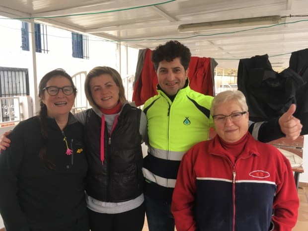
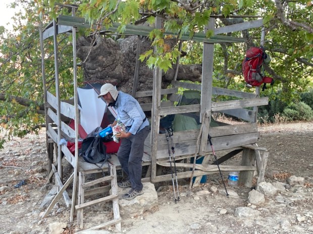
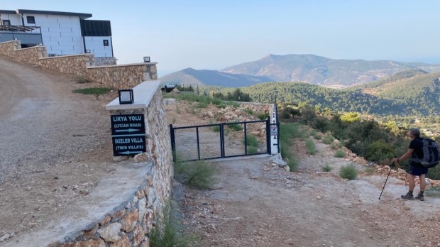
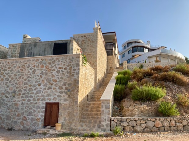
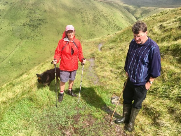
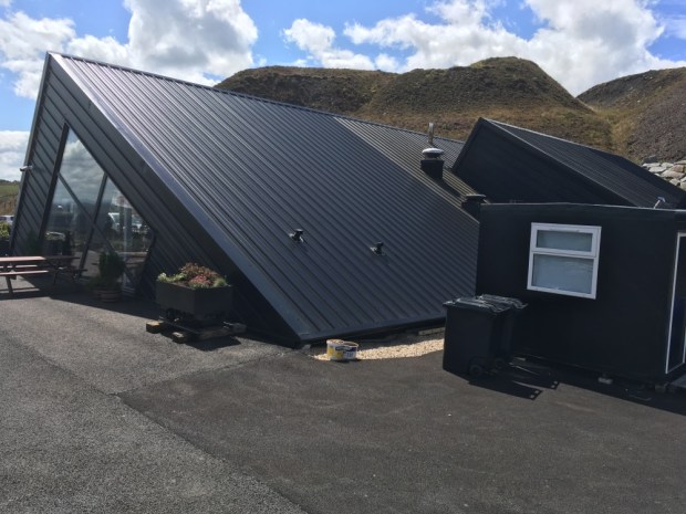
Olsen treated us well at his coming together camp/ A frame site outside of Kalkan. Our conversation relied completely on google translate which meant it was not smooth flowing or wide ranging but we did discover he was a professional footballer for Galasataray for many years.

Unfortunately the mosquitoes in the A frames did not treat us well and the little sleep was frequently interrupted by high pitched buzzing followed by frantic hunting and slapping- and repeat.

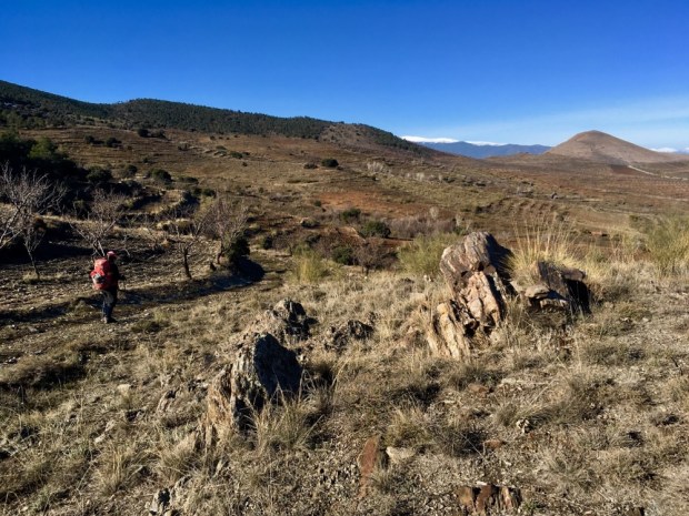
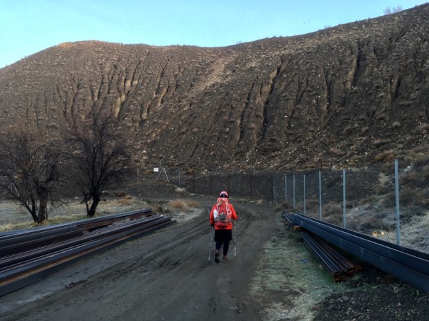
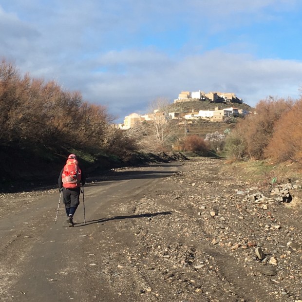
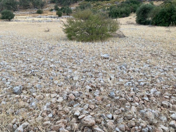
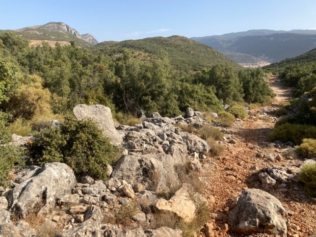
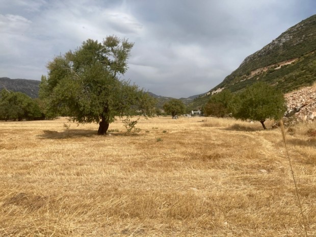
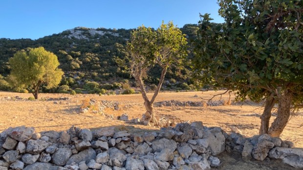
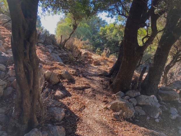
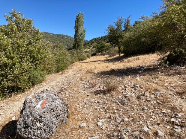
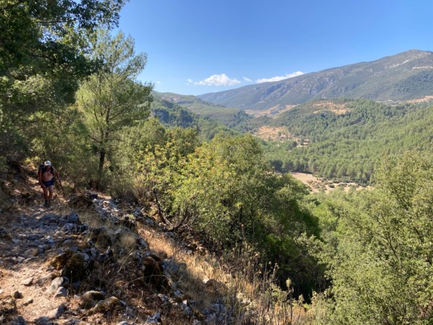
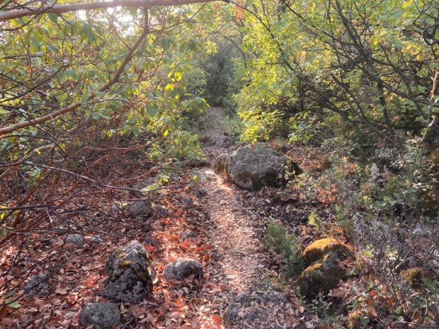
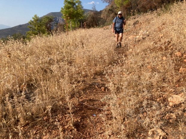
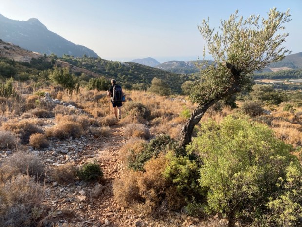
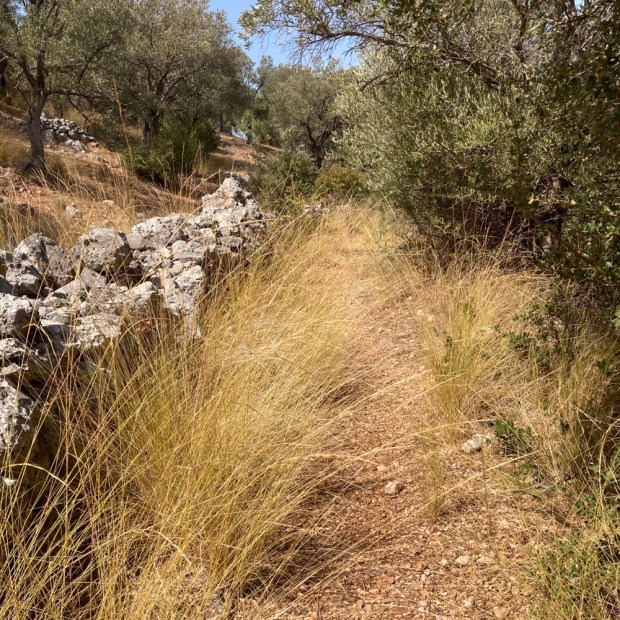
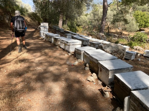
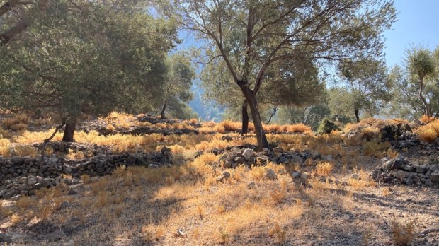
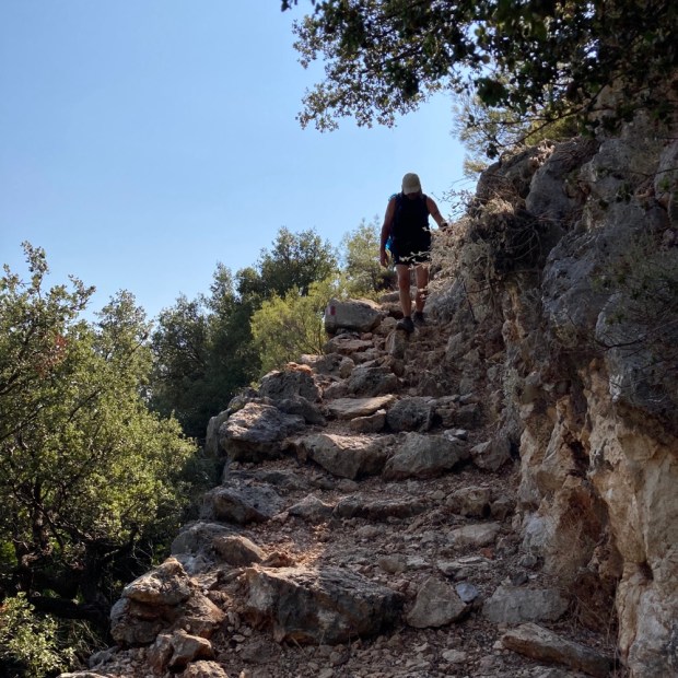
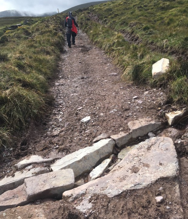
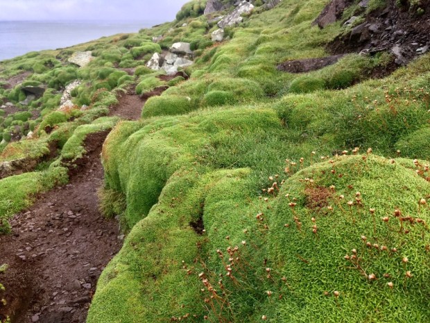
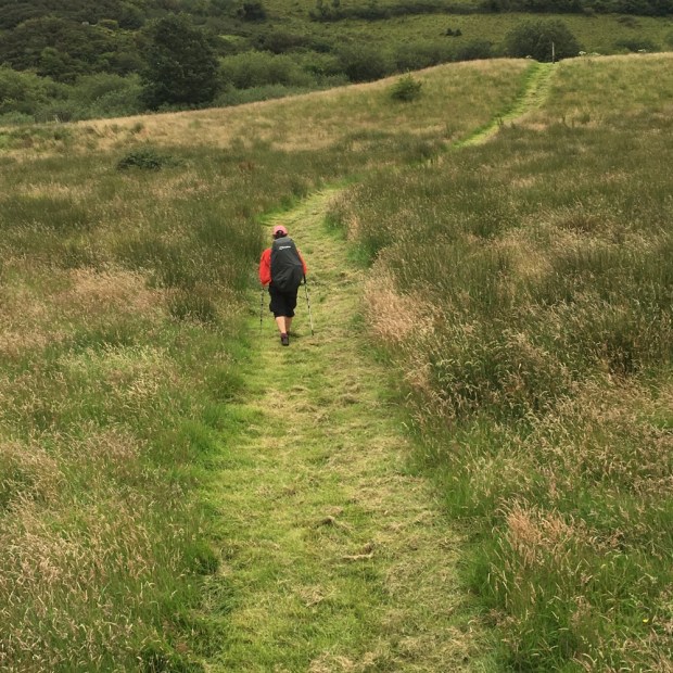
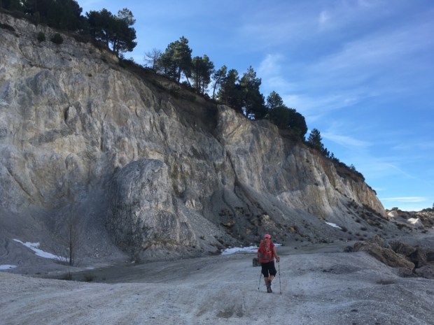
So it was kind of a relief when the Iman started his 5.50 call to prayer- our cue to get up and get hiking. Up across rocky olive groves and scrub and the stoniest fields I’ve seen. There are a lot of very stony fields here.

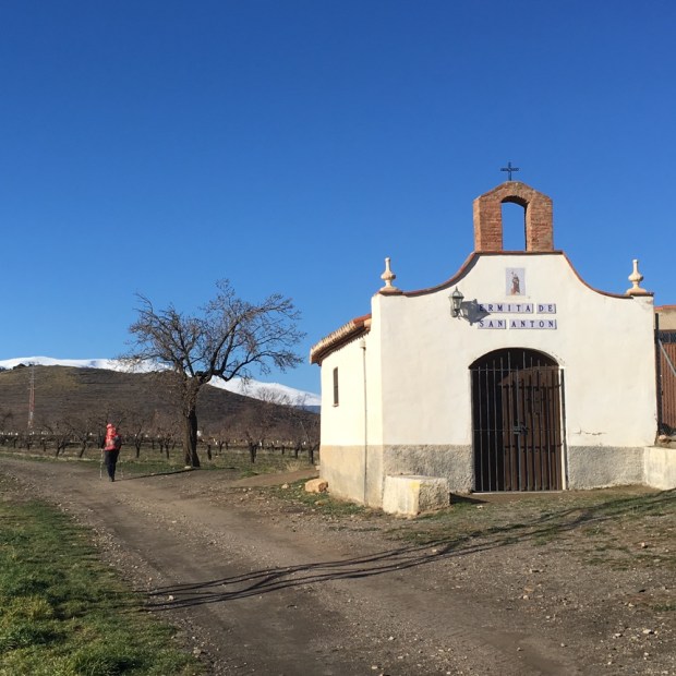
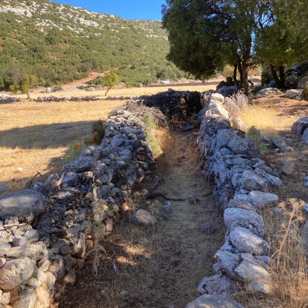
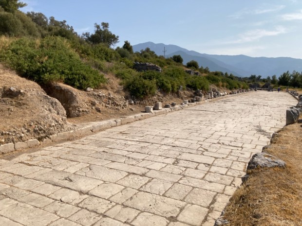
Up to a main road where a platform resting place ( kosk) was next to an old water cistern and ruins. And strangely a scattering of graves beside the road.

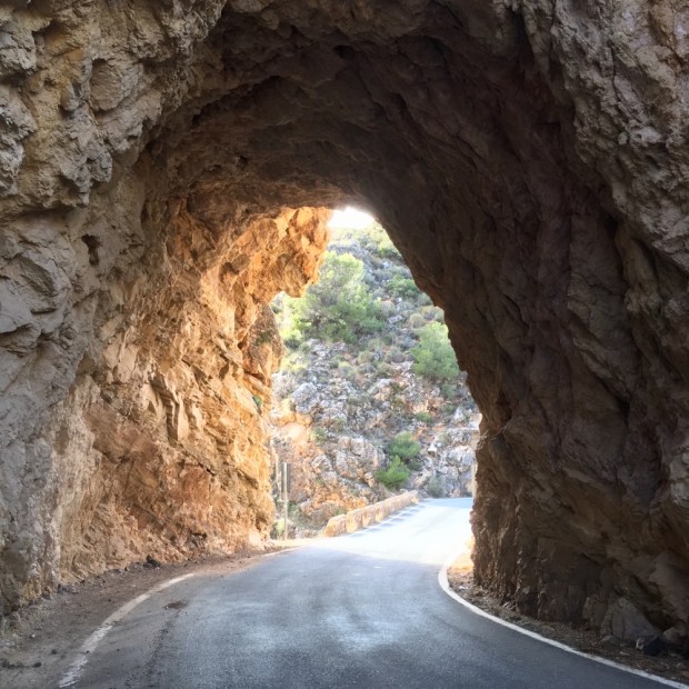
Next up, literally, a long climb. First up tarmac road of new villas, then bulldozed track awaiting new villas, then old roman road- now still used as animal migration route to get the goats to high pasture (yayla) for the summer months.

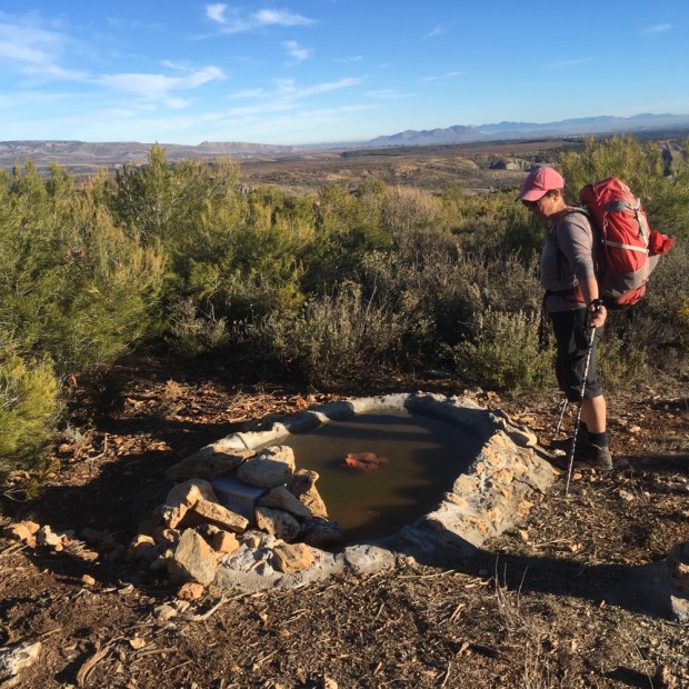
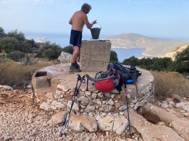
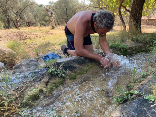
Already hot we stopped at a cistern that had a bucket and had a cold water wash and cool down.

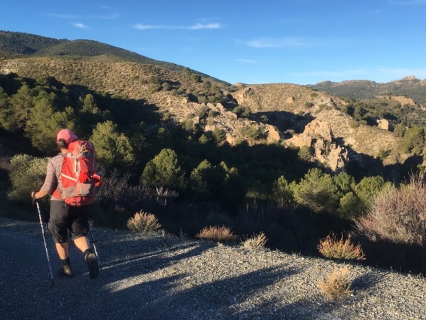
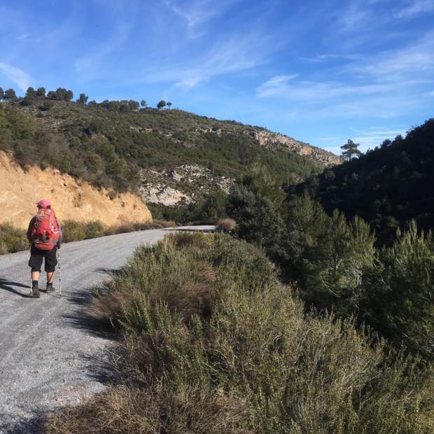
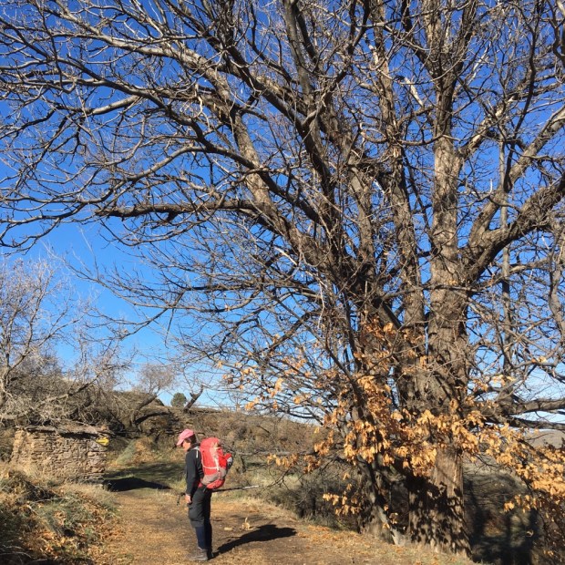
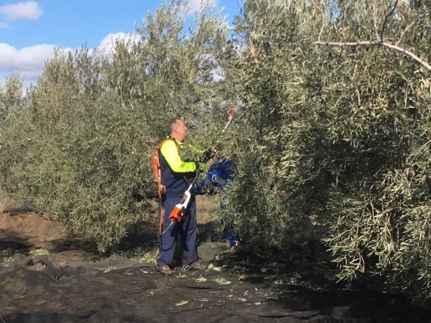
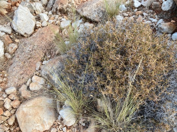
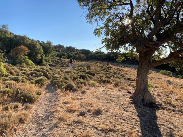
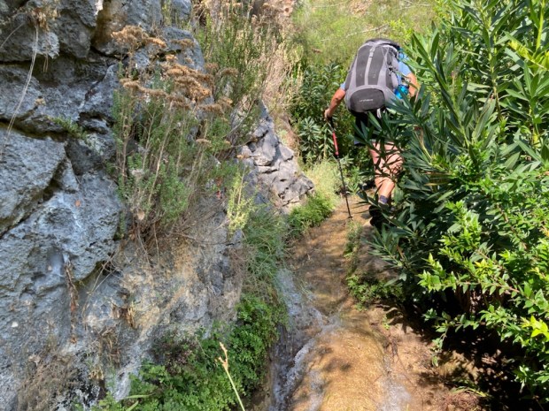
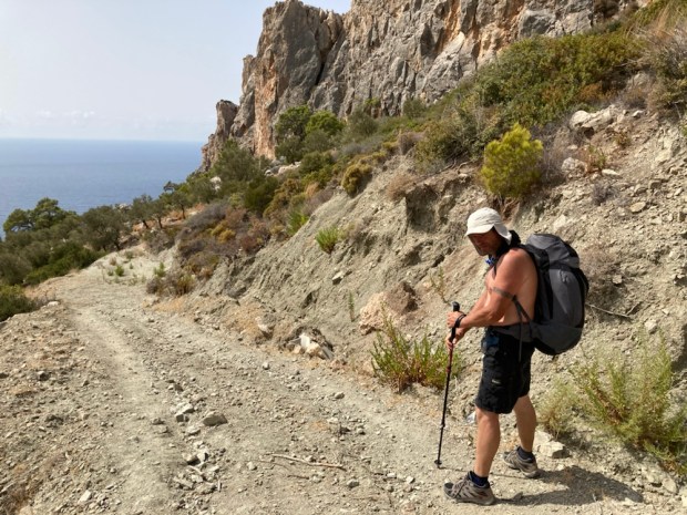
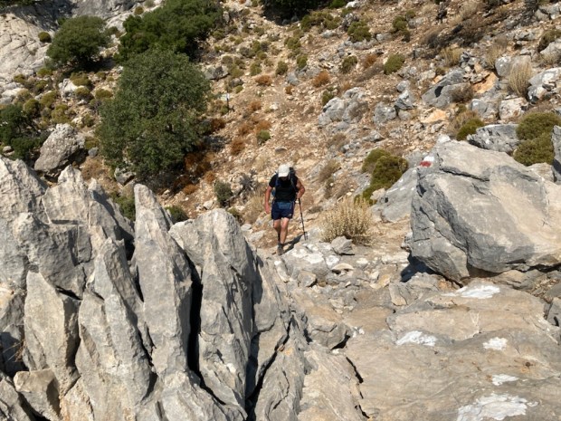
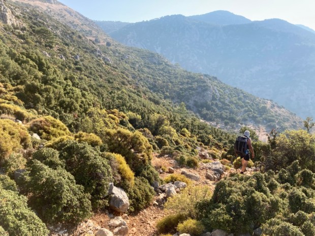
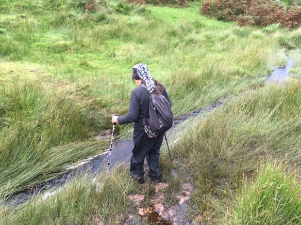
The vegetation here can be merciless. A lot of the time long trousers and sleeves are needed but we are usually in shorts and quite often top less so the thorny scrub has taken its toll.

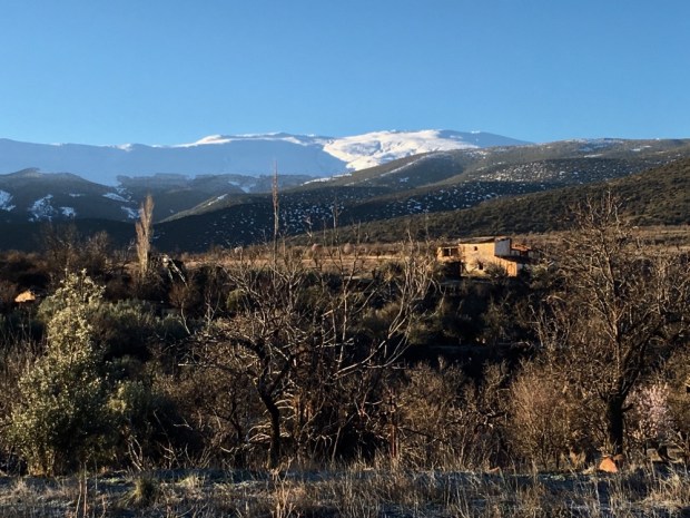
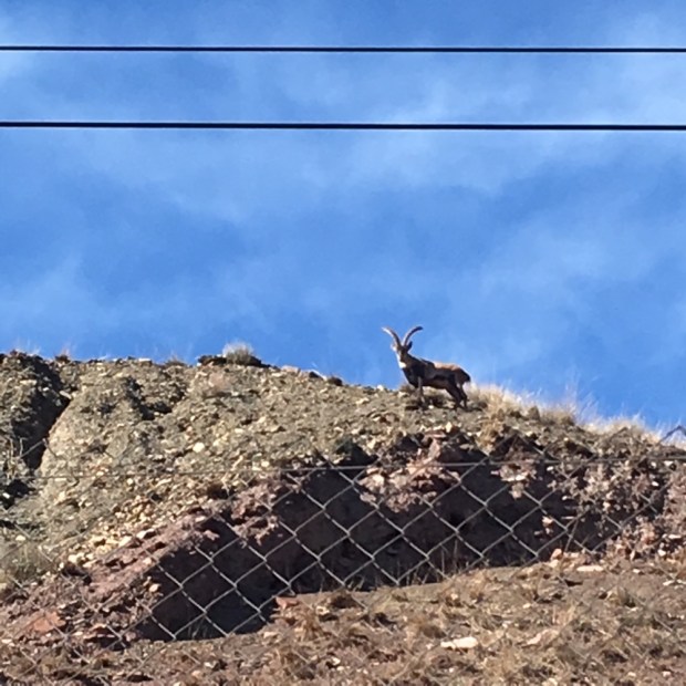
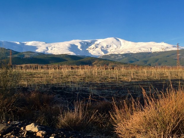
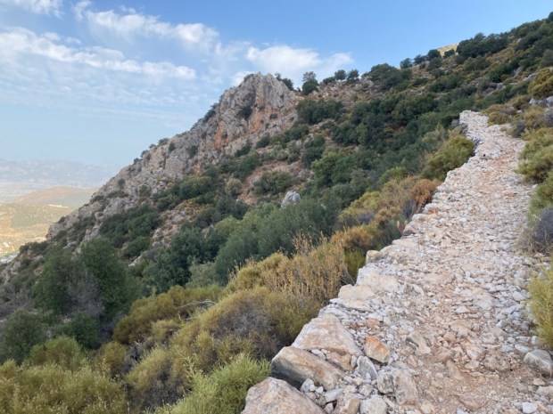
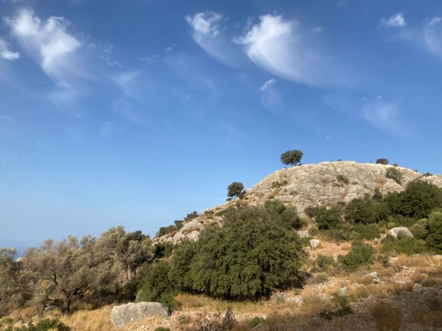
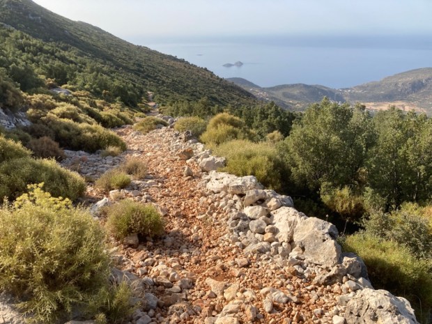
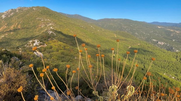
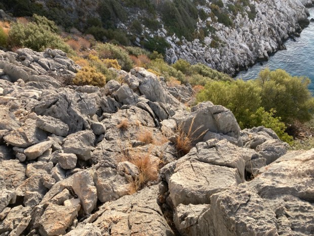
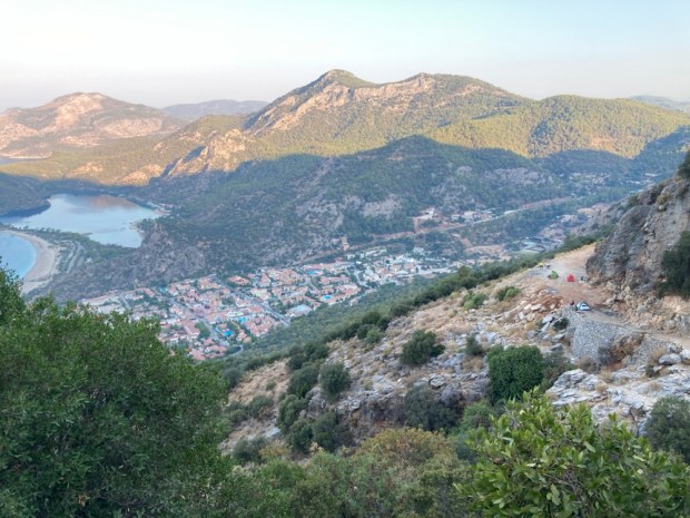
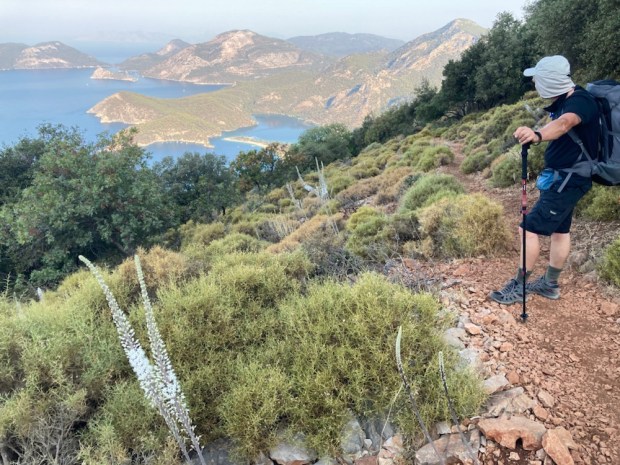
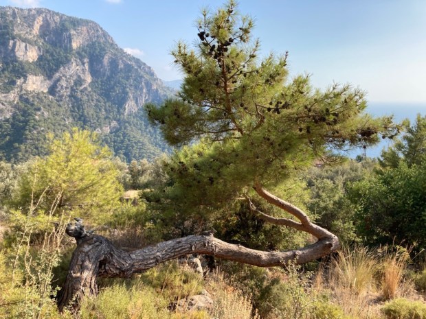
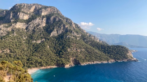
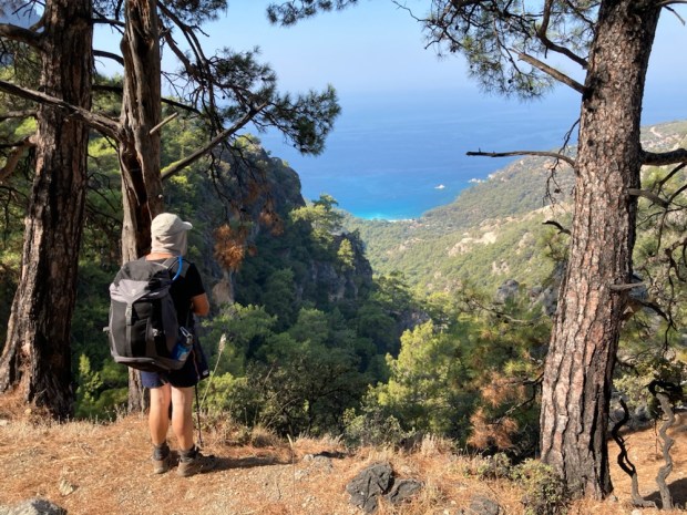
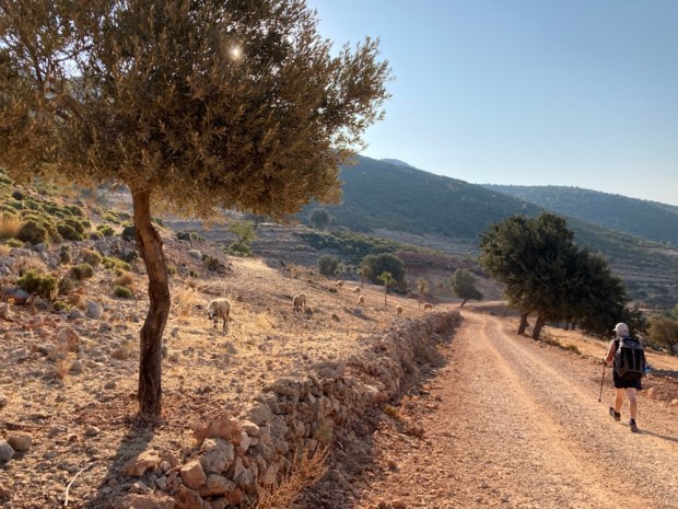
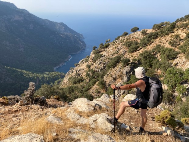
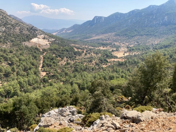
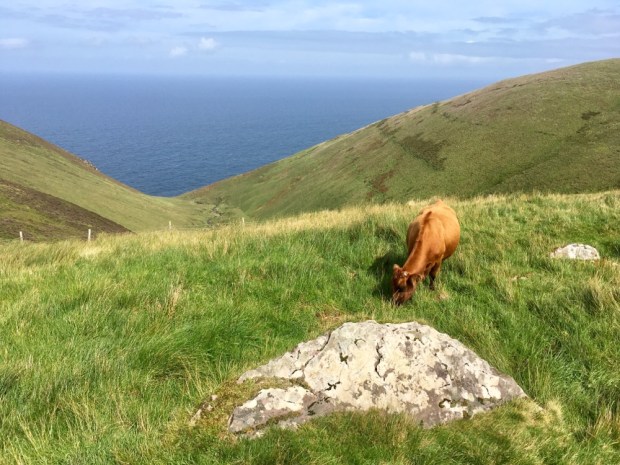
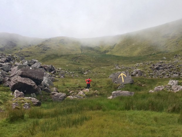
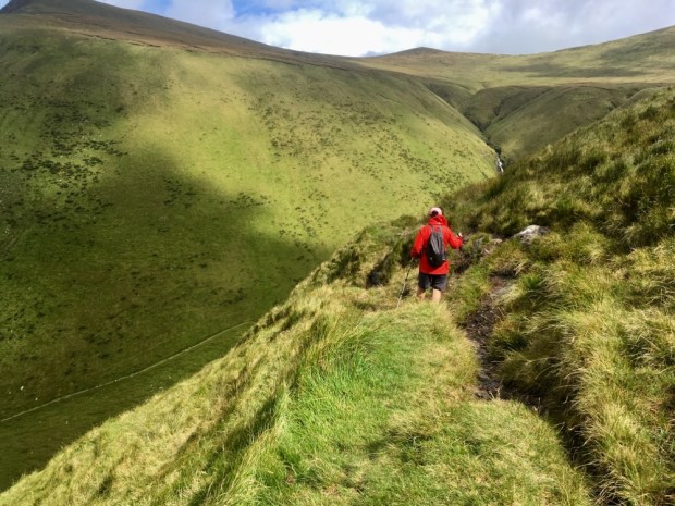
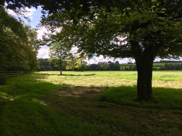
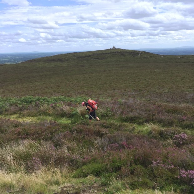
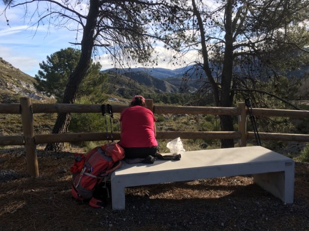
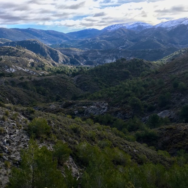
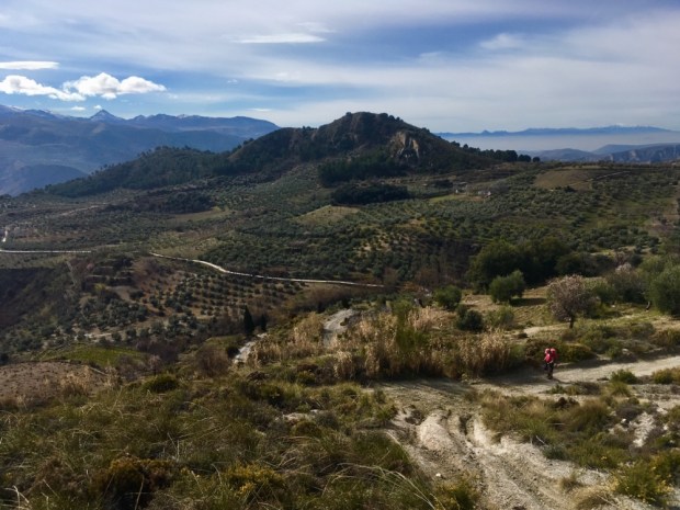
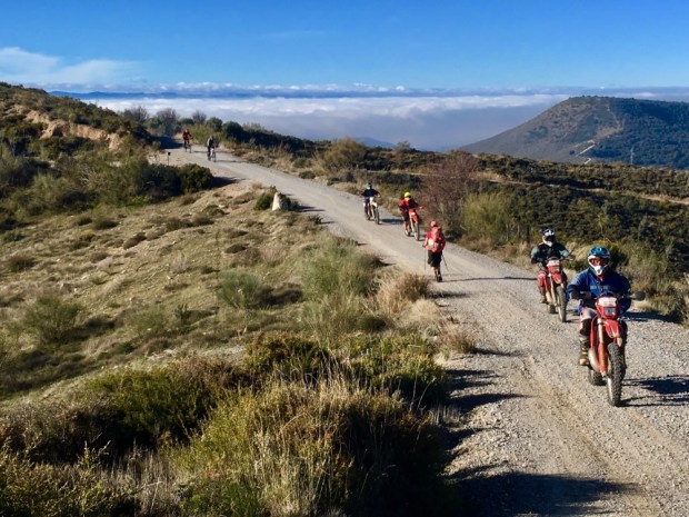
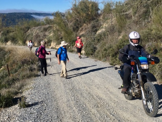
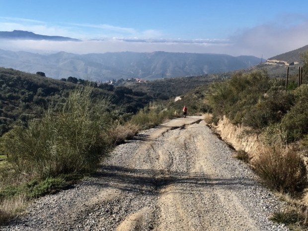
The rocky ground and fear of falling or twisted ankle means our eyes are on the ground a lot but every time we look up- a vista appears.

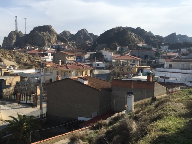
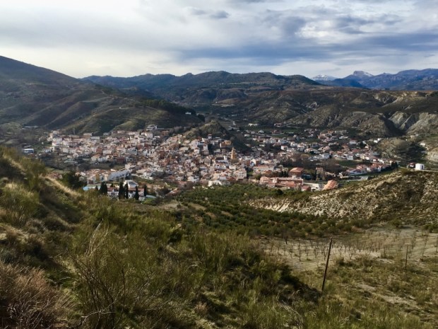
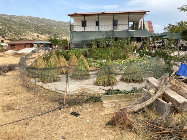
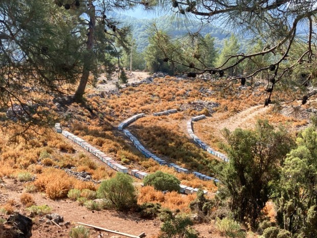
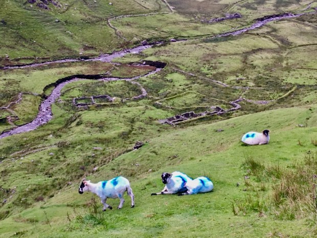
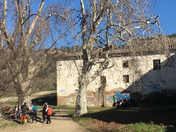
Coming into the next village, Bezirgan, up on the high plane between the mountain ranges (Ova), we passed through rows of the wooden grain stores (ambars).

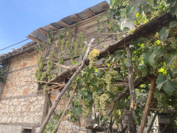
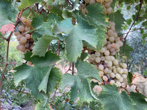
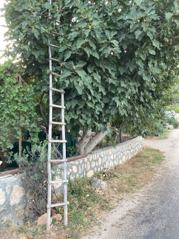
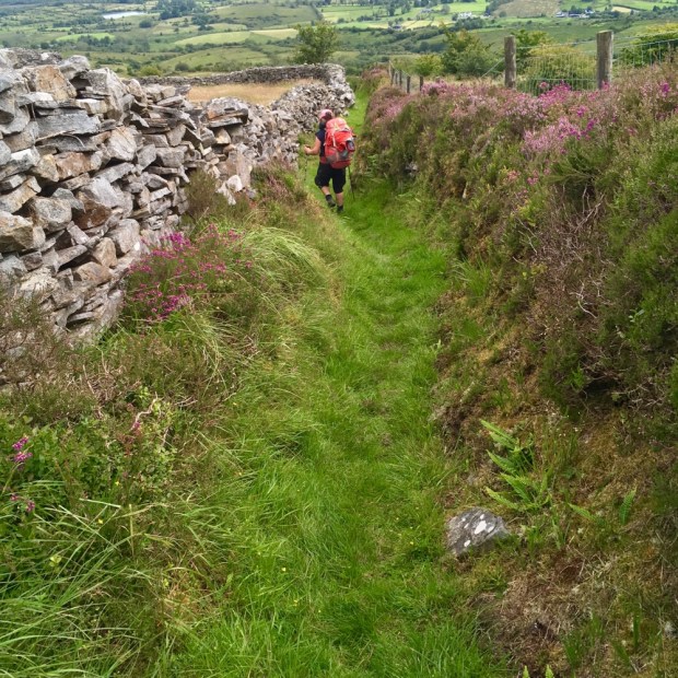
A scattered agricultural village with lots of grain fields and fruit trees, there were huge sacks of apples awaiting collection and juicy bunches of wild grapes hanging out over our route from the hedgerows. A narrow walled path led us out and up.

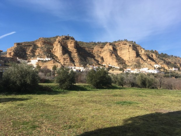
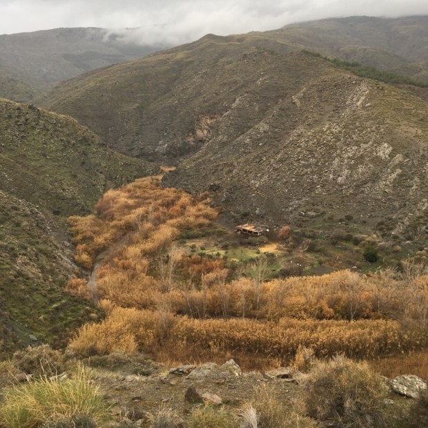
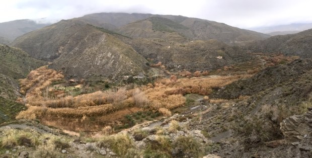
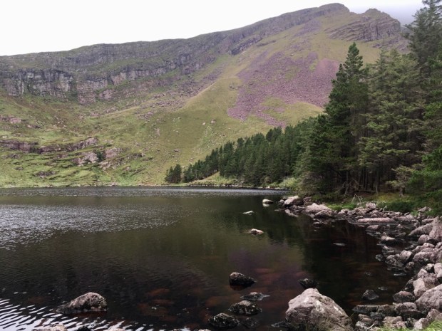
A different landscape again either side of Saribelen where we carried on past the stage end to wild camp and shorten the distance of the next days hike. We found a lovely spot amongst Burren like limestone formations and settled in for the night.

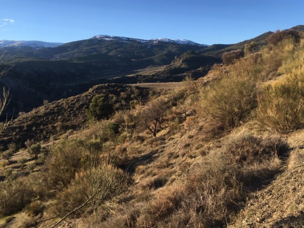
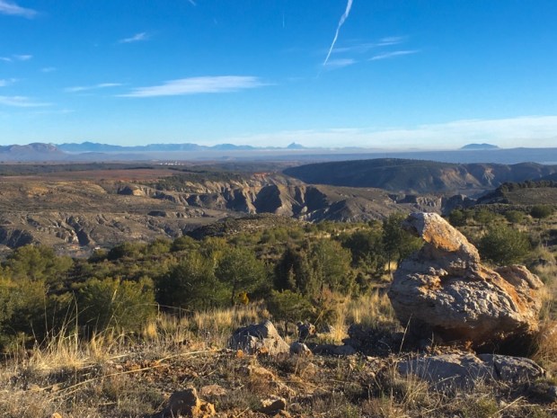
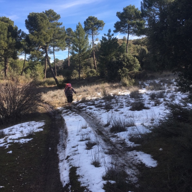
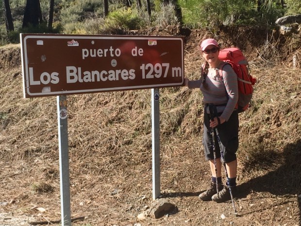
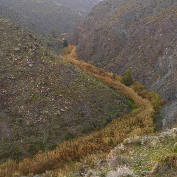
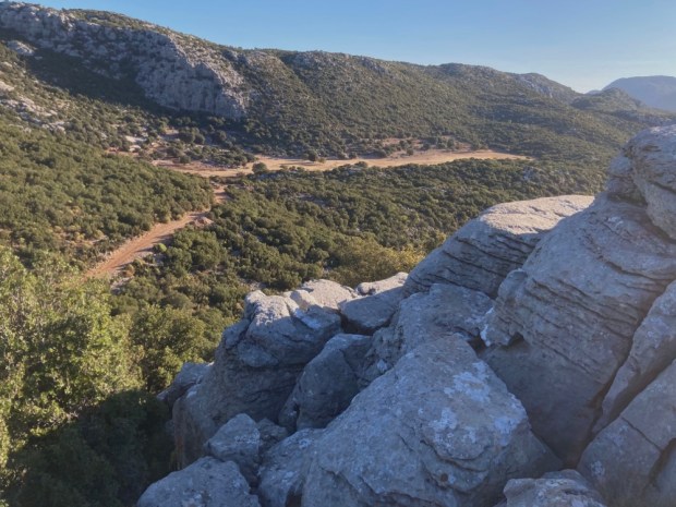
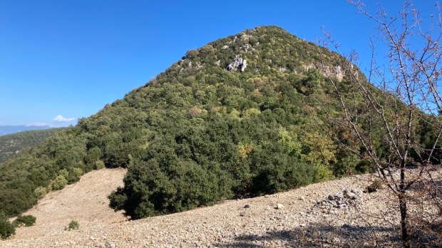
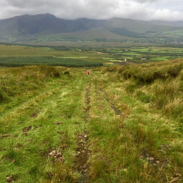
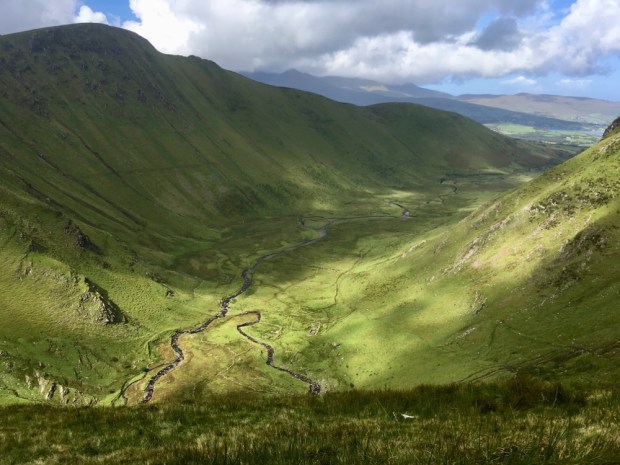
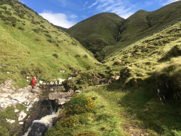
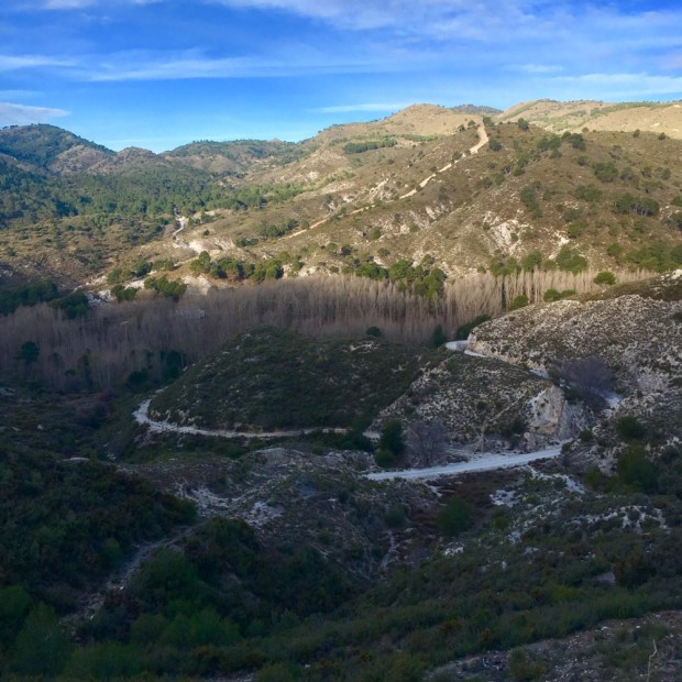
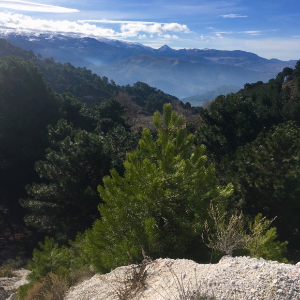
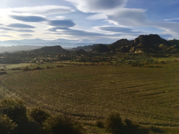
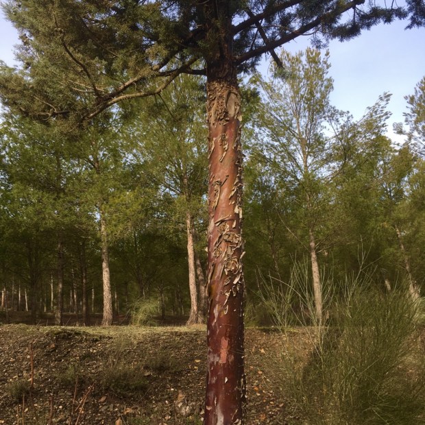
The moon nearly full on the light rocks and the wind blowing through the giant pines above us made for a interesting night but early morning we were off again to climb higher over a pass then down into another valley, past a charcoal burners circle and over an empty and austere but beautiful ova. The level going made for some rapid progress after much tortuous stumbling over stones ground.

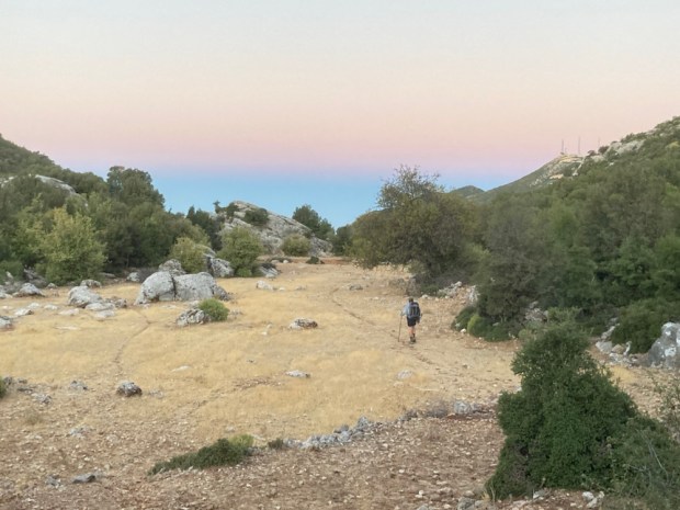
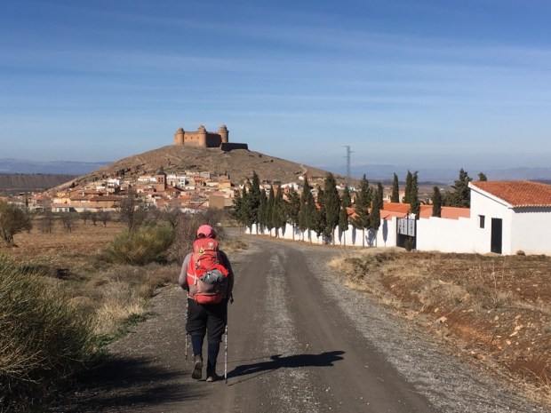
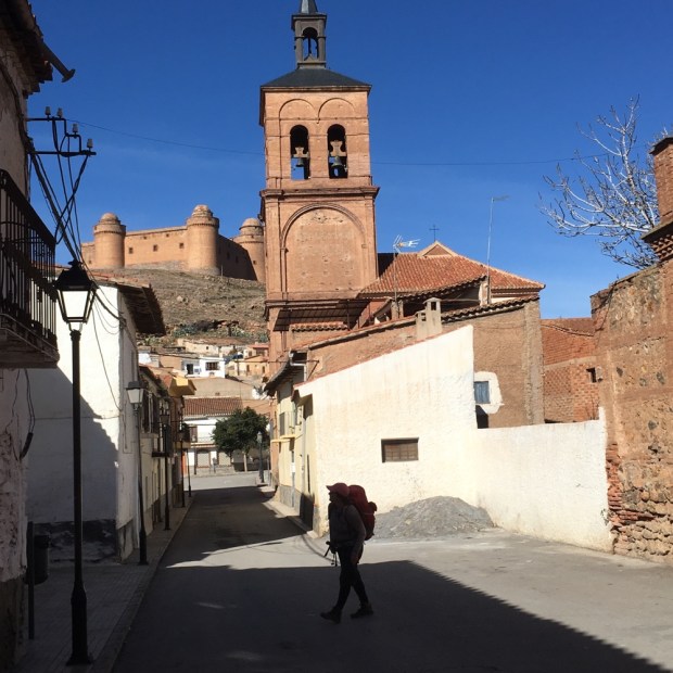
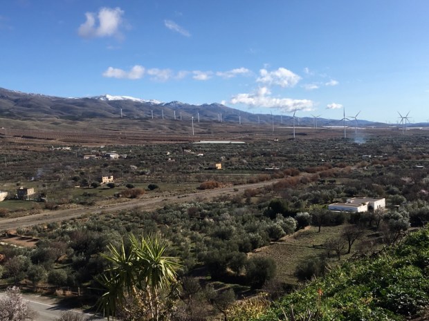
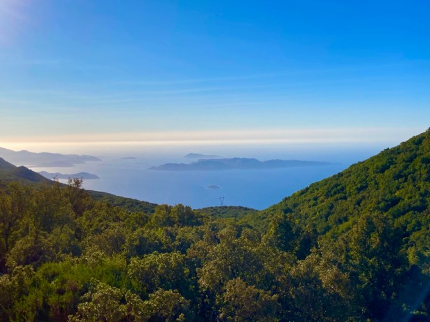
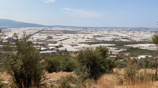
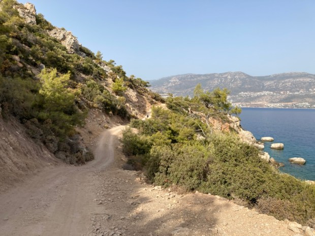
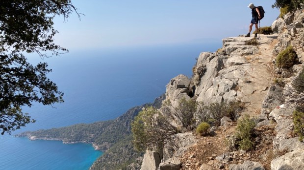
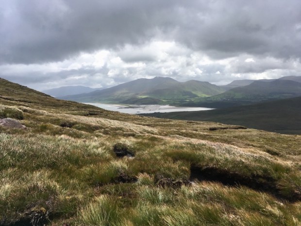
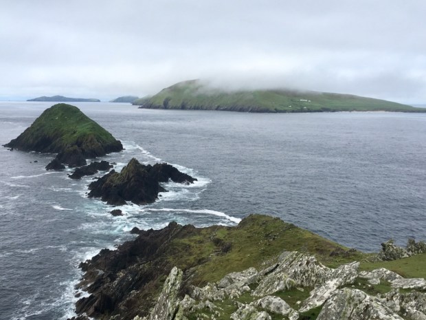
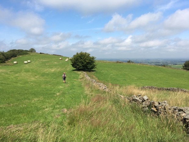
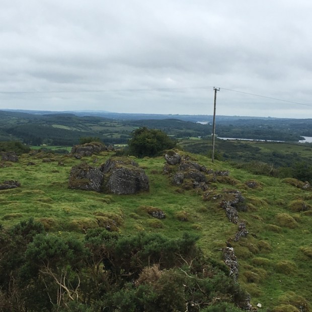
On a wide tractor track we climbed up till we had views of the coast again and continued on this high ground before dropping down again into another ova.

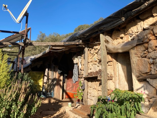
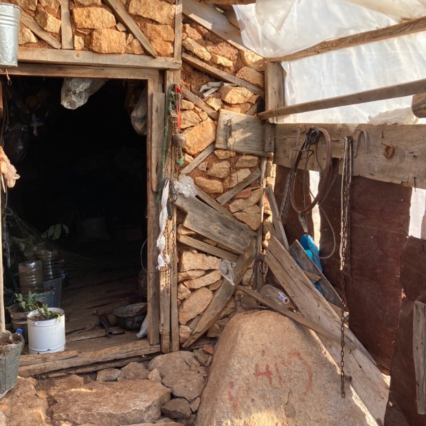
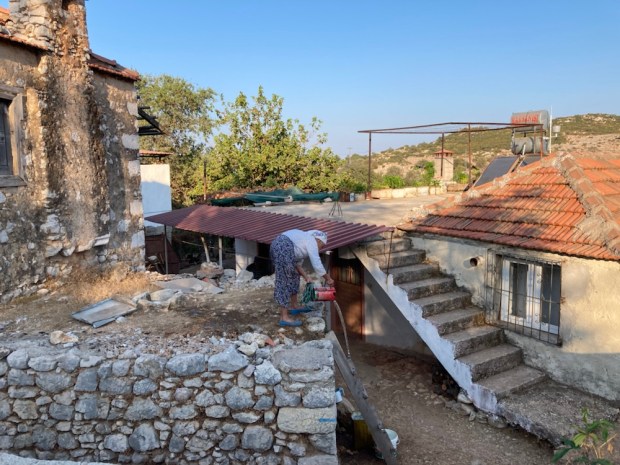
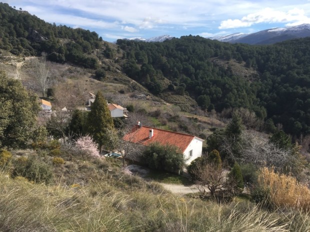
This was the home of Huseyin and the red and white markets led us straight to the little house where his wife? Called us in for cay, tea, and pronounced as in the Indian Chai.

A fine hardworking lady, who showed me her arthritic hands and left me wondering about her life.

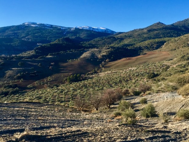
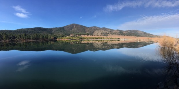
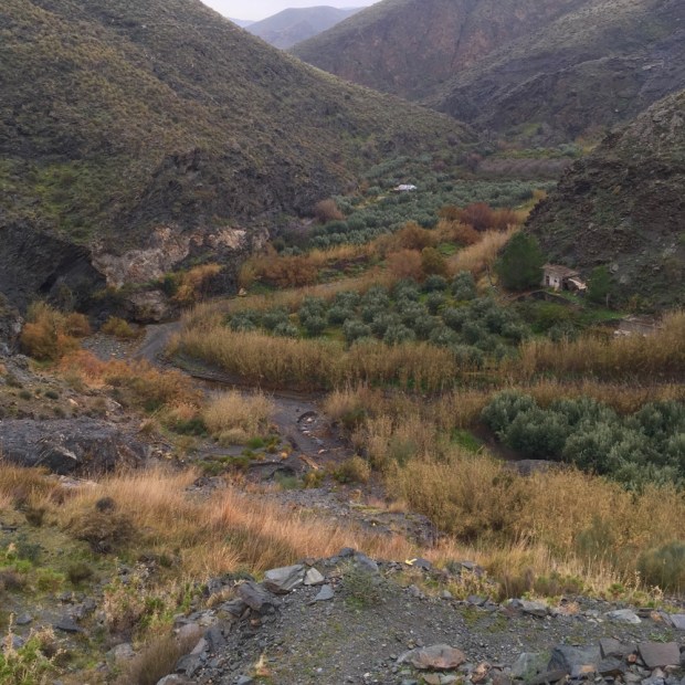
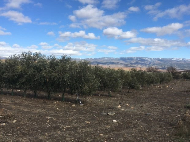
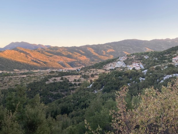
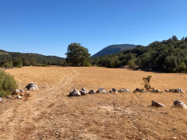
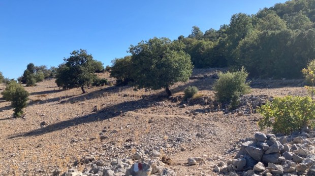
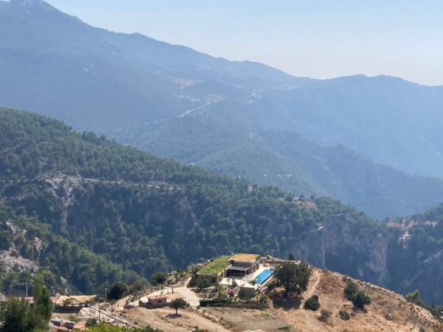
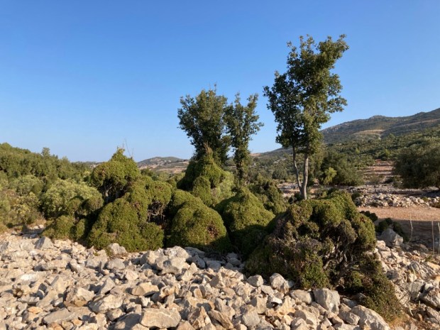
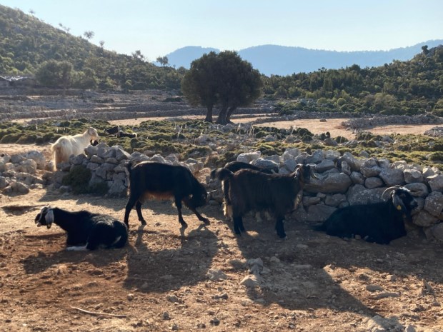
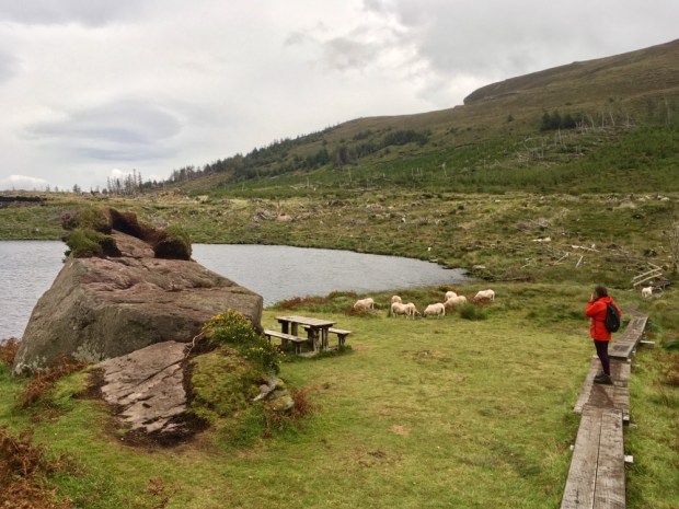
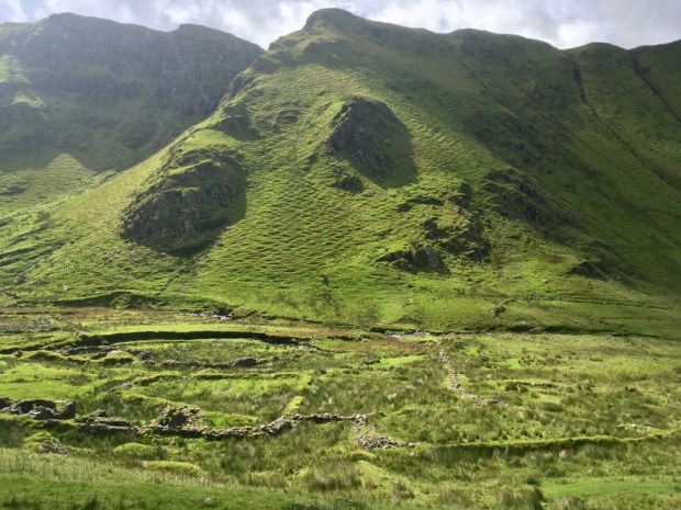
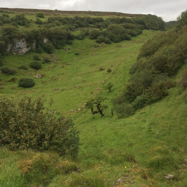
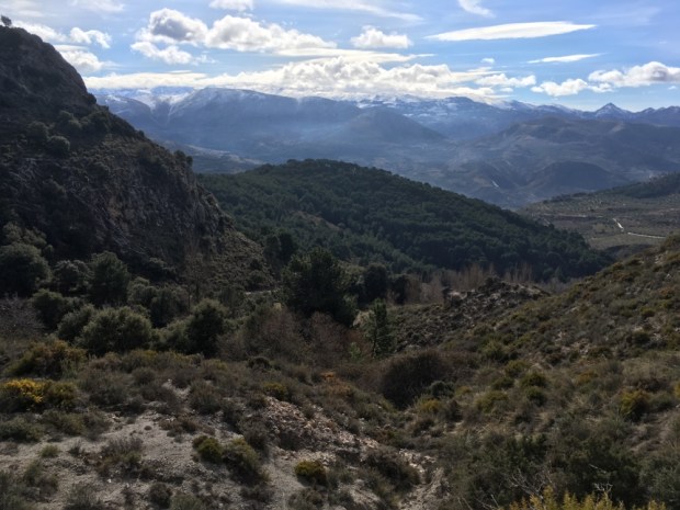
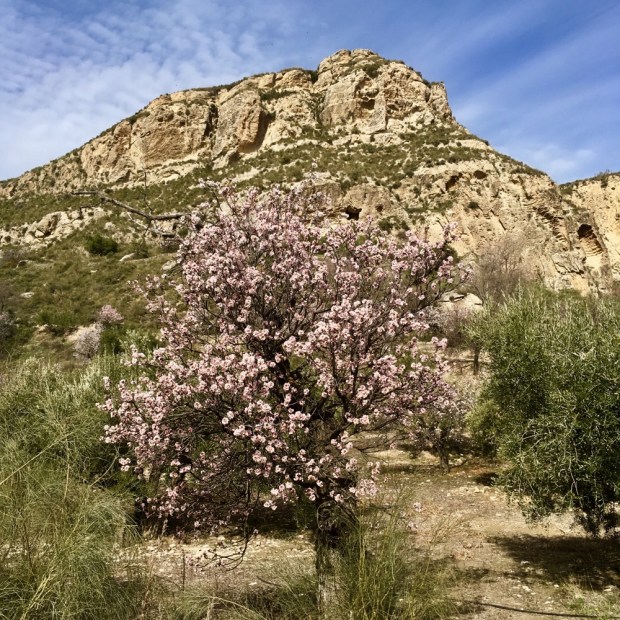
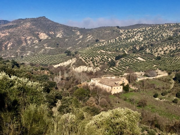
It was a magical place,with goat topiary, fantastic stone, wonderful woodland, flat fields for grazing and a huge empty landscape. I would love to see these ova’s in spring with fresh green grass and wild flowers.

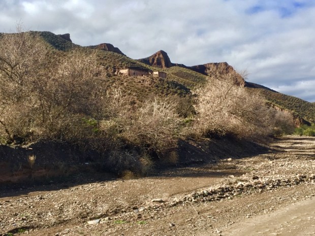
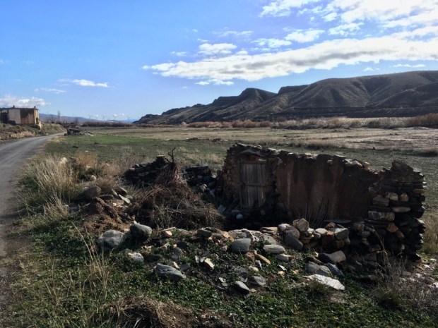
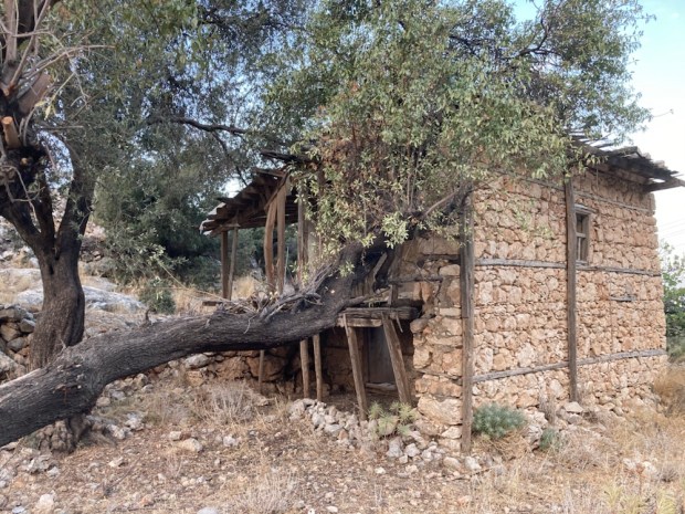
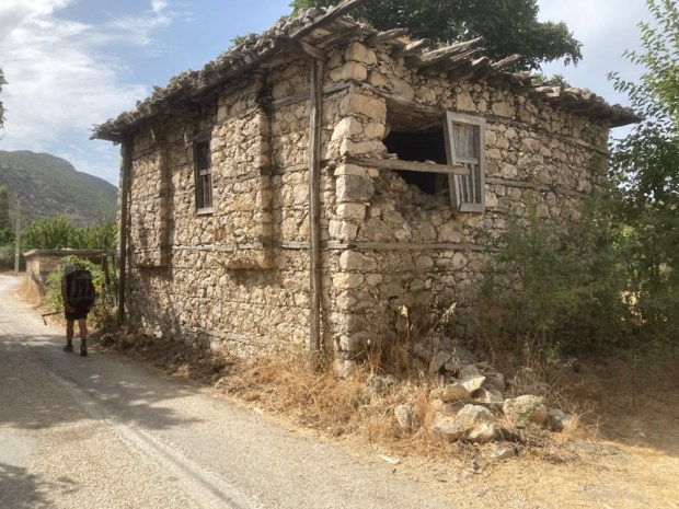
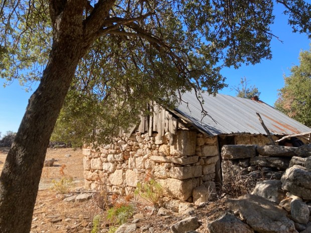
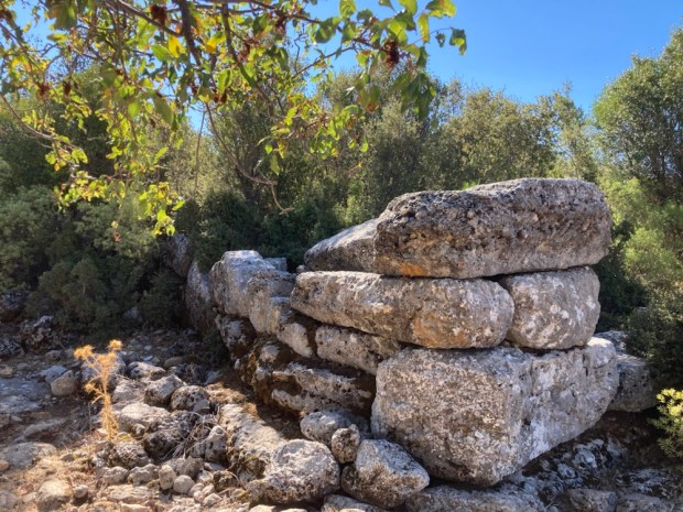
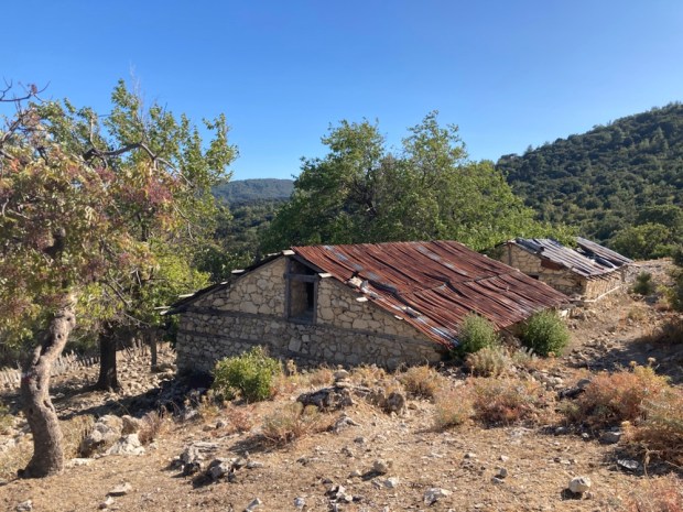
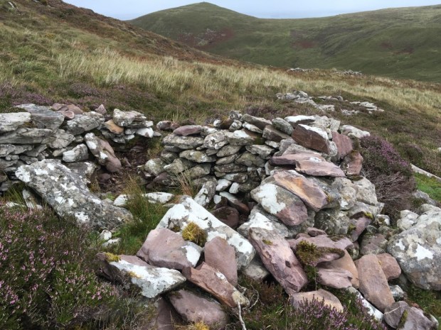
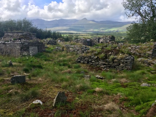
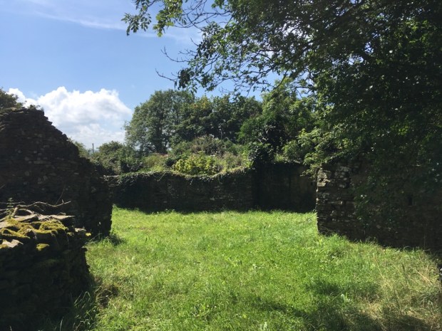
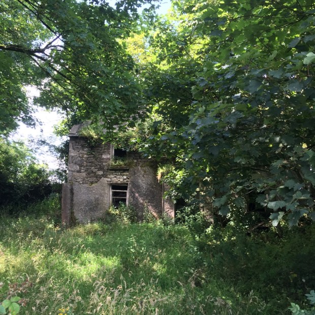
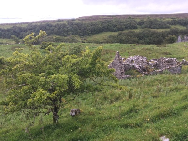
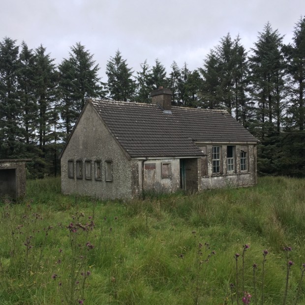
And there were traces of former lives lived here. Old farmhouses and stone remains of buildings from a dim and distant past.

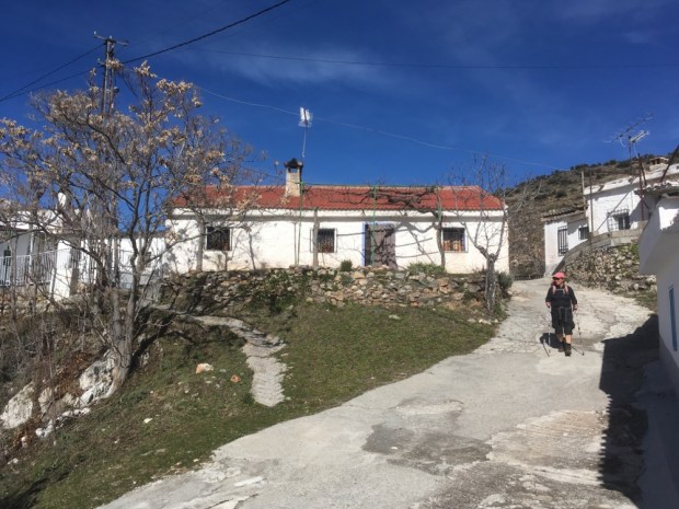
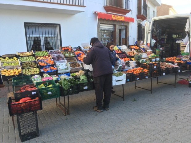
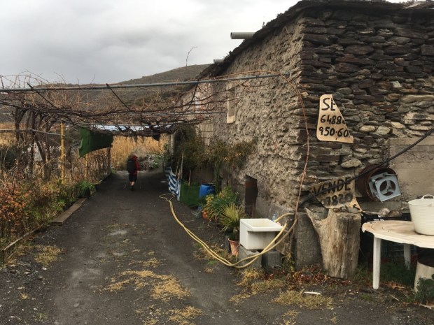
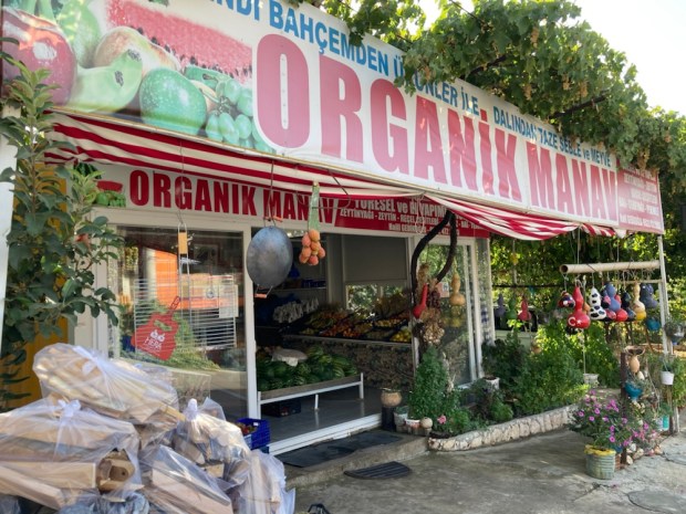
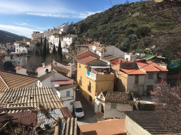
Coming into the next village and hoping to replenish our supplies at the ” market” (shop) was a slightly surreal affair.

A huge Turkish flag hung in the sky and as we approached a car drew to a halt asking if we wanted breakfast or pension. After telling the couple we only needed the shop, market – he turned the car around and drew to a stop outside Yesil’s Lodging and proceeded with the hard sell. Later we were to read he was notorious for being a somewhat aggressive salesmen. The irony was that unless you wanted a bed for the night or a cooked meal his “market” had little to offer.

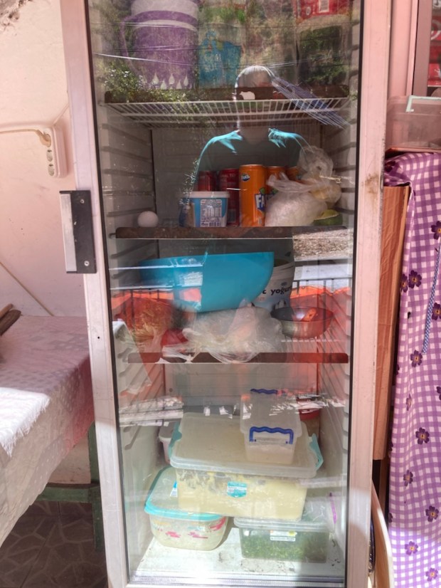
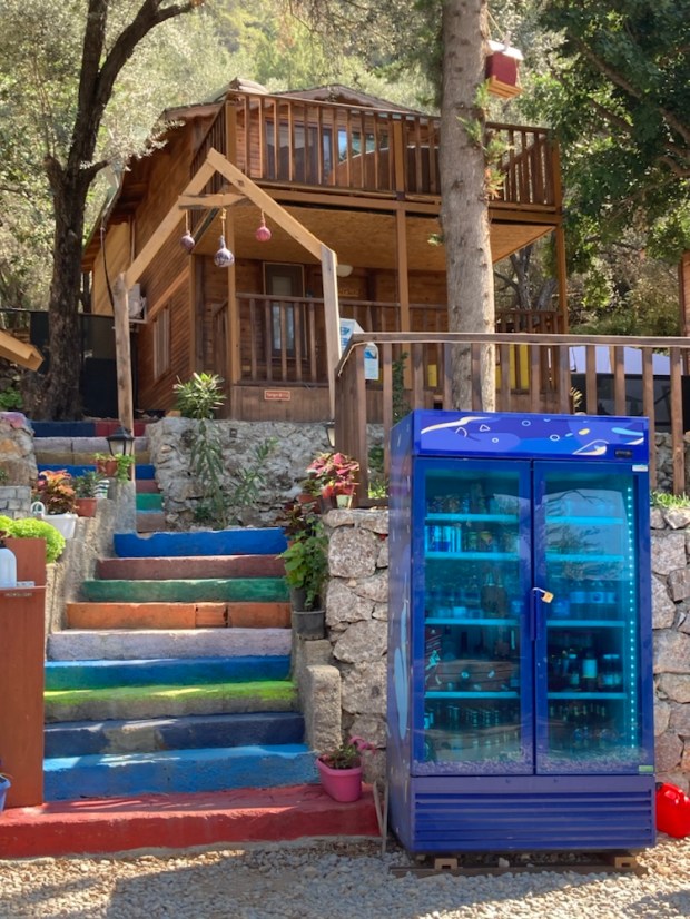
That wasn’t just a fridge. That was the village shop.

The next strange event happened not long after we had escaped Yesil’s grasping hand when we came upon the younger brother of our friend Gerry Mulkerrins picking rose hips for the cay.

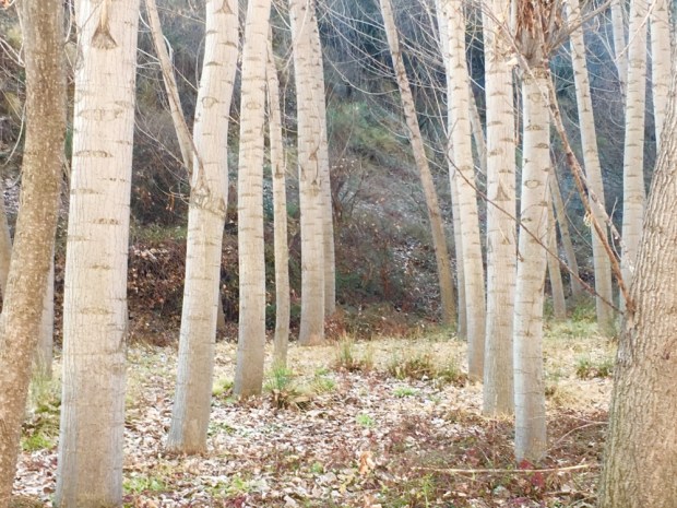
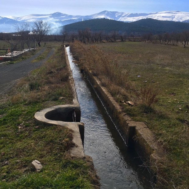
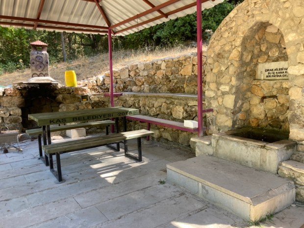
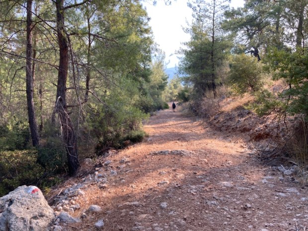
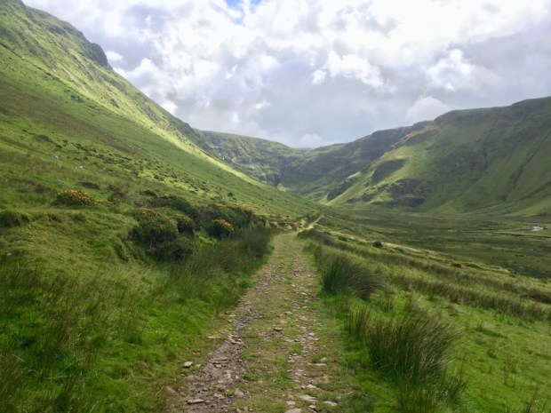
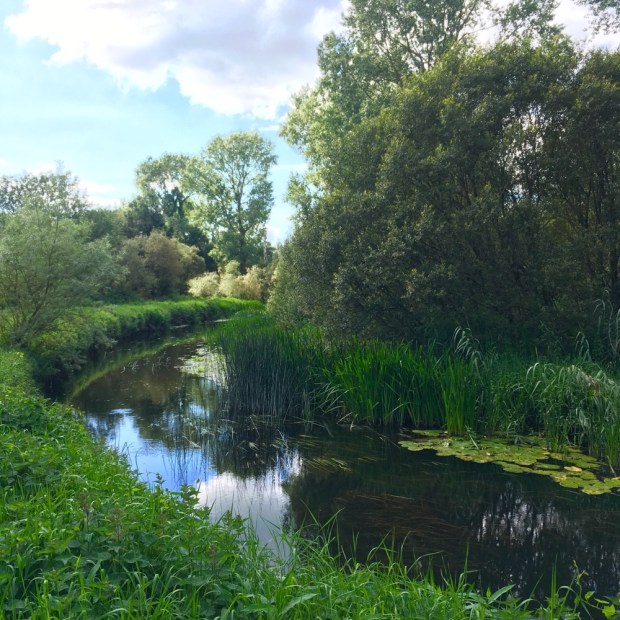
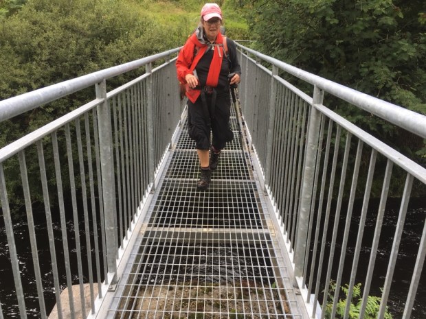
He gave us a big bunch of grapes and we carried on along a long valley into forest covered hills on a path that led us to a Wellcome resting shelter and water fountain.

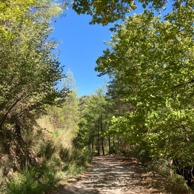
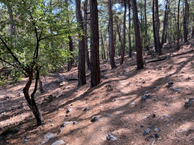
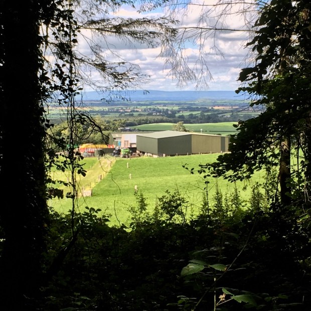
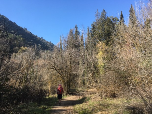
Refreshed again we began another long and steep climb that had us climbing high over the valley through woodland path and forest track. I startled a family of wild boar at some abandoned shepherds huts and they took off at high speed.

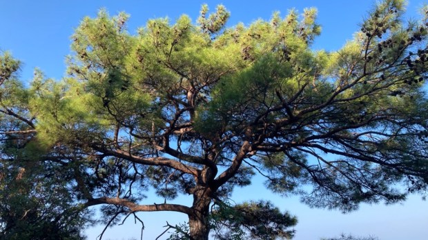
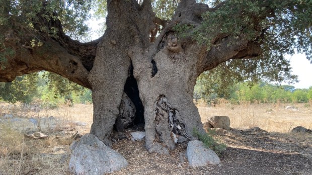
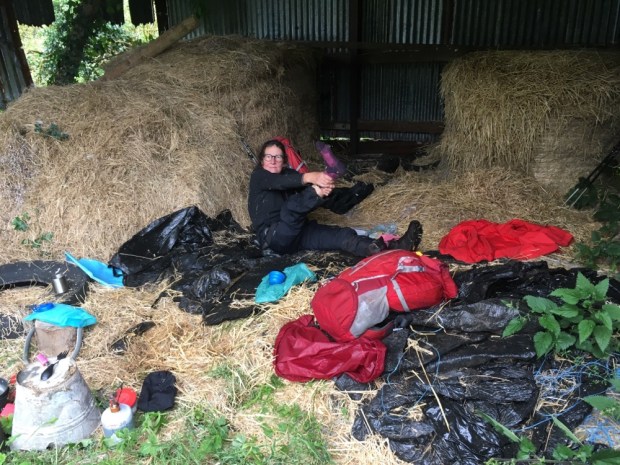
And finally at about 940m we found our camp for the night. A resting platform built under an ancient and huge spreading plain tree next to a dribbling water source.

But even a dribble adds up pretty quick to enough drinking water even when you are getting though about 4 lt a day. It was just as well we were as fortified as we were as just as we were falling asleep, a clatter if hooves on stone announced the arrival of z as large group of horses, perhaps 10, come searching for water. They returned many times throughout the night, sometimes on mass, sometimes in twos or threes. And then the screech owl started.

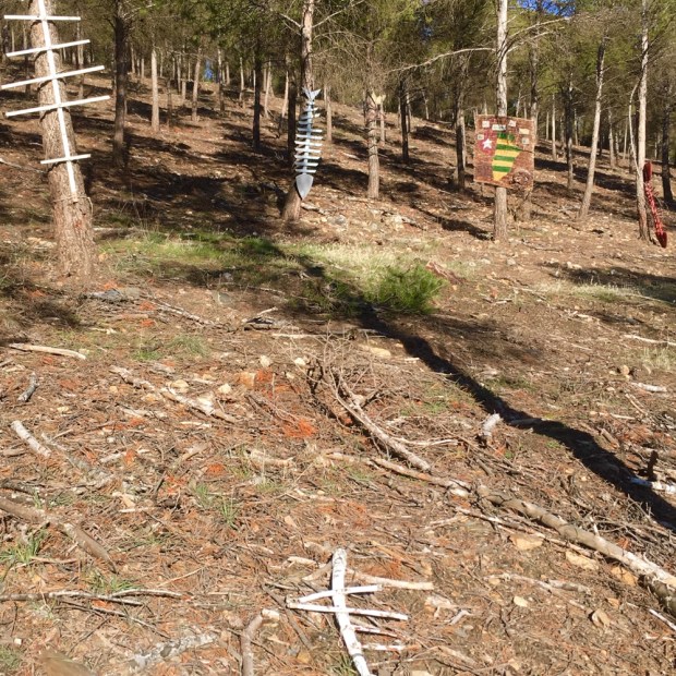
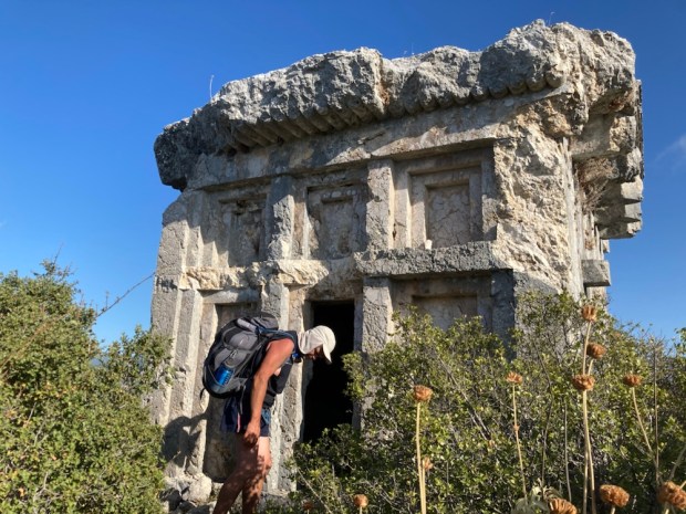
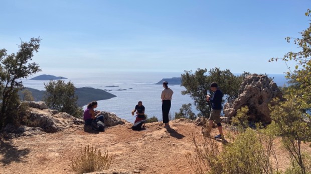
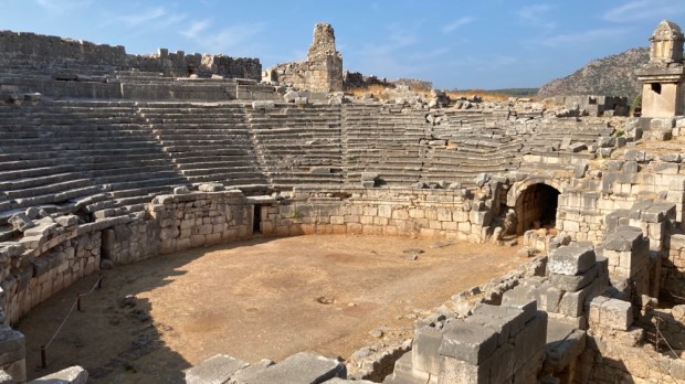
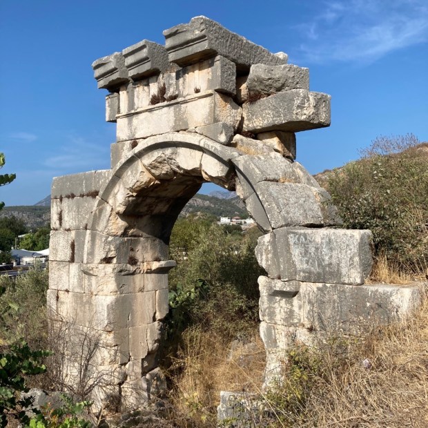
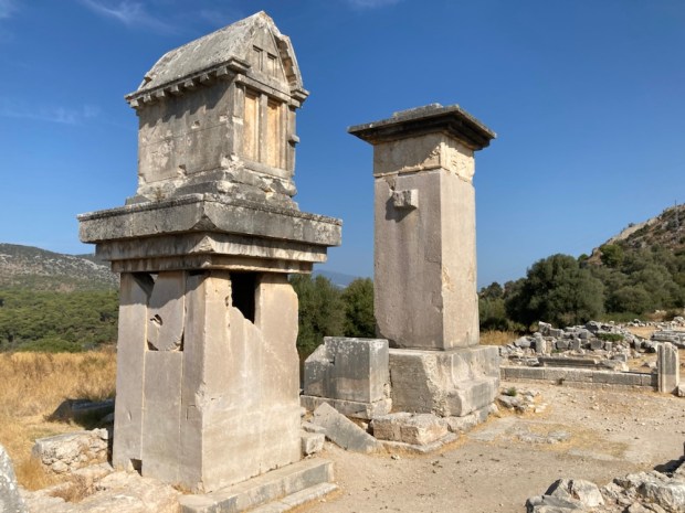
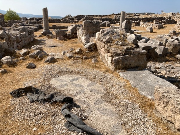
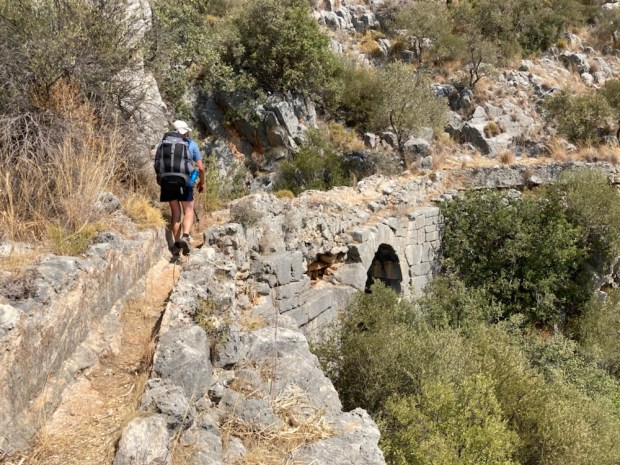
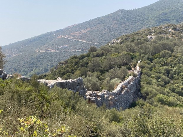
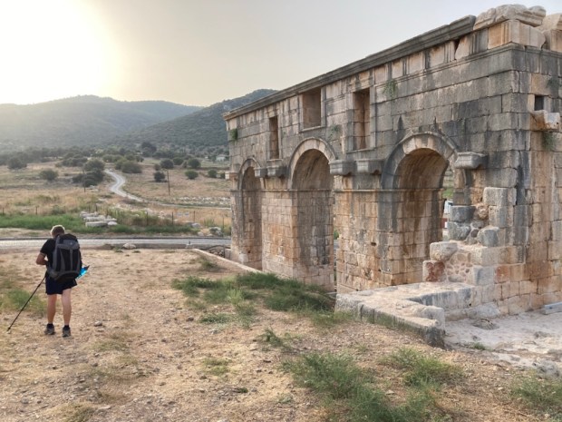
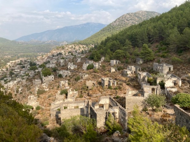
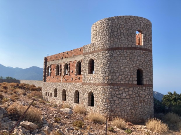
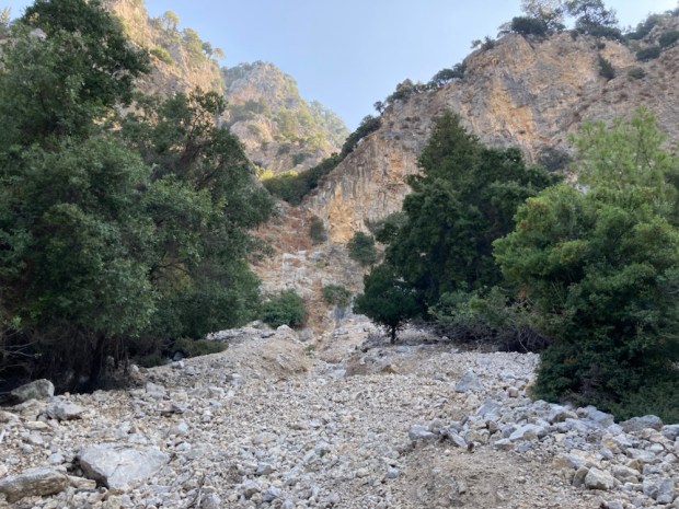
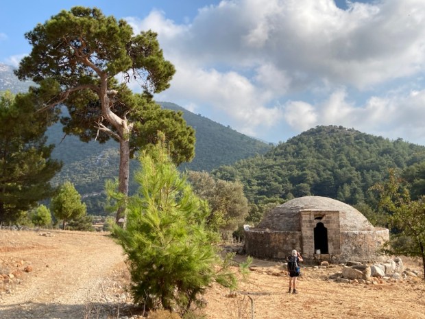
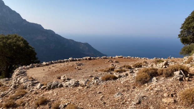
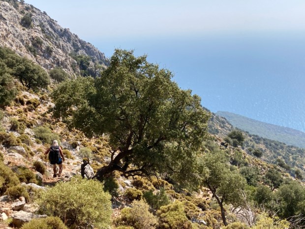
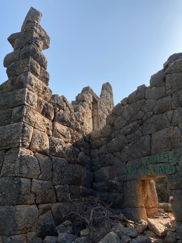
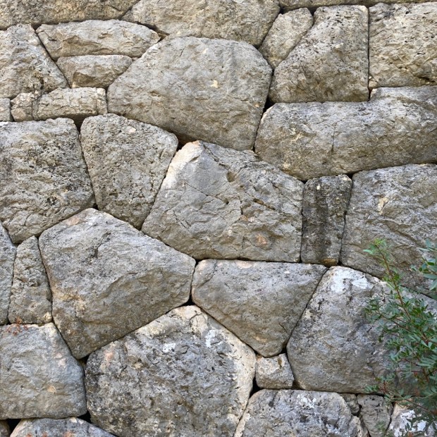
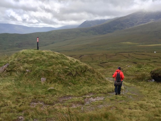
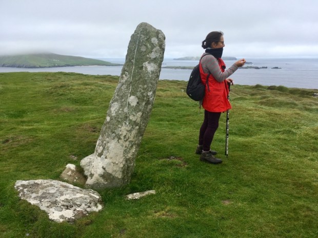
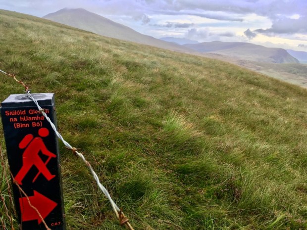
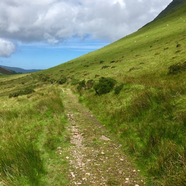
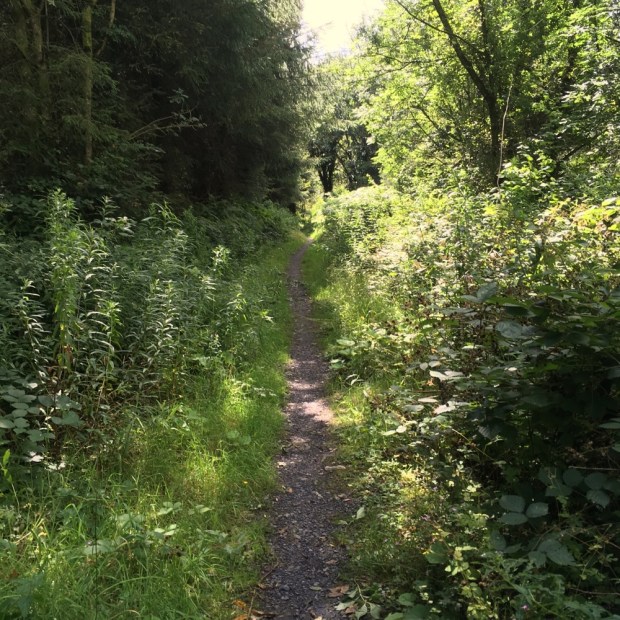
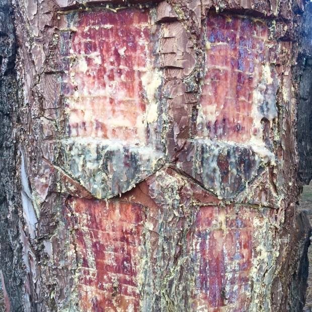
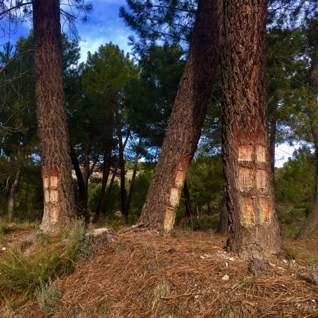
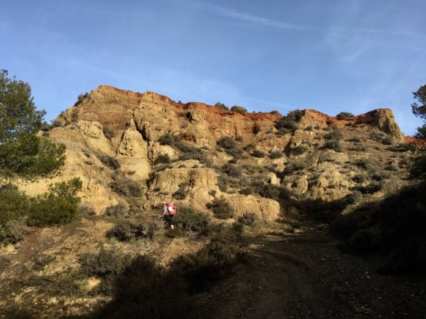
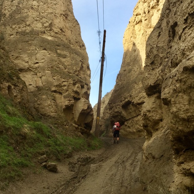
In the morning we continued up and along a wild overgrown ridge to another extraordinary archeological site- Phellos. Perched high on the end of a precipitous ridge it was most probably a Roman garrison city and has been left to the encroaching scrub for a long time.

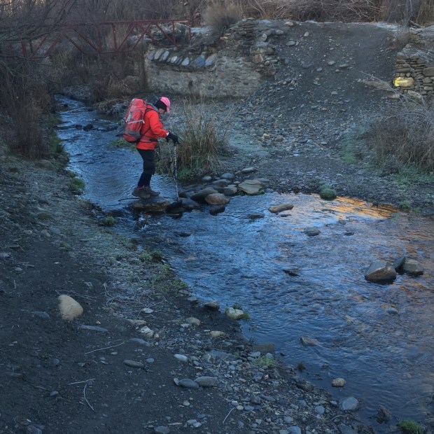
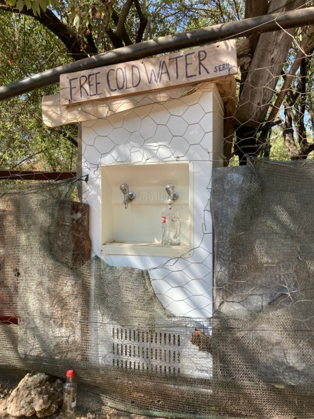
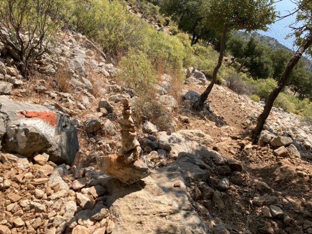
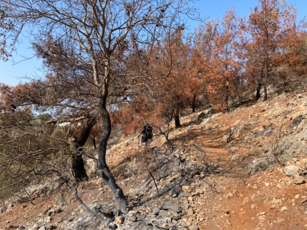
And then the long scrambling down through the stumble stones and pricking plants into Cukurbag where some kind person had positioned a free cold water machine on their garden wall.

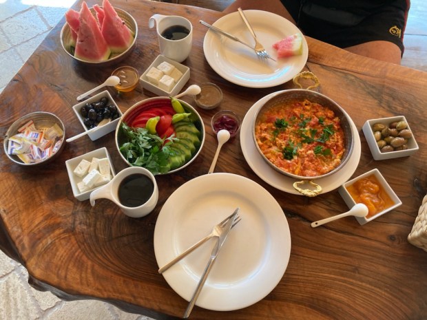
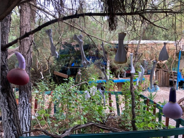
At the far end of the village, just as we had given up finding breakfast we found Nirvana. Breakfast Nirvana anyway. A beautifully put together complex of garden, houses and rustic cabins that make up 3oda.

A craftman’s vision had gone into the creation of a special place full of quirky features.

And the finest breakfast of homegrown/ homemade fruit, veg, preserves etc etc you could hope for on a long hard hike. A lucky find. 3 Oda.

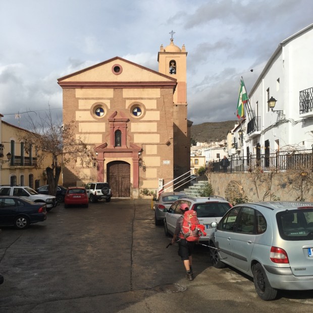
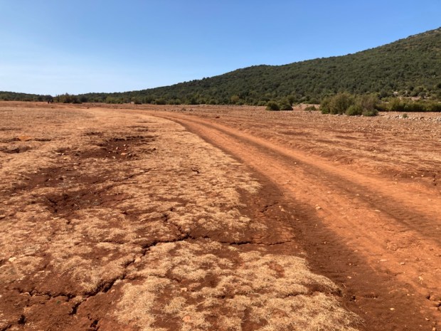
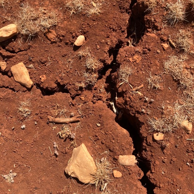
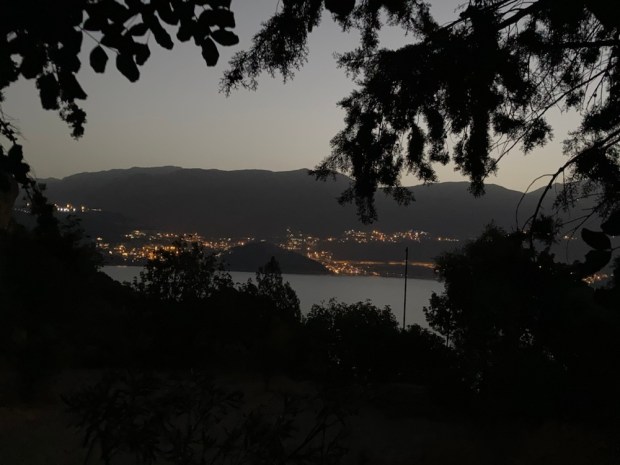
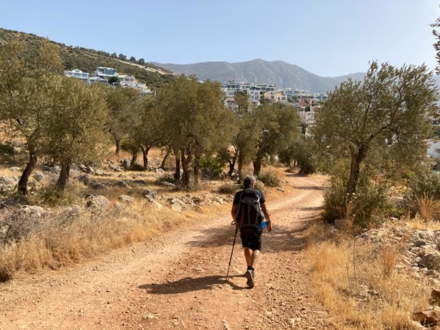
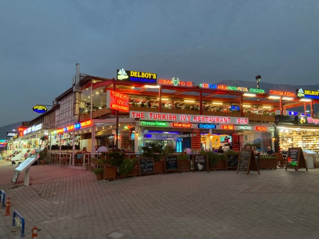
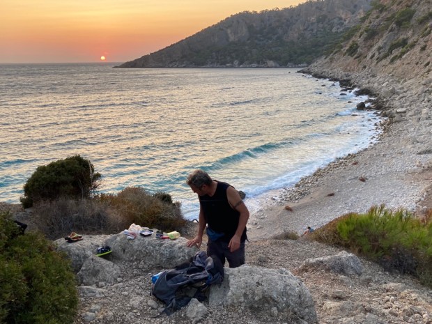
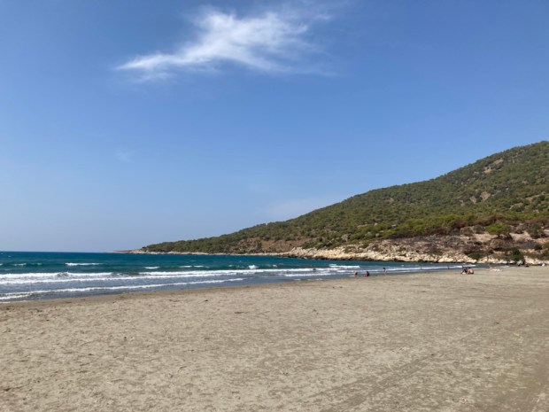
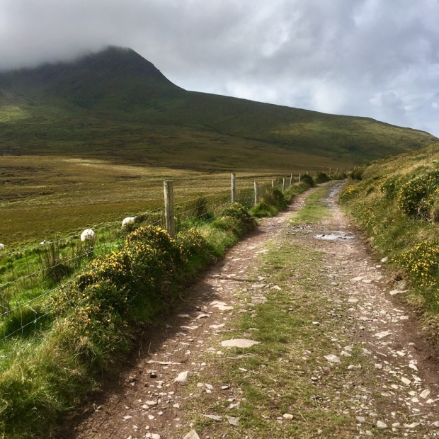
After a couple of days of bread , cucumber,cheese and tomato and little else, it was a foodie treat and we headed off on the final leg to Kas replete. Easy to start, crossing a wide, flat and dried and cracked area- difficult to finish with an incredibly steep and slippy descent down to Kas.

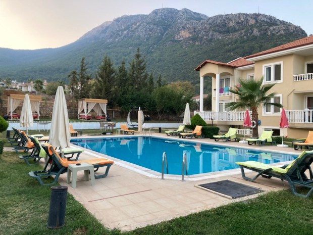
Thankfully down safely we rewarded ourselves for the hardships endured and to come with a room in a hotel with a pool and buffet breakfast. Tomorrow we go wild down the coast again. Starting with a boat ride.

THE LYCIAN WAY 2.

So 4 days trekking since last post and I’m hiding from the sun in a tiny wooden A frame at the foot of the 900m mountain we now have to climb. An emerging camp site being put together by a young guy from Macedonia. All off grid, a dozen or so little “bungalows” set in an olive grove that the Way winds through. It’s called the Olive Garden Camp if you’re ever over this way. It’s just after the busy, mostly British, resort town of Kalkan which we got through as quick as possible. Picked up a new cap for me as some bush grabbed the last from my pack this morning, and supplies and cash for Ivor, and got the hell out of Dodge. We’re hoping that a dawn start from here will have us up the mountain before the sun boils our blood.

We’ve seen a lot of outstanding ruins since Pydnai, the first of which were at the World Heritage site of Xanthos.

We’d taken a dolmus bus from Patara Green Park to avoid 5km of road through plastic greenhouses and wandered around the 2500yr old city after walking through the covered market below, which could have supplied some wonderful and cheap gardening tools. Too heavy to carry another 400km!

There were many signs illustrating the wonderful monuments that had been ” smuggled”, ” abducted” and ” removed to ” the British Museum by Charles Fellows who ” discovered”!! Xanthos in 1840. Ahh the arrogance of the robbing Empire.

More ancient wonders were literally on route later when we hiked on from Cavdir to Uzumlu and found ourselves walking an amazing aqueduct which, two millennia ago, carried water from the hills all the way to Xanthos.

Further on we discovered (that’s the Empire spirit talking!) a section that was still working, carrying a gushing flow of deliciously cool water down towards the sea of greenhouses past a delightfully chilled “kosk”or sitting platform.

From there we had to walk upstream through thick jungly vegetation passed a waterfall- not what we’d expected in this dry landscape.

Then on through shady forest but up and up through shady forest which meant by the time we literally staggered to the posh villa we’d lucked on for the night the cool pool was pure heaven.

Deborah and Ramazan treated us right royal and sent us off stuffed with a ” full turkish” in the morning to pass a wealth of fruit on route until we were past the villas and out in the scrub again.

At Amber we passed a jolly man squashing grapes and doing a fine impression of a drunken grape squasher. His wife gave us a drink of his foot juice. Lovely.

Next up Akbel provided us with a seamstress(?) for fixing Ivor’s chest strap on his pack. No money accepted.

We should have put money into the local organic veg suppliers but can’t take the weight.

Soon we were on a very inhospitable section. Not the people but the vegetation. Very sharp, very prickly, very dry, very overgrown.

We had been warned to wear long shirts/trousers but “it’s too darned hot”.

More antiquities in the middle of it all in the form of a 2000 year old Roman water engineering marvel of Delikkemer. The sealed siphonic pipes ran atop a 500m long wall, 1.6m wide and up to 12m high. Each of the 1000 pipe blocks weighs 800kg and the wall blocks are massive. The mind boggled.

On through the dried grasses of autumn to take shade and lunch at a water source we shared with a community of frogs and I think it’s where Ivor saw a tortoise in the bushes.

Whenever we are heading to a sea level stage end the route planners seem to delight in sending us up first. And so it was. On route to the village of Gelemiş we had to climb, getting temporally lost but finding more beehives.

A busy town with multiple sleeping options we chose to camp behind Medusa bar. A funky operation with showers and beer.

The red/ white markers led us astray first thing and we had to retrace our path back through the town. There is quite often a difference of opinion between map, markings and apps. Some markings have been painted by wily pension owners to lead you to their business. Allegedly.

But we made it down the road to the ancient city of Patara. Now inland from the 12km beach it used to be a harbour city and has seen a succession of people’s and cultures. And most importantly was the birthplace, in the 6th century, of one St Nicholas, AKA Father Christmas, although how he could handle the heat in that red outfit is beyond me.

What impressed me the most was the harbour bath house, a huge edifies that once housed a gym, sauna , solarium etc etc with cool, warm and hot rooms and swimming pool and underfloor heating and massive hot water storage tanks. 2000 years ago. Hats off to the Romans.

Culturally sated we went to the beach where many turtles lay their eggs. I saw a multitude of little scuffling tracks and little holes so I guess it’s laying time, not hatching time.

From there we had to traverse the peninsular to the south and back around to Delikkemer and then a “dangerous” and scary keg on to Kalkan. We thought we’d best break the stage and leave the scary stuff for a day so after a hot hike up and over Eren T mountain/ hill we descended to a lush and isolated beach to cool in the now placid waters.

Onward down the track passed other tiny bays people had claimed as their chill zones we made it to the water fountains and popular picnic/ swimming spot for local Turks. Exhausted and needing to be near drinkable water we decided to stay.

In the morning the twinkling lights of Kalkan drew us on from the camp. Back to the aqueduct then down a pretty crazy path up and down jagged rocks with 100m falls to the sea if you made a tiny error. Slow going but eventually we emerged into the opulent villa land on outskirts of Kalkan. From there a sweaty slog into town and a dolmus a few km down the highway from where we clambered through the olive groves to our tiny A frames.

4 more days and we’ll be back at the sea. Until then I’m hoping for some cool mountain air.

Oh yeah, Ivor got mobbed by wild boar in his tent last night. Didn’t sleep a wink.

THE LYCIAN WAY 1.

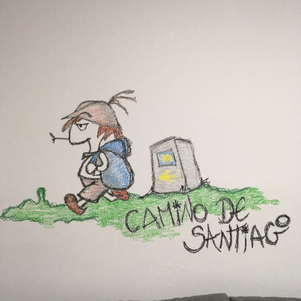
(Thanks to grand daughter Sylvie for the illustration)

Rambling man is now attempting to hike the Lycian Way, a 20 year old route put together by Kate Clow from a wealth of ancient paths, tracks and drovers roads along the Turkish ” turquoise coast”. A 540 km trek from Fethiye southeast then northeast to near Antalya, it has 29 sections and takes 30 to 33 days. We have only 26 days available so will have to miss a bit.

I say “we” cos I’m joined by Ivor Bundle again. Sadly the planned trip by the Tres Amigos was scuppered when Mickey ( Man of the Mountain) Dawson buggered up his knee and was forced to stay home.

A wise decision as this trek is no place for dodgy knees being pretty rugged in hill walking terms. We’ve only been at it for 4 1/2 days so far and I believe the easier sections are supposed to be at the beginning but it’s been pretty hard going on steep and rocky paths with sections of loose stones and scree ,occasional landslides and rockfall interspersed with wider or flatter mule and tractor tracks. Nearly all off road and totally glorious. Still 30 degrees or more, with packs weighing 12-14kg loaded with food and water, we try to start early and hunt the shade for a breather when we can.

The days are about 12 hours long and full of de-camping, hiking, hiding from sun while lunching, hiking, camping, washing clothes, reading up route etc etc that little time or internet is left for blogging – so if you’re interested in more info on this wonderful route, check online- suffice to say it passes several holiday centres on the coast but mostly travels through small villages of farmers and goat herders and travels up and down between the high pastures and forests and the beaches and harbours of the med. A long long history of a succession of civilisations, cultures and peoples have all left their marks upon the landscape and the hiker will ramble through remains of the ages as they walk here.

We started the adventure at Kayakoy, and after our first Turkish coffee and Turkish delight headed up to explore the old Greek town of Levissi, abandoned after the massacre of Greeks in the Ottoman Emoire during Ww1. A subsequent treaty and population exchange ensured the towns inhabitants could not return.

From the top of the ruined town we had an 8 km walk, following our first red/ white trail markings through a tall forest of pines with occasional views of the Taurus mountains rising pale blue in the distance.

On the far side of the ridge we were a little confused at a junction of ways until a big and boisterous man and his companion showed us the way down to Ölüdeniz and Ovacık, where we had a room prebooked. Turned out he was a publican on the strip of gaudy bars , restaurants, shops and what have you in this most British of resorts. We had no idea that such a place existed here and it was an assault on the senses.

The kindly publican had us in for a drink and we set off to eventually find our hotel, which we sadly left at 7 next morning without time to indulge in the enticing facilities.

Before long we’d made it to the official start of a long journey, fingers and toes crossed.

Immediately we started to rise steeply with views of the beaches and harbour of Ölüdeniz and the capes and headlands beyond. We passed a number of fellow hikers rising from their tents as we climbed first on a wide track and then, a sign of things to come, a rough and stony path.

Access to water is pretty important on this route and I’d bought with me a little cup/ mini bucket and string with which to gather water from the old storage wells or cisterns that dotted the route so was interested to see if the first we passed contained the life juice. It did.

Blue skies, green trees and dried and yellowing scrub made for pretty landscape.

There was abandoned development here and there and lots and lots of bees hives. Later we discovered stalls selling pine honey- a new one to me.

Finally reaching a level section of high ground we took the opportunity to relax a moment and enjoy the one spring fountain we’d found that wasn’t busy with bees.

The first stage end is at Faralya,but after a tasty and hearty lunch at a pension run by a charming and friendly couple we had the strength to carry on to Kabak beach, passing our first Lycian tomb.

Ancient and twisted trees dotted our route that steeply returned to sea level where after a swim we found the Secret Garden campsite hidden away, maybe illegally , in the woods behind the beach. First day, two stages done.

First erection of Ivor’s tent successful and rested by an exhausted sleep we left early next morning to avail of the shade afforded by the towering mountains to the east of us we had now to scale.

Cyclamens and asphodels emerged everywhere from the forest floor as we reached the top and were rewarded with far reaching views.

Old grain terraces and olive groves mostly abandoned, the strong scents of herbs and pine needles in the heat and the deep red of the naked arbutus strawberry tree.

Here and there along the route are little stalls selling cay, (tea) and water, drinks etc. Sometimes manned sometimes with honesty box they usually have resting platforms and shade, lovely shade.

They have lovely little wood burners for heating the tea water and this one had a subterranean cooler.

At Alinca we were treated to more delicious food and Turkish hospitality at a pension / shop/ restaurant. Our hosts have always been very friendly and inquisitive, and the food wholesome, local and homegrown and made. Little gifts of fruit are often offered and the tea cup often refilled.

A grand design modern home sat below us with a view to die for. Location location.

We met a couple that we bumped into often over the next couple of days, the only walkers met on the trail since the first day. Maybe it’s still too hot!

Off again, at a junction we had to decide. One way to join our new friends at the ruins of Sidyma or another route south to the nearer village of Gey. We had run out of time- so headed for Gey. It takes a long time to cover any ground on this terrain and we’re afraid we’d run out of light.

So so hot we used the magnificent old water cistern to cool down. A big metal bucket on a rope thrown into the water and hoisted for a shower. The refreshment lasted moments.

A cross country slog and a final exhausted stretch up a section of road and we arrived in Gey to ask for food and shelter. Taken in by a household we couldn’t decide were in business or not, we pitched in their yard and they again did us proud with dinner , breakfast and shower. Only problem the overpopulation of cocks that crowed incessantly from 4am!

The lady of the house wove carpet and there were huge sacks of wild herbs dried in the shed. The neighbour drew water from the cistern in the morning as we headed away , making for a wild camping spot on the coast about 8 hours hike away.

Beautiful and ancient old olive and holm oak trees, many delicate stacks of stones to mark our way, and so many asphodels poking up from the dry ground from their huge bulbs.

Long abandoned threshing circles and constant vista down towards the coast.

Another village, Bel, another lovely couple and a chance to have tea, cake and shop for supplies. Loaded up with water ( 4 lt) and good we carried on into the heat with a lot of altitude to lose.

Passed the tiny and mostly abandoned village of Gavuragili we continued down towards the pebbly beach still being pounded by big waves, similar to our swim at Kabak beach. We found a nice place to pitch in the cliff top trees next to the campground where there had been a festival last year and still sported the signs and decor. We met our new friends Olga and Basil there and I spent the night star gazing without my fly sheet.

A short day today started at 6 before the burning orb rose into the clear sky with a wash etc at the village washing station before climbing a forest track up and over a ridge and down to views over the flat plain ahead. The 12 km beach of Patara backed by protected wetlands and behind that hundreds of plastic poly tunnels. We stopped for breakfast on the trail overlooking the ancient ruins of Pydnai before exploring the amazing stone work at ground level.

From there it was a short but tricky stretch down over rock and a landscape recently burnt to a very dodgy bridge over the river separating us from Patara Green Park camping, whose advertising signs have been regularly enticing us since we started.

A day to have a swim, do the washing , erect the tents etc and wrestle with the internet in an attempt to post a blog.

We also had to mask up when the governor came to call proceeded by a mass of police.

Dingle Ramblings

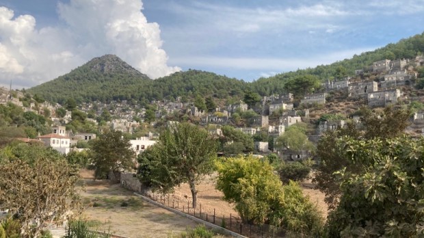
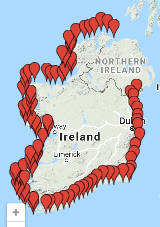
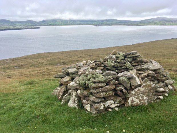
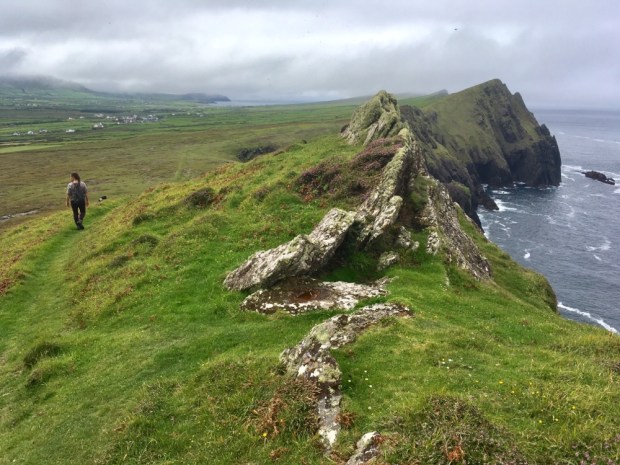
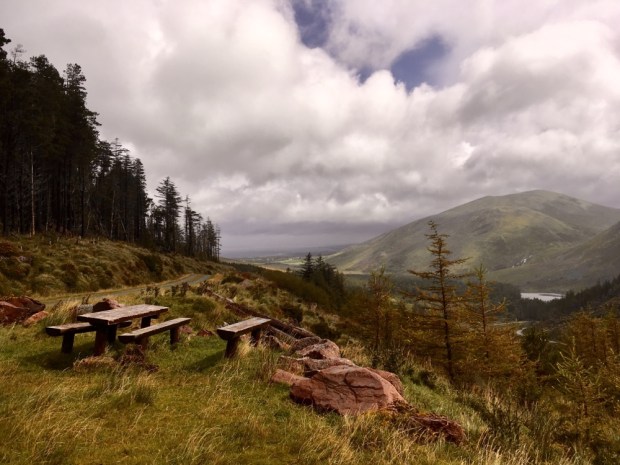
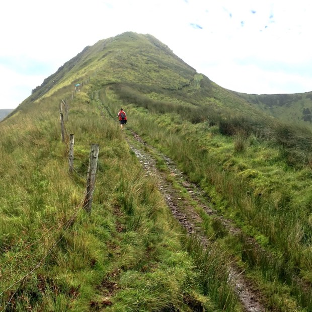
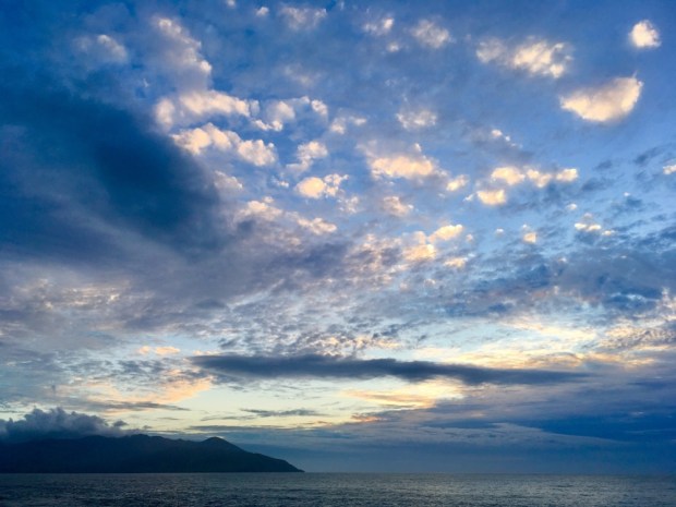
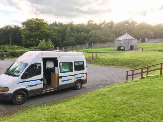
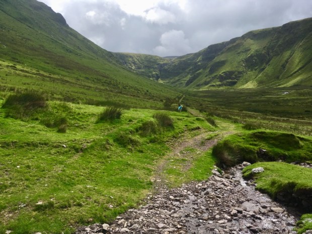
We had thought we might head down to the southwest and do the Sheeps Head, or Dingle Way long distance trails but having just survived Storm Ellen and with Storm Frances on the way thought it wiser to do day hikes from the camper as the weather permitted. And so it was that we arrived at Brandon Head under Ireland’s highest mountain outside of the MacGillycuddy Reeks with a plan.

This was staycation summer on the Dingle peninsular and we were concerned it could be crowded. But no, once you venture into the hills there is always wide open spaces for all. Even on the Wild Atlantic Way.

Our planned route of an out and back to the pass between Masatiopan and Piaras Mor north of Brandon Mountain changed when we saw the signs for a loop to Sauce Creek.

The Loop was 12km I think and we would add another 10 km by continuing west over the pass on the Dingle Way. It was a dramatic place to park up for the night with waves crashing onto the cliffs below us and views out over Tralee Bay to Kerry Head and the Slieve Mish Mountains.

Climbing the stile with the red walking man signs in the morning we climbed higher up the headland and away from the cliffs through a wild and open landscape of russet brown grasses and bracken and the purple and yellow splashes of sheep trimmed heather and gorse.

We passed one of the Second World War lookout posts that we’ve come across on numerous headlands around the coast of Ireland. Manned 24/7 by 2 men who watched for and logged and reported any military activity, the LOP’s were often accompanied with a giant EIRE laid out in white painted rocks on prominent sites to alert pilots they were over the coast of neutral Ireland. Historical remnants that often puzzle the coastal visitor there are still around 50 of the original 83 standing sentinel awaiting some other purpose.

Almost lost in the soft boggy ground and hidden in the long rushy grasses were the stone walls of animal shelters or human habitations from a time of hard and isolated living. We descended into a deep valley to ford a steam and then climb up and over the rounded summit of Cnoc Duileibhe (311m).

Heading due west towards the sounds of the sea we reached the flatish heathery area of Sliabh Glas and a view down into the jaws of An Sas. Translated as “trap with a noose” the horseshoe shaped Bay was reputed to hold fast any boat that ventured, or was swept, in. There used to be 3 families living at the bottom of the 750m long curve of cliff, scrapping a living from a few acres of land and the vastness of the sea, the last to leave in 1910 after a local midwife lost her life falling from the heights on her way down to deliver a baby.

Half of the Kerry coastline is defined as “soft” and liable to erosion and about 10 acres of these cliffs fell into the sea in 2014 so much of the remains of the early settlements are slowly being lost to the sea. As we turned our backs to the ocean and continued south the ground was riddled with deep bog holes and fenced off ravines and care was needed to avoid a twisted ankle or worse.

Rising over a knoll following the marker posts we had a vista of uninterrupted bogland and the silver glinting of Brandon Bay beyond. Reaching an ancient trackway we turned west again. We were now following the Dingle Way on its route over the shoulder of Mt Brandon and down towards Feohanagh and Smerwick Harbour.

At the far end of the track we stopped for lunch at a roofed building amongst what had been an extensive settlement. It had possibly once been a home and still had traces and relics of its past life but now looked like it was a shelter for people working on the track or tending the cattle that were now the only inhabitants of this lonely spot.

This was the hamlet of Arraglen and was once home to 13 families. A lot of effort was being put into creating a solid path from here up towards the coll high above with a mini digger creating ditches and drains. At its end we continued to clamber over the steep slope to the pass at 610m where somehow we missed the 1500 year old Ogham stone but reveled in the views down to the west.

Below us were the walls of Fothar na Manach, the Fields of the Monks, where a community of monks lived and farmed what must be one of the wildest and most inaccessible sites in Ireland next to Skellig Michael which would have been visible in clearer weather. We could see Brandon Creek, from where St Brendan and the lads headed off to America in the curragh, the sloping pointed peaks of the Three Sisters, and, fading into the murk of sea and sky, Slea Head and the Blaskets islands.

Returning to the camper via the Dingle Way along the old bog track we were rewarded with equally stunning views to the East which at times included Carrauntoohil, Ireland’s highest. But Mt Brandon continued to wear its hat of cloud. In the sheltered walls of the boreens in the valley below the colors of the fushia, montbretia and heather were a shock after the bare mountain above.

Moving on to the most westerly point in Ireland , on Dunmore Head , for the night, we were again grateful for an empty and dramatic seaside parkup without any ” no overnight parking/ camping ” signs.

We had planned to tackle Mount Eagle in the morning but the cloud was too low so we explored the short but sweet local loop around the head, where some of the last Star Wars movie was shot. We could imagine the location finder was well pleased with themselves on discovering the stunning otherworldly scenery of this western outpost with only the hauntingly atmospheric Blaskets Islands any more “Far Out”.

Atop the headland was another LOP, that’s Loop Out Point to those who haven’t been paying attention, this one with an Ogham stone for company, it’s 1500 year old script still plainly visible.

The sky was clearer to the north so we headed round the indented coastline on the Slea Head Drive wondering if pre-covid we would have encountered coach tours on the narrow winding road. Parked up overlooking the embracing shelter of Smerwick Harbour we walked a muddy farm track to gain access to the commonage around the Three Sisters.

An untamed and rugged landscape that had witnessed the savagery of man at Dun an Oir, the promontory fort we explored below the Sisters. It was here in the defensive Iron Age site that one of the bloodiest events in Irish history took place in 1580.

A force of 600 Spanish, Italian and Irish, sent by Pope Gregory in support of the Desmond Rebellion were forced to defend themselves there when their ships had been blockaded within the bay. The English forces, 4000 strong, massacred them all after they had surrendered following a 3 day siege. All but the commanders were beheaded and the bodies thrown into the sea, the heads lined up in an adjoining field, since called Gort na gCeann ( Field of the Heads).

With a wild, wet and windy night forecast as Storm Francis swept in we thought we’d better retreat inland to safety. Glanteenassig Forest Park in a sheltered valley nestled among the peaks of the Slieve Mish mountains sounded good. The 450 hectares of forest, mountain and peatland were billed by Coillte as ” an outdoor enthusiasts dreamland”. Seemed to fit the bill. Up a long single track lane towards the only farm at the valley end we turned in over the Drishoge river and drive on up the forestry track to the upper lake, Caum.

Amazingly the 2 km circular walk around the lake was all boardwalk. Some serious amount of effort and cash had been put into placing the 1000 or so slabs of 9×2. Wether this was to protect us from the environment or the environment from us I couldn’t be sure but certainly made for a dry footed walk over some seriously wet ground.

The deep lake, gauged out by a retreating glacier, was silent and tranquil as we awaited the wind and rain in a carefully selected parkup.

Our sheltered position protected us from much of the storm and it was only when I ventured away from the van in the morning that the amount of rain became evident. It was easy to understand the origin of the name Glanteenassig or Gleann Ti an Easaigh which translates as Valley of the Waterfalls. They were streaming down the mountainsides in silver ribbons and when we walked to Lough Slat the words of the Irish poet J J Callinan couldn’t have been truer,” a thousand wild fountains rush down to that lake from their home in the mountains”.

A roaring, foaming, rushing mass of white water raced down beside us as we ventured up the River Walk alongside the Owencashla and the views from the picnic spot high up on a glacial moraine were elemental.

With the storm abated we headed out to another fine seafront parkup for the night with miles of empty beach backed by a vast expanse of salt marsh. So much nicer than the nearby campsite/ trailer park we abandoned after having our showers and charging Sally’s computer.

Our final hike was around the Glennahoo valley, a truly beautiful u shaped glacial valley carved out of the mountains by unfathomable forces. We started at the old graveyard at Ballyduff or An Baile Dubh, associated with the Celtic deity Crom Dubh, a god of fertility and harvest.

An old narrow boreen led us past empty dwellings and up onto a treeless expanse of rough grass and turf banks, the track once tarmac way beyond ” civilization”.

The extraordinary track continued up the narrow ridge of Beenbo to 475m where we had a fine view back down the romantic Glen of Macha na Bo ( Plain of the Cow) and south across a featureless expanse of bog towards Anascaul, the final destination of the ancient trackway.

A bit of a soggy trudge to an unnamed hillock below us followed by an even soggier trudge back around towards the cliffs at the head of the Glennahoo river valley rewarded us with the panorama of the trip. We stopped for a sandwich and soaked it up. Nearly 300m below us lay the fields and homesteads of people who lived in the isolated splendour of a terrible beauty.

Setting off again we met a sheep farmer and dog out looking for his flock. He told us that the houses had been lived in until the fifties by the Dineens and the O’Donnells. From there another old trackway leading over the mountains from the valley took us down to Wolf’s Step, where the last wolf in Ireland was allegedly killed in 1710.

We crossed over the river here and continued down the steep track with a series of waterfalls beside us until finally reaching the valley floor and stopping again to contemplate the life of Mary ‘Macha na Bo’ the last inhabitant of this lonely spot, supposedly an old lady with long flowing white hair who would emerge to hurl abuse at hikers but also on occasion have them in for tea.

The long straight track out of the valley was about 4 km long but seemed to bring us forward decades or centuries in time. Looking back towards the mountains and turning out towards the sea the path felt in a time and space somehow separate from the 21st century tourism hotspot of Dingle and the busy city of Tralee visible in the distance.

Walking the long track had reminded me of the long long line leading back to the early inhabitants here, so palpable through the wealth of remnants left scattered across the landscape. A special place out on the western fringes of what is now known as Europe that has drawn people to it for Millenia. Long may it last.

Co Laois – The Leafy Loop in Lockdown

Looking for a long circular hike we discovered the Leafy Loop in Durrow, Co Laois. It sounded lovely. 23 km of waymarked trail through plantations of beech, ancient native mixed woodlands, conifer forest, hazel coppice, riparian spinneys alongside steams, over lush fields and along wsterside paths by the Nore, Erkina and Gully rivers.

One of the longest looped walks in the country and in a part of Ireland we hadn’t visited since calling into the Durrow scarecrow festival a couple of years ago. We loaded the camper and printed off the maps and then…

Counties Laois, Offaly and Kildare re-entered a 2week lockdown that night because of rising Covid numbers. Our planned walks were on either side of the Laois and Kilkenny border and we had a decision to make. We could do our Kilkenny Walks no bother. But the Loop went into Laois.

Right or wrong we decided, on balance, that if we stayed outside on the trails, kept well away from anybody else and didn’t stop anywhere else in the county we would be doing no harm but still felt slightly uneasy and guilty for going.

Once out in the woods and up on the hills however, taking a step from an open county to one in lockdown , the arbitrary nature of the winding border made a mockery of the imposed restrictions. We understand the need to restrict people’s contact with the virus and we behaved safely but illicitly.

The walk was normally described as starting in Durrow village but in an effort at social responsibility we avoided the possibility of human contact and started in the Coillte operated Dunmore Demesne woods on the outskirts of town.

The trail immediately lived up to its “Leafy Loop” moniker and continued to do so. Durrow means ” Plain of the Oak” and this area was reputed to have woods so dense in the 18th century that the outlaw Jeremiah Grant and his gang of ne’er do wells were able to hide out with ease. It wasn’t until the early post independence days that mass felling took place making the current tree cover a precious thing.

Following the River Gully for awhile we crossed over a stone bridge past the remains of the outbuildings to the old Dunmore House- rendered roofless in the early 20th century to avoid paying rates and soon becoming a ruin that was knocked leaving only the basement and some steps down to the river Nore.

We encountered a pulley system across the river serving some unknown purpose and later a metal bridge brought us downstream to a stone bridge carrying the main road over the river.

A very pleasant stretch beside the river bought us to another footbridge, this time across the Erkina and out onto open fields where the path followed the meanders of the Nore past the impressive bulk of another grand mansion- Knockatrina House mid way through extensive ( and expensive) reconstruction.

A beautifully bucolic landscape in the ” fat of the land”, so different from the rushy impoverished country where the multitudes wrestled a living around our way in the West. Emerging from the fields and reentering woods we crossed the main road again at the site of the Durrow brickworks, an enterprise that produced fine red bricks from shale dug from the hill we climbed from 1890 to 1922.

The steep climb took us to The Ballagh, our high point at about 250 m from where we got occasional views through the trees over the lush farmland of Laois.

The fields were big, the sheds were big and the dairy herds were big. Down through a hazel coppice , across another road and past the lodge into Bishops Wood where the man of the cloth was executed in penal times beside a tree still growing here.

Bishop’s Wood is one of about a dozen “Life Sites” around Ireland where care is being taken to restore native woodland by removal of invasive species and reintroduction of a variety of original plant life. But strangely this was where we got very confused and thought we were lost as what was marked on our maps and google earth as forest had become mono grassland.

The sizeable chunk of field in the photo had , until recently, been forest. We watched a long long line of cows progressing across the prairie from the milking sheds in the distance before turning back into the woods and the charm of the lush path beside the Erkina.

Liable to annual flooding this is part of the largest alluvial woodland in the country and is remnant of a huge wetland known as the Laois Curragh. It was bursting with green growth of meadowsweet, flag iris, Angelica, bugle, sedges rush and water mint and buzzing with insect life. From here you could continue riverside to Durrow but we took the footbridge over to our last stretch of Bishop’s Wood, freshly strimmed.

A couple of km of road saw us back in Dunmore Wood to complete the Leafy Loop, a delight in the summer and, I imagine, even better in the spring when a carpet of bluebells and wild garlic adorn the forest floor. A few minutes drive later we were in Co Kilkenny, no longer illicit, on our way to Jenkinstown Woods for the night, parked up in the walled garden below the threshing mill. Mission accomplished.

Next day we tackled the Gathabawn Loop, a 12 km hike up and around Cullahill Mountain, small enough at 250 m but towering above the surrounding plains and providing far reaching views over 360 degrees. This walk would have us back and forth across the county borders in an uncontrollable way.

We checked out the terrain from a viewpoint carpark overlooking the mountain and waited for the cloud to lift before driving down to Gathabawn village to start the walk opposite Mackeys bar.

Passing by the pleasant Millenium Garden we climbed beyond the old Coolcashin graveyard and the invisible remains of a Norman settlement to reach the charming in name and nature, Ballygooney Lane, which took us up towards the windmills and forestry of Binnianea.

Emerging from the trees we crossed open farmland to reach the equally charming Shirley’s Lane. Was the abandoned farmhouse Shirley’s old home?

Now out of the mono species grassland and on to the wilder pastures we could see why it had been given special area of conservation status. Plant rich limestone country with many different grasses and herbs and protected because of the population of Green-winged,Frog, Bee, Early purple and Twayblade orchids. We sat atop a rath for lunch and admired the views.

Weaving our way through a short section of new plantation we walked along the back of Cullahill Mountain to discover a well placed bench where we rested again to soak up the vista to the north ( Slieve Blooms), West ( Silvermines), east ( Blackstairs, Mt Leinster, Devils Bit) to add to the southerly views earlier ( Comeraghs, Galtees).

Down below us sat the remains of Cullahill Castle the seat of the MacGiollaPadraig or Fitzpatrick clan long rulers of the area until the castle was sacked by Cromwellian forces. It is apparently adorned by a Sheila- na -gig high on a surviving wall. A 17km linear walk, the MacGiollaPadraig Way, has been created from Durrow to Gathabawn and we had shared much of its route.

Crossing the fields deep in drying hay we passed the sad remains of a famine village reminding us that the rich and prosperous landscape laid out before us had not always been so bountiful for the people. Passing by the rath or fairy fort again we made our way along the Gooseneck road to rejoin Ballygooney Lane and back to the Millenium Park and a more recent Fairy world.

Miners Way and Historical Trail: A Loop Around Roscommon, Sligo and Leitrim

Seems like a long time since we were walking the Camino Mozarabe under a blue Spanish sky. Longtime lockdown under the Covid curfew. We left Spain just as the shutters came down and were blessed with acres of homestead gardens to work and rest in under a blue Irish sky for weeks as a hush fell over the world. As a cautious emerging of people began to take place so the clouds also started to gather and by the time we were able to leave the county the summer had settled into the rainy season.

But a change of surroundings was needed along with a kickstart to a much needed fitness programme and trial of our new homemade lightweight 2 person tent. And so it was that we arrived on the shores of Lough Meelagh on the outskirts of Keadew, Co Roscommon to embark on a trail I had long had on my “to do ” list. The Miners Way and Historical Trail is a complex shaped figure of eight with “wings” to surrounding towns and the Leitrim Way and the Beara Brefne Way. It’s “officially” 118km but many hikers would reckon it’s much more. Our circular route without wings or connections came in at 110 km over 5 days.

Our first day was from Keadew to Lough Key forest park. 28 km

It was a ” fine soft day” as we entered Knockranny Woods, sharing our route with a nature trail to the Neolithic court tomb. We were immediately impressed with the amount of staple studded boardwalks erected to keep us out of the slop.

The whole trail was to impress us with its signage, stiles of many styles, wooden and metal bridges, strimmed and mown grass, general waymarking and above all- access over farmland and open mountain. A lot of people have been caring for it and thanks for that.

The woods were fully formed with many mature specimens. It seemed that the historical estates in the area had bequeathed a wealth of woodland.

The first half of our trip, the first two and a half days, would be spent on the Historical Trail with another couple of days continuing on the Miners Way, bringing us back to Keadew via the iron and coal mining areas around Arigna. The closure of the mines in 1990 had led to the development of the trail in an attempt to encourage tourism to the area. And we felt it was a beautiful but neglected landscape deserving of more visitors, with a wealth of rivers and lakes and varied upland and mountainous terrain.

After walking the southern shoreline of Lough Meelagh we reentered a mossy and mushroom rich woodland for awhile before a quick change succession of quiet backroad and rushy field sections led us down to Knockvicar where we had lunch beside the River Boyle which takes leisure boats from Carrick on Shannon to Lough Key.

We had a look around the Knockvicar Organic Garden with its welcoming orchard and displays of fruit and veg and flowers. It shows what can be done with 10 polytunnels on a very small space. They also run training courses and offer a gardening service.

There was a “Trail Closed Today” sign ( which has been there for at least 3 years!) owing to some ongoing land dispute and we were sent on a detour on a bogside track and through thick scrub woodland before emerging onto the lanes leading into the forest park over the “fairy bridge”.

We were weary by the time we reached the epicenter of the park with many staycationers strolling, cycling, picnicking and boating. There was a camping and caravan park but only catering for those self sufficient in bathrooms, toilets and kitchens so we moved on looking for a wild camping site affording some shelter from the rain.

Sally fancied setting up next to the mysterious mother and child statue but the ground was too peg resistant. I couldn’t find out anything about the sculpture other than it was by Jaqueline Duigan of whom the National Visual Arts Libary says ” virtually no information is available on this artist”.

We ended up a little further down the trail, behind the Nash designed gate house to the Rockingham Lough Key estate. A wet and windy night was promised and we were well sheltered by trees and Nash’s wall.

Quickly into Boyle in the morning under a leaden sky that released its watery payload sporadically as we bought supplies and miraculously found a seamstress to mend my packs shoulder strap for under a fiver. Then a long climb up into the Curlew Mountains. After about 3 km of road we headed cross country on the ancient Red Earls road past the site of his 1599 ” Battle of the Curlews”. It was soggy going across the boggy moorland and into a block of forestry where we stumbled upon a 2 story stonebuilt farmhouse subsumed by the trees.

There was a lot of mushrooms and bilberries available but we filled up on bread and cheese as the midges filled up on our blood and the drizzle cane and went. We stopped again after a few km of empty lane when a heavy shower had us sheltering in the shed of an abandoned farm cottage. With a swing in the garden and a cot in the cow shed it had a forlorn feeling of broken dreams.

But ” things can only get better” and as the weather improved so did the surroundings as we came down out of the saturated Curlew and up into the dramatic karst landscape of the limestone Bricklieve mountains. A tarmac and gravel track turned into a grassy boreen and finally a narrow wall lined path, past beautifully located abandoned farms and cottages with mighty views down to Lough Arrow and Lough Key with the Plains of Boyle beyond. We climbed alongside and then crossed a narrow u shaped valley, the Devils Bite, before joining a disused bog track heading northwest towards the Carrowkeel passage tombs.

We had crossed into Sligo and Carrowkeel Neolithic cemetery with 14 five thousand year old passage tombs was just one of the very many impressive archeological/sacred sites in the area. Our friend was meeting us at the bottom of the access track so we didn’t have time to explore but the Bricklieves had instilled a desire to return for further ramblings.

22km done we were very happy to be transported to our friends house for a night of good food, drink, company, warmth and sleep and a lift back to the trail at Castlebaldwin in the morning for the next 22km leg.

We kept a close eye on the clouds as they rose and fell over Carrowkeel making our way on a mix of road and field around the top of Lough Arrow, over the river leaving it to the north and up past the abandoned Cromlech Lodge hotel, once prosperous enough to warrant a helicopter pad, to the Labby Stone- Ireland’s second largest portal tomb.

Another change in the landscape and we hiked mown paths across fields and up onto the Plain of the Pillars a reference to the 14 megalithic monuments in the area. It’s a place of glacial drumlins formed in groups known as “swarms” for some reason. We had lunch at a trig point at 226m overlooking Lough Arrow and a land inhabited for thousands of years, and left with a mass of reminders of their passing including a rich concentration of ancient saunas or sweat houses.

In recent years many inhabitants have deserted the land hereabouts and we past many homesteads slowly returning to the earth. Another downpour was avoided by resting up in a hay barn where we took the tea in comfort.

Settling off again under heavy dark skies over the rushing river Feorish we were on the look out for a camping spot. Nothing suitable found we asked a farmer if we could erect our tent in his hay shed. He said he had a better,less exposed option for us- the old home place cottage- and directed us toward it. It proved to be completely buried under vegetation outside and junk and rubbish inside, so bad that the damp and dark cowshed next door was preferable.

We did a fine job of fixing it up a treat and settled in for the night. Not everyone’s idea of glamping but we have modest needs!

Still misty and moisty next morning as we started another 22km leg by following an old miners track up towards the wind farm atop Carrane Hill. We had switched on to the Miners Way and the hills here were littered with old coal mines.

Down into The Glen, a narrow valley between Carrane and Corry and Lynchs mountain where many miners had lived and whose children must have attended the school we passed on the way to the Arigna river.

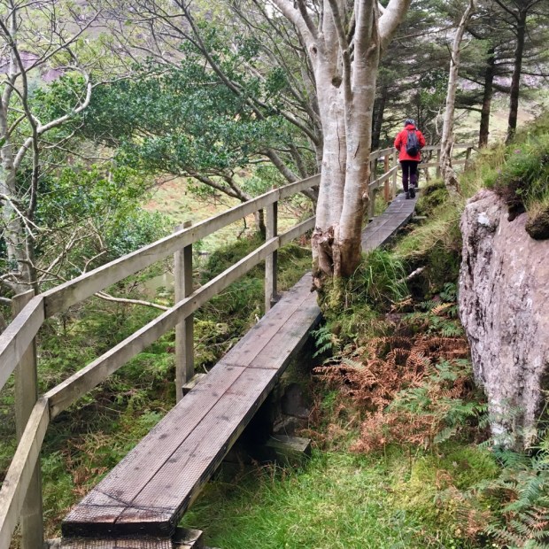
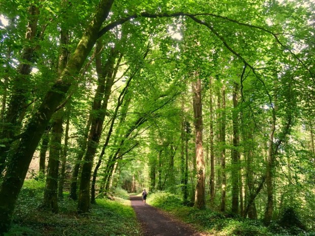
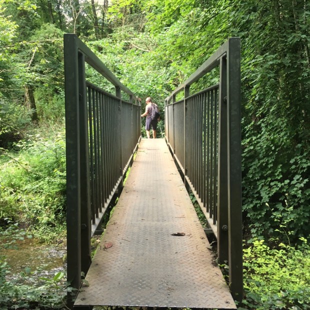
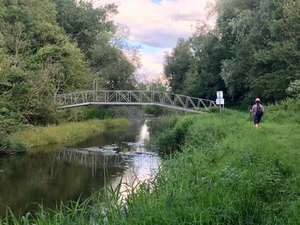
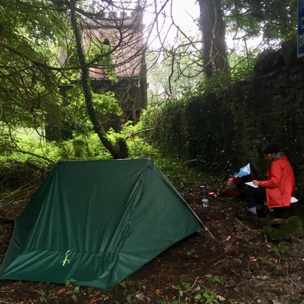
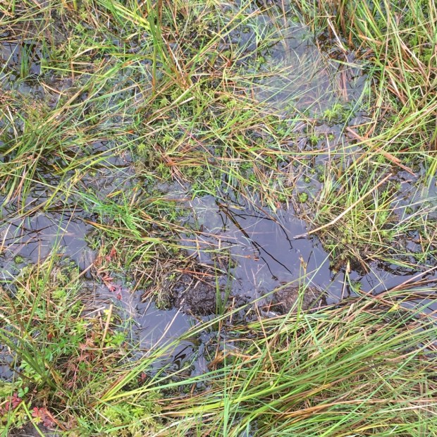
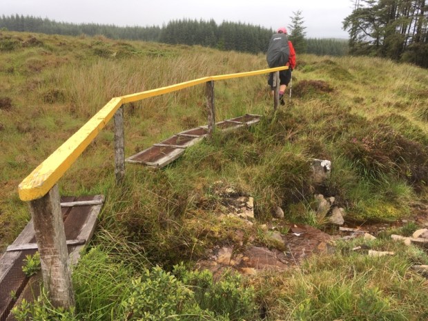
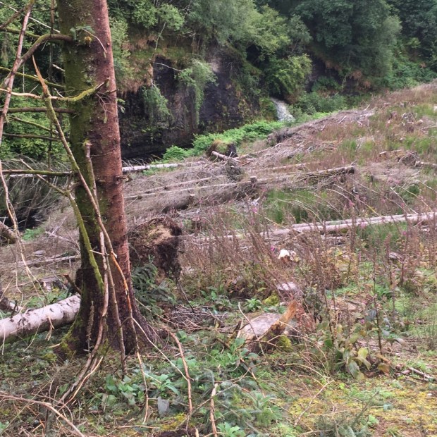
When we entered the forest things got tricky. Recent felling had left the track a quagmire of deep mud and muck. The waymarks disappeared and we were left floundering about through a section of clearfell attempting to find the bridge across the river. Not easy.

When we eventually managed to get to the road beyond the forest there was a “Trail closed today” sign! Looking online later I saw a notification on the closure due to felling dated 2018.

Onwards and upwards to the highest point of the whole trail at over 400m. By the time we reached the top ridge the rain was relentless and we were enveloped in cloud with no view to reward our efforts. Too wet to use the phones camera anyway we squelched on down below the cloud towards Lough Allen in Leitrim and the sanctuary of more friends and a place to dry out, warm up, and eat drink and be merry.

Our 5th and last day on the trail was a relief. Blue skies, sunshine and only 16 km over interesting and beautiful countryside to return us to our car.

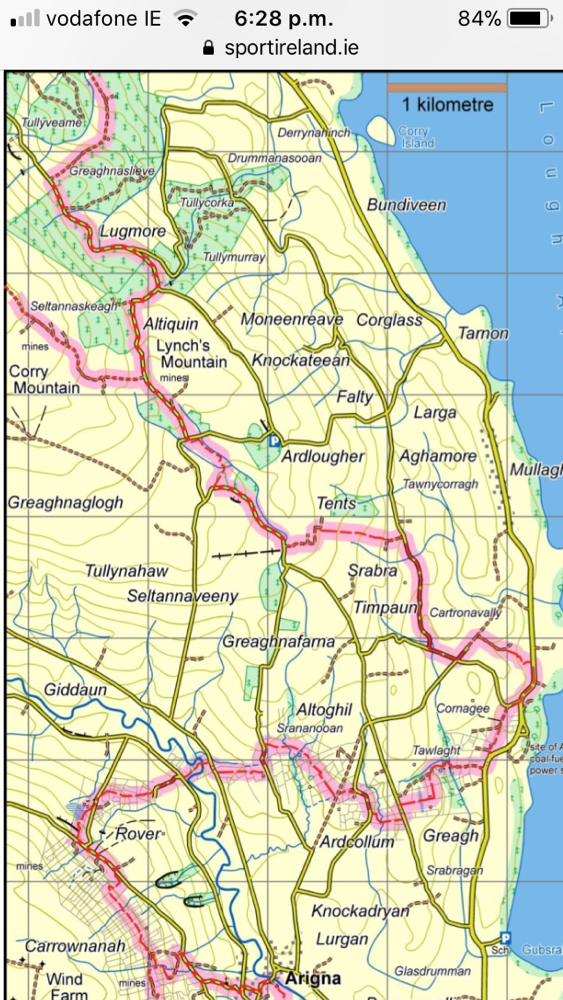
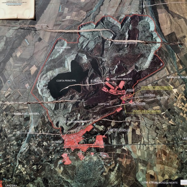
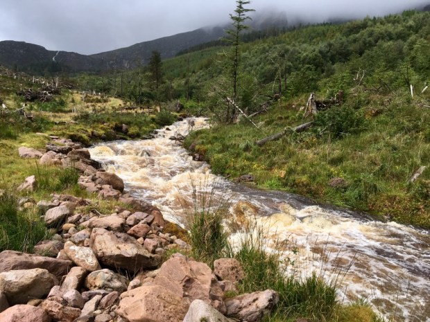
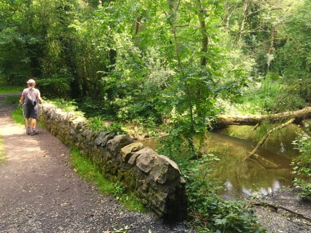
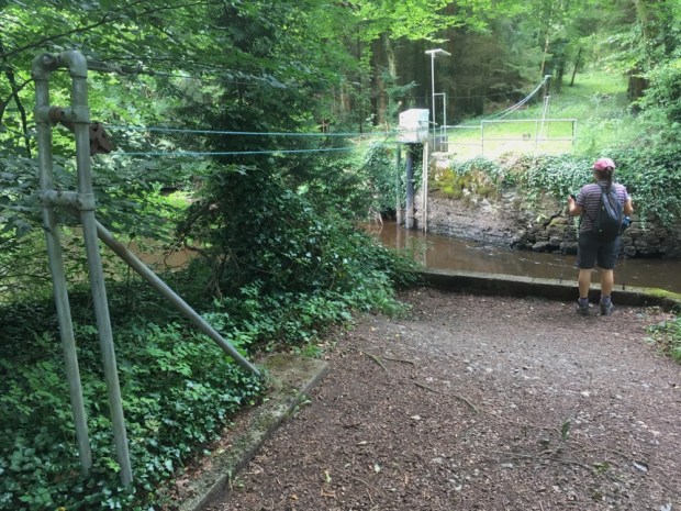
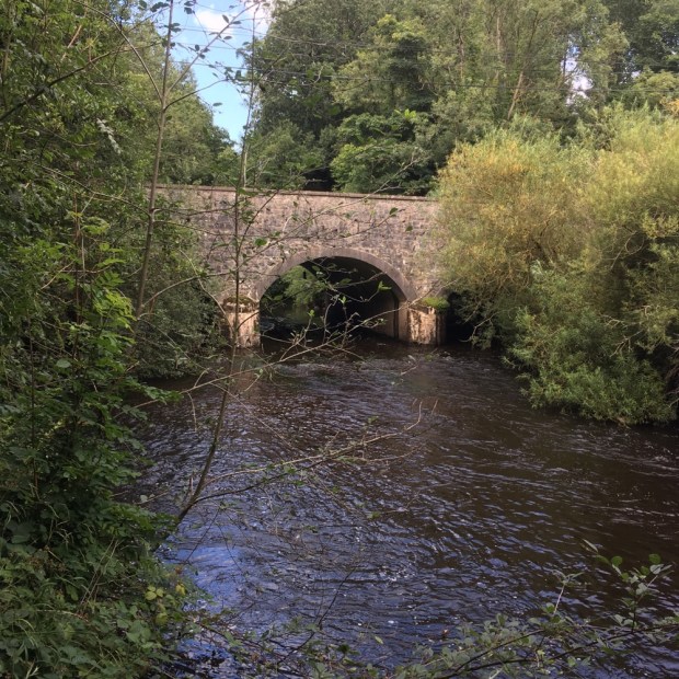
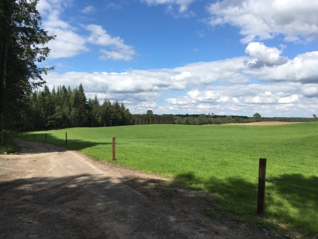
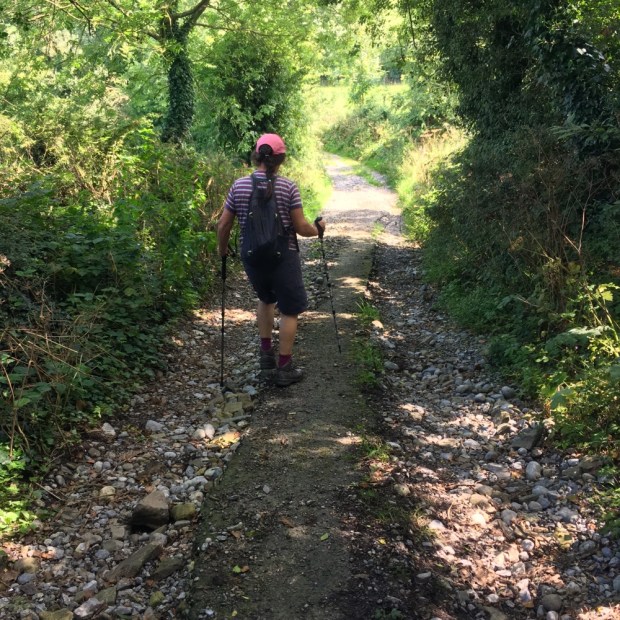
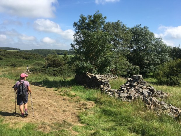
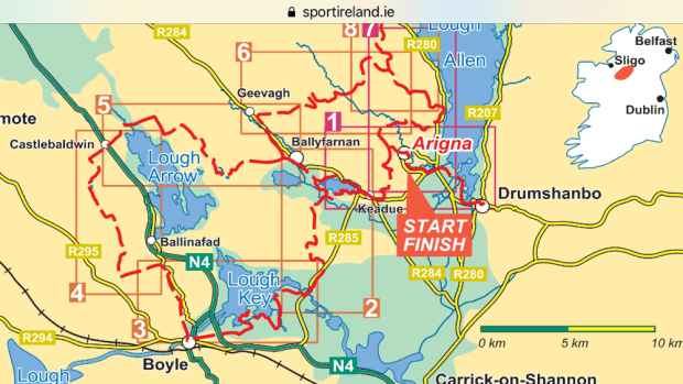
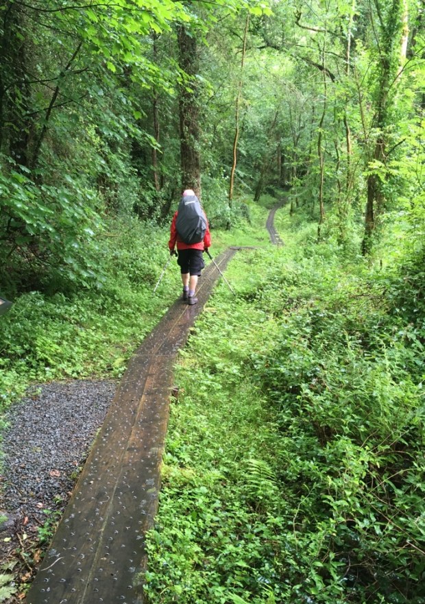
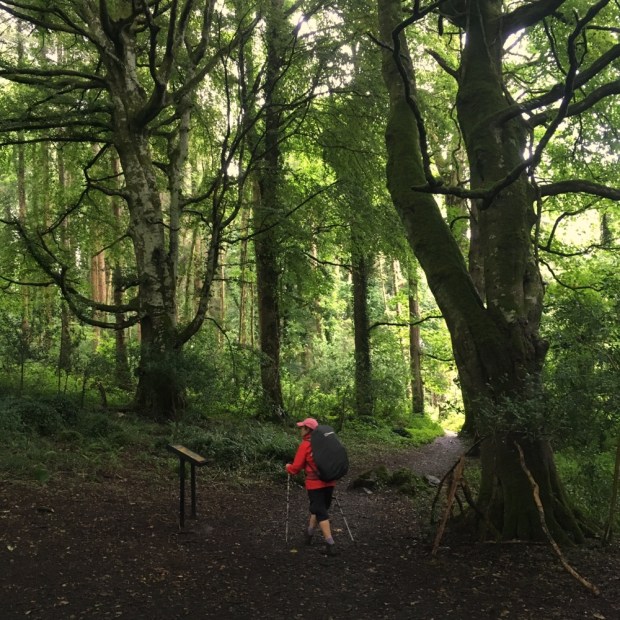
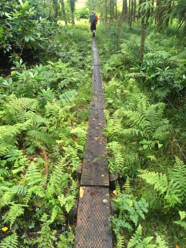
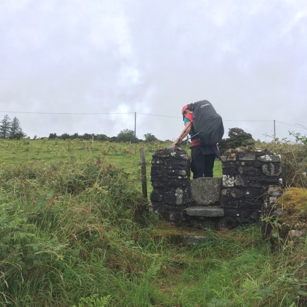
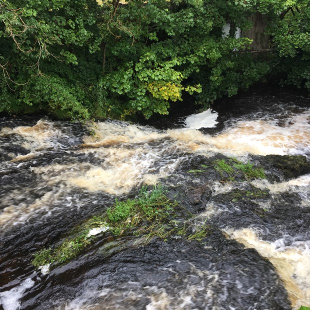
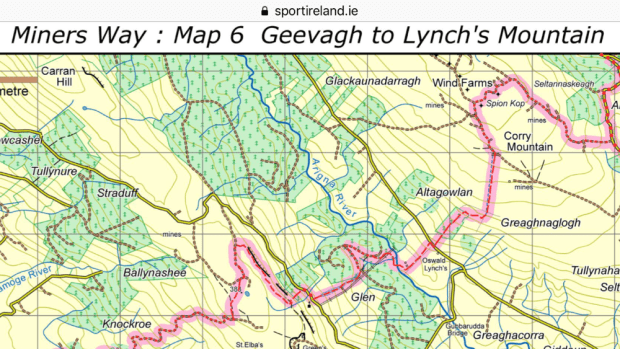
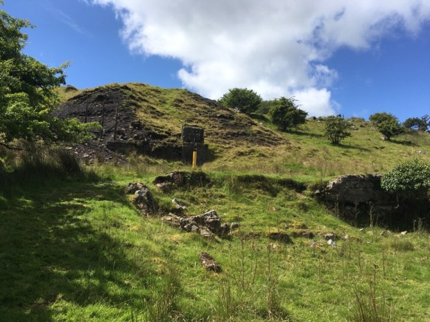
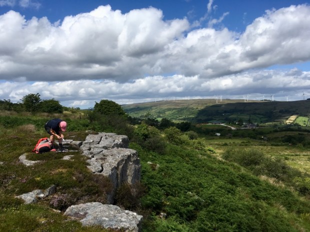
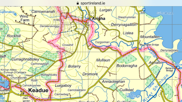
A leisurely start after a lift to the trail and off over the stiles again and along the thoughtfully laid gravel paths across fields towards Arigna. The sunlit landscape made us appreciate the terrain we’d been through even more as we recrossed the Arigna river and returned to mine country stopping for lunch at the Mining Experience Centre’s restaurant.

The final leg took us up over the flank of Kilronan mountain on ancient old miners tracks. They’ve been hacking away at the rock for over 400 years up there and it felt like we were following in the weary footsteps of generations.

A sunny final days hike was a lovely way to finish a much anticipated but sadly pretty washed out walk. We arrived back at our car by Lough Meelagh well satisfied and tempted to advise the strollers around Knockranny Woods to carry on ( and on and on and……….)

CAMINO MOZARABE: Almeria to Granada 5

Tocon to Granada.

Both of the last two stages of our journey on the Mozarabe from Almeria were spectacular and we were glad we had given ourselves the extra time that the stop in Tocon had allowed. It would have been a long haul from Peza to Quentar in one go, as it was we only had 16 km from one albergue to the next. As we walked past the big walnut trees below the bar, whose nuts the family had been cracking as we’d had dinner the night before, a woodpecker was hammering away in the branches above us.

We walked out of the village on the road for a km or so then turned up through boar churned woodland to a sparsely vegetated hillside and rejoined the original Quéntar route along a gravel track that climbed higher and higher.

Juniper appeared amid the white crazed rock that covered the landscape and we followed the track in a massive zig zag down to an area recreativa among riverside poplar trees.

Climbing again we passed through a pine wood that had been tapped for its resin. This thick sap like substance produces both rosin and turpentine. Apparently demand is on the increase because the natural material substitutes pollutant petroleum derivatives.

Higher and higher the track led us to more and more spectacular views of the Sierra Nevada’s and the hills that enveloped us. New benches,map boards and post and rail fencing were signs that there was a fair investment in encouraging this Camino route or hiking the area in general.

And then we finally reached the highest point of the entire route at the bizarre surroundings of an old talc mine. 1418m high with views across to the highest peaks in mainland Spain, covered in a smooth shiny white blanket.

What goes up must come down, and so we started our descent towards Quentar, passed some lovely fincas set among a sea of olives.

The almonds were flowering nicely as we approached the village, busy with bees from the hives we’d seen higher up the trail. Soon enough we were in the town and installed in our little hut complete with a tiny terrace in the sun.

Our last day. Quentar to Granada 20km.

Following the yellow arrows down through the town in the morning we reached the river and turned along it, watching the ducks ride the mini rapids beside us. Turning up a narrow verdant path that led to a series of well watered gardens and orchards we soon reached Dudar, a village celebrating its saints day and the origin of all the fireworks that we’d heard in our cabin the night before.

Up again out of the village steeply for 200m altitude gain, to arrive at the remains of impressive French engineering works from the 19th century. A major water syphoning system to bring irrigation from one hilltop to another.

We reached the ridge and enjoyed a long hike along the easy track soaking up the distant vistas as explosions from Dudars celebrations echoed around the mountains. For once we were sharing the Way, with weekend runners, cyclists, walkers and motor-bikers.

It was getting busy. And getting cloudy/ smoggy- we weren’t sure. But we were above the thick blanket that covered Granada. Our route turned down off the ridge, towards the ruins of a massive Jesuit monastery surrounded by olive groves that were being harvested by a gang of men and a lot of machinery, including the tree shaking tractors with the encircling funnel screens (you’d have to see them).

We nearly lost our way crossing the olive grove-( grove seems to imply somewhere small and intimate and not the immense and poisoned industrial scale monoculture they so often are) but followed the incline down to the rushing waters of the Darro river and a lush path to the gardens of the Sacromonte abbey.

Suddenly we reentered a world of people after 10 days of near solitude. Saturday in Granada is busy of course and we had to adjust quickly as we moved through the throngs in the old city beneath the Alhambra and played spot the Camino sign in the centre.

The various arrows and apps deposited us outside the doors to a church in the corner of the huge monastery of Santiago. We were in the wrong part of the convent but saw all the St James symbols and headed in to get our credentials stamped for the final time.

The place was full of a wedding party- whoops- so Sally waited with the packs outside and, assured by someone who seemed to know that yes , this was the place, I ventured in. I was confronted by all the wedding guests posing in front of the ornate gold leaf alterpiece and was pressed upon to become the wedding photographer on their cameras. After performing my duties to their satisfaction I squeezed through the crowds and managed to get a nun to get our credentials stamped and returned to me in the crush of celebrants. Job done. Time for a selfie.

A slightly surreal ending to a great weeks hiking on what is now my favorite Camino route.

CAMINO MOZARABE : Almeria to Granada 4

Guadix to Tocon

Our first section of the two to Tocon was one of the most surprising to us, with great contrasts in scenery when we had been expecting a long slog across the plain. I guess the profile should have told us.

Of course it worked out a little further according to the GPS by which time Sally’s foot was giving her some pain which took the edge off some the pleasure of walking through such natural splendors.

After a nice night at the man made splendors of the Guadix albergue and admiring the grand edifices of its glory days we followed the signage out of town.

A last minute stop off in a cafe for a peregrine breakfast, we were pleasantly surprised that it seemed to be run by social services and our two big tostadas with tomato and olive oil, two cafe con leches and two fruit salads cost us €3.80. The Camino provides! Suddenly we were away from the buildings on a dirt track that led up into eroded hills surrounding good flat farmland- with tractors and even a combine harvester hold up in holes ( in the rock- alongside old abandoned cave houses).

A beautiful stretch followed all the way to Purullena, about 7 km, of an up and down sandy track through pine trees with the “badlands” on either side. The erosion had created gorges that got narrower around us and we found ourselves in a winding tunnel of towering sandstone with openings many meters high.

The old abandoned holes became transformed into a thriving housing sector very shortly when we arrived into town. We had wanted to see the inside of a contemporary cave and the opportunity arose almost strait away with a three story museum right on our path.

The owner explained that the cave houses, with doors and windows shut were pretty constant about 16 or 17 degrees maybe 18-19 in summer. And even in the terrible rain and floods of the recent Storm Gloria the houses stayed perfectly dry owing to the iron content in the fine clay. The structure of the material is such that the ceilings ,and all inside spaces, will hold up as long as the rules governing proportions are adhered to. 40% of the people in his town live in caves and most of the good clay hills have been used. But there is a lot of renovation going on- and some expansion. Must be tricky when your extension is over someone’s bedroom. It would seem a logistical and legal quagmire but he seemed to see no problems and thought it an ideal building method. Another bedroom? Dig away! Another story? A little trickier but no material costs!

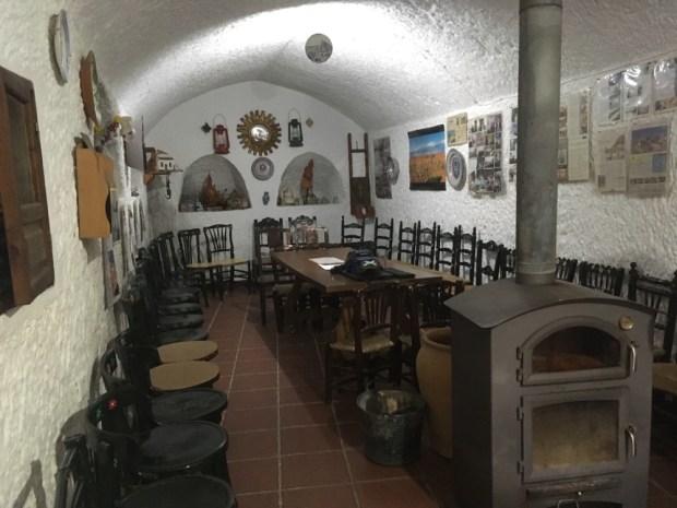
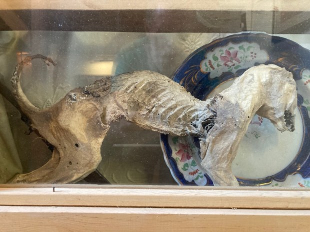
The middle floor was laid out as a home of maybe 50 years ago and the final, upper floor was stuffed full of ethnological artifacts.

We’d spent too long there and hurried on, on paths and tracks between small fields of fruit veg grapes and grain to Marchal, another troglodyte town that was making great efforts to be attractive to visitors and especially, pilgrims.

A high road past amazing rock formations and lovely wood and farmland with bueno vistas took us up in quick succession to Los Banos, with a wealth of hotels and hostals servicing people who come to “take the baths, (there are hot springs here but not accessible to us unfortunately), and Graena where we had a look at the 15th century church and shopped in our first cave supermarket.

A long riverbed track past mostly grapes and cave bodegas and then too much hard surface tarmac road- although the dramatic views made up for it- and we had made it to the 150km marker.

Finally La Peza came into view- and we left the tarmac to switchback down a steep mud track into the village where the albergue in a municipal building was cold but the local bar served a hot lentil stew.

La Peza to Tocon. 15km

We had decided to take two shortish days rather than one really long one to Quentar. This meant climbing up to 1200m again, splitting off from the usual route to Quentar to go to Tocon where the Camino Association in Almeria have procured and done a lot of work to a house and made an albergue. Then after another few Kms the original route is regained the following day. Nice and easy.

So it started with a long climb, but yet again the weather, the views and the interesting country made it a joy. So much so that I sloppily played Louis’s “Its a wonderful world” as we went.

The route was also shared for quite a way with horses, as this was the first designated riding route in Granada province, and we past one of the resting places with a newly made drinking trough.

Descending again for awhile we joined a stream bed beside a road that wound its way up through rocky woodland and jutting monoliths of talc(?) to an altitude where the snow still held on.

At the pass of Blancares the routes split and we made our way the couple of km to Tocon down a charming path with newly made wooden post and rail fencing. The tiny village is in an idyllic setting, with clear mountain water running through- supplying plenty of fuentes. The steep concrete road led us to the albergue on a sunny terrace with views to the mountains and the local bar, the only source of sustenance available, a few yards away. A great place to rest up awhile.

CAMINO MOZARABE: Almeria to Granada 3

So we did this:

from Alba steadily rising to Hueneja at 1200m. Then on the next stage we did this:

Hueneja to Alquife.

Which looks dramatic but was all between 1150m and 1275m so pretty easy going. And GPS reckoned it was 21.5km to Lacho Albergue at the top of town. They are always at the top of town! It was a -2 degree start so the steep initial climb was handy for warming us up as we left the town through acres of almonds and cherries, looking back down onto the Marquesado plain with its dozens of wind turbines. Spain’s second largest, it puts out 200 megawatt.

The iPhone camera is hopeless for capturing the wonderful vista of the snowy mountains of the Sierra Nevada to our south and the Sierra de Baza to our north. The smooth soft blanket looked deep and powdery and we guessed the skiers and snowboarders were having fun.

The pretty village of Dolar after 5kms was having market day so we bought some nuts and fruit and hung out in a plaza bar for a breakfast of tostada and cafe con leche.

We climbed again up and along a beautiful old track with far ranging views over a sea of mostly almonds. Good to see so many healthy trees and so many young ones being planted. Hopefully these can replaced some of the Californian ones that are consuming so much water and are killing so many bees with pesticide usage. Seems like with the rise in vegetarian and veganism the demands for almond milk will grow hugely and here in Spain there was plenty.

The campo was mostly empty of dwellings but we did pass one that will go in my imaginary portfolio of deeply rural, off grid retreats that I’ve been adding to on my rambles over the years. It had a fine old chestnut tree and terraces fed by a complex system of acequia or little irrigation canals. And a view to die for as the agents might say.

We reached the highest point of the day at nearly 1300m and there were still patches of snow on the track. Sally was delighted to find a boar skull from which she extracted the tusks ( a longtime hobby/ interest/peculiarity). From this height we could see the whole 1500 acre site of the massive Andasol solar power station twinkling on the plain below. Using parabolic troughs to gather the suns rays they use tanks of molten salt as a thermal energy store and so can produce power for 200,000 people day and night. Costing €900 million it was money well spent.

Then down to our next stop, in the main plaza of Ferreira where we had our sarnies and I had a non conversation with a lovely old fella I couldn’t understand a word of.

We walked on the edge of the pine forest and natural park with our eye on the imposing castle atop the hill above La Calahora, another charming ancient/ modern mix town. On our way out we passed the casa of an artist in steel whose gates were also imposing.

From La Calahorra we took a bit of a dog leg route to Alquife passing along farm tracks some of which seemed to have been cobbled at one time. We slowly approached the giant mounds of earth and rock that had been extracted by the workers at what had been Europe’s largest open cast iron ore mine. Started by the Romans it had been operational till 1996 but now lay abandoned and in ruins, although there were still some staff and security around. 40% of the iron extracted in Spain had come from this place, leaving a very large hole in the ground which, frustratingly, was out of site.

A few of the almonds had come into flower and where covered by eager bees, although their appetite must be well sated when the other countless thousands are also covered in nectar rich blossom.

We also spotted, on the slag heap behind the mine fence, a big mountain goat puck who watched us curiously but seemingly unperturbed, perhaps knowing he was unreachable.

It was a relief to finally arrive at Lacho, greeted by Manuel and shown around his growing empire. After a shower and rest we returned to the shop for supplies and returned to find a big fire set in the kitchen/ living room which we enjoyed as the sun set behind the snowy mountains and the temperature plummeted.

Alquife to Guadix 25km

After a little climb to start it was downhill all the way the following day.

Leaving Alquife by a track alongside the slagheap wall of earth it took some time to be clear of it and out onto the plain, and some time for the sun to warm the frosted landscape.

But by 10 we climbed into the village of Jerez del Marquesado where it was their turn for the market. Too early to stop, we carried on another 7 km, past some mysterious chimneys that nearly escaped my camera, and up into some pine woodland, adorned with bizarre wooden sculptures of Christian symbolism.

Finally the down hill straight began with a run down through the woods to a big reservoir in a lovely setting.

Cafe com leche and tomate tostada and a stamp in our pilgrim passports were supplied by a surprisingly modern and stylish cafe bar in Cogollos de Guadix where there was also a fine example of the old water cisterns and acequias ( and related graffiti ).

And then we walked out onto the wide, very wide, open spaces of the plain. With huge skies overhead and 360′ views of a ring of distant Sierra it must have been a lonely place to live and a hard place to work. Eventually we came upon a great gorge, and climbing down into it we followed what must be a dry river bed towards Guadix.

A couple of hours later we arrived at the outskirts of the town, with cliffs of sandstone(?) burrowed out into a warren of homes, chimneys sticking up out of the ground like mushrooms. The cuevas barrios are a sight to behold and the houses seem to encompass a range of styles and social classes.

Deeper into the centre of town, around the cathedral, were fine but frequently faded grand old buildings, including our albergue, lovingly restored over the last 35 years and full of fine art and antiques. A treat after a long days hiking.

CAMINO MOZARABE: Almeria to Granada 2.

Alboloduy to Abla- 30km

Stepping out of the albergue in Alboloduy in the morning it was obvious it had been raining during the night from the wet and puddles about but thankfully the skies showed no immediate threat as we left the town to rejoin the riverbed as directed by the markers.

We had left the river Andarax at Alhabia the day before to join the river Nacimiento which would take us all the way to Abla and beyond. The deep rich layers of sediment washed down over millennia had created fertile ground alongside the riverbed that nourished a wide variety of crops but as we delved deeper upstream and away from the town the sides of the valley closed in and we were forced up on an old mule track with views down to the abandoned fincas and their hard won terraces.

The tamarisk and cane wound through the steep sided valley bottom like a golden thread. The trail was littered with the droppings of an animal we guessed to be mountain goats, and sure enough as we reached the tarmac road at the top of the mule track we saw a herd of them bolting away across the mountainside. Turning off the road again we passed an old water cistern built 100 years ago before descending on a zigzag track back to the riverside and another series of mostly abandoned fincas.

From here to the town of Nacimiento, where we stopped for coffee, was a beautiful stretch through cane forests and along a forgotten valley of old abandoned farmsteads, once upon a time busy with working people.

The sky had been darkening and looking more threatening for awhile and we had hoping the weather would hold but soon after leaving Nacimiento, about halfway to Abla, it began to spit, then drizzle, then rain, then lash it down with a strong wind driving it mercilessly straight at us. Heads down we hurried on hoping for shelter. Eventually coming towards the little settlement on the outskirts of Dona Maria I spied a large covered patio opposite some houses. Split into three, each with a door, first two locked, the third open. We hurtled in, throwing off our packs and sopping jackets. The owners were calling from the house opposite, “yes it ok- go in.” Before long ,as we tried to dry things out on the handy washing line and watched the downpour outside, the mother and son(?) arrived with plates of bread and cheese and jamon and a bottle of wine and much kindness and chat. A hard time turned to a good time as the daughter(?) and father all came over with hot homemade cake and hearty handshakes.

Our new best friends. They insisted on sending us on our way with an umbrella each which might not have looked like hightec hiking gear but were given and received with love and joy. And they continued to keep us dry until the next joyful event a few km later.

We had reached Ocana and messaged Nely for the door code of the Association albergue when miraculously she appeared in her carshe had spotted us on her way to check the Ocana albergue. More hugs and directions and off we went again into the riverbed and rain.

Then, bizarrely, a couple of men in a car started warning us about the dangerous waters in the river and said we should not walk there. So they drove us the 5 km to Abla saving us over an hour of sodden hiking. We soon had a couple of electric heaters in the albergue bedroom drying everything and marveling at how the “Camino Provides”!

Abla to Hueneja 22km.

The snow capped peaks around us looked more inviting than threatening the next morning as we set off from the luxury of the well appointed Association albergue, all of which are run on donations and the hard work of a band of dedicated volunteers.

We were now crossing the vast high plain of the Marquesado del Zenitel, a pretty flat and fertile area of fruit and wind farming. We went on the old main Almeria- Guadix-Granada road, the ancient Camino Real, that still has a wealth of different foods and fruits growing in the well tended gardens.

The old highway used to be busy with travelers needing food and lodging, supplied by ventas now in ruins amongst the windmills.

On cue, at coffee time, we were led up into the village of Finana and a welcoming bar before carrying on across the wide plain littered with the remnants of past lives.

Past another imposing but redundant travelers hostelry at Venta Ratonera we reached the outskirts of La Huertezuela where the surreal sight of another Spanish urbanization that never happened greeted us. Abandonment through the ages.

From there it was another 6 km or so along an increasingly narrow and rocky riverbed and heathy and prosperous looking olive farms, over the motorway, and into the town of Hueneja- with its graffiti croc, nice doors and well trained vine.

Housed in a slightly bizarre 3rd floor flat next to a school our home for the night featured murals, fantastic views of the snowy mountains and some beers and wine left in the fridge by previous pelegringos.

Buen Camino.