Walking Hiking Rambling

CAMINO MOZARABE: Almeria to Granada 5

Tocon to Granada.

Both of the last two stages of our journey on the Mozarabe from Almeria were spectacular and we were glad we had given ourselves the extra time that the stop in Tocon had allowed. It would have been a long haul from Peza to Quentar in one go, as it was we only had 16 km from one albergue to the next. As we walked past the big walnut trees below the bar, whose nuts the family had been cracking as we’d had dinner the night before, a woodpecker was hammering away in the branches above us.

We walked out of the village on the road for a km or so then turned up through boar churned woodland to a sparsely vegetated hillside and rejoined the original Quéntar route along a gravel track that climbed higher and higher.

Juniper appeared amid the white crazed rock that covered the landscape and we followed the track in a massive zig zag down to an area recreativa among riverside poplar trees.

Climbing again we passed through a pine wood that had been tapped for its resin. This thick sap like substance produces both rosin and turpentine. Apparently demand is on the increase because the natural material substitutes pollutant petroleum derivatives.

Higher and higher the track led us to more and more spectacular views of the Sierra Nevada’s and the hills that enveloped us. New benches,map boards and post and rail fencing were signs that there was a fair investment in encouraging this Camino route or hiking the area in general.

And then we finally reached the highest point of the entire route at the bizarre surroundings of an old talc mine. 1418m high with views across to the highest peaks in mainland Spain, covered in a smooth shiny white blanket.

What goes up must come down, and so we started our descent towards Quentar, passed some lovely fincas set among a sea of olives.

The almonds were flowering nicely as we approached the village, busy with bees from the hives we’d seen higher up the trail. Soon enough we were in the town and installed in our little hut complete with a tiny terrace in the sun.

Our last day. Quentar to Granada 20km.

Following the yellow arrows down through the town in the morning we reached the river and turned along it, watching the ducks ride the mini rapids beside us. Turning up a narrow verdant path that led to a series of well watered gardens and orchards we soon reached Dudar, a village celebrating its saints day and the origin of all the fireworks that we’d heard in our cabin the night before.

Up again out of the village steeply for 200m altitude gain, to arrive at the remains of impressive French engineering works from the 19th century. A major water syphoning system to bring irrigation from one hilltop to another.

We reached the ridge and enjoyed a long hike along the easy track soaking up the distant vistas as explosions from Dudars celebrations echoed around the mountains. For once we were sharing the Way, with weekend runners, cyclists, walkers and motor-bikers.

It was getting busy. And getting cloudy/ smoggy- we weren’t sure. But we were above the thick blanket that covered Granada. Our route turned down off the ridge, towards the ruins of a massive Jesuit monastery surrounded by olive groves that were being harvested by a gang of men and a lot of machinery, including the tree shaking tractors with the encircling funnel screens (you’d have to see them).

We nearly lost our way crossing the olive grove-( grove seems to imply somewhere small and intimate and not the immense and poisoned industrial scale monoculture they so often are) but followed the incline down to the rushing waters of the Darro river and a lush path to the gardens of the Sacromonte abbey.

Suddenly we reentered a world of people after 10 days of near solitude. Saturday in Granada is busy of course and we had to adjust quickly as we moved through the throngs in the old city beneath the Alhambra and played spot the Camino sign in the centre.

The various arrows and apps deposited us outside the doors to a church in the corner of the huge monastery of Santiago. We were in the wrong part of the convent but saw all the St James symbols and headed in to get our credentials stamped for the final time.

The place was full of a wedding party- whoops- so Sally waited with the packs outside and, assured by someone who seemed to know that yes , this was the place, I ventured in. I was confronted by all the wedding guests posing in front of the ornate gold leaf alterpiece and was pressed upon to become the wedding photographer on their cameras. After performing my duties to their satisfaction I squeezed through the crowds and managed to get a nun to get our credentials stamped and returned to me in the crush of celebrants. Job done. Time for a selfie.

A slightly surreal ending to a great weeks hiking on what is now my favorite Camino route.

CAMINO MOZARABE : Almeria to Granada 4

Guadix to Tocon

Our first section of the two to Tocon was one of the most surprising to us, with great contrasts in scenery when we had been expecting a long slog across the plain. I guess the profile should have told us.

Of course it worked out a little further according to the GPS by which time Sally’s foot was giving her some pain which took the edge off some the pleasure of walking through such natural splendors.

After a nice night at the man made splendors of the Guadix albergue and admiring the grand edifices of its glory days we followed the signage out of town.

A last minute stop off in a cafe for a peregrine breakfast, we were pleasantly surprised that it seemed to be run by social services and our two big tostadas with tomato and olive oil, two cafe con leches and two fruit salads cost us €3.80. The Camino provides! Suddenly we were away from the buildings on a dirt track that led up into eroded hills surrounding good flat farmland- with tractors and even a combine harvester hold up in holes ( in the rock- alongside old abandoned cave houses).

A beautiful stretch followed all the way to Purullena, about 7 km, of an up and down sandy track through pine trees with the “badlands” on either side. The erosion had created gorges that got narrower around us and we found ourselves in a winding tunnel of towering sandstone with openings many meters high.

The old abandoned holes became transformed into a thriving housing sector very shortly when we arrived into town. We had wanted to see the inside of a contemporary cave and the opportunity arose almost strait away with a three story museum right on our path.

The owner explained that the cave houses, with doors and windows shut were pretty constant about 16 or 17 degrees maybe 18-19 in summer. And even in the terrible rain and floods of the recent Storm Gloria the houses stayed perfectly dry owing to the iron content in the fine clay. The structure of the material is such that the ceilings ,and all inside spaces, will hold up as long as the rules governing proportions are adhered to. 40% of the people in his town live in caves and most of the good clay hills have been used. But there is a lot of renovation going on- and some expansion. Must be tricky when your extension is over someone’s bedroom. It would seem a logistical and legal quagmire but he seemed to see no problems and thought it an ideal building method. Another bedroom? Dig away! Another story? A little trickier but no material costs!

The middle floor was laid out as a home of maybe 50 years ago and the final, upper floor was stuffed full of ethnological artifacts.

We’d spent too long there and hurried on, on paths and tracks between small fields of fruit veg grapes and grain to Marchal, another troglodyte town that was making great efforts to be attractive to visitors and especially, pilgrims.

A high road past amazing rock formations and lovely wood and farmland with bueno vistas took us up in quick succession to Los Banos, with a wealth of hotels and hostals servicing people who come to “take the baths, (there are hot springs here but not accessible to us unfortunately), and Graena where we had a look at the 15th century church and shopped in our first cave supermarket.

A long riverbed track past mostly grapes and cave bodegas and then too much hard surface tarmac road- although the dramatic views made up for it- and we had made it to the 150km marker.

Finally La Peza came into view- and we left the tarmac to switchback down a steep mud track into the village where the albergue in a municipal building was cold but the local bar served a hot lentil stew.

La Peza to Tocon. 15km

We had decided to take two shortish days rather than one really long one to Quentar. This meant climbing up to 1200m again, splitting off from the usual route to Quentar to go to Tocon where the Camino Association in Almeria have procured and done a lot of work to a house and made an albergue. Then after another few Kms the original route is regained the following day. Nice and easy.

So it started with a long climb, but yet again the weather, the views and the interesting country made it a joy. So much so that I sloppily played Louis’s “Its a wonderful world” as we went.

The route was also shared for quite a way with horses, as this was the first designated riding route in Granada province, and we past one of the resting places with a newly made drinking trough.

Descending again for awhile we joined a stream bed beside a road that wound its way up through rocky woodland and jutting monoliths of talc(?) to an altitude where the snow still held on.

At the pass of Blancares the routes split and we made our way the couple of km to Tocon down a charming path with newly made wooden post and rail fencing. The tiny village is in an idyllic setting, with clear mountain water running through- supplying plenty of fuentes. The steep concrete road led us to the albergue on a sunny terrace with views to the mountains and the local bar, the only source of sustenance available, a few yards away. A great place to rest up awhile.

CAMINO MOZARABE: Almeria to Granada 3

So we did this:

from Alba steadily rising to Hueneja at 1200m. Then on the next stage we did this:

Hueneja to Alquife.

Which looks dramatic but was all between 1150m and 1275m so pretty easy going. And GPS reckoned it was 21.5km to Lacho Albergue at the top of town. They are always at the top of town! It was a -2 degree start so the steep initial climb was handy for warming us up as we left the town through acres of almonds and cherries, looking back down onto the Marquesado plain with its dozens of wind turbines. Spain’s second largest, it puts out 200 megawatt.

The iPhone camera is hopeless for capturing the wonderful vista of the snowy mountains of the Sierra Nevada to our south and the Sierra de Baza to our north. The smooth soft blanket looked deep and powdery and we guessed the skiers and snowboarders were having fun.

The pretty village of Dolar after 5kms was having market day so we bought some nuts and fruit and hung out in a plaza bar for a breakfast of tostada and cafe con leche.

We climbed again up and along a beautiful old track with far ranging views over a sea of mostly almonds. Good to see so many healthy trees and so many young ones being planted. Hopefully these can replaced some of the Californian ones that are consuming so much water and are killing so many bees with pesticide usage. Seems like with the rise in vegetarian and veganism the demands for almond milk will grow hugely and here in Spain there was plenty.

The campo was mostly empty of dwellings but we did pass one that will go in my imaginary portfolio of deeply rural, off grid retreats that I’ve been adding to on my rambles over the years. It had a fine old chestnut tree and terraces fed by a complex system of acequia or little irrigation canals. And a view to die for as the agents might say.

We reached the highest point of the day at nearly 1300m and there were still patches of snow on the track. Sally was delighted to find a boar skull from which she extracted the tusks ( a longtime hobby/ interest/peculiarity). From this height we could see the whole 1500 acre site of the massive Andasol solar power station twinkling on the plain below. Using parabolic troughs to gather the suns rays they use tanks of molten salt as a thermal energy store and so can produce power for 200,000 people day and night. Costing €900 million it was money well spent.

Then down to our next stop, in the main plaza of Ferreira where we had our sarnies and I had a non conversation with a lovely old fella I couldn’t understand a word of.

We walked on the edge of the pine forest and natural park with our eye on the imposing castle atop the hill above La Calahora, another charming ancient/ modern mix town. On our way out we passed the casa of an artist in steel whose gates were also imposing.

From La Calahorra we took a bit of a dog leg route to Alquife passing along farm tracks some of which seemed to have been cobbled at one time. We slowly approached the giant mounds of earth and rock that had been extracted by the workers at what had been Europe’s largest open cast iron ore mine. Started by the Romans it had been operational till 1996 but now lay abandoned and in ruins, although there were still some staff and security around. 40% of the iron extracted in Spain had come from this place, leaving a very large hole in the ground which, frustratingly, was out of site.

A few of the almonds had come into flower and where covered by eager bees, although their appetite must be well sated when the other countless thousands are also covered in nectar rich blossom.

We also spotted, on the slag heap behind the mine fence, a big mountain goat puck who watched us curiously but seemingly unperturbed, perhaps knowing he was unreachable.

It was a relief to finally arrive at Lacho, greeted by Manuel and shown around his growing empire. After a shower and rest we returned to the shop for supplies and returned to find a big fire set in the kitchen/ living room which we enjoyed as the sun set behind the snowy mountains and the temperature plummeted.

Alquife to Guadix 25km

After a little climb to start it was downhill all the way the following day.

Leaving Alquife by a track alongside the slagheap wall of earth it took some time to be clear of it and out onto the plain, and some time for the sun to warm the frosted landscape.

But by 10 we climbed into the village of Jerez del Marquesado where it was their turn for the market. Too early to stop, we carried on another 7 km, past some mysterious chimneys that nearly escaped my camera, and up into some pine woodland, adorned with bizarre wooden sculptures of Christian symbolism.

Finally the down hill straight began with a run down through the woods to a big reservoir in a lovely setting.

Cafe com leche and tomate tostada and a stamp in our pilgrim passports were supplied by a surprisingly modern and stylish cafe bar in Cogollos de Guadix where there was also a fine example of the old water cisterns and acequias ( and related graffiti ).

And then we walked out onto the wide, very wide, open spaces of the plain. With huge skies overhead and 360′ views of a ring of distant Sierra it must have been a lonely place to live and a hard place to work. Eventually we came upon a great gorge, and climbing down into it we followed what must be a dry river bed towards Guadix.

A couple of hours later we arrived at the outskirts of the town, with cliffs of sandstone(?) burrowed out into a warren of homes, chimneys sticking up out of the ground like mushrooms. The cuevas barrios are a sight to behold and the houses seem to encompass a range of styles and social classes.

Deeper into the centre of town, around the cathedral, were fine but frequently faded grand old buildings, including our albergue, lovingly restored over the last 35 years and full of fine art and antiques. A treat after a long days hiking.

CAMINO MOZARABE: Almeria to Granada 2.

Alboloduy to Abla- 30km

Stepping out of the albergue in Alboloduy in the morning it was obvious it had been raining during the night from the wet and puddles about but thankfully the skies showed no immediate threat as we left the town to rejoin the riverbed as directed by the markers.

We had left the river Andarax at Alhabia the day before to join the river Nacimiento which would take us all the way to Abla and beyond. The deep rich layers of sediment washed down over millennia had created fertile ground alongside the riverbed that nourished a wide variety of crops but as we delved deeper upstream and away from the town the sides of the valley closed in and we were forced up on an old mule track with views down to the abandoned fincas and their hard won terraces.

The tamarisk and cane wound through the steep sided valley bottom like a golden thread. The trail was littered with the droppings of an animal we guessed to be mountain goats, and sure enough as we reached the tarmac road at the top of the mule track we saw a herd of them bolting away across the mountainside. Turning off the road again we passed an old water cistern built 100 years ago before descending on a zigzag track back to the riverside and another series of mostly abandoned fincas.

From here to the town of Nacimiento, where we stopped for coffee, was a beautiful stretch through cane forests and along a forgotten valley of old abandoned farmsteads, once upon a time busy with working people.

The sky had been darkening and looking more threatening for awhile and we had hoping the weather would hold but soon after leaving Nacimiento, about halfway to Abla, it began to spit, then drizzle, then rain, then lash it down with a strong wind driving it mercilessly straight at us. Heads down we hurried on hoping for shelter. Eventually coming towards the little settlement on the outskirts of Dona Maria I spied a large covered patio opposite some houses. Split into three, each with a door, first two locked, the third open. We hurtled in, throwing off our packs and sopping jackets. The owners were calling from the house opposite, “yes it ok- go in.” Before long ,as we tried to dry things out on the handy washing line and watched the downpour outside, the mother and son(?) arrived with plates of bread and cheese and jamon and a bottle of wine and much kindness and chat. A hard time turned to a good time as the daughter(?) and father all came over with hot homemade cake and hearty handshakes.

Our new best friends. They insisted on sending us on our way with an umbrella each which might not have looked like hightec hiking gear but were given and received with love and joy. And they continued to keep us dry until the next joyful event a few km later.

We had reached Ocana and messaged Nely for the door code of the Association albergue when miraculously she appeared in her carshe had spotted us on her way to check the Ocana albergue. More hugs and directions and off we went again into the riverbed and rain.

Then, bizarrely, a couple of men in a car started warning us about the dangerous waters in the river and said we should not walk there. So they drove us the 5 km to Abla saving us over an hour of sodden hiking. We soon had a couple of electric heaters in the albergue bedroom drying everything and marveling at how the “Camino Provides”!

Abla to Hueneja 22km.

The snow capped peaks around us looked more inviting than threatening the next morning as we set off from the luxury of the well appointed Association albergue, all of which are run on donations and the hard work of a band of dedicated volunteers.

We were now crossing the vast high plain of the Marquesado del Zenitel, a pretty flat and fertile area of fruit and wind farming. We went on the old main Almeria- Guadix-Granada road, the ancient Camino Real, that still has a wealth of different foods and fruits growing in the well tended gardens.

The old highway used to be busy with travelers needing food and lodging, supplied by ventas now in ruins amongst the windmills.

On cue, at coffee time, we were led up into the village of Finana and a welcoming bar before carrying on across the wide plain littered with the remnants of past lives.

Past another imposing but redundant travelers hostelry at Venta Ratonera we reached the outskirts of La Huertezuela where the surreal sight of another Spanish urbanization that never happened greeted us. Abandonment through the ages.

From there it was another 6 km or so along an increasingly narrow and rocky riverbed and heathy and prosperous looking olive farms, over the motorway, and into the town of Hueneja- with its graffiti croc, nice doors and well trained vine.

Housed in a slightly bizarre 3rd floor flat next to a school our home for the night featured murals, fantastic views of the snowy mountains and some beers and wine left in the fridge by previous pelegringos.

Buen Camino.

CAMINO MOZARABE : Almeria to Granada 1.

It’s been 5 years since I was on a Camino to Santiago- 5 years since I walked the Camino Mozarabe from Malaga to Mérida. Myself and Sally clocked up the pilgrim credits on the Kumano Kodo in Japan in November and gained dual pilgrim status for our efforts but being back in Southern Spain we couldn’t resist another ramble on the Mozarabe. This time starting in Almeria, the dry warm southeastern corner of Andalucia.

The route would take us, in 9 or 10 stages, 200 km northwest around the back of the Sierra Nevada to Guadix and Southwest from there to Granada. We would go from sea level up to between 1000 and 1400 m for 100 km.

And we chose the freak weather event of Storm Gloria to start in. There was death and destruction across a great swathe of eastern and southern Spain as we drove through the rain from Malaga. By Motril, 100km east, we were under blue skies. Arriving in Almeria we met up with the wonderful Nely, one of the Camino Angels and member of the Association that looks after the signage, albergues and everything else connected to the promotion of this Mozarabe route.

She showed us where we could safely leave the camper for 10 days then gave us our pilgrim passports for the route stamps and insisted on driving us to the cathedral and the Alcazaba the imposing fortress built by the moors over 1000 years ago.

Next morning we set off down the sea front past the Eiffel designed rail bridge for the couple of km to the cathedral where we got our credentials first stamp of the Camino as mass was given under the fine ornate construction.

And so the long trek out of the city began. The Association had done great work marking the route and we were never left wondering which way to go as we followed a variety of symbols.

We stopped for coffee after about 8km in Huercal and soon after ,with the temperature rising under the blue skies, we passed under the AP7 coastal motorway and headed off on a more rough and ready route- the dry riverbed.

Leaving it only briefly at the old Arab capital of Pechina the riverbed took us all the way to our bed for the night after 21 km, at Rioja, in a wonderful little Association albergue ,decorated with pilgrim floor mosaics, adjoining the municipal swimming pool.

A leaflet there talked about a geological walk from there so we had a look, hiking under the motorway again to a forgotten and sad little picnic park set among some eroding sandstone cliffs.

Day 2 – Rioja to Albodoluy 25.5 km

We were blessed again with dry weather overnight and as we set off under a mixed sky of pale predawn milky blue and darker clouds over the mountains to the east, we had our fingers crossed that the awful weather suffered elsewhere would not come this way. A small road beside and above the river led us to Santa Fe de Mondújar passed some old cortijos that had seen better times.

Things improved in Santa Fe where we stopped for coffee and tostada in the charming square before heading off, finally, into wild country, with wide open vistas, rough paths, riverbeds and the desert like Badlands around Alhabia where we stopped for a tapas lunch after 16 km.

Another 8 km ( according to my Garmin GPS which seems to disagree with other sources of information) of track beside and on riverbed passing a wealth of rich fertile lushly irrigated gardens and orchards and we turned into a huge cleft in the hills to encounter Albodoluy, our destination for the night.

Another lovely Association albergue awaited us, with seriously hot water in the shower(s!) and a fine kitchen. Again, we had the place to ourselves. The last folk went through a few days ago and it’s pretty quiet at this time of year.

Tomorrow is a big one. At least 29 km but I’d say my GPS will say 33 km. And it’s uphill all the way.

With a big lump near the start. And rain forecast. And snow at the top.

Walkabout 2 : Back to the Bibbulmun

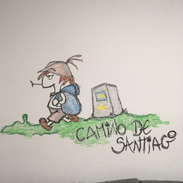
7 years ago I wrote about a 10 day /200km hike we’d done in the forests of Western Australia on a wonderful track that goes all the way from Perth to the south coast. We had walked from Kalamunda, at the start, to the next trail town of Dwellingup and had loved the experience. Back in Oz we were determined to do another stretch of the 960km Bibbulmun Track but after completing the Cape to Cape time available was running short.

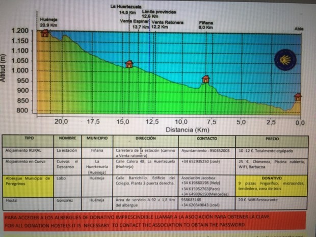
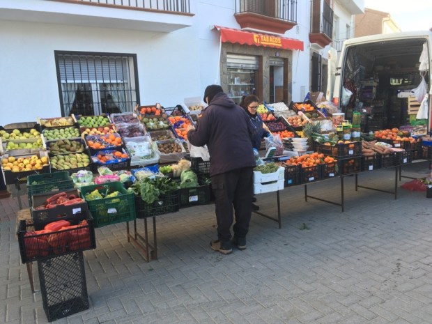
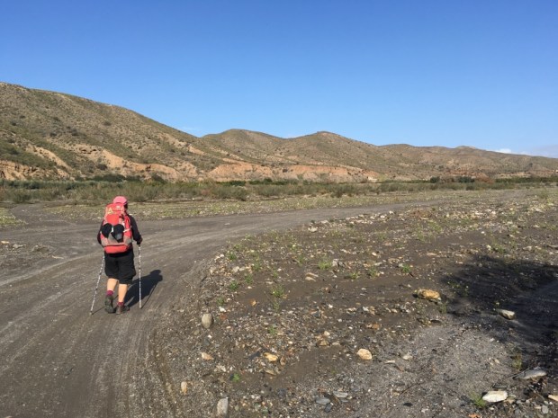
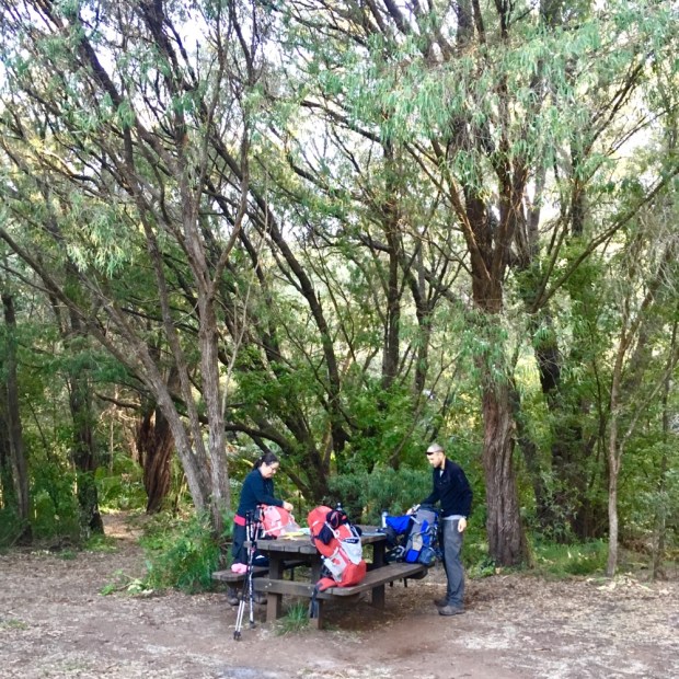
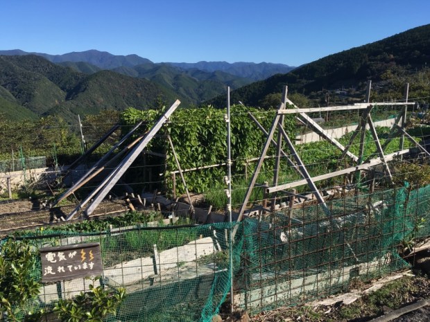
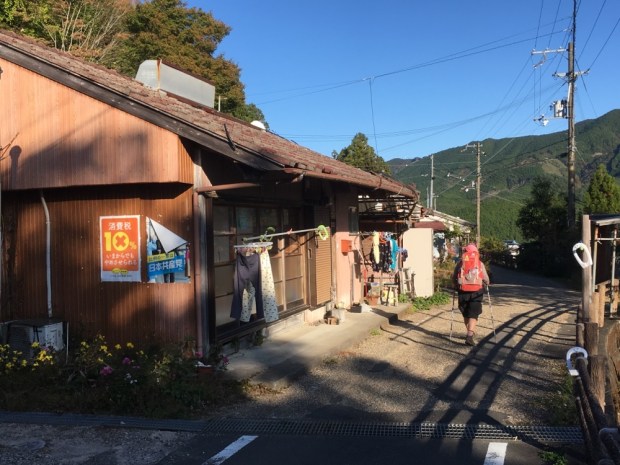
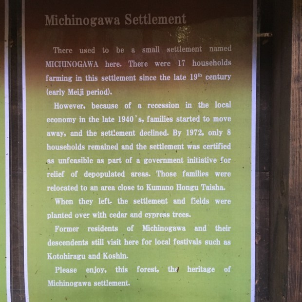
We decided to do a shorter stage of 4 days / 3 nights from Collie to Balingup missing out a 7 day section. There is usually no food available on the stages/sections, you’re way out in the bush miles from “civilization”, so you have to carry everything with you- which needs careful planning. On this leg we were going to cross a road after a day and a half where there was a tavern serving food so we scheduled a slap up feed around that. Even so our packs were heavy setting off from Collie.

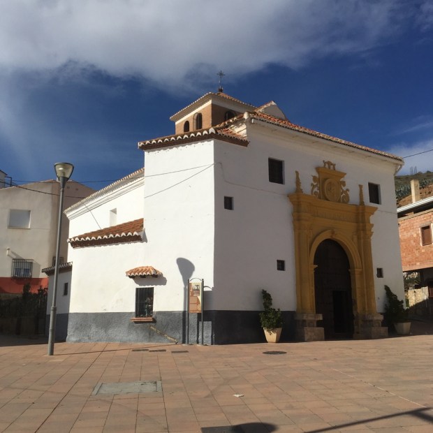
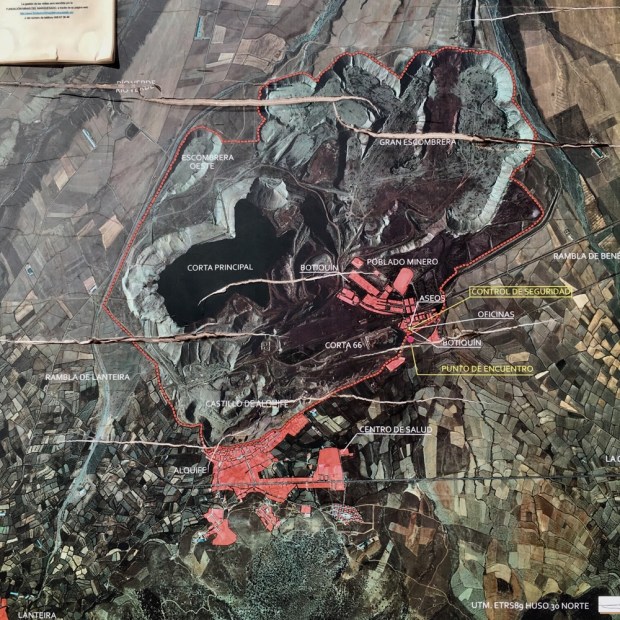
Collie was and is a coal mining town, unlike many in the area that were founded on the logging industry, and had a couple of facilities we enjoyed- a swimming pool to cool off in and a cutting edge art gallery, where we were invited to an opening of a show of portraits.

Nice people, nice wine, nice nibbles.

img_5480img_5478img_5479img_5477img_5476img_5473img_5474

An early self service breakfast at our historic old hotel of well faded grandeur allowed us to get on the way soon after 6, passing both the fire danger level sign and a notice saying that it is not recommended to be on the track at all between December and end of March and if you are, to leave it in the event of a fire risk of “high” or above.

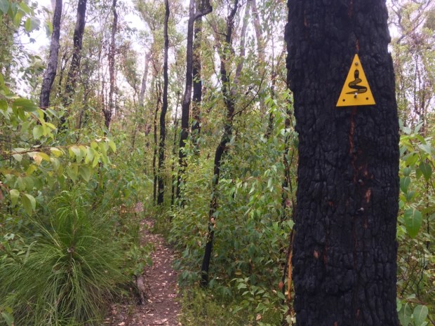
We were “severe”. Slightly worrying. We’d been watching the infernos in NSW on the news with 1000’s of hectares of bush and 100’s of houses burning and Sydney an impenetrable smog. A lot of talk and denial of the increased severity being connected to climate change and also the need to manage prescribed or controlled fires better.

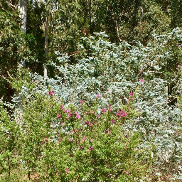
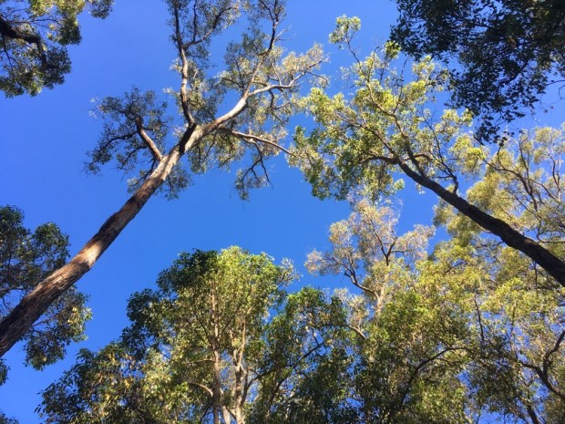
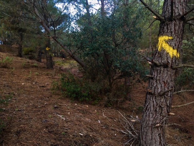
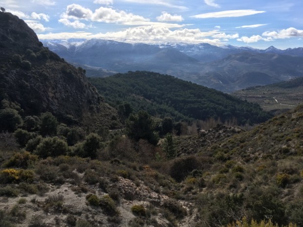
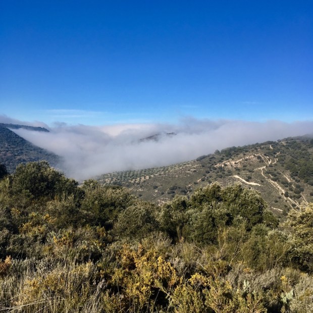
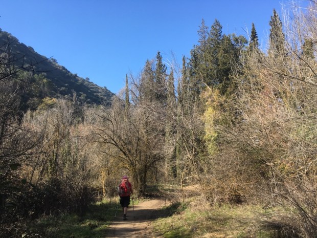
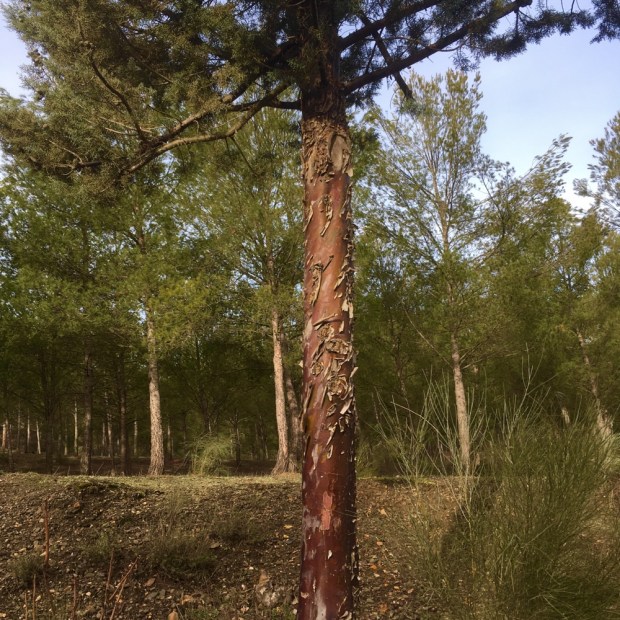
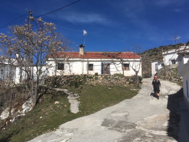
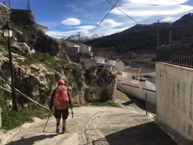
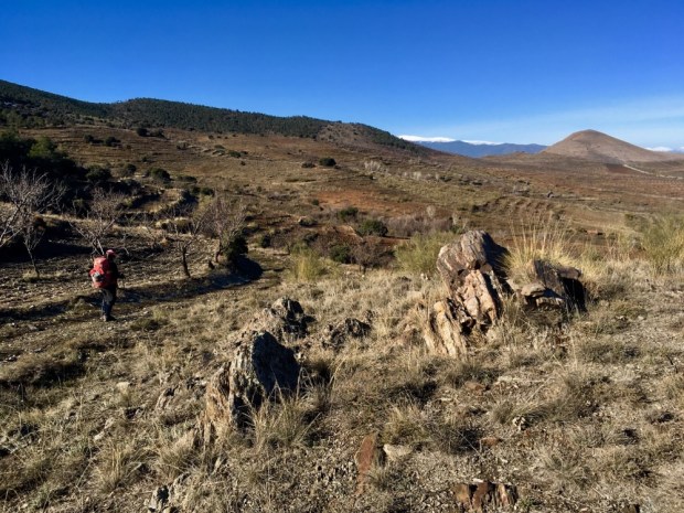
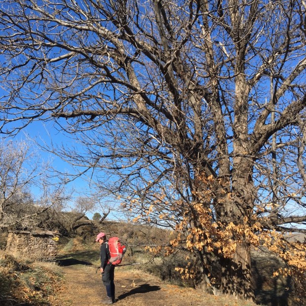
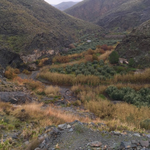
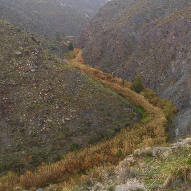
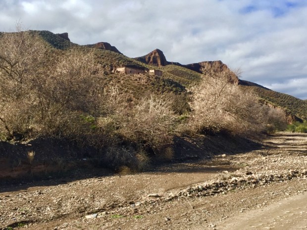
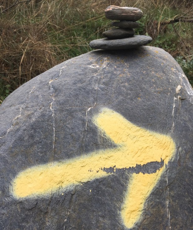
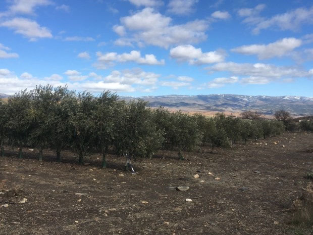
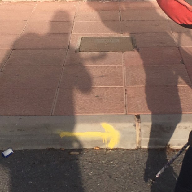
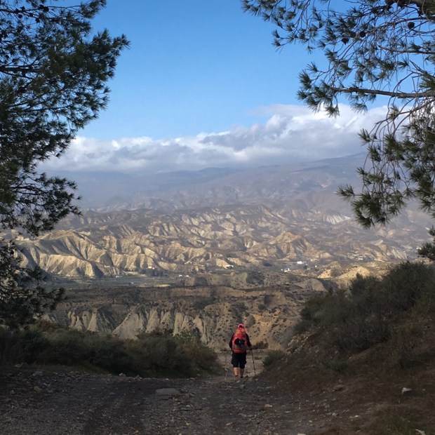
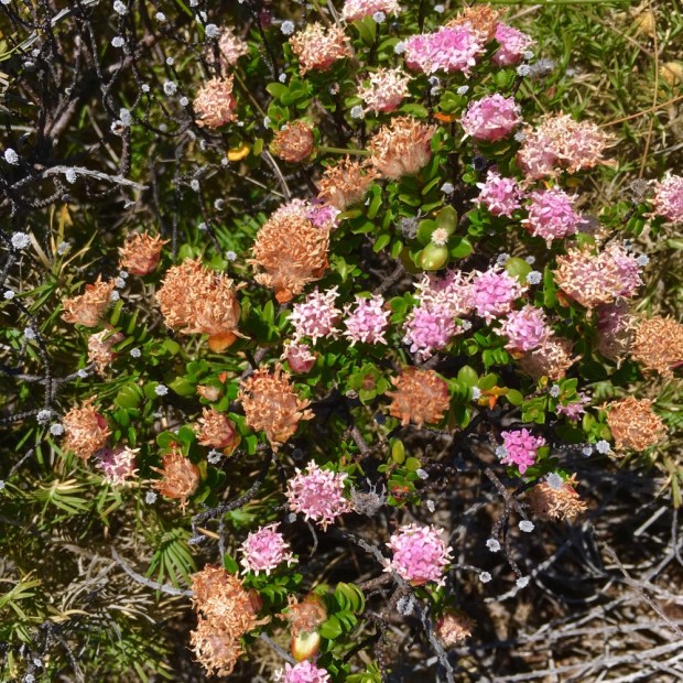
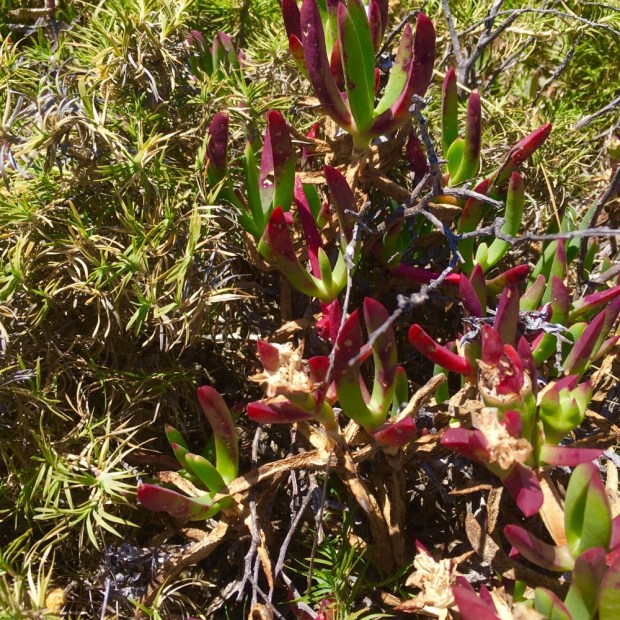
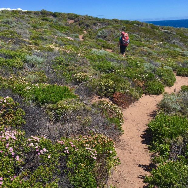
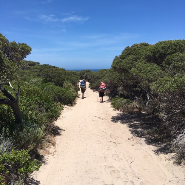
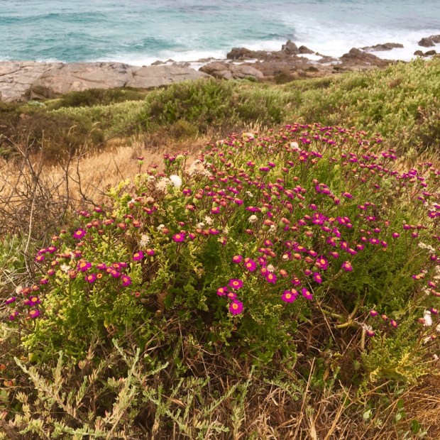
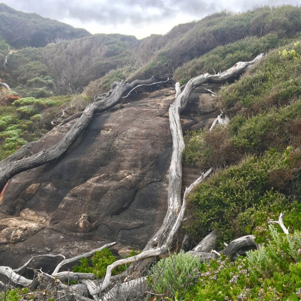
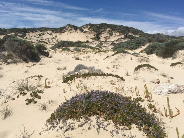
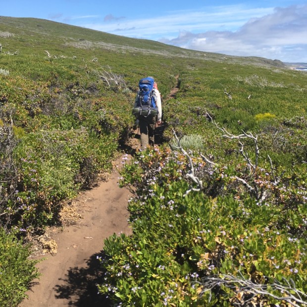
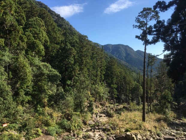
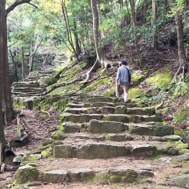
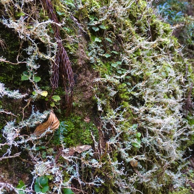
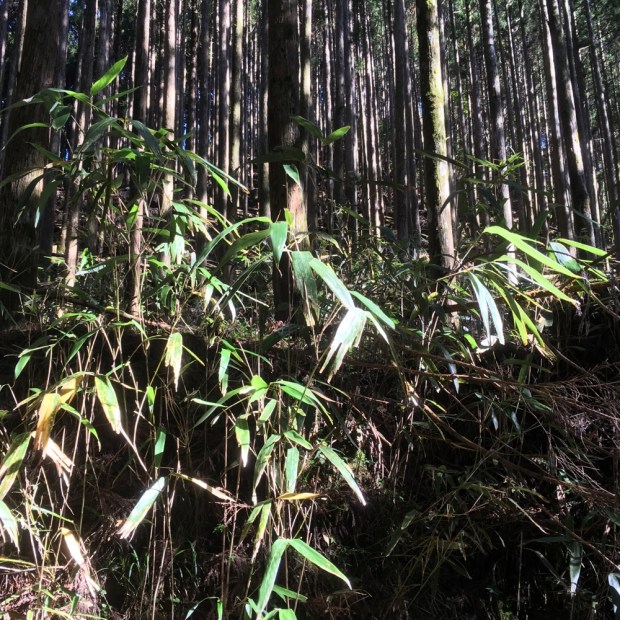
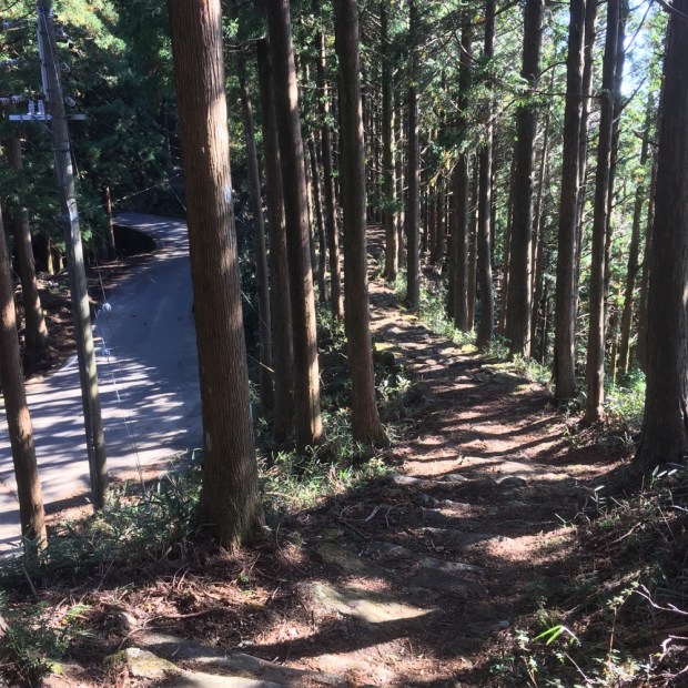
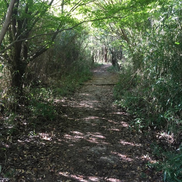
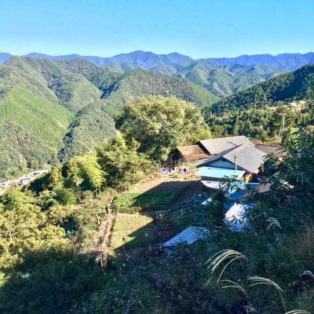
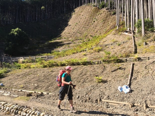
We were soon enveloped within the forest, the sights and sounds and scents taking us back years to our last Bibbulmun immersion, as we followed the yellow ” Waugal” symbol deeper into the immensity of Western Australian bush. We had enjoyed the Karri forest section on the Cape to Cape but the feeling of being a tiny dot making your slow way through mile upon mile upon mile of mixed Jarrah,Wandoo, Marri and a host of other tree and scrub species is special.

The easy path and flat ground made for a good rhythm of fast walking and we made good time to Collie river where it was too early for a swim and a 4×4 access track had allowed messers to travel down and defile the place with their fast food crap. Always a shocking jolt of a sight in deep country we hurried on past the cartons and bags to where the ethos of “leave no trace” was important to the people passing through.

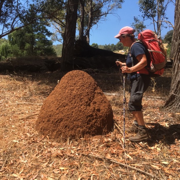
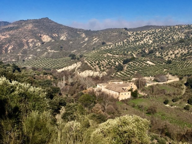
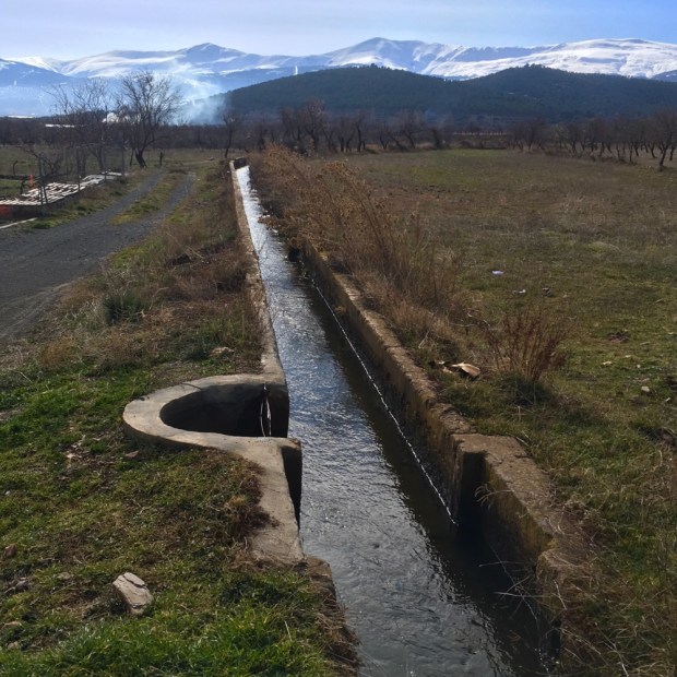
As the temperature built we passed Mungalup Dam, where unfortunately no swimming was allowed as it was a drinking water supply. Other dams were for agricultural use and allowed not only swimming but all kinds of boating including with outboard motors. A web of old logging tracks crisscrossed our path through the forest with the scattered trunks and stumps witnesses to a huge industry that started with the arrival of Europeans and peaked around the First World War, although continuing to a lesser degree into the 1980’s.

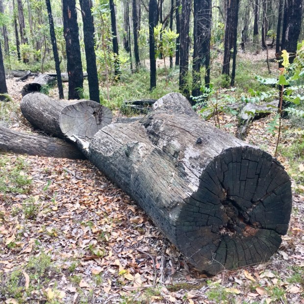
The regenerative powers of the Jarrah were good to see. Areas that had been clear felled were returning to high forest again.

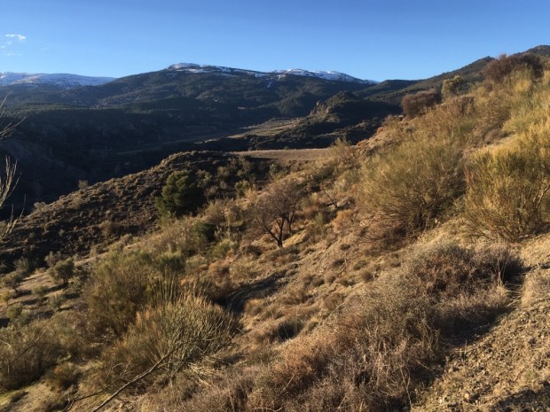
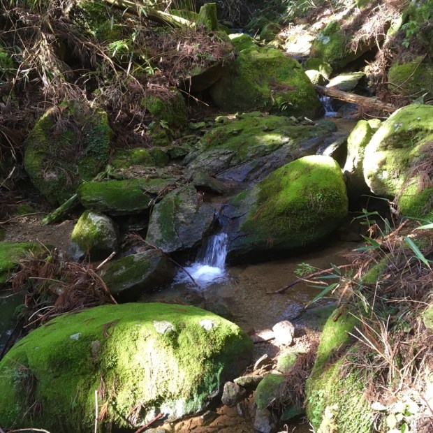
It was difficult to imagine the track in winter or spring when rains made stepping logs necessary and the creek systems were full of flowing water. There was however a little shower forecast and a couple of drops did manage to hit the ground without evaporating before we got to Yabberup camp after 20km.

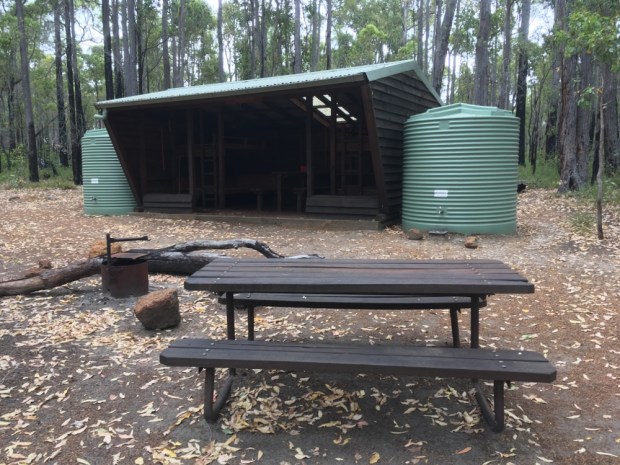
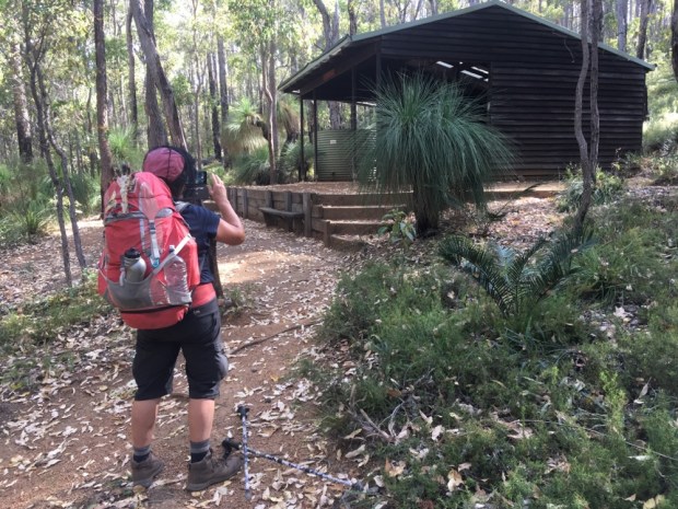
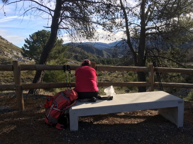
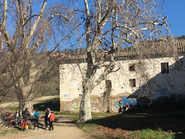
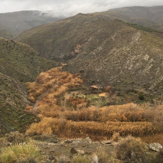
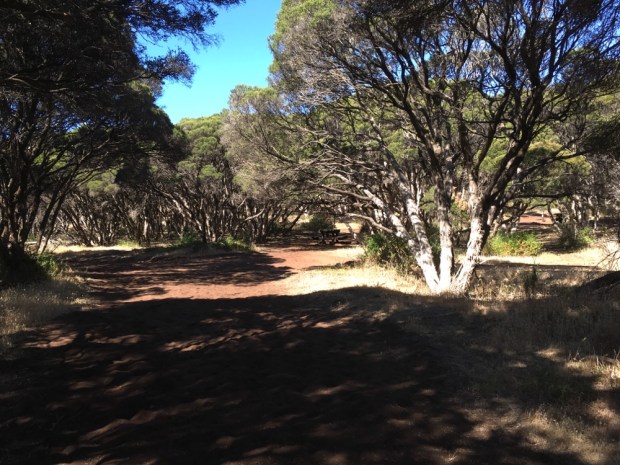
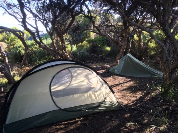
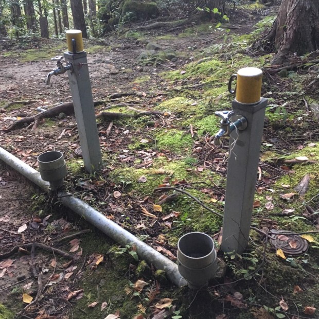
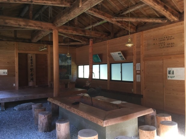
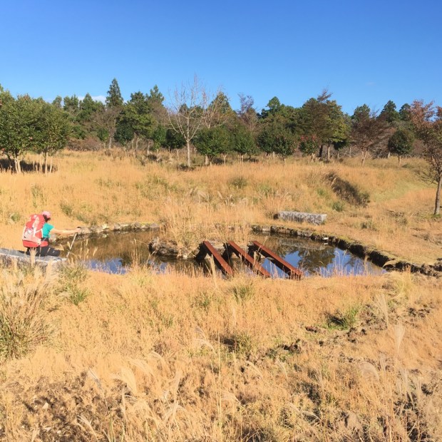
These shelters, erected about every 20km, are a wonderful resource. They offer sleeping platforms, fire pits (in season), long drop dunny( always with toilet paper!), tables and benches and most importantly, water. They also have cleared and level tent pitches although there’s a very good chance that in summer you’ll have plenty of hut sleeping space and can avoid having to carry a tent and the less you have to carry the better. As luck would have it there were a couple of showers once we were safe under cover and we spent the afternoon reading the entries in the camp log book and listening to the bird song.

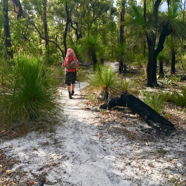
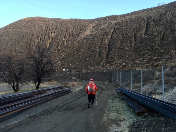
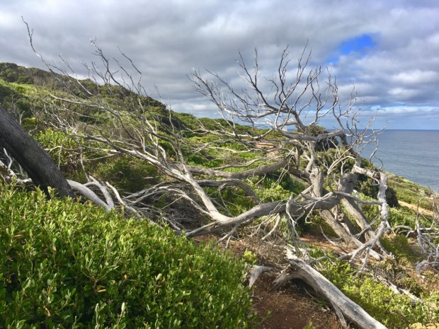
After a much more comfortable night on a new leakfree sleeping mat we set off again through the much burned landscape.

I’d been reading a bit on the use of fire in landscape or country ” management” by the Aboriginal people for tens of thousands of years. A vital tool for their survival and wellbeing, it was part of a complex and very sophisticated system of rotational “gardening” on a massive scale that allowed for a sustainable and biodiverse existence that helped to ensure the health of all species of fauna and flora. A lot could be learned from them.

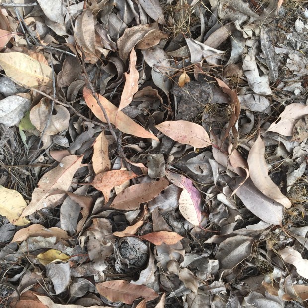
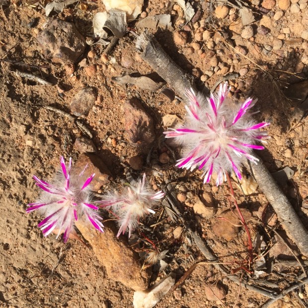
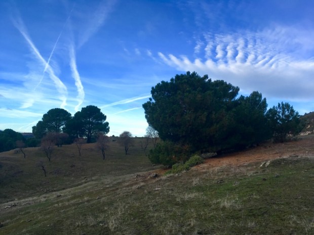
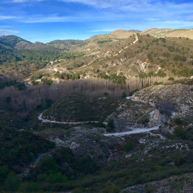
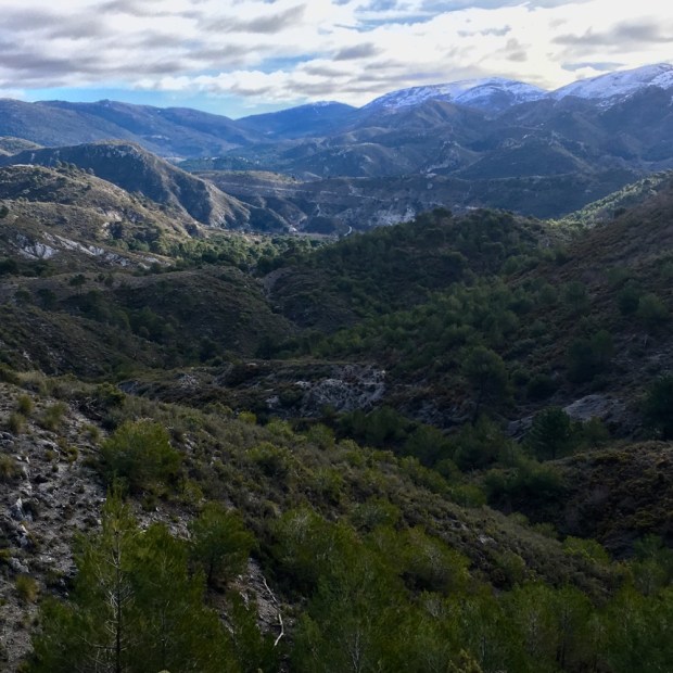
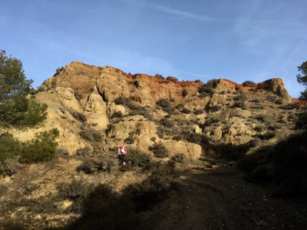
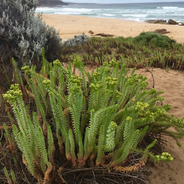
With the vast majority of the 1000km track going through eucalyptus forest it would be easy to assume it is boringly similar. On the surface perhaps so but once attuned to the subtle changes in vegetation, geology and the history of land use, it becomes everchanging. Just by watching where your feet fall you discover a wealth of variation over a short distance.

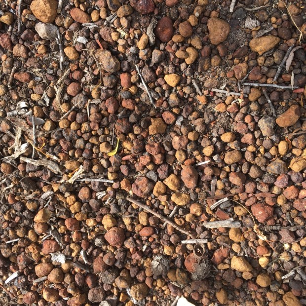
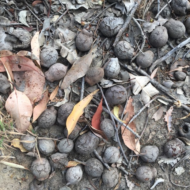
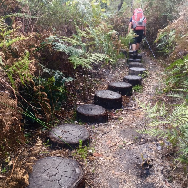
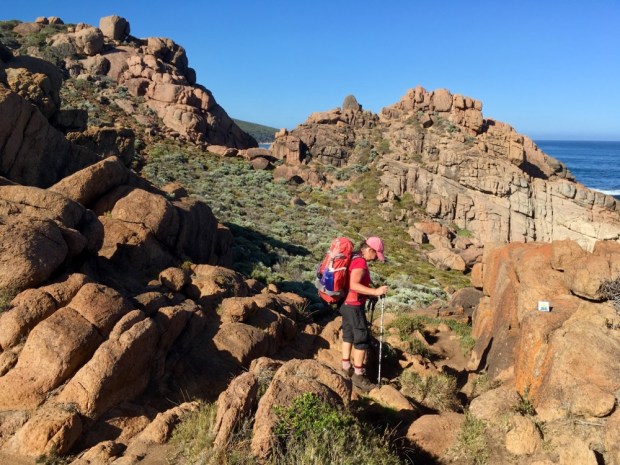
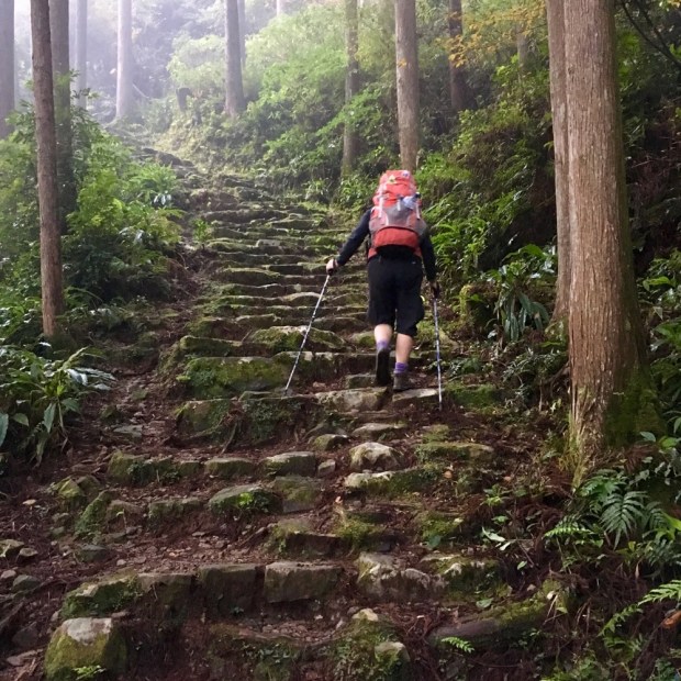
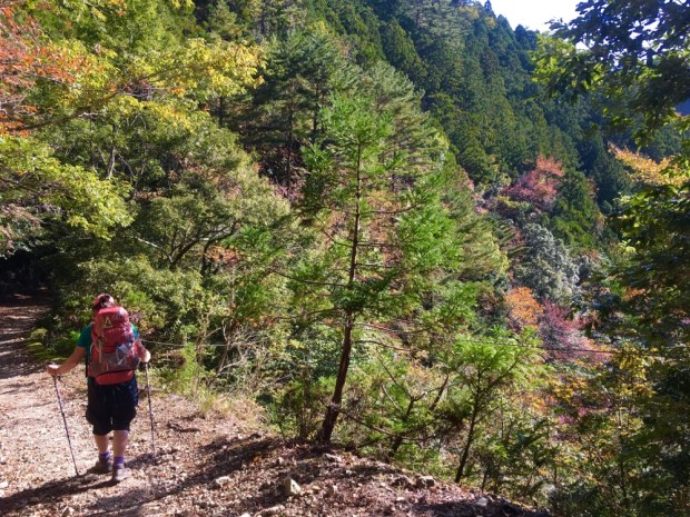
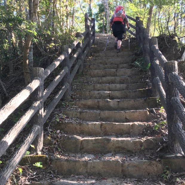
Some surfaces, like the pea gravel and the hard round gum nuts, could be easy to slip on, especially down hill, but mostly the track is easy going. We had encountered the biggest accents and descents of the whole trail on our previous trip, when we had to scale Mt Cuthbert, Vincent and Cooke, the highest at 582 m, and the profiles of our current journey were a relief after the jagged peaks and troughs of the Kumano Kodo.

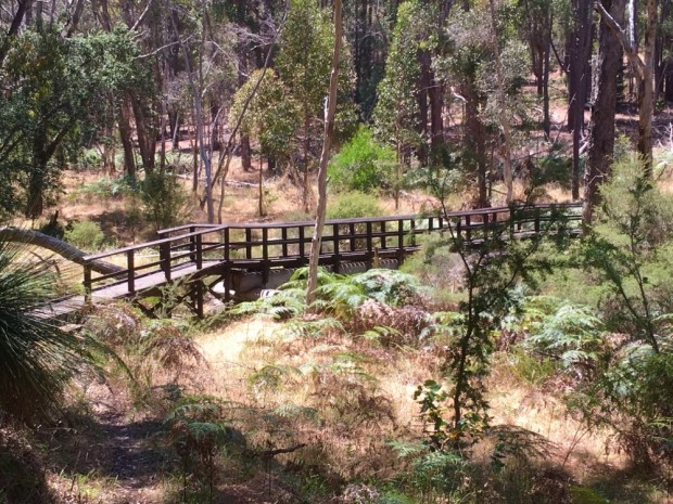
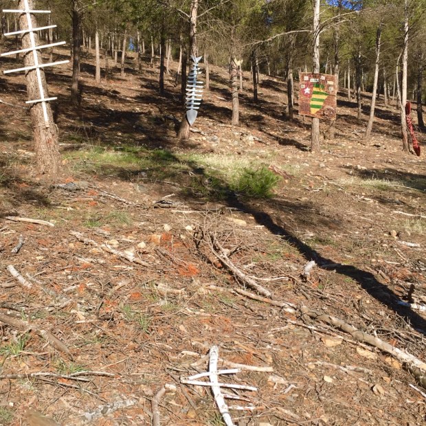
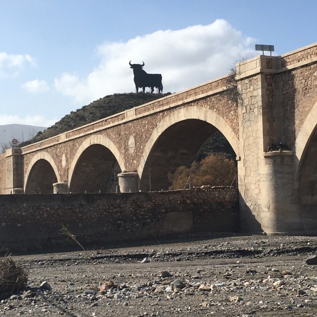
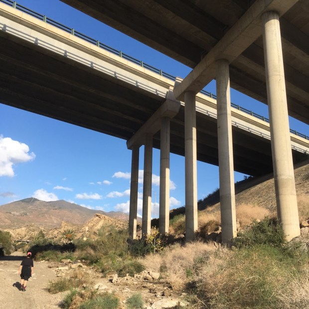
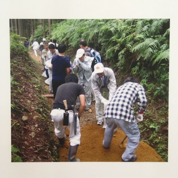
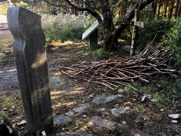
Fair play to the teams of volunteers and the rangers and workers from the Parks and Wildlife service who build and maintain infrastructure like the bridge above and the shelters, and keep the track clear and marked.

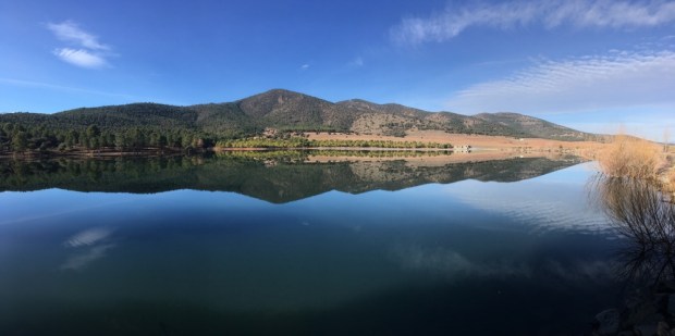
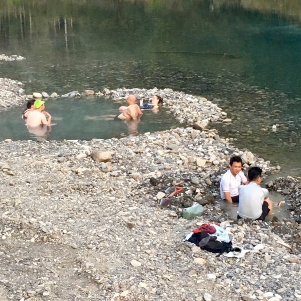
We stopped at Glen Mervyn Dam for a cooling swim after passing a number of campers on the shoreline with canoes, paddle boards, speedboats and water skis.

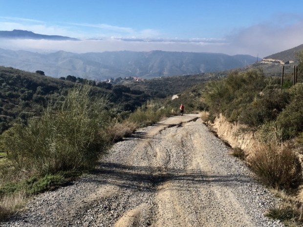
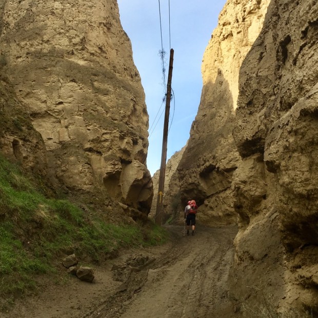
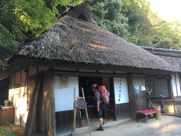
Another couple of hours in the shady forest and we descended on the slippy pea gravel to the tarmac road where the Forest Tavern or Mumby Pub promised a cold Coke, a coffee and for Sunday lunch a big cooked meal and pint of beer. A joy only spoilt by the necessity to leave in the early afternoon heat across open ground without the shady forest. We travelled beside farmland on an old railway track before climbing a steep hill, sweating and panting, to rest gratefully in the shade again, admiring the views and comforting a lost and lonely lamb.

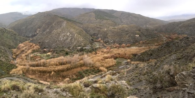
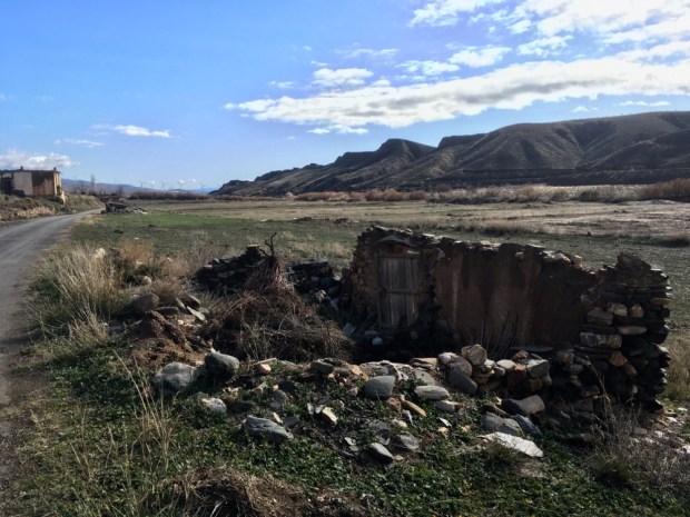
Now in the Greater Preston National Park we continued to Noggerup Camp where we had a bottle shower to cool down and wash off the track dust and did a little clothes washing. Nearly all of the Bibbulmun travels through land in the care of the Parks and Wildlife service whether that is a nature reserve, a National Park, a conservation park or a state forest with only the latter allowing any ( sustainable) timber production. It’s heartening to be able to hike for days, weeks, even months through a landscape that will no longer be exploited, although it is debatable to what degree the management practices are “correct”.

Not long before sunset we were joined by a man who seemed to be struggling somewhat and was so overweight that he seemed an unlikely hiker. How wrong first impressions. Jens, originally from Denmark, had just walked from Collie- 40km. He had completed about 12 end to ends on the track – that’s 12000km. He usually headed south from Perth in December when there’s less people on the trail, and did a south to north migration March to May. And he did this with multiple heath problems- herniated discs, trapped nerve, knee and other injuries due to bad accident, diabetes, big weight problem that he had to sort out before he could have his liver transplant!

He started hiking to rehabilitate after his accident and initially it would take him 14 hours to walk 5km. He needed to stop every couple of hundred metres to recuperate. Now he said it takes him a couple of weeks when he first gets back on the track for his knees to loosen up, another couple for the rest of him to get in shape and then the last couple of weeks he’s flying it, eating up the distance by walking for 18hrs- resting for 6- walking for 18- resting for 6- and repeat!

Mind you when we met him- early in the process- he was chewing painkillers and anti inflammatories big time. He also planned to rest up in the shelter the next day and continue on the track by night when it was cooler.

Our strategy for dealing with the heat was to get as much of the stage done as possible before it got too hot. Which meant an early start to Sally’s birthday.

So I woke her at 4.30 with a cup of tea and some birthday candles ,(definitely bad in a total fire ban- we later learnt we weren’t even supposed to use our Jetboil camping gaz), and hiked hard for a couple of hours before stopping for a b’day brekkie of smoked salmon and jerky.

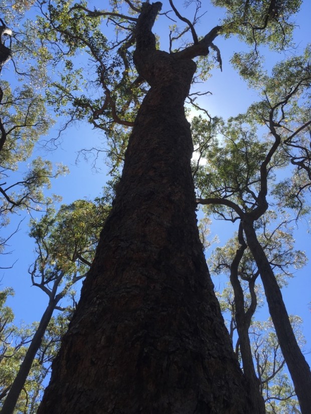
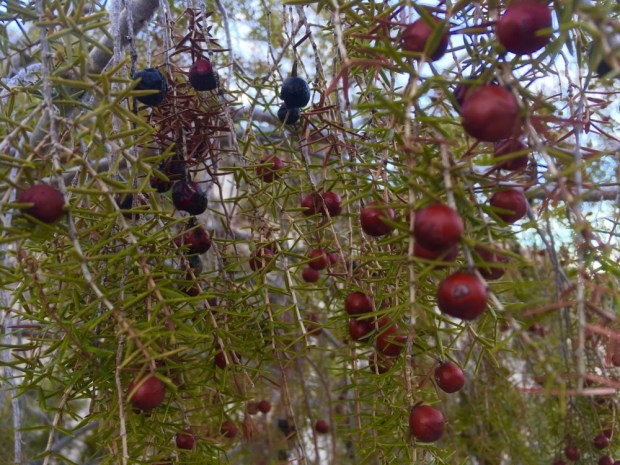
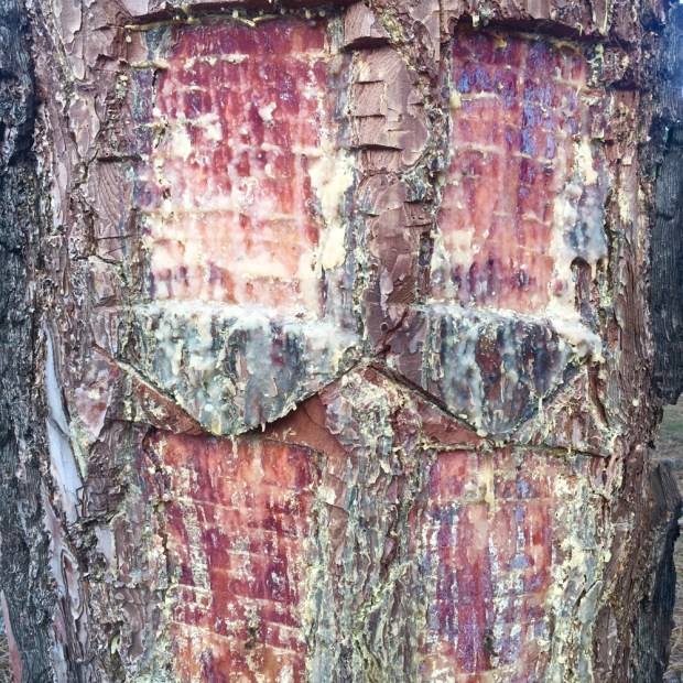
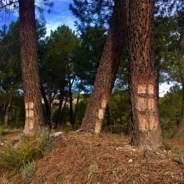
It was a beautiful mornings hike on old railway formations, cuttings and embankments, from the days of the logging camps and then into a large area of virgin Jarrah forest with immense trees whose towering trunks seemed unimaginably big for axe or handsaw. Some of the Marri trees exuded a red gum the Aboriginal people used as an antiseptic and to tan leather.

As usual the last few kms seemed to stretch a lot further than reasonable and with many more ups and downs than expected but by mid day we had travelled the 24km to Grimwade camp and after a quick bottle shower cooloff, relaxed with a b’day cuppa and packet of Tayto’s, the taste of home.

Other treats included the cans of G and T I’d secretly carried for the last 4 days that we enjoyed with our noodles, mushroom soup and dehydrated “shepherds pie”. Quite the feast. Jens by the way has one meal a day. Soaked ( not heated) couscous and a sachet of tuna. Everyday.

We’d been too hot for a finish so determined to start even earlier. Our last day on the Track started in the gloaming. Packing up as light first bled into the eastern sky, we were on our way by 4.30, reveling in the cool morning air.

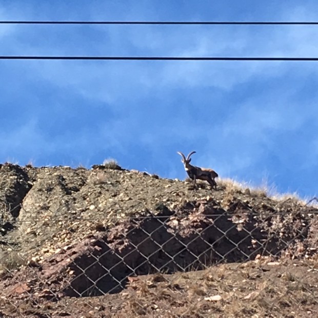
We sent a few roos bouncing off through the bush and admired, and attempted to mimic, the varied birdsong, but didn’t see as much wildlife as we had on the Cape to Cape. We were told it was because the sand surface there stifled any vibration whereas here the animals heard and felt us coming. We did see quite a lot of wild pig scuffling and on our last morning, 3 adult and 1 baby emu ran across the land below us. And plenty of flies, ants and termites.

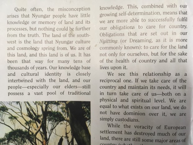
The forest was beautiful in all its various stages. Whether full growth virgin or coppiced regrowth. Whether thick, tangled and bushy or black and burned with vivid green shoots emerging. It was all a rich tapestry. One that was understood and nurtured by the First Nations People. One of the Nyungar people whose country was South Western WA and included the Bibbulmun group had written in the article on fire stick farming of the deep and overriding connection the Indigenous people feel for their ” country”.

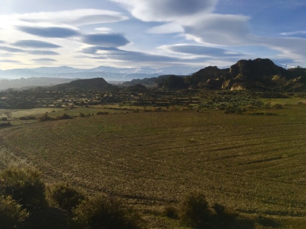
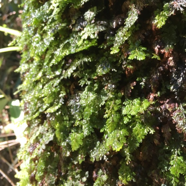
It ended up being a long hike on that last day. 29 km till we emerged from the forest to the rich farmland on the approach to Balingup. It gave me time to ponder on the similarities between the spiritual connection with and import of “country” to the Aboriginal or First Australians and the sanctity of nature worshipped in the Shinto faith by those countless pilgrims on the Kumano Kodo as they journeyed through the cedar forests before us. And to the recent, and desperate, moves to give legal rights and protection to nature in jurisdictions around the globe. In a race to the finish ” new animism” attempts to recognize interdependence in the living world and afford rivers, mountains,forests, lakes and in the case of Ecuador, Mother Nature , now enshrined in its constitution, the same rights as humans. Doing away with an intrinsic spiritually towards nature and replacing it with legal protection might be necessary in this faithless and destructive era when time is nearly up but it is also clumsy and riddled with complexities the legal profession can earn money from while the planet burns.

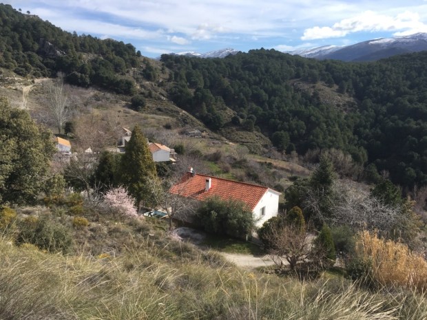
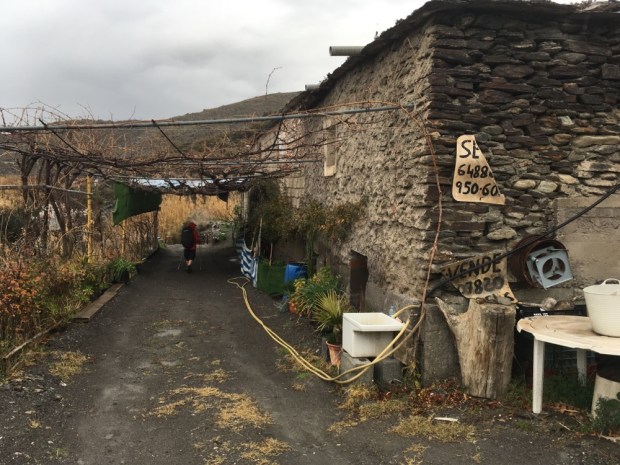
We came out of the forest for the last time exhausted but also rejuvenated by the experiences of the past 6 weeks. A couple of km of baked grass and we were able to stock up with food and drink and retire to a little cabin and garden for rest, relaxation and reflection.
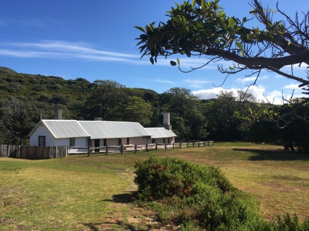
CAPE TO CAPE TRACK Western Australia 1

We decided to continue our World Series hiking exploits with this one whilst visiting sonny Milo in Perth.

After a weeks gardening to recover from the Kumano Kodo it was back to rucksack packing again. But this time we were going to have to carry 2 person tent, sleeping bags, sleeping mats, food, cooking and eating stuff and more water. It all adds up and our bulging bags were heavy. On a previous trip down under we’d done a couple of hundred Km of the Bibbulman through the gum, jarrah and karri forests of the Darling range so kinda knew what to expect of a hike in the Ozzy summer but this one didn’t have the camp shelters every 20 km or so but did have a few commercial camp sites and a some small towns to pick up supplies on route. There were also some simple camping sites with a picnic table and compost toilet with a water tank that may or may not have anything in it. Reading about it it became obvious that the challenging aspect was not so much the distance but how much of it was on loose soft sand beaches and tracks. Well we’d had a weeks training in those conditions on the Fisherman’s Trail in Portugal in the summer so felt like we could manage. A bit of complex logistics saw me and Sally set of from the Cape Naturaliste while Milo drove halfway down the trail, to Prevelly, left the vehicle there and cycled back north to our camp for the night at Yallingup, 16.5 km from our starting point.

Hiking north to south, with the sun behind us ( southern hemisphere innit) we set off from the historic lighthouse on a wheelchair friendly access for all track for a few km until things started to get wild.

Although spring was on its last legs and the dry heat of summer was coming in fast there were still a lovely selection of wild flowers in bloom.

The bush was thickly vegetated with an impenetrable wall of greenery either side of our mostly narrow pathway that undulated along the coastline with views of the blue waters and white surf. Dropping down to the beach we got our first taste of soft sand hiking then back up to the eroded limestone cliff tops and sandy 4 wheel drive tracks.

Deep in the bush we past the simple Duckworth Camp, cos we were heading on another 4 or 5 km to shorten the following day. Arriving hot and weary in Yallingup we swam in the sheltered lagoon before meeting Milo and returning to our camp through the gardens of Caves Hotel.

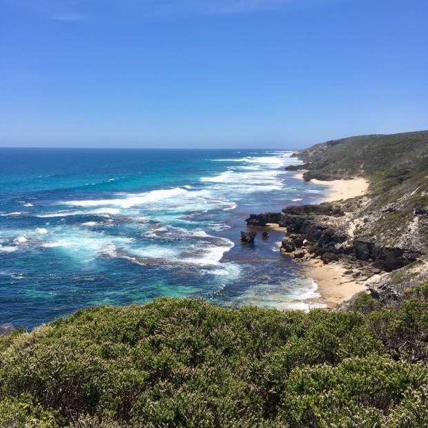
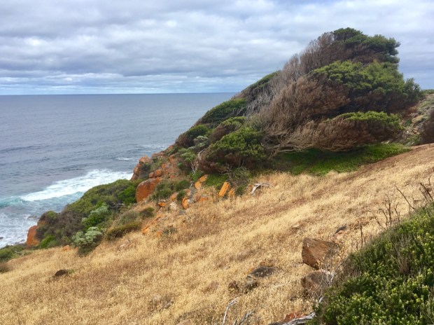
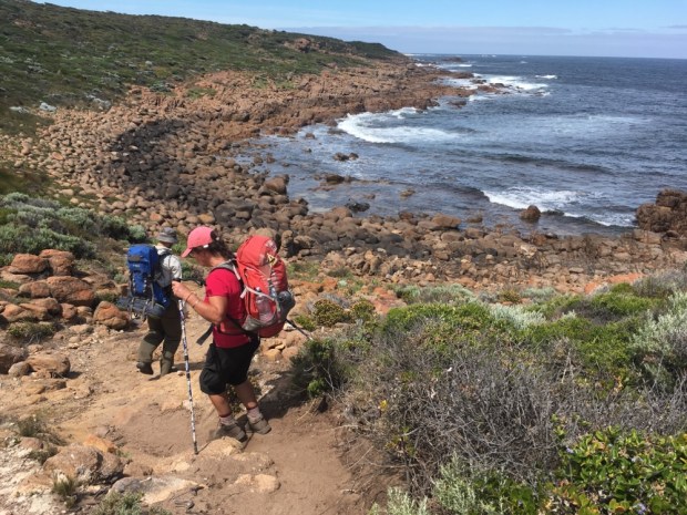
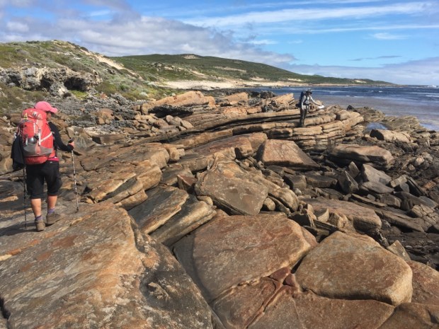
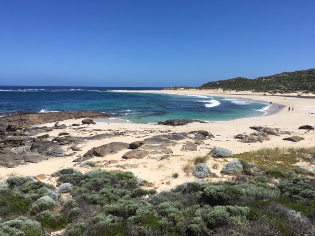
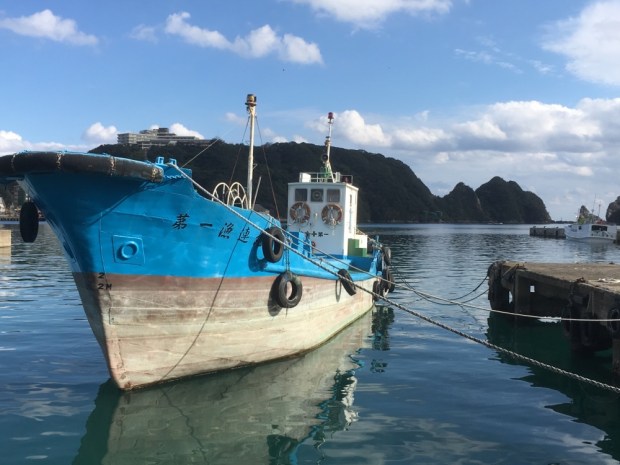
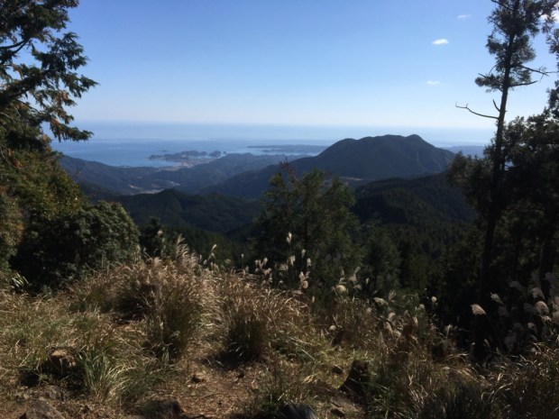
Up and on the trail by 7 with the sun already climbing steadily it was another fine day for the many surfers along this coast. There are quiet a few 4 wheel drive tracks that give them access to amazing beaches and breaks and we stopped for me to have a swim at one where a pod of dolphins rode the waves next to the surfers.

We crossed a couple of brooks that managed to make it all the way to the sea and I climbed up to the Quinninup waterfall accompanied by croaking frogs and flitting birds. We had seen and heard a lot of birdlife and now saw our first lizards and a quenda at the Moses Rock camp where we stayed, after a 22km hike, sheltered in amongst the tea trees.

Next day was nice and cool to start as we continued along the coast through a mixture of thick bush, rocky escarpments and white squeaky beaches. There had been a number of lookouts and scenically placed benches for whale watching as this is directly on a major migratory route and also for surfers to watch the waves and each other. For us they were a welcome opportunity to rest awhile and gaze out at the deep blue beyond. There were also keen fisherman both on the land and in the water with spearguns. The plant growth testified to the relentless wind as they crawled over rocks and were aerodynamically shaped by the forces.

We came to a shark warning speaker and entered a long section of coastline where these were placed in popular surf/ swim areas.

And wouldn’t you know it, when we got to a lovely bay at Gracetown in the midday heat and got in the inviting azure waters to cool off the siren overlooking the beach started flashing red lights and a disembodied voice said the beach was closed, leave the water, sharks were in the area. There are helicopter spotters and also baited drum lines. There have been a number of attacks around here.

But after another couple of hours of hiking in the heat we were forced back in the water to cool off on a reef protected beach before turning in land and passing an old homestead now under National Trust management, and into the forest for a change where a quiet and secluded camp awaited. Another 20 km done and time to pour some boiling water on a dehydrated meal before turning in for a fitful night on my leaking and comfort free sleeping mat.

Up and about in the forest early again on a sandy track that narrowed as it reentered coastal scrub. We disturbed some Roos near a place with bizarre rock formations jutting above the greenery.

It was beautiful walking and varied with narrow paths through the scrub, wide 4 wheel drive tracks, rocky cliff tops and sandy beaches walking next to lapping waves of a calmer morning sea. Before too long we had reached the Margaret River a famous stretch of fresh water that now , in the summer, had a sandbar preventing its emergence into the sea. A lovely spot to swim- without the boisterous waves and salt.

So after only 12.5 km we had reached Prevelly where we had to say goodbye to Milo ( after offloading any weight we thought we could do without) and book into a campsite where we had a caravan and a bed with a soft mattress. Oh delights. The campsite also had a restaurant a grocery and an off license. About 70km done in 4 days. Now we have to do the same again in 3 days with about 16km of soft sand involved. Fortified with food, beer and wine I’m feeling optimistic.

KUMANO KODO: The Nakahechi Pilgrimage 3

After days in the forests and mountains ,tiny rural hamlets and ancient temples , re-entry into “normal” urban environments were a shock to the system. When I say ” normal” of course it’s all relative. The suburban house we hobbled to from the Daimon-zaka slope was a guest house that the host didn’t live in.

Everything was automatic. Lights came on as you moved from space to space. No switches. If for some bizarre reason you wanted to exercise some control yourself there were various remote controls to dim or higher or lower or increase a multitude of functions and devises. If you entered the toilet the light came on, the lid came up and the heated seat and bottom washing jets were ready for action.

I did admire the nifty idea of having the cistern refill as a hand wash sink. So sophisticated and yet, ironically, the few remaining simple squatting style toilets are signed as ” Japanese style”. Some of this “smart devices” and ” Hive” and ” internet of things” may be common or garden to many of you but for someone who lives in a two hundred year old pile of stone with a bunch of reeds on top, it was a future shock to stab at the living room light remote and have a wall size projection suddenly start up, informing me of the date, time , weather , moon size and position and offering me the whole of the WWWeb for my viewing pleasure. I just wanted to see where the tea was.

We retreated to the ancient temples.

Or actually we retreated to the natural wonder that gave reason for the temples origin. The sacred Nachi Falls. Emperor Jimmu discovered the 133 m waterfall over 2500 years ago while being guided by Yatagarasu, the three legged crow, and they have been worshipped ever since. Along with a number of sacred trees on the site the falls are the object of the original nature worship that has been joined by the Buddhist temples and Shinto Kumano Nachi Taisha in a multi belief system syncretism. No religious fundamentalism here.

They were beautiful and awesome and mighty and thundering with life and energy and the kind of thing I could get behind on the worshipping spectrum. As were the trees and general surroundings. Other people seemed to agree and they left prayer papers, burnt wishing sticks, bought power amulets and rang bells and shook long hollow logs full of potents. And took pictures.

In the sightseeing mode we took the bus down to Kii Katsuura on the coast for a different perspective of the mountains and have a ramble around. The place is tuna central with a big fleet and a massive market. Tuna tuna everywhere.

There were lots of Onsen around, but not open till later, so we settled for the public foot Onsen, where people casually took off their socks and shoes and sat bathing their feet for awhile on the Main Street. As you do. There were even tuna at the bottom of the foot bath.

On our walk across town to the beach and bus/ train station we admired the mish mash of urban architecture. Surprised to see that planning and regs seemed loose to say the least and that the clean cut minimalism I associate with Japanese style was not universally employed. Also that my preconceived notions of the wealth of the nation could have been misplaced.

Got to the Pacific and had a paddle before catching the bus to our bed in Albergue Kodo.

Our last full day in Japan and we had our last of the three Grand Shrines to visit. A short bus ride up the coast was Shingu and the Kumano Hayatama Taisha, symbolizing the past, while Nachi Taisha covers the present and Hongu Taisha the future. By worshipping at all three one is thought to find salvation, peace and good luck for each realm. But first we needed to visit another shrine, the Kamikura- jinja, where the gods first descended from heaven. It is nestled under the huge monolith known as Gotobiki-iwa, halfway up Mt Gongen and offers panoramic views of the city.

The magnificent and sacred rock, bound by a massive shimenawa rope, is at the top of a flight of 538 ridiculously steep stone steps that on the 6th of February every year, 2000 men dressed in white throw themselves down in a frantic nighttime race whilst carrying flaming torches. Pure Shinto madness representing sperm cascading down from the male phallic rock to enter an archway of women awaiting at the Torii gates below. And hopefully awaken the sun and bring fertility.

We clambered down slowly with caution horrified at the idea of uncontrolled leaping from those heights. At the bottom we crossed town to the Taisha, again agog at the buildings on the way.

The shrine was more peaceful than the other two had been, with the usual mix of ritual water, and prayer, grand structures and simple nature. There was a 1000 year old sacred podocarpus nagi tree and a family ceremony of some kind.

We had a picnic lunch after climbing to the top of the old castle ruins gazing out to the green forested mountains we had become so intimate with over the previous 9 days. The blue river that flowed into the sea here was the same one that carried countless pilgrims on boats from Hongu.

One final temple, one final stamp at Asuka- jinja.

One final treat when a man appeared from nowhere and led us into the temple where he played a bamboo flute for us.

A tune called Kumano Kodo.

We are moving on to Western Australia now, for treks in the bush, but before we leave the Land of the Rising Sun I want to thank the Japanese people we met for their hospitality, their kindness, helpfulness, generosity and good humor. I would also like to thank the ones we didn’t meet for their hard work keeping the Kumano Kodo trails as beautiful as they are.

Sayonara.

KUMANO KODO: The Nakahechi Pilgrimage 2

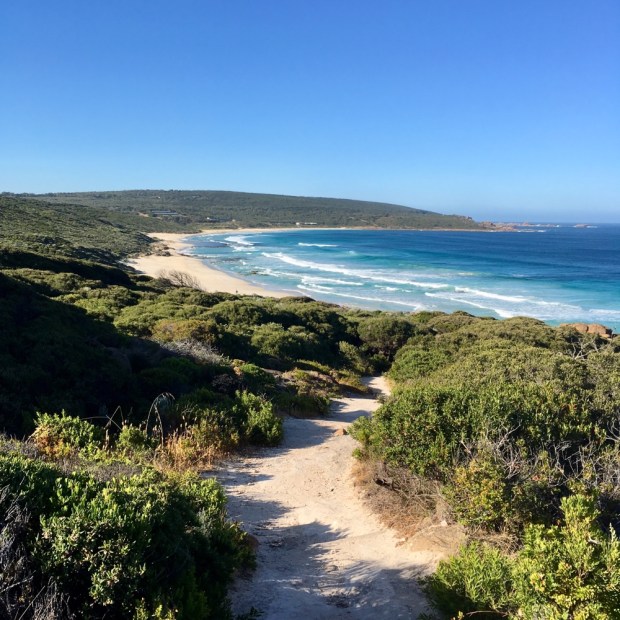
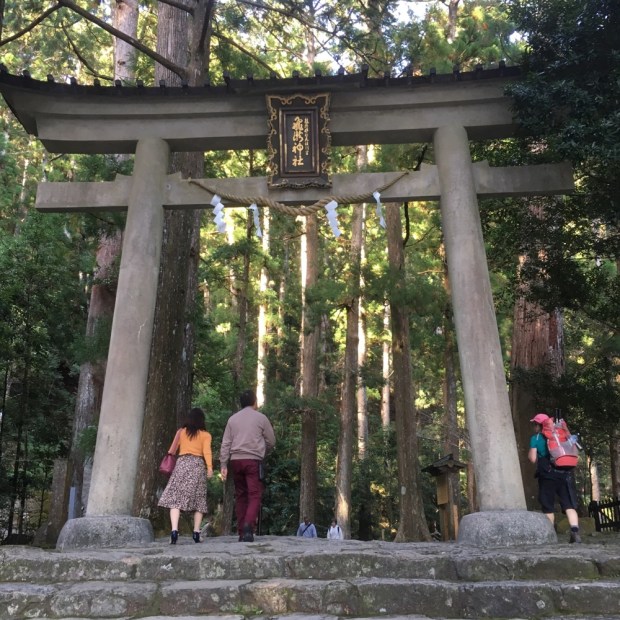
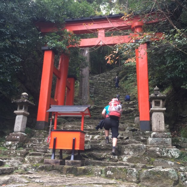
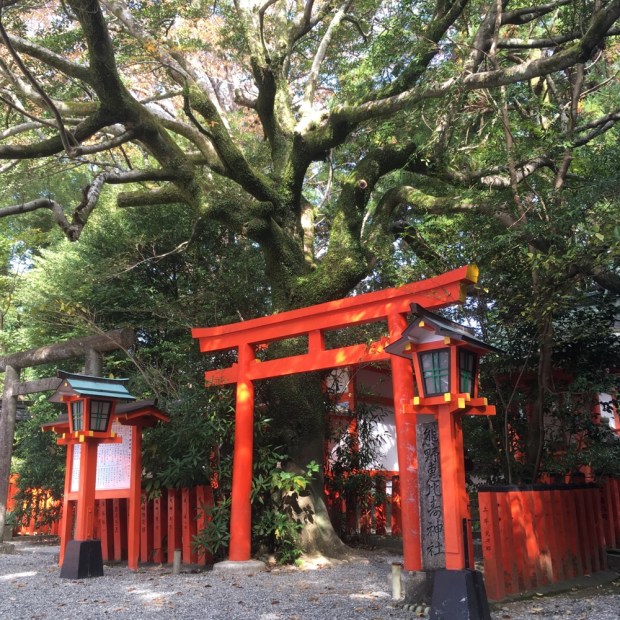
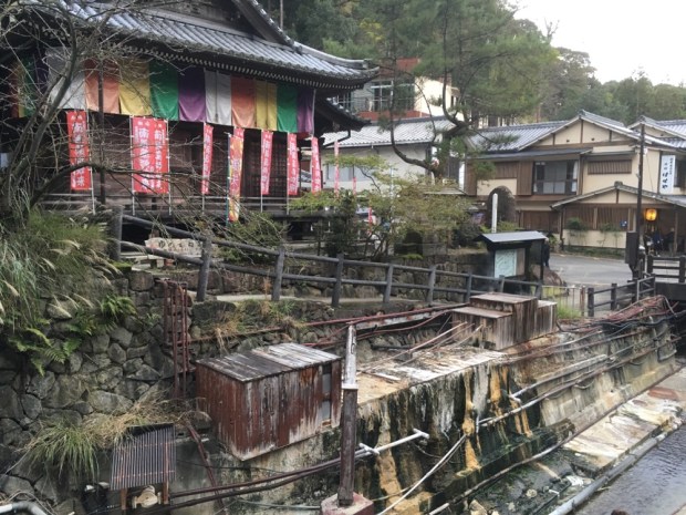
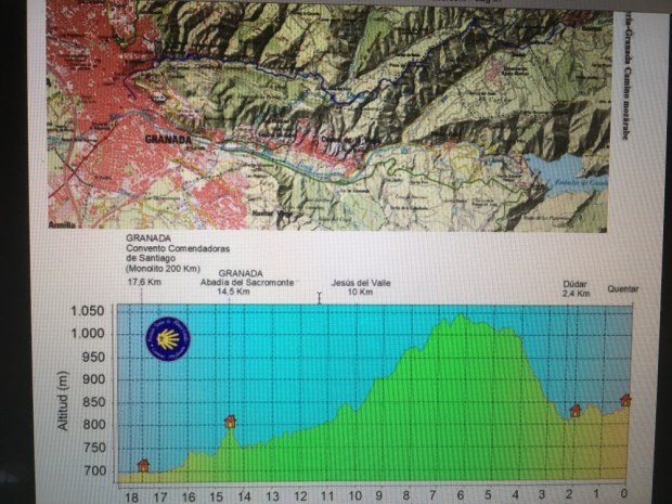
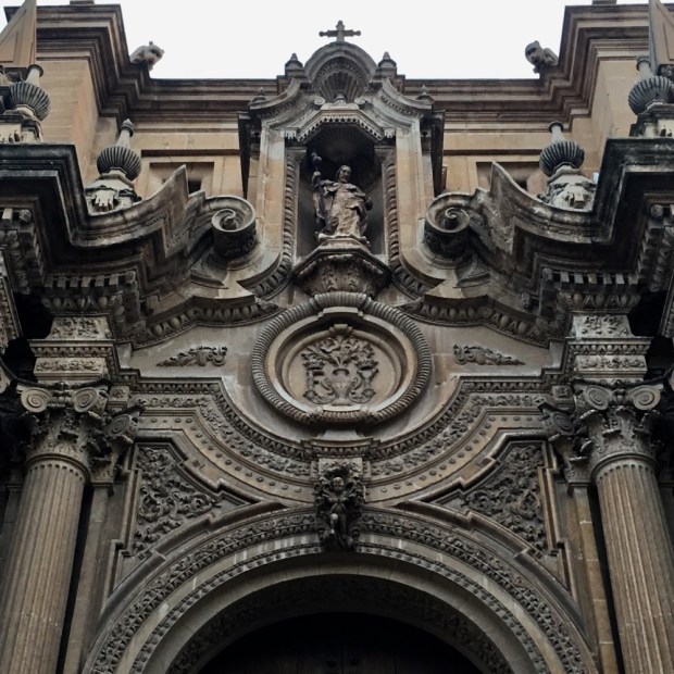
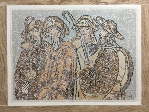
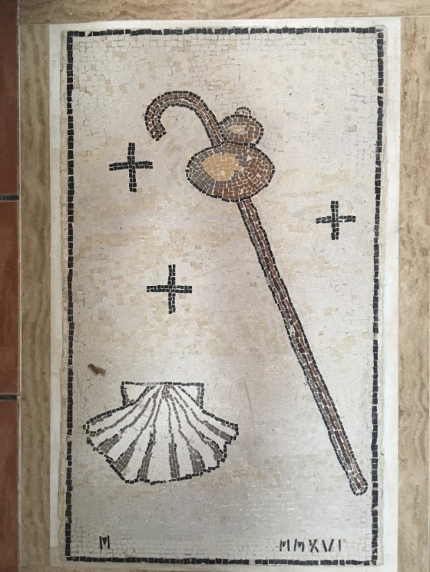
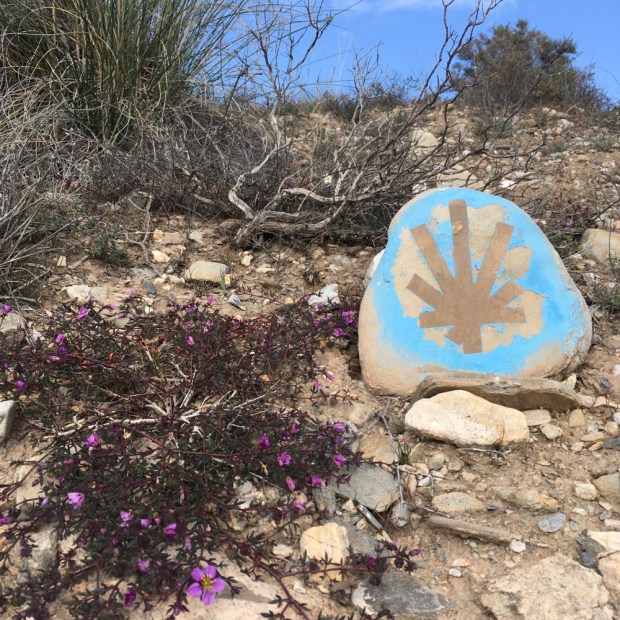
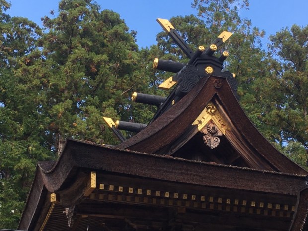
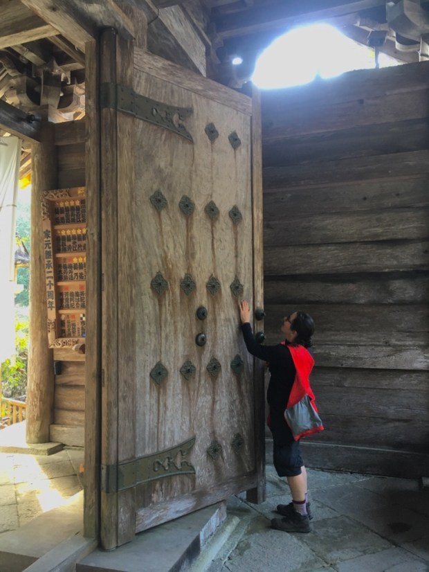
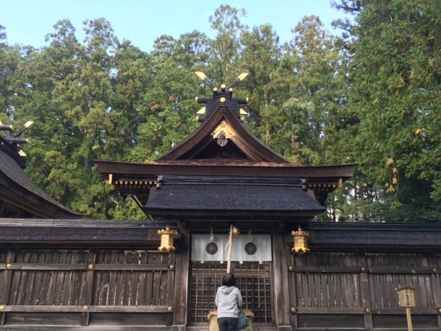
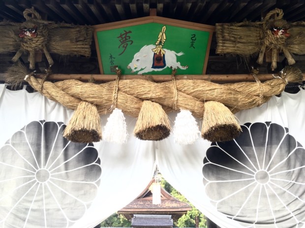
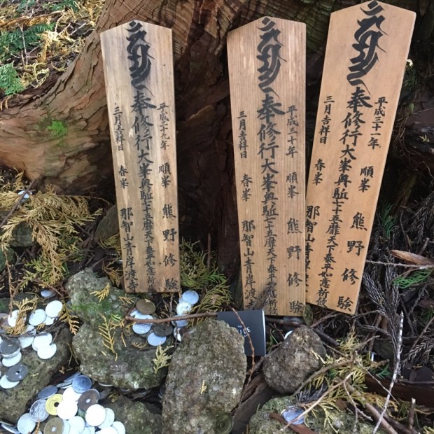
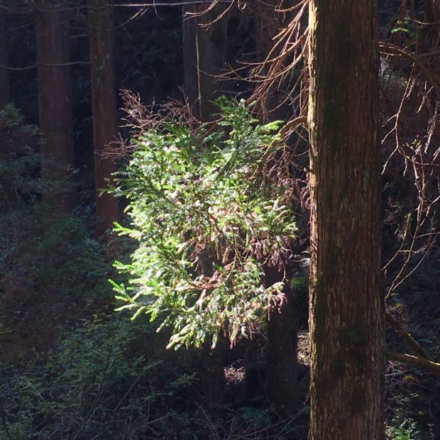
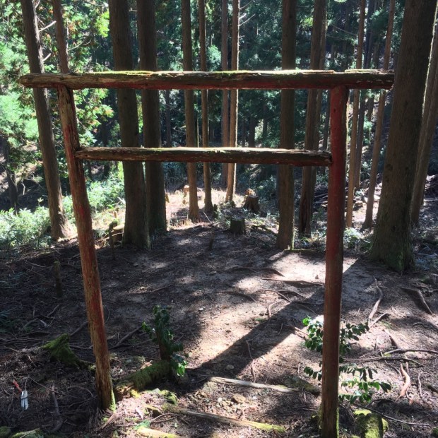
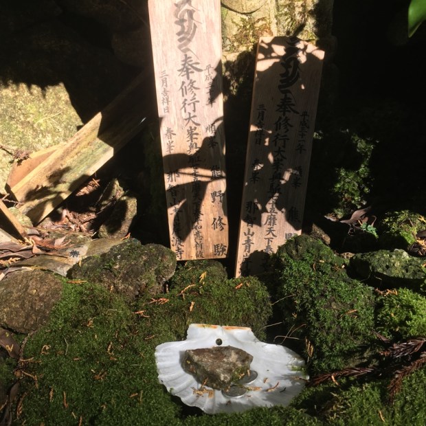
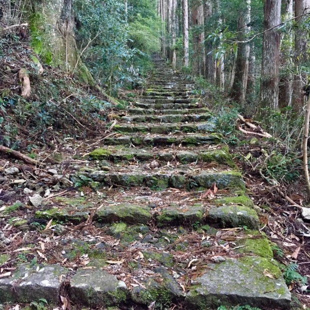
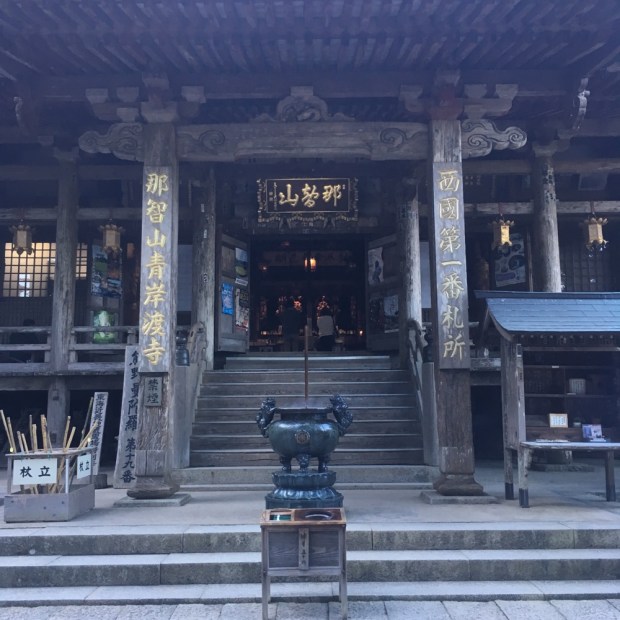
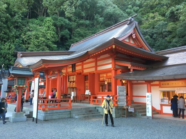
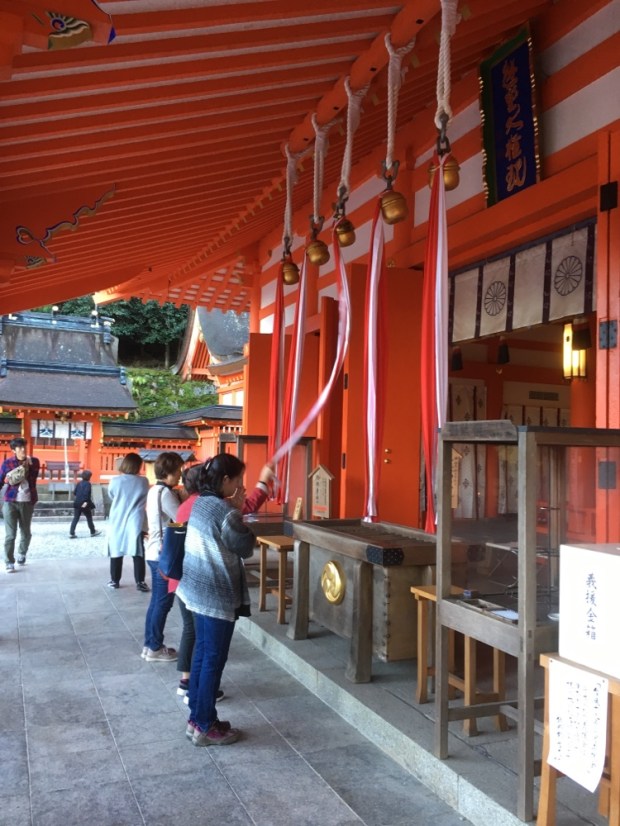
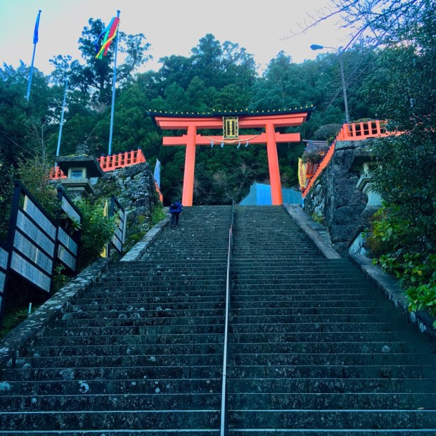
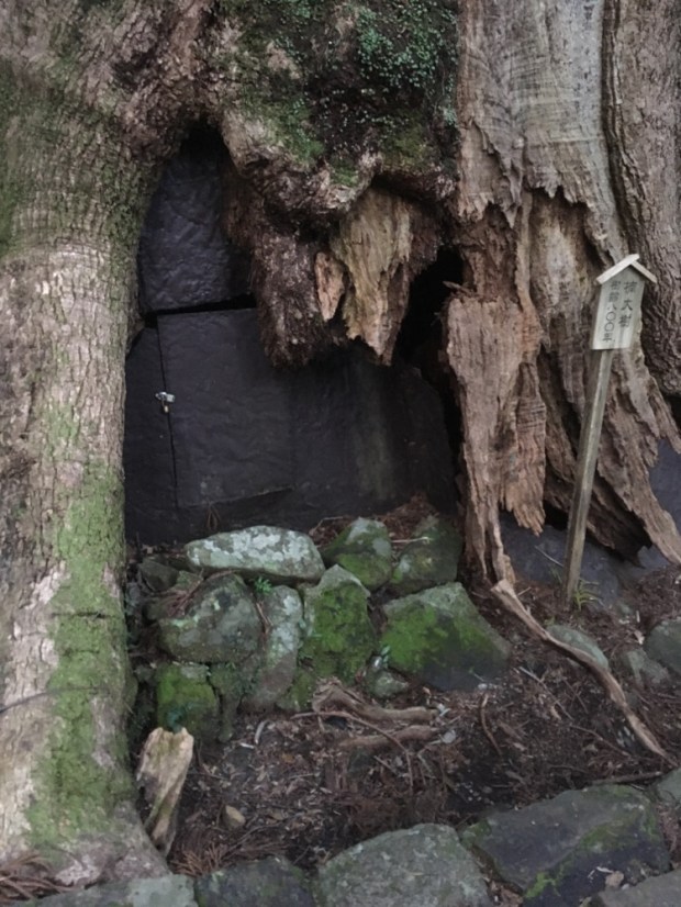
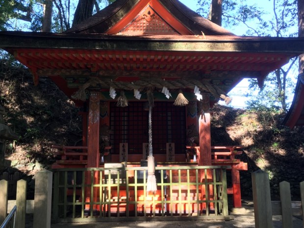
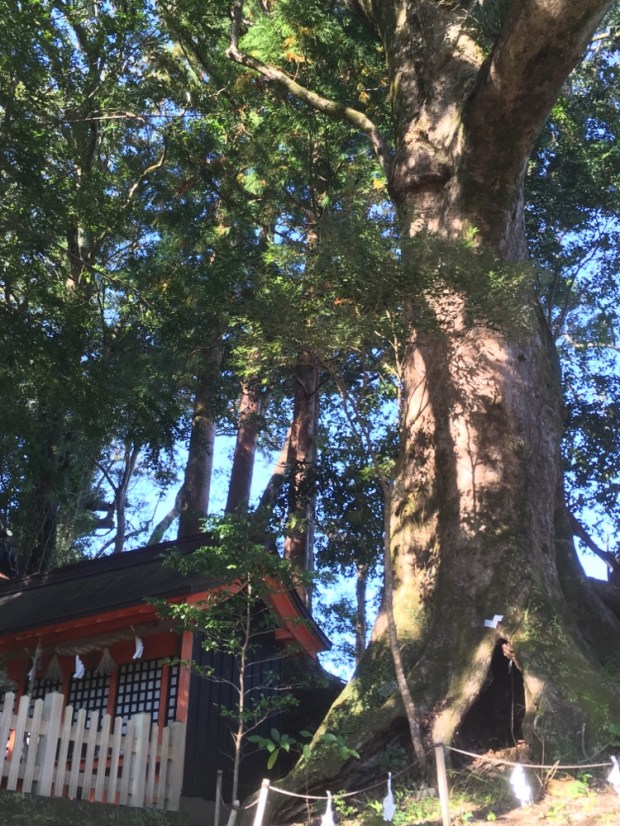
We needed time to see the Grand Shrine of Hongu properly which meant taking a day off the hike. So we missed out on the shortest and easiest section of the whole pilgrimage, a low level 13 km route to Koguchi. Waking in the morning to rain we were happy with our decision and it gave me a couple of hours to post the last blog. The rain had turned to intermittent showers by the time we got to Hongu town and leaving our packs in a luggage locker (it’s all so organized) set off up the flight of flag bedecked stone steps. The Kumano Sanzen is a collective term for the three Grand Shrines of the Kumano pilgrimages. First appearing as a single religious institution in the 11th century they were originally for the worship of nature but adapted to and included the incoming Buddhist beliefs. Because of this diversity of interpretations Kumano has developed into a sacred site for a wide range of religious traditions, each worshipping side by side in harmony.

The whole place was amazingly transferred from its riverside site in 1891 after a tremendous flood devastated the area and the architecture is astonishing. The huge thick roofs that slope and curve so gracefully are constructed entirely of cypress bark and are replaced about every 50 years.

With the wealth of cedar and cypress carpeting the surrounding mountains it’s no surprise to see such copious quantities used in the buildings but still awe inspiring. As is the detailed carpentry with no nails and fine joints.

The main sanctuary is entered through the Shinmon gate, decorated with a giant Shimenwa rope, made of hemp and silk for enclosing the spirits or a sacred space, and a curtain printed with an image of chrysanthemum flowers.

We called to the temple office and a monk escorted us to a huge drum that, as duel pilgrims, we were encouraged to beat in the complex rhythm he showed us. Honour indeed. Outside of the main area were all sorts of ritual spaces for drinking and washing, leaving offerings, ringing bells, burning incense and buying a massive range of charms and amulets. Time to move on.

In the cultural Heritage Centre we learnt more of the history of the Kumano Kodo. How incredibly busy it had been from the 14th century when the pilgrims were discribed as a line of ants across the land, how groups of volunteers work tirelessly on keeping it together and the Yamabushi who often guide on the ways.

By now we had decided to continue our personal pilgrimage on from Koguchi to the Grand Shrine of Nachi Taisha on a continuation of the Nakahechi or the Ogumotori- goe leg. It was the toughest section, climbing 1260m, including an 800m slope and 20km to our accommodation. There were all sorts of horror stories about it but we hadn’t thought the “hike from hell” so bad and after a day off we’re feeling pretty bullish. So we took a couple of bus rides( a pleasant change to see some low level riverside country) to Koguchi and set off from there 6.30 the following morning as the village was still wrapped in mist. It was immediately and relentlessly steep and a little slippy as we climbed the ancient stone steps onwards and upwards.

We came to a mossy spot where a rock was carved with 3 characters representing the main deities worshipped at the Sanzan. It is here that the Kumano spirits are believed to meet and chat over tea. Perhaps our labored breathing prevented us from hearing them.

At a little covered shelter there were some thoughtfully plumbed taps for drinking water to quench our thirst before continuing on up.

Now the silent forests have taken over the land it’s hard to picture people living here but a sign described how busy this remote area had been servicing the pilgrims of the past.

And then came the Dogiri- zaka translated as ” Body Breaking Slope”. You get the idea.

But all things come to an end and eventually, and actually by 9am, we were at the top of the Echizen-toge pass at 870m. As the famous poet Fujiwara Teika said in his pilgrimage diary from 1201, ” This route is very rough and difficult; it is impossible to describe precisely how tough it is”. And if a famous poet can’t I am certainly at a loss for words. I will only quote another poem, taken from the last “poem monument” installed on this route.

“One drop of sweat with every step, while climbing Ogumotori-goe in the depths of the Kii Peninsula “.

A victory selfie and an offering of thanks for safe passage and we were off on an up and down path for the next 6 km.

There had been a big landslide which meant a diversion on a forest track adding an extra 40 minutes to an already long trek but it emerged back on track at a lovely rest shelter, accessible by road, complete with coffee vending machine and a little garden. Life was good.

A couple of km uphill on the tarmac then off into the depths of the forest again on some more beautiful sections alongside streams, through bamboo groves and past hundreds of rounded rocks that looked like volcanic ” bombs” to me but I’m sure I’ll be corrected.

You’d have to give thanks for all this beauty and the little wayside shrines gave us the opportunity. We came to a grove where a Torii gate seemed to protect a sacred cypress and someone’s beloved dog.

On the approach to Mt Myoho we came upon some fellow pilgrims, all smiles and chat. This area is the Abode of the Dead. The souls of the dead gravitate to the higher mountains and spirits inhabited this section of the trail.

We reached the Funami-toge pass not long after and were able to enjoy our bento box lunch in the sun soaking up the views of the Pacific Ocean below us to the south. 4km downhill from here to the Nachi Kogen Park just above the Shrine where there was a pile of abandoned pilgrim sticks.

The Park was a bizarre and neglected place with the look of a white elephant. Perhaps built with world heritage money spent on something nobody wanted??

All the more strange for it to be on the outskirts of such a popular and sacred Grand Shrine that we now approached on the last flights of stone steps. ( Or so we thought!)

We explored rather wearily but we’re excited to climb through the 800yr old hollow Camphor tree, taking our prayer sticks with us. More amazing structures more ancient history and lots more people involved in timeless rituals.

And then, the sting in the tail, the Daimon-zaka slope. A 600m long cobbled stairway lined with centuries old trees that was truly spectacular but the last thing our knees needed.

Another km or so from the bottom of the steps took us a long way from the misty sacred mountains and deep into a strange suburbia where our bed was. But more on that next time.

KUMANO KODO: The Nakahechi Pilgrimage 1

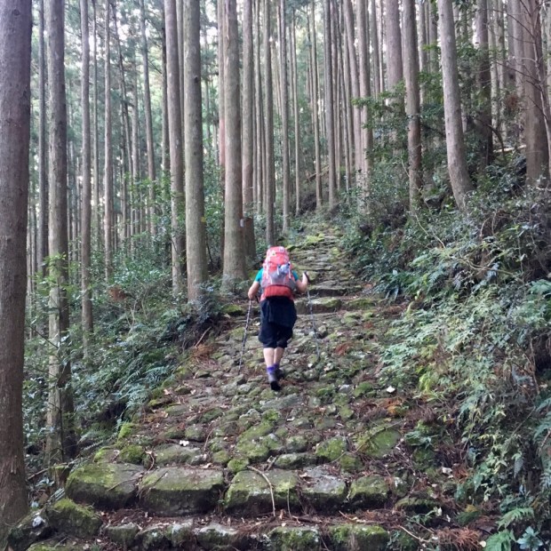
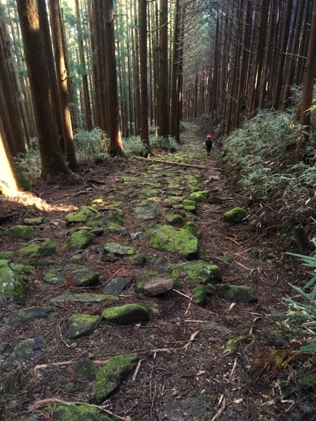
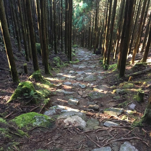
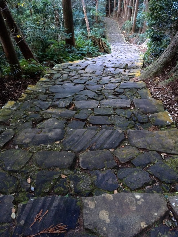
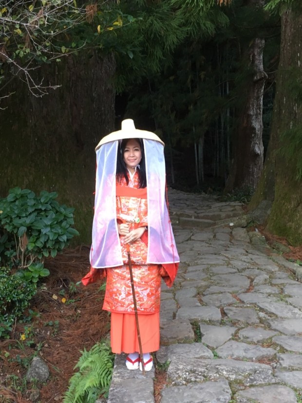
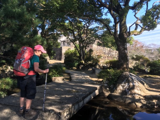
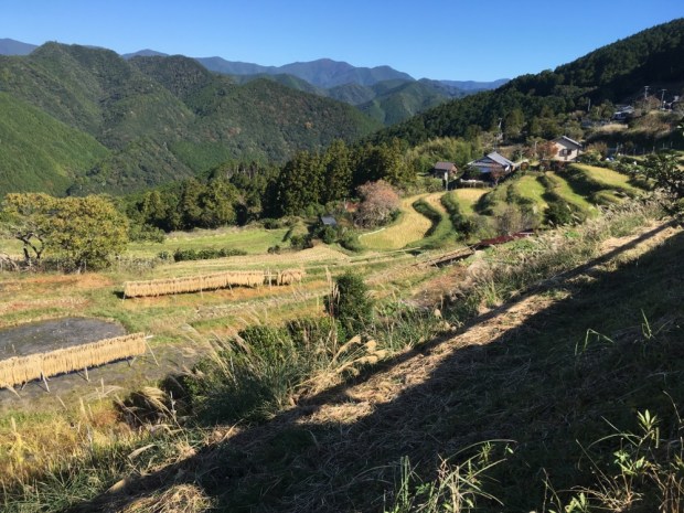
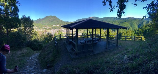
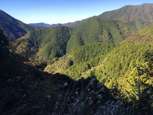
Gluttons for punishment and intent on spiritual redemption we were catching a 6 am bus to Takijiiri- oki to begin the most popular of the Kumano Kodo pilgrimages. The Nakahechi main route takes 38.5km to reach Hongu Taisha from where, traditionally, it continues another 27 km to Nachi Taisha to the south, although nowadays people often stop at Hongu. Not us of course.

Waiting for the bus outside our lodging we got a hot coffee from the vending machine and watched the light pick up the sulfurous steam rising from the waters of the river that ,as we arrived the previous night, were enjoyed by bathers in their dug out hot pools.

Riding a Japanese bus is a very efficient experience with a payment system that impressed. You take a numbered ticket on entry. There is an electronic sign with all the numbers on and their appropriate fares owing as the journey progresses. So when you alight you read your number’s fare and put your ticket and money in the machines. And the drivers wear smart uniform with hats and gloves.

So the busy roads and villages made us realize we were now in a different environment to the empty wilderness of the Kohechi. The awareness was made more acute when we arrived at the trailhead to souvenir shops, coffee shops and other hikers.

So off through the Torii gates and massed shrines, past mighty roots,to the Tainai Kuguri ( meaning- to pass through the womb) cave entrance. It’s said that women who can squeeze through the gap are said to have an easy labour. So Sally had to have a go on a professional midwifery basis.

With the low hum of traffic in our ears we climbed up a steep and rocky hillside over prominent tree roots glossed by countless boots. More little shrines and waymarkers and a stretch of flagstone pathway running through a tunnel of greenery beside a road. I thought it well that the early roadmakers had not surfaced over this ancient thoroughfare as has happened in so many places.

We were now getting hungry having had no breakfast. The guesthouse had turned our breakfast into a “bento” box of lunch and seeing the shrine figures all bibbed up couldn’t resist opening our parcels. Christmas was early!

We reached the outsides of a village with signs for nice looking places offering accommodation. All so different from the Kohechi, but more varied I guess. It’s always interesting to us to see other cultures gardens.

We got to Takahara Kumano- jinja , the oldest shrine on the whole route, stood over by a 1000 yr old camphor tree.

We availed of the stamps for our new passports and walked on into the village where the big “rest area” overlooked picture perfect paddy fields whose thirst was quenched by a tall working waterwheel.

Past Takahara we climbed steeply into the mountains and away from any settlements for 8 km. There was a neglected cabin and shelter deep in the woods and a little while later a beautifully tranquil pond. Peace descended.

The serenity was somewhat broken at the Jujo-oji clearing where a large group of walkers were having a picnic and at the shrine and stamp box we had to queue briefly behind a bunch of Aussies.

We rose now on our final ascent to the high point of the day at the site of the Uwada-Jaya Teahouse (690m). We had passed a number of these little flat areas where for centuries there had been tea houses or inns to nourish the weary traveller or pilgrim. The trail now descended quickly, sometimes with steep switchback stairways of log stairs, to reach a small creek. We had noticed that this route had far more running water than the Kohechi and wondered about the micro climates going on around these complex crinkled landforms.

One of the above pictures shows a monorail track that snaked down through the forest. We’d seen one earlier at an old abandoned farmstead with a petrol engined trolley for bringing stuff up the steep slopes. I really can’t imagine how they do their forestry work out in such remote and trackless mountains. I’m not sure how much logging or harvesting goes on. We’d seen some in more accessible areas but in most places they had seemed to do a lot of thinning, leaving all the timber out there, often placed horizontally between trunks or stumps, presumably to help stop landslides. The remaining trees were then allowed to grow on to maturity(?) maybe purely to help with erosion. Good news for the planet anyway- there is an endless sea of cedar on this peninsular but as someone who has just spent a lot of money on a cedar ceiling and works hard to gather timber for fuel the vast amount left lying about was hard to deal with.

We continued down passing a rest shelter and picnic area popular in the spring for admiring cherry blossom and down into the largest settlement of the day at Chikatsuyu village. Nearly 1000yrs ago groups of up to 300 pilgrims would stay here and perform cold water purification rights in the river before worshipping.

Climbing out of the village the views of the mountains to the east and south opened up as we climbed 200m mostly on tarmac on the old highway passing a sad number of fairly recently abandoned homesteads. Abandonment was a theme that resonated as we hiked through the area, both in the roadside settlements and deep in the forests where until the 70’s people were farming. Emigration to the cities and rural depopulation is a world wide phenomena and we were witnessing the Japanese story.

But then a cheerier side to the flourishing of this ancient route was shown when we arrived at the lovely thatched rest area with a traditional irori hearth, a chimney less fireplace for cooking and smoking all your roof timbers. Bad for the lungs but good for insect control.

The lovely ladies who volunteered there gave us cups of tea and little gifts of origami and chatted away in Japanese. We were in the shade of the giant cedar trees of the Tsugizakura-oji shrine. These 800 yr old trees, some with a circumference of 8 meters, were scheduled for destruction along with the shrine in the governments ” shrine consolidation ” program in 1906 and were saved by the actions of Minakata Kumagusu, ” an eccentric genius researcher and avant – garde environmentalist “. I like the sound of him!

There was a sacred spring here with healing waters that we unfortunately missed but we did see the ancient cherry tree with associated folklore and got the stamp to prove it.

Finally at Nonaka, after18km and 1200m ascent were our lodgings complete with goats. A couple from Tokyo had moved here 3 years ago to run a guest house and were doing very well. The world map wallpaper in the dining space was covered with pins denoting where all there guests had come from and it was very impressive. Good to see that like the Camino, the pilgrimage route can give new life to a declining rural area.

The finest breakfast so far set us up for what we thought would be a relatively easy day as we were starting at 500m even though the distance was the longest at about 20km. It wasn’t easy.

Continuing along the old highway now a quiet backroad past more neglected spaces awaiting rebirth we reentered the forest and were sent on a detour created after a major landslide after the 2012 typhoon. It was tough going climbing up and over the Iwagami-toge pass at 670m.

Then down again on soft forest tracks and log steps, passing more signs of now afforested old terraces,to eventually reach the valley floor again and the Yukawa- gawa river. Before crossing over we visited the beautifully situated Jagata-Jizo shrine where we learnt that travelers in the area are often overtaken by Daru spirits, serpent like witch creatures capable of taking an invisible form, penetrating the human body and inflicting fatigue and painful torment! They had me.

Crossing the river on another log bridge we began yet another climb, passing another old tea house site and checkpoint where from the 15th century a toll would be inflicted on pilgrims, up to what we foolishly imagined was the last pass of the day, the Mikoshi-toge at about 580m.

The site of the remains of the Doyu – kawa settlement seemed a somber place with the ghosts of the ancestors hanging about, as did the more obvious remains of the Michu-no-gawa hamlet where there were 17 households at one time.

Soon after we crossed a large area of landslide management. A lot of this goes on and must cost the state a fortune.

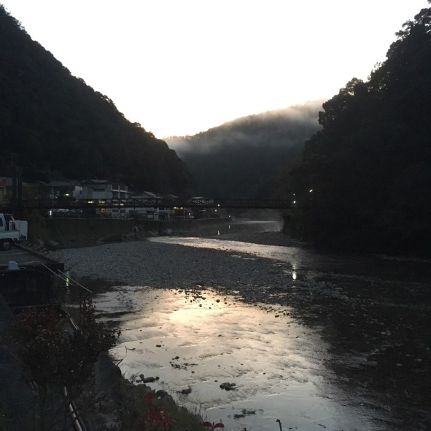
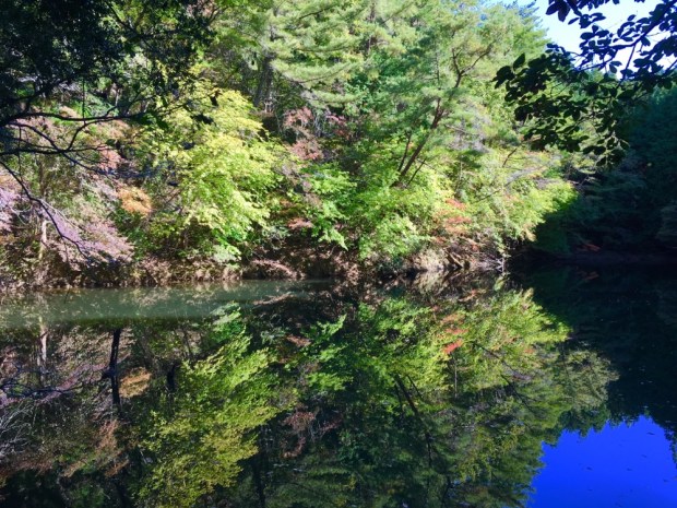
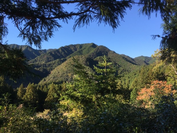
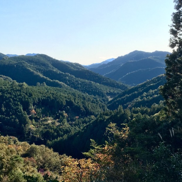
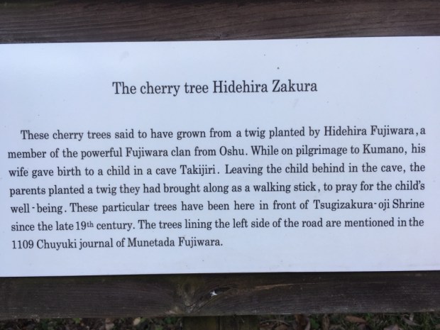
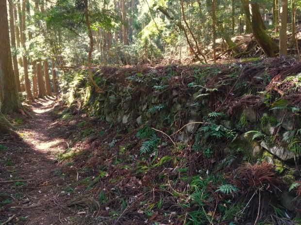
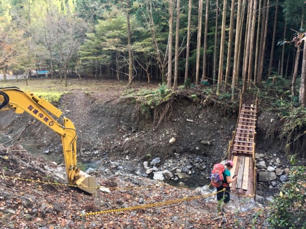
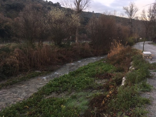
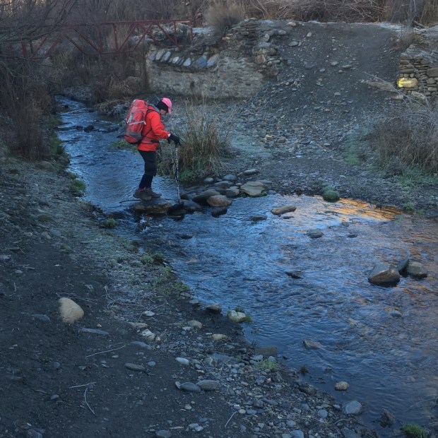
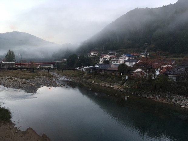
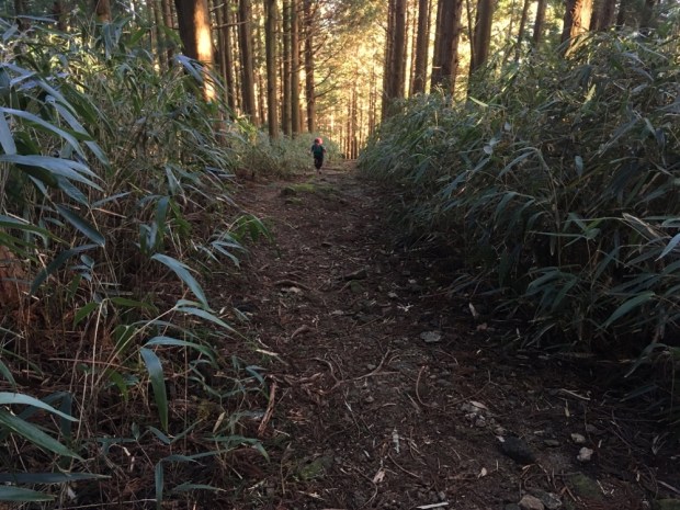
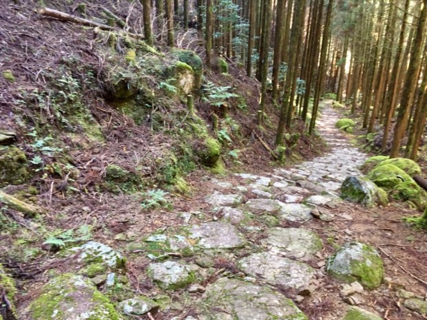
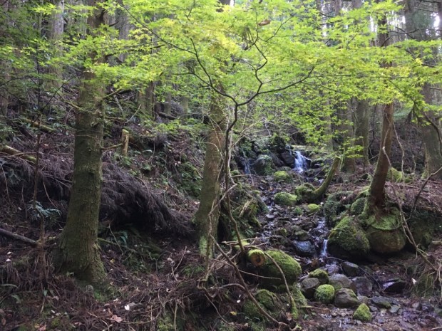
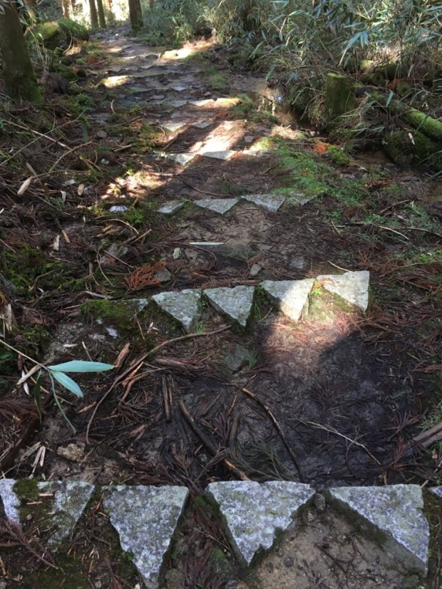
We descended to the river Otonashi-gawa where there had been bad flooding that had taken out a bridge which meant there were diversions in place. The route to Hongu was sent straight on and the side route to Yunomine, where we were staying ,went right on the Akashi-goe trail. We went right. There was a lot of serious engineering work being done on the river and they had luckily installed a log bridge just days before that took us over the river to the start of a big slope.

We should have looked at the altitude profile for this ” shorter” route. It must have been because it came at the end of a long day of ups and downs but the climb to the 450m pass seemed to go on forever.

Claiming the summit at last we continued up and down along the ridge with occasional stunning views across the green cloaked folds and past another old tea house and cemetery finally given up to the forest in the 70’s.

The track got perilously narrow on the edge of a big area of felled forest and a view to reengineered landslip.

A carved waymarkers from 1855 pointed us down the trail towards the ” hell slope” where steep and slippy mud and flagstones took us down through the hot steam and sulphur smells of Yunomine Onsen.

Discovered some 1800 years ago and thought to be one of Japan’s oldest hot springs, the healing waters are pumped into a number of baths around the village including the tiny Tsuboyu Onsen, a World Heritage site. We got our tickets for it and quickly dropped our bags at the hostel, returning for our allotted 30 minutes of wonderfully restorative hot healing for our weary muscles.

It had been a tough one and we realized we’d been pushing it a bit with not enough downtime for seeing the offtrail sights.

So we decided to finish this pilgrimage at Hongu, in the traditional style, and give ourselves some time by taking the bus to Koguchi. The weather was forecast for rain so the timing is good.

So we will now visit the three major sacred shrines of the Kumano Kodo, the Kumano Sanzan, the Hongu Taisha, Nachi Taisha and Hayatama Taisha in Shingu and I’ll get back to you.